Home › Forums › 20th Century › Tibbett’s Brook in the early 20th Century
- This topic has 0 replies, 1 voice, and was last updated 6 years, 5 months ago by
 ndembowski.
-
AuthorPosts
-
-
November 18, 2017 at 4:58 pm #311
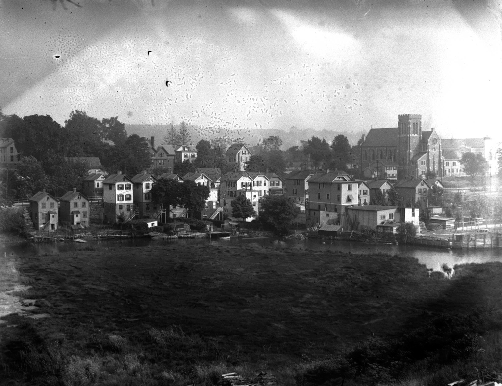
This is a unique photo from 1915 looking down from Spuyten Duyvil Hill. Tibbett’s Brook runs through the foreground with the Church of the Mediator (still standing) on the right. The small homes along Corlear Avenue were waterfront property at the time. Looking at the houses on the left in relation to the street level, you can see just how high the streets were raised compared to the natural elevation of the ground. This was done to prevent flooding in Kingsbridge.

In this view of Corlear Avenue, you can see how the street level was raised. The sewers were built right on top of the ground. Then landfill was poured to raise the street to the current elevation. Many of the houses that you see on the left are still standing and residents need to climb down stairs to get into their front doors.
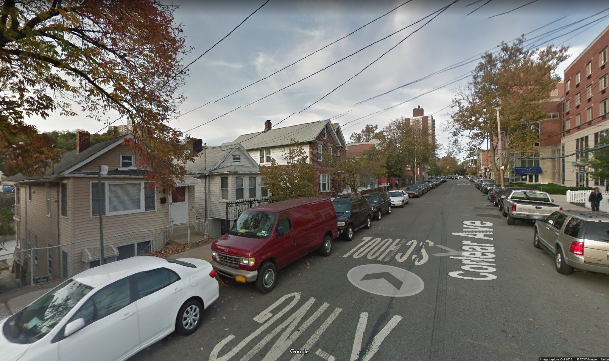
A contemporary view of the same street depicted above. Notice the difference between the bases of the houses on the left and the street level. The giant sycamore tree on the right is clearly visible in the earlier photo as well.

Tibbett’s Brook west of Broadway and 236th Street in 1907. Again you can see difference between the elevation of the street and the natural level of the ground.

And here at 238th Street.

Now the brook is funnelled into the sewer system in Van Cortlandt Park. The Friends of Van Cortlandt Park have an effort underway to daylight the brook

In colonial times, the brook and mill pond in Van Cortlandt Park were used by the Van Cortlandts to power a gristmill.

Urban explorer Steve Duncan once explored the sewer where the Brook currently flows. I have tried to map the course of Tibbett’s Brook in my map of Kingsbridge during the revolution (best viewed on a large screen) by georeferencing many old maps. The map is a work in progress as you will see.
-
-
AuthorPosts
- You must be logged in to reply to this topic.