Home › Forums › The Colonial Era › The Area Around the Van Cortlandt House in the 18th Century › Reply To: The Area Around the Van Cortlandt House in the 18th Century
The Roads and Paths around the Van Cortlandt House (Part 1 – The Albany Post Road)
Walking around the Van Cortlandt House in the park you will come across several intersecting trails and paths. Some of them have the look of old colonial-era roads. Some of those paths, in fact, harken back to that era–but some do not.
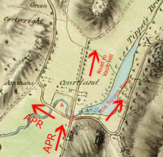
Zooming in a bit closer to the area adjacent to the VCH in the 1781 Clinton map, you will see a cross-intersection just southwest of the Van Cortlandt Mills. The road coming from the south is the Albany Post Road, or (“APR”).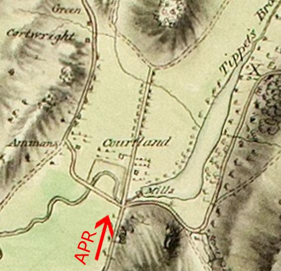
At this intersection it splits off into three directions. The road heading west is the continuation of the Albany Post Road. The road that goes straight north from the intersection leads to Vault Hill, where the Van Cortlandt family buried their dead. The road that heads east from the intersection is the road to Mile Square or the Mile Square Road.
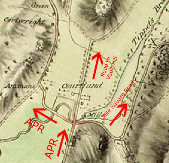
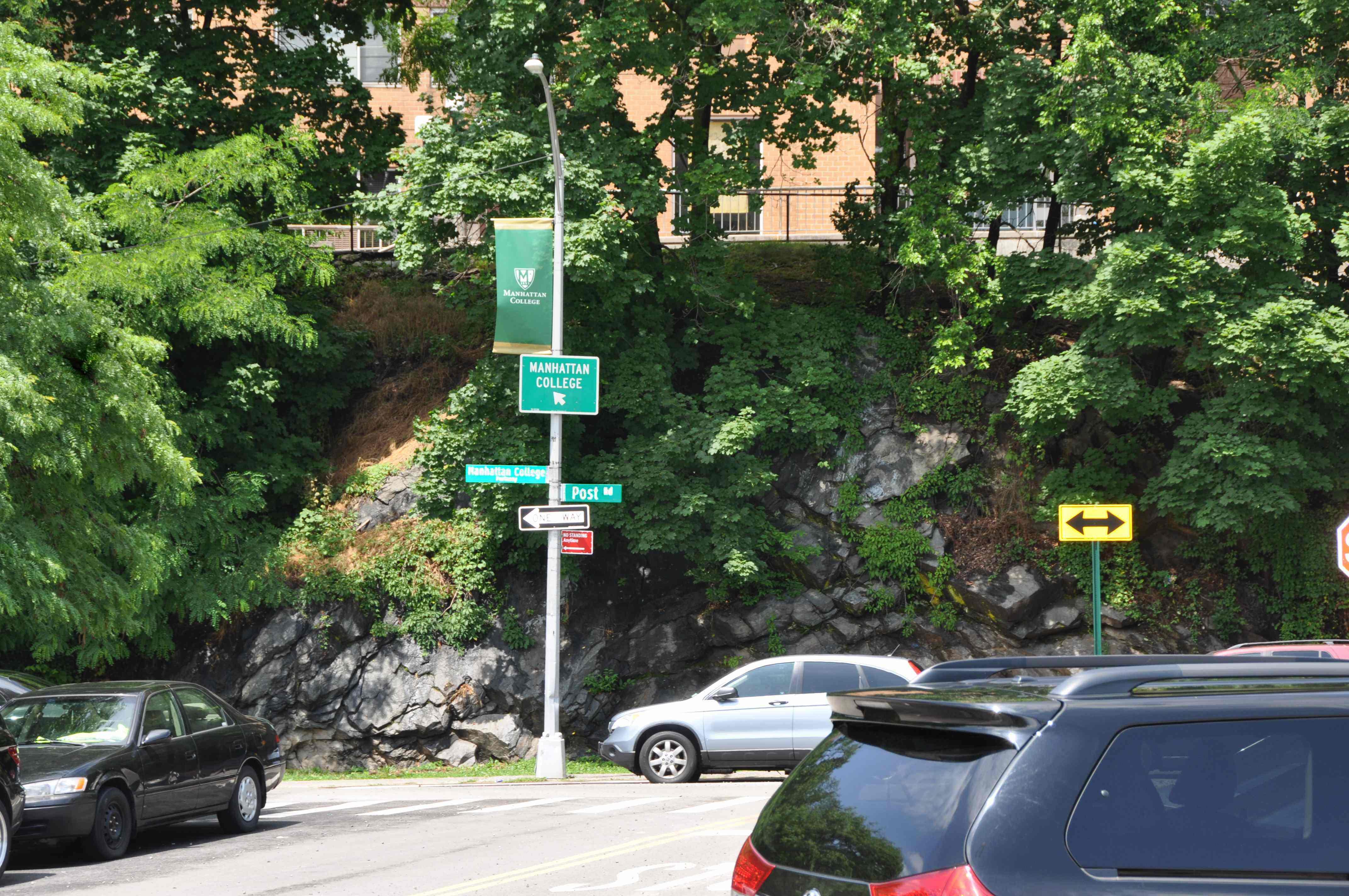
From this intersection, the Albany Post Road cut west and continued to about the site of present-day Broadway and 242nd Street. It continued north along what is still known as “Post Road.” It is fun to think that this part of one of America’s oldest roads still has its original name. In the old days, it wound its way north through Yonkers and along the Hudson River all the way to Albany. In colonial times, it was also known as the “turnpike” and the “River Road.” The photo below shows today’s street sign with “Post Rd.”
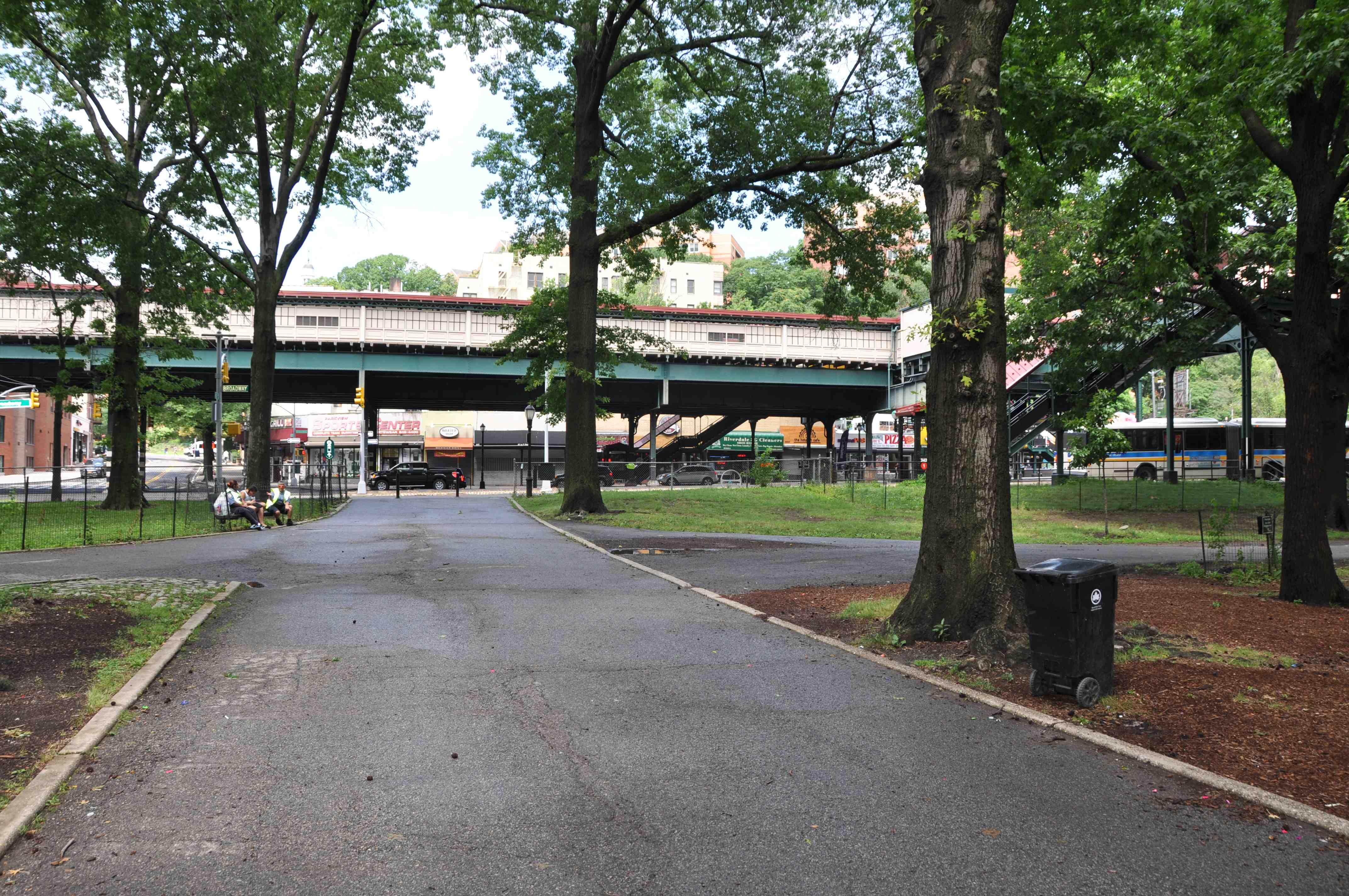
It would easy to forgive someone for thinking that the section of the Albany Post Road that went west through today’s park still exists in the form of the path pictured below.
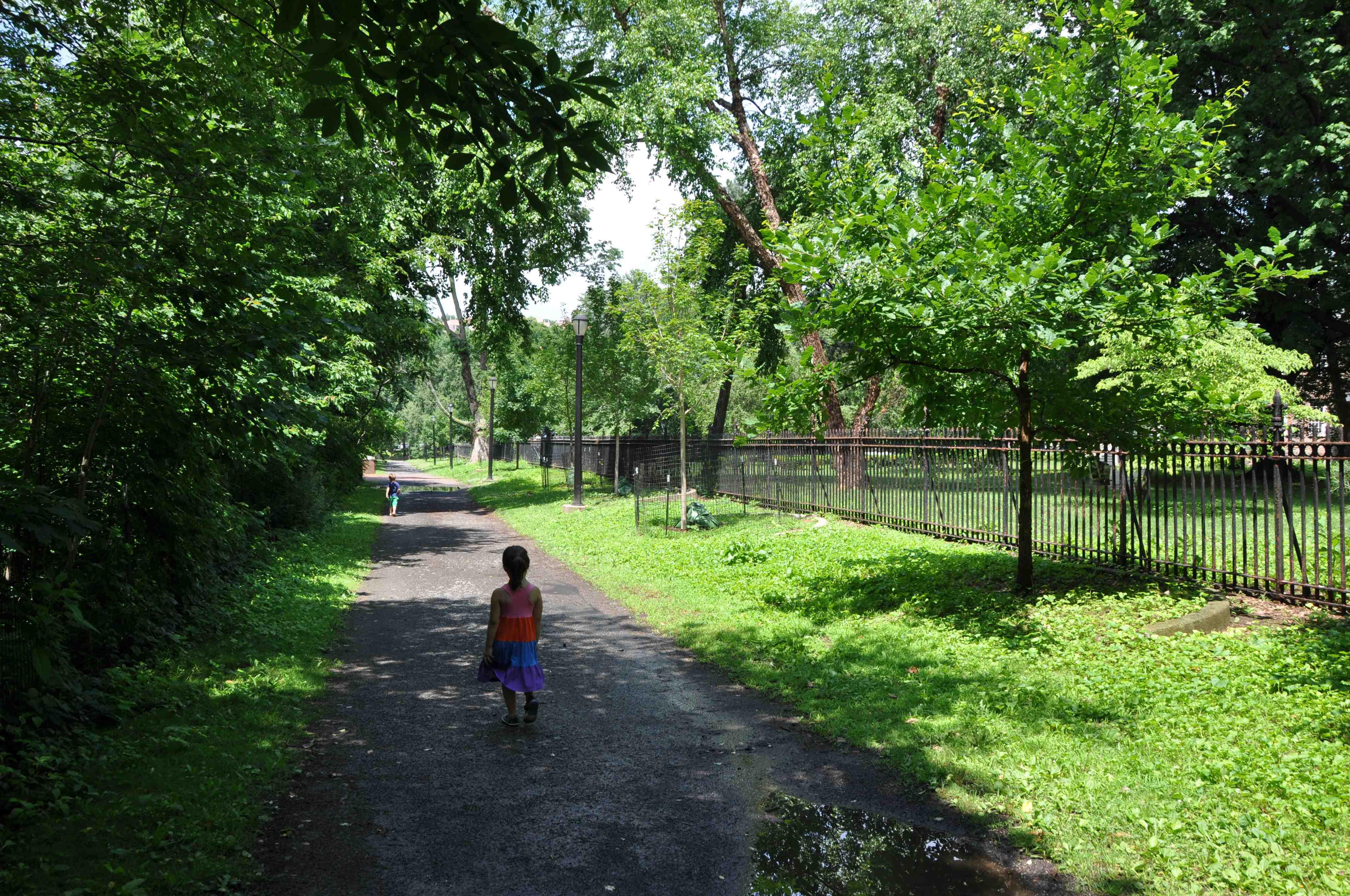
This path has a rustic look to it and travels in the same direction that the Albany Post Road would have as it traversed today’s park (east to west). And it is located south of the Van Cortlandt House as indicated in the 1781 Clinton map. However, there are a few reasons why this path cannot be a section of the old Albany Post Road. First of all, if you look carefully at the 1781 Clinton map you will see that Tibbett’s Brook (shaded blue on the below map) flowed north between the Van Cortlandt House and the Albany Post Road (in the spot indicated by an “A” on the below map). It would actually be impossible for Tibbett’s Brook to flow north in the area between the above-pictured path and the Van Cortlandt House. That area, where today there is a garden on the grounds of the house museum, is at a much higher elevation than Tibbett’s Brook and we all know that water can’t flow uphill. Secondly, the 1781 Clinton map indicates a much greater distance between the Van Cortlandt House and the Albany Post Road than exists between the Van Cortlandt House and the path pictured above.
This is not to say that the path in today’s park is a new trail. While it is not a remnant of the Albany Post Road, it is actually a very old path. Have a look at the below section from an 1868 Beers, Ellis, and Soule Atlas of New York and Vicinity.
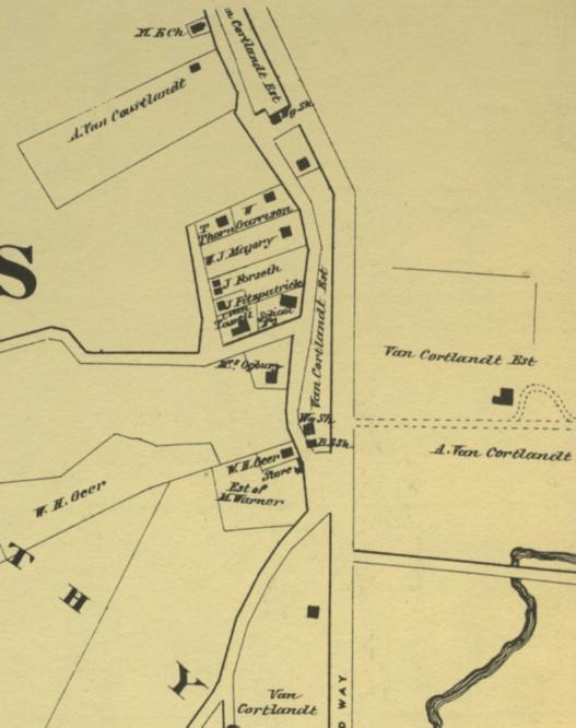
The Van Cortlandt House is on the right under the words “Van Cortlandt Est.” You’ll notice the presence of the present-day trail in the form of dotted lines on the map south of the house. This trail led from the Van Cortlandt House to the large intersection west of it, where there was a store, a school, a post office, and a blacksmith shop. This intersection was centered around the same area as the above photo showing the street signs. That was the core of the village of Mosholu. The laws of human laziness would seem to suggest the need for the path running along the fence of the Van Cortlandt House as it was a direct way to get from the Van Cortlandt House to this intersection. Further to the south, under Tibbett’s Brook in the above map, you’ll see the original section of the Albany Post Road running east to west just as in the 1781 map. That section of the Albany Post Road would intersect Broadway roughly in the area of today’s 242nd Street. The old Albany Post Road actually crossed today’s park roughly where today you find the path pictured below.
The below map produced by the Dept. of Public Parks in 1872 also shows the Albany Post Road hitting Broadway south of the Mosholu intersection. The Van Cortlandt House is indicated with the letters “VCH.”
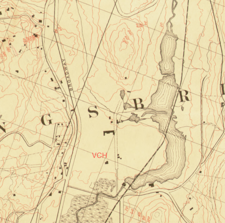
You will also notice the contour line just to the south of the Van Cortlandt House. It represents a drop in elevation from the area just south of the house to the lower area where Tibbett’s Brook once flowed. You can descend that slope to the marshier area below by walking from the east/west path down this staircase that is about 150 feet south of the garden:
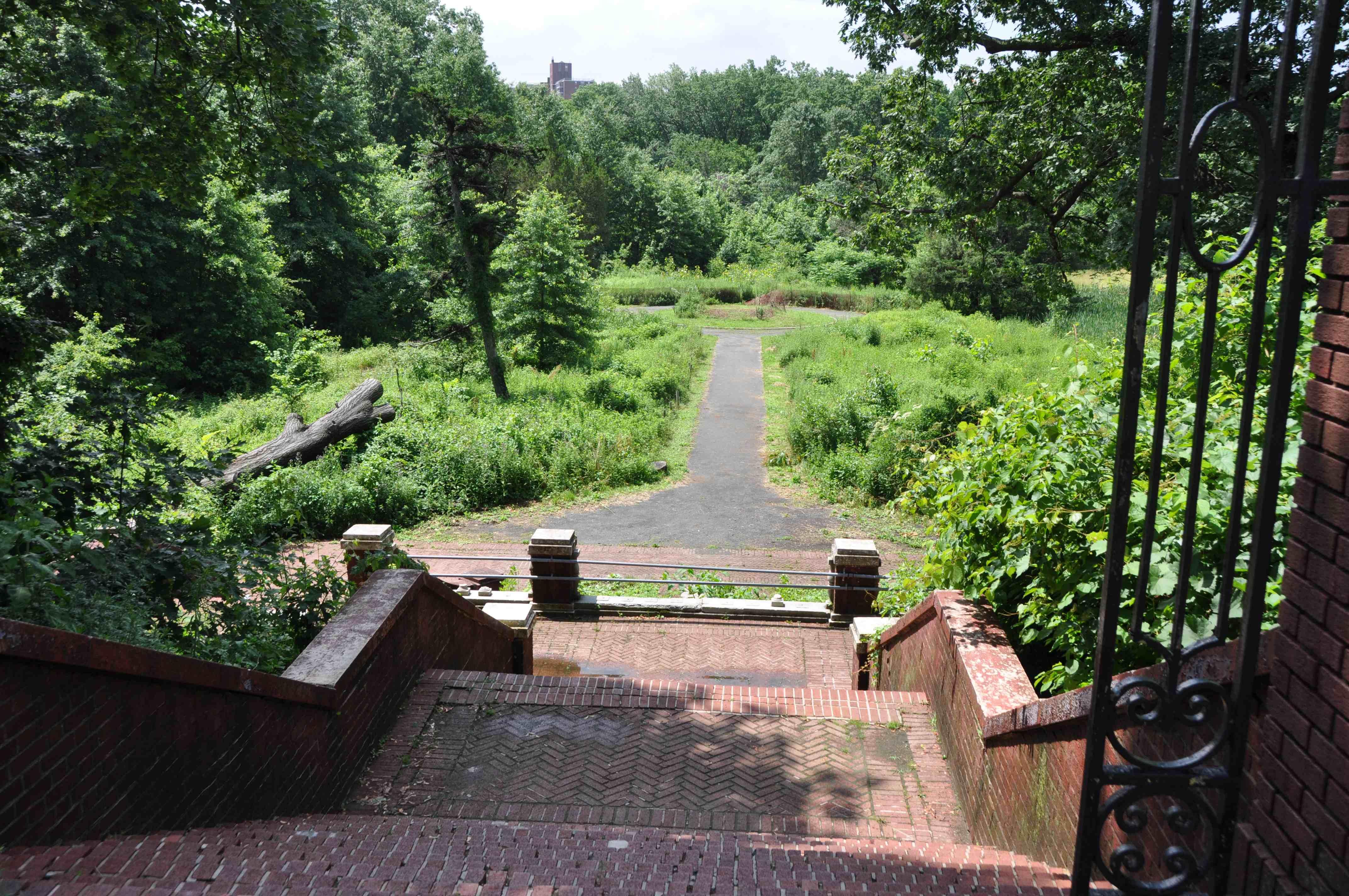
You can see that it would be impossible for Tibbett’s Brook to flow north up that hill. Interestingly, the contour line in the 1872 park map seems to mimic a set of three unlabeled line segments in the 1781 Clinton map, highlighted in lime green below. They seem to form a frame around that area of low elevation. Could they have represented a wall? It is difficult to say.

I will write more on the other roads and features around the house after July 4th. Enjoy Independence Day!