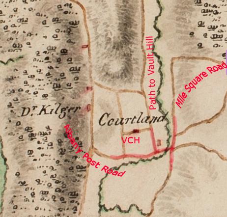
Home › Forums › The Colonial Era › The Area Around the Van Cortlandt House in the 18th Century › Reply To: The Area Around the Van Cortlandt House in the 18th Century
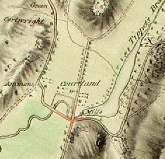
The “cross” intersection that was south of the Van Cortlandt House appears in the 1781 Clinton map and other maps of that period (although I have yet to find one with the same level of detail as the 1781 Clinton map). Below is the 1781 Clinton map with the intersection highlighted in red.
The below image is a snippet taken from a fascinating 1778 British map held in the Library of Congress, entitled “Skecth [sic] of the road from Kings Bridge to White Plains.” As you can see, it is definitely more of a “sketch” than a detailed work of cartography.
The roads are drawn somewhat abstractly so see the below labels to align this sketch with the 1781 Clinton Map.
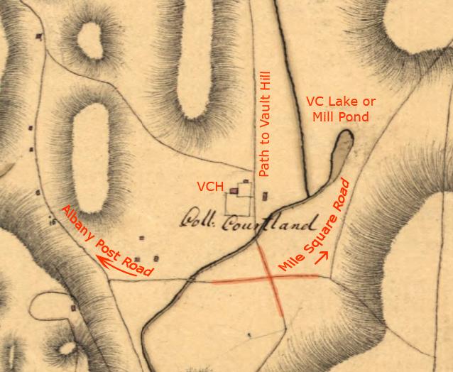
The purpose of the above map was to show the disposition of British troops, which held positions north of Kingsbridge (in Yonkers, Dobbs Ferry, etc.) at that time. This explains the lack of detail in this area. Nonetheless, the intersection where the Albany Post Road, Mile Square Road, and path to Vault Hill branch off is indicated roughly in the same area.
That same intersection is visible in the below snippet from another map from the Clements Library at the University of Michigan–although it does not come together in a neat cross as in the above maps. This is another British map from the revolution and it is even more abstract and lacking in detail.
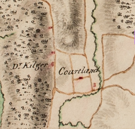
The mill pond is not even depicted here but the paths and roads are discernable and labelled below.
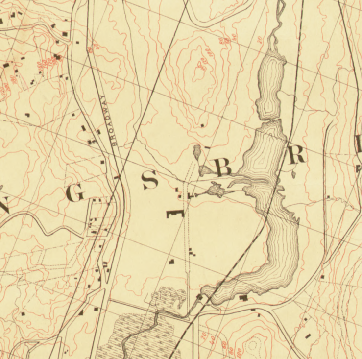
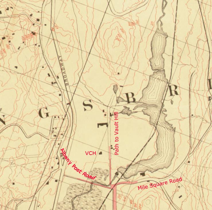
100 years after the revolution, that intersection is still clearly visible in the below snippet from an 1872 Department of Public Parks map.
Annotated version:
Over 100 years later in today’s park–in roughly the same location as that old intersection–you see this:
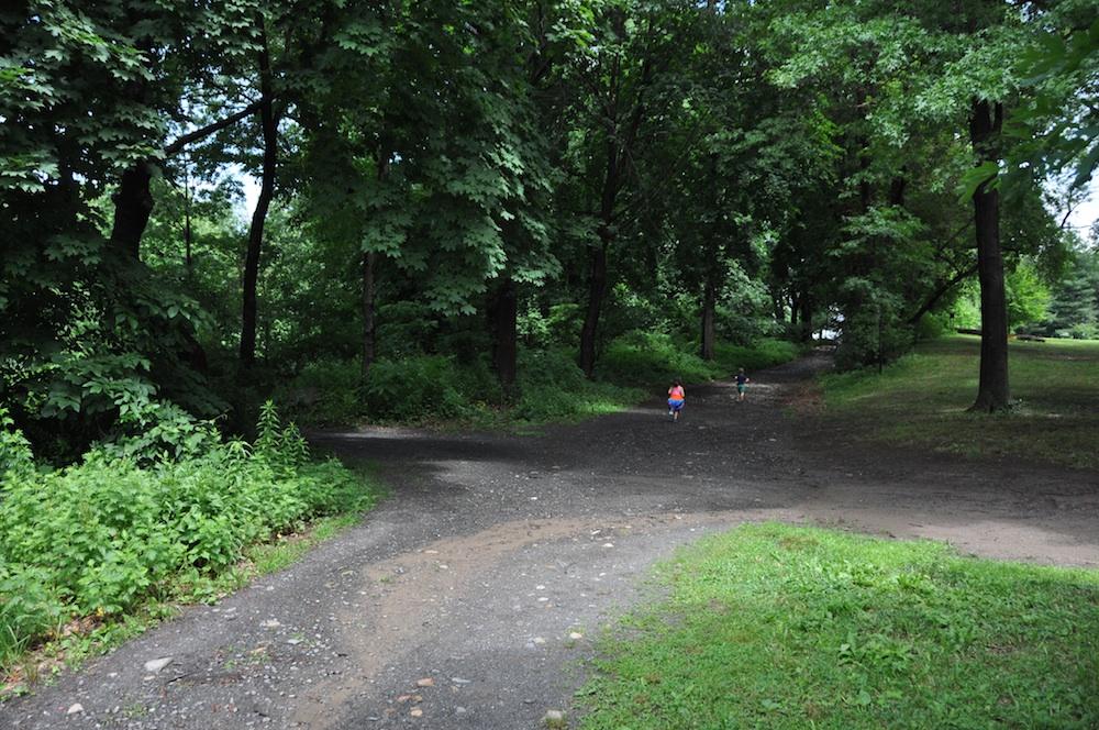
The view is looking north just north of “Tibbett’s Wetland.” While this might not be in the exact same spot as that old intersection, it is very close. The path veering off to the left in the photo roughly follows the path of the Albany Post Road. The pool in today’s park prevents this path from continuing to Broadway. If you were to take the path to the right, you would be heading east below the south edge of Van Cortlandt Lake in roughly the same direction and location as the old Mile Square Road. If you were to continue straight ahead north (like the two kids in the photo), you would be travelling along the old path to Vault Hill. As you walk that path toward Vault Hill you will notice a stone wall on your right (pictured below), which gives it the look of an old colonial road. Although I cannot say how old that stone wall is, that path certainly seems to be in the same place and have the same trajectory as the old path that lead to Vault Hill in the 18th century.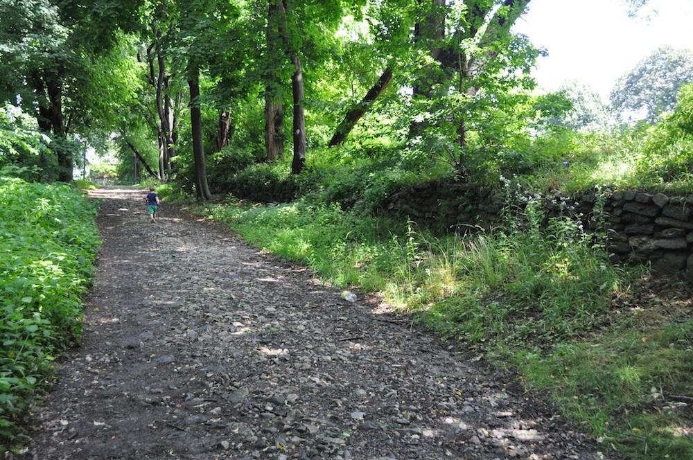
If we take another look at the 1781 Clinton map, this path continued straight (over today’s Parade Ground) to the base of Vault Hill, where it forked into two smaller paths. The left fork connected to the Albany Post Road and the right fork headed north along the west bank of Tibbett’s Brook all the way to about where the Cross County Parkway is today. In other words, it generally follows the path of today’s Saw Mill River Parkway. In colonial times, it was only a path but it would have been important to the families that lived along the western banks of Tibbett’s Brook (the Posts and Oakleys).
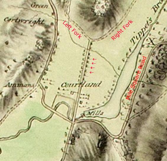 Another curious feature of the Van Cortlandt property is depicted on the 1781 Clinton map. As the path to Vault Hill traverses the modern-day Parade Ground, the map shows that it is bordered by regularly-spaced objects on both sides (by the arrows). It seems like this must have been a tree-lined path. Another possibility is that it was some kind of elevated boardwalk to get over the field, which could get marshy at times. A tree-lined path seems likelier however.
The Mile Square Road was a well-traversed lane as it offered residents of Mile Square (and parts of Eastchester via Hunt’s Bridge) the most direct route to Manhattan by land. Mile Square was a settlement, of about 1 square mile, composed of 7 farms that, notably, were not part of Philipsburg Manor. During the revolution, both armies occupied, fortified, and fought in Mile Square and the road was patrolled regularly by light troops and irregular cavalry that were based in the Kingsbridge area.
That pretty much covers the roads, paths, and trails around the Van Cortlandt House at that time. Coming up are posts about the watercourses, the buildings, the Van Cortlandts, and their neighbors.