Home › Forums › Photo Contests › May 2019 Photo Contest
- This topic has 9 replies, 3 voices, and was last updated 7 years, 1 month ago by
ndembowski.
-
AuthorPosts
-
-
May 2, 2019 at 1:14 am #953
This month’s photo is a real challenge. The first response to this post that correctly names the street and cross street wins the contest.
If nobody gets it right away, there will be a hint coming in a couple of weeks.
Part of the idea is to get a conversation going among the members so feel free to share your thoughts on the photo even if you are not sure about the location.
-
May 2, 2019 at 2:57 pm #955
I’ve come across this pic before, and seen it labeled as “possibly” Kingsbridge. I’ve looked a little, but not been able to nail down the location, so tended to think it might be elsewhere.
I’m excited to know you know the location! I will have to redouble my efforts to see if I can determine the spot! -
May 2, 2019 at 7:19 pm #956
Best guess Exterior St where Tibbets brook empties into Harlem River
-
May 2, 2019 at 7:38 pm #957
-
May 3, 2019 at 5:31 pm #958
The brickwork around the culverts is very similar to that in several photos of the new aqueduct, around the time of the construction of the Jerome Park Reservoir.
The barrels are obviously temporary, making me think that the street over the water may have been extended after the time of the photo. This would be backed up by the brickwork, which looks like it is ready to be extended, as in this photo.
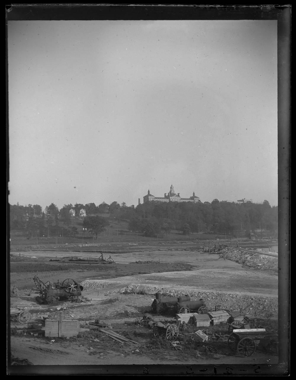
![The brick conduits for the reservoir's water supply [New Croton Aqueduct?] during the construction of Jerome Park, Bronx, N.Y., undated [c. 1905-1906].](https://kingsbridgehistoricalsociety.org/wp-content/uploads/hm_bbpui/958/fejwhmtu9k72i07iptcyb563mraxz525.jpg)
https://cdm16694.contentdm.oclc.org/digital/collection/p16124coll2/id/39611/rec/3I’m also struck by the height of the trees to the left, and the fact it appears they may be downhill from the water. Although I had initially assumed this was somewhere along Tibbetts Brook, those two features make me lean more towards an entirely created watercourse, connected to the reservoir.
-
May 3, 2019 at 5:47 pm #959
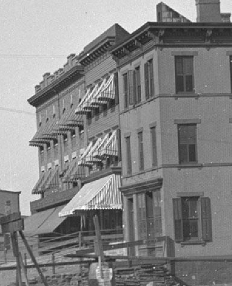
Thomas Casey, here is a ca 1905 pic of the location you suggest.
At the right edge, you can see the new location for the train tracks being constructed, which will form a barrier between Spuyten Duyvil Creek on the left and the Ship Canal to the right. I think it was around 1905 that the reroute was completed, before that the train tracks went all the way up to 231st St before looping back down to the Spuyten Duyvil RR cut by the Johnson Iron Works.
The Roman Catholic Orphan Asylum is on top of the hill, which is where the VA Hospital is today, so this pic is very close to the same view as in your post.
https://cdm16694.contentdm.oclc.org/digital/collection/p16124coll2/id/36182 -
May 3, 2019 at 5:59 pm #960
Thank you….but not the answer ?
-
May 5, 2019 at 10:42 pm #961
No, you don’t have it yet. Several of the buildings depicted are still standing.
-
May 6, 2019 at 6:03 am #962
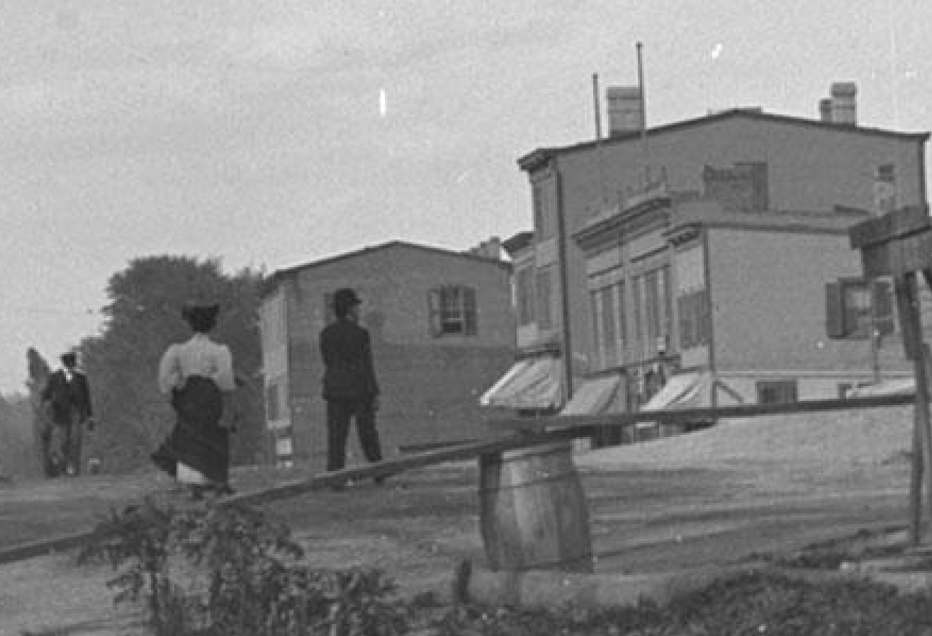
Once I knew several were still standing, that made it a lot easier. I was able to recognize the parapet rooflines of 5582 and 5590 Broadway in 1940s tax photos.
Great photo!
I’m a lucky owner of Tieck’s Riverdale, Kingsbridge & Spuyten Duyvil book and sure enough, on page 108 he describes “the immense Broadway twin sewer” that was laid about 1900.
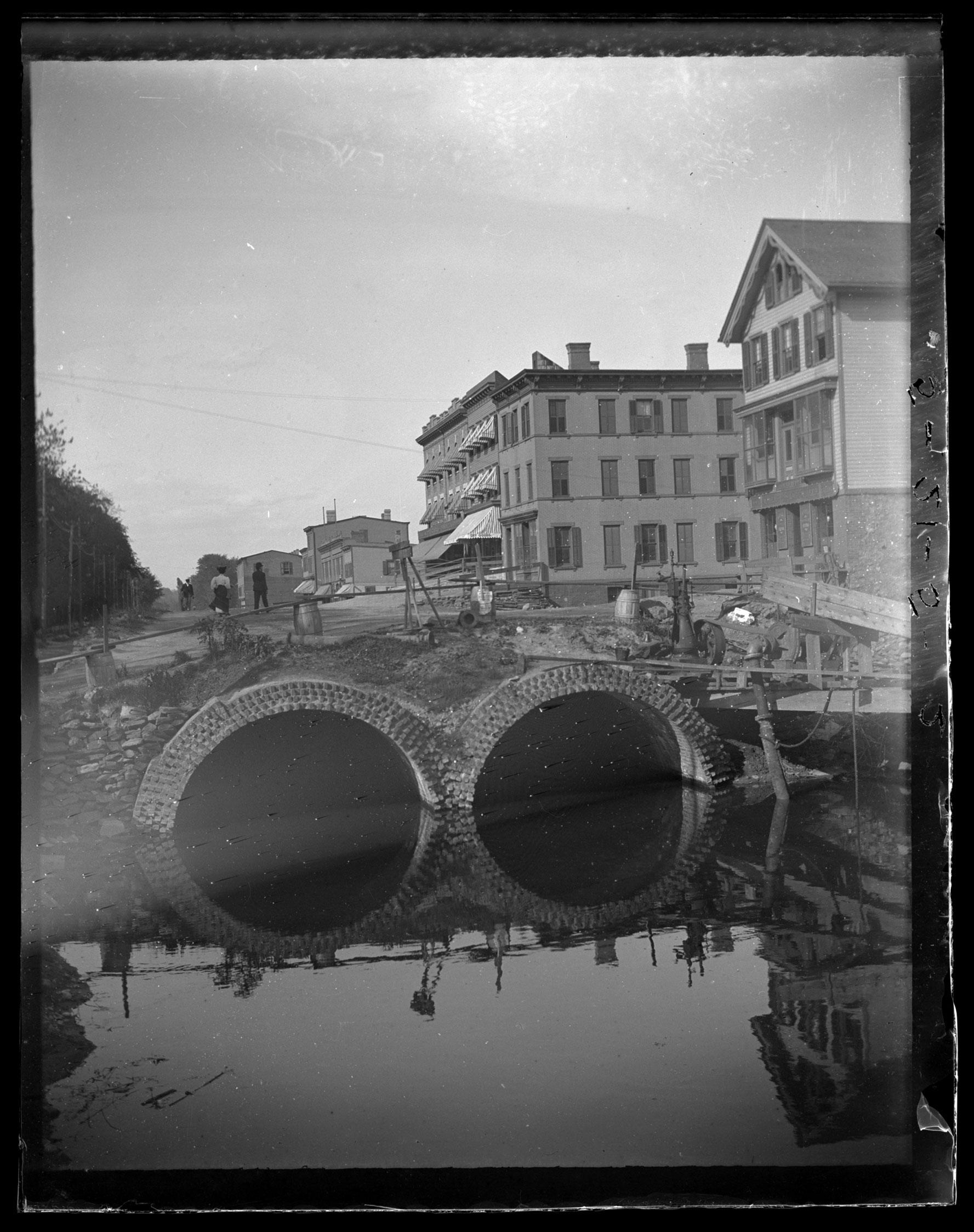
So, intersection is Macomb St (231st) and Broadway, looking north on BWay ca 1900.
The frame house at the right was replaced shortly after by the 5 story building shown in this 1916 pic with the sign on it
https://cdm16694.contentdm.oclc.org/digital/collection/p16124coll2/id/27564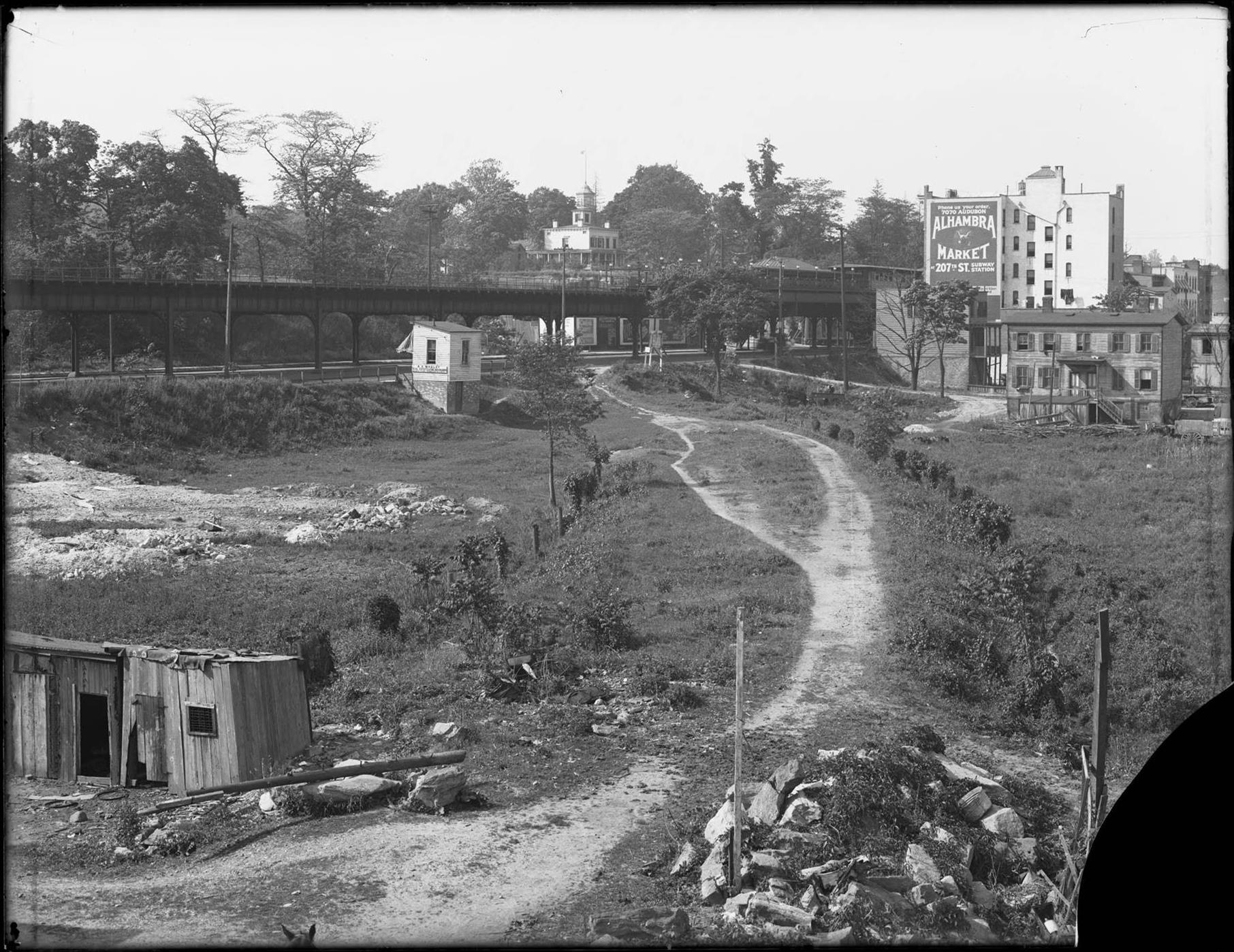
Going right to left from that frame house in the original photo we have 5580, 82, 86, & 90 Broadway, all still standing and easily recognizable today.
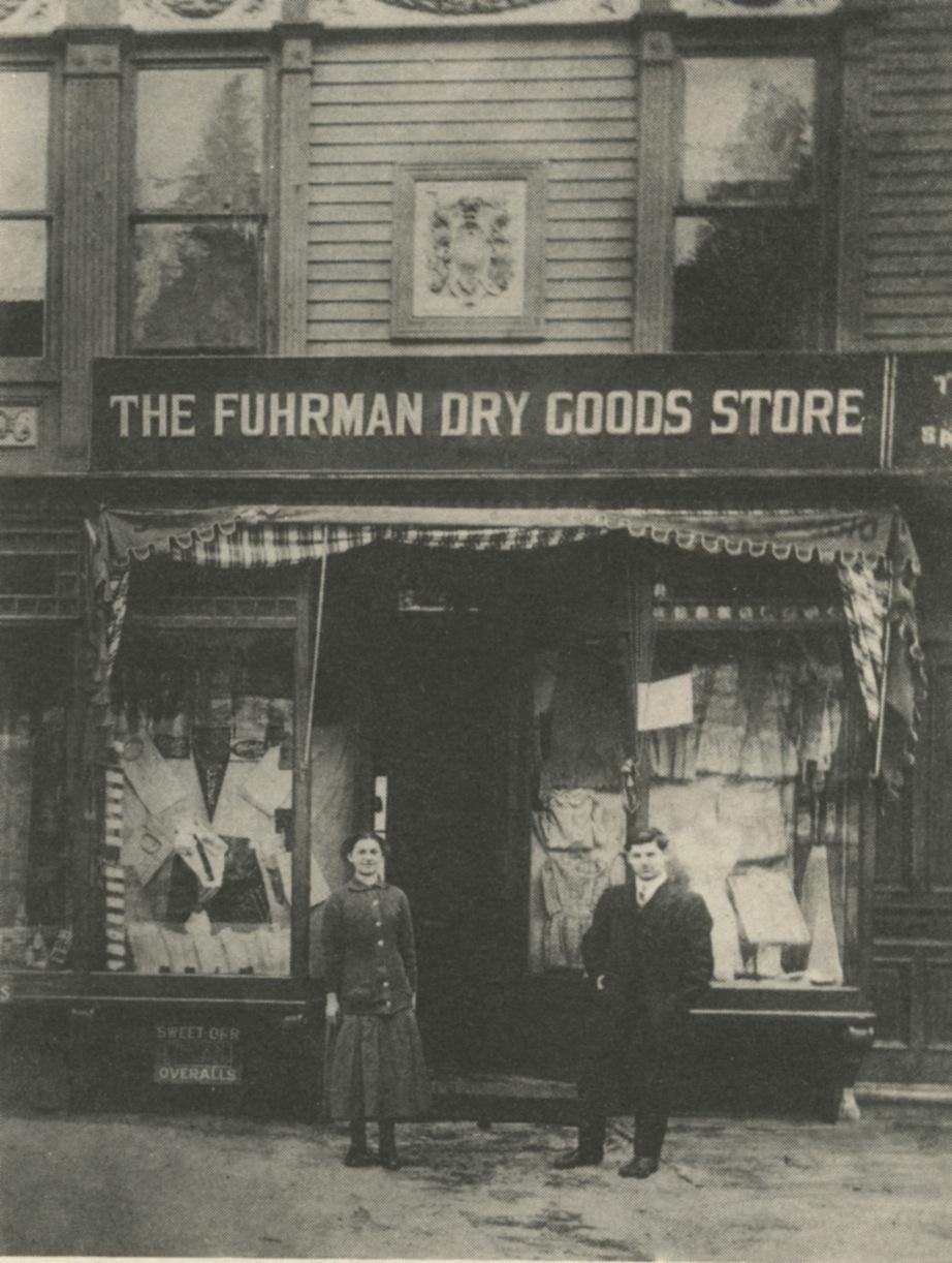
After that it is trickier to see in the blurry background, and according to Tieck those wooden frame buildings were all raised one story to be at street level after broadway was raised. I’d guess we are looking at them BEFORE they were raised up. At least three of them should still exist, including 5610 Broadway, which was the original location of Fuhrman Brothers, though I can’t distinguish them enough to sure which one it is. Here is what it looked like ca 1940
http://nycma.lunaimaging.com/luna/servlet/s/8b33rg
I’m a member of a Facebook group dedicated to solving mystery NYC photos and I had this one on my list of possible ones to submit.
Thanks for posting, I’d come across this one before and wanted to know where it was. Knowing it really was Kingsbridge area, and particularly knowing several buildings still existed made it solvable.
I had no idea there were pipes like that running under Broadway, but it is a great piece of the puzzle of understanding the huge changes to the area that make it often hard to picture what was where. The raising of the terrain can be particularly tricky, and I like how this pic makes it clear that Broadway was raised before some of the surrounding areas, which explains why raising the terrain still left the El as elevated as it still is. -
May 6, 2019 at 11:38 pm #963
Nailed it! Nice going, ALasky and thanks, Tom, for participating as well.
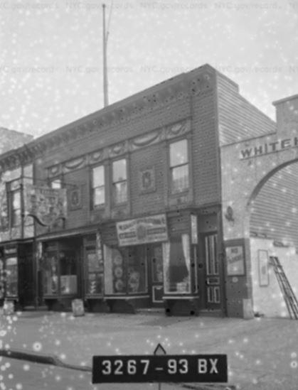
It is indeed W. 231st and Broadway.
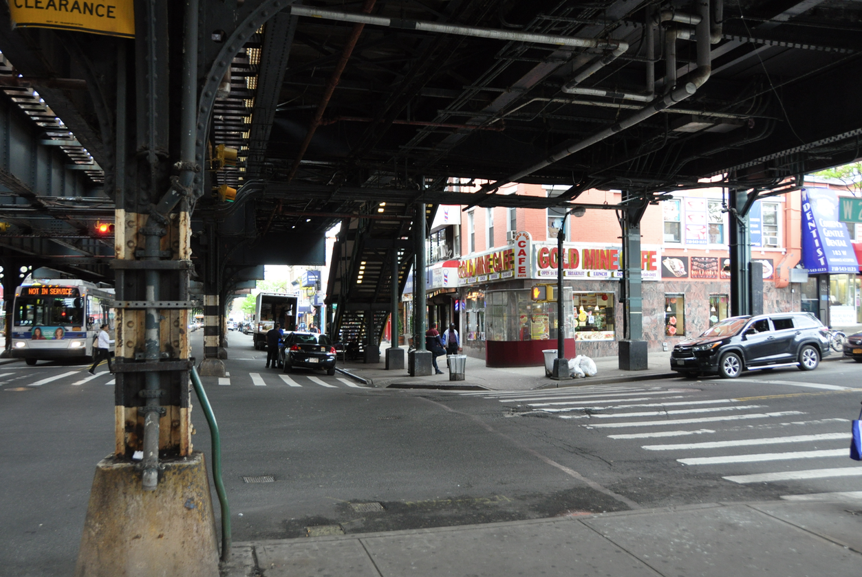
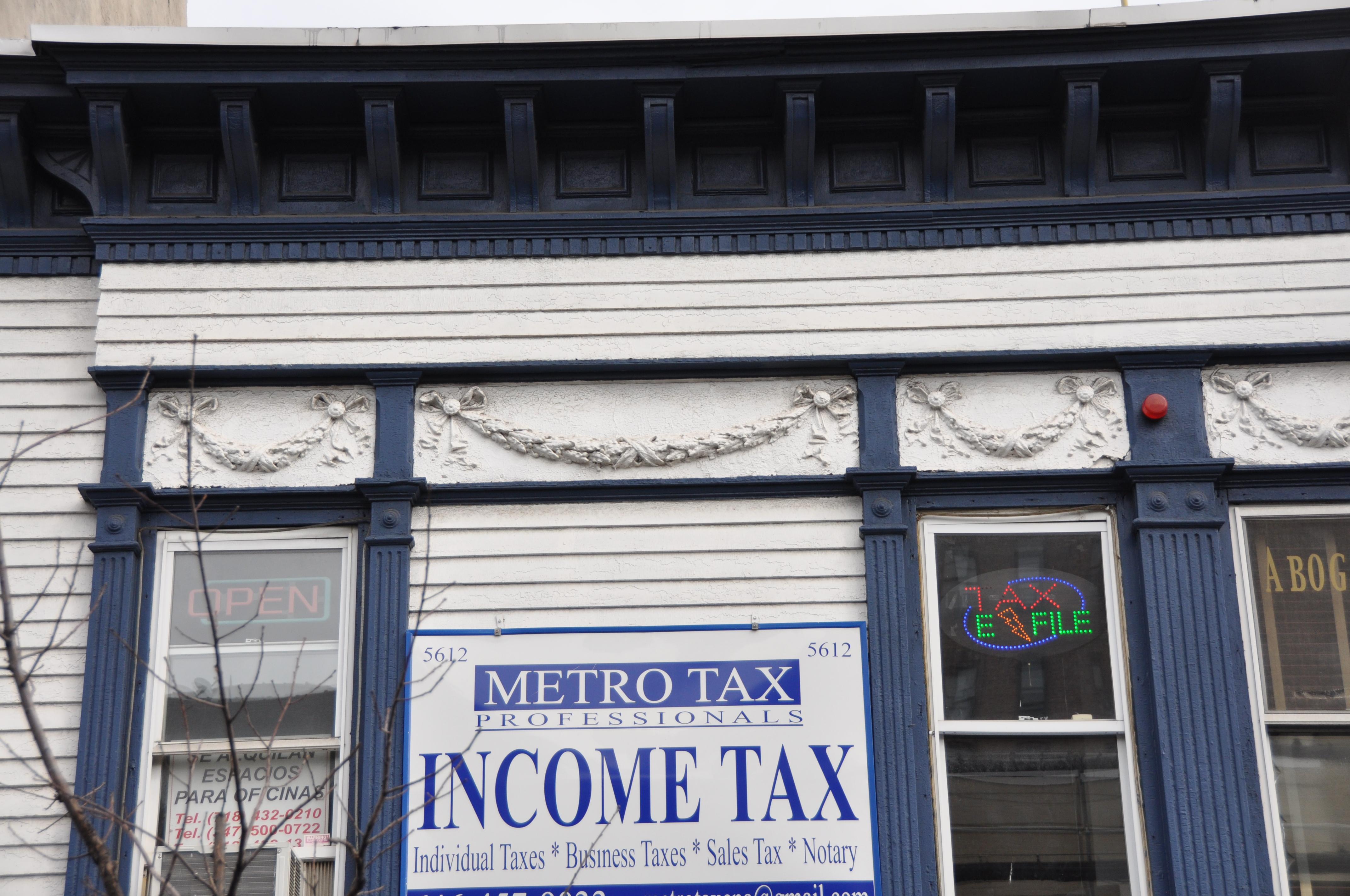
The three-story apt. building on the corner is now the home of the “Gold Mine Cafe” and the three adjacent buildings are still standing:
Here’s the view from the street. The overhead train obscures most of the view:
The decorative elements and number of windows match the 1905 photo.
Further down the street are more buildings that are still around (including the one from the tax photo posted by ALasky).
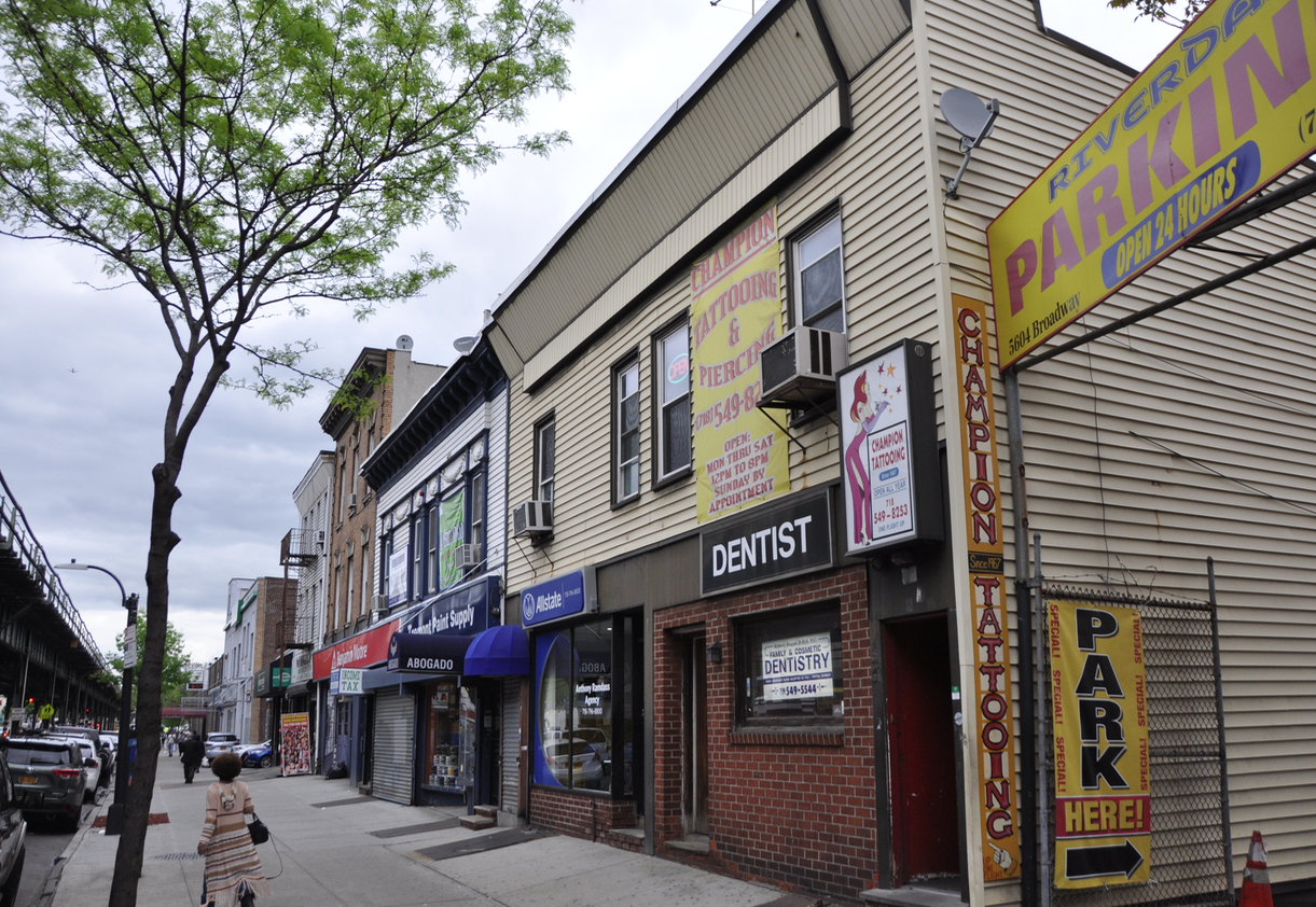
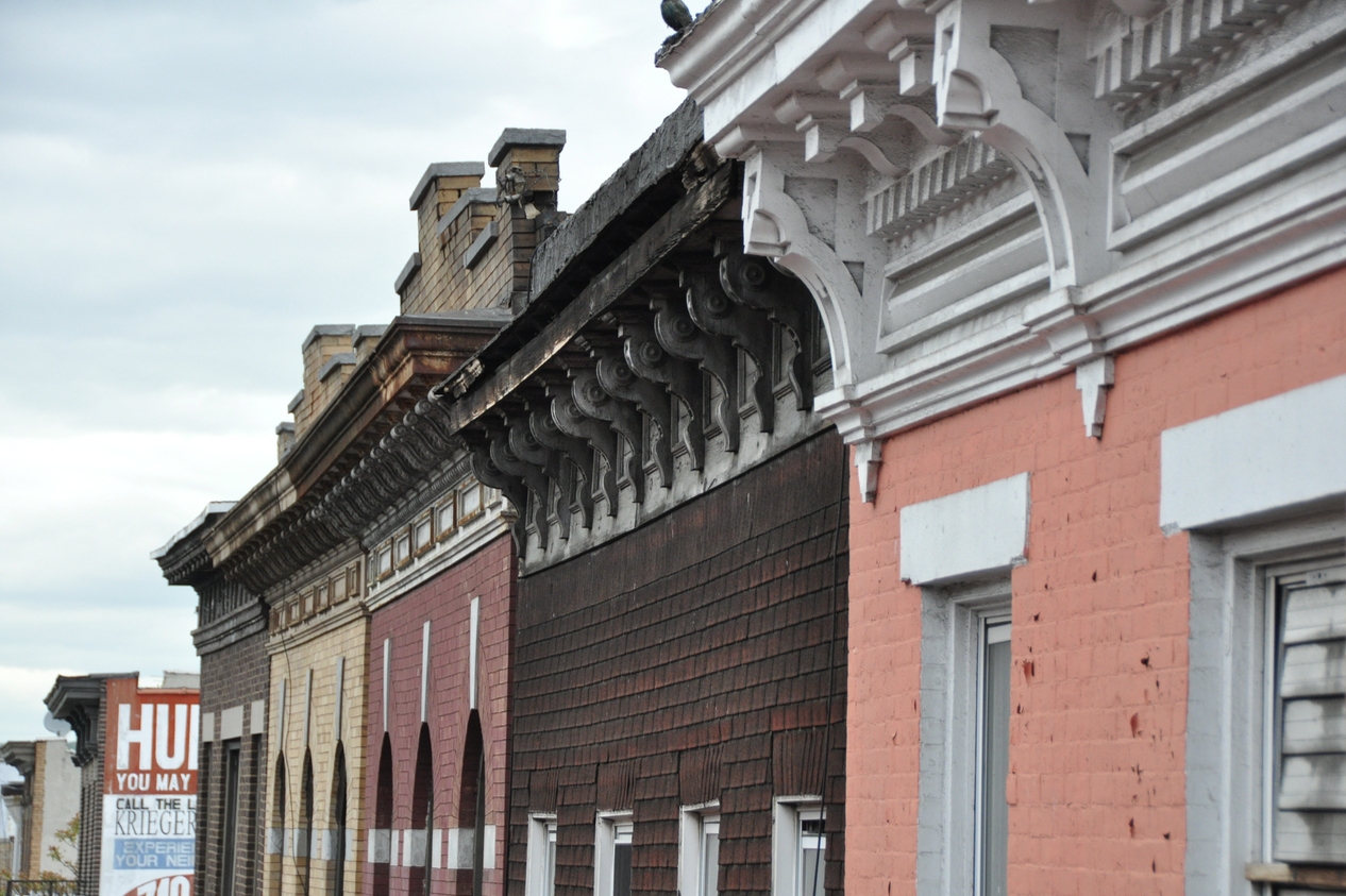
The white and blue painted building is the former home of Fuhrman’s Dry Goods, a department store:
You can still see some of the decorative elements from the facade:
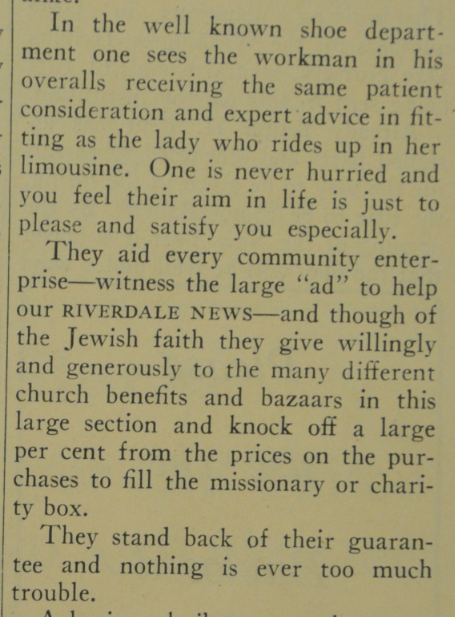
Fuhrman’s was a beloved local store. Here is a section of an opinion piece from the Riverdale News from the late 1920’s:
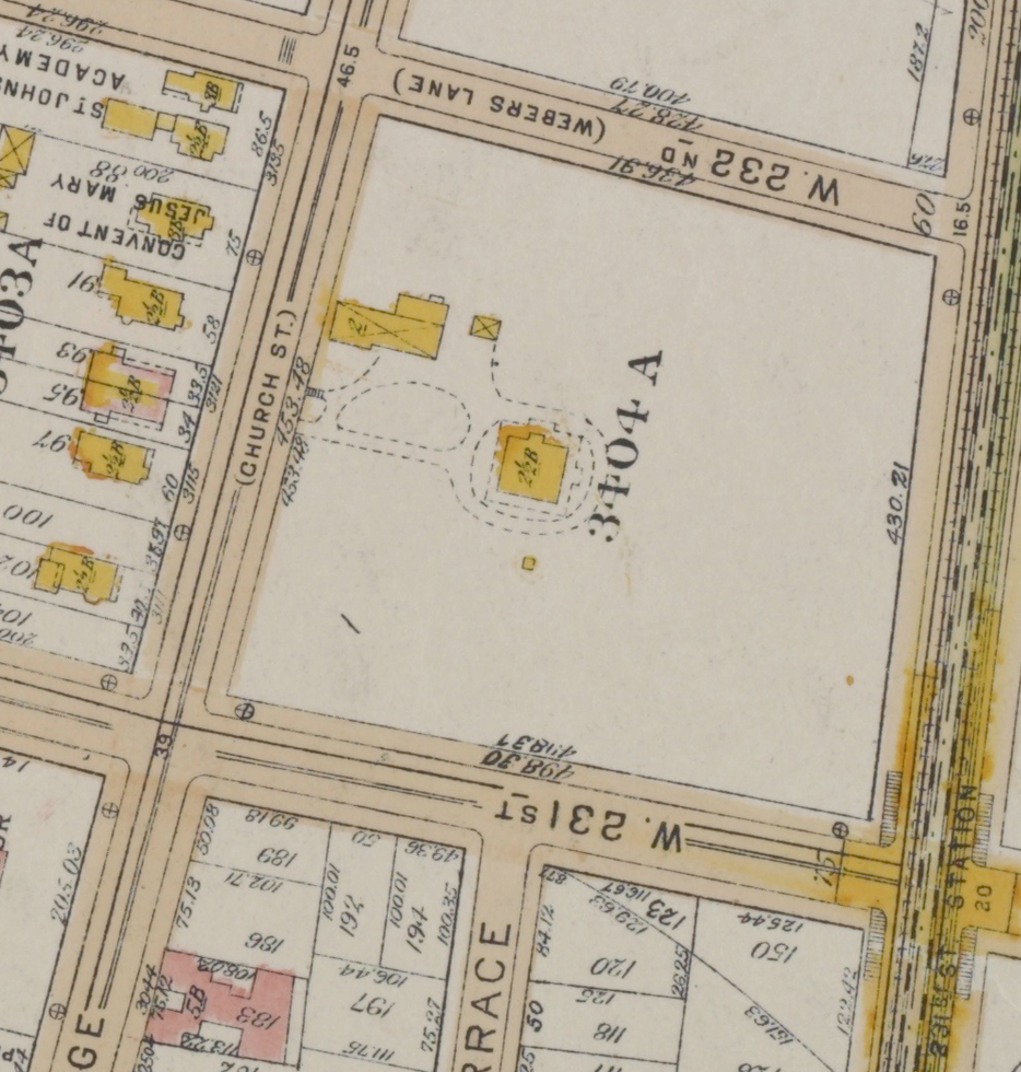
The trees on the left side of the 1905 photo may seem strange but according to this 1921 map, there were no buildings on the west side of Broadway between 231st and 232nd Streets. There was only one building within that block. The below map snippet has Broadway on the bottom and Church Street is now Kingsbridge Avenue:
The double-culvert sewers run under Broadway. I had always been under the impression that Tibbett’s Brook was buried in tunnels like these under Tibbett Avenue but numerous articles state that the Brook actually runs under Broadway through the tunnels in the 1905 photo:
At the southwest corner of [Van Cortlandt] lake, the freshwater flow of Tibbetts Brook is routed down into a storm drain that leads to the Broadway sewer, where it mixes in with raw sewage and stormwater. “On a dry day, four to five million gallons of water from Van Cortlandt Lake goes into the Broadway sewer,” says Taylor.
That mix leads to a filtration plant. When rains are heavy, the plant cannot handle the flow so the overflow (sewage included) empties into the Harlem River. The effort to daylight Tibbett’s Brook would help solve the problem of raw sewage being dumped in the River. The Times has more info on the buried brook here.
Thanks for reading and participating.
-
-
AuthorPosts
- You must be logged in to reply to this topic.