Home › Forums › The Industrial Era › Locust Grove in Van Cortlandt Park?
- This topic has 11 replies, 3 voices, and was last updated 7 months, 1 week ago by
jbakerjonathan.
-
AuthorPosts
-
-
September 2, 2025 at 7:24 pm #4981
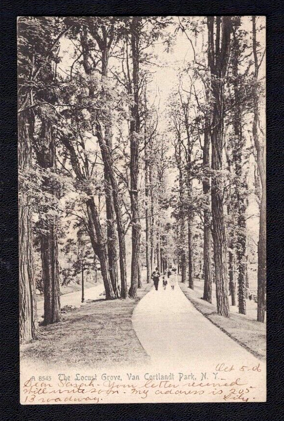
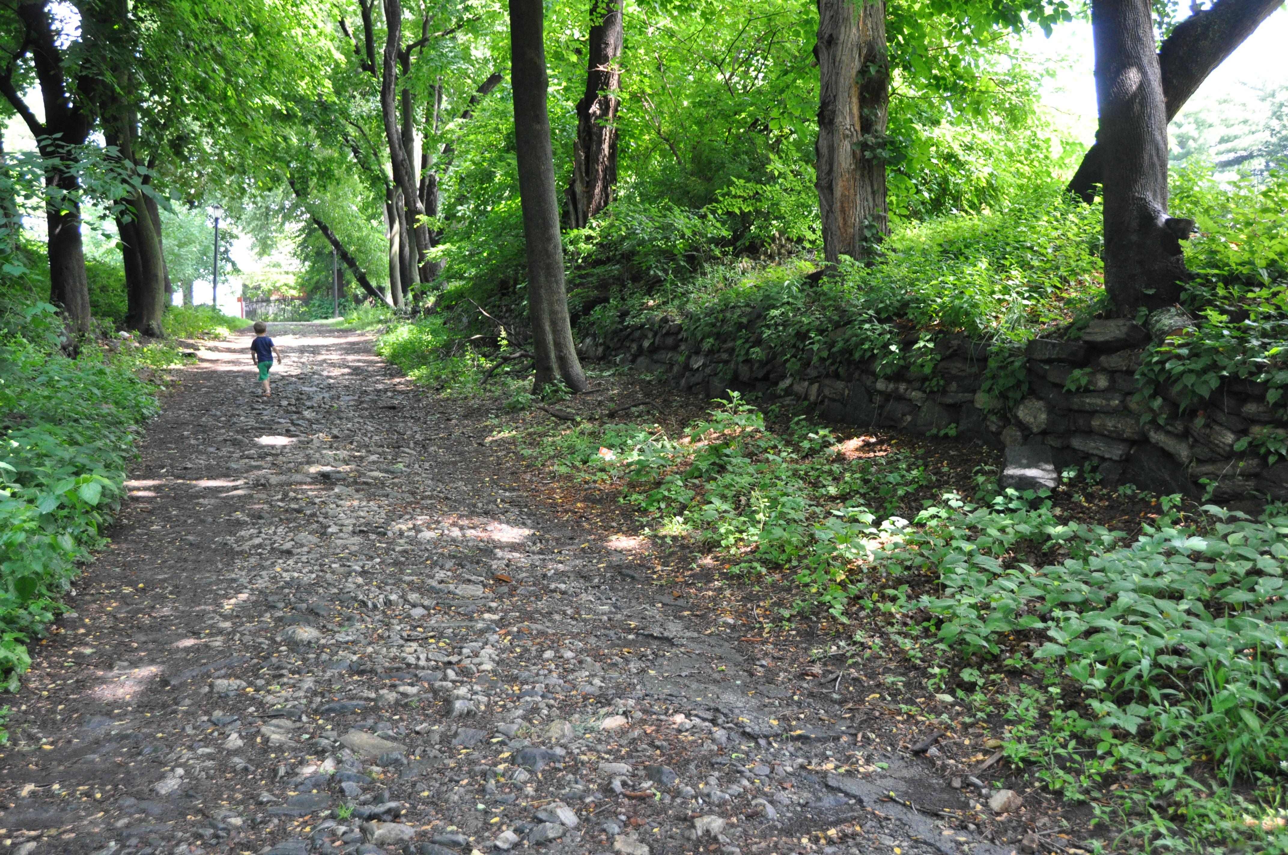
I am wondering if anyone knows or if anyone can help me find where the “Locust Grove” was located in Van Cortlandt Park. The grove predates the establishment of the park (I’ve seen a number of references to it as early as mid 19th century).
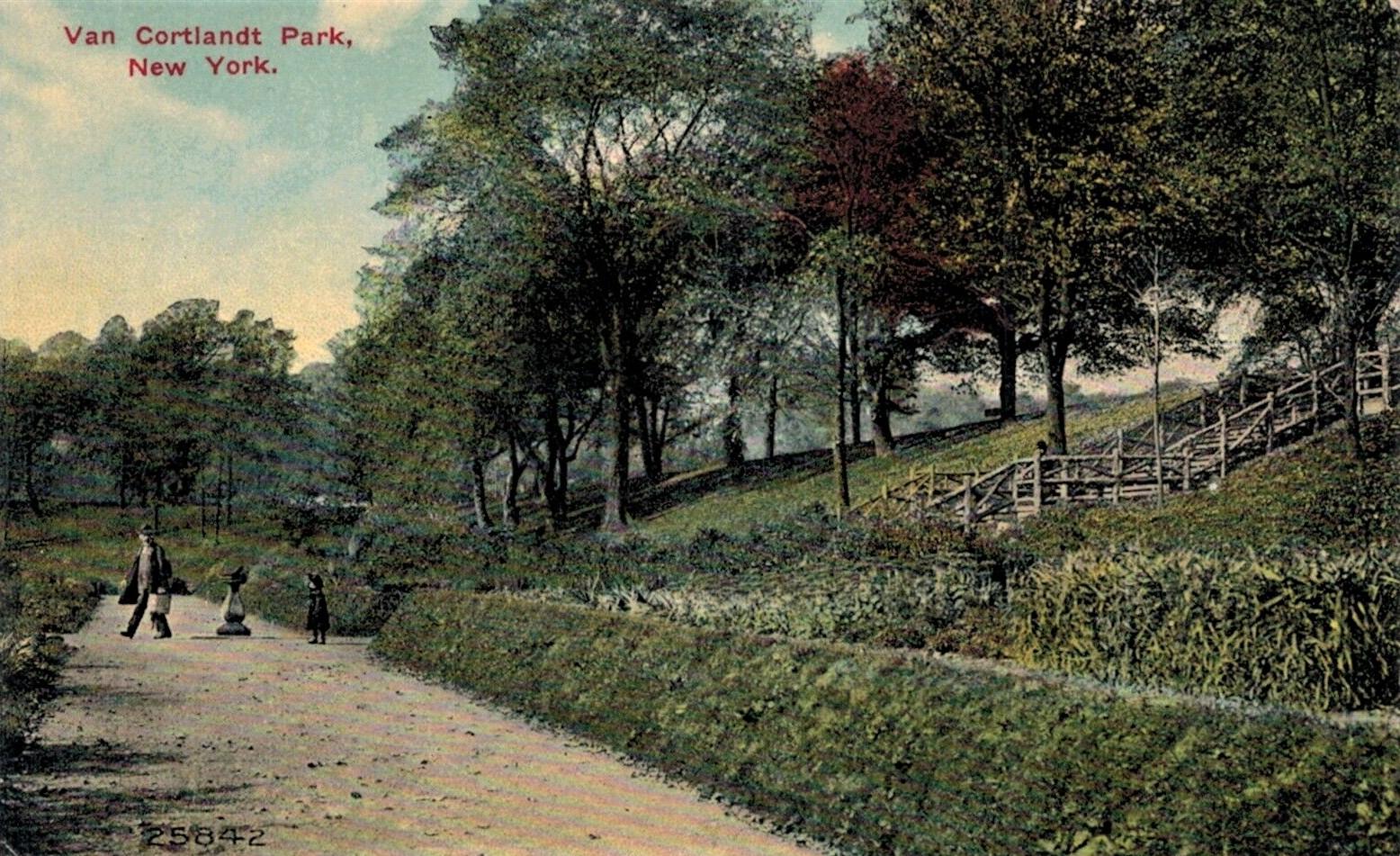
Just east of the Van Cortlandt House Museum is a park trail or road lined with stone walls. I think it may have been there because there still are some locust trees on either side of the trail. But I’m not 100% sure. This postcard depicts the grove:
-
September 2, 2025 at 8:30 pm #4982
There are tennis courts to the east of the Museum House. Do you mean to the east of those, or between them and the Museum? There seems to be a road next to the path. Do you have a date for the photo in the postcard?
-
September 3, 2025 at 12:11 am #4983
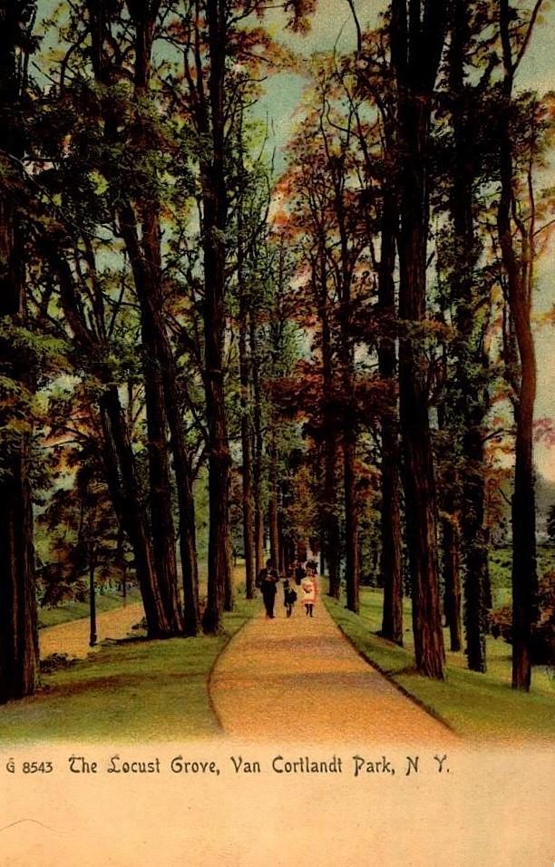
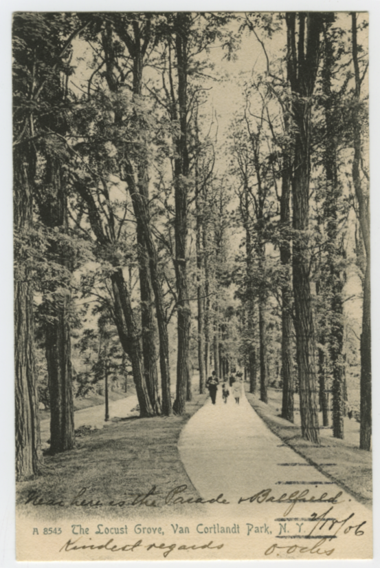
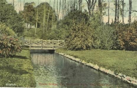
Mine is 1905. Nick found a similar postcard that the sender stated the grove is near the ballfield
-
September 3, 2025 at 12:12 am #4984
-
September 3, 2025 at 12:13 am #4985
-
September 3, 2025 at 12:27 am #4986
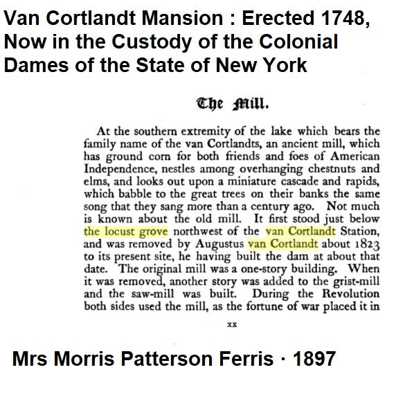
Van Cortlandt Mansion : Erected 1748, Now in the Custody of the Colonial Dames of the State of New York states the Grove was above the Old Mill.
-
September 3, 2025 at 9:24 am #4988
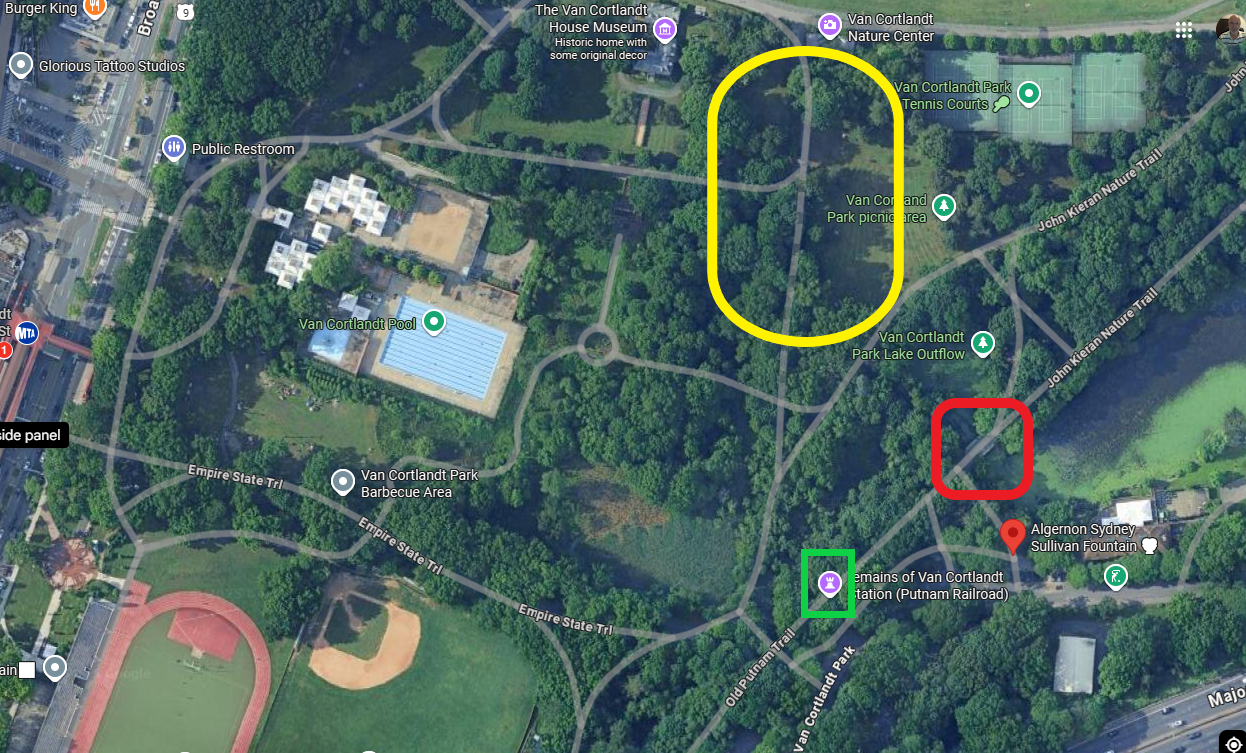
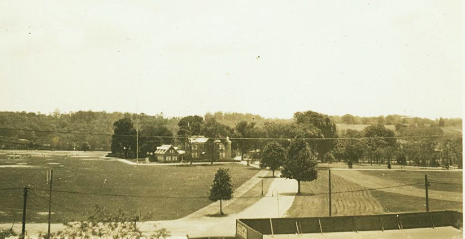
Following the description in Thomas’s article on “The Mill”, “It [the old mill] first stood just below the locust grove northwest of the van Cortlandt Station,”, I place the location approximately within the yellow oval. I show where I believe the old Mill stood in the red square for clarification. The train station is the green square.
I am perplexed that I don’t see either the van Cortlandt House to the rear, if the the photo was taken facing North, nor the train station, if the photo was taken facing South. Also, I can’t place the road with the street lights next to the path with anything in the area. The nearest street in that area is van Cortlandt Park road leading to the Boat House.
Further, the clothing worn by the people in the picture don’t seem to be turn-of the-century style, specifically, the lady’s skirt (unless I’m misinterpreting).
Thomas, you never cease to amaze me with your ability to offer relevant material. Thank you!
-
September 3, 2025 at 9:27 am #4989
In the 1924 aerial view, the van Cortlandt House is in the blue circle, the approximate location of the Locust Grove is in the yellow oval, the Train Station is in the green rectangle and the location of the Old Mill is in the red oval.
The lack of trees in the yellow oval area would indicate that either many trees were felled or that there were few trees to begin with. What constitutes a “grove” might just be in the eyes of the beholder.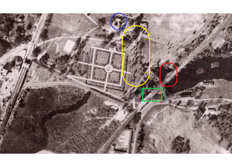
-
September 3, 2025 at 9:39 am #4990
I do not have a date for the postcards but the document Tom shared contains a useful clue. If the locust grove was northwest of Van Cortlandt Station, this aerial view of the park from the early 20th century is helpful:
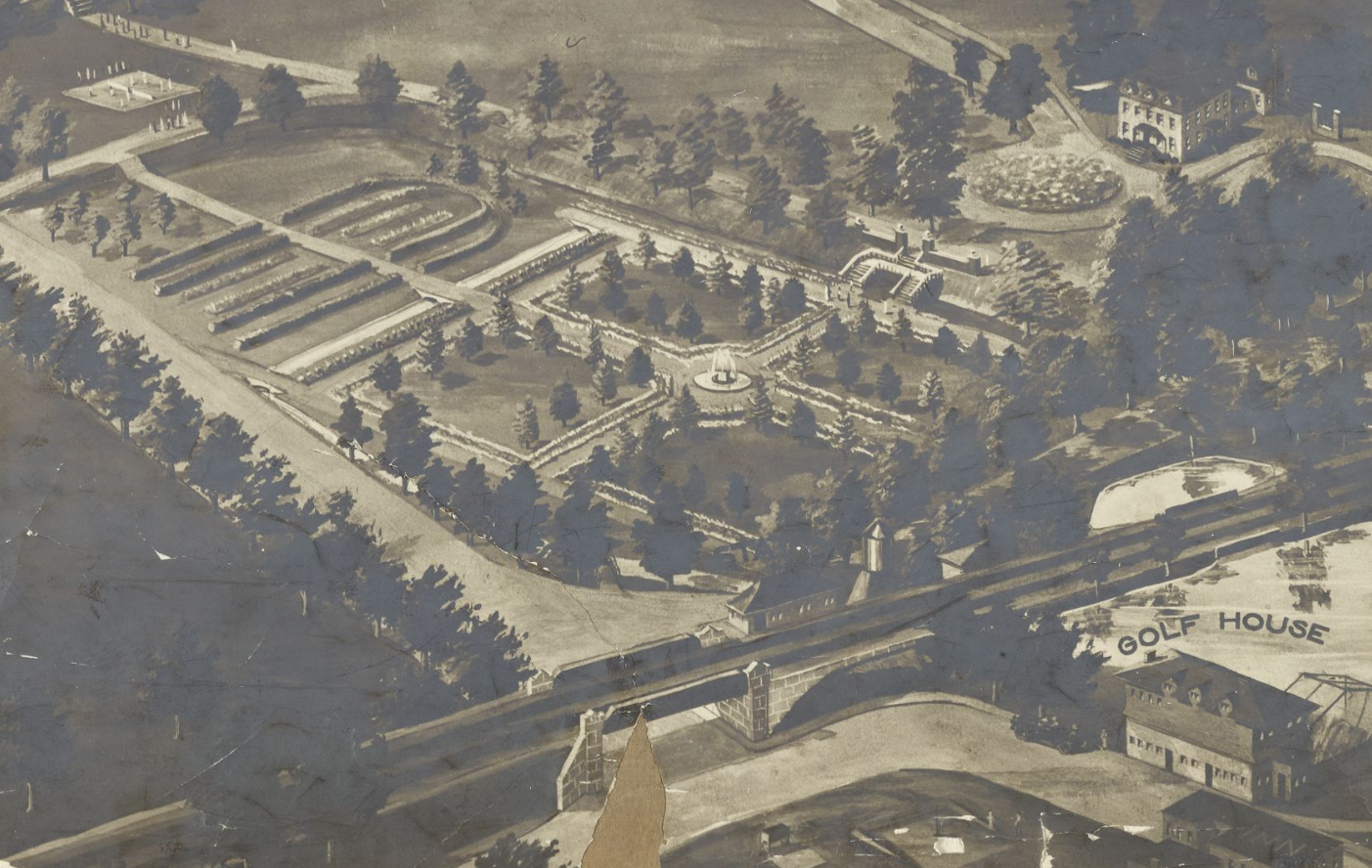
For orientation, Van Cortlandt House is on the top right and Van Cortlandt Station is bottom center. The view is looking north/northwest. I am thinking the locust grove was probably this allée of trees:
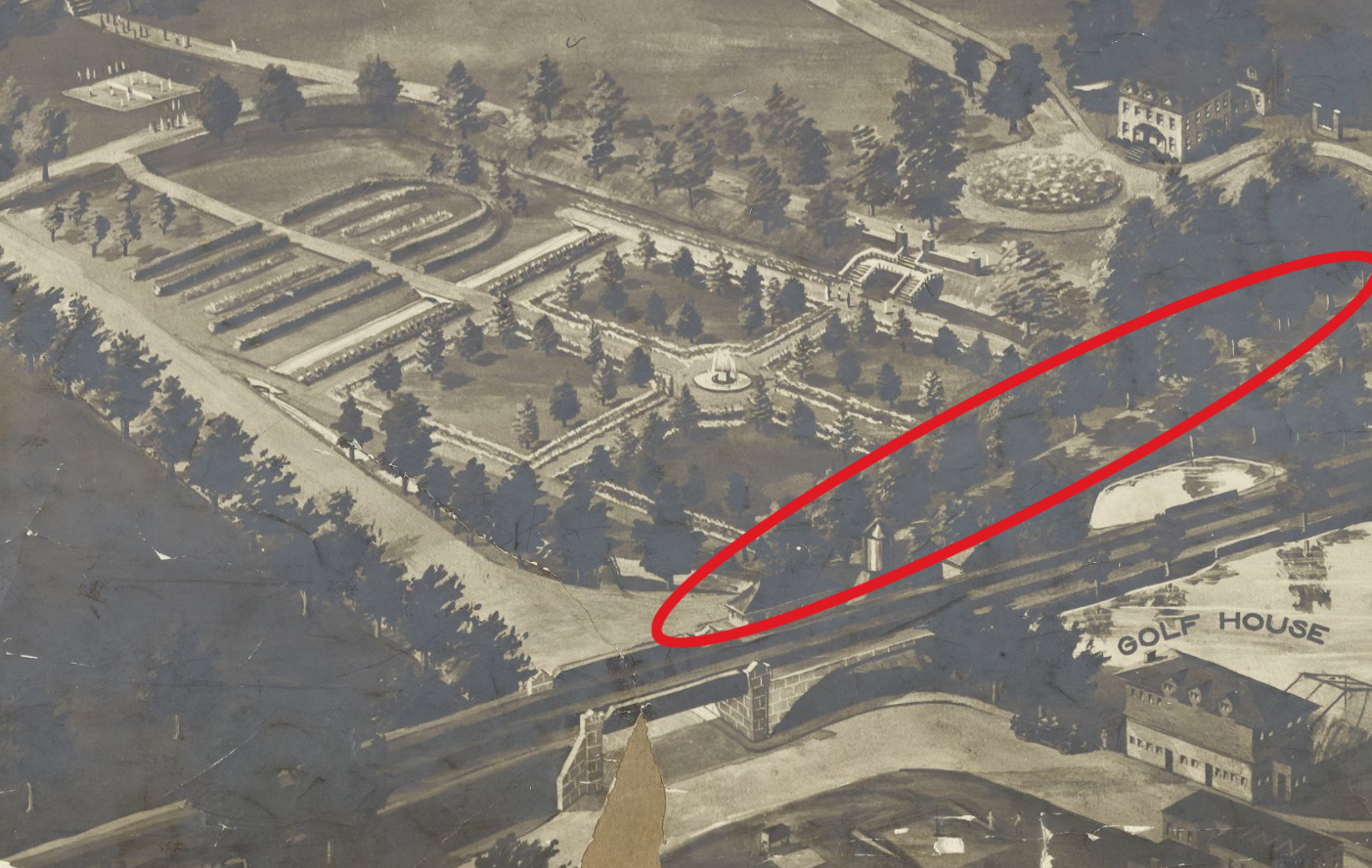
That would have been along the same park trail east of the Van Cortlandt House Museum that is currently lined with trees (a few of which are locusts):
-
September 3, 2025 at 9:40 am #4991
I was writing my post as you were writing yours, Jonathan. But it looks like we are in agreement.
-
September 3, 2025 at 9:55 am #4992
Your 1924 aerial view is helpful as to the layout of the sunken gardens, but other 1900 images show a more wooded scene between the VC house and gardens. The paths may have gone West to East and then turned North.
-
September 3, 2025 at 5:32 pm #4994
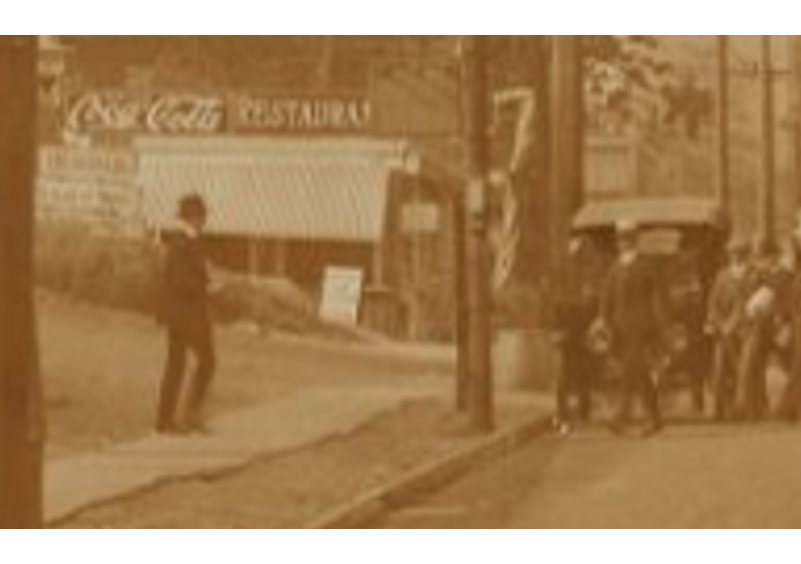
In the post #4992, the last picture seems to be taken from across Broadway looking toward VC House. I’m trying to place the photographer’s position. I’m wondering if he was standing on Old Post Rd behind the restaurant shown in these pictures that were taken around 1917 (from NY Public Library Digital Collection).
-
-
AuthorPosts
- You must be logged in to reply to this topic.