Home › Forums › The American Revolution › 250 Years Ago This Week – Spuyten Duyvil Fortifications
- This topic has 0 replies, 1 voice, and was last updated 1 week ago by
ndembowski.
-
AuthorPosts
-
-
August 25, 2026 at 6:52 pm #5407
250 years ago in Kingsbridge this week…
Thousands of British troops had come to New York and were about to fight George Washington’s army on Long Island.
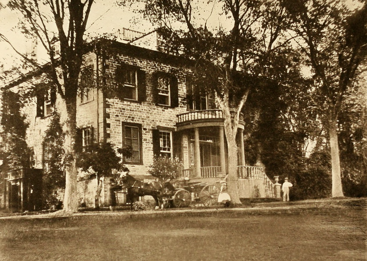
Washington ordered Major General William Heath to take command of a division of troops based in Kingsbridge to defend the strategically important bridges in this neighborhood. Heath’s headquarters was located at the home of Frederick van Cortlandt II, a building which was torn down in the early 20th century. It stood on the south east corner of W. 238th Street near the intersection with Waldo Ave:
The soldiers and militia that were stationed in Kingsbridge, Spuyten Duyvil, and Inwood were busily building fortifications. One unit based in Spuyten Duyvil, Colonel Swartwout’s Dutchess County militia regiment, was ordered to build fortifications on Spuyten Duyvil:
 From the order book of Barnardus Swartwout’s Company for August 23, 1776, NYHS
It says: “Col. Swartwouts Regiment are to carry on [or continue building] the works [or fortifications] on the point north of the mouth of Spiten Devil and the hill contiguous to it.” The “works” on the hill are well-known but what exactly were they building on the “point North of the mouth of Spiten Devil?” Revolutionary-era maps show that two defensive walls were built close to the mouth of the Spuyten Duyvil Creek at the point where it meets the Hudson River (note the two V-shaped lines right at the tip of Spuyten Duyvil). Those are what the Dutchess County militia was building 250 years ago.
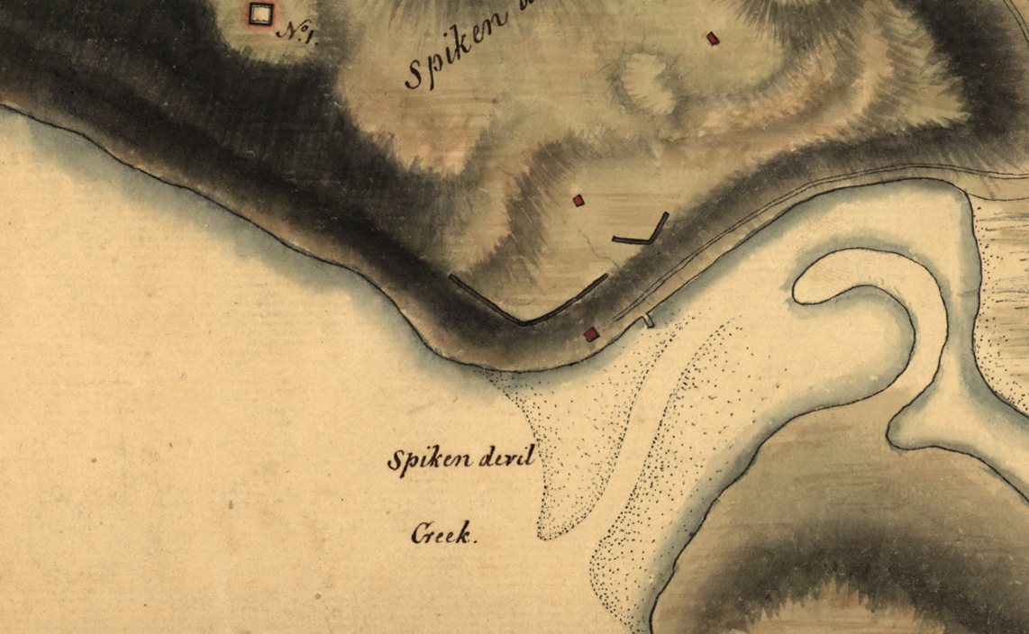 map: Library of Congress
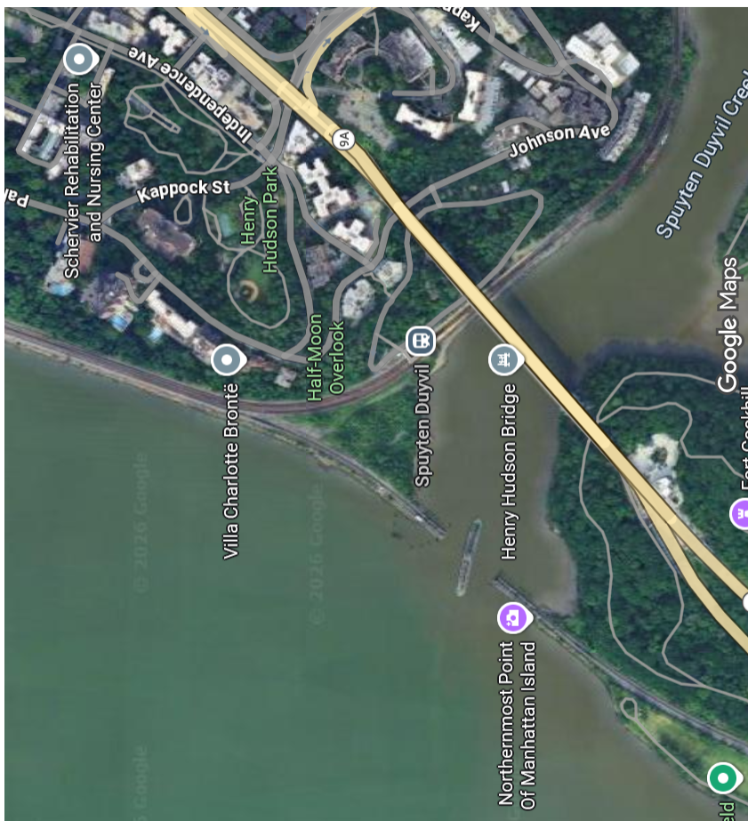
That’s this area today:
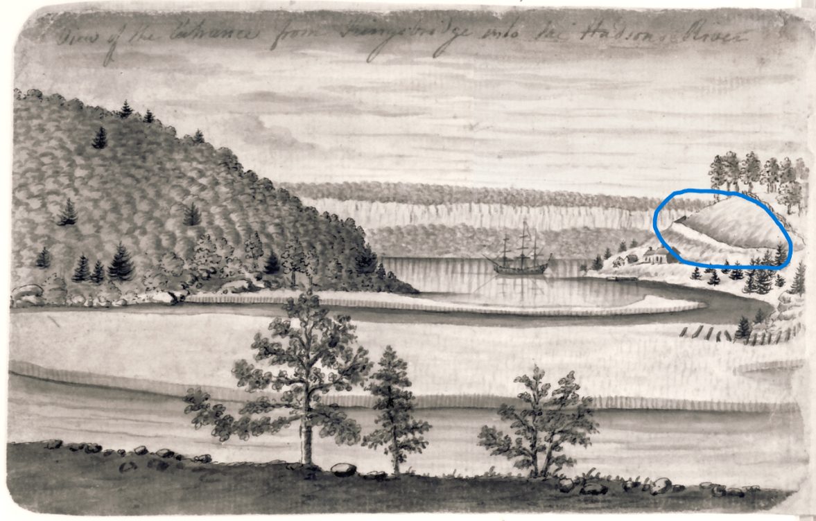
You can see those defensive walls (often referred to as “redans”) in this watercolor below by Captain Thomas Davies, who was a British officer stationed in Kingsbridge during the Revolution. The view is looking west toward the Palisades with Spuyten Duyvil on the right and Inwood Hill on the left. The redan is in the blue circle:
 In the early 1800s, Jacques Milbert drew the same scene and I always wondered if this line was a remnant of those redans. It seems to be in the same place.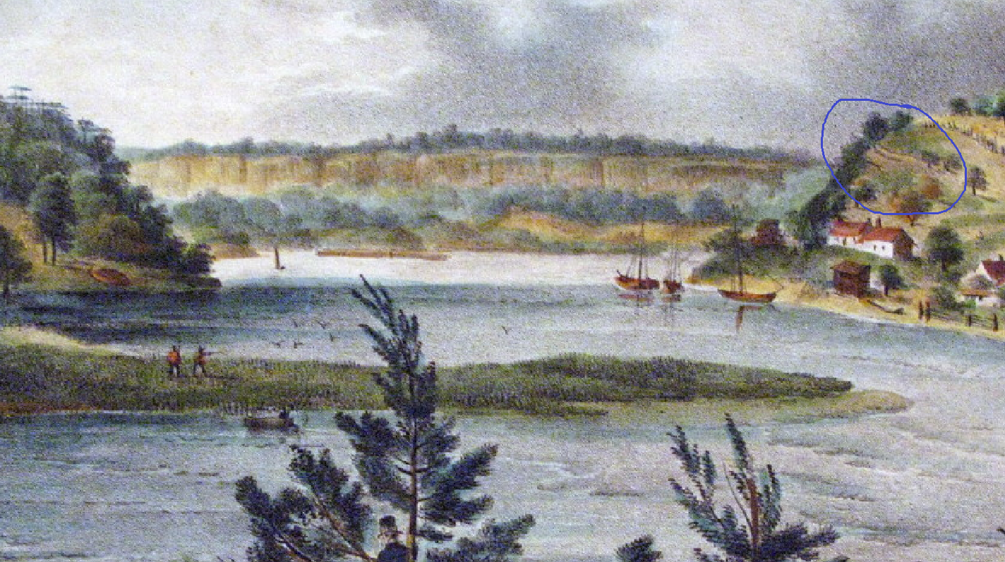
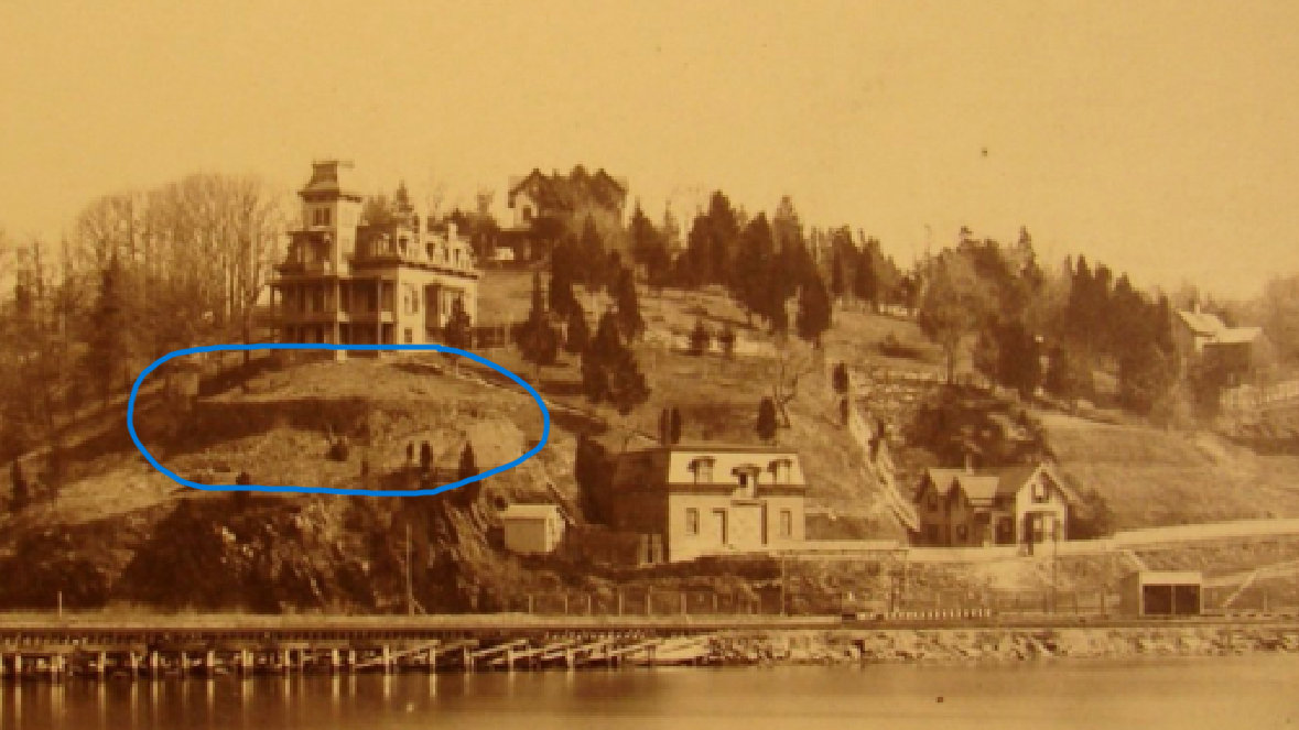
This area was photographed from a different perspective in the late 1800s (looking northeast from Inwood Hill) and I can’t help but notice that there is a prominent V-shaped wall in that same area. Could the retaining wall in the photo have any relationship to the Revolutionary redans?
-
-
AuthorPosts

- You must be logged in to reply to this topic.