Home › Forums › The Colonial Era › The Burger King lot on Broadway
Tagged: Broadway 1915
- This topic has 9 replies, 3 voices, and was last updated 2 hours, 43 minutes ago by
Thomas Casey.
-
AuthorPosts
-
-
November 21, 2026 at 2:41 pm #5582
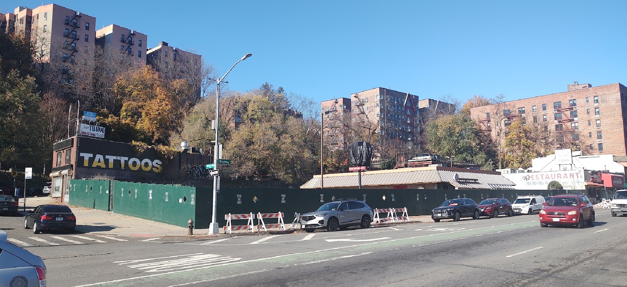
The Burger King between Broadway and Post Road at W. 242nd Street has closed and will be demolished. The Burger King lot is adjacent to Post Road, which is a remnant of one of the oldest roads in America, the Albany Post Road. Before Broadway was constructed, the old post road basically formed the southern and western boundaries of the lot, which sat in the nook where the Post Road hooked north forming an elbow or “L” shape.
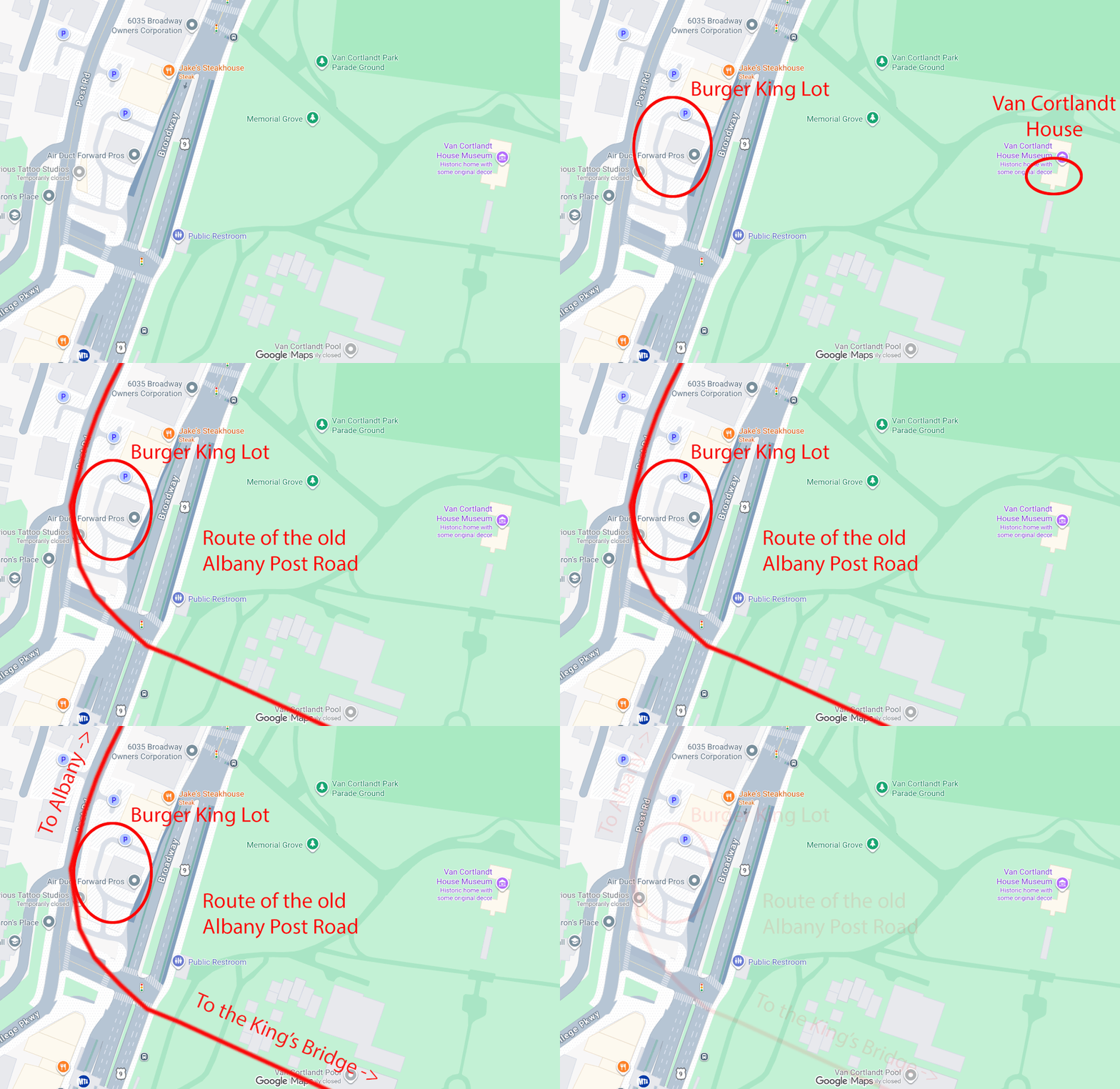
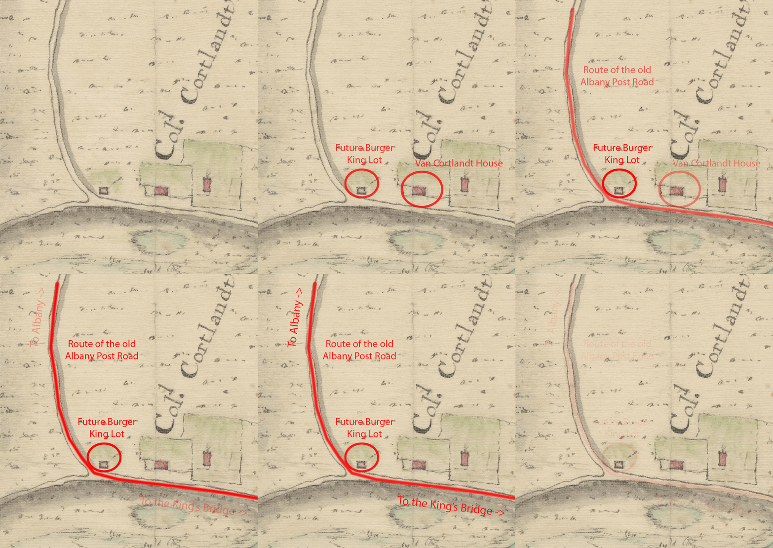
You can see that same hook in the Old Albany Post Road on early maps of the area, such at this one from before the Revolution:
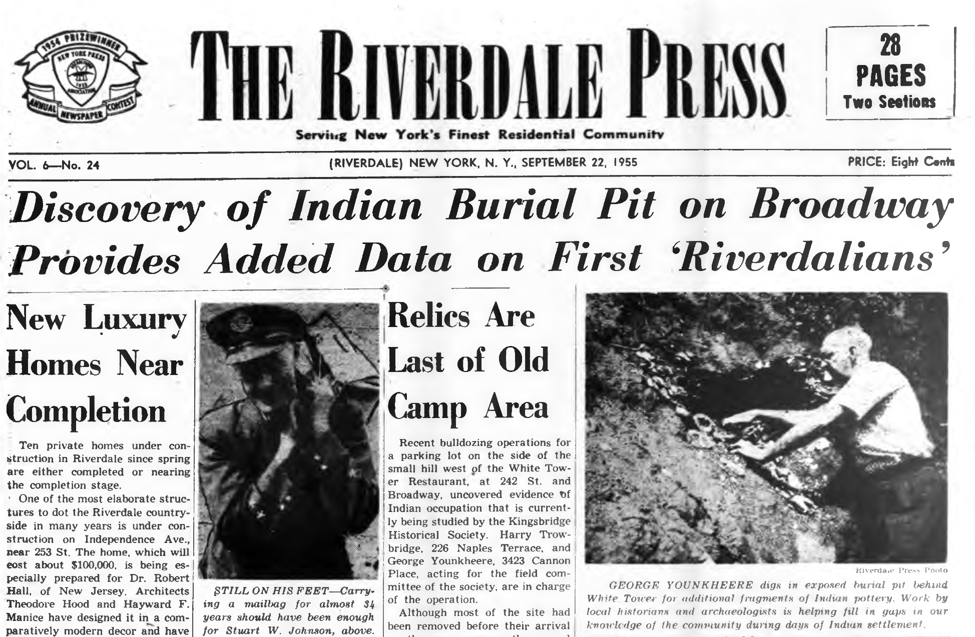
Before any Europeans, Africans, or others arrived in this hemisphere, indigenous people were active on the site. When the first burger joint was built there in the early 50s, the sloping hillside between what is now Broadway and Post Road was excavated to make the land flat and level with Broadway. The excavated hillside became the restaurant parking lot where a large retaining wall holds back the hill on the west side of the lot. Indigenous artifacts were found as part of this excavation conducted by local amateur archaeologists.
The early ownership of the Burger King lot can be traced all the way back to the first colonists. In the 1640s, when our region was still part of the Dutch colony of New Netherland, the property became part of the lands of notable Dutch colonist Adriaen van der Donck (sometimes called the “Jonkheer”). After the English took over New Netherland, two transplants from New England purchased Van der Donck’s lands in our neighborhood. They were named William Betts and George Tippett. When William Betts died in 1673, he left lands in the “Younckers Plantation” to his sons. The Younckers Plantation was what they called the area around Van Cortlandt Park–named after the “Jonkheer” Adriaen van der Donck.
The preamble of the will of William Betts:
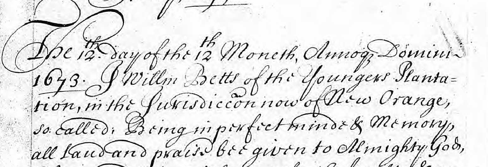
(A side note about the above clipping from the 1673 will of William Betts: In those days, the area was not known as Riverdale or Kingsbridge. The will states that he is William Betts of “the Youngers Plantation in the Jurisdiction now of New Orange.” New York was briefly known as “New Orange” after the Dutch reconquered New York in 1673 and renamed it “New Orange.”)
By the early 1700s, the land was in the hands of a descendant of William Betts named Joseph Betts, who had wanted a seemingly much younger woman, Abigail Baxter, to be his wife. Abigail’s father, Thomas Baxter, may not have loved that idea. In those days, single women generally had a tougher time supporting themselves due to gender-based restrictions on occupations and other factors. Abigail’s father had to worry about what would happen to his young daughter should her older husband die before she did. He came up with a creative solution. Before Thomas Baxter would give his daughter’s hand to Joseph Betts, Baxter had Betts transfer ownership of his homestead and half of his other landholdings to his future father-in-law, who would hold it for the sole benefit of his daughter, Abigail. This would ensure that his daughter would not be left without property if her older husband died before her. If Abigail should become a widow, she would have many suitors to choose from given her large estate. She could also subdivide her lands and sell parcels to support herself.
The deed that recorded this land transfer to Abigail’s father described Joseph Betts’ property as “bounded . . . south & west by ye highway.” That description makes the lot unmistakably the same as the Burger King lot (only bigger), which had the old Albany Post Road as its southern and western boundary. The deed noted that a Van Cortlandt owned the land to the north of the lot.
Just as her father anticipated, Abigail Betts became a widow. At that point, she started selling parcels of land and was signatory to an unusually large number of deeds, especially for a woman in our area at that time (even though she did not know how to write her name).
Predictably, Abigail remarried to someone named Jacob Johnson but he too died and she was a widow again before 1718. She remarried again, this time to Abraham Emmons. The Emmons household also included enslaved and free Black people like Mary Brown, the sister of militiaman Robert Brown.
When Abraham died, Abigail Emmons again was widowed and she again was left with a large estate. Her son, Thomas Emmons inherited the homestead and a vast fortune. He was apparently living there during the American Revolution and a number of period maps labeled the property:
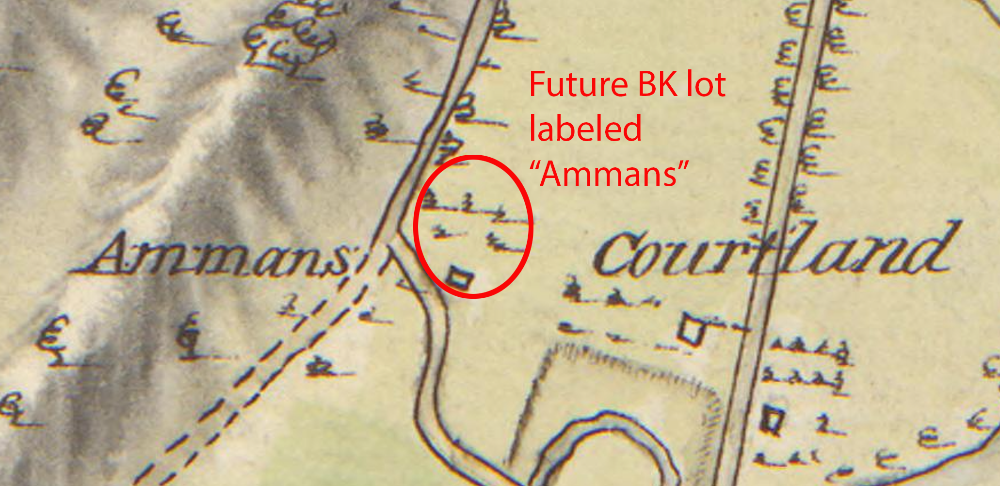
Thomas Emmons was a local political organizer at the onset of the Revolution. His home was close to a number of skirmishes during the Revolution and he certainly would have seen many soldiers march past his home on the strategic road to Albany. On July 3, 1781, a serious fight occurred in front of the Van Cortlandt House and apparently spilled over onto his property. One veteran of the Revolution, Asa Jones, wrote that he took part in “a considerable battle at a place called Emmon’s Hill” on that date. After the Revolution, a cider mill and a black smith shop stood on the property. I don’t know how long the original house survived on the site but there was a house and blacksmith shop there as late as 1873.
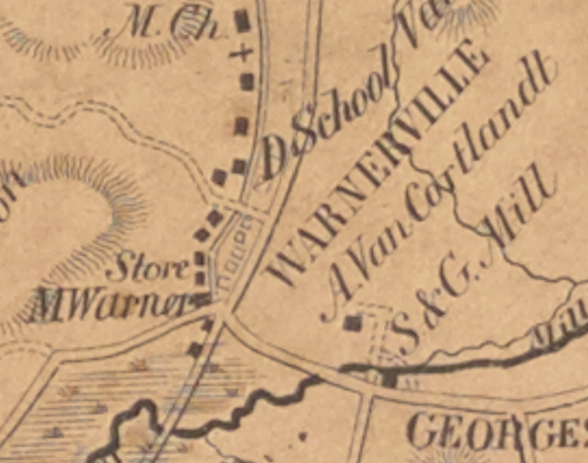
In the 1800s, that little area around Broadway became an important hub of activity for the neighboring community, which was briefly called Warnerville and later Mosholu. The local district school was in that area. There was a blacksmith shop, Warner’s country store (which housed the Mosholu post office), and a temperance hall, which stood on the Burger King site.
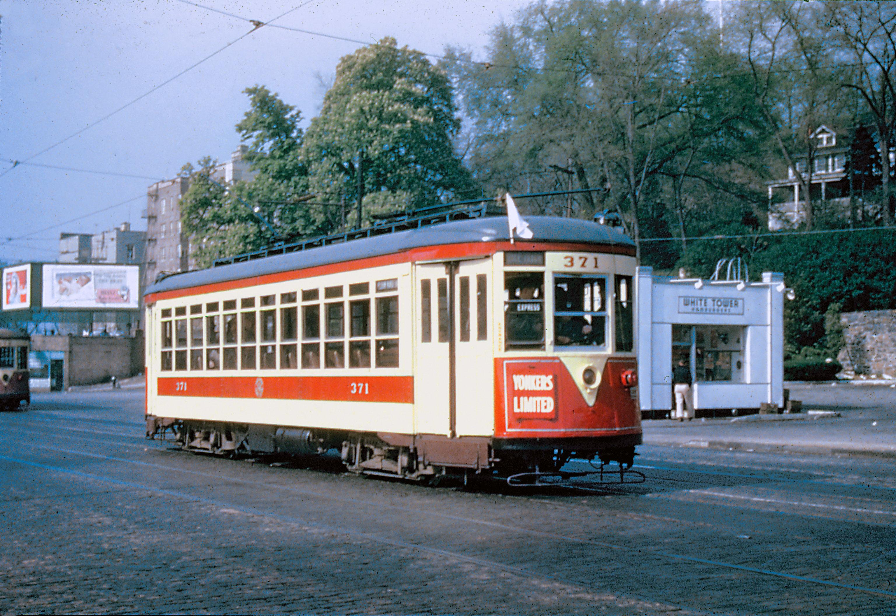
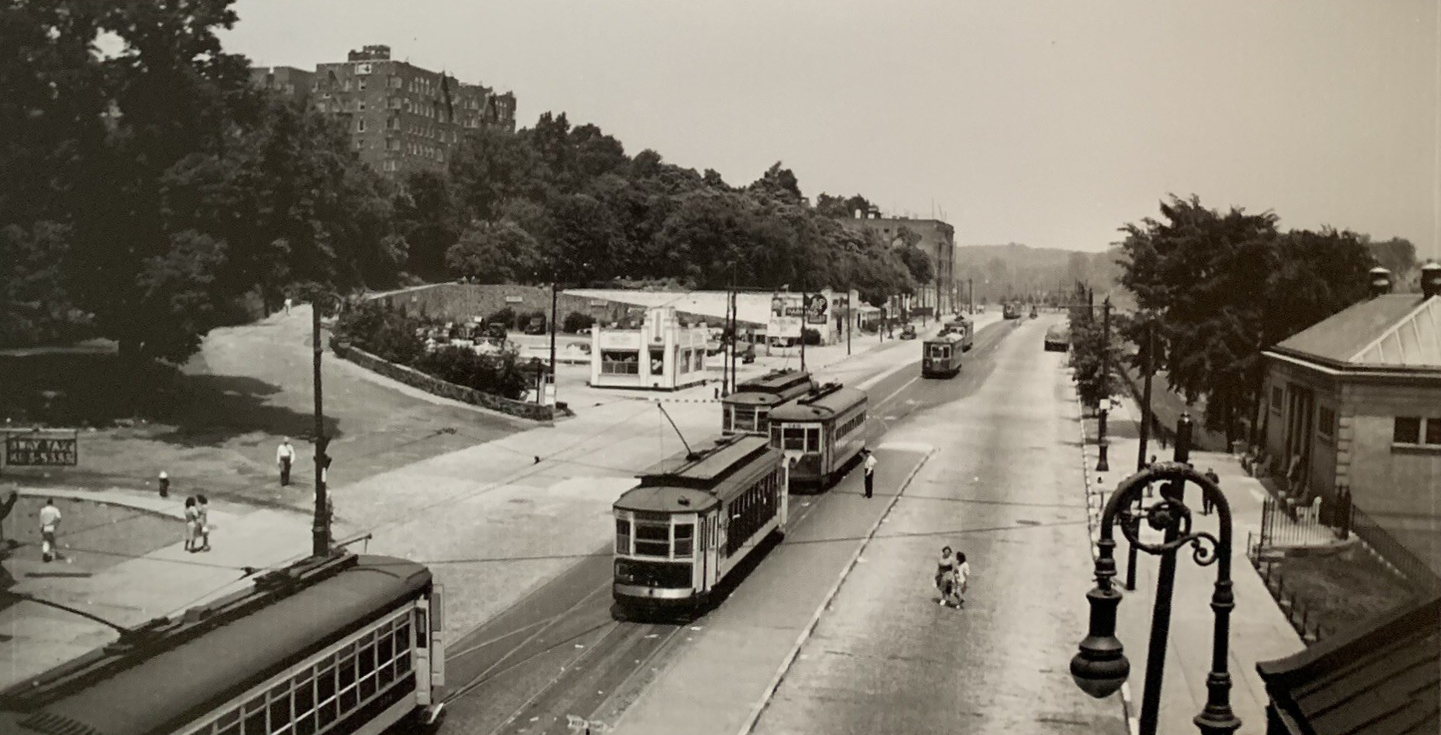
An 1851 Sidney & Neff map labels the area “Warnerville.” I don’t know much about the intervening years but in 1955 the Burger King lot was excavated and the retaining wall built. A burger place called White Tower operated there. I wonder if any of our members have memories of what was there in the 60s and 70s.
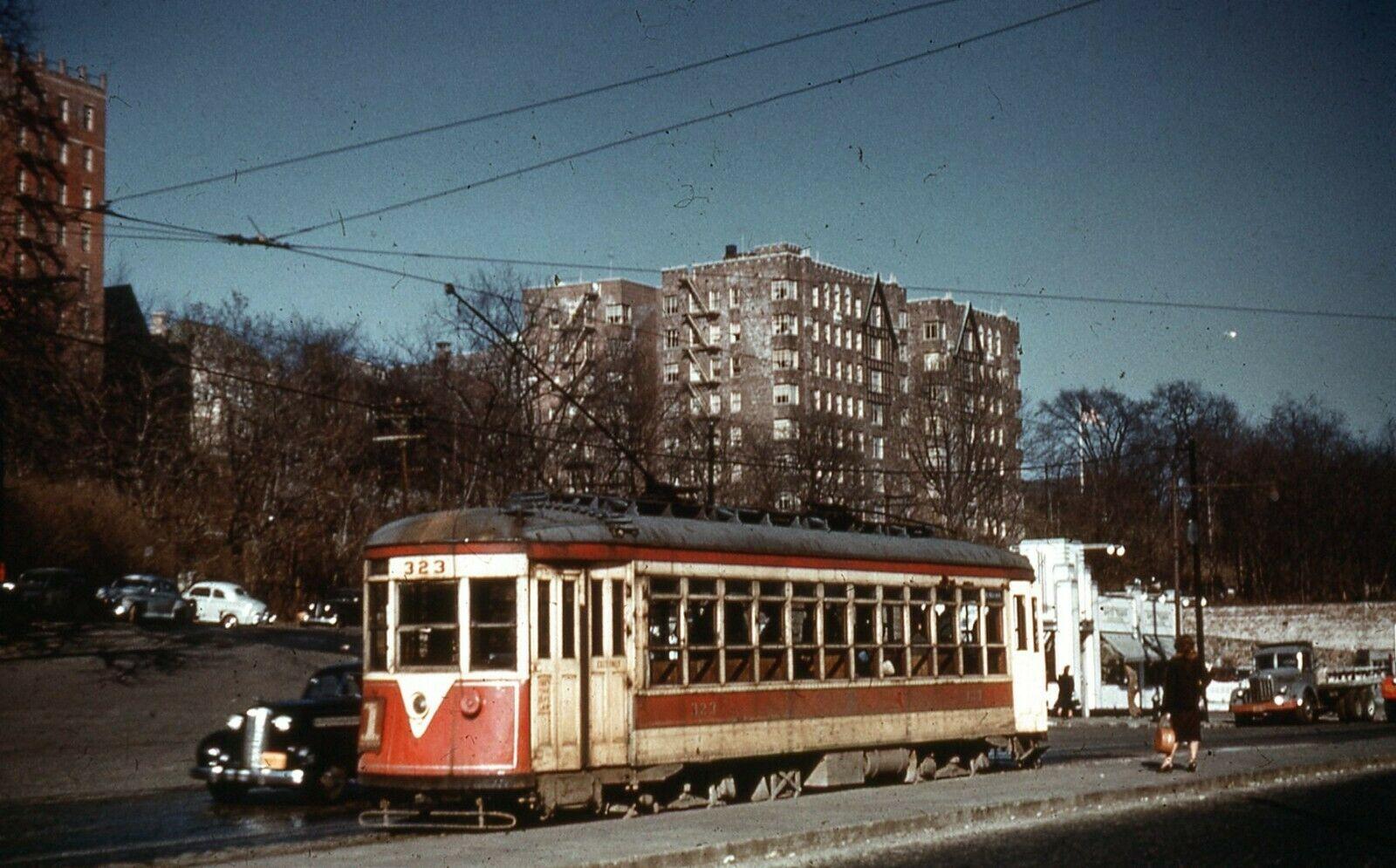
Some photos of the “White Tower” restaurant:
-
November 21, 2026 at 4:25 pm #5583
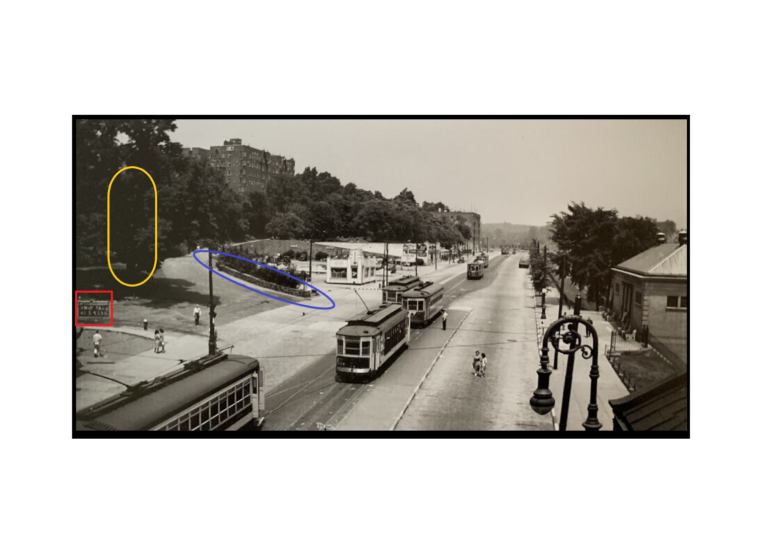
The blue elipsoid shows the stone wall that was there in 1940-41. I hit the back of my head when my older sister and her friend, Junie, tried to pull me up backwards onto the top and I slipped out of their hands. I bled all over the new sailor shirt that my mother had just made for me and I thought that it was ruined.
The tree in the yellow oval was a chestnut tree that dropped really big chestnuts. We called them horse chestnuts. I don’t recall ever eating any.
The taxi business shown in the red square became the Riverdale Limosine Service at a later date,
To the north of the White Tower that sold 10 cent hamburgers, 13 cents if you wanted sautéed onions on top, was the A&P. After WWII there still was rationing, but it was loosening. One day the store was selling quarter pound sticks of butter with a dairy coupon (a big event). My mother had a number of the coupons (blue cardboard tokens) and sent me there. There was a long queue of mostly women and I went there three times. The man doling them out looked down at me and said “You’ve been here before. I don’t want to see you again!) I got the third stick, though.
Nick, do you have a date for this picture? Thanks for all this information. We have a rich history in this area.
-
November 21, 2026 at 5:30 pm #5584
Thanks for adding to the history, Jonathan. I don’t have a date on the photo but the White Tower restaurant is there and it was built in 1955.
The only apartment building on Broadway visible in the distance is 6063 Broadway:
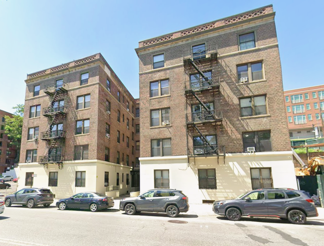
That’s one of the first apartment buildings in the area. It is even visible in the background of photos from the World War One encampment in Van Cortlandt Park:
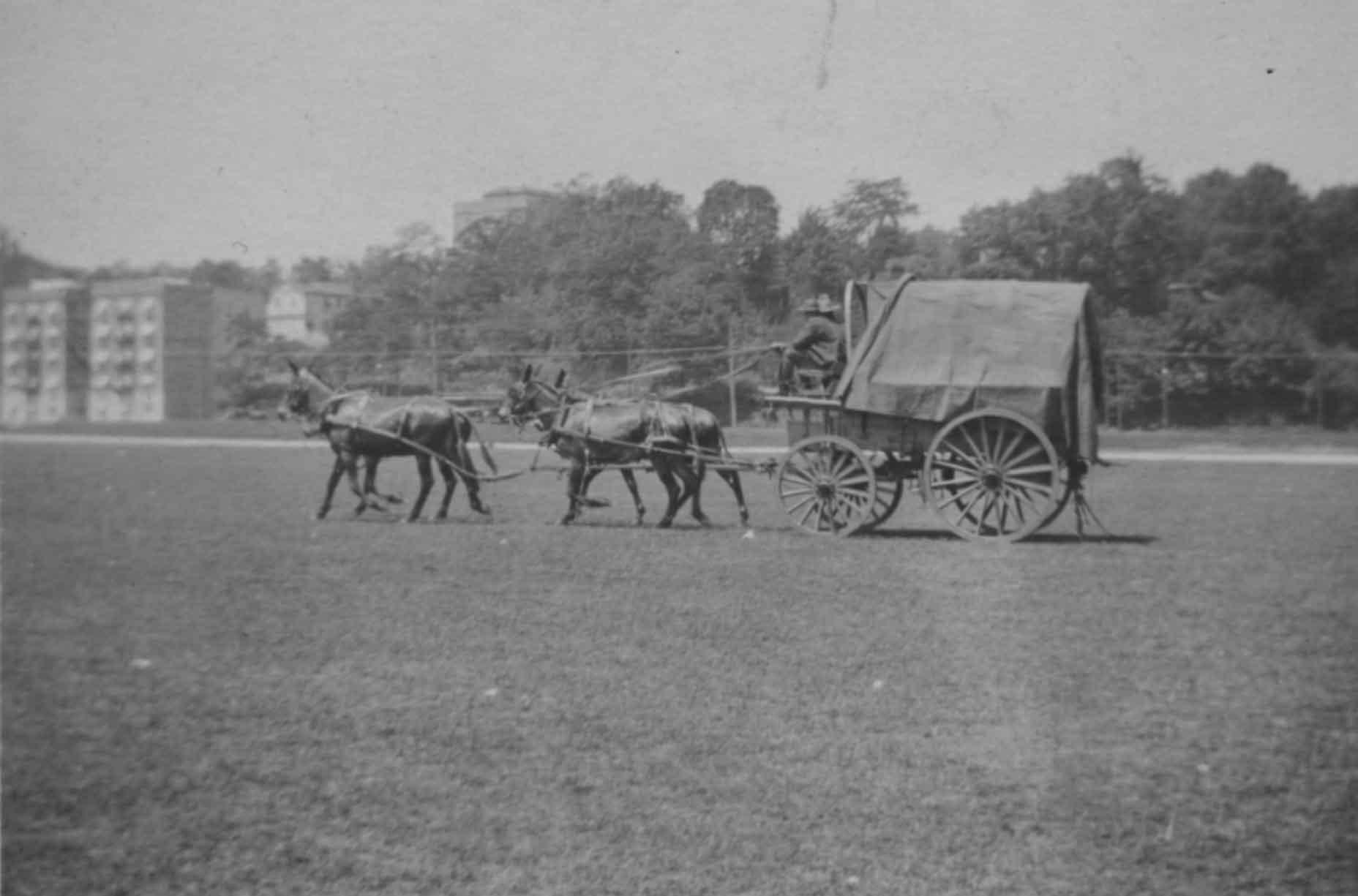
6035 Broadway, “The Fieldston,” is a much taller building and was built in 1960 I believe. Since it is not in the photo you asked about, it was taken between 1955 and 1960.
-
November 22, 2026 at 9:14 am #5585
The White Tower photograph is about November 1952 when the last Trolley’s from Younkers ended.
-
November 22, 2026 at 9:35 am #5586
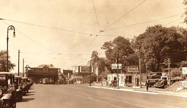
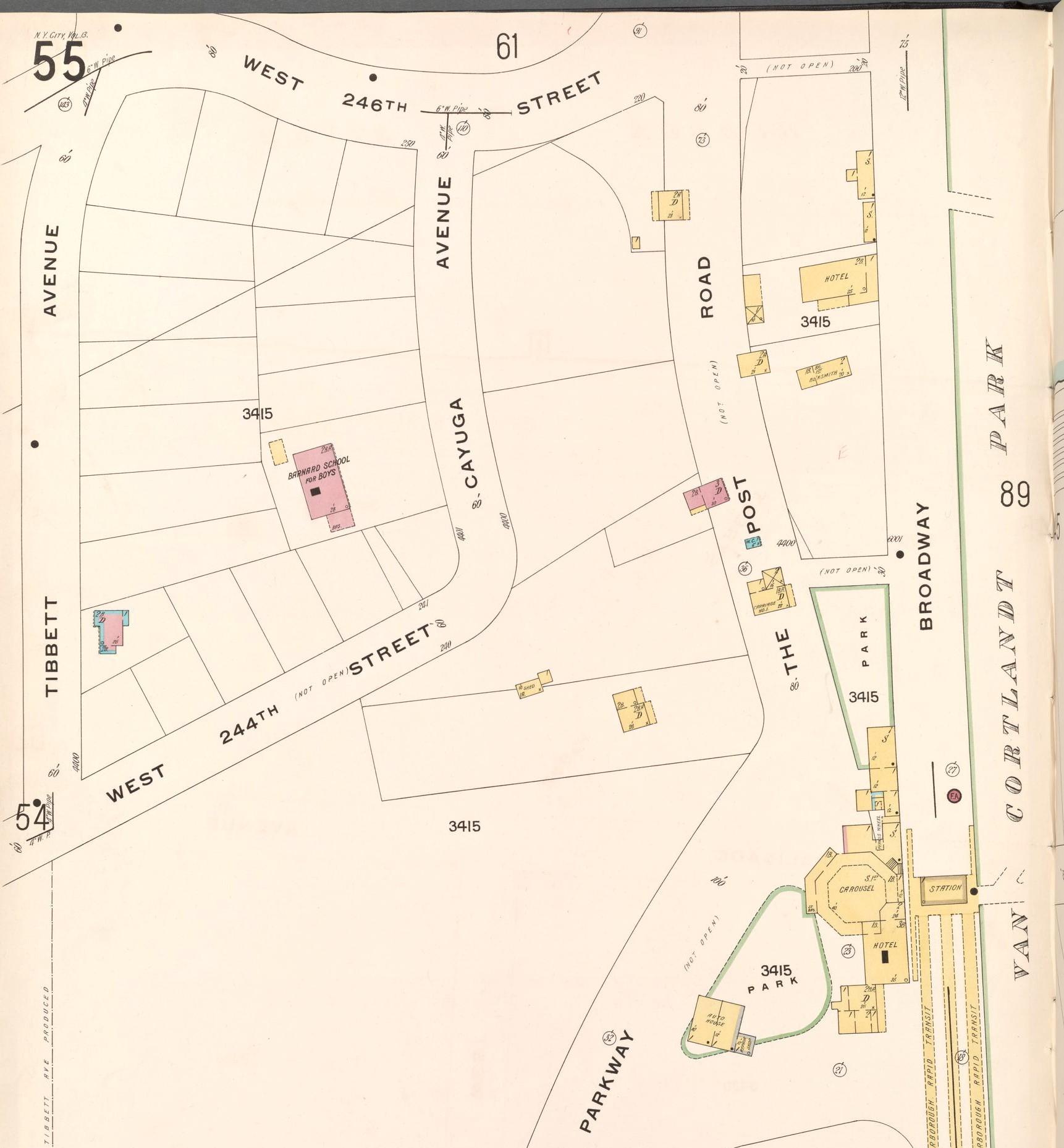
Broadway 1935 & Bronx V, 13 Plate No. 55
-
November 22, 2026 at 9:36 am #5587
-
November 22, 2026 at 9:45 am #5588
-
November 22, 2026 at 9:53 am #5589
Good point about the trolleys, Tom!
I went back and looked at the 1955 Riverdale Press article posted about about the excavation of the site. They were not excavating to build the restaurant but rather to expand the parking lot there. So, the White Tower was there before 1955 and the photo is older than ’55 as well.
-
November 22, 2026 at 10:24 am #5590
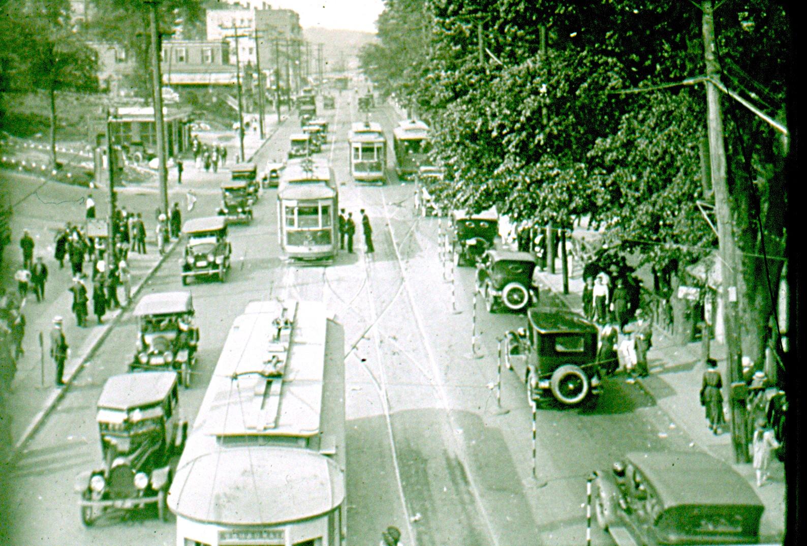
A undated early picture from W. 242nd St looking North on Broadway
-
November 22, 2026 at 10:36 am #5591
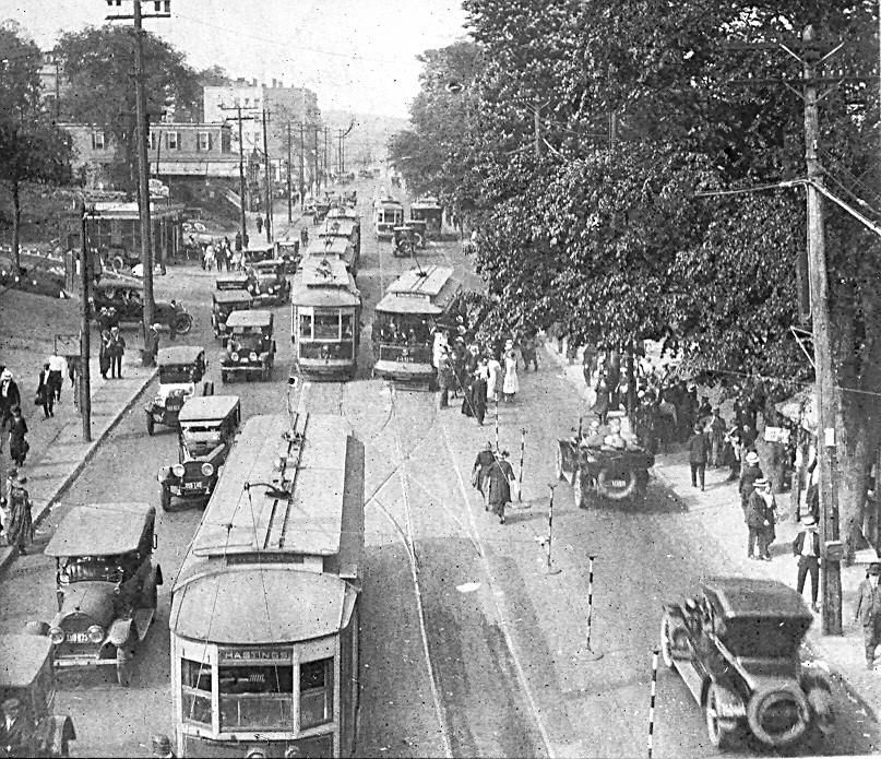
Found a better image from my collection, May 22 1921
-
-
AuthorPosts


- You must be logged in to reply to this topic.