Home › Forums › Photo Contests › September 2019 Photo Contest
Tagged: Spuyten Dyvil mystery
- This topic has 38 replies, 7 voices, and was last updated 1 year, 8 months ago by
Thomas Casey.
-
AuthorPosts
-
-
September 11, 2019 at 10:21 pm #1114
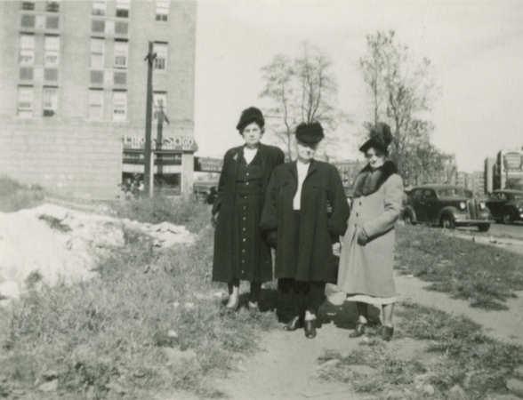
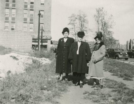
Can you name the location of the below photo (street and cross-street)?
Contest Rules:
1) Your response must be posted on the forum here (you cannot email your response to us).
2) Your response must name the street and cross-street depicted in the photo.
3) Responses due by September 30th.
4) You must be a member of the Kingsbridge Historical Society to participate. Become a member here.
Check back here for hints and a clearer image in a couple of weeks if no one guesses the correct answer.
-
September 14, 2019 at 9:17 pm #1124
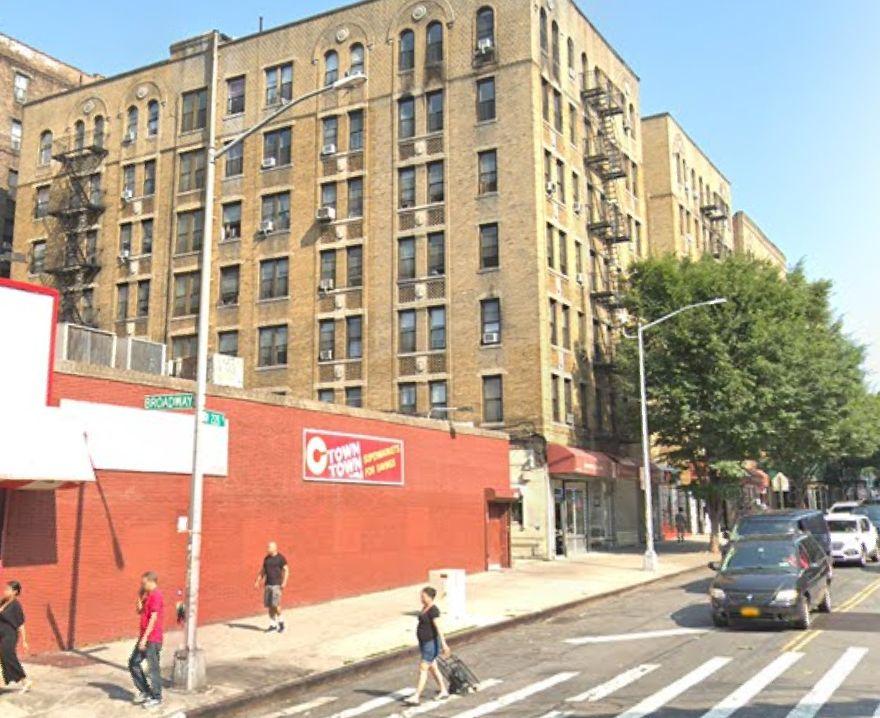
I’m pretty sure this location is at West 228th Street and Broadway. Where the ladies are standing is now covered by the CTown Supermarket.
I knew that there was a store on the right-hand side of the building because you can see the awning, so I looked for buildings with that particular pattern of windows, with a store on the first floor facing the street to the right. Once I figured out what I was looking for, and that I could rule out any buildings that were not in shopping areas, it didn’t take long to find it using Google Maps.
Lois
-
September 14, 2019 at 9:35 pm #1125
Nice find……The Ladies and all the buildings are all in Manhattan.
-
September 15, 2019 at 8:14 pm #1126
Nice work, Lois. Below is a clearer image.
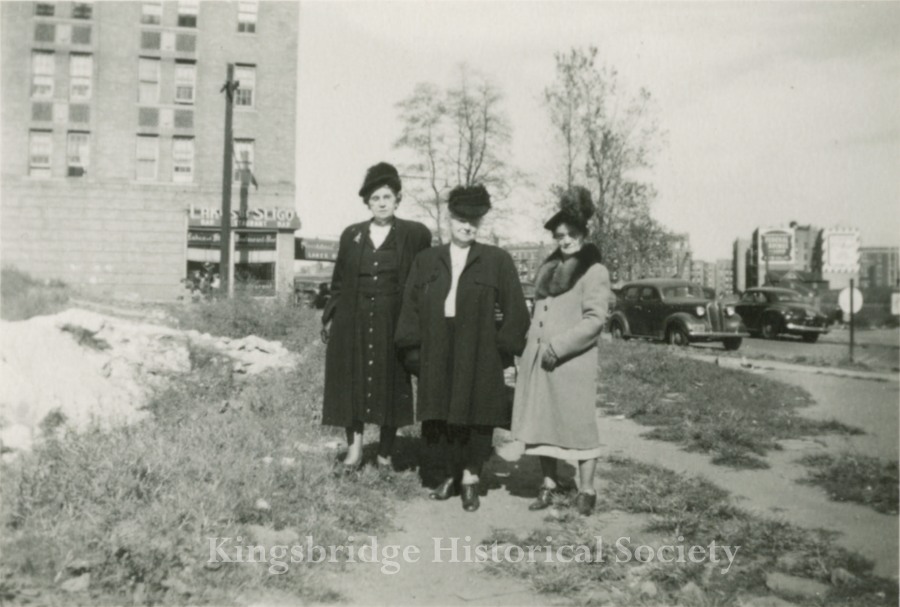
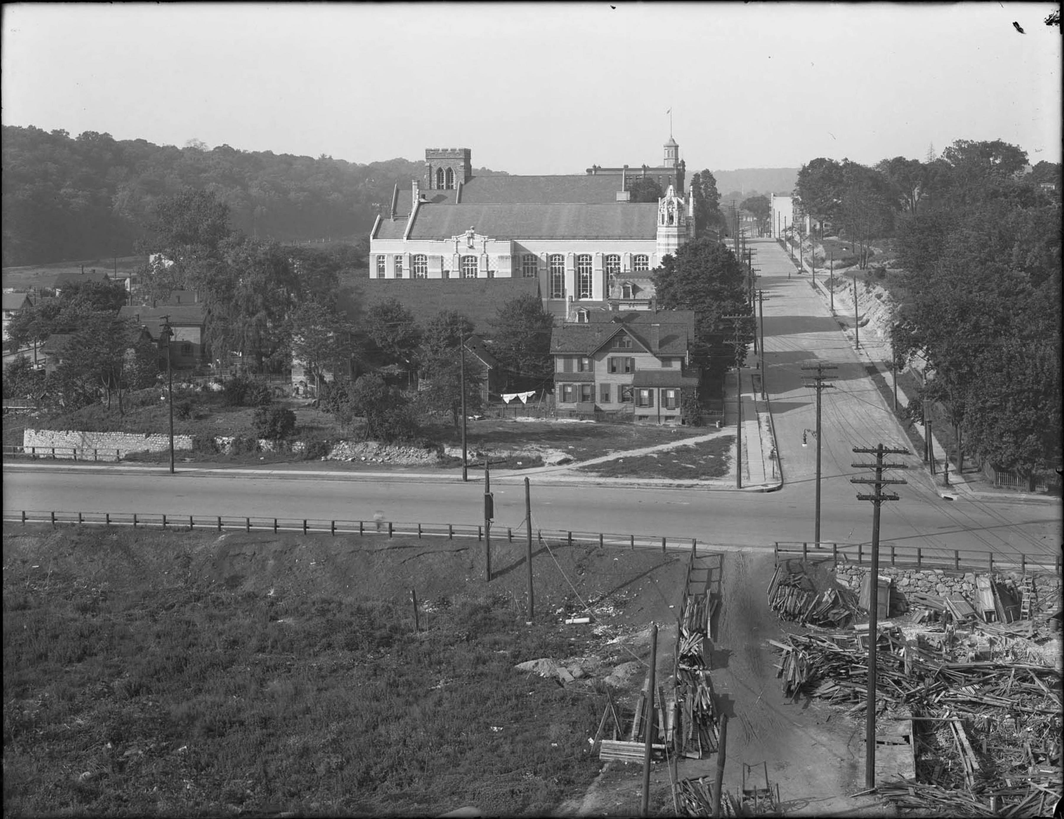
On the left you will see the “Lakes of Sligo” bar and on the right you will see a house and apartment building on Godwin Terrace. This is the base of Marble Hill and that appears to be an outcropping of Inwood (or Kingsbridge) Marble on the left. The photo was taken in 1949 so the Marble Hill housing projects were not yet constructed. Assuming these ladies were in their 70s, they saw many changes in the neighborhood in their lifespan including the disappearance of Spuyten Duyvil Creek and Tibbetts Brook. It is not surprise to me that the KHS was founded in 1949 given the changes that the this generation witnessed in the area. That outcropping of marble would not be around much longer either. The foundation for the grocery store on the corner of 228th and Broadway cut deep into the Marble:

The above photos along with about a dozen others from the neighborhood will be available for members to view in the “Members Area” shortly.
-
September 17, 2019 at 4:49 am #1127
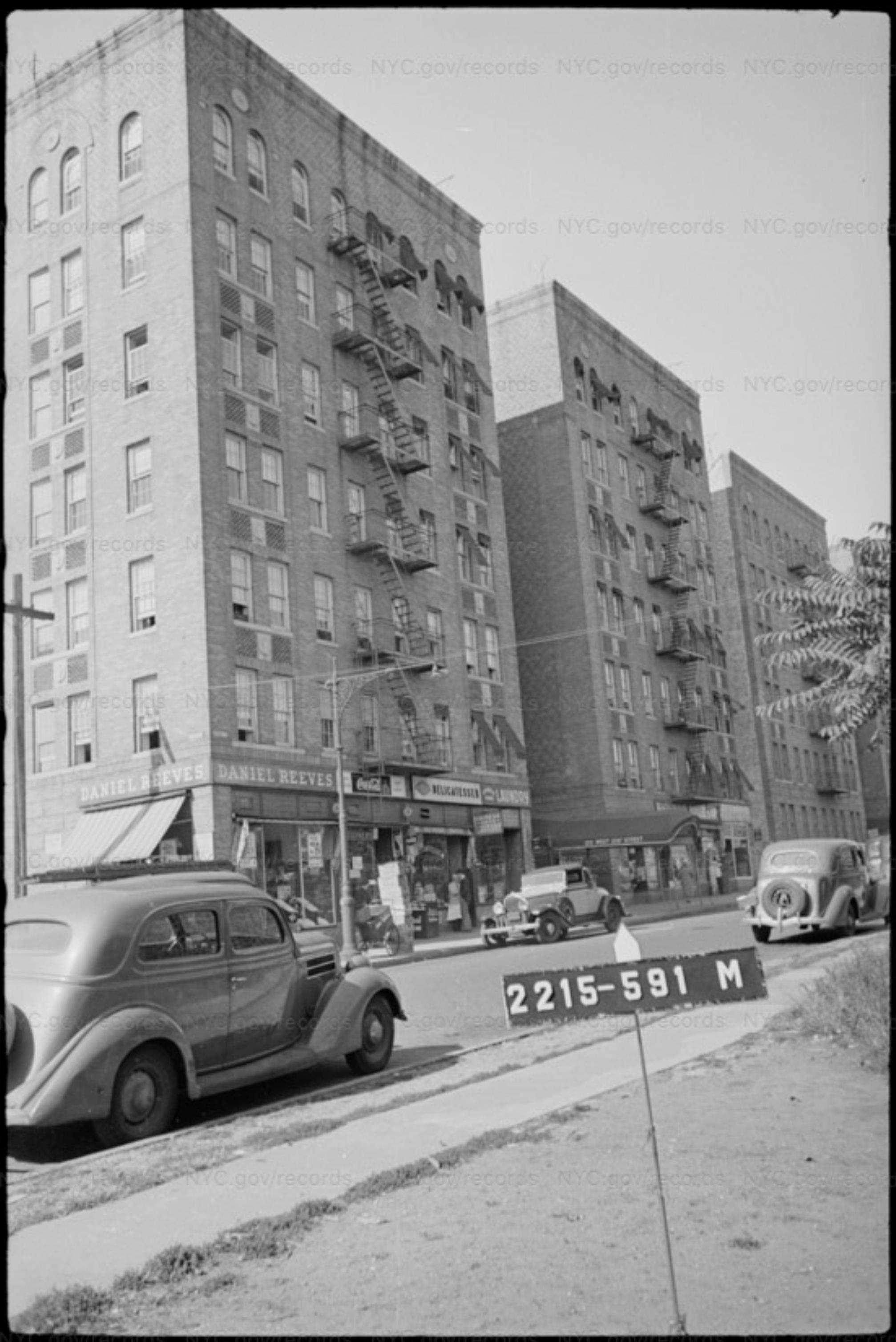
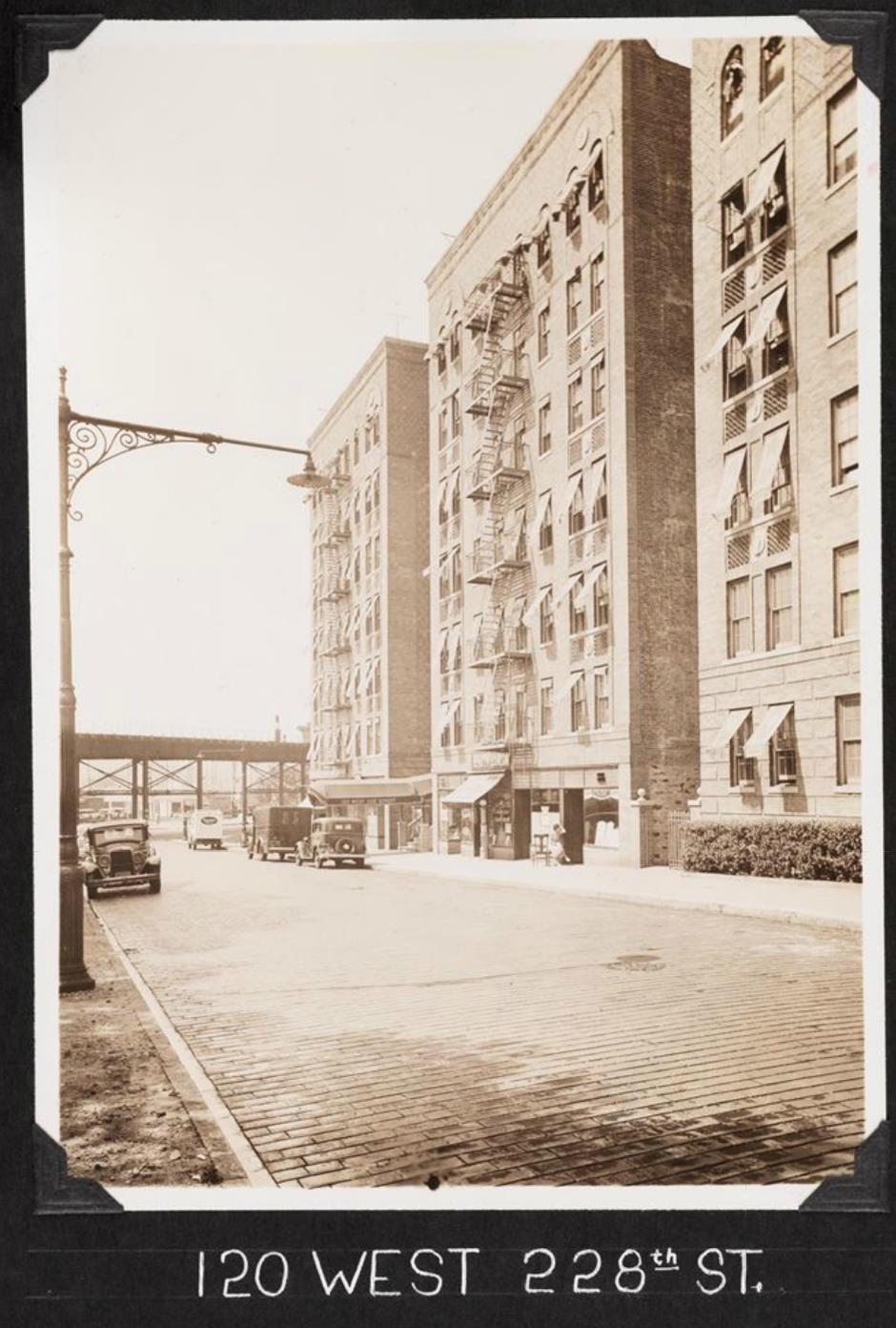
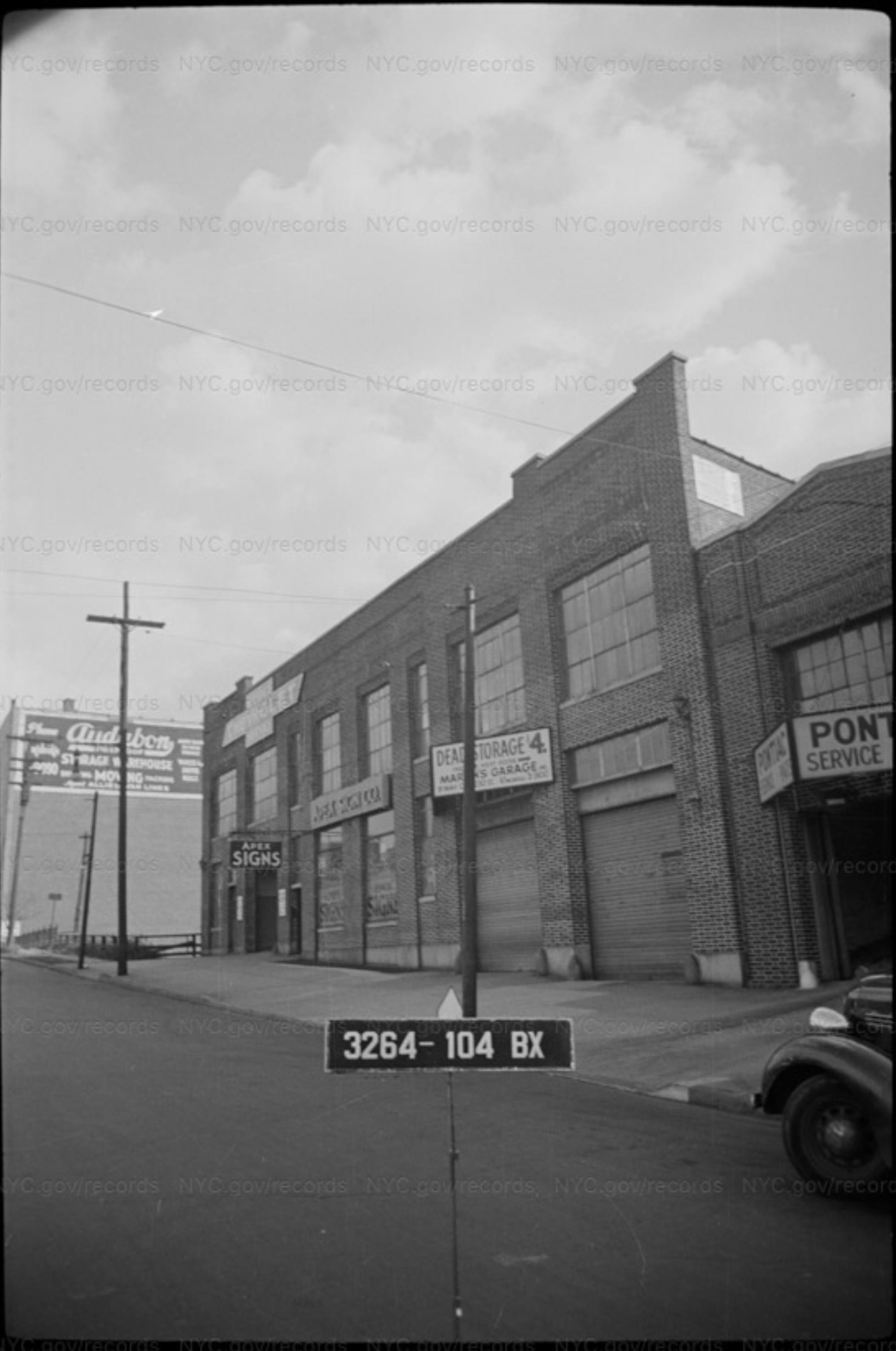
Here is the building on the left in a 1940s tax photo when it was a Daniel Reeves store. I love that the phone pole appears to be the same and the shadow of the pole on the building appears to be almost the same in both pictures.
I love browsing 1940s tax photos. They can be almost as complete as a 1940s version of Google Street View, or at least hint at it.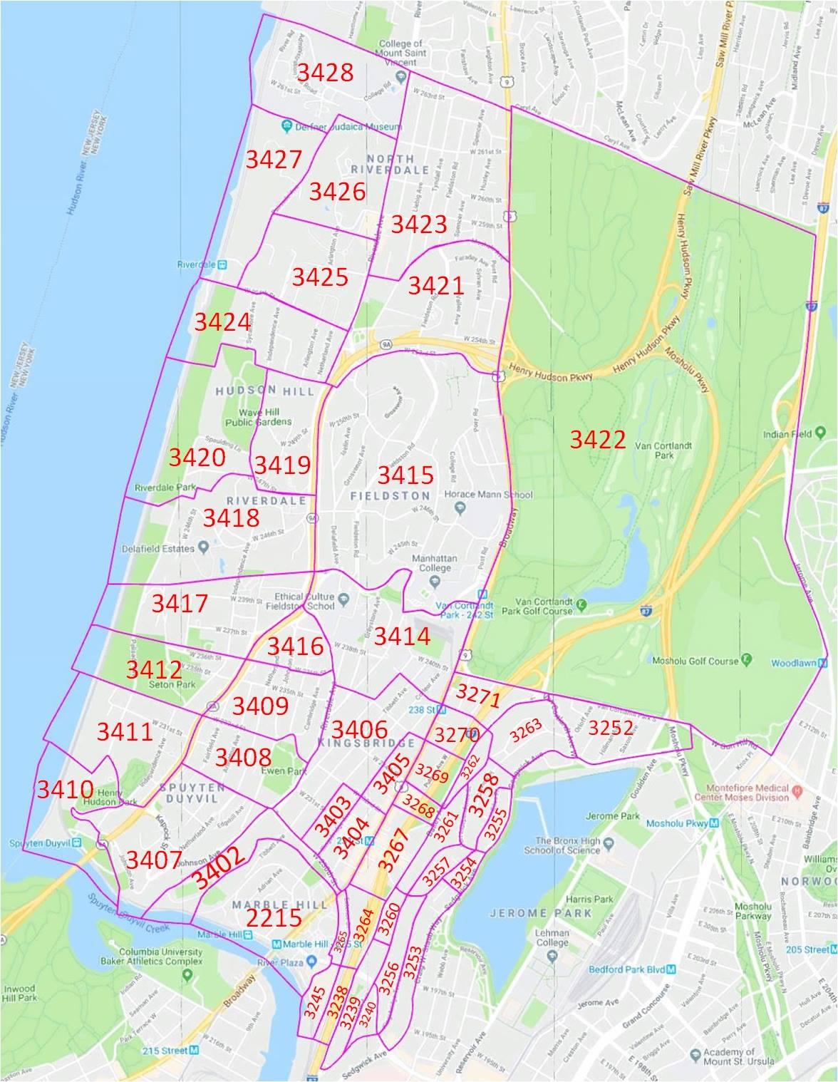
Here is a map which can assist in searching out 1940s tax photos in the Riverdale/Kingsbridge area.
The 1940s tax photos have only been available online for about a year. They are organized via block and lot number, but unfortunately the numbering of Riverdale & Kingsbridge changed between the 1940s and now. Most areas of the city, including Marble Hill, can look up their current block & lot number at the City-Wide GIS map, and use that to search 1940s photos.Riverdale and Kingsbridge need the block numbers off of old maps, in this case, from the 1938 Bromley Atlas.
The story of how the 1940s photos came to be online is a great read, and explains a lot of why things like addresses are prone to mistakes in the archive. It is a wonder any organizational info managed to stay associated with the original negatives. The block and lot number are usually included in the photo, so can often be more reliable.
Once you have found the block number, go to the NYC Dept of Records archives, and select the appropriate collection, for instance DOF: BRONX 1940S TAX PHOTOS and try a search like block=3404, or a more complex one like block=”3404 OR 3403 OR 3267″. I’ve found searching by block catches pics you might miss if you searched by address and there was an error or omission in the spelling of the address.
Some Riverdale blocks were huge, and were subdivided by letter, like 3423A–3423W. You can delve into those divisions, and also see lot numbers, by accessing the 1938 maps (and others) at the NYPL Map Warper site. A tremendous resource. The more you learn to navigate the NYPL map collection, the more info you can find.
The tax photo above is in Marble Hill, so be sure to select the MANHATTAN 1940s TAX PHOTOS, then search for block=2215 AND lot=591Some other favorite sources for old NYC photos are…
OldNYC, which offers a convenient way to find geolocated pics from the NYPL
NYPL Digital CollectionNew York Heritage digital collections
Museum of the City of New York
New York State Archives Digital Collections
Once I know the location of a photo, I often seek out related photos.
This one from the KHS member area overlaps the OP. (Original Photo that started this thread.) In the back left of this photo are 226 Kimberly Place, and in front of it, 3014 Godwin Terrace. 226 Kimberly Pl is the one with the two billboards painted on it.
226 Kimberly Pl and 3014 Godwin Terrace are in the back right of the OP, and in the OP PS 207 can be seen behind them.
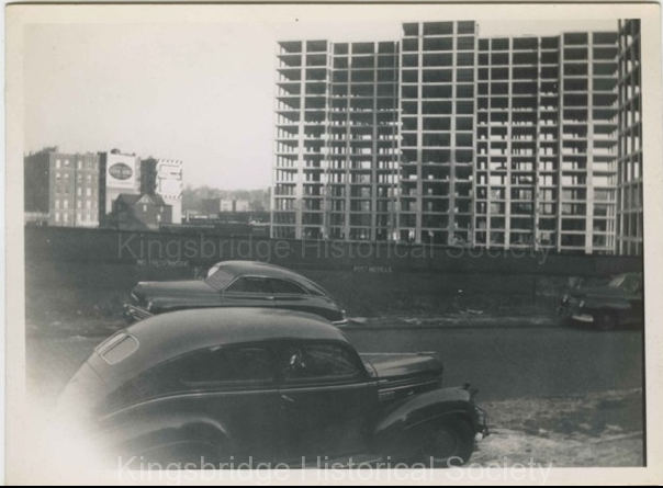
This clip from a January 6th, 1951 aerial photo shows some great detail of the area in the background of the OP.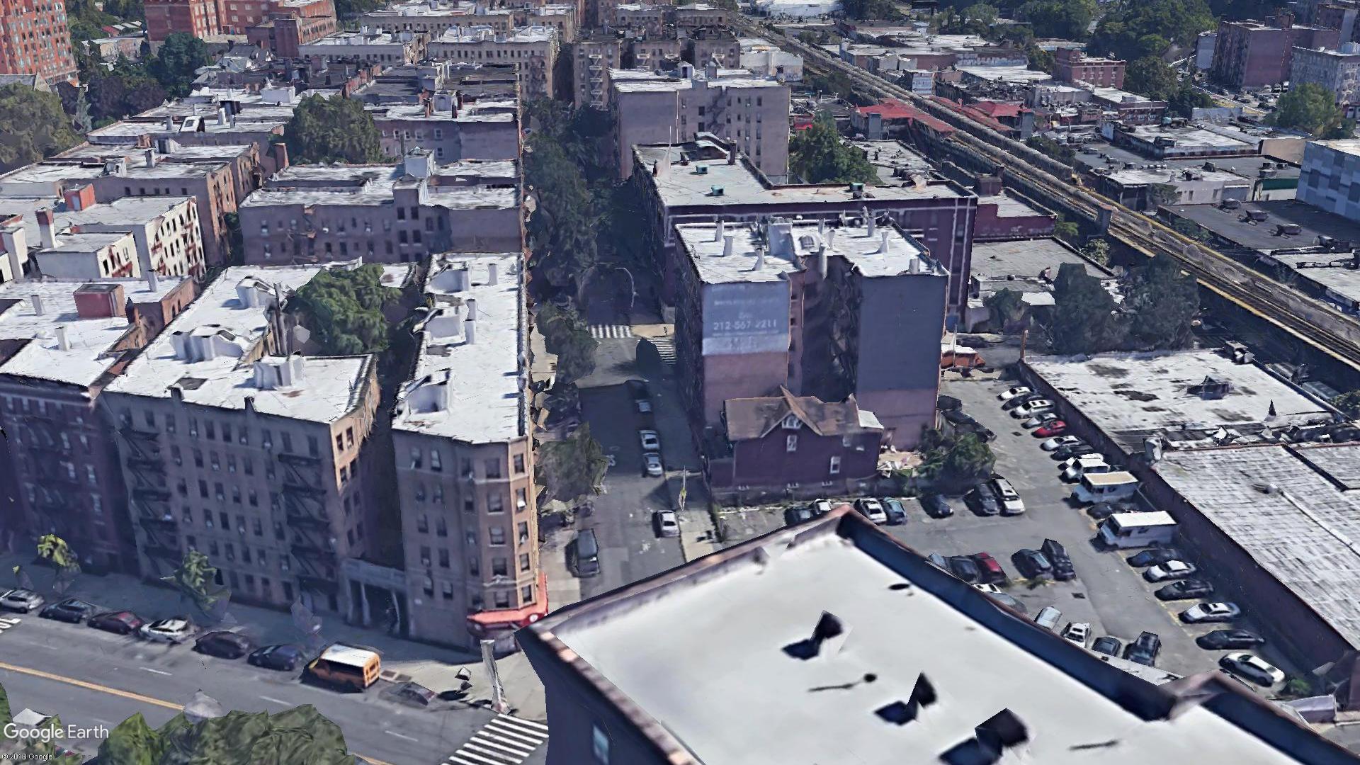
This is a simulated Google Earth view that is the closest I could get to the angle from the OP.I love that the frame house at 3014 Godwin Terrace is still there. I have been told that this is the same house that was across from The Kings Bridge and that it was moved one block east and rotated 180 degrees at some point in the ’20s or ’30s. I have yet to find verification of this, but it seems likely.
This would be 3014 Godwin Terrace at its original location, 3011 Kingsbridge Ave, ca 1916.By 1938, the maps show the phone company building there. On a FaceBook Riverdale group, someone said she grew up at 3014 Godwin Terrace and was always told it had been moved one block and rotated to get to its current location. Perhaps there are pictures of it being moved.
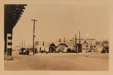
This ca 1940 photo is looking the other way from the OP.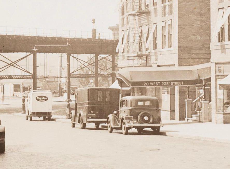
Zoomed all the way in, I believe one can barely make out the Daniel Reeves lettering. At some point soon after it became Lakes of Sligo, which I believe was a bar and possibly restaurant. It appears to have been there well into the 70s.
I noticed that the El supports don’t match up with Nick’s most recent picture. I think the young man in the tartan vest is actually in the Bronx, and I think he is looking at the construction of the Kingsbridge Post Office.
Both photos looking east on 230th St. Notice the Audubon Storage Warehouse building in the 1940 pic, I believe it is also visible behind the Tydol sign in the Kingsbridge PO pic.
-
September 17, 2019 at 1:04 pm #1128
Great post with lots of amazing resources for finding photos. Most of the photos you posted I hadn’t seen before. And you are correct about this photo:
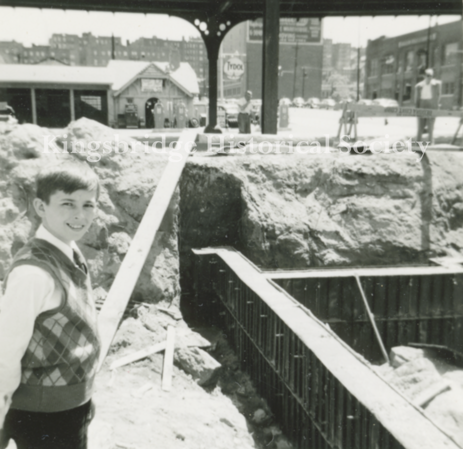
It was jammed in an envelope with the mystery photo so I figured it was the same spot when I noticed the marble bedrock. However, the gas station in the background was at the corner of W. 230th and Broadway so it has to be the foundation of the post office. Good sleuthing. The NYPL has a photo of that gas station here and it is labeled as W. 230th and Broadway.
Tieck’s red book has a good writeup on the construction of the post office including the human remains (possibly from the Revolution) that were discovered during its construction.
-
November 18, 2019 at 7:39 pm #1156
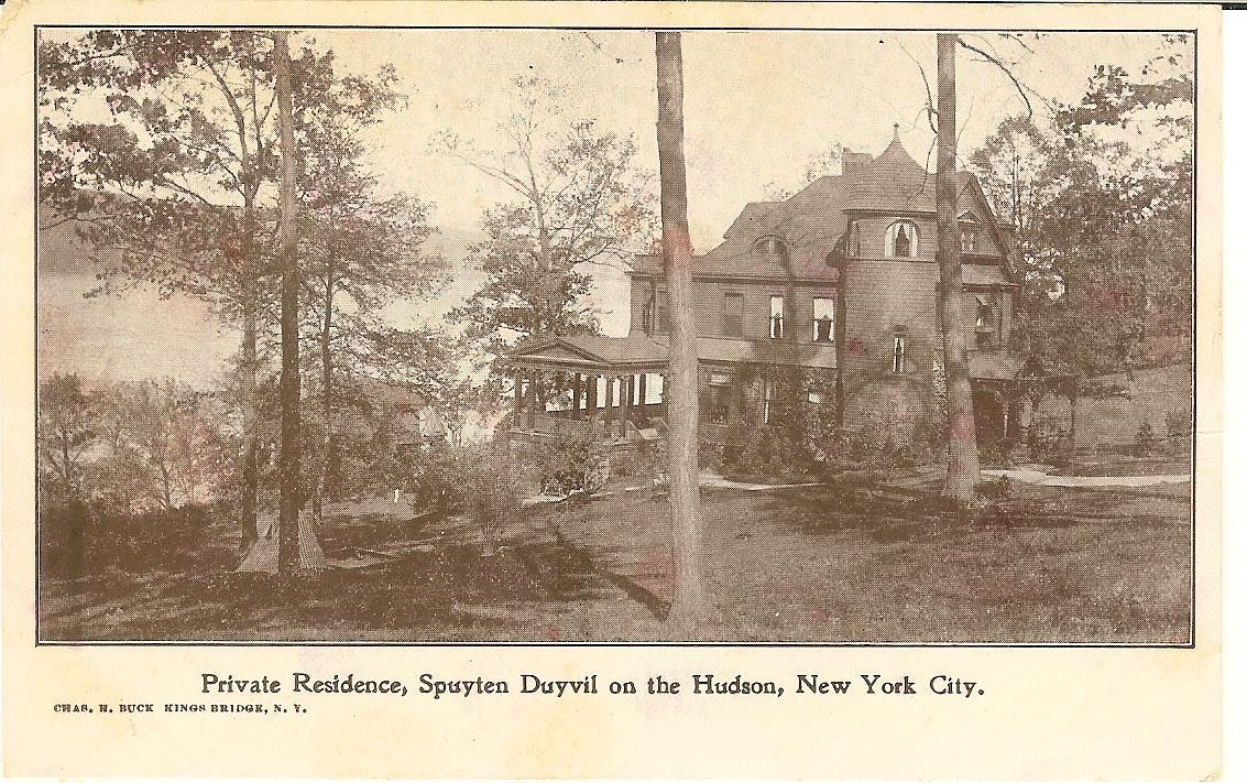
This is one of my Charles H. Buck titled “Private Residence, Spuyten Duyvil on the Hudson NYC”. I have scanned the area using google views and I do not believe the house is still standing. I have not found any image to identify it either. I am posting the image in hopes that one of our members may have a good lead and or know the address or former owner. Thank you
-
November 25, 2019 at 3:52 am #1159
I can’t back it up, but my guess would be the current location of 2621 Palisade Ave, and that it was there as late as 1957, as seen in this 1957 map from NYPL.
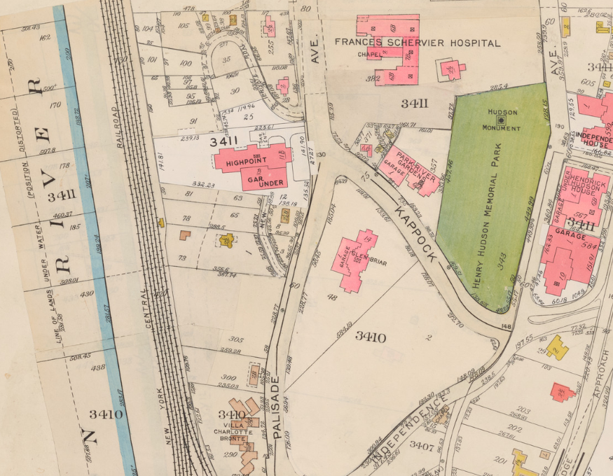
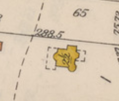
The shape on the map, as shown in the close-up on the right, seems to match the pic, and the geography certainly could be a match.
I’d love to find a pic to back this guess up, but haven’t been able to find one. -
November 25, 2019 at 2:12 pm #1160
Yes, the small yellow house below Highpoint does look like a match.
Great detective work, now to find out who was the owner and if a photo can be found. Many Thanks
-
November 25, 2019 at 3:28 pm #1161
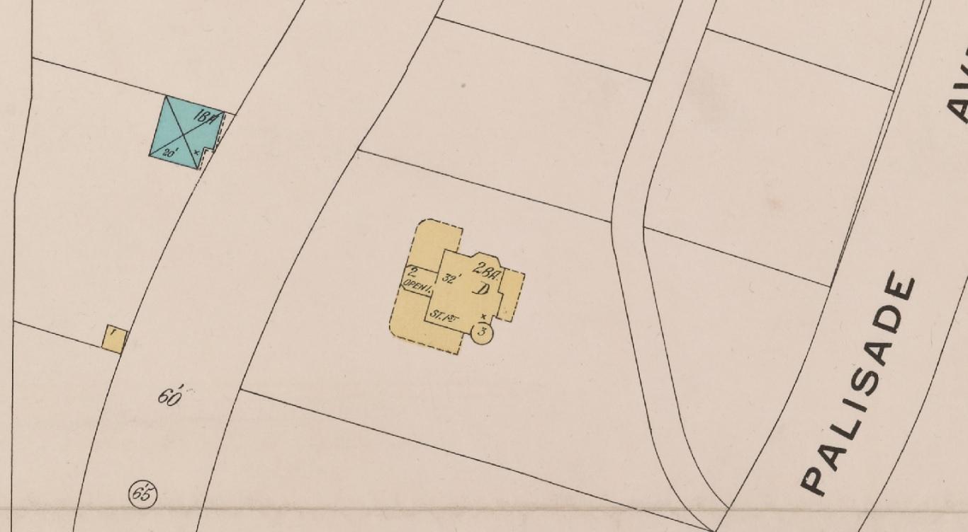
Since the Buck postcard is from cir 1910, I also looked at the 1888 – 1914 map.
I do like that image and the way the lower house is in the appx angle from the main house. Take a look. Thank you, Tom
-
November 25, 2019 at 5:15 pm #1170
1911 map shows John N. J. McKelvey as the owner.
Lots to be found about Mr McKelvey by searching MCKELVEY and SPUYTEN together.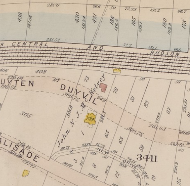
-
November 25, 2019 at 5:59 pm #1171
A cherished piece of Spuyten Duyvil’s past could be in jeopardy. And while the Villa Rosa Bonheur might not be completely obliterated, it could be fundamentally changed.
Kevin McDermott, who’s lived in the neighborhood for more than a decade, wanted to know what was happening to the Villa Rosa Bonheur on Palisade Avenue near the Spuyten Duyvil train station, a charming, stony structure clinging to the cliff side under the Henry Hudson Bridge.
Built in 1924 as a co-operative by John J. McKelvey — a lawyer, writer and developer, who also was the first editor-in-chief of the Harvard Law Review — the seven-unit apartment building hit the market last year, according to published reports.
McKelvey — who also built the Villa Rosa Bonheur’s sisters, the Villa Charlotte Brontë and Villa Victoria around the same time — had more than money on his mind when he created what would be Riverdale’s first apartment houses. Alarmed by what he called the encroaching “city ugly” — the wave of high-rise development spreading through northern Manhattan and other parts of the Bronx at the time — McKelvey’s answer, according to the Lehman College Art Gallery, was to construct cooperative apartments resembling villas made up of individually owned duplex and triplex studio homes.
The marriage of Lowell H. Brown, a son of Mr. and Mrs. Archer Brown of East Orange, N.J., and Miss Constance McKelvey, a daughter of Mr. and Mrs. John Jay McKelvey, took place yesterday in Edgehill Church, Spuyten Duyvil, and was followed by a reception at Bonnie Brae, the McKelvey country home. October 11, 1914, Page 11
-
November 25, 2019 at 6:03 pm #1172
John Jay (J.J.) McKelvey was born Sunday, 24 May 1863, in Sandusky, Ohio, to the parents of John McKelvey and Jane Rowland Huntington McKelvey. J.J.’s paternal grandparents were Matthew McKelvey and Nancy Adams McKelvey, and his paternal great-grandparents were William McKelvey and Mary Toppings McKelvey along with Bildad Adams and Mary Hines Adams. William McKelvey of Scotch-Irish American, Revolutionary War regality removed with an assembly after the war to the Western Reserve; where John McKelvey fashioned and financed Sandusky and a section of its first short line railroad, which eventually enveloped by the Pennsylvania Railroad. Whereas, J.J.’s maternal grandparents were Apollos Huntington and Deborah Rowland Huntington with his maternal great-grandparents being American Revolutionary War soldier Elisha Huntington and Esther Ladd Huntington and great-grandparents of the William Rowland lineage. J.J.’s five siblings included: Janet Huntington McKelvey Swift, Alice Rowland McKelvey Milne, Jennie Adams McKelvey, Charles Sumner McKelvey, and Ralph Huntington McKelvey. J.J.’s sister Alice and father John helped document their family’s English and Welsh pedigree, colonial ancestors, war-time service, and Fire Lands migration.[7]
After successfully completing his college course, J.J. initially married Mary Clark Mattocks on 12 July 1887 in Cleveland, Cuyahoga County, Ohio, at the bride’s childhood home.[8] Before settling into their described “Bonnie Brae” on the Hudson River at Spuyten Duyvil, J.J. and Mary visited her mother in Los Angeles, California to consolidate contiguous land for the completion of their estate on Palisade Avenue, New York City.[9]
-
November 25, 2019 at 7:58 pm #1173
Great info, and it seems likely that “Bonnie Brae” is the spot we are looking at on the map, and perhaps, the spot we are looking at on the map is the house pictured in the postcard, but we aren’t sure.
I’d love to find a wider pic that includes that house.
I’ve looked for 1940s tax photos, but alas, quite a few areas of Riverdale are missing and this seems to be one of them.
I’ve looked at aerial photos, but the best I can find are blurry or tree covered at that particular spot.
I took a quick look at this great old footage, but the Hudson River section seems to start just north of where we are looking.
On the positive side, if that is not the spot, I can’t come up with a better one.
Just like to be sure the we are clear we are guessing, and haven’t backed up the guess yet, even though it may be a good one. -
November 25, 2019 at 11:21 pm #1174
Dear Alan, Charles Buck only took photo’s of prominent buildings and mansions. I am sure the 1909 image on the postcard is it. The wedding was in 1914 and there was not that many houses with that footprint. McKelvey died in 1947 and I am sure his estate sold the last house “Bonnie Brae” before that. The other projects, Rosa Bonheur, 1924,Villa Brontë, 1926, Villa Victoria in 1926 In 1933, Mr. McKelvey lost Villa Victoria in foreclosure, and the Rosa Bonheur co-op failed in 1941. John McKelvey said that his father “made a lot of money, and he lost a lot of money — almost everything in the building of the Villa Victoria — but he was able to regroup, and he always took it day by day.” From 1933-1941 it was probably developed. The Houses that are near “Bonnie Brae” are substantial but built in the 1940 – 1970’s
-
November 27, 2019 at 5:19 pm #1177
Thank you all for this great McKelvey detective work. Ironically I recently found Bonnie Brae on a 1909 map.
The asbestos abatement of Villa Rosa Bonheur is complete, Timber Equities has received a demolition permit and will begin demolition next Monday.
I will be petitioning the Community Board for a street co/naming of Bradley Terrrace in January. I am scrambling to pull together documentary evidence of John J. McKelvey’s contributions to our community, I would be very grateful for any materials you could send my way, or point me to, and if people could show up for the presentation. (third Thursday in January). A big turnout is important to a positive vote.
I haven’t had a chance to to fully read this string but I’m very happy to see it. Thanks so much.
-
July 5, 2024 at 4:21 pm #4195
I was browsing ebay again it led me to the name McKelvey and I remembered this forum issue. I found an article about a different home owned by Mrs. Mary McKelvey of Spuyten Duyvil in the March 1926 Architectural Forum, along with Miss Cora A Week of Riverdale that I was able to id from Ancestry as living at 4680 Waldo Ave in Fieldston.

-
July 5, 2024 at 4:26 pm #4196
McKelvey-Weeks


-
July 5, 2024 at 4:28 pm #4197
McKelvey-Weeks

-
July 5, 2024 at 4:29 pm #4198
Cora Weeks former home 4680 Waldo Ave 2024

-
July 7, 2024 at 9:37 am #4203
I believe the Mary McKelvey house designed by Julius Gregory is 3117 Palisade Ave., at the southwest corner of Palisade and West 232nd.
-
July 7, 2024 at 1:30 pm #4206
Dear blackbird1, Thank you, you are 100% correct ! It is nice to know a few 100 year old homes are still with us.
Mary McKelvey house designed by Julius Gregory is 3117 Palisade Ave. 3117 Palisade Ave.

see 2024
-
July 8, 2024 at 2:07 pm #4213
Tom, there’s another Julius Gregory-designed home still standing at 721 West 231st Street, also for Mary McKelvey, same “English cottage” style. And he apparently designed a third one for her that I have yet to identify; it was overlooking the Hudson somewhere in Spuyten Duyvil. I’m happy to email a photo to anyone who thinks they might know it. Sorry, but I haven’t figured out yet how to post images here.
Jackie -
July 9, 2024 at 1:27 pm #4214
Jackie,
Have your photo ready, and click the little Mountain & Sun box above.
A new tab will open, identify that the image is about 2019 photo contest and
click the source, ( your laptop ) or camera – browse your files and click on the image.. Then submit tab
-
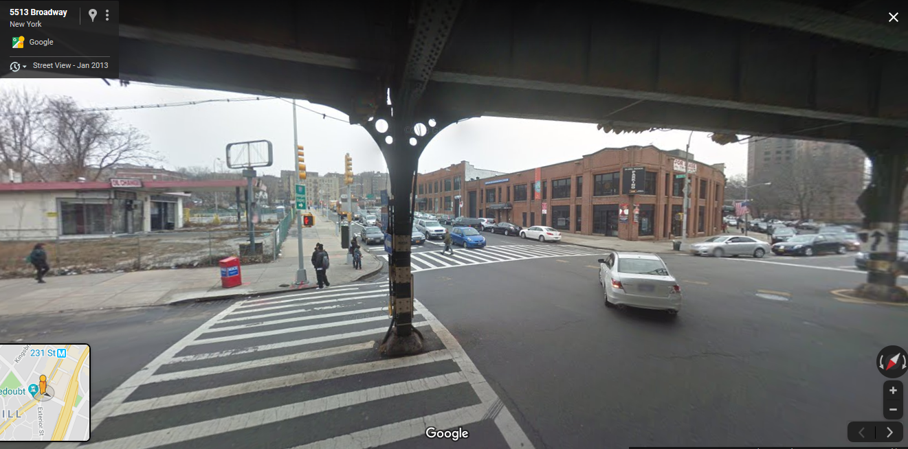
July 9, 2024 at 1:48 pm #4215
Mary McKelvey house , 721 W 231st St ( 2013) Julius Gregory-designed home

-
July 9, 2024 at 2:07 pm #4216
Julius Gregory designed 42 homes in Fieldston
-
July 9, 2024 at 2:11 pm #4217
Julius Gregory (1875-1955) designed 42 homes in Fieldston ( none for Mary Mckelvey )
4600 Delafield Avenue
4620 Delafield Avenue
4526 Delafield Avenue
4570 Delafield Avenue
4645 Delafield Avenue
4667 Delafield Avenue
4690 Henry Hudson Parkway
4715 Delafield Avenue
4543 Delafield Avenue
4756 Delafield Avenue
4561 Fieldston Avenue
5051 Iselin Avenue
4701 Iselin Avenue
4612 Grosvenor Avenue
4646 Grosvenor Avenue
4658 Grosvenor Avenue4666 Grosvenor Avenue
4641 Grosvenor Avenue
4660 Iselin Avenue
300 College Road
274 College Road
319 College Road
271 College Road
4730 Fieldston Road
4615 Livingston Avenue
4660 Livingston Avenue
4680 Livingston Avenue
4670 Waldo Avenue
4686 Waldo Avenue
4530 Fieldston Road
4501 Livingston Avenue
4483 Manhattan College Parkway
4487 Manhattan College Parkway
4491 Manhattan College Parkway
4401 Tibbett Avenue
4411 Tibbett Avenue
4417 Tibbett Avenue
316 West 245th Street
366 West 245th Street
4428 Waldo Avenue -
July 9, 2024 at 5:39 pm #4220
Thanks for posting those photos and the instructions. I’ll give it another try…
Here’s the mystery Julius Gregory/McKelvey house in Spuyten Duyvil (I hope)
-
July 9, 2024 at 5:41 pm #4221
It’s supposed to have a tile roof that imitates a thatched roof. Anyone know where it is?
-
July 10, 2024 at 4:28 pm #4224
Tom, here’s an unsigned article from the February 1921 issue of House and Garden that gives more detail. Specifically, it says the house is overlooking the Hudson River.

-
July 10, 2024 at 4:35 pm #4225
Different view, but the house plans are the same. Mentions Spuyten Duyvil specifically. Maybe it’s on one of the small private roads off Palisade Avenue, like Scenic Place? Or the private road off Palisade just off the intersection of Kappock and Palisade? Hoping it’s still there.
-
July 11, 2024 at 5:52 pm #4247
231st and Palisades yesterday, will look again down scenic pl at another day for the house your looking for.

-
July 11, 2024 at 10:20 pm #4249
Thanks, Peter! Fingers crossed it’s still around.
-
November 9, 2024 at 4:41 pm #4500
Just came across an Ebay item that I copies by Julius Gregory (1875-1955)
-
November 9, 2024 at 4:43 pm #4501
-
-
AuthorPosts
 ( 2013) Julius Gregory-designed home
 ( 1924) Julius Gregory-designed

- You must be logged in to reply to this topic.