Home › Forums › The Colonial Era › Stony Brook
- This topic has 0 replies, 1 voice, and was last updated 7 years, 9 months ago by
ndembowski.
-
AuthorPosts
-
-
October 23, 2018 at 9:19 pm #574
[caption id="" align="alignright" width="613"]
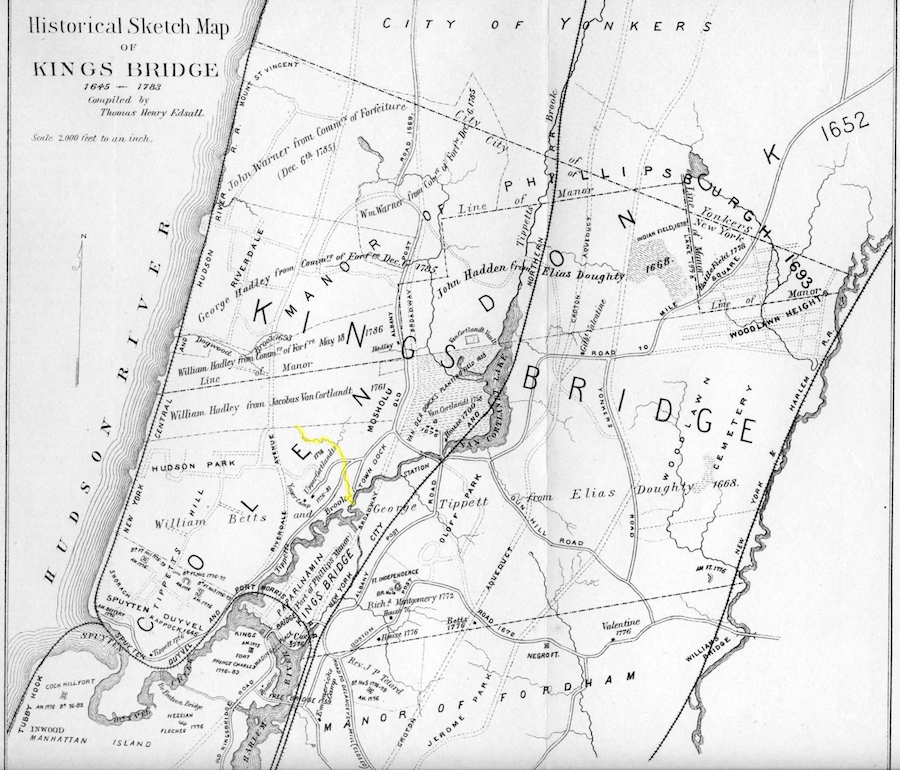 Thomas Henry Edall’s Historic Sketch Map of Kingsbridge with “Stony Brook” highlighted in yellow[/caption]
As part of my research for an upcoming article, I have been looking at a lot of colonial-era land deeds of Riverdale, Kingsbridge, and Spuyten Duyvil. Not having numbered lots or street names, the deeds refer to the land’s natural features to describe the bounds of a property. This is a typical example taken from a 1686 land deed from Hopestill Betts to John Barrett, both “of the Younkers, in the County of Westchester.” The property and its bounds are described as:
“eight acres of upland moore or less sittuate and being in the Precincts of the aforesaid Younkers, being bounded (viz) To the southward by a brooke comeing off from a hill running off from the said hill into another brooke that runns into Muscoota, eastward by the Brooke of a great hill, westward by a marked oake sappling by a path that goeth to William Chattertons northward by the aforesaid Brooke by a marked black ash tree standing over the river.”
Not confusing at all, right?
Joking aside, you see the reference to “Muscoota” in the deed. In this case, that refers to Tibbett’s Brook, which flowed through the valley of Kingsbridge. Another name I came across in multiple deeds is “Stony Brook.” I also saw “Stony Brook Meadow” and “Stony Brook Landing.” It wasn’t easy but I figured out that the Stony Brook was a stream that still, in part, exists. You can see some of it in Brust Park, located across the street from the main entrance to Manhattan College. The brook is indicated on many old maps including the one on the right (highlighted yellow). There is a staircase in Brust Park that takes you to the Ethical Culture Fieldston School. The brook is on the right of the stairs.
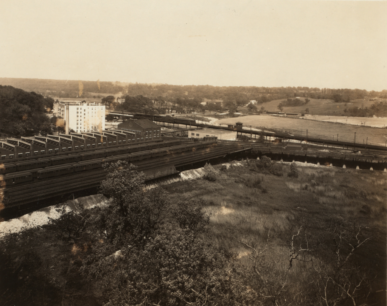
The Stony Brook used to flow into Tibbett’s Brook near today’s Gaelic Park. Marsh grasses grew there and that was the “Stony Brook Meadow.” The photo from the NYPL shows the area before the football field was constructed. Note the grasses.
The “Stony Brook Landing” was where the Stony Brook flowed into Tibbett’s brook. Thomas Henry Edsall’s map (above) labels the area as the “town dock.” It is pretty amazing that boats could get that deep inland considering what it looks like today.
Another name I have been coming across in the old deeds is the Lime Kill (kill being the Dutch word for stream). Maybe I’ll be able to figure out what this refers to but it is very difficult to make sense of various stakes, rocks, and trees used as markings at that time.
-
-
AuthorPosts
- You must be logged in to reply to this topic.