Home › Forums › The Colonial Era › The Colonial Dutch Garden in Van Cortlandt Park
Tagged: Fountain Van Cortlandt Park
- This topic has 11 replies, 4 voices, and was last updated 5 years, 11 months ago by
Peter Ostrander.
-
AuthorPosts
-
-
August 6, 2020 at 7:36 pm #1588
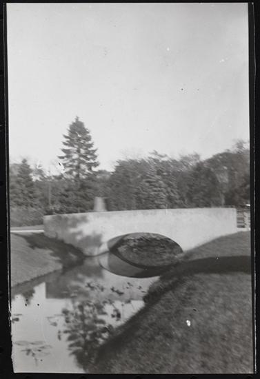
One part of Van Cortlandt Park that has always interested me is the low ground just south of the Van Cortlandt House Museum. It is now an overgrown and untended area. This is the view from the high ground just North of it:
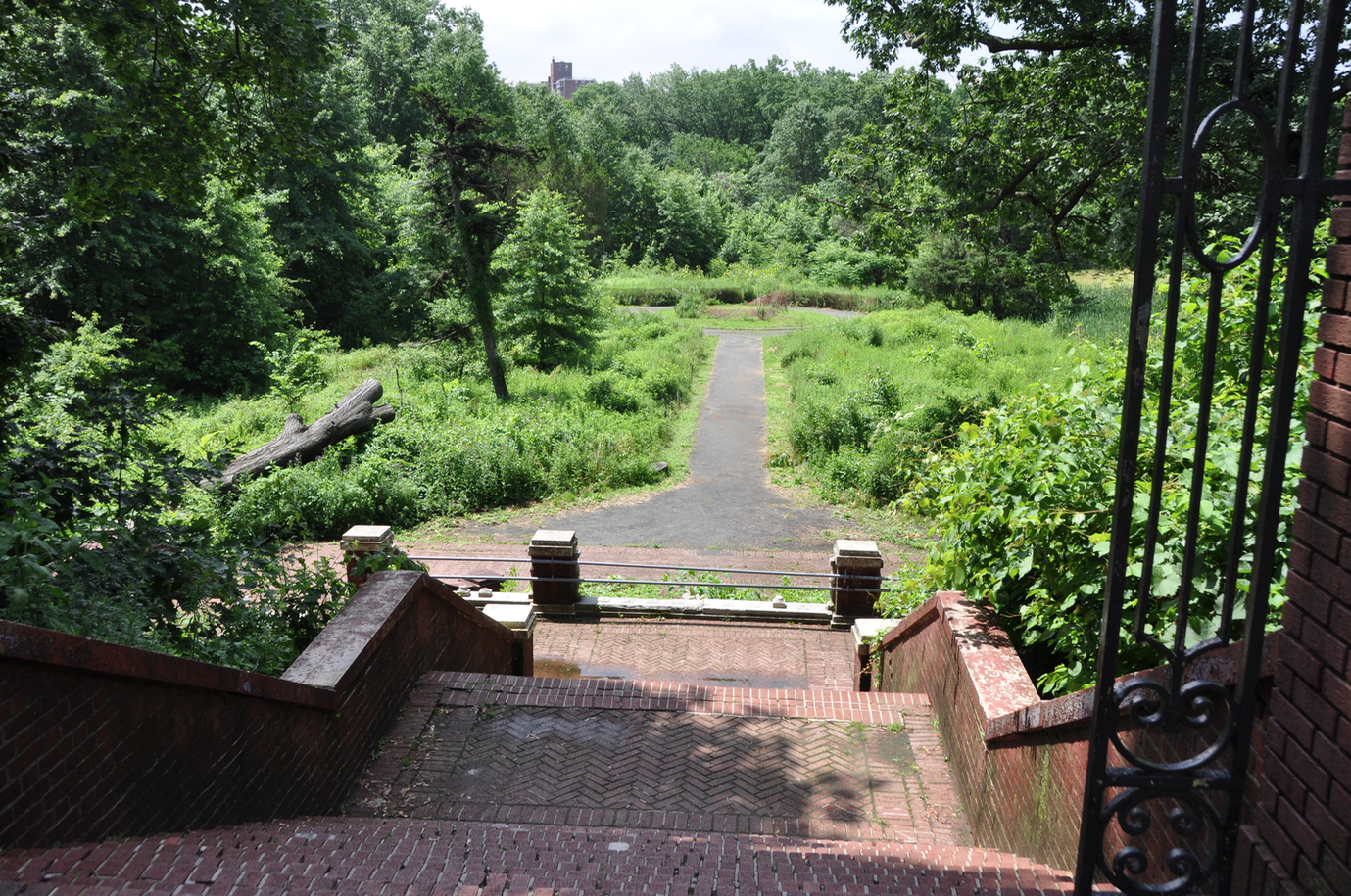
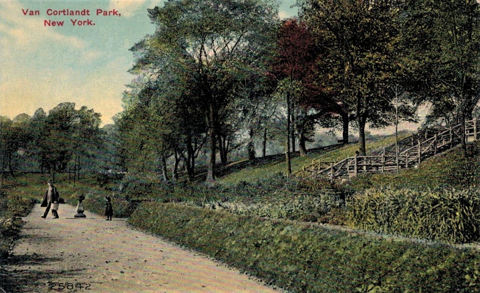
The stairs in the foreground lead down from the ridge that the Van Cortlandt House stands on. The stairs are now closed because they were not maintained and are now a safety hazard. The area below seems to be a popular hangout at night for drinkers and smokers as there is plenty of litter at the bottom of the stairs. It is not easily accessible and you seldom see anyone there in the daytime. The view from the other direction is pleasant:
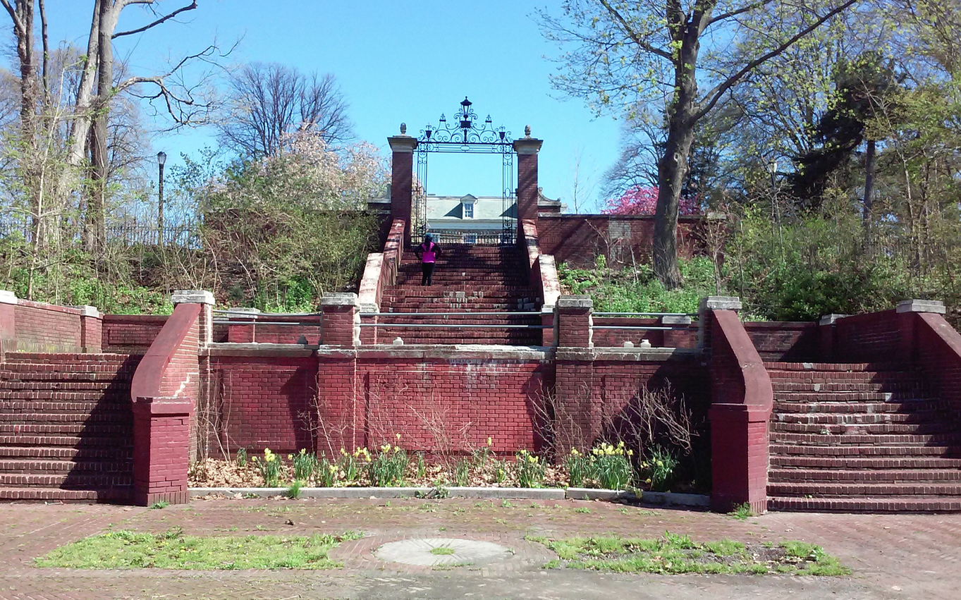
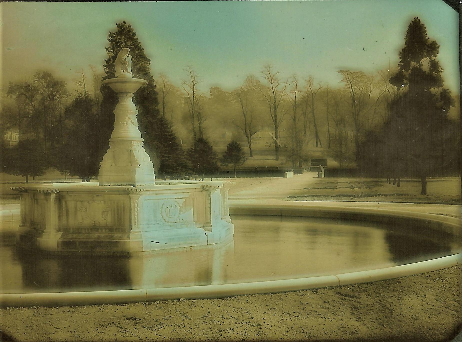
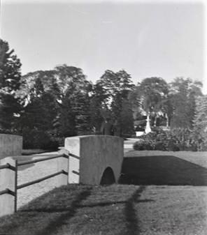
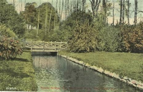
In the foreground you can see the millstone from the Van Cortlandt gristmill that was powered by the nearby lake. The roof of the Van Cortlandt House is in the background under the iron gate. If you were to back up from where this photo was taken, the entire house would be in view above the ridge. I had seen postcards of this area from the turn of the 20th century. At that time, this area was presented as the “Dutch Colonial Garden:”
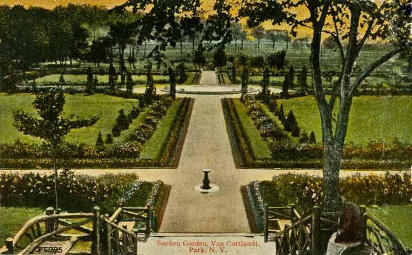
It was a finely manicured garden. The view looking the other way:
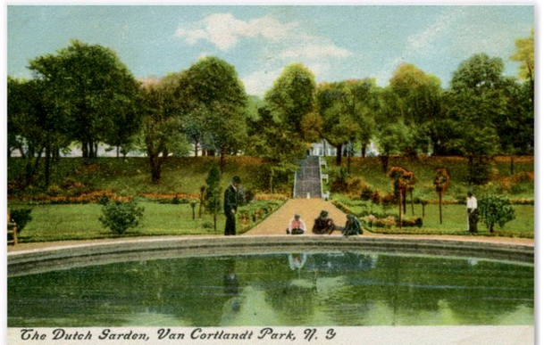
If I recall correctly, there was a sculpture and fountain in the pool pictured above but it cracked shortly after construction as the ground below (once a wetland) was not firm and gave way. Having seen those images, I assumed that the ridge in the above postcard was built after the area became a park at the end of the 19th century–when steam powered construction equipment could easily move rock and earth. But just recently, the University of Michigan’s Clements Library rescanned a 1781 map that shows that the topography of this area goes way back to colonial period:
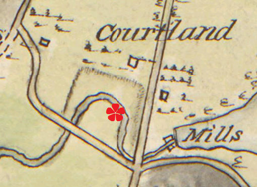
The red asterisk marks where this area is today. As you can see, in 1781 there was a ridge between this place and the Van Cortlandt House, which is the square labeled “Courtland.” In fact, this location appears to have been surrounded on three sides by ridges. Perhaps the Van Cortlandts had this area landscaped to give travelers the same impressive view of their house that you get when looking through the iron gate today. The road just below the asterisk was the Albany Post Road, which would have been well traveled–ensuring that many travelers would gaze upon their mansion. It is also possible that the course of Tibbett’s brook was redirected to give it the “U” shape that is seen on the map around the asterisk. A visitor to the area in 1778 noted in a diary that below the Van Cortlandt House there was a “sweet canal,” which would indicate that the brook was altered in some way. But it is also possible that this ridge was constructed earlier but unfortunately there are not very many detailed early maps. Given the hard labor involved, I imagine that slave labor was likely employed in shaping this landscape.
After the land became a park, I imagine the “Dutch Garden” must have been one of its most popular features. In the 1800s, walking a park’s gardens was one of the main ways to enjoy a park. 100 years later, running and biking were more popular and the focus of the park shifted to the parade ground. Plus, the public pool was built, which further isolated and this underused area.
-
August 6, 2020 at 8:00 pm #1589
I remember the remnants of the fountain being there when I was a child, my mother used to take us to play there, the mothers could watch us play in what was the front central court without fear of one wondering off. They wouldn’t let us near the fountain as it was derelict, filled with broken soda and beer bottles, clearly a teen-hang out drinking spot when the sun went down. I think NYC fiscal crisis prevented necessary maintenance though clearly the front central court and fountain had fallen in to disrepair long before that fiscal crisis.
-
August 6, 2020 at 8:33 pm #1590
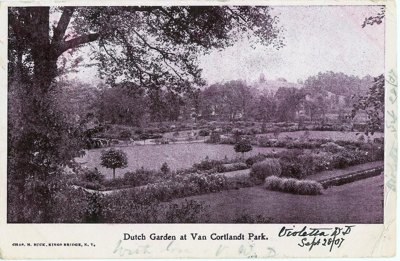
Yes …many postcard views of the Dutch Gardens were made. The little stand at the bottom of the steps had a sundial on it.
-
August 6, 2020 at 8:37 pm #1591
Charles Buck Post card view of the Dutch Gardens 1907
-
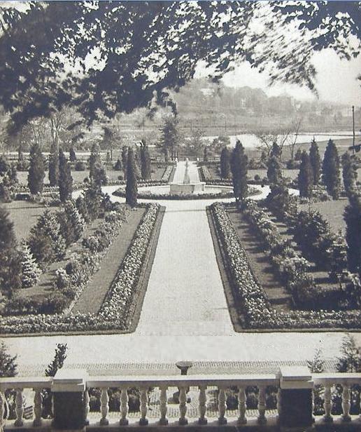
August 6, 2020 at 8:38 pm #1592
1925 view of the Dutch Gardens VC Park
-
August 7, 2020 at 1:04 am #1593
I am always amazed how much interest and attention is given to the Dutch Gardens. Built in 1902 poorly and improperly that they had to be rebuilt by 1911. Not much Dutch about it but was built during the Colonial revival period of interest ca 1900-1920s as the 150 anniversary of America Independence approached. By the early 60s the gardens were in decay once again with the west side taken for the 2 pools which again poorly planned and built soon ran into problems. Again a lot of money wasted by another poorly designed and planned Parks Dept project .
Regarding the hill south of the VC Mansion. My thought is that it is not man made or built by slaves or others. The 1781 map indicates a 3 sided deep ridge much as a present day topgraphical map would indicate the same today, steep hillside slopes.. The last glacier created the parade ground by wearing down the Inwood Marble while leaving the Riverdale ridge to the West and Van Cortlandt ridge to the East made of Fordham gneiss.
This ridge is basically the end of the parade ground that was likely eroded by the glaciers movement south and the receding waters, and cut deeper by the water action from Tibbett’s Brook over the centuries. The ‘U” shape and course of the brook is likely due to nature as well. Major storms can and do change the shape of streams, creeks and rivers and in a few cases have changed the directional flow of rivers.
Today the area is reverting back to a more natural state until someone in Parks or Community Board comes up with another poorly designed project to waste taxpayers money.
-
August 7, 2020 at 1:21 am #1594
Dear Peter, I guess the “Dutch” was the bridges and canals that resemble Amsterdam or New Amsterdam. See pics
-
August 7, 2020 at 1:23 am #1595
See the fountain in the distance, over the canal
-
August 7, 2020 at 1:28 am #1596
Before…it was just made of wood
-
August 7, 2020 at 1:45 am #1597
The sun dial at the bottom of the steps in VC Park
-
August 7, 2020 at 1:48 am #1598
Interesting–I haven’t seen those photos before. I remember seeing photos of massive amounts of tulips planted in the garden as well and tulips are well-known symbols of The Netherlands.
I think the ridge is part natural. After all, artifacts were found on that ridge that predate European colonists. But seeing that map in high-resolution makes me think that it was also shaped by humans. It forms pretty neat little 90 degree angles in the corners, which would be pretty rare in nature. Jacobus Van Cortlandt also had Tibbett’s Brook dammed up to make the lake so he was not averse to changing the landscape.
It is a shame that features are built in parks and allowed to just fall apart. The stairs in Brust Park were like this too. Halfmoon Overlook in Spuyten Duyvil was also closed because the stairs were unsafe, I think. They get grants for capital projects so they can build something but the maintenance budget is very skimpy so they can’t keep it up.
-
August 7, 2020 at 7:44 pm #1599
HI Tom – Good point perhaps the canal and bridges was their intent to call them Dutch Garden in association with the Van Cortlandts.
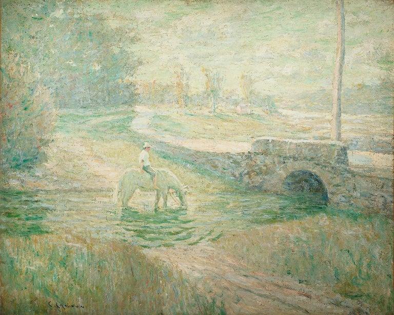
Regarding the bridges. There is a painting by Ernest Lawson (1873-1939), one of the” Eight ” artist, that is possibly a bridge in the Dutch Gardens. The painting is entitled The White Horse. There is no attribution to this site but Lawson did paint upper Manhattan and Bronx in a series dubbed Harlem River School by critics.
-
-
AuthorPosts
- You must be logged in to reply to this topic.