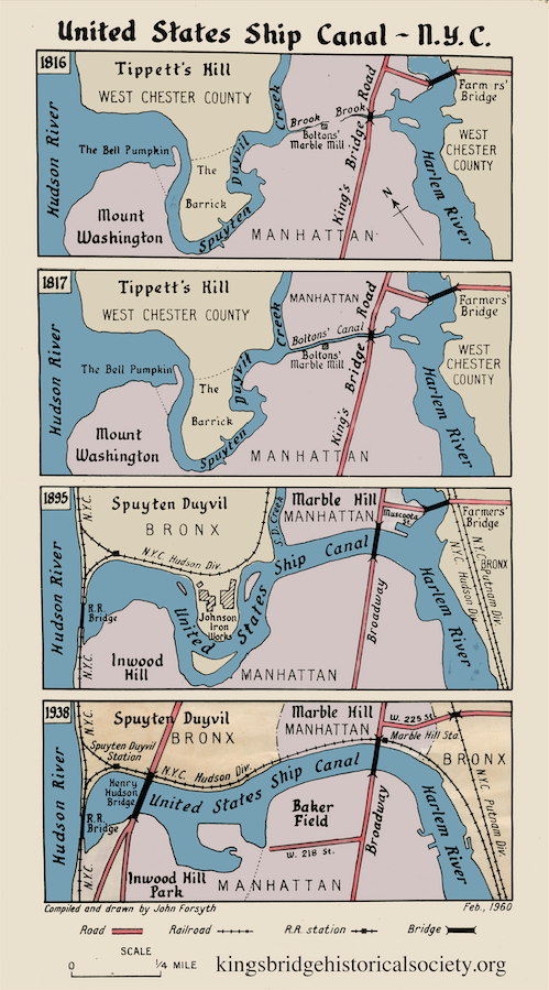
One source of endless fascination for local historians is recounting all of the changes made to our natural waterways. The biggest change was the digging of the Harlem River Ship Canal and filling the Spuyten Duyvil Creek, which resulted in separating Marble Hill from northern Manhattan. John Forsyth’s illustration makes the evolution of the creek clear:
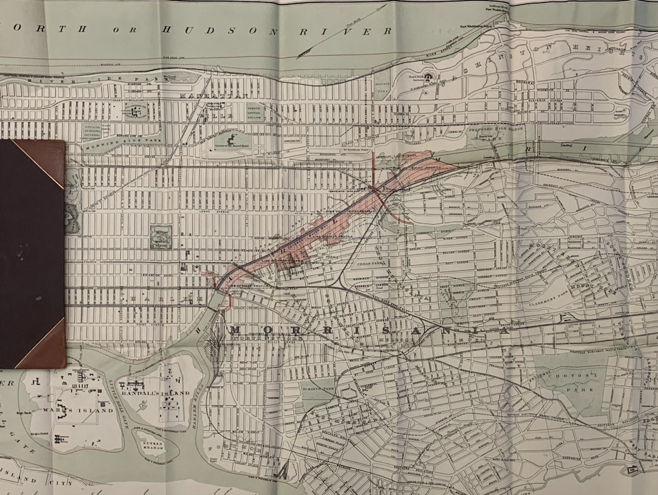
One thing to know about the canal project was that not everyone was in favor of it. An alternative proposal suggested burying the Harlem River in the sewer system or simply filling it in to seamlessly connect Manhattan Island to the mainland. The Thaddeus and Stevens plan for the river involved covering the Harlem from Morrisania to near High Bridge (the red area on the below 1891 map):
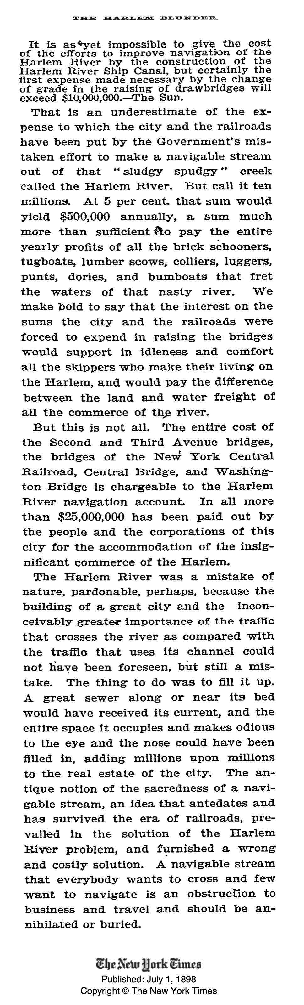
After the canal was constructed in 1895, the New York Times lamented the cost of the canal and openly advocated for the eradication of the Harlem River, stating “a navigable stream that everybody wants to cross and few want to navigate is an obstruction to business and travel and should be annihilated or buried.”
Perhaps it is selfish of me to say that I am glad that the Harlem River wasn’t “annihilated or buried” as the NYT article called for. Portage of the Circle Line boat from the Third Avenue Bridge to beyond Macombs Dam Bridge as part of the cruise around Manhattan would require Herculean strength <grins> Seriously, being able to cruise around Manhattan, taking in all of the various sights along the route, is an adventure not to be missed. A lotta times it’s better to leave things as they are.
.