Home › Forums › The Industrial Era › The Spuyten Duyvil and Port Morris Railroad – Part 2: Through the Hill
- This topic has 6 replies, 4 voices, and was last updated 6 years, 11 months ago by
ndembowski.
-
AuthorPosts
-
-
August 16, 2019 at 11:39 pm #1096
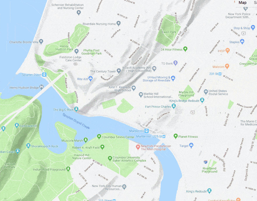
Previously, I wrote about how the presence of the Spuyten Duyvil and Port Morris Railroad’s construction workers impacted the area around Kingsbridge. Of even greater impact was the construction itself and the route of the completed railroad. The below animation depicts the route of the SD&PM RR over a contemporary street map.
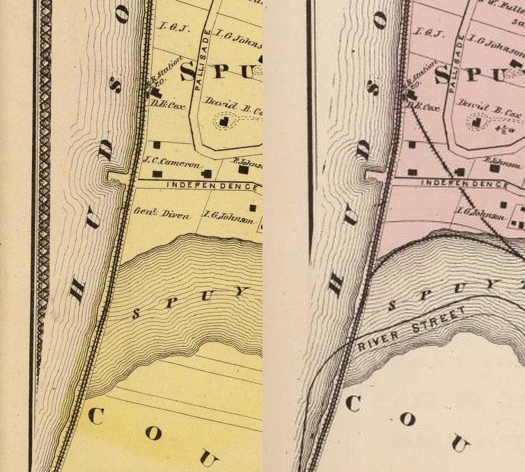
To get trains from the Hudson to the Harlem would require some serious engineering and terraforming. Below are two side by side map snippets depicting where the Hudson and Harlem Rivers meet. The map on the left shows 1868 (before construction) and the map on the right 1873 (after). Curved track was laid to accommodate northbound and southbound trains.
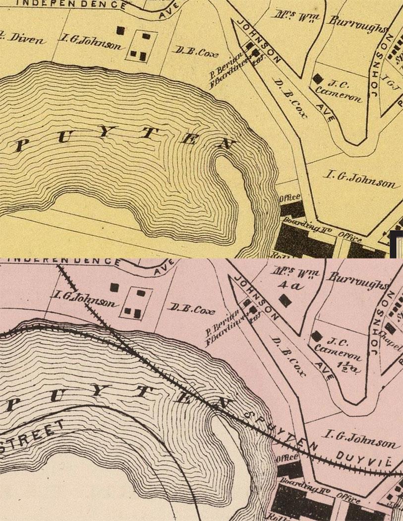
Moving further to the east on the maps, you can see the new railroad track running right over the Spuyten Duyvil Creek. the 1868 map is on top and the 1873 on the bottom:
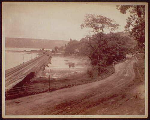
This leg of the railroad did indeed go over water on a bridge causeway. A few depictions of that causeway exist. The below view is looking west from the peninsula that jutted out into the Spuyten Duyvil Creek from the Bronx side (the photographer was standing where the letter “E” appears in the word “Spuyten” on the above map):
The below illustration is from an 1893 edition of Harpers Weekly. It depicts an eastbound train over the causeway bridge with the Hudson and the Palisades in the distance. The vantage point is further to the west than the above photo and the artist is facing southwest.:
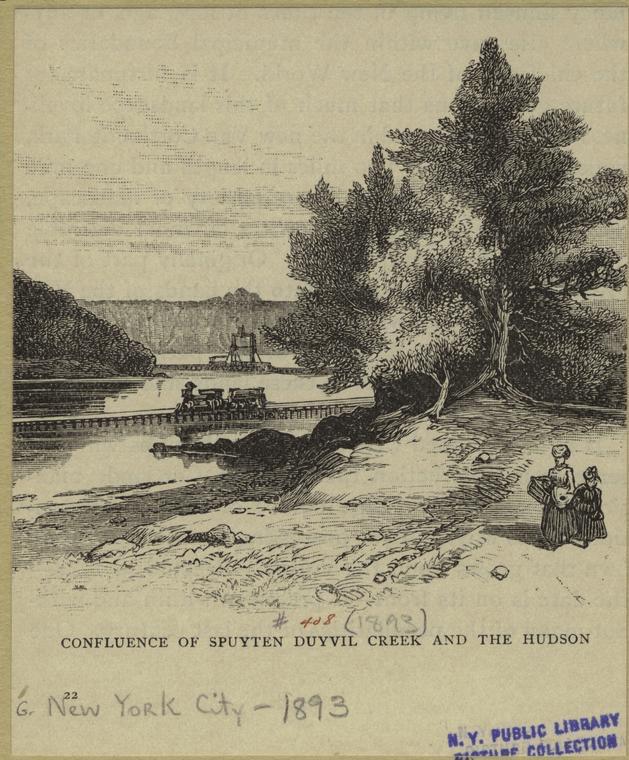
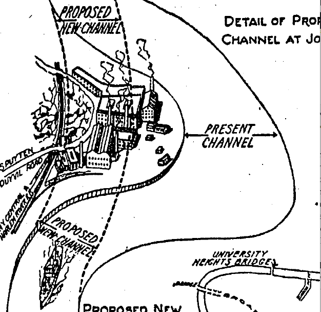 The eastbound train depicted above was heading straight for the peninsula that jutted into the Spuyten Duyvil Creek on The Bronx side. That peninsula no longer exists. It was blown up and cut through when the Harlem River Ship Canal was straightened in 1938. A newspaper illustration depicting the demolition is on the right. However, in the 1870s, the peninsula was the home of the neighborhood’s biggest employers: the Spuyten Duyvil Rolling Mill and the Johnson Foundry. The railroad could not go around the peninsula as that would be too tight of a turn and it could not go over Spuyten Duyvil hill as that would be too steep of a grade. So they blasted through the hill. The below map comparison shows the route through the hill (the map on the left again shows 1868 and the right 1873):
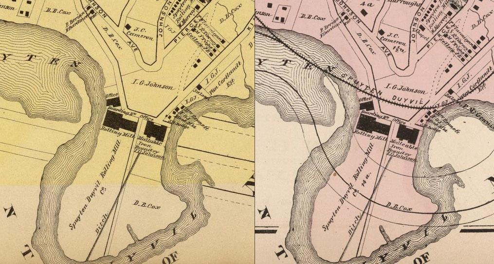
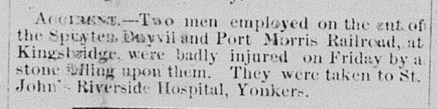
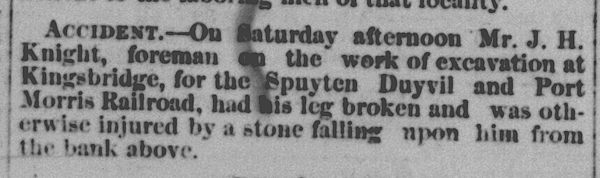
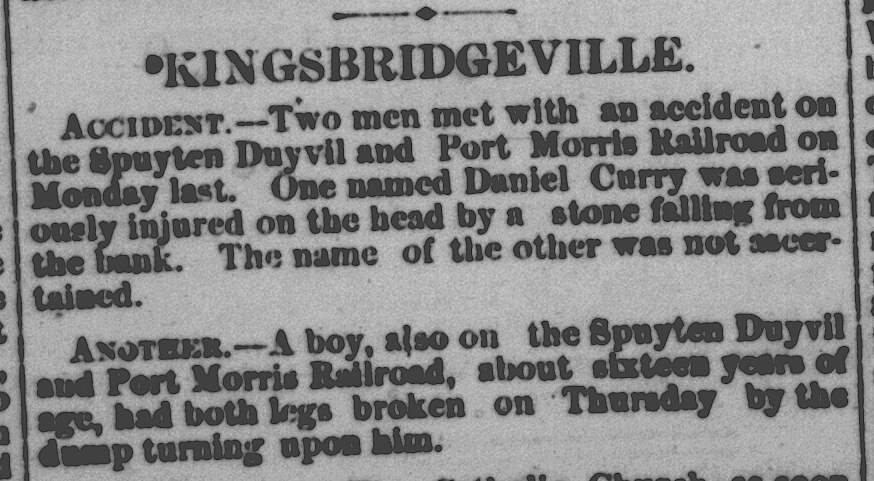
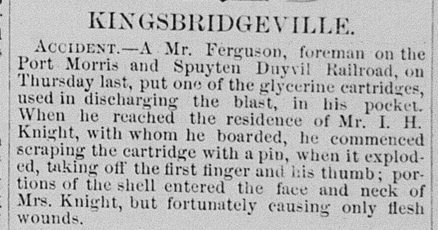
Workers blasted through the hill of solid rock that was about 100 feet high and wide enough for two tracks. It was dangerous work during a time when ensuring worker safety was not a feature of the legal system. As a result, stories like these in the Yonkers Statesman were common at the beginning of 1871:
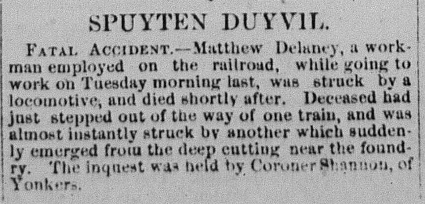
Toward the end of 1871, when the “rock cut” through Spuyten Duyvil Hill had been completed and trains started running, it was no less dangerous. People were long accustomed to walking along railroad tracks. But walking over the tracks at Spuyten Duyvil was especially dangerous as the “rock cut” hid oncoming trains from view:
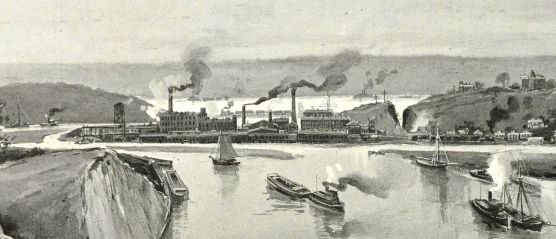
About a decade later, that same obstructed view would cause a terrible train accident. But the construction workers left a lasting legacy–the “rock cut” has been in use for nearly 150 years. Below is a cutout from an 1895 Harpers Weekly. The view is looking west with Spuyten Duyvil Hill and the “rock cut” on the right. The foundries and mills dominate the peninsula and the Palisades loom in the distance. Inwood Hill is on the left
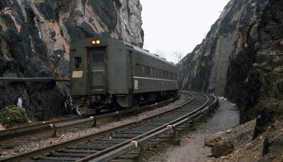
The below image depicts a Penn Central passenger car slipping into the “rock cut” eastbound after leaving Spuyten Duyvil Station in 1975. It is a familiar site to anyone who just misses their train to work downtown.
From Spuyten Duyvil Hill, the railroad would make its way over well-traversed roads and through the well-populated town of Kingsbridge. That last leg of construction through the neighborhood would be chaotic and it drew the ire of locals. That will be the subject of the next post.
-
August 17, 2019 at 8:25 pm #1097
Now if you can help me locate where the old station was, I would be very appreciative.
-
August 17, 2019 at 8:26 pm #1098
-
August 18, 2019 at 5:48 pm #1099
I did not know this but you made me curious so I looked into it and found this.
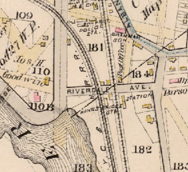
Just below where you see “Riverdale Ave” you can see “Kingsbridge Sta.” I guess Riverdale Ave is the old name for West 230th Street. I am thinking that the postcard is looking east from Broadway and that the building in the center of the background is the red rectangle on the above map labeled “Dr. Parsons.”
-
August 19, 2019 at 6:19 pm #1101
You can see the Kingsbridge station behind and under the tracks in this 1916 view.
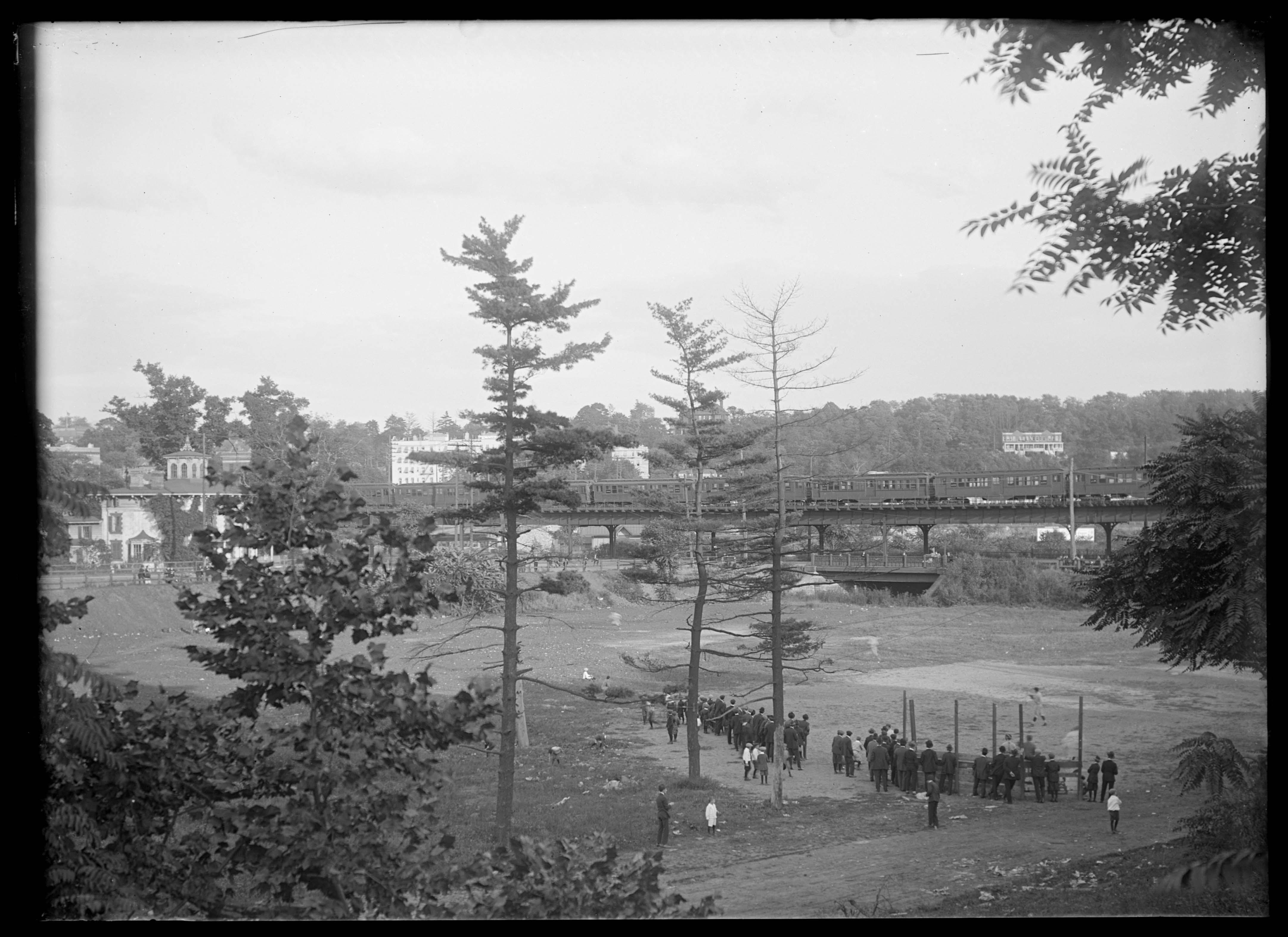
Close up of above pic, showing station
http://dcmny.org/islandora/object/nyhs%3A598It shows up even more clearly in this view, which I believe is taken from the steeple of St Stephens
https://cdm16694.contentdm.oclc.org/digital/collection/p16124coll2/id/27554
This pic is one of three that can be combined into this awesome 1916 panorama…
-
August 20, 2019 at 8:06 pm #1102
Great post, Nick! Thank you! I had no idea there used to be a causeway in front of my old home at the Villa Rosa Bonheur. I gather they filled in the shoreline out to the tracks at some point — and that’s why we have a park there now.
-
August 26, 2019 at 5:06 pm #1109
Thanks. Yes, that area north of the tracks was filled in but it does seem to be pretty close to sea level judging by the flooding and large puddles there after a rain.
Great detective work on the train station, Alasky.
-
-
AuthorPosts
- You must be logged in to reply to this topic.