Home › Forums › 20th Century › 231st & BWay 1916
- This topic has 1 reply, 2 voices, and was last updated 6 years, 9 months ago by
Thomas Casey.
-
AuthorPosts
-
-
October 23, 2019 at 5:12 pm #1140
I came across two photographs labeled “Unidentified upper Manhattan elevated subway station” and recognized details from another photo that place them as 231st & Broadway, and most likely June 2nd, 1916.
I’ve posted the other photo before on a different thread, but I’ll post it again, with some explanation, as it is one of those eye popping photos that take some thinking before you recognize where it is and how well you know the location.
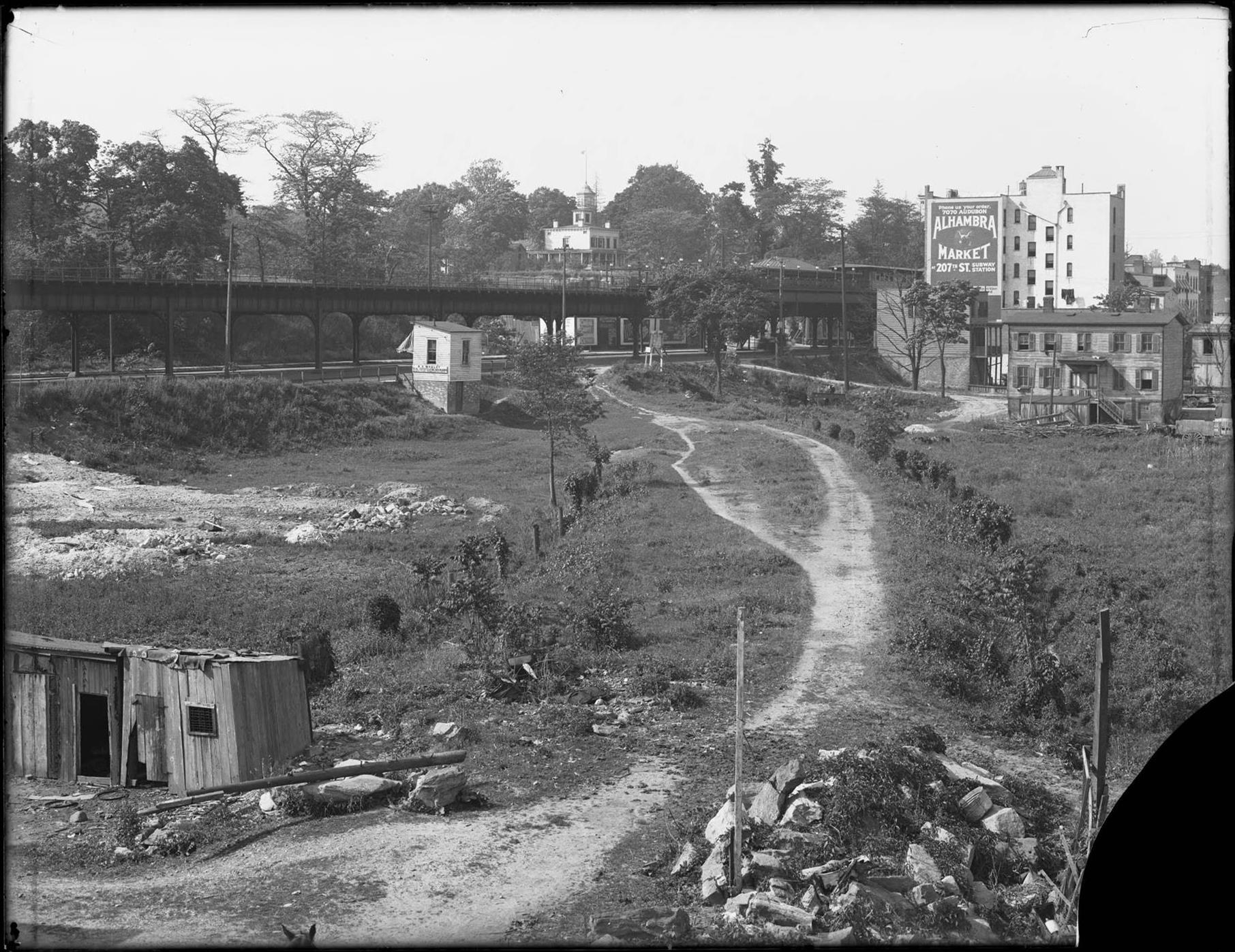
It is labeled “View of the old New York Central Railroad tracks, looking north from W. 230th Street, Bronx, June 2, 1916.”
It shows the sweeping curve of the abandoned railway from when it used to make a much bigger loop to the north, before the Harlem Ship Canal was built, around the turn of the century.
The camera is looking northwest.
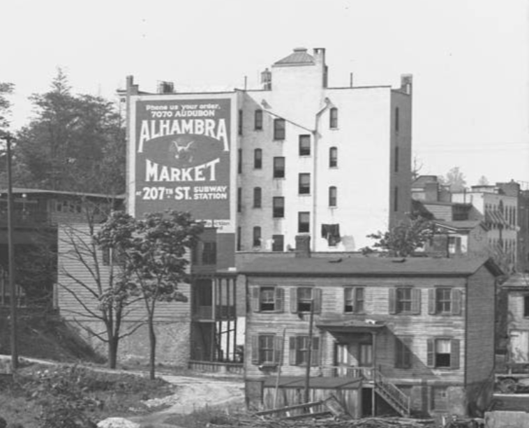
The multi story building with the billboard used to sit at the southeast corner of 231st & Broadway. 231st St station is to the left of the billboard.
The top center is confusing, as you are seeing two spires, one behind the other.
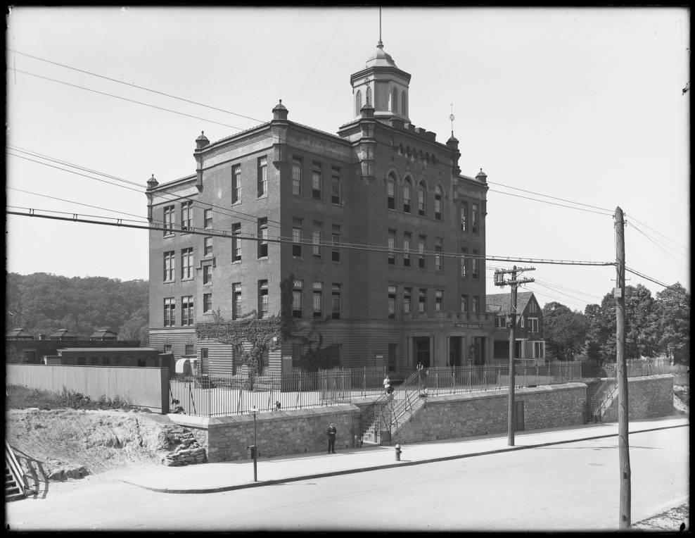
Peeking out in the back is the top of PS 7, at 232nd & Kingsbridge
In front of PS 7 is the White residence, at 231st & Kingsbridge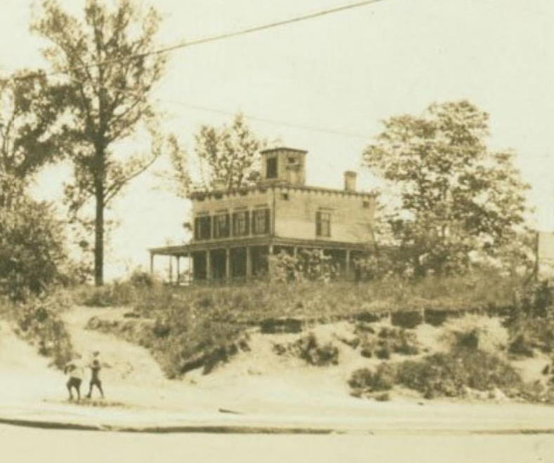
 This building is the feature that identifies the following two photos as 231st & Broadway.
Unidentified upper Manhattan elevated subway station, undated (ca. 1916).
Unidentified upper Manhattan elevated subway station, undated (ca. 1916).
I’ve noticed in other old photos of elevated lines that still exist, that most features can be IDed using modern Google maps street views. Most major features are unchanged in over 100 years. This is the case for these photos and the 231st Street area. I won’t bore you with the details, but you may enjoy trying it yourself and seeing how well things line up, for instance where the supports are wider to support the station.
I suspect all three of these pics were taken the same day, which is noted as June 2nd, 1916.
That was quite a day for fans of wonderful old photos of this area.
This link should show a search for that date at New York Heritage digital collections. Many fantastic W. D. Hassler photos, including this wonderful panorama.
The exact match of the billboard, and the other photos W. D. Hassler took on June 2nd, 1916 make me think the two newly IDed ones were likely also taken by Hassler on the same day. Certainly near enough to have the billboard look exactly the same.
NOTE: most of the pics in this post are in better resolution than they may appear. You may enjoy viewing the images in a separate window, or downloading them, to view at maximum resolution, or follow the link to the source URL
-
October 24, 2019 at 6:59 pm #1141
Very nice selection of images…Thank you – Tom Casey
-
-
AuthorPosts
- You must be logged in to reply to this topic.