Home › Forums › Photo Contests › April 2023 Image Contest
- This topic has 11 replies, 5 voices, and was last updated 3 years, 2 months ago by
jbakerjonathan.
-
AuthorPosts
-
-
April 26, 2023 at 8:13 pm #3347
The Kingsbridge Historical Society is grateful to have received this watercolor painting from new members, Bart and Deborah Schiavo:
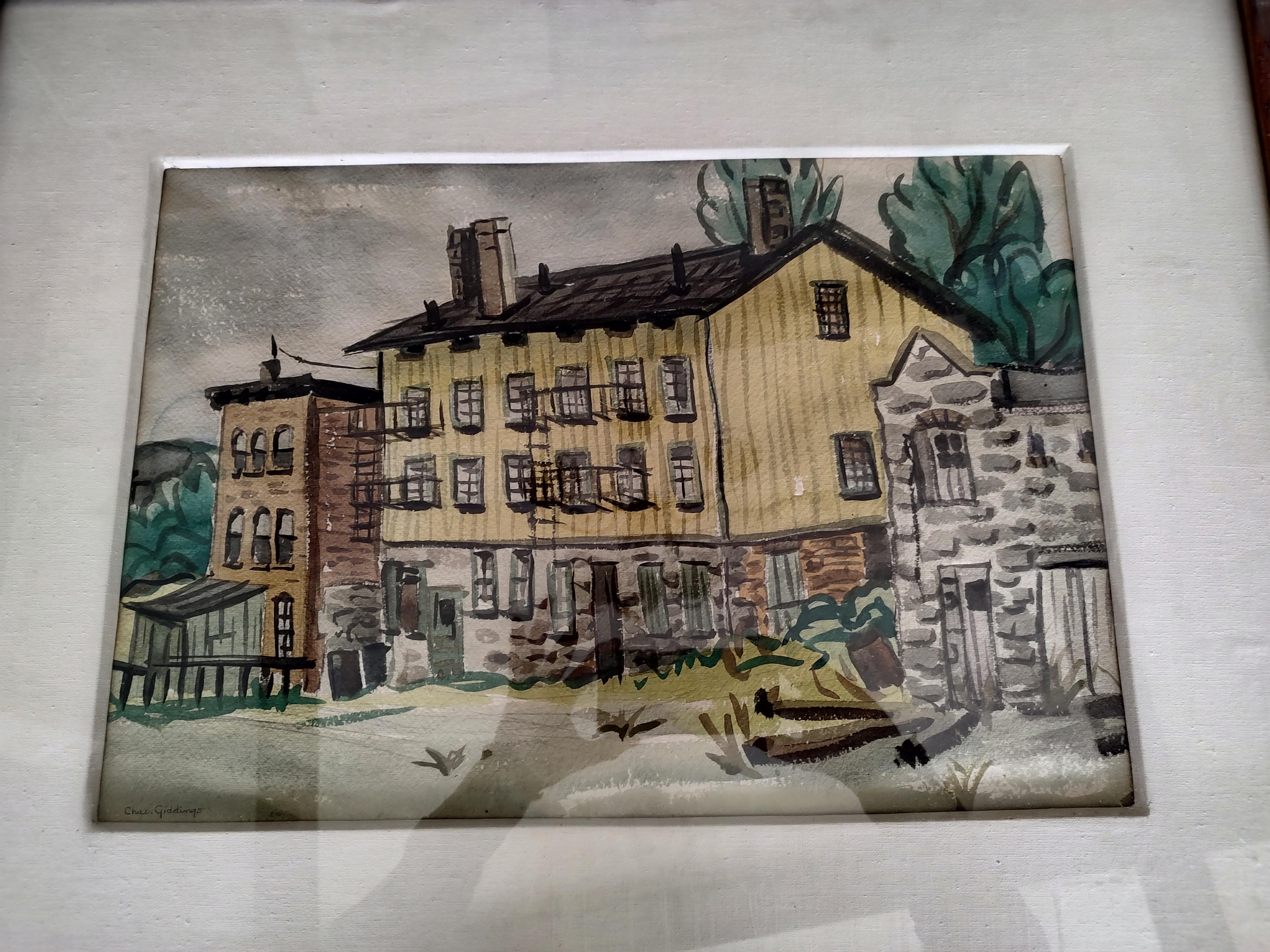
Deborah informed us that it had been in her family for a long time and that her father told her it was supposedly a local scene. When I first saw it, I had no idea where this could have been. Neither did the other officers of the KHS. It was only by a stroke of luck that we found a photo depicting these buildings and they did indeed stand somewhere in our neighborhood. The only hint I will give is that the building in the center was noteworthy and well-known at one point.
Can anyone figure out where these buildings stood? This is not an easy one by any stretch so good luck!
-
April 27, 2023 at 10:11 am #3348
Nick, is the photo available on the site for us to find?
-
April 27, 2023 at 10:25 am #3349
Looks like the building at the north end of the Kings Bridge.
-
April 27, 2023 at 10:26 am #3350
Why do you make it so difficult to post a simple image.
-
-
April 27, 2023 at 10:26 am #3351
-
April 27, 2023 at 11:06 am #3352
“Kingsbridge, the Bronx neighborhood with royal connections” ….. Interesting, but lets not forget the Bronx neighborhoods of Highbridge, and Williamsbridge. Both have there own Train Station & Post Offices. You could not travel the Old Boston Post Road, without crossing the Kingsbridge & the Williamsbridge from Manhattan to Boston
-
April 27, 2023 at 7:04 pm #3357
It does look something like Macomb’s mill at the King’s Bridge but that is not the building featured in the watercolor.
The buildings in the watercolor are depicted in a photo on the website, although not too clearly.
-
April 29, 2023 at 9:14 pm #3358
A couple of hints:
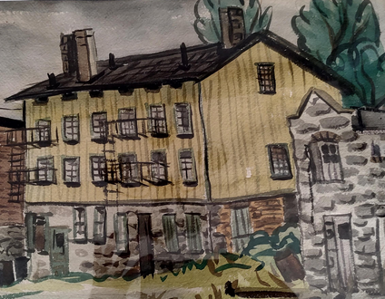
The yellow building in center was described as “legendary” by the Rev. William Tieck.
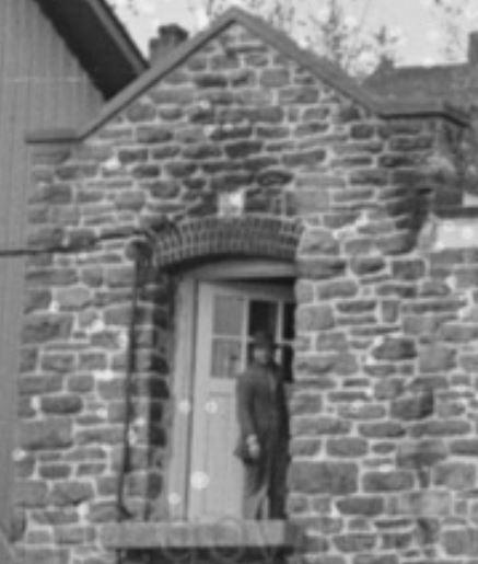
A photo clipping of the building on the right:
-
May 2, 2023 at 10:06 am #3359
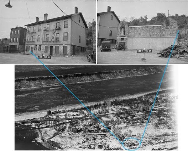
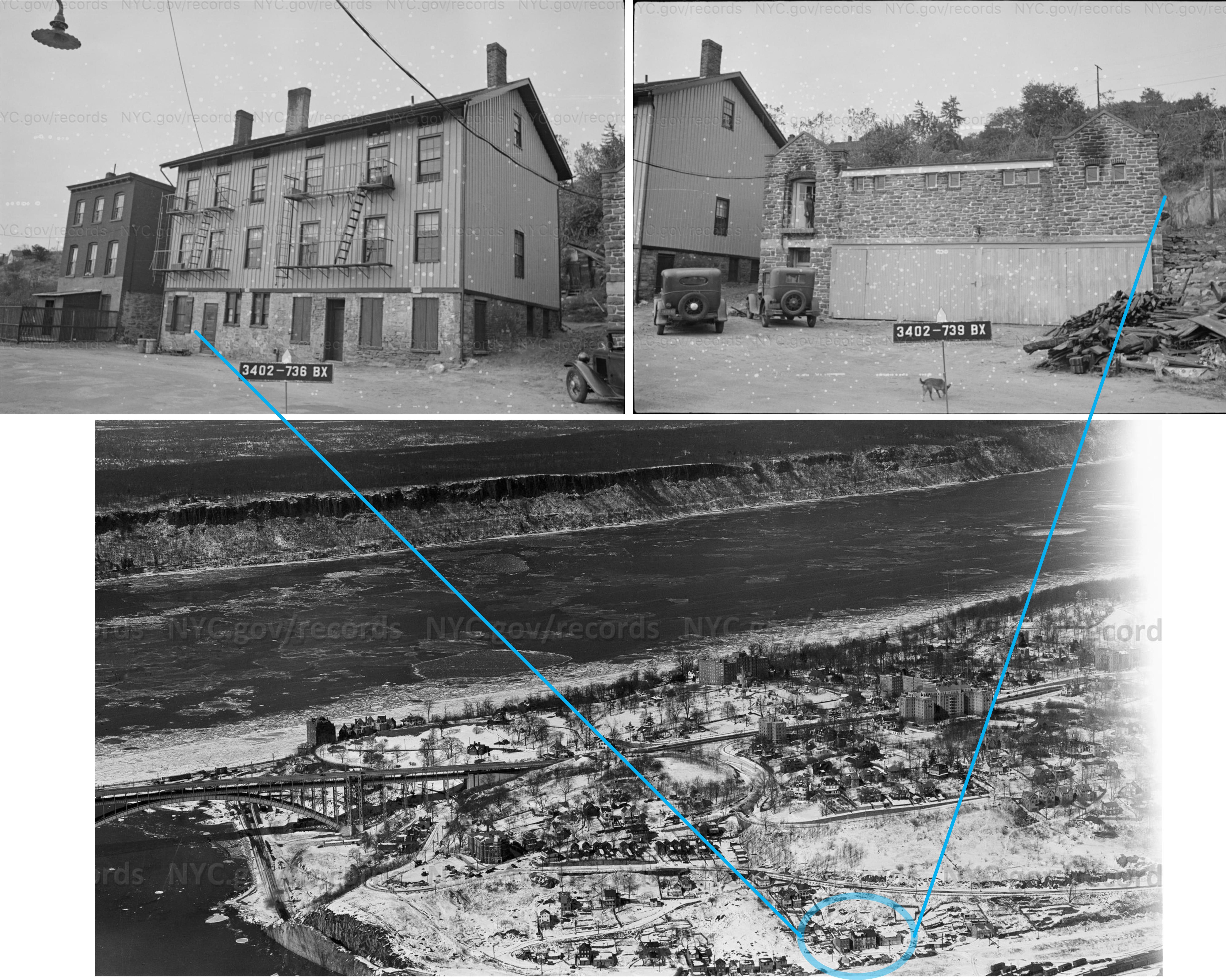
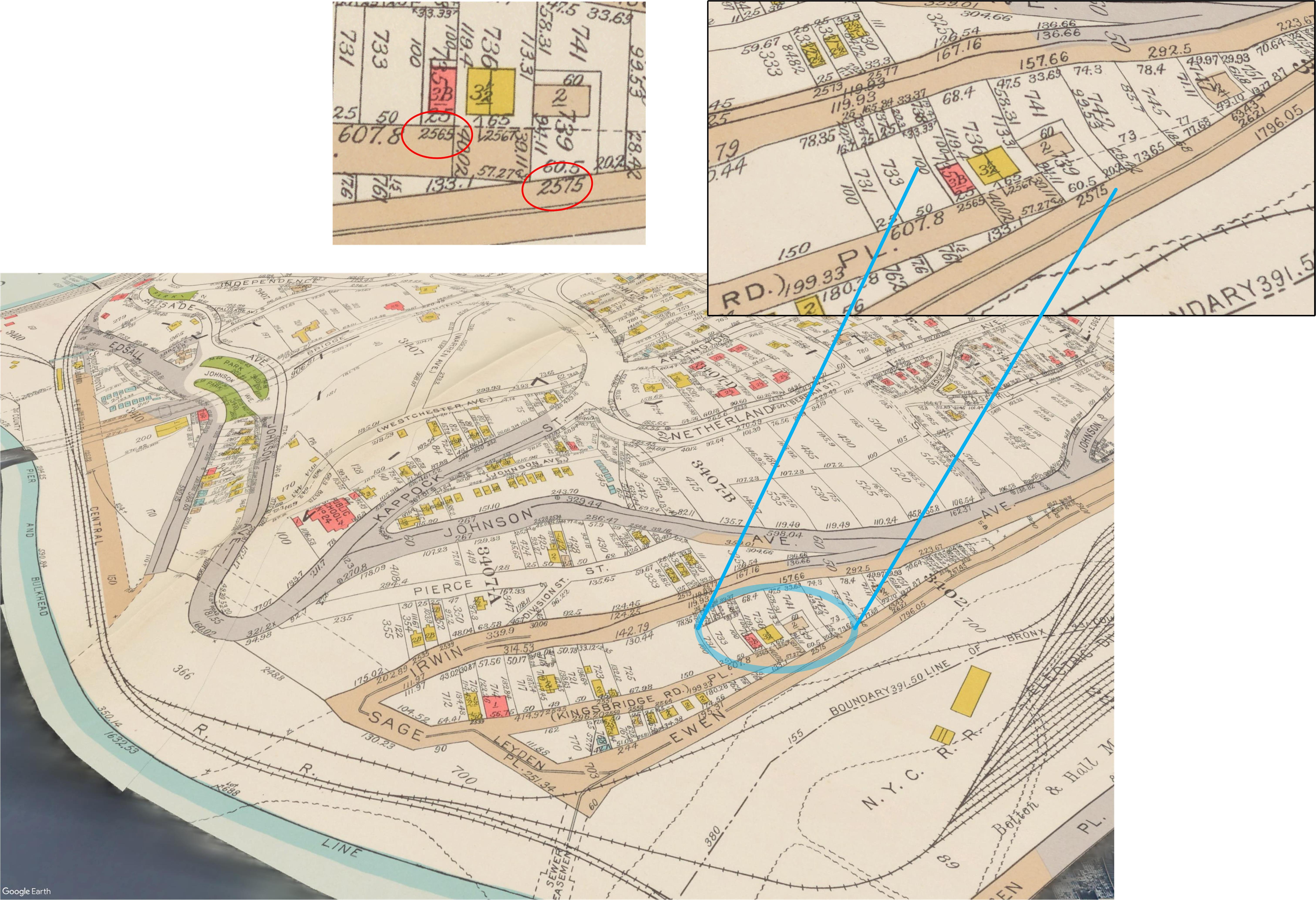
Here are a couple of pics from the 1940s tax photos, where the buildings are labeled 2565-2575 Kingsbridge Road, and a few others showing where they stood, and a Google Earth simulated view where the location is today.
https://nycma.lunaimaging.com/luna/servlet/s/9g6e2r
https://nycma.lunaimaging.com/luna/servlet/s/r3jen91938 map

https://digitalcollections.nypl.org/items/0701ad80-b6c6-0132-dc4a-58d385a7b928

-
May 2, 2023 at 3:43 pm #3360
Kudos, Alan Lasky! Great detective sleuthing! Your additional information and photos are eye-opening in showing how sparsely populated the area was in 1940. Off in the distance one can see the Charlotte Bronte Villa and the four-year-old Henry Hudson Bridge. The map shows Sage Place – Kingsbridge Rd that no longer exists (that I could find).
Further to the South on the map there is a lot #725. The NYCItyMap site shows the J.F. Kennedy H.S. being on lot #725. Assuming the lot numbers remained the same while the Block numbers were changed (at some point), that would put the buildings in question to the north of the current high school, perhaps at the north side of the high school at the parking lot. Or am I completely mistaken?
-
May 2, 2023 at 7:42 pm #3361
The photos Alan found of the three buildings from the watercolor are pretty great. This was the photo where I first found the buildings:
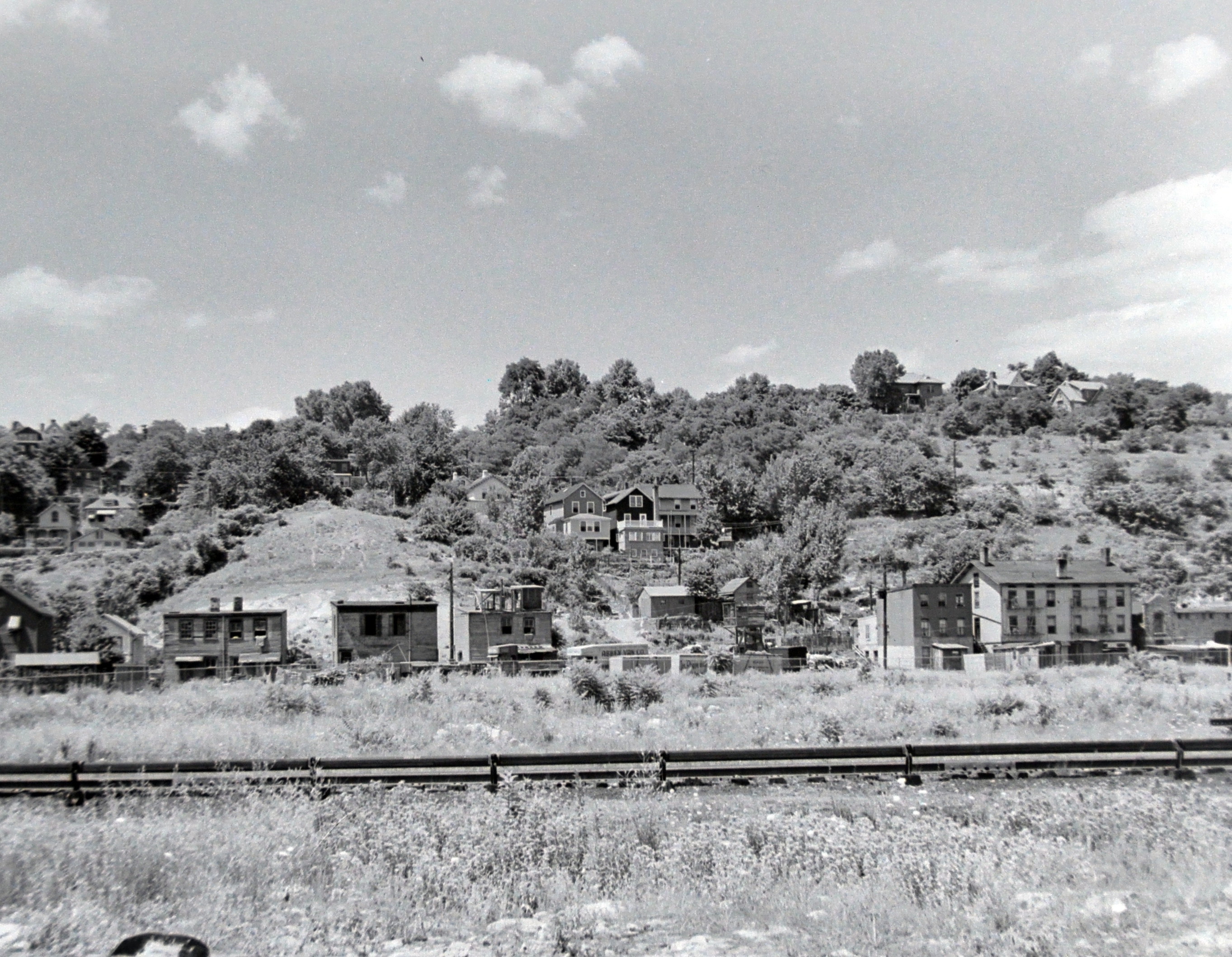
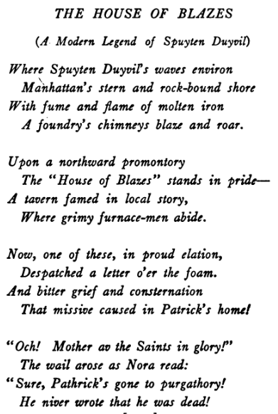
The three buildings from the painting are on the right. This view is looking to the northwest at Spuyten Duyvil Hill in 1939 as if you were standing on the JFK High School athletic fields today. These buildings were part of the old “mill town” of Spuyten Duyvil, which no longer exists. The “mill” was the rolling steel mill of Isaac G. Johnson at Spuyten Duyvil, which employed many immigrant laborers. The large yellow building in the watercolor was the legendary House of Blazes. It was known as Spuyten Duyvil’s “house of ill repute.”
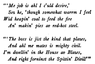
The House of Blazes was the inspiration for this poem by Arthur Guiterman:
When the author Theodore Dreiser lived on Marble Hill, he described the view of the mill town as in the photo above as being “occupied by a range of low, yellow, wooden tenements, the homes of a number of foreign workmen, who were employed in the steel mills beyond, and back of them again was the bank of a huge hill which towered like a leviathan above them. They were so homely, the little tenements of yellow. They snuggled so humbly between the green wall of earth and the hurrying current of the river. They looked by day like some brown patchwork left over from a preceding autumn of glorious color and by night like some jewel-studed stuff of velvet, or some wall of ebony set with diamonds. High overhead, above the crest of the hilltop shone the stars, and far below lay the water, gleaming and twinkling with rays which the tenements cast. I remember looking with a soulful, heartfelt awe upon the beauty of the scene and wondering whether I should ever be able to describe it and whether I could ever make anyone feel what I was then feeling.”
-
May 3, 2023 at 9:56 am #3362
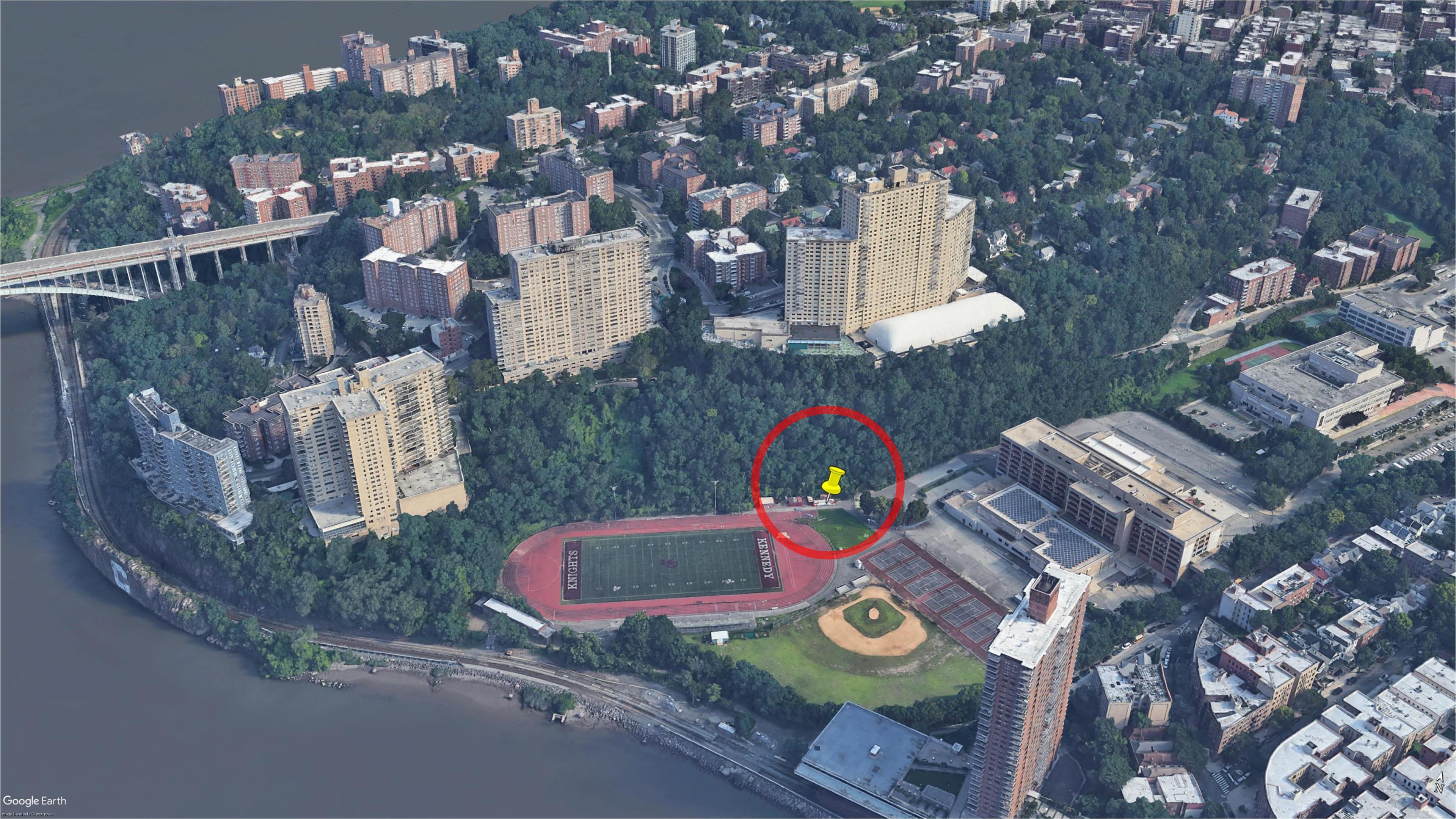
Upon closer examination, overlaying the 1938 map with Google Maps, I do believe that Alan Lasky’s positioning of the buildings at the edge of the high school track is correct. My earlier positioning suggestion was incorrect. I’m sorry for any confusion I may have caused. Again, it was astute analysis made by Mr. Lasky.
In the aerial view dpr_18162, #1 Riverdale Avenue can be seen.
-
-
AuthorPosts
- You must be logged in to reply to this topic.