Home › Forums › 20th Century › Burying Tibbetts Brook – Construction and Chaos in Kingsbridge ca. 1900
- This topic has 19 replies, 5 voices, and was last updated 4 years, 7 months ago by
Peter Ostrander.
-
AuthorPosts
-
-
November 26, 2021 at 3:15 pm #2373
[caption id="" align="aligncenter" width="1810"]
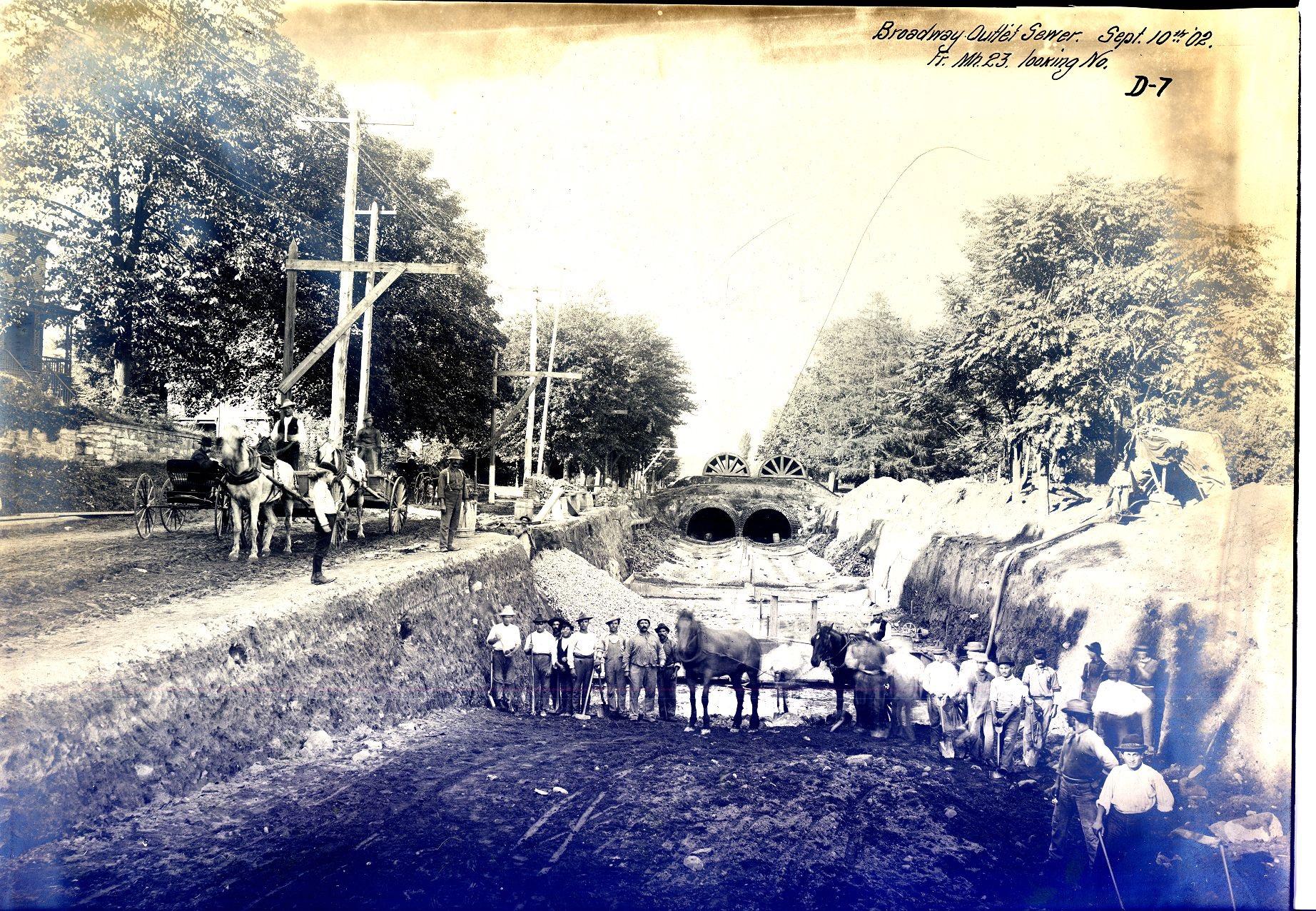
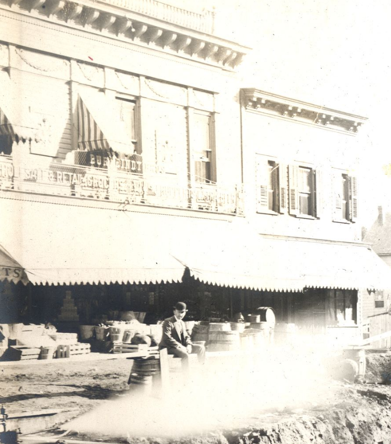
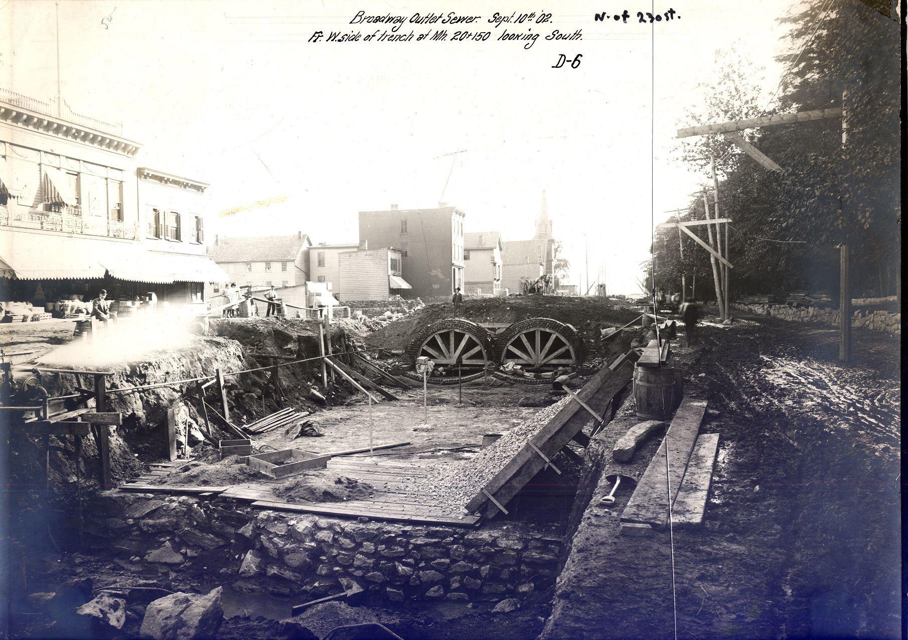 This photo depicts the construction of the Broadway Sewer, which was designed to drain the Tibbetts Brook watershed. The view is looking south on Broadway if you were standing just south of 232nd Street. On the far left is Burfeindt Brothers Grocery and this building still stands. The decorative elements on the facade can be seen on the Tremont Paint Supply Building today. The steeple in the distance belongs to the old Methodist church that once stood on the northeast corner of Broadway and Verveleen Place. Photo: Special Collections, Lehigh University Libraries, Bethlehem, Pennsylvania.[/caption]
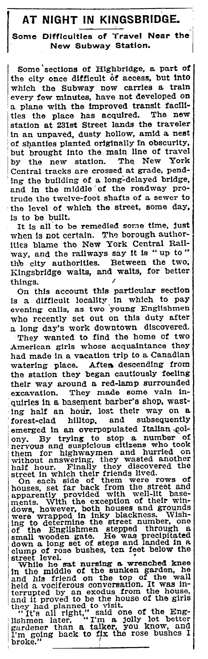
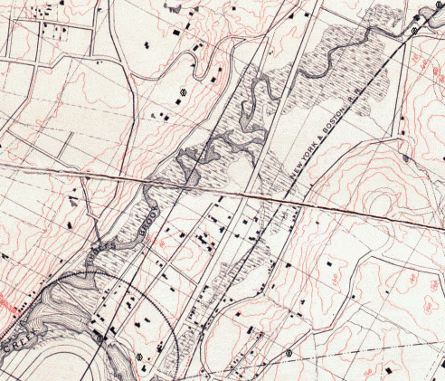 After the intense flooding of I-87 during hurricane Ida, there is renewed interest in daylighting Tibbetts Brook as a way to prevent such flooding in the future. Tibbetts Brook once flowed through Kingsbridge and emptied into the Spuyten Duyvil Creek before those waterways were filled in after 1900. The brook still flows above ground in Yonkers and south into Van Cortlandt Park but the Kingsbridge section was channeled into the Broadway sewer, which carries it to the Ward’s Island Wastewater Treatment Plant. It is obviously not very efficient to treat this water and the system is easily overwhelmed by big storms. So why was Tibbetts Brook ever buried in the first place and how was it accomplished?
Memoirs and photos from the late 1800s show that the brook was enjoyed by locals for recreation. Local kids swam, fished, and caught turtles in the brook and skated on it in winter. Adults fished and rowed in the brook and it was even used to transport farm produce from the “free dock” located at modern 240th Street and Tibbett Ave.
[caption id="" align="alignright" width="580"]
 1870 Yonkers Statesman[/caption]
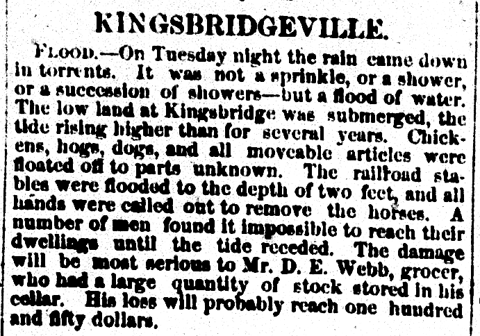
But the brook presented problems as well. For one thing the marshlands were blamed for a large quantity of mosquitos, which were associated with disease. Another was the flooding caused by storms and high tides. Turn-of-the-century resident George Arthur Bergen recalled that houses “were plagued by flooding cellars, especially during neap tides.” This drove some property owners to put their buildings on stilts. The Yonkers Statesman reported on one terrible flood:
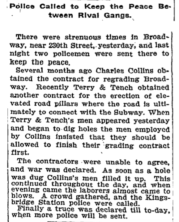
 Lastly, the brook was an obstacle to real estate development and there was a lot of money to be had if it could be made into dry land. Some private landowners were biding their time and waiting to sell their property until the brook was drained and trolleys and trains were built, after which time they could make a lot of money. In 1899 Bronx Borough President Louis Haffen granted the contract for sewer construction to a Tammany Hall leader, Bart Dunn, who promised to get the job done in under 3 years. He ended up taking over twice as long to finish the job. Both Dunn and Haffen would be accused of corruption and theft over the project. Dunn eventually served jail time. Area residents were quite upset about the state of the neighborhood.
[caption id="" align="aligncenter" width="1844"]
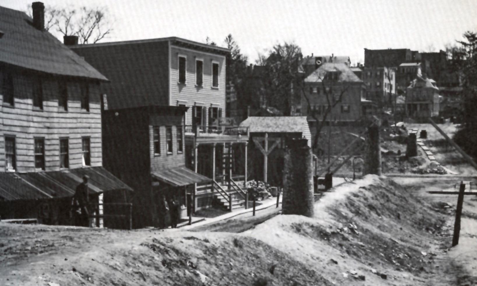
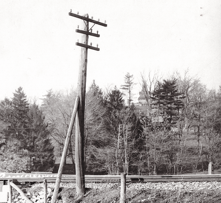
 View looking north on Broadway from above W. 231st Street. Photo: Special Collections, Lehigh University Libraries, Bethlehem, Pennsylvania.[/caption]
The burial of the brook made much of Broadway an open pit. In addition, the adjacent streets were outfitted with sewers, which were built directly on top of the street. And low-lying parts of the neighborhood were being raised with fill. This resulted in the odd sight of manholes sticking out of the street like chimneys all over the neighborhood as they waited for the streets to be regraded.
[caption id="" align="alignnone" width="1637"]
 View looking east from W. 231st and Broadway with Bailey Ave in the background. The house on the far right still stands at 3100 Bailey Ave.[/caption]
The sewer construction was just one of the major projects happening in the neighborhood at the time. Broadway, as a roadway, would obviously need to be mended after getting torn up for the sewer. The Broadway trolley and elevated train tracks were also in the works:
[caption id="" align="aligncenter" width="579"]
 10/19/1906 New York Times[/caption]
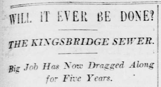
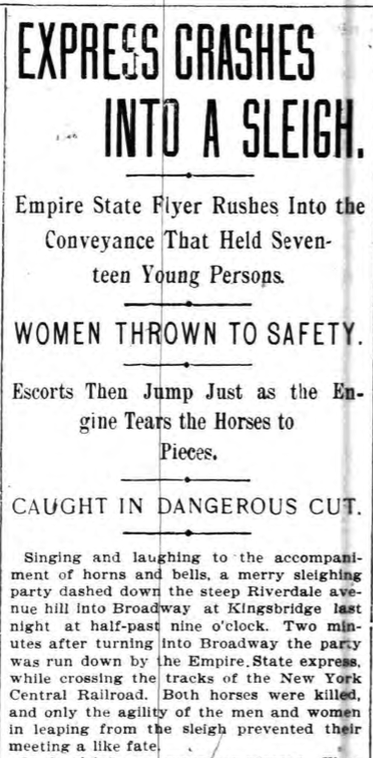
Most area residents know that 231st and Broadway is a busy intersection. Double parked cars, buses, pedestrians, and cars turning left make it tricky to navigate. At the turn of the century it was even worse. The delayed sewer project meant the street was an open pit. Worse than that, there were the high speed trains of the New York Central crossing Broadway at street level just below modern 231st Street. The trains sped through the center of Kingsbridge and were the cause of many accidents before the tracks were relocated to the north bank of the Harlem River Ship Canal.
[caption id="" align="aligncenter" width="1823"]
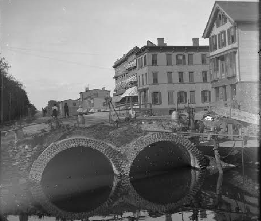
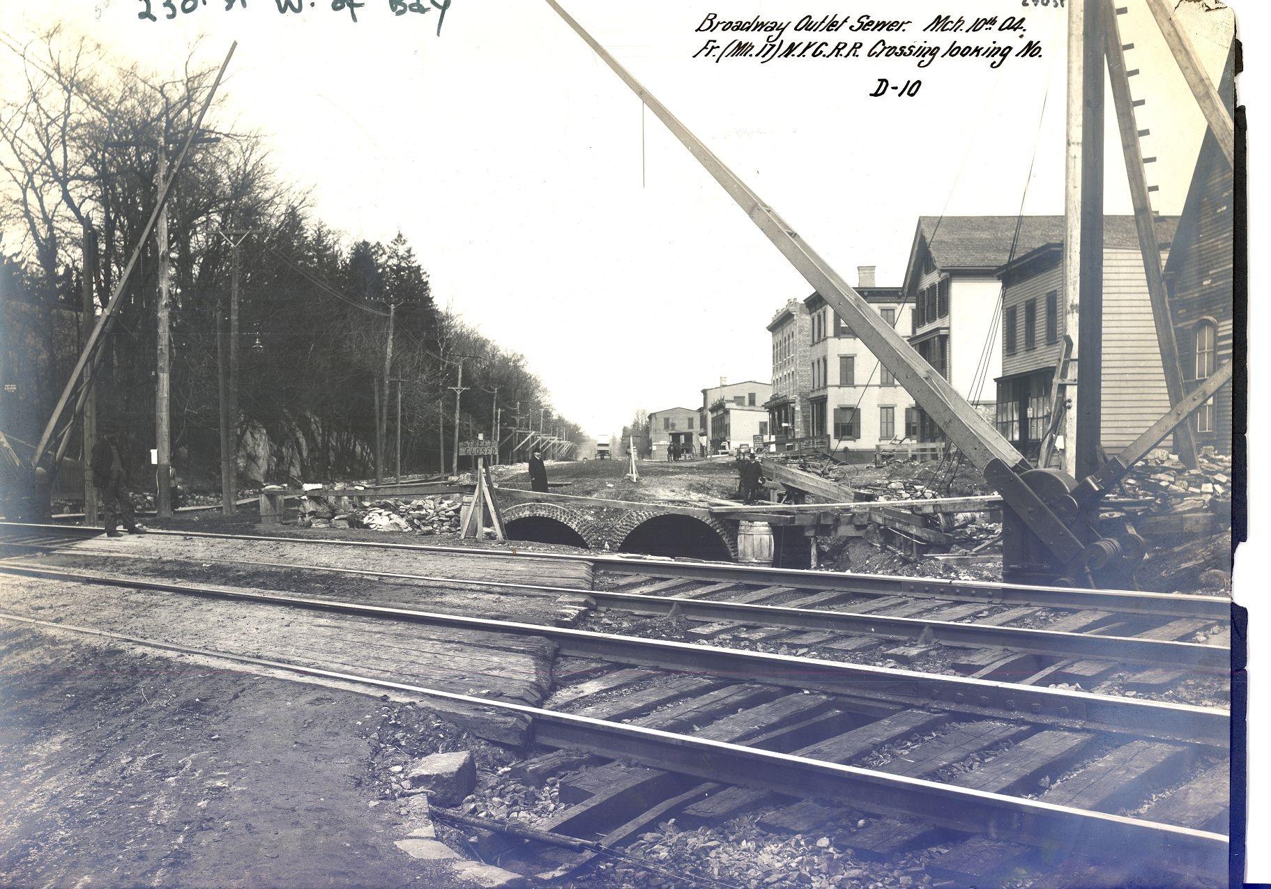 View looking north on Broadway from just south of W. 231st Street. The New York Central cross Broadway in the foreground and the double-culvert sewer can be seen just beyond. Photo: Special Collections, Lehigh University Libraries, Bethlehem, Pennsylvania.[/caption]
[caption id="" align="aligncenter" width="373"]
 2/4/1898 New York Herald[/caption]
[caption id="" align="aligncenter" width="880"]
 Intersection of 231st and Broadway looking north. The three story brick building still stands and is home to the Gold Mine Cafe at 5578 Broadway.[/caption]
The period between 1890 and 1910 saw the introduction of gas street lamps, the Broadway trolley, the elevated train tracks, the burial of Tibbetts Brook, the building of the Harlem River Ship Canal, and the development of Van Cortlandt Park. The neighborhood was totally transformed in a very short period.
[caption id="" align="aligncenter" width="1813"]
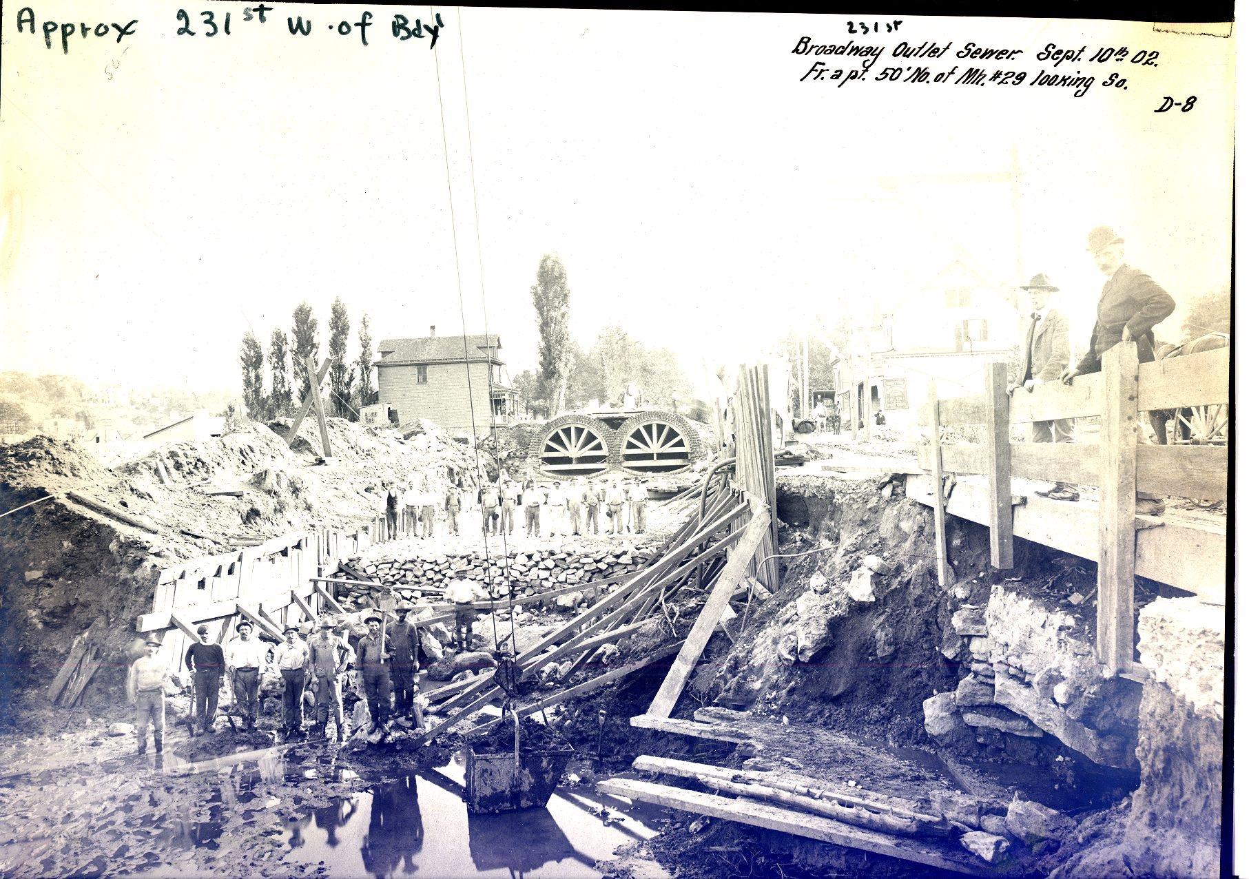 Photo: Special Collections, Lehigh University Libraries, Bethlehem, Pennsylvania.[/caption]
[caption id="" align="alignnone" width="1834"]
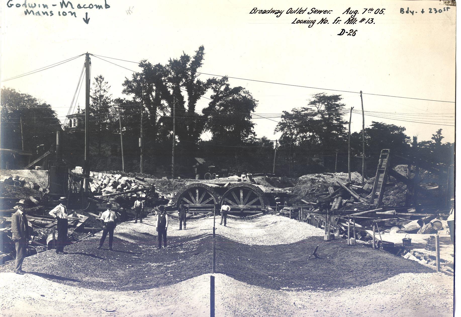 View looking northwest. The cupola of the Macomb-Godwin mansion can be seen on the left (current site of a Dunkin Donuts at W. 230th and Broadway). Photo: Special Collections, Lehigh University Libraries, Bethlehem, Pennsylvania.[/caption]
A short 1908 New York Times article sums up the state of the neighborhood at that time:
-
November 26, 2021 at 4:25 pm #2374
I have attached the Burfeindt Bros at 5586 Broadway Kingsbridge, 74 feet from the corner.
-
November 26, 2021 at 4:30 pm #2375
Burfeindt Bros 5586 Broadway Kingsbridge – Brewers
-
November 26, 2021 at 4:31 pm #2376
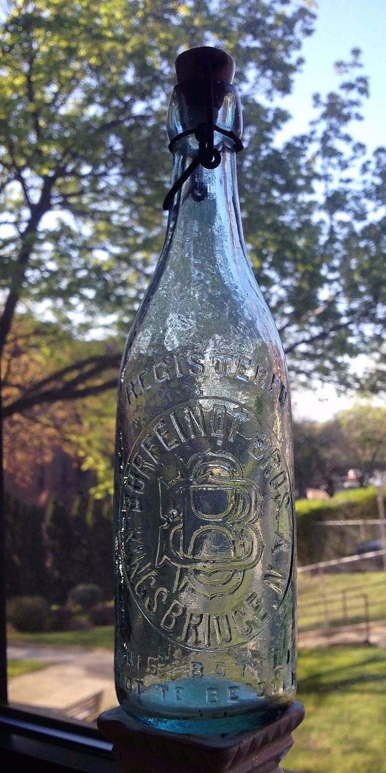
Burfeindt Bros 5586 Broadway Kingsbridge bottle
-
November 27, 2021 at 12:29 pm #2377
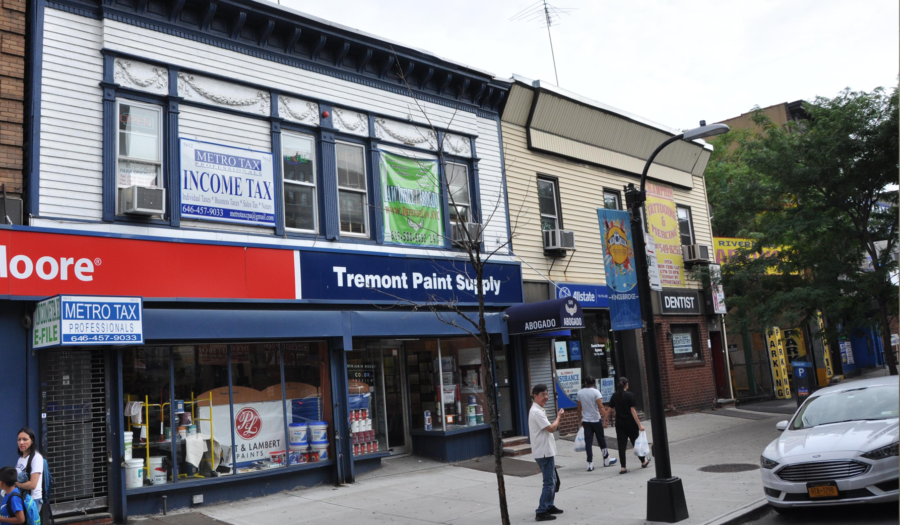
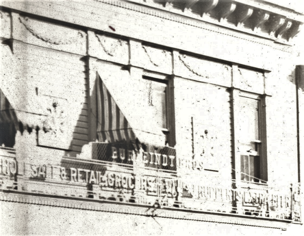
Here is a closeup of the Burfeindt Grocery from the first photo above:
A little more legible:
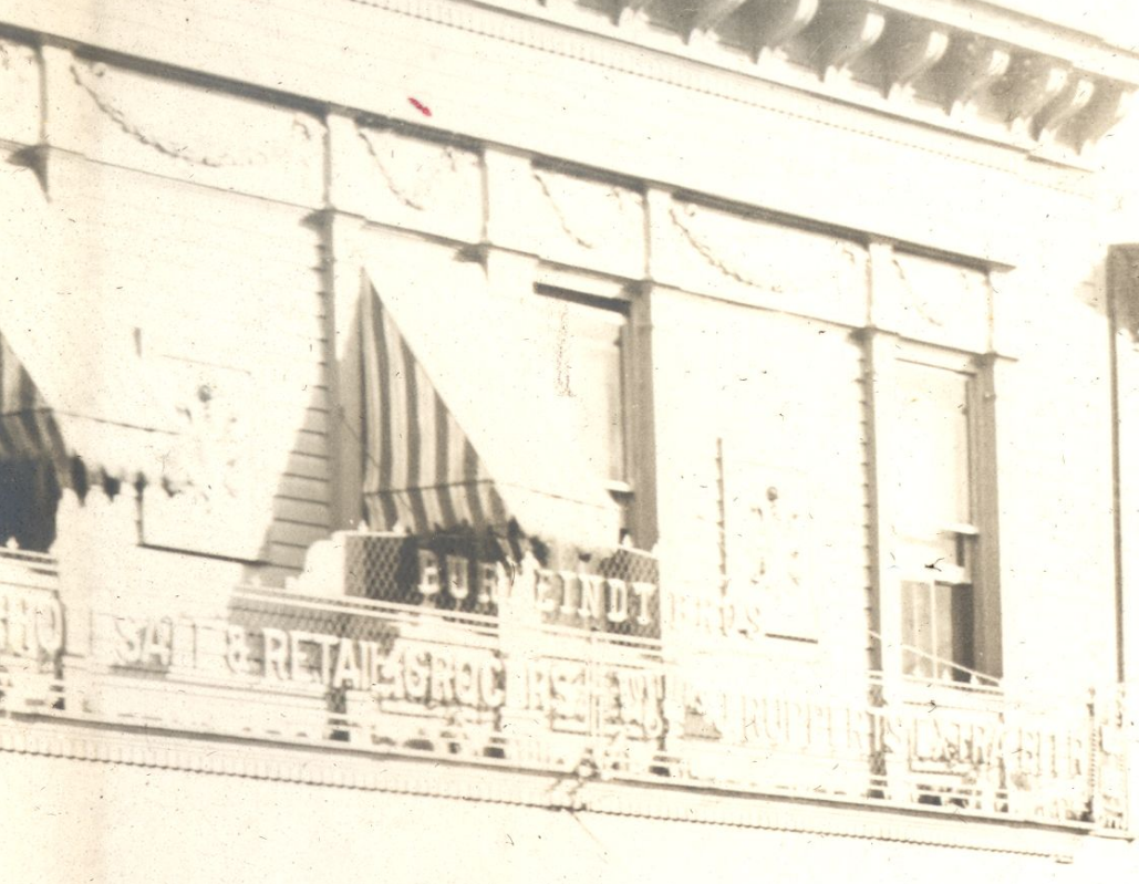
Here’s the detail on the building today:
I was thrilled to find those old sewer construction photos in the Lehigh University collection. They have many more of the neighborhood that I have never seen before. Such as this one from 1904:
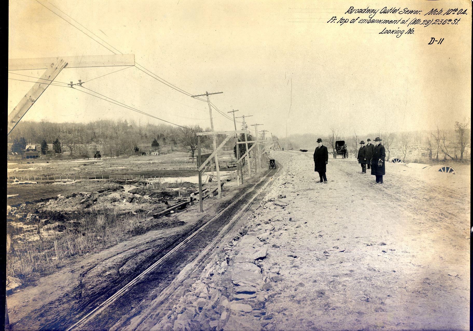
That’s the view looking northwest from about W. 236th Street and Broadway. Here’s a closeup of the area west of Broadway:
Those cows are grazing about where Gaelic Park is today with Manhattan College Parkway climbing the hill in the background.
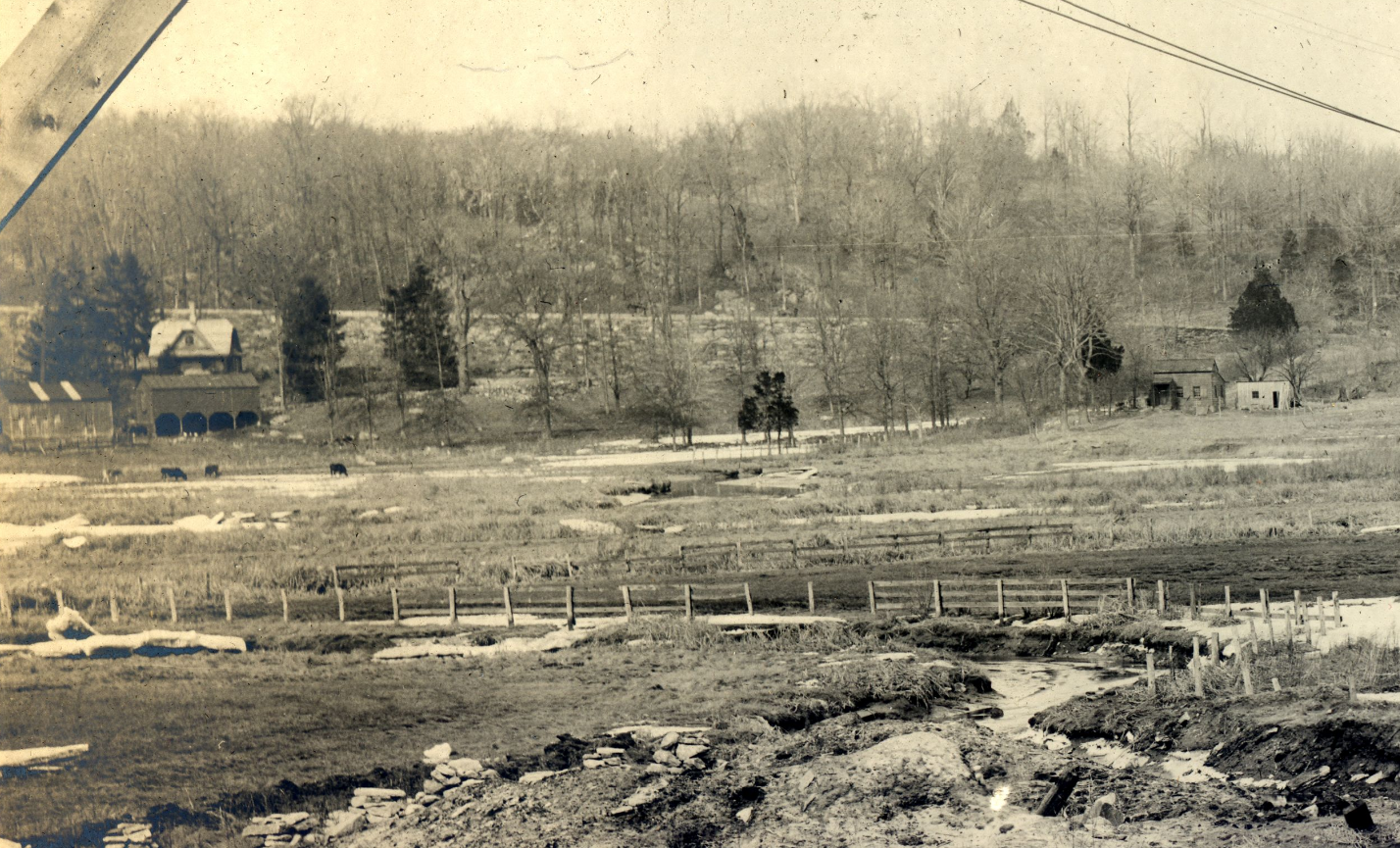
Here’s another one that I thought was great:
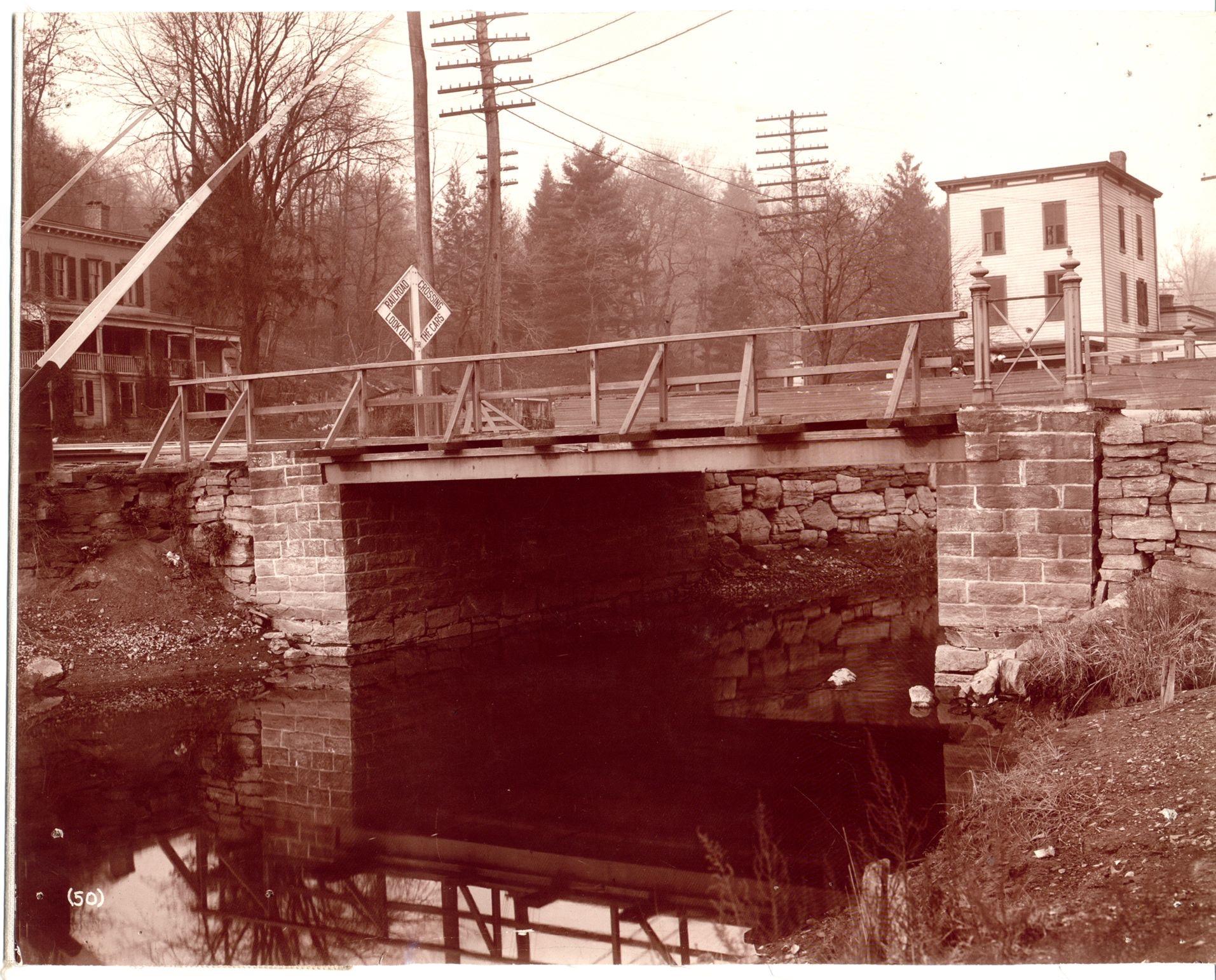
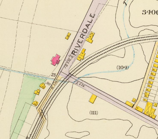
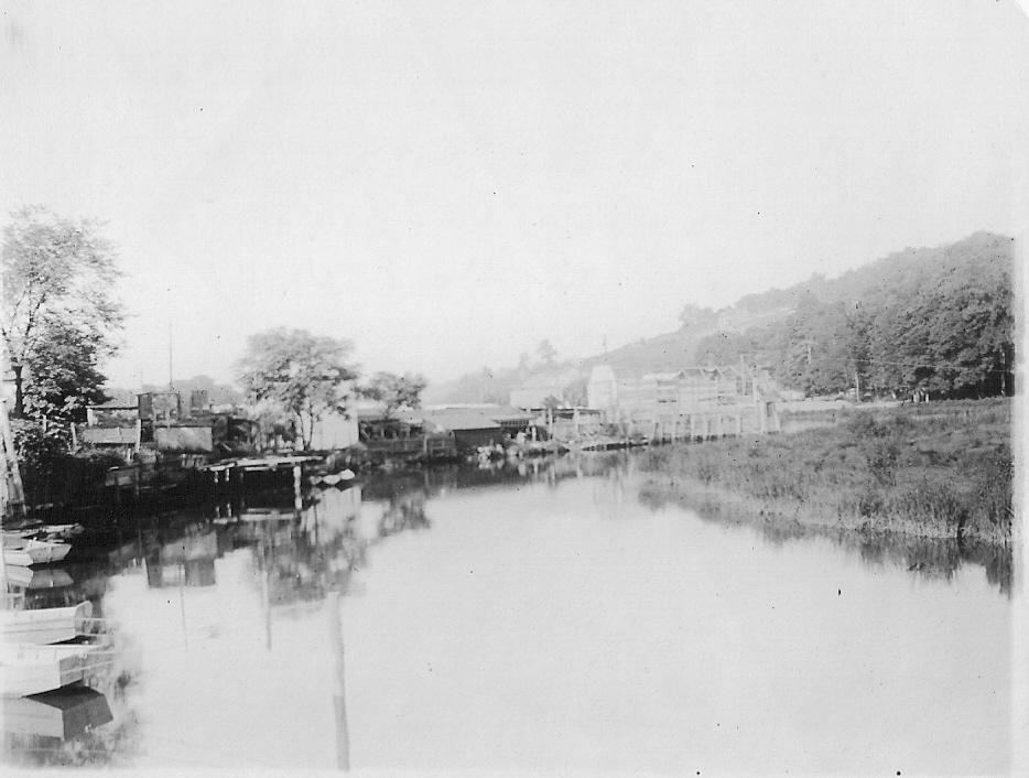
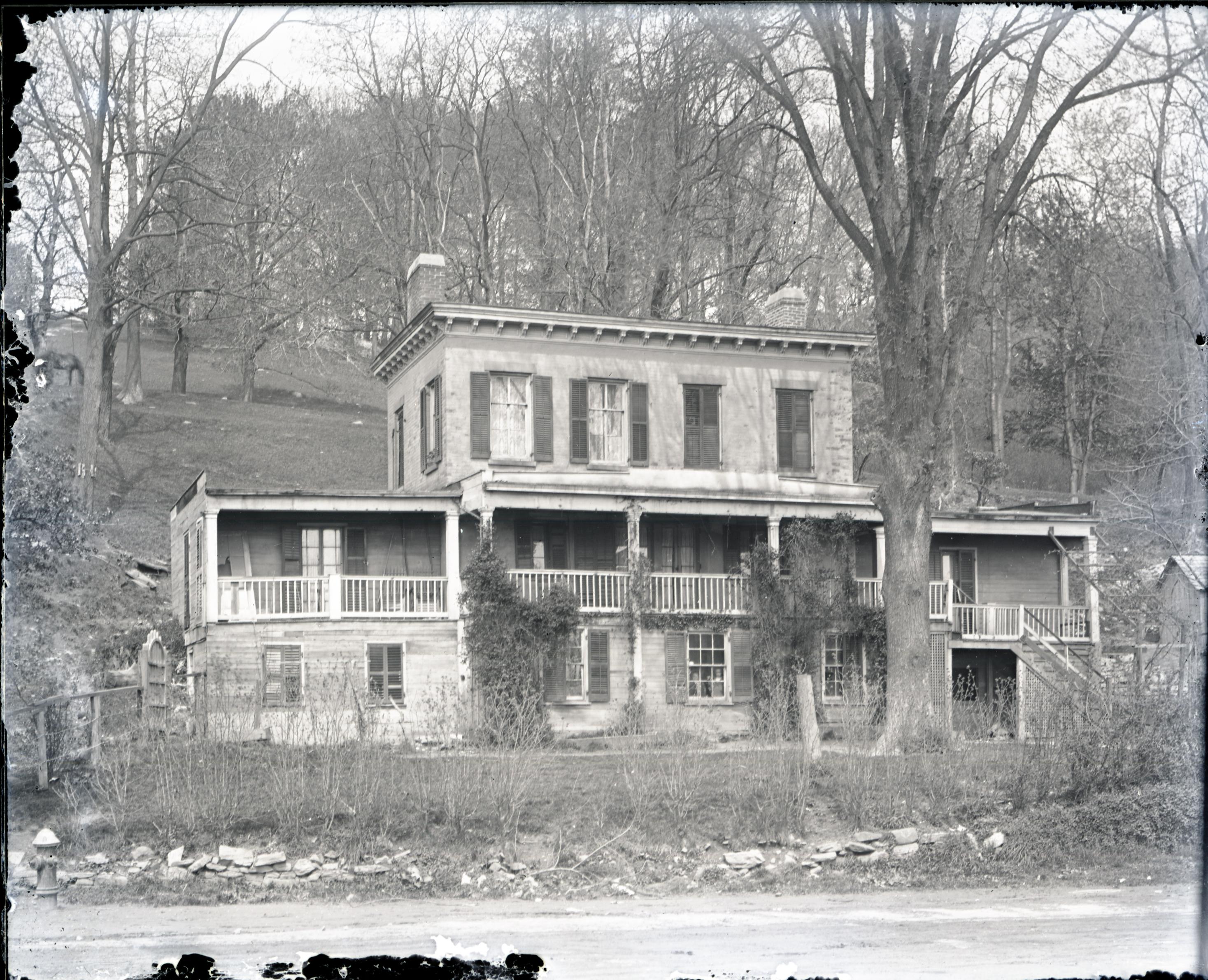
That is a bridge over Tibbetts Brook at W. 230th Street and Riverdale Ave right where the brook flowed into the Spuyten Duyvil Creek. It was also where the New York Central trains crossed so it was another nightmare intersection that locals complained about. The view is looking northwest and that is the old Tippett house that stood in modern day Ewen Park. It is the red building in this 1893 map snippet:
-
November 27, 2021 at 12:41 pm #2378
Nick,
Thank you for clearing it up…and the many new images
-
November 27, 2021 at 4:41 pm #2379
Great photos on the draining of Tibbetts brook tributary and raising of Broadway. Few additional facts that might be of interest.
1) The first photo mentions a church steeple. This was the original St Stephens church that was used from 1878 to 1898. The present day St Stephens was opened in 1898. It was for the 50th anniversary of the new St Stephens that the KHS founder (Rev Dr William Tieck) wrote his first book, “God’s House and the Old Kingsbridge Road”.
2) The changing map from old to new present day is a great visualization of our area, thanks Nick. I wanted to just point out that the Tibbetts Brook is at the left in blue on the map yet the photo’s of the twin drainage tunnels are on Broadway. What is not always known is that Kingsbridge was once known as the Island of Kingsbridge or native term Paparinemin. The Harlem River in the past use to flow north through today’s Target Shopping center and the Marble hill housing then it would flow west at 230th St and under the Kings Bridge, continue west to Riverdale Ave where it would meet up with Tibbetts Brook and both would flow south through today’s Kennedy H.S. school complex around the then Johnson foundry and west out to the Hudson River. But It was during high tide and rain storms that part of the Harlem River would also flow north along Broadway and meet Tibbetts Brook about 238th st which formed the Island of Kingsbridge.When not high tide or flooding the low lying area of Broadway was wet and swampy. It was due to this problem of tidal flooding that the twin drainage pipes were installed along Braodway to correct and create more usable land, drain the swamp like areas, rid the village of mosquitoes and set the stage for the right of way for the planned IRT subway. The Tibbetts Brook continued to flow as shown on the map to at least 1915 when Tibbetts too was slowly filled in and diverted into drainage pipes. Tibbetts Brook today still flows south from Van Cortlandt park south under Corlear and Tibbett Ave past 230th St and under Kennedy H.S. to meet the Harlem River and out to the Hudson all through buried drainage pipes.
August 1910 234th St view south west with Tibbetts Brook
-
November 28, 2021 at 11:24 am #2380
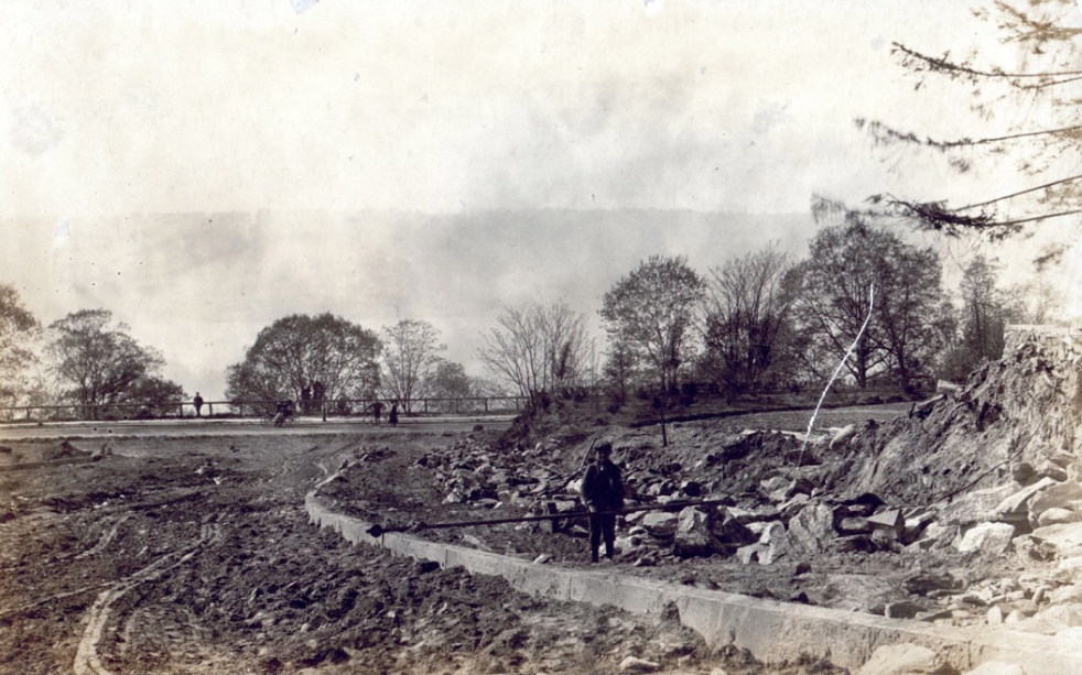
Nick, Thomas, Peter this is all great, great stuff. The Lehigh University find is an incredible find. (The file I found was the Construction of Bronx Public Works 1893-1935 ) Nick, please let us know if you found a source for the photos individually. One thing that was remarkable to me was seeing the Broadway sewer with culverts for Tibbetts Brook running underneath it as it crossed Broadway/240th St at a diagonal. It shows just how much the ground was raised. Peter what is the source of the view of Tibbetts from 234th st? I’ve added some photos from the Westchester Historical Society including one of the railroad crossing Tibbetts just upstream (on Peter’s map). Also are two views of the Tippett House, seen in Peter’s photo (the first without the railroad crossing warning sign)

-
November 28, 2021 at 1:13 pm #2381
Not to change the subject, but there are a lot of step streets in the Northwest Bronx. However, I have seen this image of Tiebout & 183rd St. from the Lehigh University files some years ago and I thought it was interesting.
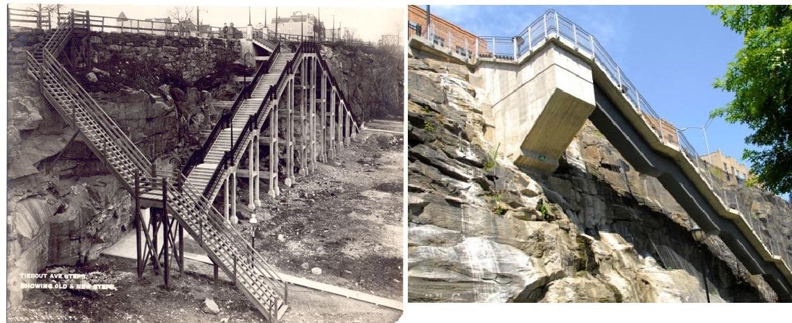 g. I think new steps look scary to me !
 -
November 28, 2021 at 2:34 pm #2382
Hi Zach – just to clarify and give proper credit Nick provided the initial photos and created the changing map for this forum item.
The photo I attached of 234th St and Tibbetts brook is from the KHS photo collection. The photo(s) were donated to the Society in the 1960s by a family who lived in the area at the time.
The house in your photos at the bottom of the hill was at that time owned by the Ewen family whom the park today is named after. A larger Ewen home was located further up the hill on the only flat space in this hillside park that is today a dog run.
A word from the sponsor -The Kingsbridge Historical Society would greatly appreciate if anyone reading these forums and have photos or items to donate they would be greatly appreciated by the Society. Regarding photo’s digital copies are welcome if you would rather not donate the actual photos.
-
November 28, 2021 at 3:03 pm #2383
Yes, those stairs look iffy!
If you want to see the photos individually with a zoom feature click here.
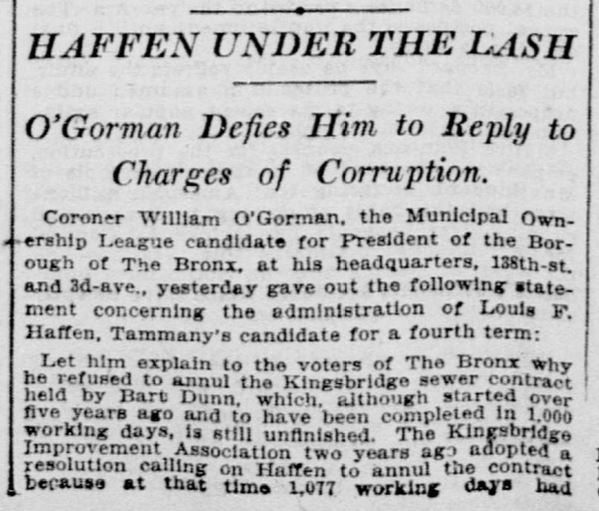
There’s a fun feature in the photo of the Tippett house that you posted, Zach:
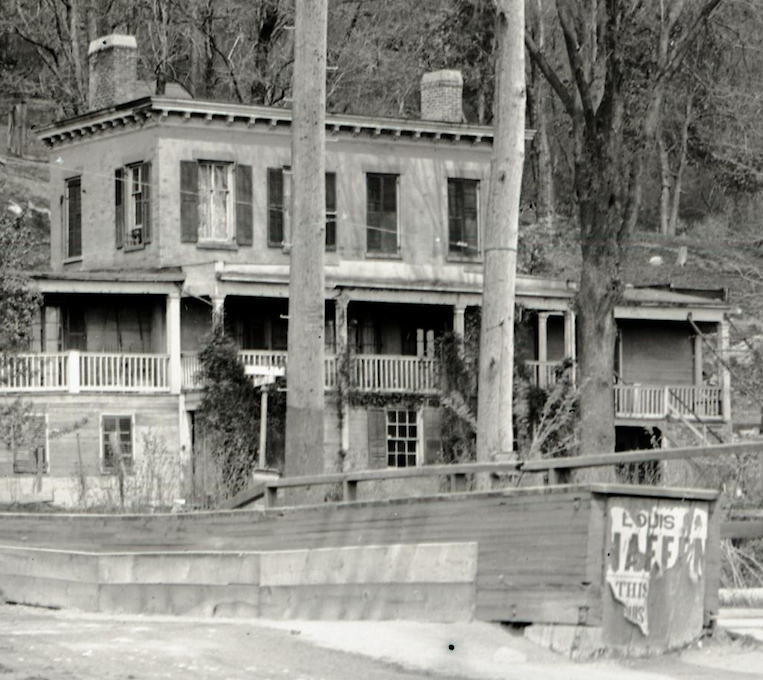
Note the ripped up campaign ad for Louis Haffen on the bridge. That was the borough president that was accused of corruption over the sewer construction:
Here’s one photo from the Lehigh collection that surprised me. I didn’t know this existed at all:
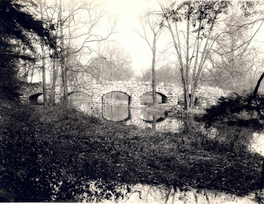
The caption: 654 Ewing Estate Riverdale Ave. & W. 231st St. (Ewen), 1132 in lower right corner, no date, black and white photo 6 x 8 (Bucolic scene with rounded stone five-arch bridge reflected in winding stream among slender, lightly leafed trees)
I wonder, is the caption accurate?
Here’s one that looks like it could be our area but there is no location provided:
To me it looks like the Palisades are in the distance.
And to echo Peter’s thought–yes, we always welcome donations of neighborhood photos!
-
November 28, 2021 at 3:35 pm #2384
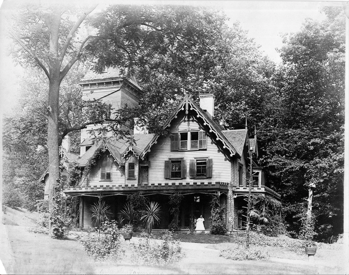
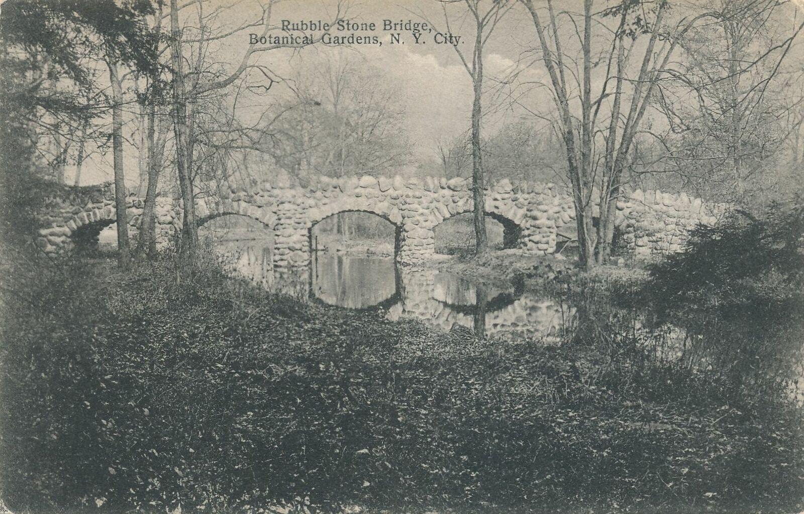
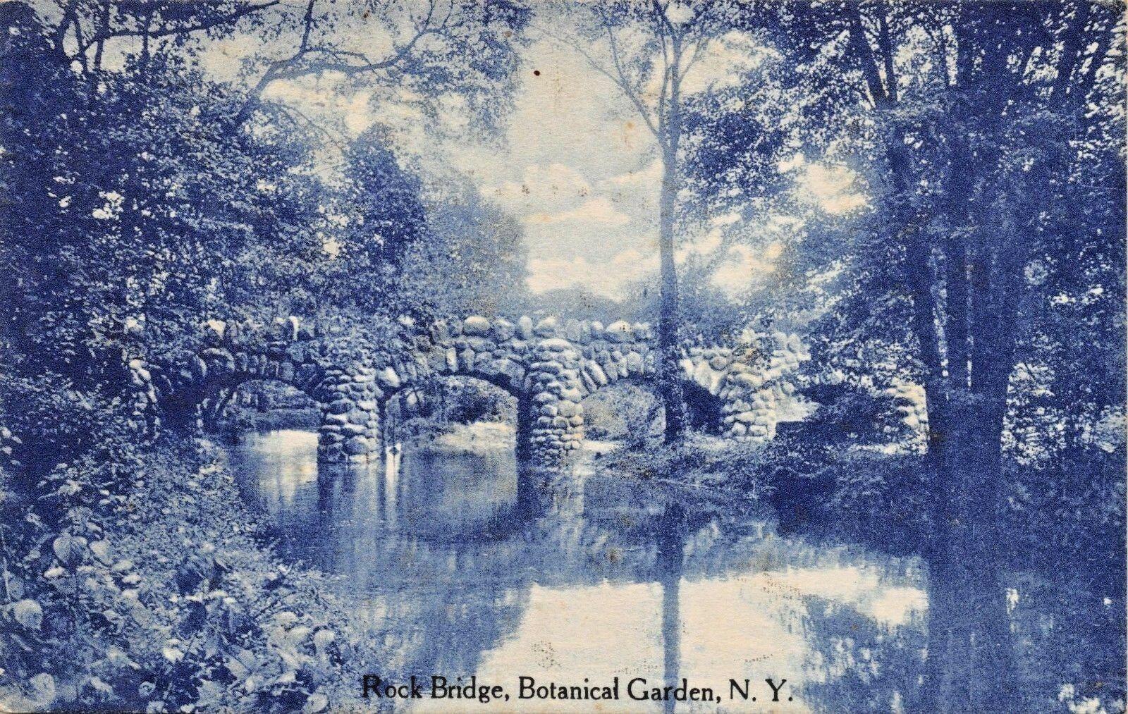
Nick,. The image of 654 Ewing estate looks like Botanical Gardens Bx ny
-
November 28, 2021 at 3:37 pm #2385
-
November 28, 2021 at 3:40 pm #2386
-
November 28, 2021 at 6:46 pm #2387
Thanks, Tom. You nailed that one. Peter told me he didn’t think the caption was right and I had my doubts as well.
-
November 29, 2021 at 3:19 pm #2388
Peter, Thanks for the tip on the Ewen’s owning Tippet. It took me a very long time to understand where the railroad bridge over Tibbetts was until I was able to identify the Ewen mansion in the background
Nick – great to learn that history about corruption in city contracts.
-
November 29, 2021 at 3:20 pm #2389
(Whoops, Ewen Estate didn’t load. Reduced file size and tried again.)
-
December 6, 2021 at 8:27 am #2393
NYT on 12/6/21 has an article about Tibbetts Brook, “Why New York Is Unearthing a Brook It Buried a Century Ago.” Nick is mentioned in the article.
-
December 6, 2021 at 9:06 am #2394
Thanks Dott. If you read the article, you get the sense that the relevant city agencies are much more serious about making this daylighting happen than in the past. Here’s the link.
-
December 6, 2021 at 12:35 pm #2395
Interesting article but time will tell. Back in early 1990’s there was talk and effort for upgrading the old Putnam RR line for a walk and bike trail. Last year 25yrs later they finally blacktopped the old Putnam rail line trail. A bit earlier in mid 1980’s there was talk and community meetings for a Greenway trail along the Hudson River along Spuyten Duyvil and Riverdale. Last time I was down at the river, actually just last week, there is still no Greenway trail. This is not a knock against those who still work towards the Greenway trail, been there done that, but this is NYC. If the City administration and our elected officials want something it can happen and sometimes fast.
-
-
AuthorPosts
- You must be logged in to reply to this topic.