Home › Forums › The American Revolution › Isaac Low – Delegate to 1st Continental Congress and local resident
- This topic has 18 replies, 5 voices, and was last updated 2 years, 6 months ago by
ndembowski.
-
AuthorPosts
-
-
January 2, 2024 at 1:23 pm #3831
The story of our area during the Revolution is a fascinating one and I hope to host a series of presentations about it as we approach its 250th anniversary. There is a lot to the story that has never been told including the fact that the neighborhood was home to a prominent political figure in Revolutionary New York.
[caption id="" align="alignright" width="399"]
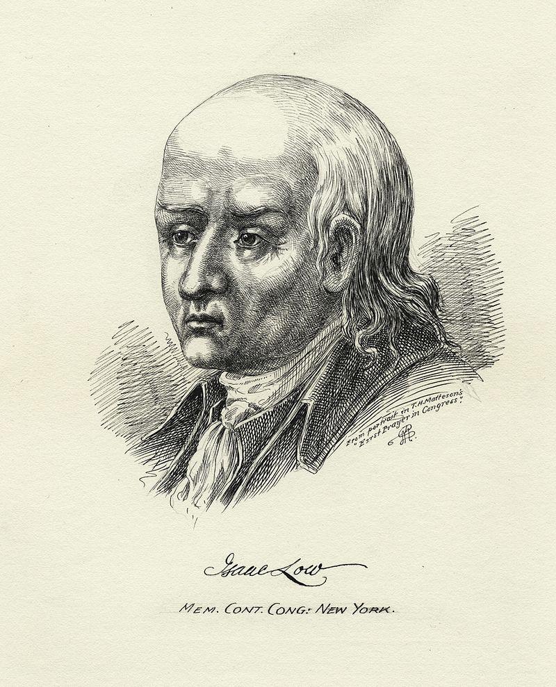 Print of Isaac Low. NYPL digital coll.[/caption]
Isaac Low was an influential merchant, a delegate from NY to the Stamp Act Congress, the chair of New York’s revolutionary Committee of Correspondence, a member of the Provincial Congress and a delegate to the 1st Continental Congress alongside John Jay, James Duane, Philip Livingston, etc. He was known as a critic of the British government’s policy of “taxation without representation” with regard to the American colonies. So why isn’t he better known? Probably because despite his disagreement with British policy, he did not favor breaking ties with Britain, which positioned him in the loyalist camp after the Declaration of Independence.
I never would have associated Isaac Low with our neighborhood but for an email I received from Samuel McKenzie, a researcher at the Saratoga County History Center at Brookside Museum in Ballston Spa NY. He discovered documents showing that Low lived in our area and asked if I knew exactly where his house was located.
[caption id="" align="alignleft" width="492"]
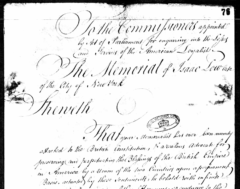 Petition of Isaac Low[/caption]
The documents that Mr. McKenzie found are fascinating. Like a lot of area residents during the Revolution, Isaac Low suffered great loss of property as soldiers scavenged and foraged the countryside at the expense of its civilian population. Since Low was a loyalist, he filed for compensation for his losses with the British government’s Commission of American Loyalist Claims in London in 1785. His written testimony to the commission referred to his “Country House near King’s Bridge” that was located “under the Guns of Fort Independence.” He stated that his house and barn were dismantled under orders of Major General Tryon in order to build barracks for British troops. His claim for compensation was bolstered by the testimony of British Major General Tryon himself, who wrote that “a new barn near Mr. James Van Cortlandts belonging to Mr. Isaac Low was taken down by my order and appropriated towards repairing and building barracks for the accommodation of the troops in the Vicinity of King’s Bridge.” Low estimated his damages at 400 pounds sterling, which included the cost of “cartage, labor of several negroes and the timber and lath which were given him by Colonel Van Cortlandt.”
So, where was Low’s house? The easiest way to find out would be to find the deed of purchase. The Westchester County archives holds all of the registered land deeds for the area in the 1700s when the neighborhood was still part of Yonkers. But there are no deeds in Low’s name for our area. That means that he never bought land here and his house probably stood on land that he did not own.
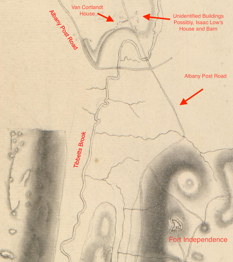
One helpful clue from Low’s request for compensation is that his home sat “under the guns of Fort Independence.” That is a reference to the largest fort in the neighborhood that stood between modern-day Giles Place and Cannon Place in Kingsbridge Heights. Since the fort was built on a height, pretty much the entire Kingsbridge valley would have been “under the guns” of the fort. Another clue is that Isaac Low’s barn was “near Mr. James Van Cortlandts.” Here it is worth pointing out that James van Corllandt was Isaac Low’s brother-in-law. So, perhaps Isaac Low’s house was built on the property of his wealthy brother-in-law, which would explain why there is no deed in Isaac Low’s name for the land. During the Revolution, you would have had a clear line of sight from the Van Cortlandt house to Fort Independence. So an adjacent house could be said to sit “under the guns” of the fort.
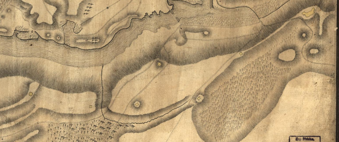
One British map from the Revolution shows a couple of buildings to the east of the Van Cortlandt house that I have never been able to account for. Those buildings sat on the Van Cortlandt property and could have been the home and barn of Isaac Low. They seem to have been located in the vicinity of the tennis courts in modern Van Cortlandt Park. That is my best guess of where Isaac Low lived while in the neighborhood.
Another aspect of Isaac Low’s testimony that I found interesting was the reference to the “labor of several negroes and the timber and lath which were given him by Colonel Van Cortlandt.” James van Cortlandt was apparently leasing out his enslaved workforce as a construction crew. This practice, which led to the suppression of wages for free laborers, was not unheard of in colonial New York. It is also the first original document I have seen stating that enslaved people did work on construction projects in this area.
Other than to say that the house was built here and later dismantled, there is very little else I can say about it. But I did discover at least one significant moment in the history of Low’s house that was recorded. On October 20, 1776 the Continental Army was repositioning itself to counter the British maneuvers in Westchester County. At some point that day George Washington wrote a letter to Joseph Trumbull about his situation. The header of that letter was: “Head Qrs Kings bridge Octob. 20th 1776” indicating that Washington wrote the letter from his headquarters in Kingsbridge. At some other point on that same day Washington wrote a letter to Robert Livingston with the header: “Mr Lowe’s 20th Octr 1776.” Since Washington was in Kingsbridge that day, he must have penned the letter from Isaac Lowe’s house in Kingsbridge.
-
January 3, 2024 at 2:37 pm #3832
Fascinating post Nick—Thanks, Dan Mullane
-
January 4, 2024 at 8:04 am #3833
From George Washington to Robert R. Livingston, 20 October 1776 To Robert R. Livingston Notes from the National Archives. “GW apparently wrote this letter at Isaac Low’s house, which was adjacent to recently constructed Fort Independence in Westchester County about a mile northeast of King’s Bridge or, in present-day terms, near the south end of Jerome Park Reservoir in the Bronx. The British army dismantled Low’s house later in the war to obtain materials for building and repairing barracks at Laurel Hill on Manhattan Island ” This description could also place the Low’s residence at below ( South ) of Fort Independence between Sedwick Ave and Jerome Ave at Kingsbridge Road.
-
January 4, 2024 at 8:43 am #3834
-
January 4, 2024 at 8:47 am #3835
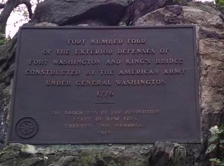
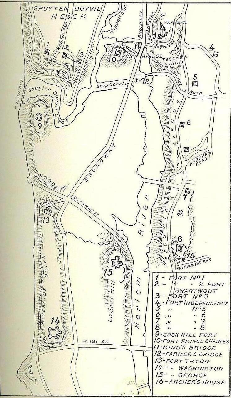
This is an other map that has the Forts. ( #4 is placed at Sedwick Ave and Reservoir Ave with a Plaque)
-
January 4, 2024 at 8:48 am #3836
-
January 4, 2024 at 8:59 am #3837
This map shows a few houses along the Old Boston Post Road, below Fort Independence, Leading down Kingsbridge Terrance to
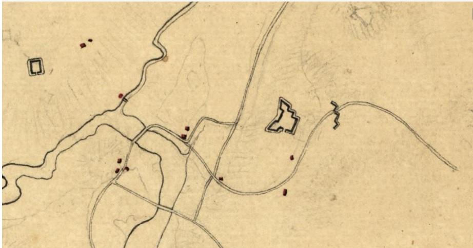 Albany Crescent.
 -
January 5, 2024 at 11:24 am #3838
I agree, Tom, that we cannot know for sure that Isaac Low’s house was where I initially suggested (in today’s Van Cortlandt Park). I picked that spot because the testimony stated that Low’s barn was near James van Cortlandt’s house, which is the Van Cortlandt House Museum. But another reason why I think Low’s house could have been there is that the structures I identified on the map don’t appear on Revolutionary era maps from 1781, indicating that they stood at the war’s outset, but could have been destroyed or dismantled later during the war. Although unless something else definitive turns up, your guess is as good as mine.
-
January 5, 2024 at 2:07 pm #3839
Nick, I also think that the disappearance of the structures next to the Van Cortlandt Mansion is extremely important evidence. I wish we could identify many more of the local owners during 1776
-
January 5, 2024 at 2:32 pm #3840
It has been a weird fixation of mine to figure out what all those unlabled building markers represent on Revolutionary era maps–to find out who they belonged to…
One thing that is helpful (obviously) are maps where the inhabitants are labeled like this one:
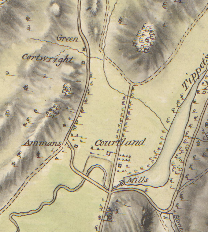
But the above map is from 1781 and many homes were destroyed or abandoned by then so many of the residents’ names are missing. The maps from earlier show more home sites than this one. Another document that’s helpful is the 1775 militia roll for the South Yonkers company. It is a long list of names of local people and you search for them in land deeds, recorded wills, and other documents in archives to figure out where they lived. You can also use the 1790 census and later maps to get some clues.
-
January 8, 2024 at 4:35 pm #3842
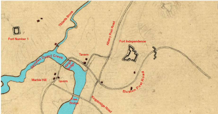
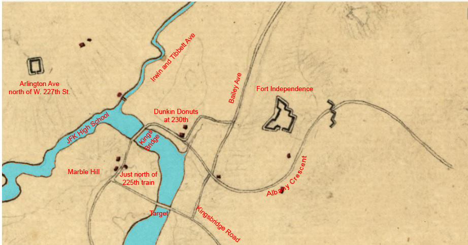
What an interesting discussion. I really appreciate the red notes and arrows on the first map. I wonder if that could be done on the submitted maps as I need help with the orientation. Thanks.
-
January 8, 2024 at 5:42 pm #3843
Thanks Dan. I labeled and colored one of those other maps for you (two versions):
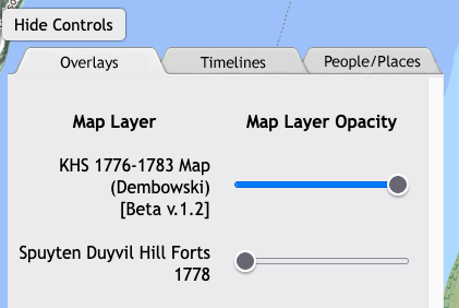
You may want to check out the link here to a map that I made. It is not exactly working as intended because my programming code is outdated but you can adjust the slider buttons that look like this below in order to see different layers:
Back in the early days of the Society a member made this map, which is pretty great.
-
January 9, 2024 at 10:29 am #3844
Hello Nick.
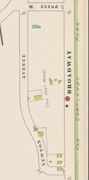
I was comparing the maps you referenced in your message #3840. In particular, I was looking at the Hadley House and another to the south of it that seems to exist today, namely, the house at 4710 Post Road. I’m wondering if this is the house of Emmons whom you mention in your article “The Hadley House at 5122 Post Road, is this the oldest house in The Bronx?”Also, do you have information regarding the closing of the section of the Post Road between W 246th Street and 4708 Post Road? I assume that Horace Mann School purchased the land, but from whom? If I recall correctly, that section of Post Road was closed around 1952. Were there any private homes involved in the sale to Horace Mann School? If so, were they razed?
-
January 9, 2024 at 10:30 am #3845
Correction: post #3843…sorry.
-
January 9, 2024 at 12:15 pm #3846
Good questions. You sent me down a bit of a rabbit hole this morning. Just a little background for anyone else that might be reading:
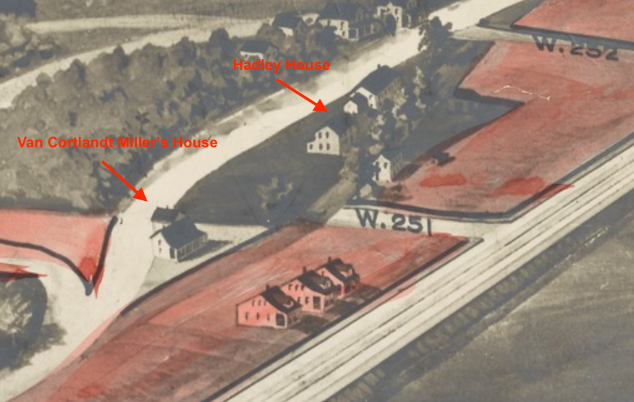
The Hadley House is a house that still stands at 5122 Post Road in Riverdale just north of W. 251st Street. It is a city landmark and I wrote a deep dive article about it here. But the first of your questions relates to another historic house that stood just to the south of the Hadley House on the old Albany Post Road during the Revolution. That building was known as the Van Cortlandt Miller’s House and it is no longer standing. I’ve labeled both houses on the map below (the Hadley House was rented by Isaac Green during the Revolution).
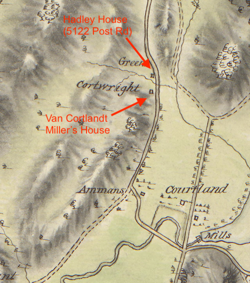
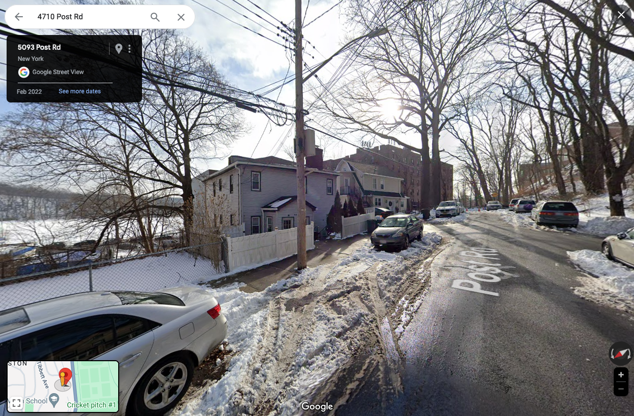
In the above map you can see that the Van Cortlandt Miller’s House was occupied by someone named Cortwright in 1781. But the Van Cortlandts owned the house and property around it. There were a number of people families named Cartwright, Cortwright, or Kortright in our area. Perhaps one of them was the miller at the Van Cortlandt mills during the Revolution and was living in the Miller’s House at the time. The Miller’s House, if it hadn’t been torn down, would have been on the dead-end section of Post Road South of W. 251st. That’s a bit off the beaten path so here’s a photo of that street (view looking south with Van Cortlandt Park’s Parade Ground on the left and the Horace Mann campus in the distance).
The two houses on the left are modern constructions and not historic. I am not sure when the Van Cortlandt Miller’s House was torn down but it was still standing about 100 years ago. The Van Cortlandts owned most of the property between Broadway and the Post Road since the colonial period and sold it at auction in 1919. The NYPL has a great aerial view of the land that was to be sold at that auction:
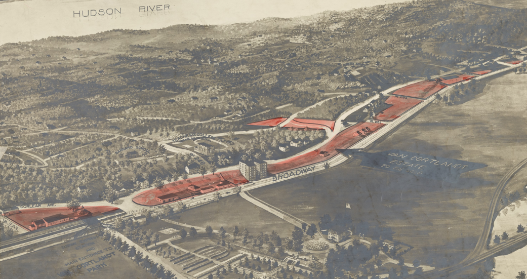
Zooming in on the area around W. 251st and Post Road….
The Miller’s House looks like a Dutch-style farmhouse with a nice porch. Here’s a photo of it in the collections of the Museum of the City of New York:

Perhaps the Miller’s House was knocked down to make way for the apartment building that now stands at the corner of W. 251st and Post Road.
The second part of your question about the section of Post Road that is now part of the Horace Mann campus is interesting. Here’s a photo of Post Road and W. 246th Street. I always assumed that the road leading into the campus to the left of the security booth was the old Post Road.
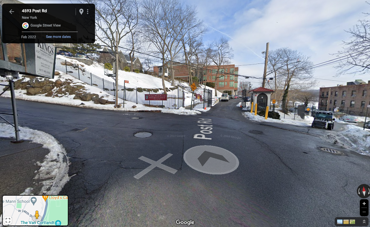
But there’s a lower road just to the right of the security booth. I’ve never paid attention to it before:
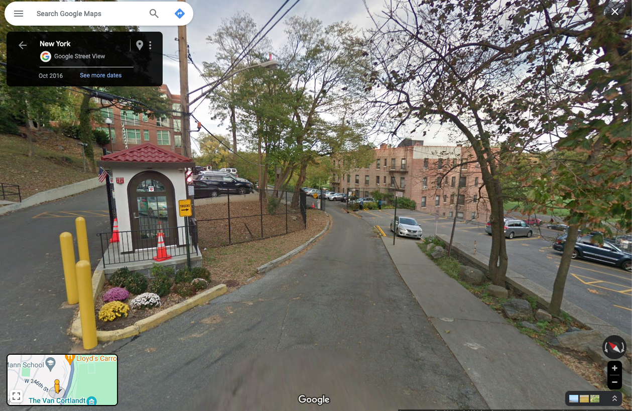
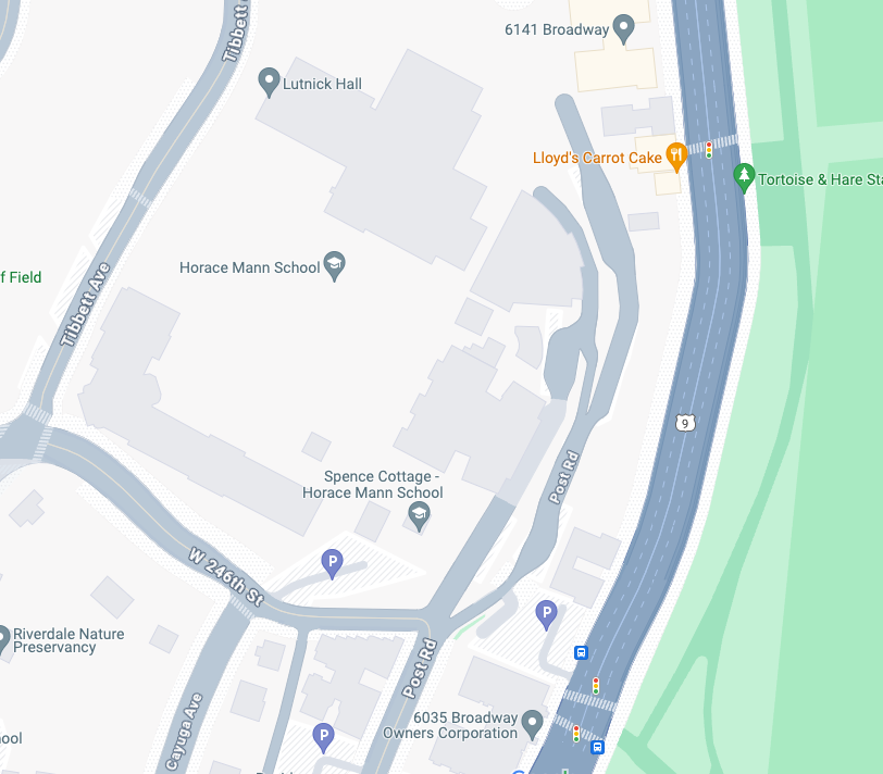
Looking at the Google Map below, it would appear this lower road is actually the Post Road.
The same NYPL Van Cortlandt Estate Sale aerial view depicted that area in 1919:
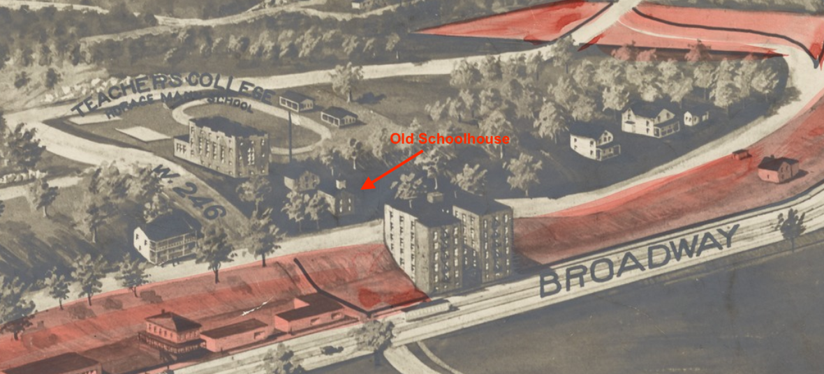
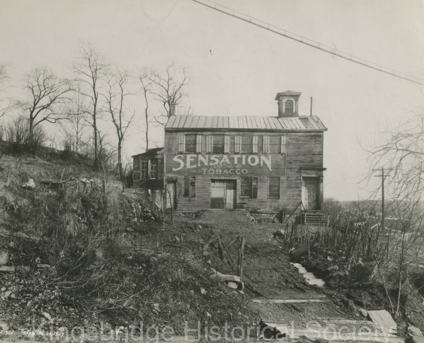
I labeled the old Mosholu schoolhouse because we have an image of it in our collection (ca. 1927):
-
January 9, 2024 at 2:27 pm #3847
This map from 1896 may help –Plate 279 ( Bronx, V. 12, Plate No. 279 [Map bounded by Broadway, W., 236th St., Fieldston Rd.] )
Specifically –
-
January 10, 2024 at 9:56 am #3849
Thank you for all this useful information!
From Google Earth views it looks like Horace Mann acquired both upper and lower Post Roads. Did they purchase the land in the 1919 auction and then develop it in the 1950s? (When was the Mosholu schoolhouse razed?)
In the photo used in the auction there appears to be a possible error: what is now known as Manhattan College Pkwy is shown as Corlear Ave in the lower left corner. For years before 1953 it was known as Spuyten Duyvil Pkwy. Could the name have been changed subsequent to the auction?
Also, in the photo, just behind the elevated station, there is a round house structure. Was this a carousal, a tavern or had it some other function? It is also shown in a post card in your collection. Do you know when it was razed?
-
January 13, 2024 at 1:26 pm #3854
What a great series of posts/pictures/maps! Nick the map you made with the sliders is a treasure! It ought to be prominently displayed on your web page for all to enjoy. I always wondered where exactly those “ancient” roadways went and now I know. It is a gem.
BTW, I might be one of the oldest and long tenured member of the KHS as I, and two friends, joined in 1956 when we were students at PS 95. Revered Tieck welcomed us in. Somehow he arranged for us to talk on NYC school radio, WNYE, about the society and a then current exhibit of before and after pictures arranged by Lou Garbus.
-
January 13, 2024 at 1:52 pm #3856
Thanks for the compliment. I would probably publicize it more but ever since I upgraded our server, it lost a lot of its functionality.
I think you are right about being your tenure as a member. 1956, wow!
-
-
AuthorPosts
- You must be logged in to reply to this topic.