Home › Forums › 20th Century › Kingsbridge Article with Nice Photos from Municipal Archives
- This topic has 5 replies, 4 voices, and was last updated 7 years, 6 months ago by
Peter Ostrander.
-
AuthorPosts
-
-
November 11, 2018 at 1:44 pm #604
I just came across a thorough article on the history of the King’s Bridge on the Hidden Waters Blog.
It included several photos and some historical information that I had never seen before so I would recommend checking it out. Here is one of the photos that I liked in particular.
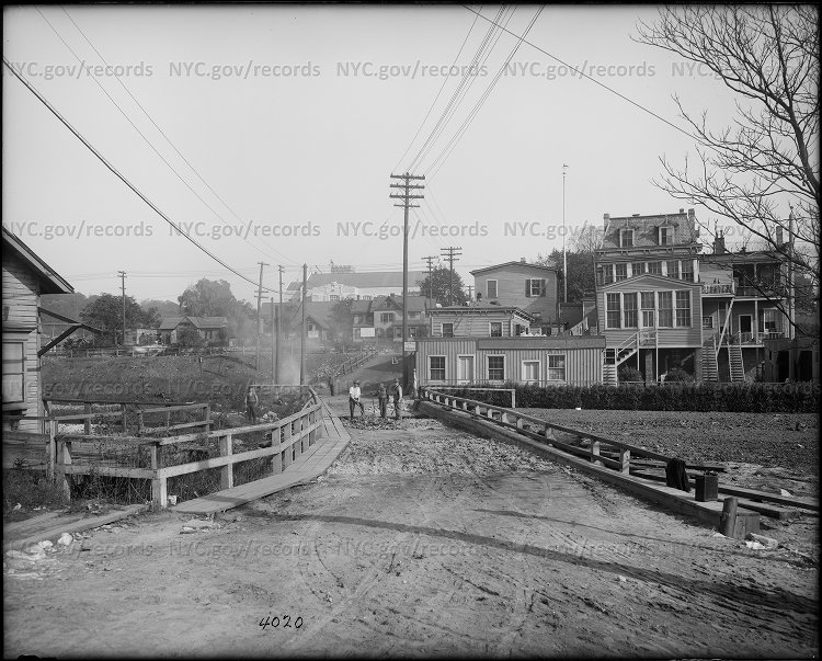
The view is looking north from Marble Hill into Kingsbridge in 1913. It shows workers ripping up the planks of the bridge with the creek filled in to the right. What a found most exciting was the watermark because it pointed me to the municipal archives, which has been apparently very busy scanning and uploading their photograph collections. I’ve only just begun to explore what they have up there but I noticed they have many tax photos from 1940 available for free viewing. Even better, the site lets you zoom in on the photos to get plenty of detail. Here’s one that I found from the tax photo collection of 189 West 231st Street:
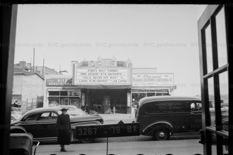
 Imagine that, a movie theater in Kingsbridge! Actually, there was more than one theater in Kingsbridge at the time–a lot more entertainment than we have in the neighborhood now. I like the name of this one, the “DALE” theater. When I lived on Bailey Avenue, my wife and I frequented “Louie’s Dale Diner,” which I always thought was an unusual name but it makes sense considering it replaced the theater. Check out the Municipal Archive’s 1940 tax document collection here: 1940 Tax Photos
 -
November 25, 2018 at 9:26 pm #713
I have been having fun exploring the 1940 Tax Photos. You may know that they were only recently made available for free viewing and downloading from the site. Prior to Nov 1 of this year, they were only available to view on microfilm at the Chambers Street archives or online purchase for $40+/- each. Although I have had success finding family residences in Morisanna (Elton Ave) and in other boroughs, I was not as lucky with the family residences in Spuyten Duyvil. Searching has been a challenge as most of my family lived in the area between 1867-1920 and many of the residences were no longer standing in 1940 and/or the streets changed. The main address was 5189 Broadway (or 5189 West 225th) and it’s not in the collection. In 1914, one family member, who was a fireman, lived at 151 West 231st Street, near to the photo you posted above from 189 West 231st. There are a few other 100 West block photos as well, which are fascinating to see.
-
November 27, 2018 at 2:05 am #718
I know that they were only recently made available because I spent $40 on a photo just a few months ago, which is now free! It was a pizza parlor that my family operated on White Plains Road in the 40’s.
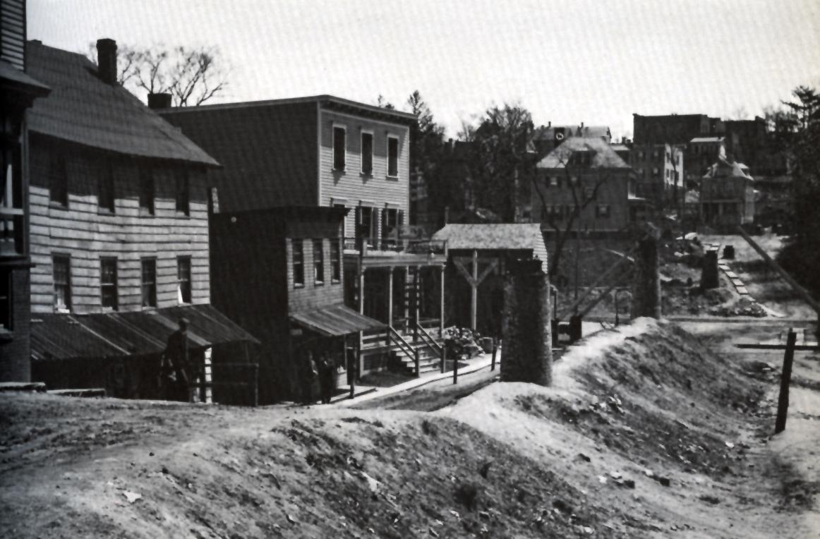
You mentioned that one of your family members lived on West 231st Street in 1915 near the area in the photo that I posted. I wonder if you have ever seen the below photo. It is pretty much the same area W 231st Street East of Broadway in 1909. It can be found on p. 107 Riverdale, Kingsbridge, Spuyten Duyvil by William Tieck (the founder of the KHS). In part, the caption reads: “In April, 1909, when this photo was taken looking east from Broadway, Macomb (231st) Street would have made a good set for a Western movie. What look like the tops of four smokestacks are manholes rising out of a sewer built prepatory to raising the street so that it could bridge the railroad tracks.”
The other address you mentioned, 5189 Broadway was right on the corner of 225th Street according to the below map I found at the NYPL. You can see the street addresses along Broadway:

There’s not a lot of detail but here’s that corner in 1902 before the elevated train was built. It comes from an amazing panorama at the LOC.
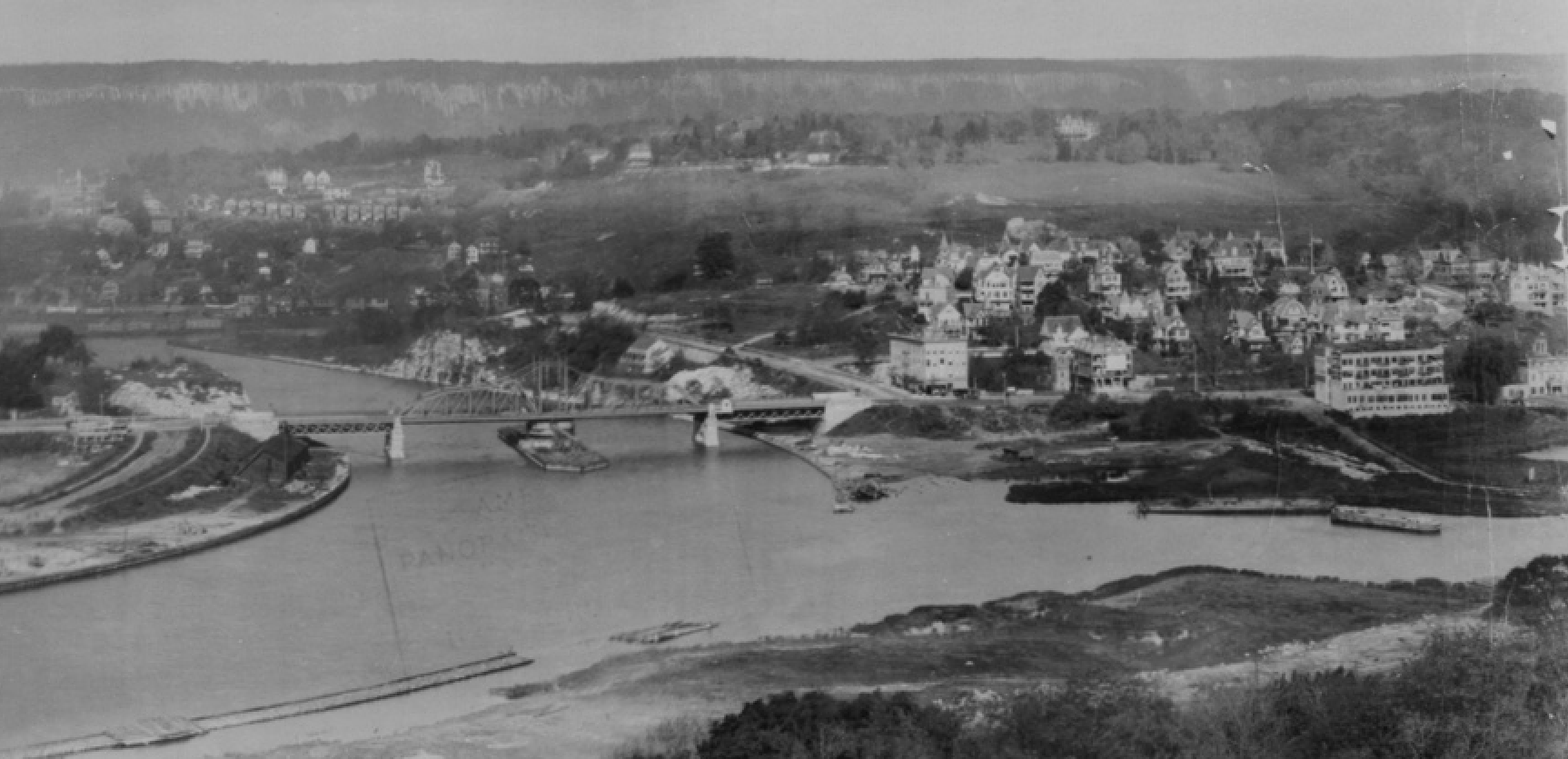
Here’s the same area after the train was built. The stadium in the foreground is the Kingsbridge Velodrome:
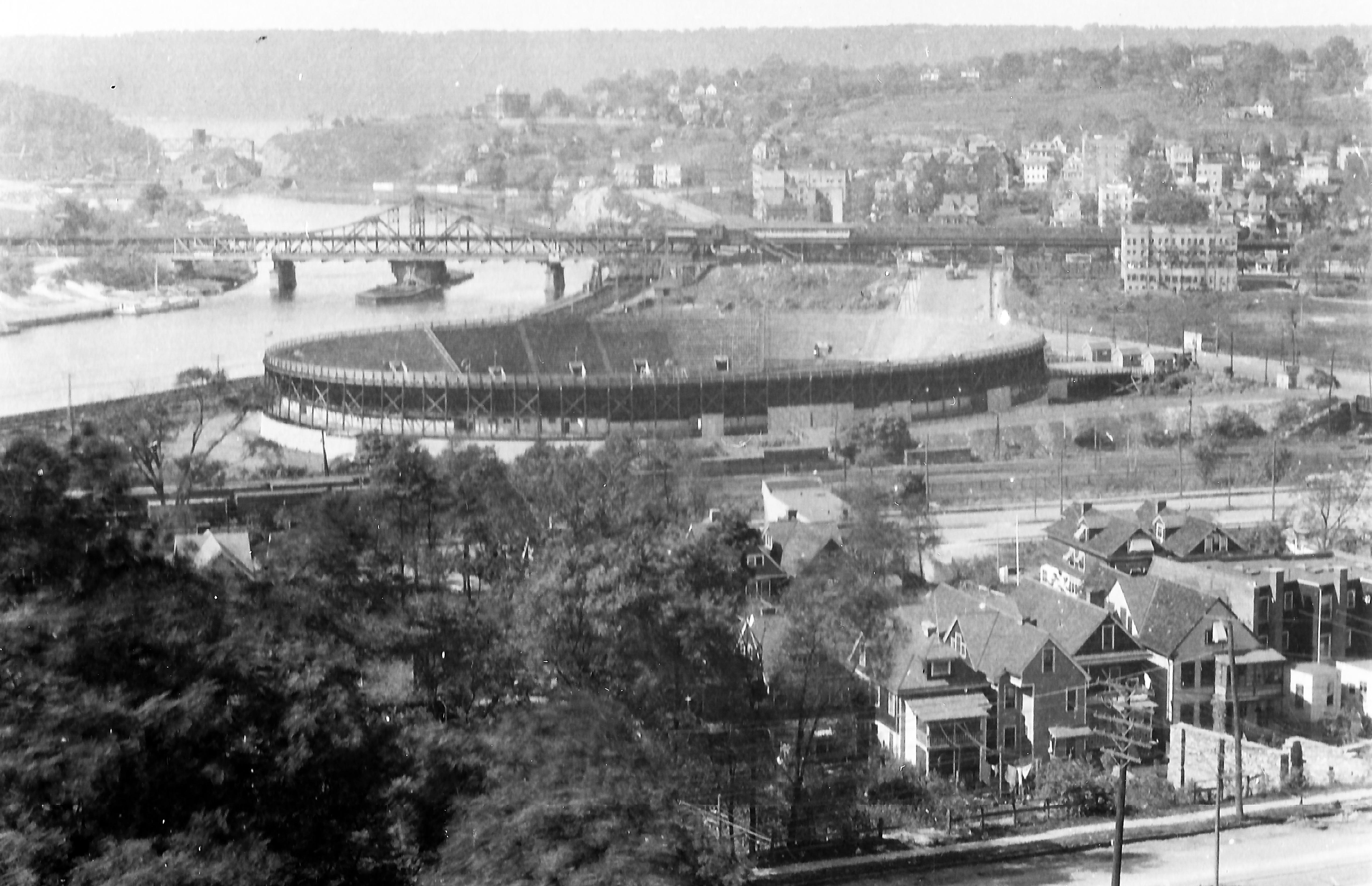
You can see the top of 5189 Broadway just sticking out above the tracks.
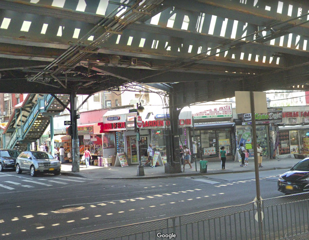
Here’s that corner in 1952. The building is on the far left with a store on the ground floor.
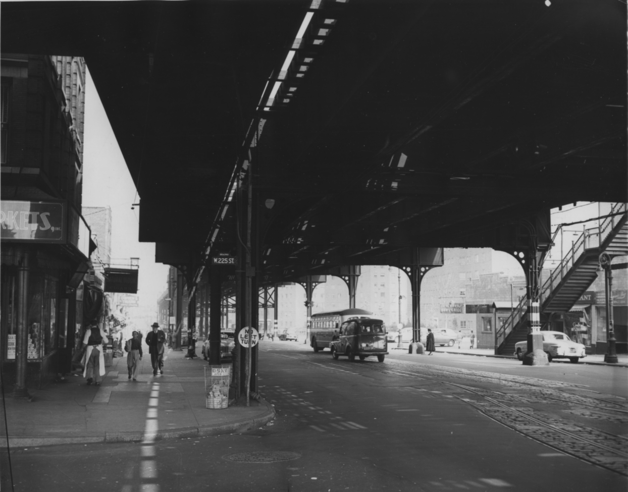
The old multi-story building on the corner must have been torn down. Today the building on the corner is a one story corner deli called “Garden of Eden” with the address of 5187 Broadway. I don’t know how much of this you already know or have seen but your comment got me curious.
-
January 10, 2019 at 1:02 am #825
I think today COlumbia’s baker field is where the velodrome was. Or is it the Target? When did the velodrome come down? Was it built for an Olympics? I know NYC has never hosted the olympics, but they must have bid a couple of times.
-
January 10, 2019 at 1:55 am #826
The Velodrome was East of present day Target store and was used for professional bike races. The velodrome opened May 30th, 1922 and cost of a quarter-million-dollar for the bike track, built to hold 16,000 fans. It also was used for 6 day bike races and boxing matches. it burned down August 4th, 1930 .
-
January 10, 2019 at 1:59 am #827
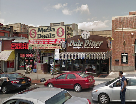
The Dale theater was actually located where the Maga Deals store is located in the picture shown above. It was a family movie theater but at the end of its life turned into showing ‘Art’ movies and X-rated for few years before it closed. It was a pretty small theater compared to the RKO Marble Hill theater on Broadway and 232nd st.
-
-
AuthorPosts
- You must be logged in to reply to this topic.