Home › Forums › 20th Century › Old Bridge Tavern
Tagged: Dan Mullane
- This topic has 24 replies, 8 voices, and was last updated 3 years, 2 months ago by
jbakerjonathan.
-
AuthorPosts
-
-
January 6, 2020 at 1:18 am #1198
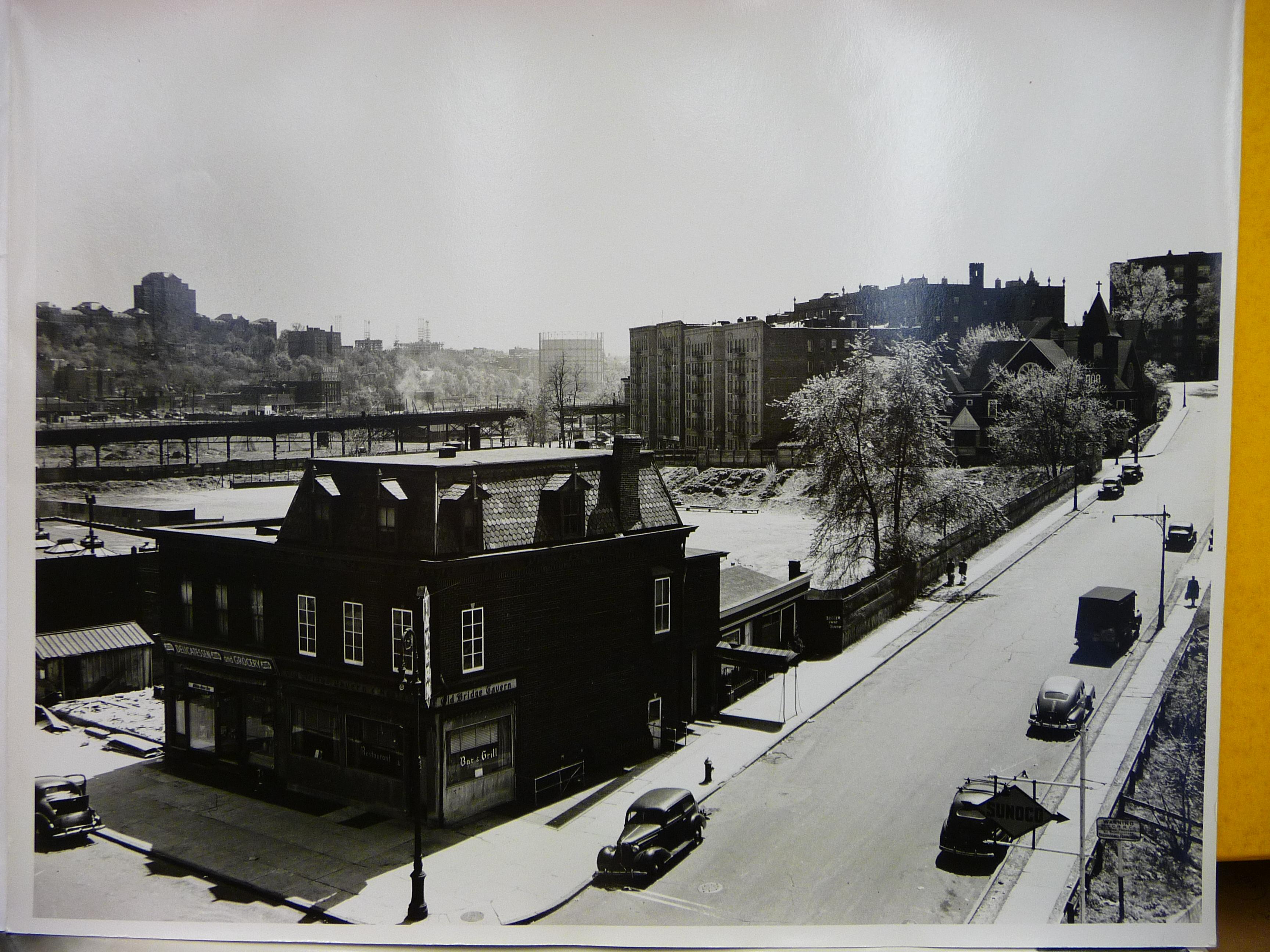
I found this photo on my computer but I really can’t remember where it came from. I am thinking it was taken in the mid 40’s or earlier. By zooming in on the building on the corner, you can see that it is the home of the Old Bridge Tavern. This is West 230th Street and Kingsbridge Avenue.
-
January 6, 2020 at 1:56 am #1199
Interesting picture, but note it would appear to be on the Manhattan side.
-
January 6, 2020 at 1:59 am #1200
PS – I also like the view of the former Roman Catholic Orphanage which later became the Veterans Hospital off in the distance.
-
January 6, 2020 at 2:13 am #1201
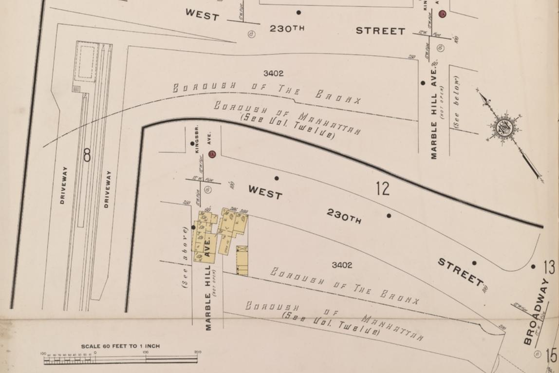
After further review…….it looks like a Bronx reception. From this old map, the building is in the Bronx
-
January 6, 2020 at 2:43 am #1202
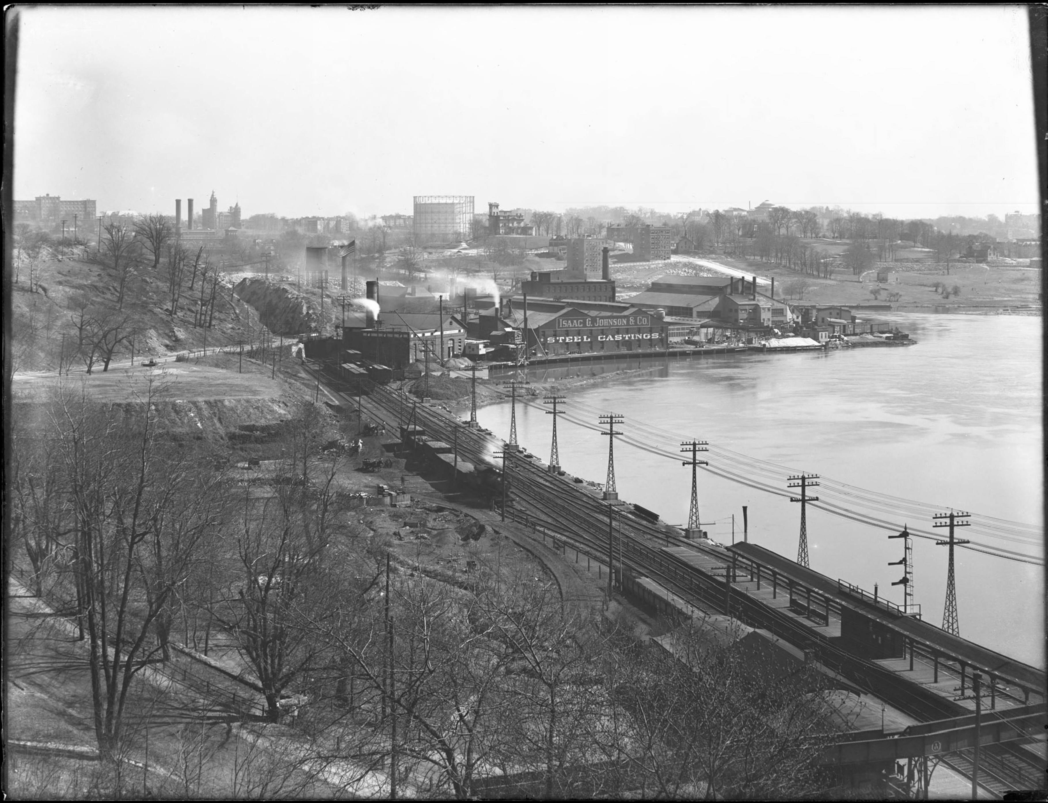
Two additional items of interest is the old gas tank in far distance located then at at the foot of the Fordham landing at the 207th Street bridge. Also in the distance are 3 of the Fordham Hill Apartment building complex then under construction. ( you need to enlarge the photo to see them clearly)
Of even more significance is the street shown, Marble Hill Ave, is also named The Rev Dr William A Tieck Way – Founder and first President of the Kingsbridge Historical Societ. The KHS initiated the street naming process and helped its passing by the City Council.
PS- The photo is also likely a RCSA photo – ‘right click save as’ internet find ! A Good one.
-
January 9, 2020 at 12:59 am #1203
As far as I can tell, the Fordham Hill Apartments were completed in 1949, and as they are under construction here, I’d say this is 1948 or 1949.
I see no signs of construction underway for the Marble Hill Houses, which were completed in 1951. I think The Old Bridge Tavern did not survive that construction. It seems to have been replaced by another structure by the time of this Jan 6 1951 photo.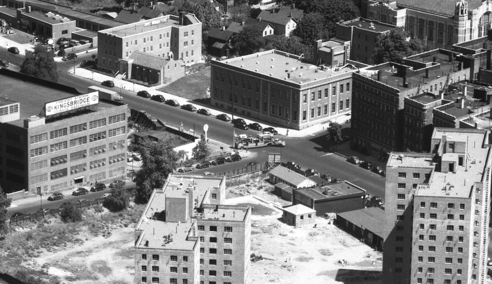
This photo, from Herb Maruska’s collection, credited as 1939, shows the VA Hospital under construction between the original buildings of the RC Orphan Asylum. This source says the asylum was sold to the Treasury Dept in 1921.
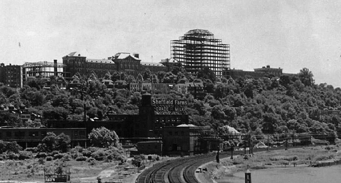
The gasholder shows up in many pre 1950s photos. It was demolished in 1951 to make way for the Deegan Expressway.
The gasholder, the asylum, and Webb’s Academy (demolished shortly before the OP to make way for the Fordham Hill apartments) are great landmarks for old photos of the area.
Here all three are visible behind the Johnson Iron Works in 1918. (Only the south wing of the asylum is visible.)
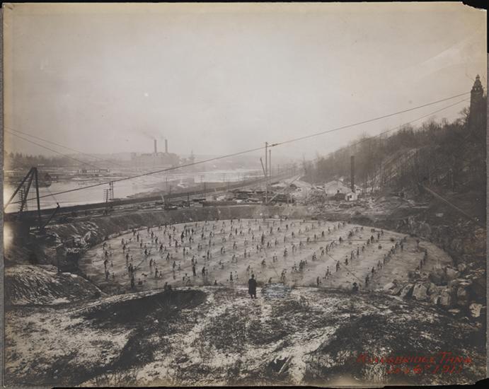
Here is the gasholder under construction in 1911. The view is to the north with Webb’s Academy at the upper right and the Kingsbridge Power House on the Manhattan side. Marble Hill is in the distant center. I don’t know what part of construction needed all these folks, but it looks like a ballet.
-
January 10, 2020 at 3:05 pm #1214
Those are some amazing photos. I love the one of the Johnson Foundry looking east. Thank you for including links for where you found the photos. I wonder what those buildings were that replaced the Old Bridge Tavern…
-
January 11, 2020 at 4:35 am #1215
I have nothing to base this guess on, but I wonder if the blocky looking building that replaced The Old Bridge Tavern might have been temporary offices for The Marble Hill Houses, or the construction company building them.
I don’t know when the playground was opened, but Tieck mentions it in 1964, in what looks like an earlier draft of several chapters of his 1968 book. (Link is to a Fulton Search PDF of The Riverdale Press 4/2/64)
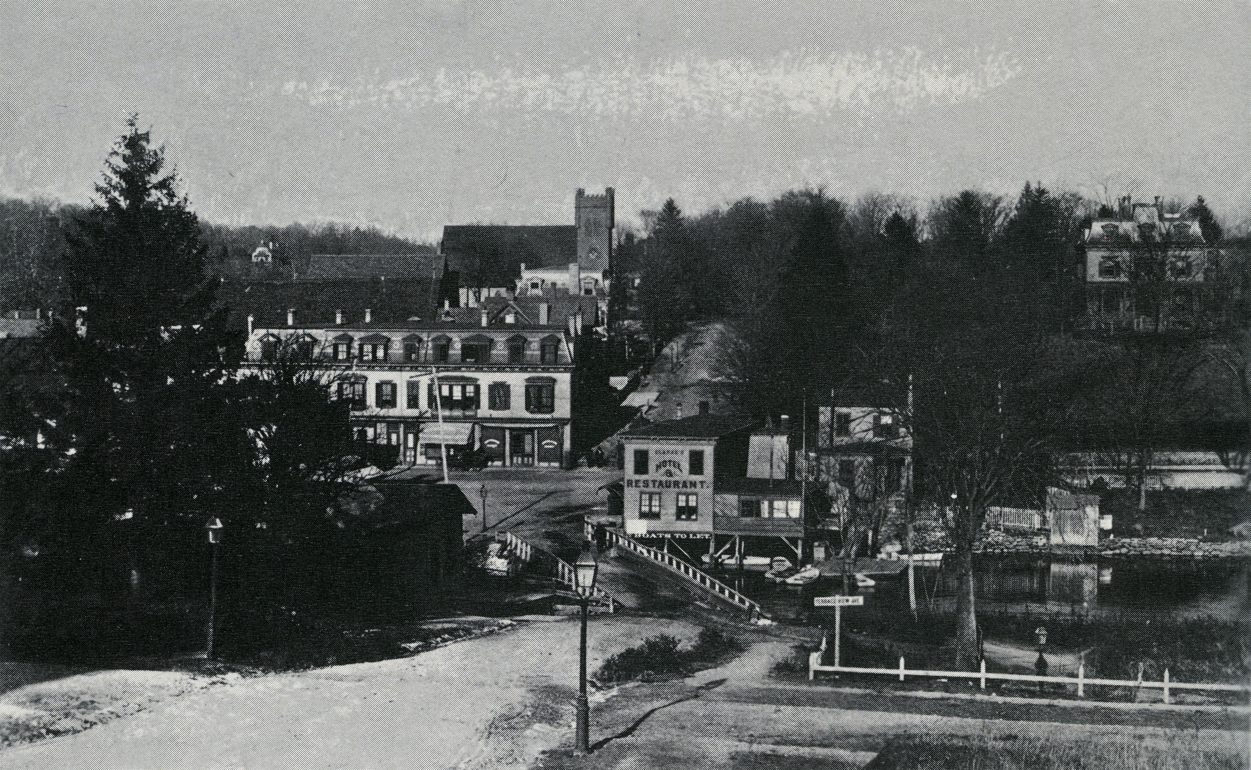
In 1964, Tieck says “…torn down in 1949 to make way for the present playground. At the time of its demolition the comer structure was well-known as the Old Bridge Tavern and was something of a landmark.”He also describes how The distinctive mansard roof shape of the tavern was actually part of a larger building and was moved from across the street after most of the area was destroyed by fire in 1903.
I had not known this wonderful tidbit of info until this thread. It explains some older pics that show the distinctive mansard roof at the site of the phone company building, not adjacent to The Kings Bridge, like this one from Tieck’s book.
I HAD heard (and mentioned in another thread at some point) that the other building that occupied the phone company site (peaking out between the mansard roof and St Johns,) was moved one block south and rotated 180 degrees to where it apparently still stands at 3014 Godwin Terrace. Tieck seems to mention this in passing, but doesn’t add specifics. I learned this from a facebook post from someone who had grown up at 3014 Godwin.
So, Tieck gives us a history of the building that housed the tavern from the 1800s to 1949, and by 1964 mentions the playground.
There is a blocky looking building there in January of 1951, but at most 15 years later it is gone, and is not mentioned.
Here are the 1940s tax photos of the area
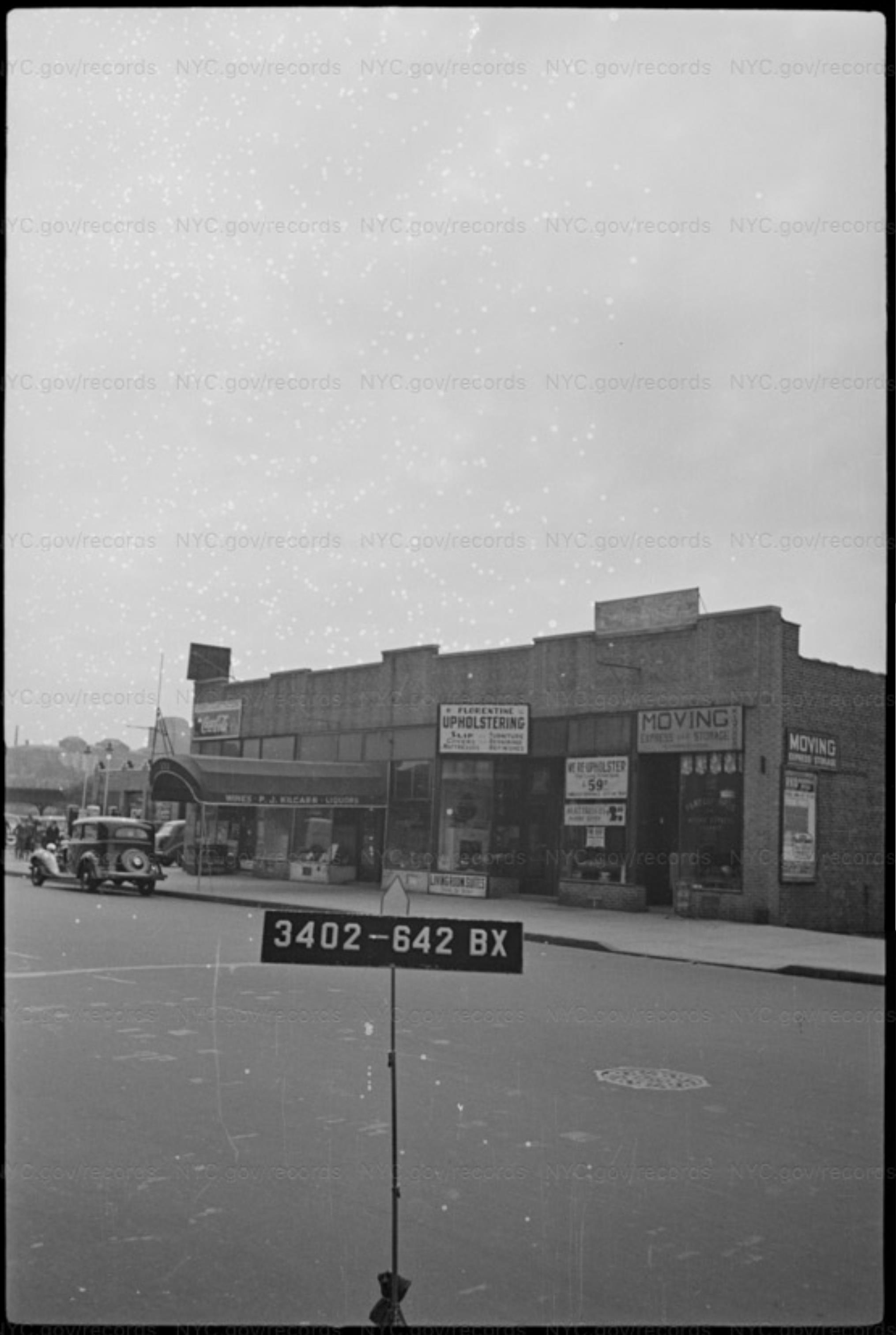
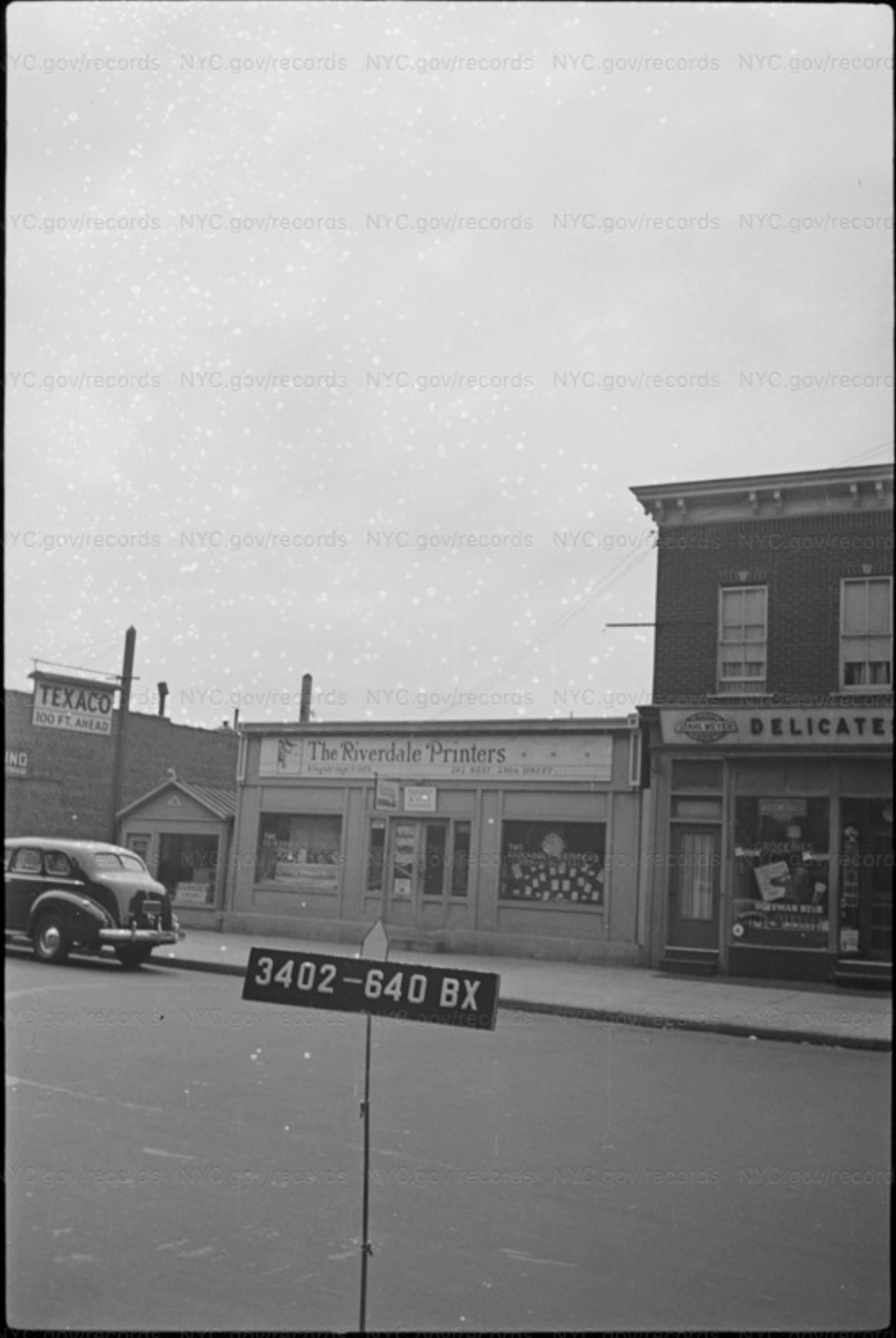
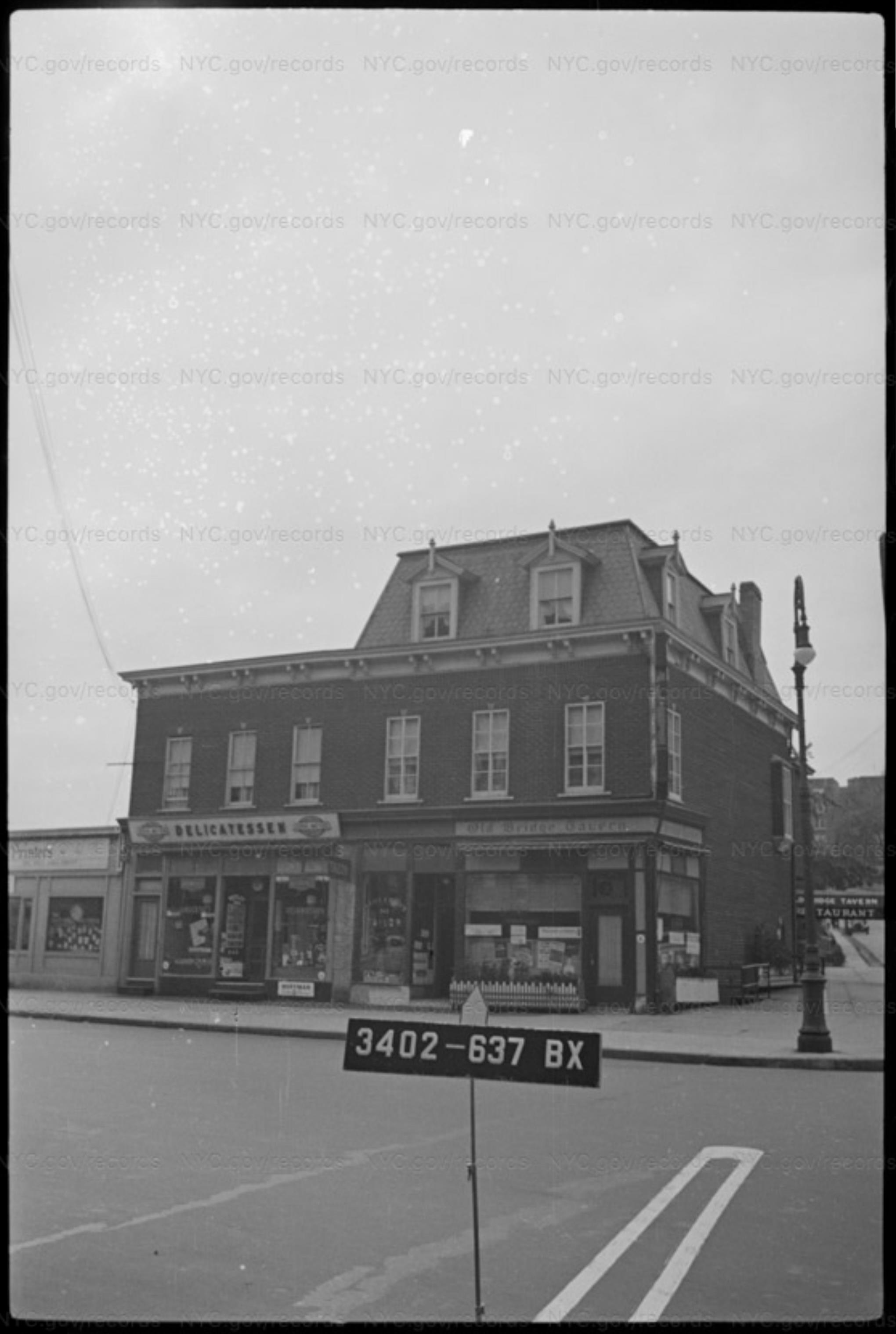
The middle building seems to already be reduced to rubble by the time of the OP ca 1949. The one on the left is still there in 1951. The skylights show up in both the OP and the 1951 aerial view.
All of this combines to make me think the blocky looking building was temporary, and leads to my guess about it being the office. Just a guess though.
I love the RCSA photo designation. I try to keep text files of links to photos, so I don’t usually find RCSA photos on my hard drive. My bane is SISBCRW, Seen It Somewhere But Can’t remember Where, when I remember a photo I’ve seen but can’t remember what archive I was perusing or what I was searching for and can’t find it again.
-
January 11, 2020 at 11:42 pm #1216
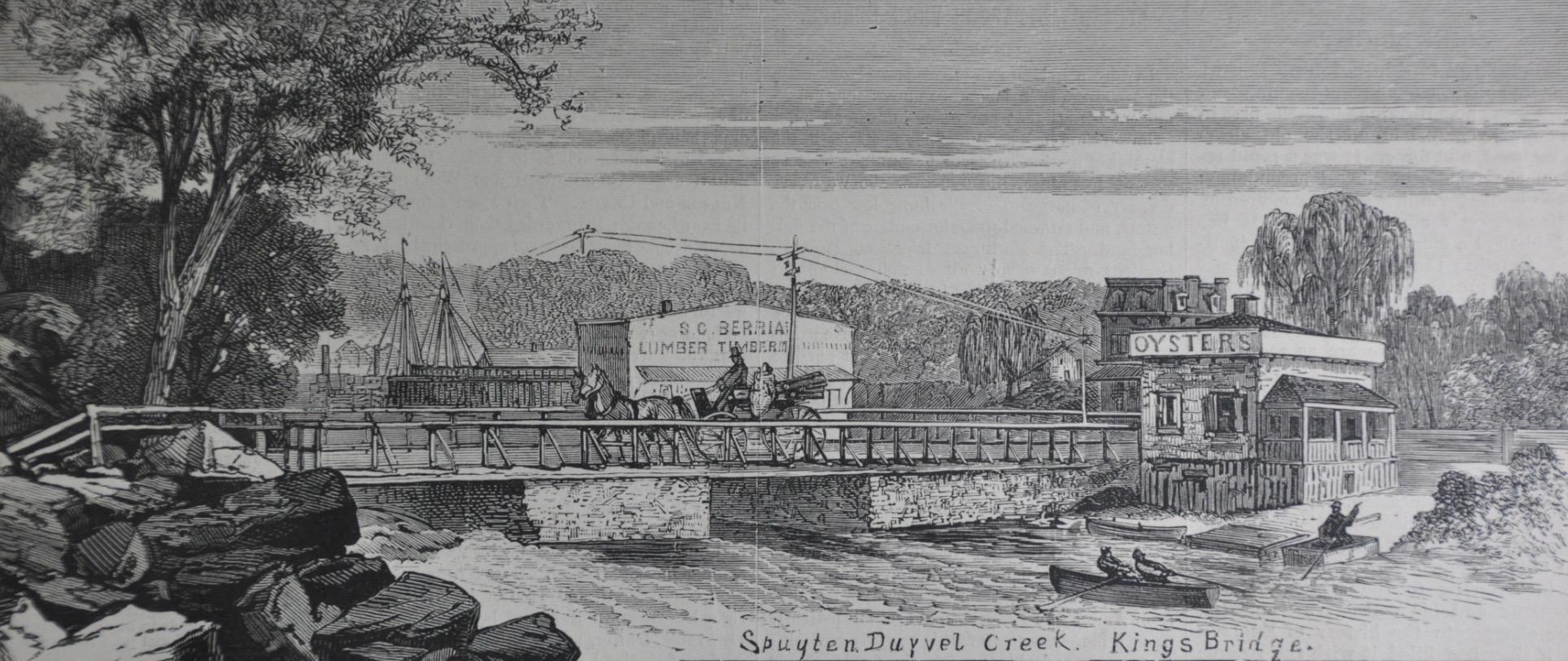
Thanks for posting that. That Tieck article makes me think that The Old Bridge Tavern building might have been the same as the building behind the oyster shack in this 1873 Harpers illustration. What do you think?
-
-
January 12, 2020 at 4:57 pm #1219
Sure looks similar. I’d guess it was the same building.
-
July 6, 2020 at 1:27 pm #1521
Thanks for all the info on the Old Bridge Tavern and yes the Playground for the Marble Hill Houses is located there. I can remember going to the Basketball courts there and having to give your keys or wallet to the Parkie as collateral in order to use one of the Basketballs. Great memories…
-
September 9, 2020 at 3:43 pm #1610
<span style=”-webkit-tap-highlight-color: rgba(0, 0, 0, 0);”>
</span>
-
September 9, 2020 at 3:57 pm #1611
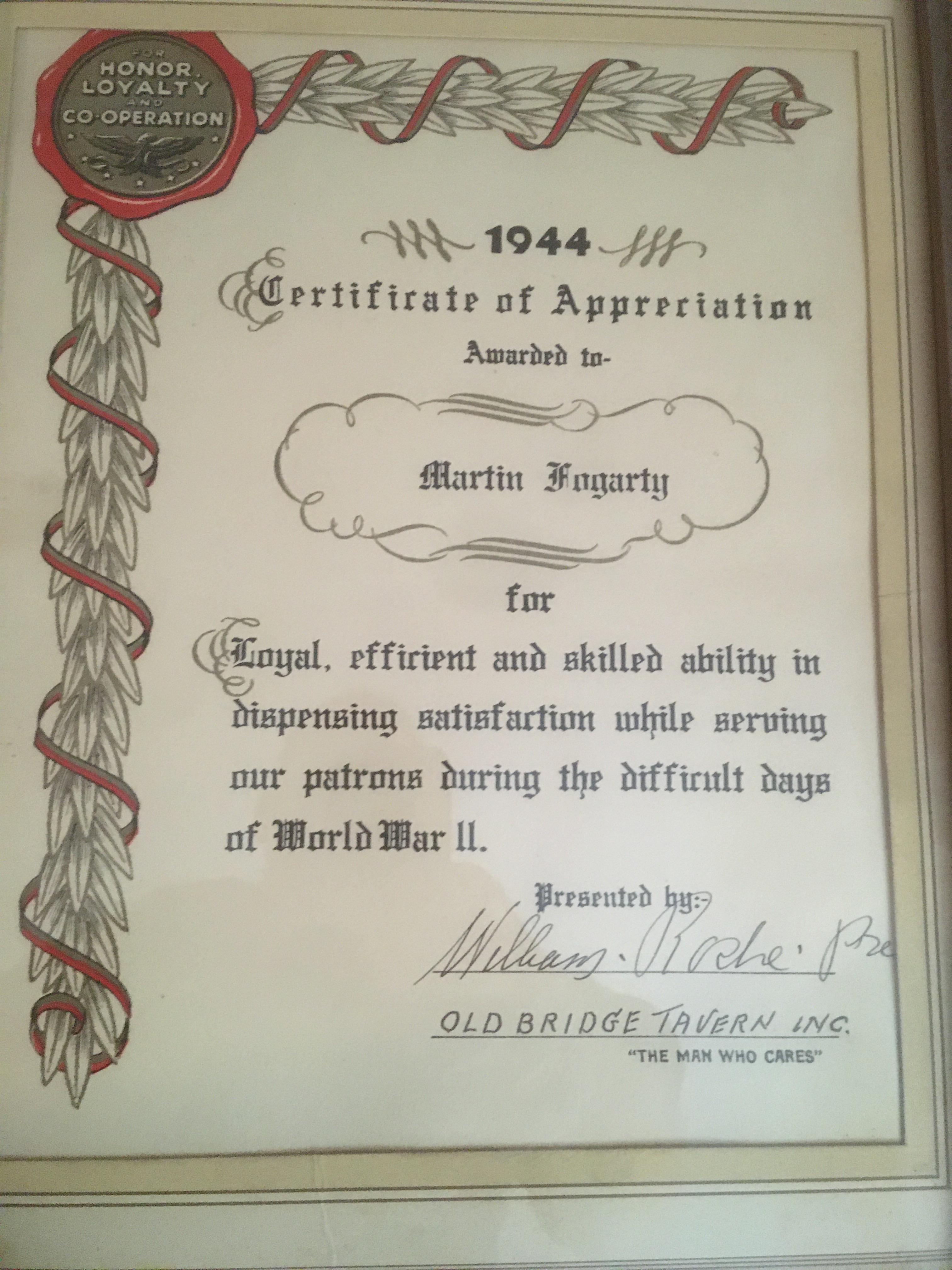
My grandfather, Martin Fogarty, was the bartender there during World War II. He received a “Certificate of Appreciciation” from the owner at the time, William Roche, for what I believe was his ability to take peoples minds off of the war while they were at the Old Bridge Tavern. He also worked at the Lakes of Sligo and Sweeney’s on 231st Street. He was often reffered to as the “Mayor of 231st Street.”
-
September 9, 2020 at 4:40 pm #1612
-
September 9, 2020 at 11:42 pm #1613
Thanks for an interesting post, Marty. I love the line about “skilled ability in dispensing satisfaction!” I have to confess that I don’t have a good idea of what the war years were like in the neighborhood although I imagine people felt the need to connect with their neighbors at places like the Old Bridge Tavern. I know I learned a thing or two about the neighborhood from the old bartender at The Piper’s Kilt before it closed down. Places like that help tie a neighborhood together.
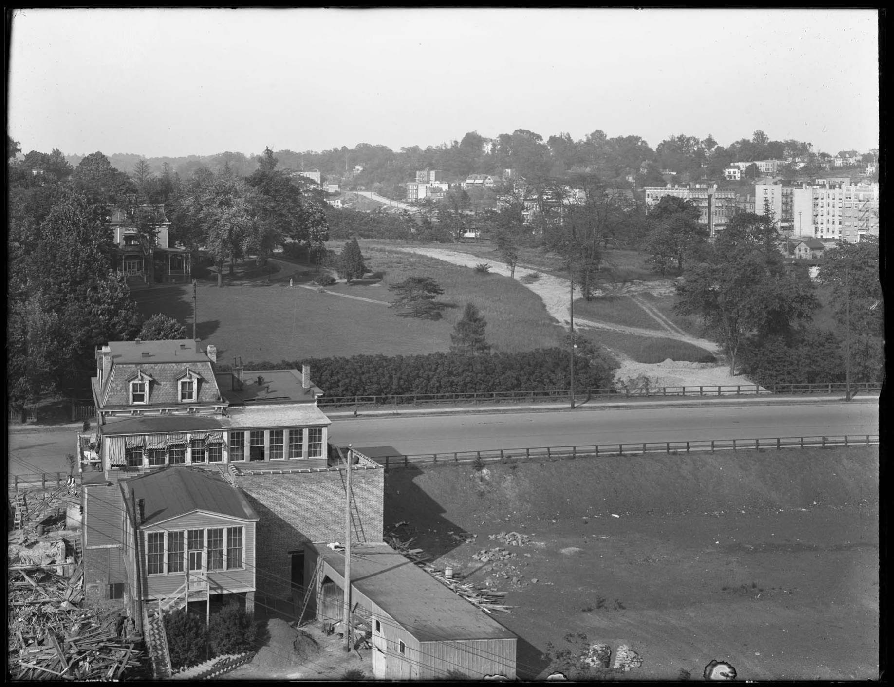
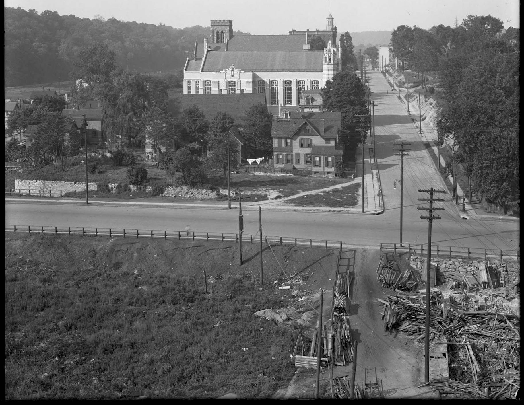
It is an interesting coincidence that you should post this today. Across the street from the Old Bridge Tavern stood another building from the Victorian period–the Moller mansion, which was built in 1870 and still stands at 3029 Godwin Terrace. Just today we learned in the Riverdale Press that this building was recently sold and the transaction bears all the usual signs of a demolition/development project site. It would be a shame to lose such a building 150 years after its construction. I will have more on this shortly.
[caption id="" align="aligncenter" width="420"]
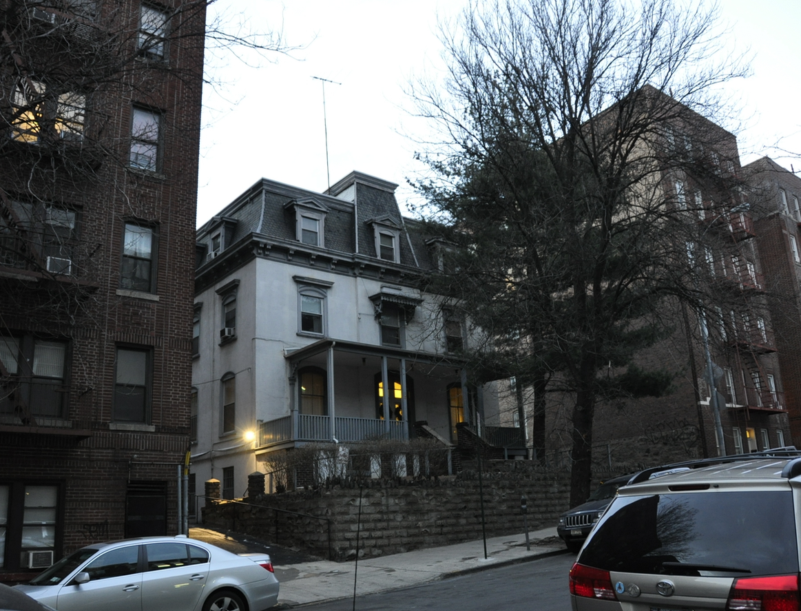 The Moller Mansion at 3029 Godwin Terrace[/caption]
 -
September 10, 2020 at 1:49 am #1614
The Moller Mansion was actually used by the Dominican Sisters who taught at St. John’s School when it was at its original location on Godwin terrace and Kimberley Place. My grandfather,who worked at the Old Bridge Tavern, actually lived next door at 3025 Godwin Terrace with my grandmother, father and his brother and two sisters. It would be a shame to see it torn down. What a great neighborhood Kinsbridge was. I loved going there as a child and still drive through when I get the chance. a lot of happy memories.
-
February 25, 2021 at 11:50 pm #1879
-
February 25, 2021 at 11:51 pm #1880
That sure looks like the Tavern to me. And see below the buildings that were along the road got changed when the road was realigned.
-
February 25, 2021 at 11:52 pm #1881
-
February 26, 2021 at 12:00 am #1882
This is a better view of the tavern building (thank goodness for the mansard roof!) when the Kings Bridge road is still there but it’s not bridging any gap any more
-
February 26, 2021 at 12:13 am #1883
The Old Bridge Tavern is not the Moller Mansion…OB had 2 windows on top, the Moller, has three
-
February 11, 2023 at 4:16 pm #3268
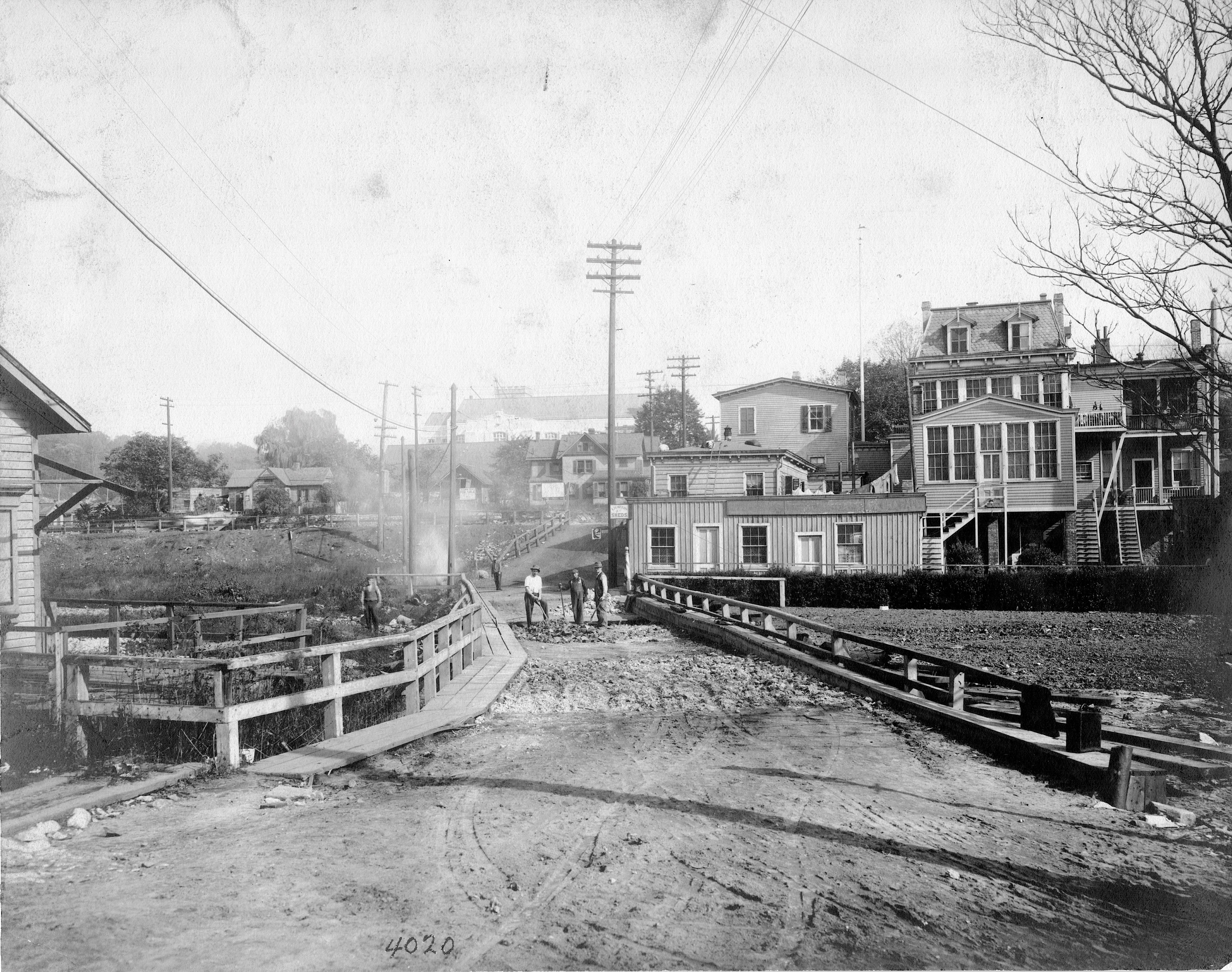
Judging from the photograph of the rear of Old Bridge Tavern, there must be about 35 feet of fill to the surface of Spuyten Duyvil Creek. The tavern itself lost two lower levels and then there must have been an additional 15 feet to the top of the creek. And then the creek must have been about 10 feet deep in the middle, I’m guessing. That is a lot of fill, spanning the distance from 230th Street to St.Stephen’s Methodist Episcopal Church, south of 228th Street. Wikipedia states that excavated material from the construction of Grand Central Terminal was used as fill. Additional excavated material was also transported to Croton-on-Hudson, 40 miles up-river to construct a station there.
The U-Haul building appears to be situated on the filled-in Creek. I wonder how deep the footings are for that building! -
February 12, 2023 at 4:18 pm #3269
Many thanks for all the info on the Old Bridge Tavern and especially Marty Fogarty’s imput. I went to St. John’s School with Marty’s Mom and knew of his Dad and some of his Dad’s friends. Went to a luncheon a few years ago that Marty’s Mom organized and saw quite a few Alum from St. John’s School.
Dan Mullane
-
March 2, 2023 at 3:27 pm #3300
I’m judging that the picture of the King’s Bridge (#1882) was taken circa 1910 because, in the background, there appears to be a derrick on the tower of the Church of the Mediator which looks almost completed. The church’s cornerstone was laid in 1911 and the creek was filled in in 1914 according to Wikipedia.
-
May 16, 2023 at 4:52 pm #3372
Regarding Nick’s post #1198, there is foliage on the trees, people walking with overcoats and jackets and a 1942 Pontiac Streamliner parked behind the van on Marble Hill Avenue south of West 230th street. Since I can see no gas ration sticker in the passenger window of the auto facing W. 230th (at the corner) and rationing began in the May of 1942, I would judge the photo to have taken in late Fall, 1941 or early Spring, 1942. That’s my WAG.
-
-
AuthorPosts
- You must be logged in to reply to this topic.