Home › Forums › 20th Century › Putnam Railroad – Crowdsourcing a Question
Tagged: Old Put; Putnam Railroad
- This topic has 12 replies, 6 voices, and was last updated 2 years ago by
John Tierney.
-
AuthorPosts
-
-
January 11, 2022 at 4:44 pm #2412
I received a question from a new member today concerning the below photos, which I were taken around 1949. But where were they taken (as in the cross streets)?
Photo 1:
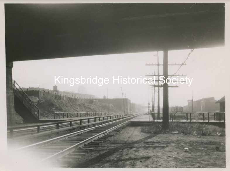
Photo 2:
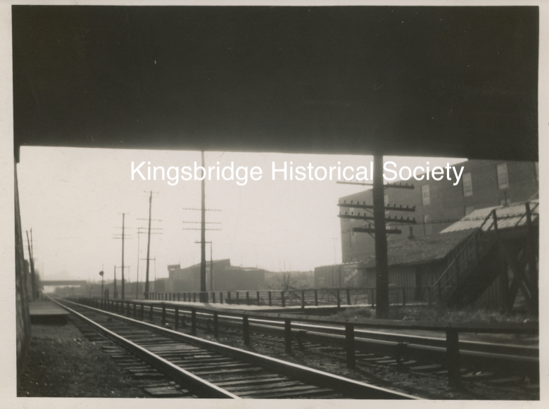
Photo 3:
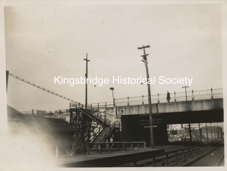
Photo 4:
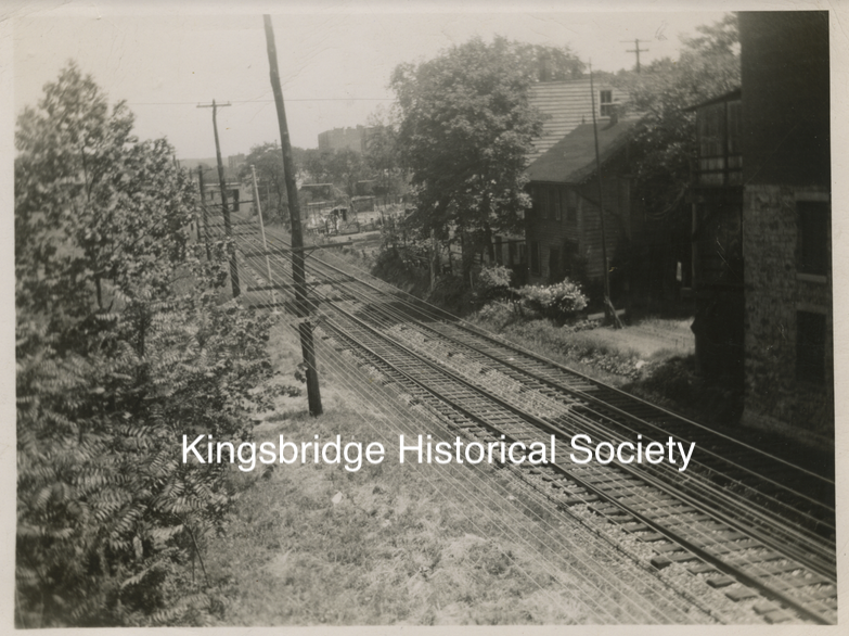
You can clearly see that these photos predate the Major Deegan construction. I want to say that photo 4 is the Albany Crescent area and that the buildings on the right were probably knocked down for the thruway. I am not sure though and would appreciate any information.
-
January 11, 2022 at 5:42 pm #2413
Okay, I’ll start with what I think is the obvious in hopes that it gets things going and people showing me wrong. Seems to me the first three photos all show the (presuming Kingsbridge) train station with northbound and southbound platforms, which would make things pretty easy to identify. Might the towering shadow above the apartments in the first photo be the gas works plant?
-
January 11, 2022 at 6:39 pm #2414
I believe all 4 photos are taken from the 231st station location, that is east of Broadway and just west of Albany Crescent down to where the old Putnam rails are still located. The Major Deegan today is to the East of these Putnam rail tracks,. This area may some day, maybe even in our life time, be the location for the day lighted Tibbetts Brook.
Looking South #1 looking SE and #2 looking south West. Looking North are #3 and # 4, #3 looking NW and #4 looking NE. The south bound stair case was still there in the 1960s, for the old Putnam south bound station. It was boarded off but easy to climb over. It was a safe place you could drink beer before you turned 18.
-
January 11, 2022 at 7:58 pm #2415
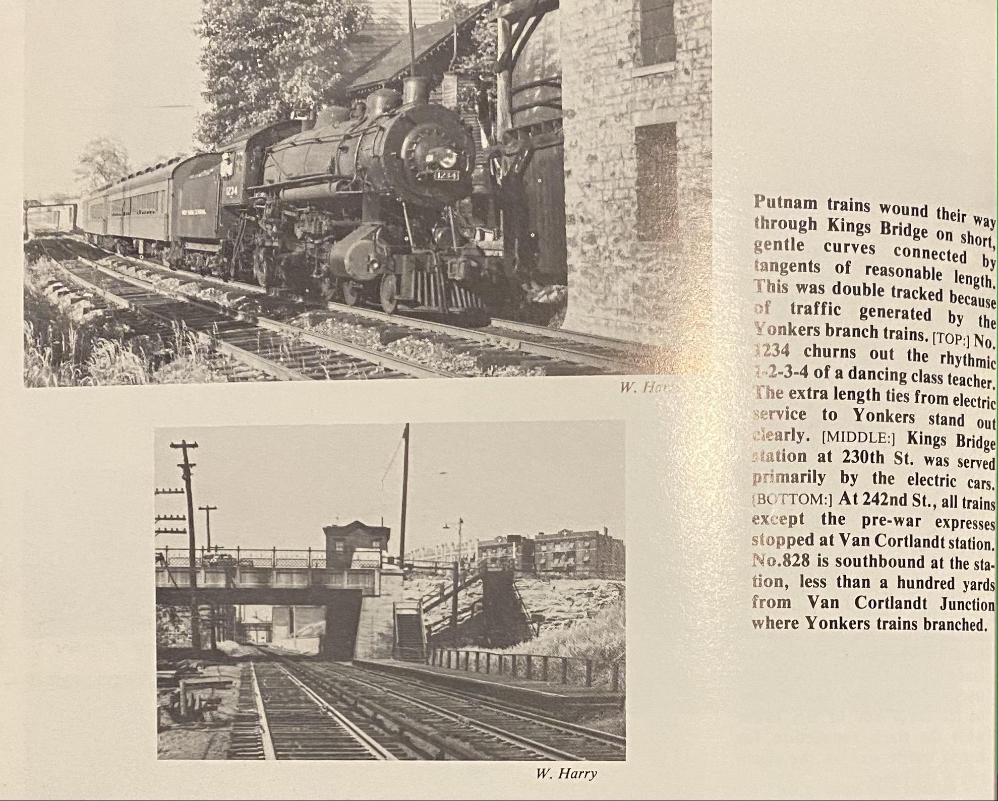
I recently picked up “The Putnam Division: New York Central’s Bygone Route through Westchester County” by Daniel R. Gallo and Frederick A. Kramer published by Bells & Whistles 1989. Not much attention paid to our area other than the transition from urban to rural at VCP station. Some other points of interest.
-
January 11, 2022 at 8:09 pm #2416
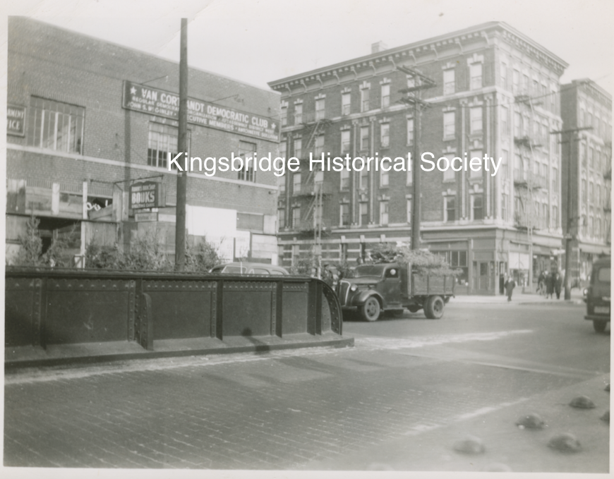
I have to assume there are other pictures on the page of the book as the description doesn’t match what is shown. The bottom photo is definitely 231st st as you can see the curve of Albany Crescent and the apartment house at upper right. Or as you said they may not have paid attention or weren’t familiar with the area. Good photos in any case.
-
January 11, 2022 at 8:19 pm #2417
Yes, I cut out the bottom photo!
-
January 11, 2022 at 8:28 pm #2418
Clearly the photo 4 Building with 2 windows, matches with the Building in the Book with Engine 1234
-
January 12, 2022 at 9:56 am #2419
Yes, that’s it, thanks. The large brick building on the right in photo #4 and in the train engine photo must be the old Tynan’s hardware/Robert’s Bookshop building on W. 231st that was torn down to clear way for the thruway. It was on the east side of the tracks where the Deegan is today. It is shown in the photo below on the left, which was taken in 1951.
-
January 12, 2024 at 5:26 pm #3851
Does anyone have maps or photos of South Yonkers local stations for Old Put before VCP? Or just an idea of location? Thanks!
-
January 12, 2024 at 8:59 pm #3852
I’m not sure if you are looking for:
1) where railroad stations were located in today’s South Yonkers before the trains entered Van Cortlandt Park or
2) where railroad stations were located in our area before the creation of Van Cortlandt Park (when this part of The Bronx was known as South Yonkers)?
Either way, here are three maps that might be helpful:
Map of the Bronx. [including part of Yonkers, Mount Vernon, and New Rochelle].
Map of the Bronx [including Yonkers, Mount Vernon, and New Rochelle].
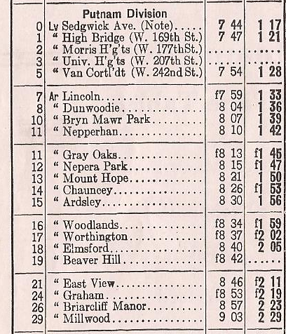
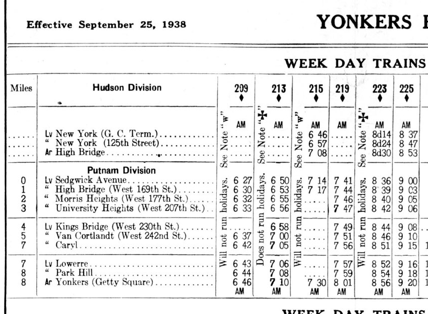
The railroad changed ownership many times even before they finished building it and went by many different names so that’s why it is referred to as the “New York and Northern” above. Below are timetables for the Putnam Division of the New York Central. Here is the main branch (1942):
And here are the stops on the spur to Getty Square in Yonkers:
You can still see remnants of railroad infrastructure in several parts of Yonkers.
-
January 13, 2024 at 1:25 pm #3853
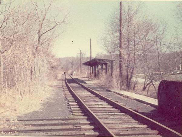
One of my favorite stations is the Old Putnam Railroad station, still in Van Cortlandt Park
-
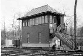
January 13, 2024 at 1:27 pm #3855
Just North of the Station you can still find remains of the JS Tower
-
July 21, 2024 at 3:30 pm #4280
Thank you, Zach, Peter and Nick! Great to see what it used to look like at 231st Street. I’m a railroad buff myself, but I have to say I’m glad the Old Put is now a path instead of a railroad in the park, and I hope they do bring back the creek.
-
-
AuthorPosts
- You must be logged in to reply to this topic.