Home › Forums › 20th Century › Stony Brook in Brust Park
Tagged: Stony Brook in Brust Park
- This topic has 3 replies, 3 voices, and was last updated 6 years, 6 months ago by
Thomas Casey.
-
AuthorPosts
-
-
January 3, 2020 at 7:07 pm #1194
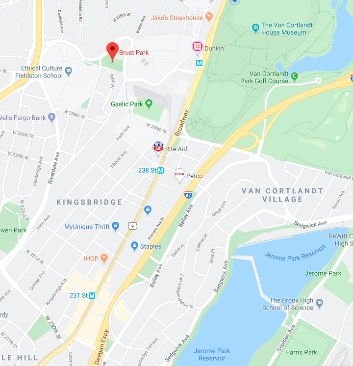
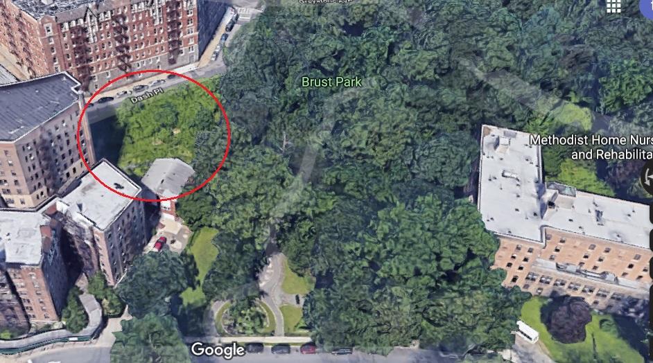
I recently met some neighborhood folks that are working to halt a development next to Brust Park in Riverdale. Brust Park is located across the street from the main entrance to Manhattan College on Manhattan College Parkway.
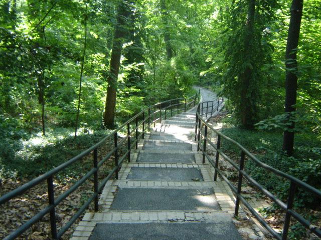
I used to live next door to the park and walked through it to get to work. Although it is small, walking on the path through the park is pleasant as there is a little babbling brook that flows through large rock outcroppings and bolders alongside the path. The path is also flanked by large trees of different varieties giving you the idea of what the area looked like long ago.
I particularly enjoyed the idea of the brook as it seemed so out of place in The Bronx where most of the old streams and brooks were diverted into sewers a long time ago. It turns out the brook through Brust Park has been there quite some time. You can see it near the top left of the below 1874 map:
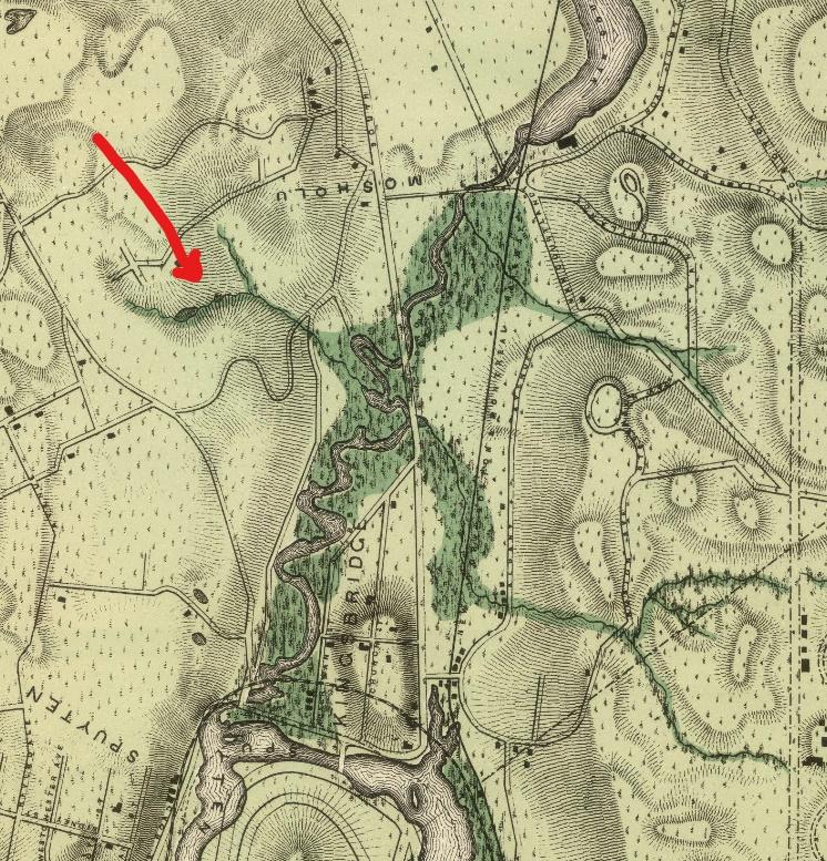
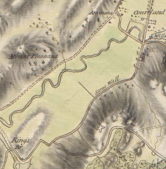
You can see that the stream gathered rainwater from the hills around Fieldston and flowed down into Tibbetts Brook in Kingsbridge. While the stream flows through Brust Park above ground today, it enters the sewer system at the lower end of the park near Manhattan College Parkway. The brook was indicated on much earlier maps–the below being a British intelligence map from 1781. Again the brook through today’s Brust Park can be found on the top left next to the words “Mount Pleasant,” which is the hill occupied by the area around the Ethical Culture Fieldston School.
[caption id="" align="aligncenter" width="563"]
 Clements Library, University of Michigan[/caption]
In Thomas Henry Edsall’s History of the Town of Kings Bridge, there is a map that compiles all sorts of interesting historical information. This map depicts the brook as well just above the big “E” on the top left:
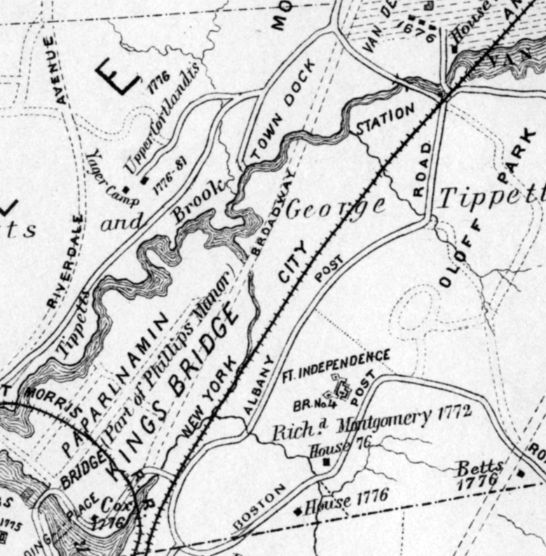
One thing that I always found interesting about Edsall’s map is the “Town Dock” that is labeled where the aforementioned brook intersected with Tibbetts Brook. The presence of a dock that far inland seemed hard to believe but I recently came across the below surveyors map that depicted the site as the “free landing” (landing being a synonym of dock). You can see the outline of Tibbetts Brook on the left. The “old road” depicted at the top is Waldo Avenue.
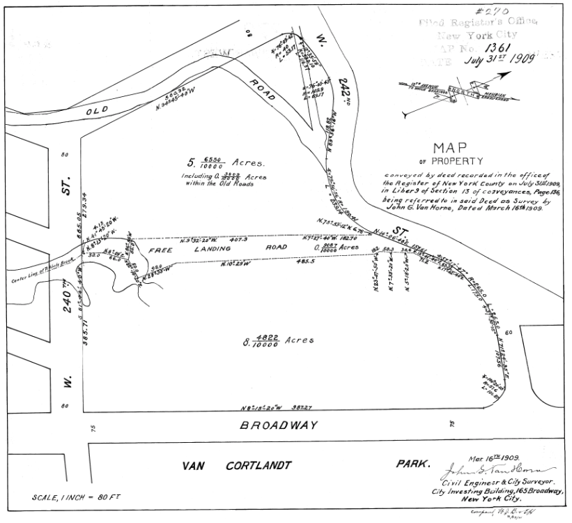 The above map depicts the area that is currently the MTA’s trainyard and Gaelic Park used by Manhattan College.
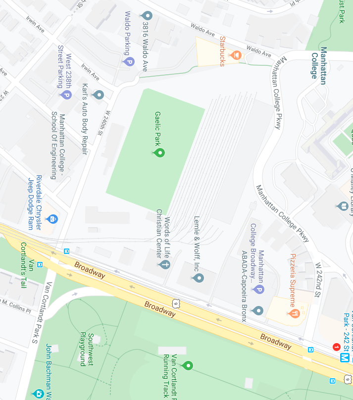
One thing that is notable about the brook through Brust Park, from a historical perspective, is that it was used as a boundary marker in early local land deeds. As early as 1688 one can find reference to a “Stony Brook” in a land deed from Samuel and John Betts to John Barrett. Several other local deeds refer to the “Stony Brook” including a 1726 deed from William Betts to Edward Meeks, which additionally refers to “a certain landing commonly called Stoney Brook landing.” I believe this could have been another name for the town dock or landing that would have been very useful to local farmers looking to get their produce to market.
In the Thomas Henry Edsall map that I included earlier, you can see just south of the Stony Brook a cluster of buildings labeled “Upper Cortlandts.” This was the home of Frederick Van Cortlandt II, which stood just south of today’s W. 238th Street and Waldo Ave. When Frederick Van Cortlandt acquired the surrounding land in 1768 from Edward Meeks, the deed referred to “Stony Creek” and “Stony Brook Landing” as boundary markers. Since there were no named streets, lot numbers, nor gps coordinates, natural markers were used to mark boundaries. Often these would be large rocks or marked trees. Stony Brook was particularly useful as a boundary as, unlike a tree, it could not be chopped down. It is nice to know that a little slice of the natural environment is still with us.
-
January 3, 2020 at 7:46 pm #1195
This development is owned by Timber Equities, of Villa Rosa Bonheur fame.
<p style=”text-align: left;”>It is unfortunate that both historical and environmental resources are at risk due to the real estate development of small properties in our community.</p> -
January 3, 2020 at 8:32 pm #1196
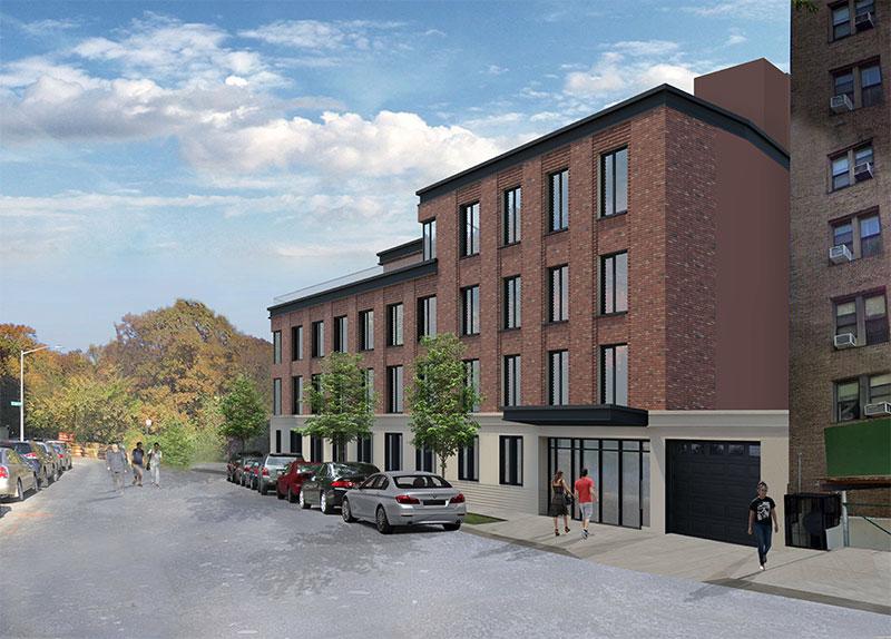 3893 Waldo Avenue – Designed by Kutnicki Bernstein Architects, is located in the Riverdale section of The Bronx at 3893 Waldo Avenue. The structure will rise five stories above ground and measure 41,177 square feet with 29 rental units. A small portion of the property will support unspecified community facility space.
The building features a simple red brick façade that is set above light-colored masonry at the ground floor.
-
January 3, 2020 at 8:40 pm #1197
-
-
AuthorPosts
- You must be logged in to reply to this topic.