Home › Forums › 20th Century › W. 240th Street, Edward Delafield, and a Chimp
- This topic has 8 replies, 5 voices, and was last updated 2 years, 5 months ago by
kathy.valyi@gmail.com.
-
AuthorPosts
-
-
January 30, 2024 at 2:49 pm #3866
I received an email question from a member asking if I knew why W. 240th Street was never constructed west of Independence Ave even though it shows up on this map from 1960 running west to meet Douglas Ave:
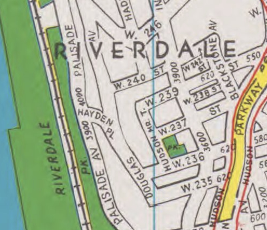
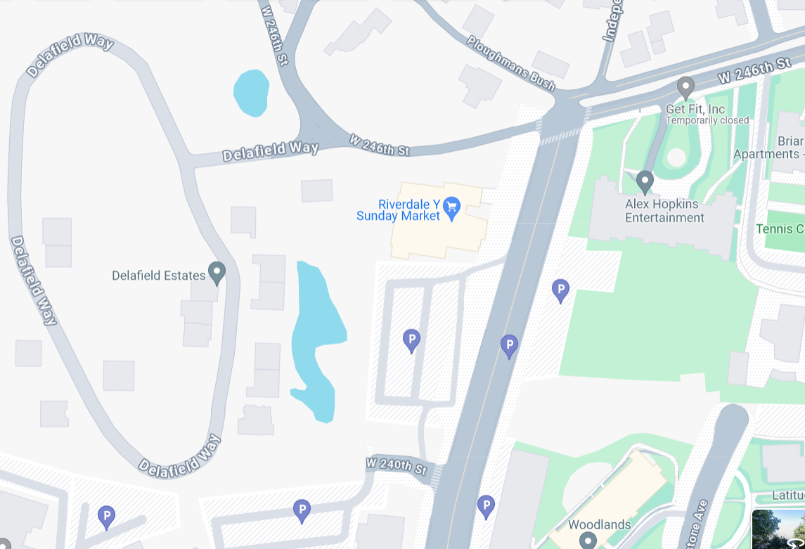
On the contemporary Google map, you can see W. 240th is just a nub of a road that connects to a couple of driveways.
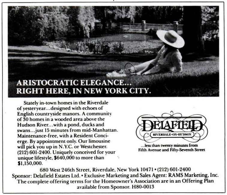
I don’t know the answer to the question but if the road had been constructed further west, it would have crossed (or have been the southern boundary of) the modern “Delafield Estates” development. That is a “gated community” of newer homes. From what I have read, it was previously the estate of Edward Delafield, who donated the property to Columbia University in 1965 with the hope that it would become a botanical garden. Columbia sold it to the developer who created the Delafield Estates. Here is a 1985 advertisement:
I didn’t realize that the Delafields had property in the neighborhood so late into the 20th century. I also didn’t know before today that, for a while at least, the famous Nim Chimpsky linguistics experiment was conducted on the site.
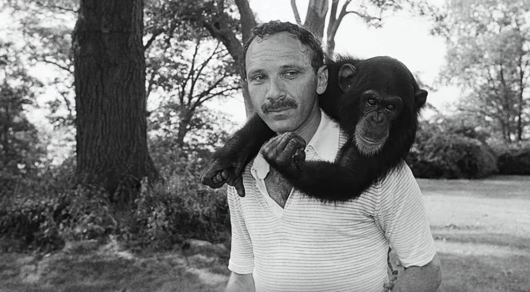 Researchers attempted to raise Nim as a human child to study if a chimp could learn language (as a challenge to Noam Chomsky’s theories of language acquisition). So, they tried to teach American Sign Language to Nim, who never truly learned to communicate beyond signing a few phrases to get rewards from the research team.
What does this have to do with the original question? Not much, but perhaps Edward Delafield, being a wealthy and influential person, resisted any attempts to put a road (W. 240th St.) through or adjacent to his estate? There is a good shot of Edward Delafield’s mansion in the below video before it was destroyed by a fire. Nim the chimp can be seen hanging out on the front lawn:
The Delafield Estates has a good history here.
-
January 30, 2024 at 4:03 pm #3869
Thanks, Nick. Hello, everyone. I’m the member who asked the initial question. I grew up in a building on West 239th St, with a parking lot that bordered the last undeveloped acreage of the Delafield Estate. There’s a notably steep hill that descends to the estate, leading to where West 240th St would have been had it been built. Does anyone have information on the process for getting the city to erase a street, such as West 240th St, which city planners have drawn on official maps but was never constructed? Exploring this through official records may provide the answer to my question. Nick’s suggestion about Edward Delafield’s resistance seems likely, however.
-
February 1, 2024 at 2:20 pm #3875
The late Gilbert Kerlin, who in 1954 championed the effort to preserve the area west of the parkway for private homes when developers sought to build highrises and who founded the Riverdale Nature Preservance 50 years or so later saw mapped but unbuilt streets as part of the arsenal of those who sought to block out-of-character development. They can’t be built on. So many preservationists want them to remain on the city map, not to be removed.
-
February 1, 2024 at 5:11 pm #3876
-
February 1, 2024 at 5:15 pm #3877
Gilbert Kerlin is quoted in this 1977 New York Times article about plans to develop that remaining portion of the Delafield Estate after Columbia University decided to sell it. There’s no mention of West 240th Street, but clearly he was among those trying to preserve the site: https://timesmachine.nytimes.com/timesmachine/1977/10/19/92276224.pdf?pdf_redirect=true&ip=0
-
February 2, 2024 at 2:56 pm #3879
In fact, Gil Kerlin split from Friends of the Greenbelt, the organization that was leading the battle against the proposed development. As you can discern from The Times article (though the writing is not as clearl as it might be) he favored the developer’s plan to build 72 units in the kind of condominium development typical at the time in Westchester, arguing that since development was inevitable, low-rise condos of this sort would be preferable to apartment buildings. The Friends organization, which won the fight, favored single-family homes on larger lots.
-
-
January 31, 2024 at 7:16 am #3870
From other photographs found on the internet, it seems that Ben Riley”s Arrowhead Inn located at 246th Street and Riverdale Avenue was a large building that had indoor and outdoor dining! Looking for it on Google Maps turned up nothing for me. I must have walked passed it many times during the 1950’s, yet I don’t remember it.
What has become of the building and the property?
-
January 31, 2024 at 7:18 am #3871
Sorry. I have posted on the wrong list. Please ignore.
-
February 3, 2024 at 2:18 pm #3883
There are a number of places where the official city map differs from the actual street. Another example is Sycamore Avenue. The official map indicates that it continues southward in a fairly straight line, across Wave Hill’s property. The actual Sycamore curves east before going south and then ends where 252nd Street begins. Changing the official city map is an expensive, massive legal process without clear outcome…
-
-
AuthorPosts
- You must be logged in to reply to this topic.