Forum Replies Created
-
AuthorPosts
-
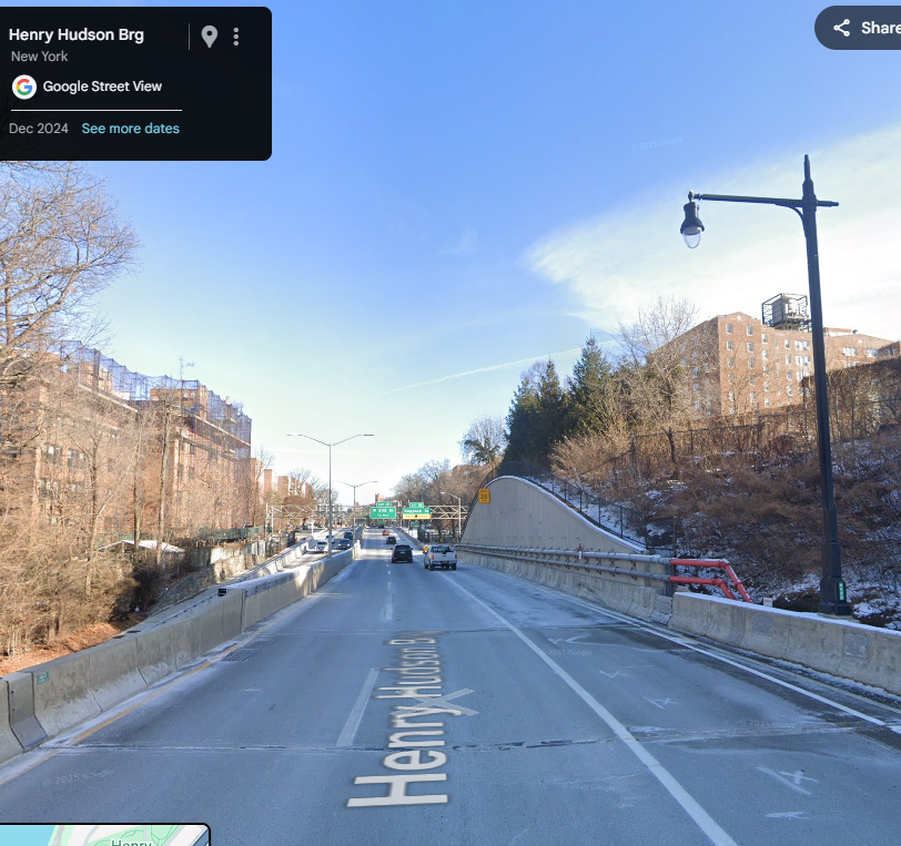
Here is a view taken in December 2024 of where the location of the Johnson house was, with a concrete retaining wall replacing the excavated stone ledge next to the house shown in the sepia photo.
Thomas, are you referring to the house within the green hexagon? Nick identified the Johnson house that is next to the HHPkwy in the sepia photo. Your photo shows just how beautiful that house was. What a shame that it was torn down and, I think, replaced by a parking lot next to 55 Knolls Crescent.
tmara2, thank you for all this information! I hadn’t realized how close to the stables the old railroad line was. The picture brings into focus quite well the description Karl gave.
Philip LeStrange,
The station I referred to in my post 4897 was on the eastern, main line of the Putnam.
The photos I referenced in my post 4939 are, as Alan Lasky said, of the Van Cortlandt Station at the south end of VCP, before the track splits with a spur going toward Mosholu Ave and your station.
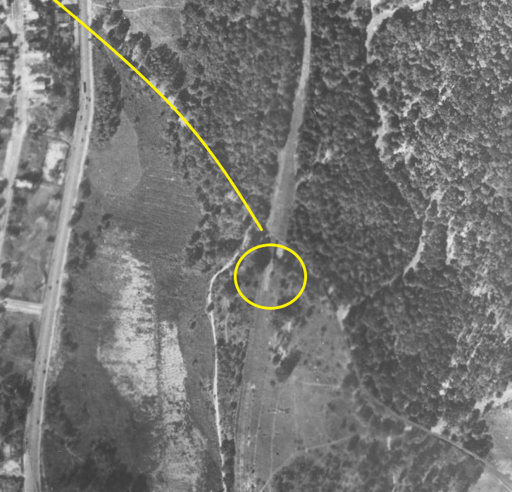
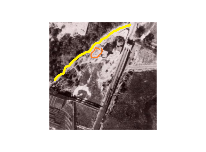
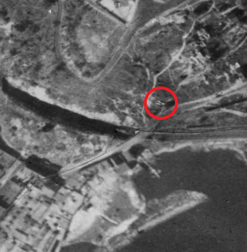
Perhaps this 1924 aerial view might show the location of the Mosholu Station.
The yellow line is Mosholu Ave that crosses Broadway and goes into VCP. The yellow circle may be the train station.
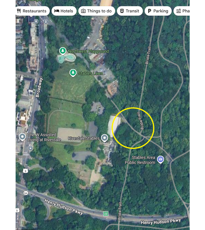
It looks as though one can drive into the Park on Mosholu Ave until reaching the stables, then there is a walking path that continues…perhaps all the way to where the station had been located.
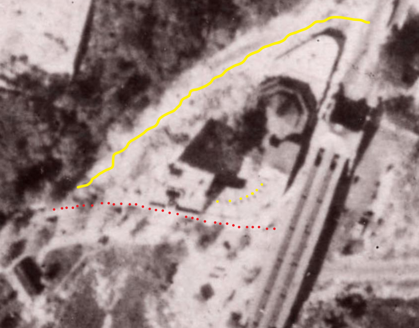
Karl, the red dots show 242nd street, the yellow line shows SDP and the yellow dots show the one-story buildings on the curve, one of which would house The French Bakery.
DWDitmars, thanks for these photos! The Old Stone House gives us a perfect “picture” of what it looked like. Do you have a date for the photo?
The pictures of the family on the porch show how “straight-laced” society was, and how uncomfortable it must have been in the summer without A/C. Moustaches were de rageux for the men as well as suits and ties and high collared blouses and maxi-skirts for the women. I’m breaking a sweat just thinking about it, lol.
Philip LeStrange,
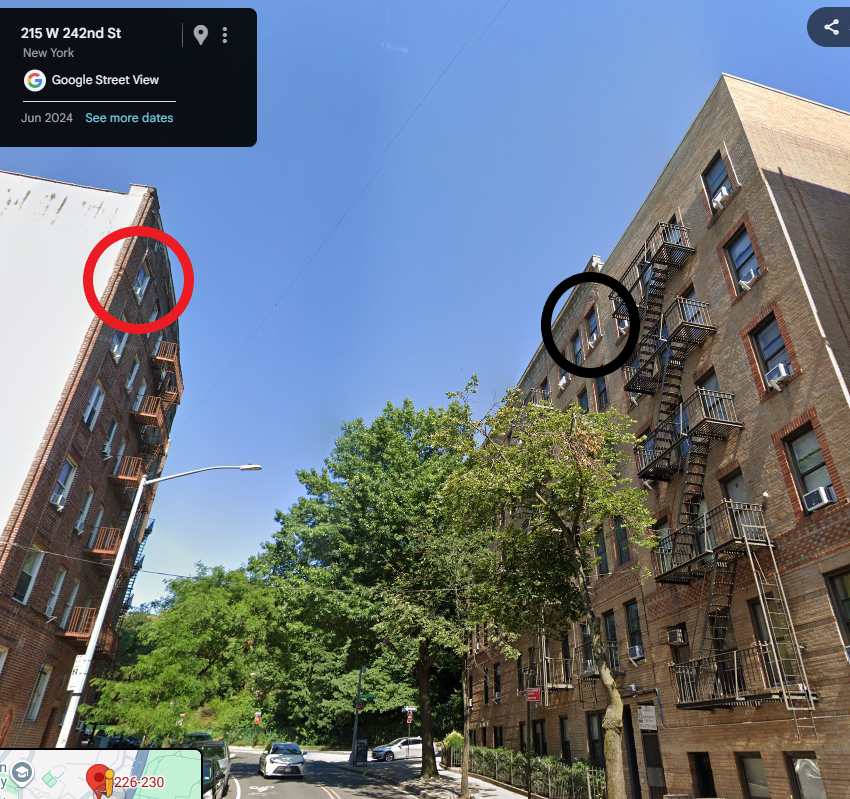
Alan Lasky has posted some pictures of a Putnam train station that may be the one you are interested in. Search for 1468 and scroll down through the pictures until you reach the two that show the station.Closer examination of the aerial photo leads me to believe that my apartment building is not in the picture, at least not completely constructed. The orange shape is where my building should be in the year 1924, right next to 215 W 242nd St. that is shown and casts a shadow. The yellow line is Spuyten Duyvil Pkwy which should go right past 4652. Perhaps construction has just begun. The resolution isn’t good enough to say for sure. According to NYCityMap, both 4652 and 215 were built in 1923 and the Then & Now app claims the photo was shot in 1924. One of those two sources isn’t completely right. Frustrating.
Karl,
According to NYCityMap 226 W 242nd Street was constructed in 1924. My building, 4652 Manhattan College Pkwy, was constructed in 1923.
I have a story about when I was a teenager and lived there. One afternoon after school I was in my room and heard loud voices. I looked out my bedroom window across to 226 and saw a fight going on in the top apartment between teenage brothers. One of the brothers was knocked against the window so hard that it broke the glass and the sash, He almost went out onto the street but luckily didn’t. I mean, he grabbed both sides of the window opening to prevent his falling. It was surreal. The picture shows my bedroom window in the black circle and the other bedroom window in red.I think that the name of the bakery was The French Bake Shop or maybe The French Bakery.
I was attending CCNY in the Fall of 1950 and then transferred to a college in North Carolina and was basically away until I got out of the Army in 1963. Prior to that we were neighbors 8^)
I’m wondering if the circled house is the Berrian-Johnson house.
Thank you Nick. From the photo it appears that the structure was razed subsequent to 7/17/1935 and prior to 1/6/1940, the date of the aerial photo (or did I overlook the house in the photo). My photo was dated circa 1940, so it may have been the last photo of the building as it stood in the Fall of 1939, I’m guessing. It looks like the property ended up being a parking lot next to 55 Knolls Crescent in the early 1950s. Sad.
Your second photo apparently was taken around 1902. Close inspection shows the words “Spuyten Duyvil” laid out on the embankment underneath the pedestrian overpass to the train station. I’m sure that they are all gone now, but can you identify any of the buildings on the hill to the left of the station?
I wonder what the story is of the boat the O.H. Notter (or Hotter, as best that I can make out). She doesn’t look seaworthy in the picture, lol.
ChatGPT estimates the population to be between 7,000 to 12,000 in 1940, depending on the boundaries chosen. Intuitively, that seems high.
Thanks for these, Nick. I wonder when the building in your last photo was razed. 2575 Palisade Ave seems to be in its location now and that building was constructed in 1958, according to NYCityMap.
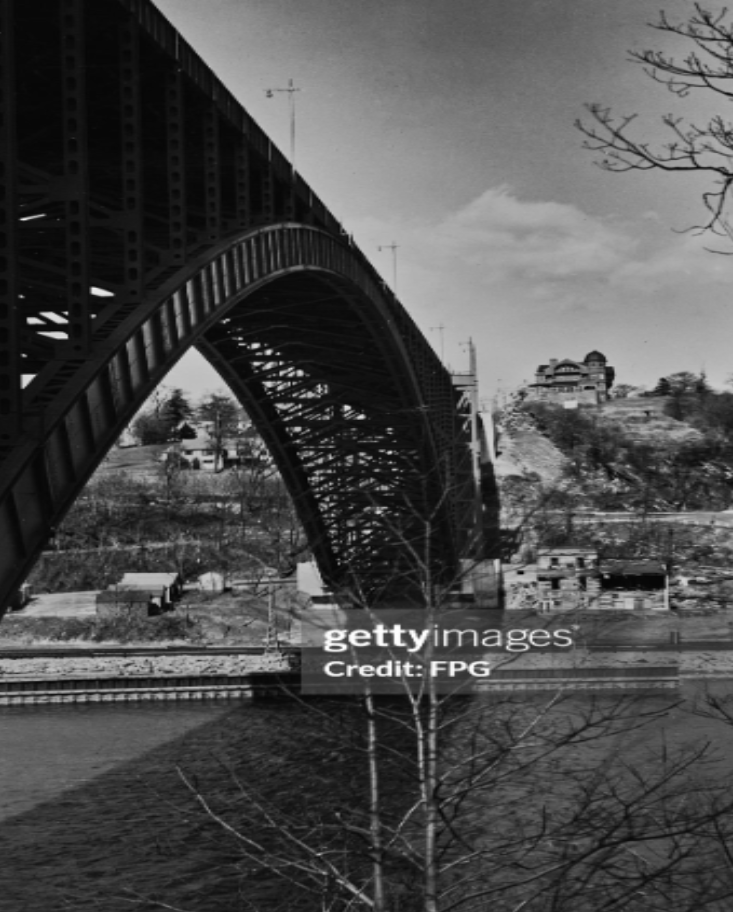
Do you have the link to the aerial photo in your first picture? I’d like to see the building that seems to be just out of frame to the right. I’ll post a photo of it below (circa 1940, Getty Images, credit FPG). Palisade Ave and Edsall Ave can be seen below it (about an inch at this scale). It’s a beauty and I’d like to know its history.
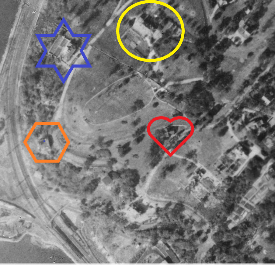
Correction of location of Villa Rose Bonheur. My apologies.
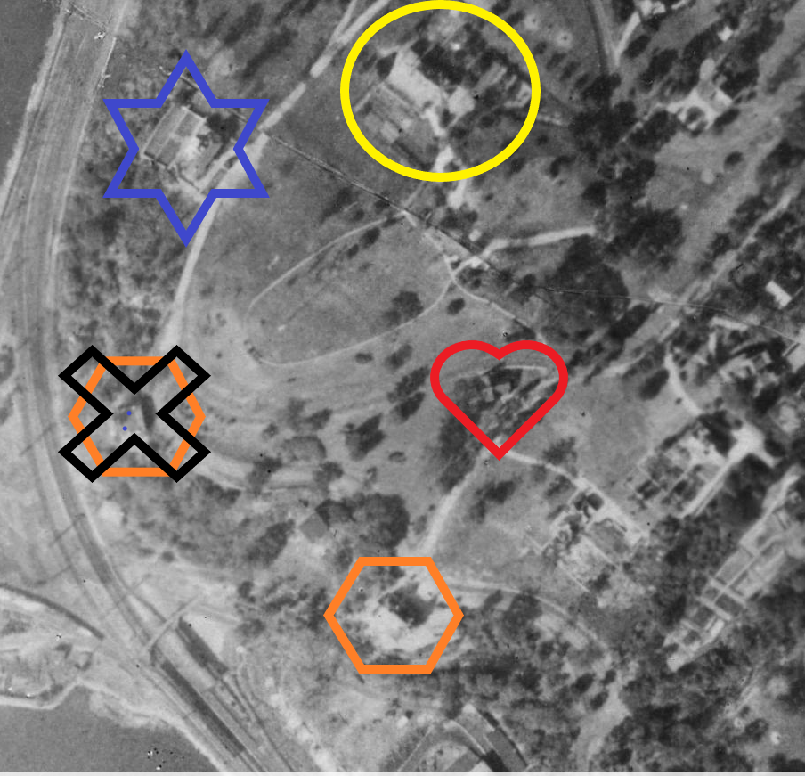 .
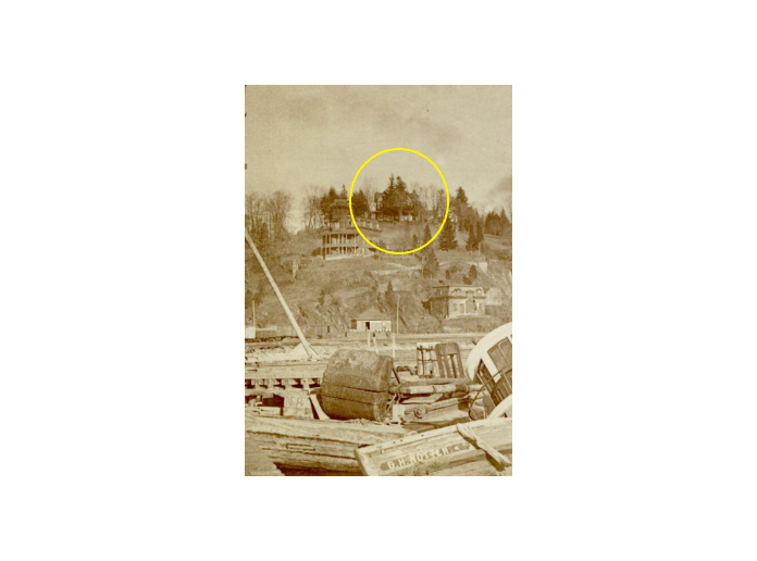
.Thank you, Peter. Would this 1924 aerial photo show the Berrian-Johnson house (circled in yellow)? The resolution prohibits greater detail, but it seems that the house is facing the East River and Inwood. It also seems to show an large cleared area in front of the house, giving us an idea of what a denuded expansive view the area would have had in the Revolutionary Period. Edgehill Church is in the red heart showing the two locations relative to one another described in the article in post #1648.
The Villa Rose Bonhuer, newly constructed, is shown in the orange hexagonal, I think.
I have no idea what the building in the blue star was. It might have been located at what is now 2521 Palisade Ave which was built in 1986 (according to NYCityMap site).
Your post #1762 above has the photo of the gavel.
Regarding the photo of sfp1979’s great great uncle, Evert Berrian Snedeker, I believe that the negative was NOT reversed. The cardigan sweater shows the left overlapping the right (the button holes on the left flap, the buttons on the right flap) as is the custom for men’s clothing. There doesn’t appear to be any buildings close to the circled house that would match that seen in the post #4876, either. I don’t think that that photo is of the Berrian-Johnson house.
I would guess that when the house was first constructed, many trees may have been felled or perhaps (not likely) there was only brush then. I’m glad you had that experience. I’ve taken it upon myself to visit the various graves of my relatives throughout the States…a somewhat weird endeavor, for sure! I’ve even found the building lot where my father, together with my grandfather, build a home in Harlan, Iowa. I have a picture of him with his family standing before the unfinished house, him being 10 years old at the time. I understand your feelings.
A hop, skip and jump away from KHS in Henry Hudson Park? Glad you found where the house was. Were you able to determine the orientation of the house with regard to the Hudson River?
Thanks for this, Stephanie, as always.
I suppose that we can infer that no “no-sublet” clause existed and that the lease was periodically renewed in good faith, since it wasn’t mentioned in the article. As far as I know, a tenant in good standing cannot be evicted until end of the lease. I wonder if that eventually happened. Housing was in great demand after WWII. Willian J. Levitt jumped on the opportunity with the Levittown development on Long Island beginning in 1947 and then in Pennsylvania and still later in New Jersey.
Blackbird1 shows us the 1930 Census indicating Rea Irvin living at an address without a street number on Kapock St on April 27th of that year. How could he not have had that as his primary address unless he was pulling some skulduggery? As you point out, on September 6th of that year the NYT published that a transfer of title of the Berrien-Johnson property had occurred sometime before that date (logically speaking) to Rea. He might have been planning to move when the census was taken or shortly thereafter when the notice of sale was announced, or perhaps it was just a serendipitous spur-of-the-moment thing for him.
I found the “Warrior” essay regarding the Irish Terrier interesting. Smart dog who knew where to get first-aid! Is this from a 1925 issue of The New Yorker? If so, I don’t understand how this demonstrates Rea not having the Kapock house, which is in the Spuyten Duyvil district, as his primary location in 1930. Also, I’m not sure that the neighbor’s dog, the Irish Terrier, fought Rea’s dog; the essay mentions “an opponent”. I’m sure that I have probably missed something. Would you point me in the right direction?
Thanks again for all this.
Disregard my last posting. It’s the wrong house.
Could this be the Berrian-Johnson house in this 1924 aerial photo?
Thank you for the link to NYC Then & Now. It’s a fascinating map. Alas, zooming in doesn’t improve the definition at all for my neighborhood. It’s interesting to see the changes. I can recall the flower arrangement that the Parks Department planted in front of the Manor house. It really was breathtaking to see the hundreds of flowers neatly planted in the grid pattern, with the marble fountain in the center. The last time I was there, probably 10 years ago, the fountain was boarded up with plywood sheets. From the 2024 photo is seems to be completely missing. Sad.
I seem to recall there being photos of the station in total disrepair…rusting away, in posts on this site. I’m sorry that I can’t be more specific. As a boy, I would on occasion in my wanderings in Van Cortlandt Park reach that area on the Putnam Trail and I can recall seeing the remains of the station, together with the stone samples that were placed there to see the effects of weather on the different types of stone. I recall climbing on them, which was a challenge for a boy. I didn’t know what they were or why they were there until I found out on this site. They were the choices for the construction of the Grand Central Terminal, I believe.
What you posit could very well be true! Two things: do we know the date of the postcard picture and (I don’t know if it matters) do we know the orientation of the house relative to the compass? The lighting of the picture indicates relatively strong sunlight. Was it morning or was it late afternoon? A mystery 8^)
I see a possible similarity between the right ears of the two gentlemen. Beyond that, there isn’t enough detail to say for sure.
When we compare your photo with that of Thomas’s postcard picture I would say that they are not the same house. I compare the number of columns from the end of the house to the steps, four in the postcard picture (including the one right at the steps) and three in your photo. Also, comparing the capitals at the top of the columns we can see different designs. Further, there are decorative fillets where the columns meet the roof in your photo that are not there in the postcard picture. I think that the house in your photo is not the Berrien-Johnson house.
-
AuthorPosts