Forum Replies Created
-
AuthorPosts
-
December 1, 2025 at 5:37 pm in reply to: Kingsbridge Burial Ground (aka Tippett/Betts/Berrian burial ground) #5077
Thanks Jonathan.
The number of burials has never been determined. We also really don’t know the spatial extent of the cemetery. There is a fence around part of it but it was installed during the 20th century.
Now there is more than one sign at the burial ground. I’ll take a photo and upload it later.
I have never seen the condemnation record but, if it exists, it would be good to know how it was worded. I believe other Bronx parks were formed after condemnation of the land. I do not know exactly why that was done but perhaps someone else has an idea.
As for the boy in the photo:
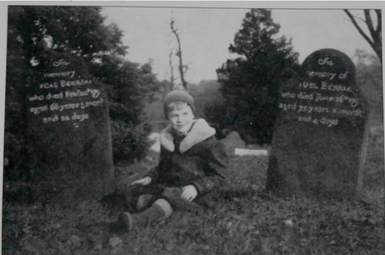
His name was Theodore Baumeister III. I first saw the photo (and the boy’s name) in Patrick Raftery’s book on Bronx cemeteries. I tracked down Theodore’s phone number and called him sometime in 2017 or 2018 when he was in his 90s and living in the south. He told me that he remembered the day that his mother took him to the cemetery to take the photo. He was a Berrian descendant and proud of it.
The headstones are now on loan to the Kingsbridge Historical Society from NYC Parks. They were a special feature of our exhibit on the Revolution. The paint or chalk that you can see in the lettering in the photo has worn away but the engraving is still very visible.
November 30, 2025 at 8:47 pm in reply to: Kingsbridge Burial Ground (aka Tippett/Betts/Berrian burial ground) #5075In doing some research on the American Revolution, I was reading a soldier’s journal and came across something that could relate to the burial grounds in Van Cortlandt Park. The journal was written by a Hessian soldier, who was stationed in the Kingsbridge area (the Hessians were the German soldiers that fought on the British side in the war). In his journal entry for July 2, 1781 he described a skirmish in what is now Yonkers:
“During the skirmish, Brigadier Buttlar was killed. He was buried, together with a Hessian jaeger, near Courtland’s house.”
I would bet that if these soldiers were buried near the Van Cortlandt House in what is now Van Cortlandt Park, that they were probably buried in the Kingsbridge Burial Ground, which is just a couple hundred yards from the house. If that’s true, over the course of the war there could have been many more buried there. There could be American, British, German and French soldiers buried there since all were involved in the fighting near Kingsbridge.
I am going to add this journal (the Journal of the Prince Charles Regiment translated by Bruce Burgoyne) to the list of known documents related to the Kingsbridge Burial Ground.
There could be more in our archives on Thomas Cuthbert. I’ll let you know if I find anything. I suspect he is too obsure of a person for AI progams to be able to produce anything on him (since AI is just looking for what has already been written about him on other websites).
If you just use Google or another search engine, you can find some information on many of the people that lived on the large Riverdale estates at that time.
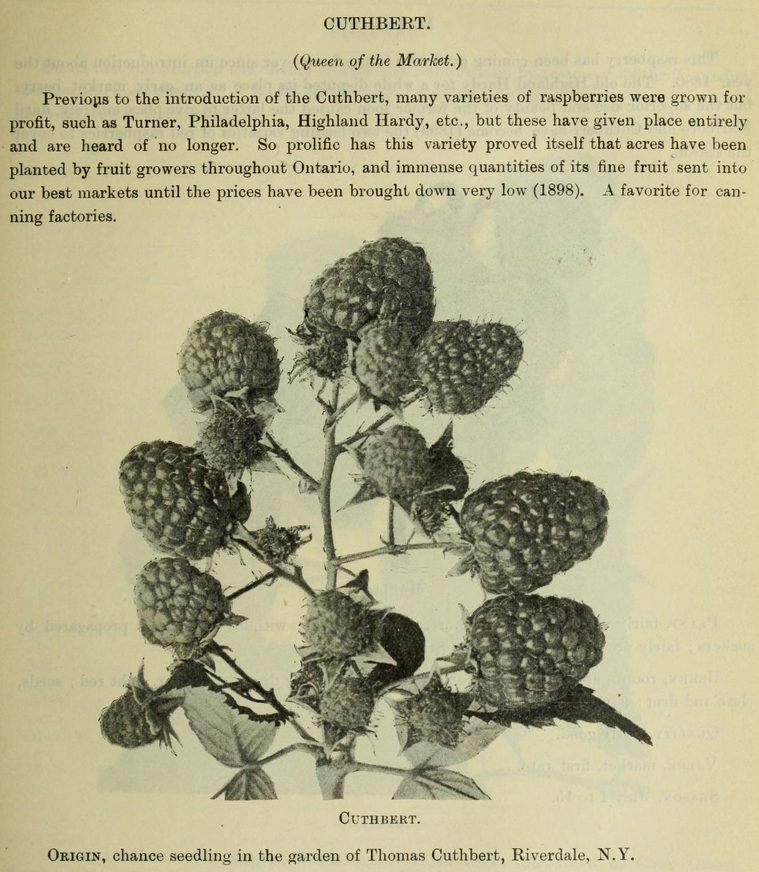
Just as an odd side note, you can see on the map above that Rosenthal’s neighbor to the north was Thomas N. Cuthbert living on “Cuthbert Lane” (today’s W. 261st Street). It was on that property that a genetic mutation resulted in a special variety of raspberry bush: the Cuthbert Raspberry. Seedlings from that raspberry were grown on farms all over the country and it became the dominant raspberry in the market for over 50 years.
Thanks Jonathan. We are definitely are thinking about cost and durability. But we are also limited by what the NYC Landmarks Preservation Commission will allow based on its status as an individual landmark. Slate is beautiful and durable but it would be unlikely to get approved by the landmarks commission since the building never had slate historically.
If you were unable to attend last week’s meeting about the Croton Aqueduct you didn’t hear our big news. Please see this announcement that was sent out from NYS Assemblyman Jeffrey Dinowitz’s office:
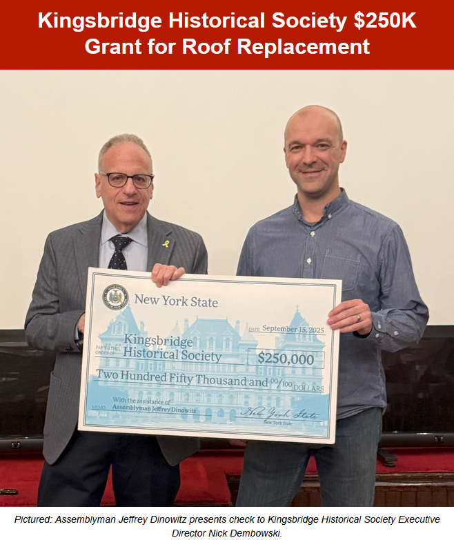
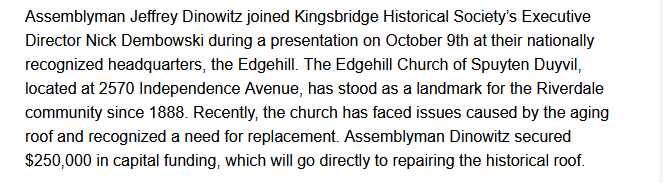 This $250,000 grant will cover the cost of replacing the roof and gutters at Edgehill and we could not be happier about it. The roof situation was our biggest and most expensive problem and it now has a solution. Please note that NYS capital construction funds often take more than a year to be dispersed so work will not begin imminently. But we can all breath a sigh of relief and look forward to that day. We are so appreciative that Assemblyman Dinowitz thought our group was worthy of this generous allocation.
We wish to thank all of you for your participation in the KHS. New York State does not give out money to save historic buildings unless they are actively serving the community. So, without your support and participation this would not be happening.
There is an article in this week’s Riverdale Press about the grant. Once it is made available on their website I will post it here.
[caption id="" align="aligncenter" width="988"]
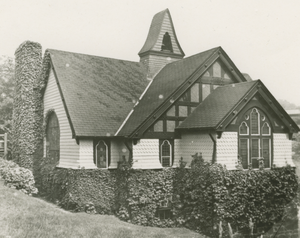 A view of Edgehill circa 1940[/caption]
I was writing my post as you were writing yours, Jonathan. But it looks like we are in agreement.
I do not have a date for the postcards but the document Tom shared contains a useful clue. If the locust grove was northwest of Van Cortlandt Station, this aerial view of the park from the early 20th century is helpful:
For orientation, Van Cortlandt House is on the top right and Van Cortlandt Station is bottom center. The view is looking north/northwest. I am thinking the locust grove was probably this allée of trees:
That would have been along the same park trail east of the Van Cortlandt House Museum that is currently lined with trees (a few of which are locusts):
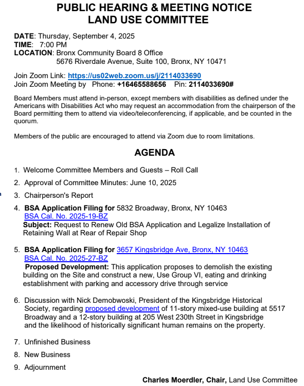
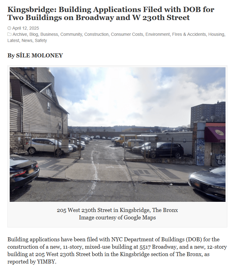
For anyone that is interested in this proposed development at W. 230th Street and Broadway, I have been asked by the Land Use Committee of Community Board 8 to appear at their meeting tomorrow, Thursday September 4th, to discuss the matter. We would like to work something out with the development company to ensure that human burial sites are not destroyed when the foundation for the new building is excavated. When the Kingsbridge Post Office was built in 1951 on the adjacent lot, multiple burial sites and ancient artifacts were uncovered on the property. This led Bronx historian Theodore Kazimiroff to call the site the “most notable” indigenous “village site” in our area.
The meeting starts at 7:00 PM and this is the Zoom link:
Join Zoom Meeting: https://us02web.zoom.us/j/2114033690
Join Zoom Meeting by Phone: +16465588656,,2114033690# US (New York)
Meeting ID: 211 403 3690This topic is the last item on the agenda so there is no need to tune in exactly at 7:00 PM.
Yes, that’s it.
Hi there.
From what I have read…
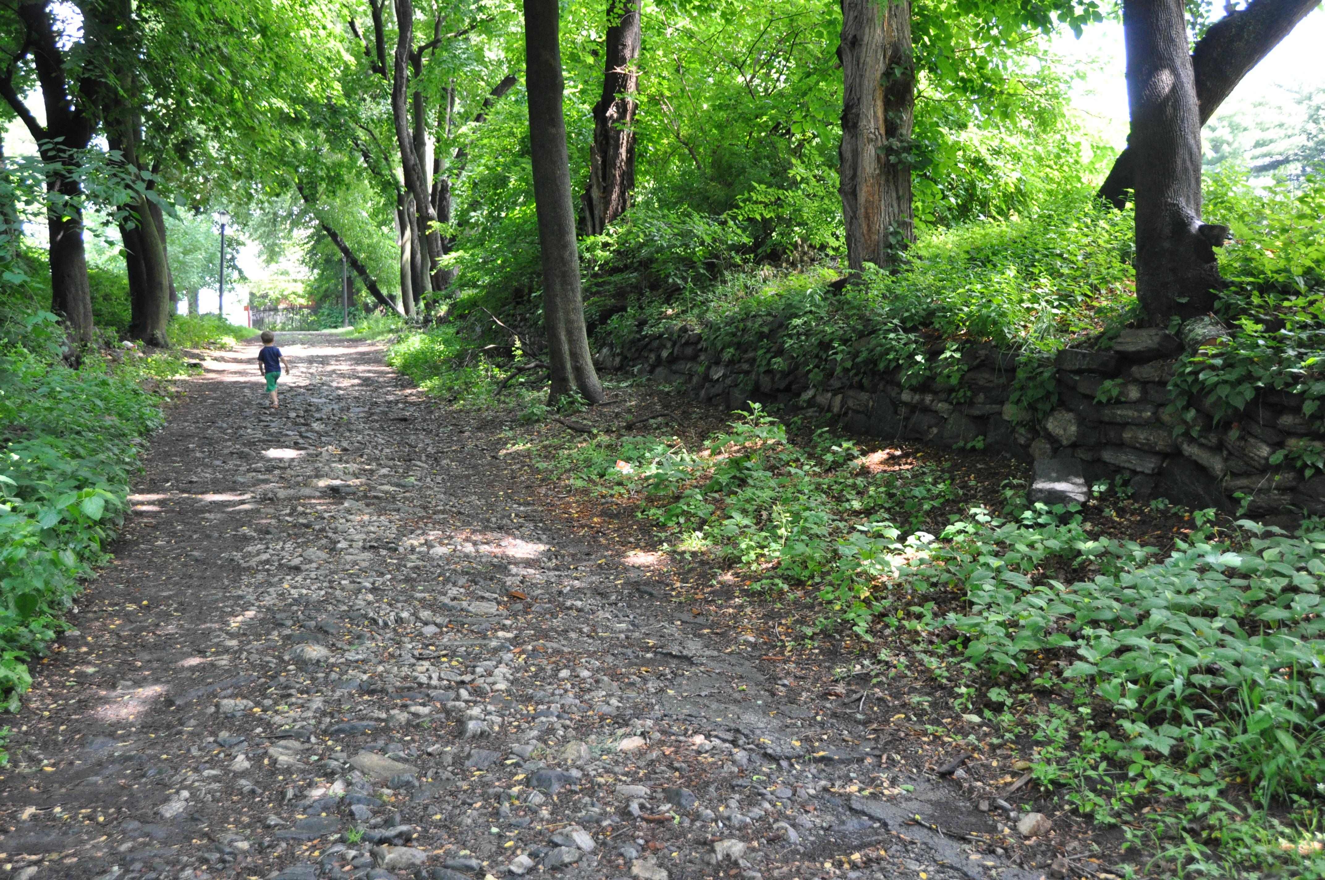
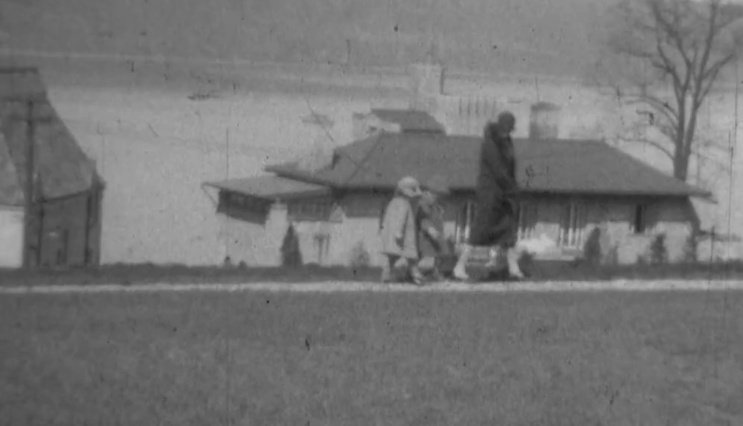
1A) There were fish and other wildlife in the brook. In this forum thread, you can see a photo of a man fishing where Gaelic Park is today. Kingsbridge was well known as a good fishing spot.
1B) I have not seen anything about industrial waste or sewage flowing into it. While there was no sewer system until the 20th century, the homes had outhouses in their back yards. Locals swam in Tibbetts Brook so it probably was not too bad.
1C) I think the large landholders that owned property in Kingsbridge stood to gain financially from burying Tibbetts Brook. Once the land was dry, it became valuable for development. The neighborhood was prone to flooding as well from all of the waterways and locals were agitating to have sewers installed. There is more information about that in this forum thread.
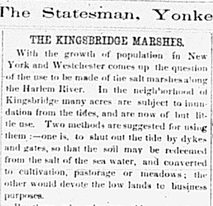
The salt marshes adjacent to the brook were not desirable by the late 1800s. This is from an 1869 Yonkers Statesman newspaper article:
1D) Tibbetts Brook could not have been navigable for large boats but it was for smaller ones. There was a town dock near the site of Gaelic Park. It was used a landing back in the 1700s and it was called “Stony Brook Landing.”
That’s great, Buddy. The Riverdale Press archives have been so useful for local history that I wish your father started it a decade earlier.
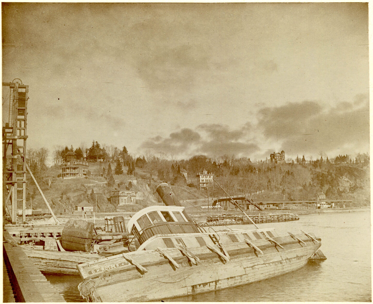
Here is a link to the aerial view in the New York City Municipal Archives, Jonathan. I really like the photo:
Here is link to a photo of the house you are interested in, Jonathan.
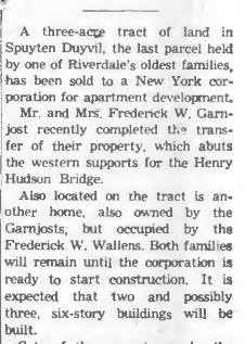
It was a beauty but was torn down not long after the Henry Hudson Bridge was completed. It belonged to the Johnson family although I would have to check our archive to figure out which Johnsons lived there. In the 1850s, the Berrians sold the entire southern half of Spuyten Duyvil to Elias Johnson and the other industrialists that owned the Johnson Stove Works and rolling steel mill. The Johnsons were a big family so they occupied many of the houses on the hill.
Here is another photo that shows the house (on the crest of the hill, right side) before the Henry Hudson Bridge was built. The view is looking toward Spuyten Duyvil Hill from the Spuyten Duyvil train swing bridge at the base of Inwood Hill.:
Hi Jonathan.
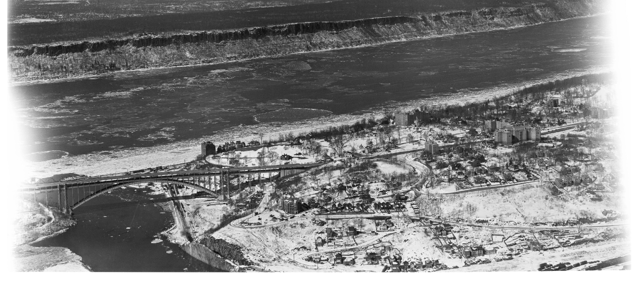
Here is another angle of that corner of Spuyten Duyvil. This is a 1940 aerial view:
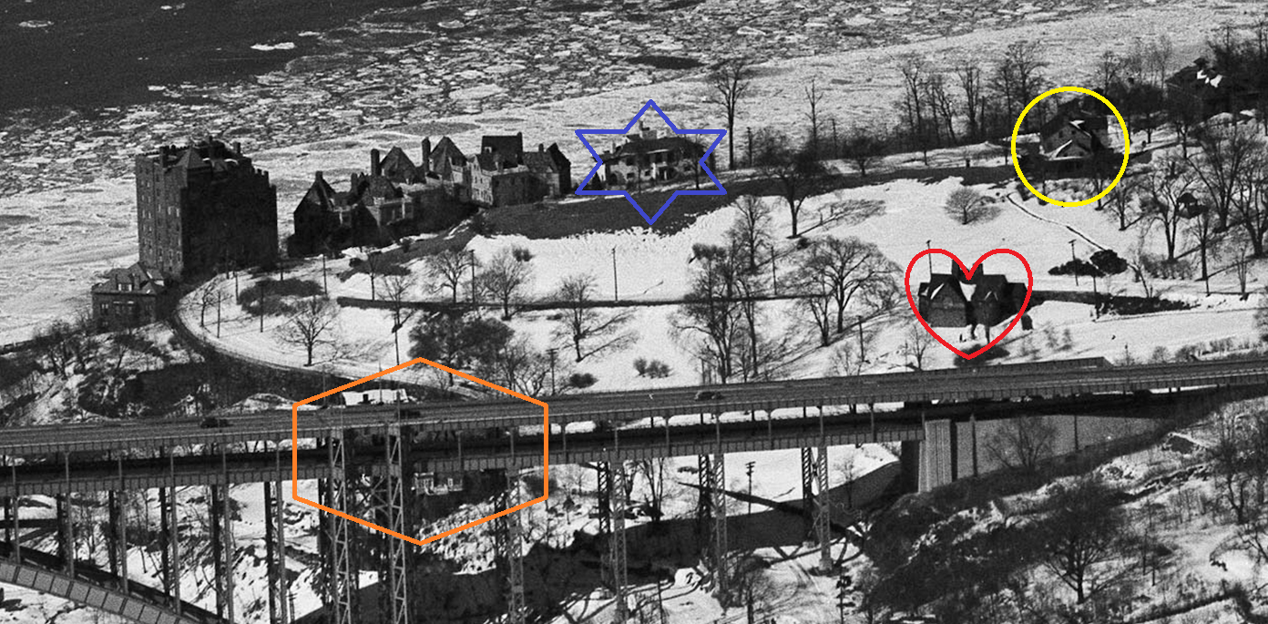
I used your shape/color scheme:
red heart = Edgehill Church
blue six-pointed star = Palisades Ave house
yellow circle = Berrian-Johnson House
orange hexagon = Villa Rosa Bonheur (obscured by bridge)
Here it is with no annotation:
I wonder how many people lived in this area at that time vs. now.
Here is a view of the house on Palisades just to the north of the Charlotte Bronte. I don’t have a date on this.
I too believe that the photo in post #4876 might not have been taken in front of the Berrian-Johnson House. But it could have been taken in front of another house belonging to the Berrians in the neighborhood. The Berrians had multiple houses on Spuyten Duyvil. For a while, the hill was known as Berrian’s Neck. They also had property in Kingsbridge and Fordham. Even the Edgar Allen Poe house on Kingsbridge Road was once owned by the Berrians. They were a big family spread all over The Bronx.
If you are asking about the grocery store that was connected to the Amalgamated Co-ops, I would recommend getting in touch with the librarian in the special collections room at the Leonard Lief Library at Lehman College. They have a great deal of material and expertise about the Amalgamated Co-ops. I think the library has issues of a monthly publication that was published by the co-ops.
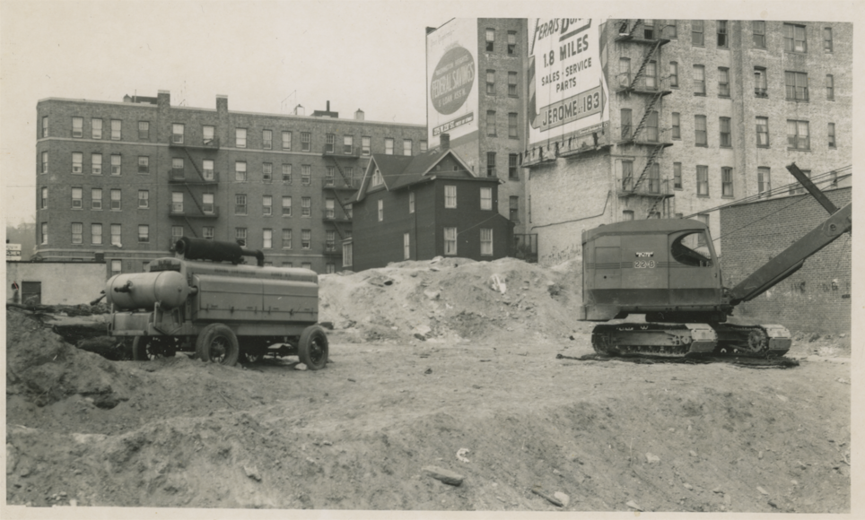
You are correct! That is indeed a photo from the construction of the Kingsbridge Post Office at W. 230th Street and Broadway in 1951.
Here is the full image taken from about Broadway looking to the northwest (the excavators are working close to Broadway and the old brown house that still stands on Godwin Terrace can be seen in the background):
And to Tom’s point, this site is very well known to local historians. I can’t think of a place in the Bronx with a longer and richer history. This is the approximate location of the “wading place,” where indigenous people could cross the Spuyten Duyvil creek to get to the island of Manhattan from the mainland. That’s because before the 20th century, the Spuyten Duyvil Creek flowed where W. 230th Street is today.
The animation below shows the corner of W. 230th and Broadway today and what that same scene looked like 200 years earlier. Note that the Spuyten Duyvil Creek flowed on the same course as W. 230th Street.
When the Kingsbridge Post Office was constructed in 1951, the construction site was excavated by local historian Theodore Kazimiroff and others. They found the buried remains of what was apparently a Revolutionary War soldier (he had a musket ball in his chest). Kazimiroff also found many indigenous artifacts and called it the “most notable” indigenous “village site” found in our area. This is the same approximate location of a colonial-era tavern, which was built in 1669. That tavern had a long history which I explain in this video if you are interested.
I have had my eye on the parking lot behind the post office for some time:
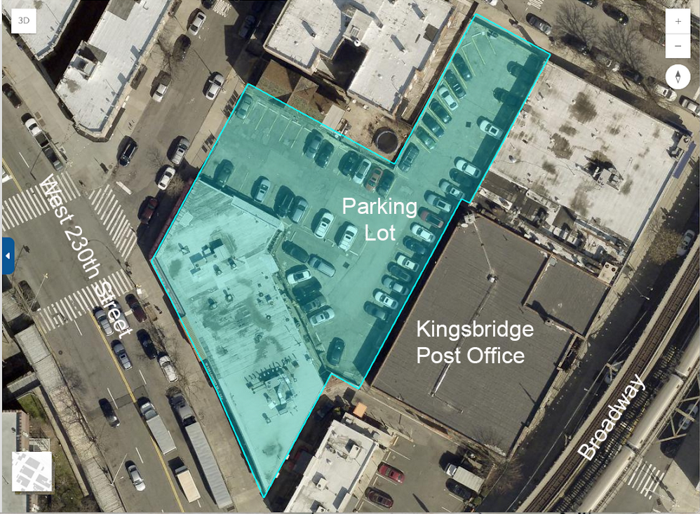
As far as I can tell, there has never been a building constructed where the parking lot is located. That means that there is a very good chance that cultural artifacts are still buried beneath the lot, as was true of the post office site. A few years ago, KHS member Julie Abell Horne helped me mark the parking lot site on New York State’s Cultural Resource Inventory System–hoping that an archaeological review would be mandated if the parking lot were ever developed. It now appears that the lot will be developed soon. Applications for building permits at the Department of Buildings indicate that a large apartment building will be built there (Block 5700 and Lot 78). It does not appear that there will be a mandated archaeological review. But I hope that an agreement can be reached with the developer to allow for archaeological monitoring through the excavation process. Otherwise important cultural artifacts could be hauled away in a dumpster.
A recent story in the Norwood News:
Today the Preservation League of New York State placed the Church of the Mediator on its “Seven to Save” List for 2025-2026. Apparently, the Preservation League usually does not highlight buildings in New York City so this is significant:
https://www.preservenys.org/blog/seven-to-save-2025-2026-edition
Hopefully, this will help save the building.
We can relate, Lewis. Edgehill has its own city-owned retaining wall in need of repairs.
I will look for a photo and post it if I can find something.
March 11, 2025 at 6:21 pm in reply to: Ethical Culture Fieldston Campus and Lincoln’s Collector #4674You should be able to order a better copy of Hiram Barney’s Cedar Knolls property from “Historic New England.” Here is the link to the Barney photo album in their collection:
https://www.historicnewengland.org/explore/collections-access/gusn/285244
The Huntington Library (the California one, not the Bronx one) has the Hiram Barney papers which apparently includes information about his New York real estate:
https://oac.cdlib.org/findaid/ark:/13030/tf658004sg/
The results from these large real estate auctions were often written up in the newspapers so you might want to search for newspaper reports from the time to find out how the whole estate ended up in the hands of the Ethical Culture Society.
One thing I didn’t mention in the thread above is that Hiram Barney wrote about meeting Lincoln before the Emancipation Proclamation. It is a fascinating account:
On the morning of the 5th of September I862, Colonel John Hay
the Private Secretary of the President came to me while at breakfast at
Willards Hotel and asked when I intended to leave Washington. I re-
plied that I intended to go home by the evening train of that day. He
said that the President had sent him to request that I would see him before
leaving the the city. I promised to call at the Executive Mansion between
the hours of one and two o’clock.When I called in fulfillment of the appointment, Louis the door keeper
said “the president expects you but he has gone to the Navy department
and wishes you to find him in Mr Wells’ private room.” He was with
Mr Wells when I opened the door and I thinking I might be interrupting
a private conversation I apologized and was withdrawing, when both
said “come in come in” and Mr Lincoln said “We have no secrets from
you.” We sat in conversation upon topics of general interest for a few
minutes, when Mr Lincoln laid his hand upon my knee and said “I want
to see you”-and added, rising “Come with me.” I followed him to the
War Department-he walked very rapidly-so fast that I had to trot
to keep up with him. The Secretary of War had three private rooms-we
entered the first-no one was there. Mr Lincoln closed the door and we
went into the second which was also unoccupied, and Mr Lincoln closed
the door of that room also-we then proceeded to the third room the
door of which was also closed when the President said, “There, now
I think we will not be interrupted”-and added, “I have something to
show you which I think will please you.’ He then drew from the left
breast pocket of the dress frock coat which he wore a manuscript and
read it to me. It was his first emancipation proclamation. When he had
read it he handed it to me to examine. I looked it over and saw that it was
all in his own hand writing with which I was familiar. I then returned
it to him remarking upon its character and upon the consequences of its
promulgation and expressing my gratification that he had come to the
conclusion to which he had been so long urged by many earnest patriots.
I then asked him to read it again. He said “you must not talk about this
-for no human being but yourself has seen it or knows anything about
it.” I said “I thank you for this confidence and you may be sure that I
will respect it. My object in asking you to read it again is to offer
one or two suggestions if I heard aright. He said he would be very
thankful for any suggestions and immediately read it again. I offered
only one suggestion which he said he approved and would adopt-it was
the only change from the draft that I recognized in the proclamation
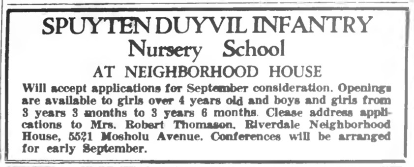
which was issued on the 22nd of September.Thanks for the post and photos everyone. It does seem like the Spuyten Duyvil Infantry moved around quite a bit. Once the construction is finished at Edgehill, we can look through the back issues of the Riverdale News from the 1920s to see if there was some kind of announcement when it opened.
I wonder if the school had any relationship with Edgehill Church. You mentioned that it started out in the back yard of Mrs. Frederick Garnjost. She was born Jane Bradley Johnson, the daughter of James Johnson–one of the sons of Isaac G. Johnson who ran the iron and steel works on the Spuyten Duyvil Creek. The Garnjost home was just about across the street from Edgehill Church at the bottom of Independence Ave where it intersects with Palisade Ave, near modern day 2390 Palisade Ave:
[caption id="" align="aligncenter" width="876"]
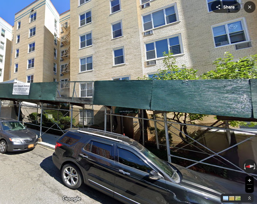 View looking northeast on Independence Ave.[/caption]
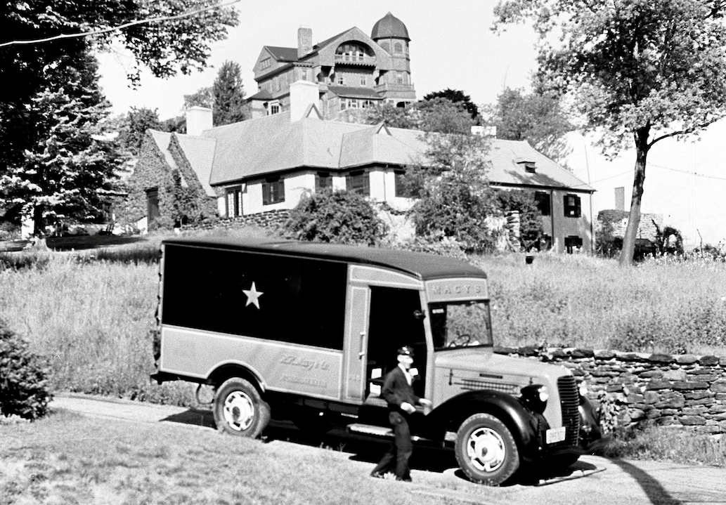
When the Garnjosts lived there, Spuyten Duyvil looked a lot different. Here’s a view of their house in the mid-1930s. The Garnjost home is below in the foreground and another home belonging to the Johnsons can be seen in the background. It looks like someone just got a delivery from Macy’s. The truck is on what is now Independence Ave but was then a private road owned by the Johnsons:
Jane Garnjost was involved with the church school at Edgehill Church. Was this something different than the Spuyten Duyvil Infantry or were they the same thing? In the basement of Edgehill there still are a bunch of tiny antique wooden chairs that would be ideal for a nursery school.
[caption id="" align="aligncenter" width="532"]
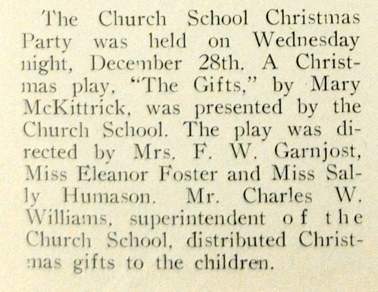 From the 1939 Riverdale News[/caption]
Jane Bradley Garnjost was a charter member of the Kingsbridge Historical Society. Apparently she was also one of the last of the Johnson descendents living in Spuyten Duyvil:
I also found this in the September 4, 1952 issue of the Riverdale Press if it is useful:
My daughter attended Spuyten Duyvil Pre K at its current location in the old Kingsbridge Library. One of my favorite things about it is a huge chunk of locally quarried marble in the back yard. If you ever feel like you need to get rid of that rock, please donate it to the Kingsbridge Historical Society!
Some of those structures were part of the James Douglas estate, which was later occupied by UN Secretary General, U Thant. Here is part of a 1948 photo from the NYS Archives (labels added by me). You can see the pool on the left partially obscured by the word “House.”

Here is a little more information about the park: https://kingsbridgehistoricalsociety.org/forums/topic/raoul-wallenberg-forest-2/
This thread also discusses the area: https://kingsbridgehistoricalsociety.org/forums/topic/the-hudson-river-and-railroad-illustrated/
To my knowledge, all of the kilns would be across Palisade Ave in Riverdale Park. Those were part of the local lime mortar manufacturing enterprises of the early 19th century (but possibly earlier as well).
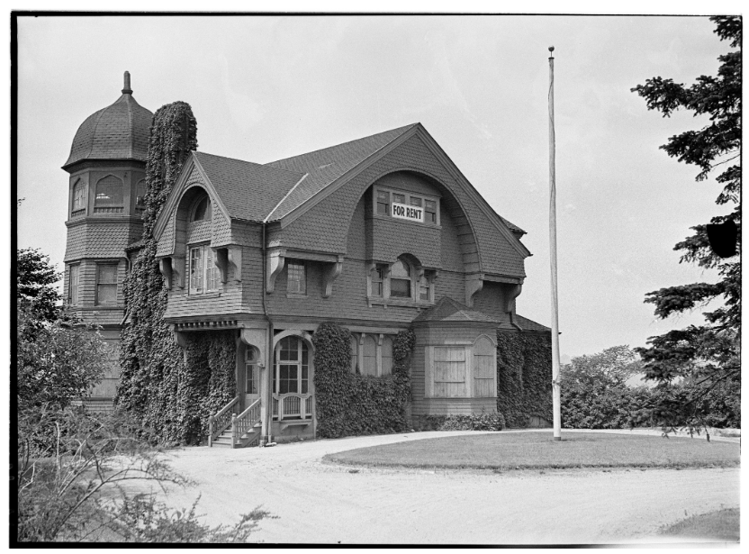
November 10, 2024 at 9:24 am in reply to: Beautiful Riverdale “Victorian Home” To Be Torn Down–How old is it? #4502Here is a view of the Victorian Home from the 1850s, drawn by Edwin Whitefield. This shows the home when it was owned by James E. Bettner. The artist drew many local homes from that time period. More about that here.
 September 17, 2024 at 4:01 pm in reply to: Beautiful Riverdale “Victorian Home” To Be Torn Down–How old is it? #4395
That’s interesting Richnhil. I imagine the house has a lot of memories that were made in the 20th century as well.
As an update, the Land Use Committee of Community Board 8 has referred the matter to the Landmarks Preservation Commission. I formatted my research on the house to include footnotes here.
The Hebrew Home has agreed to refrain from demolishing the house until after January 1, 2025 to give the Landmarks Preservation Commission some time to review the issue.
September 9, 2024 at 1:30 pm in reply to: Beautiful Riverdale “Victorian Home” To Be Torn Down–How old is it? #4390The Land Use Committee of Community Board 8 will discuss the issue of the “Victorian Home” this Wednesday, September 11th. The meeting starts at 7:00 PM but there are a couple of other items on the agenda first. So, you might want to tune in at 7:30 or so if you are interested. The Zoom link to join the meeting is:
Join Zoom Meeting: https://us02web.zoom.us/j/2114033690
Join Zoom Meeting by Phone: +16465588656 Meeting ID: 2114033690#
September 3, 2024 at 1:13 pm in reply to: Beautiful Riverdale “Victorian Home” To Be Torn Down–How old is it? #4375Thank you for that information Julie. I had no idea that process was so easy.
The utility building that stood on the site of Warner’s barn (and that was torn down recently) does not appear historic after reviewing recent photographs. This is from Google Street View:

Thank you Karen Argenti and Jodie Colon for sending me this photo of the “Victorian Home” from the Environmental Assessment:
 August 31, 2024 at 10:32 am in reply to: Beautiful Riverdale “Victorian Home” To Be Torn Down–How old is it? #4369
Some additional facts about the property that folks might find interesting:
- I mentioned that John Warner, who lived in an earlier version of the “Victorian Home,” was elected to serve as the captain of the Yonkers militia during the American Revolution. He was the 2nd captain to have the post becausethe 1st captain turned out to be a secret agent for the British!
- The property adjacent to the house was used as a rock quarry by the Warners and by James E. Bettner, who made a business venture out of it in the 1800s. The stone was loaded onto boats and taken down to the city where it was used for building.
- People driving through the “estate area” of Riverdale today are often shocked by the condition of the roads, which are riddled with potholes. As you can see in the maps above, a section of Palisade Ave started off as the road to Warner’s dock. If Captain Warner had his way, the roads would be in much better shape. In his will, he ordered that the road leading to his house and dock “shall at all times be kept in good repair fitting for the passage of carriages.”
- The Warners continued to be a well-known family in the area even after they sold their land to Better. The Warners ran a popular country store near W. 242nd Street and Broadway and, for a period, that area was known as Warnersville. The Warners married and were related to all of the other early settler families: the Dyckmans, Tibbetts, Hadley, etc.
- On the upper right hand side of the below map animation, you will see that the 1837 property map indicates a barn with the same footprint as one of the “utility buildings” that are slated for demolition. This utility building, if I recall correctly, also has victorian elements to its design. That could also be a very old building.

-
AuthorPosts