Forum Replies Created
-
AuthorPosts
-
Here is a thread with more information.
If you zoom in on the facade of the building, you can almost see the words: “Old Bridge Tavern and Restaurant.”
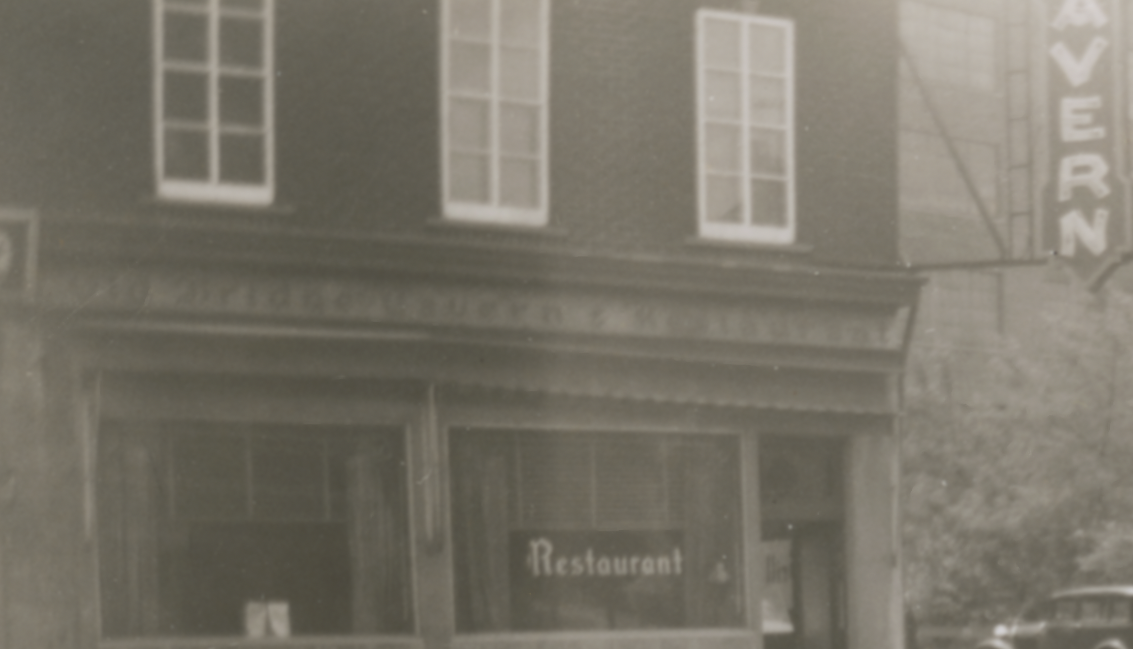
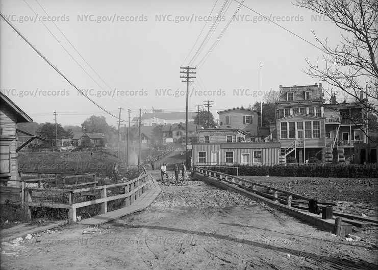
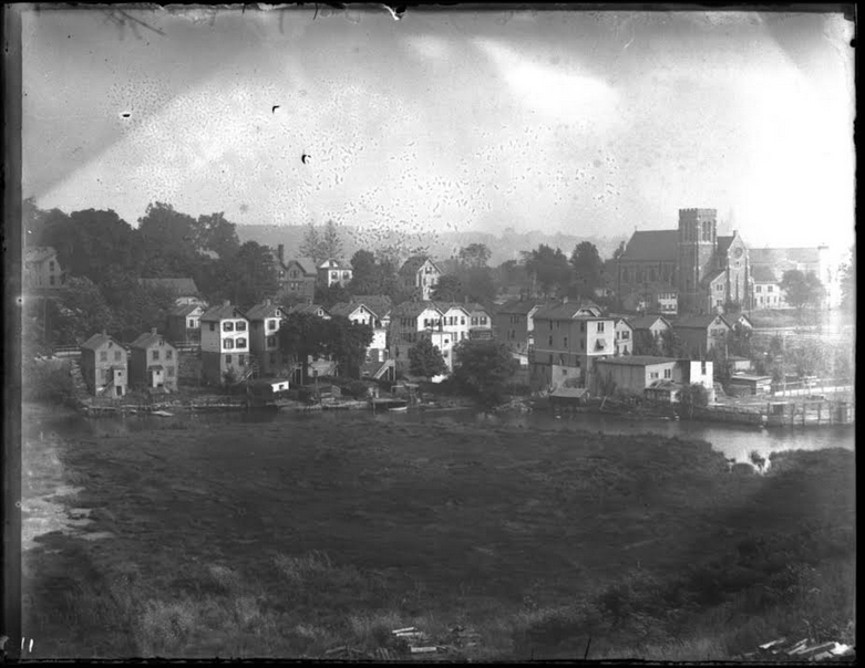
Somehow I didn’t notice this question before today. I also wish I knew a little more about the Old Bridge Tavern. But I do know it was situated at the southeast corner of W. 230th Street and Kingsbridge Avenue. You can see it in the foreground of this remarkable early 20th century panorama (NYHS):
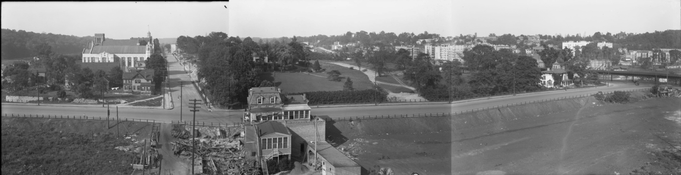
The view is looking north from Marble Hill. That is W. 230th Street runnging across the middle of the photo and Kingsbridge Avenue running perpendicular to it on the left. Along Kingsbridge Avenue you can clearly see St. John’s-Visitation Roman Catholic Church and the tower of the Church of the Mediator poking out behind it. On the far right, you can see the elevated train above Broadway with the Godwin Mansion at the corner of W. 230th St. and Broadway (where today there is a Dunkin Donuts). The lower half of the photo is newly created dry land from the filling in of the old Spuyten Duyvil Creek.
The tavern was clearly an old building with a mansard roof as you can see in this 1949 photo (view looking north at the back of the tavern from Kingsbridge Avenue):
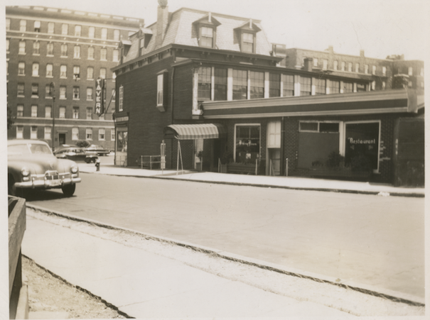
A view from the other side:
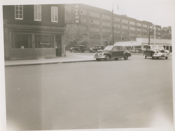
That’s the modern day U-Haul Building in the distance. Today the Old Bridge Tavern property is part of the playground.
Here is a great photo of the Old Bridge Tavern on the right with the “old bridge”–the Kingsbridge–still visible, even after the creek had been filled in (municipal archives).
The plaque about the Wading Place is located on the exterior of St. Stephen’s Methodist church on Kingsbridge Avenue and W. 228th Street (pictured center left):
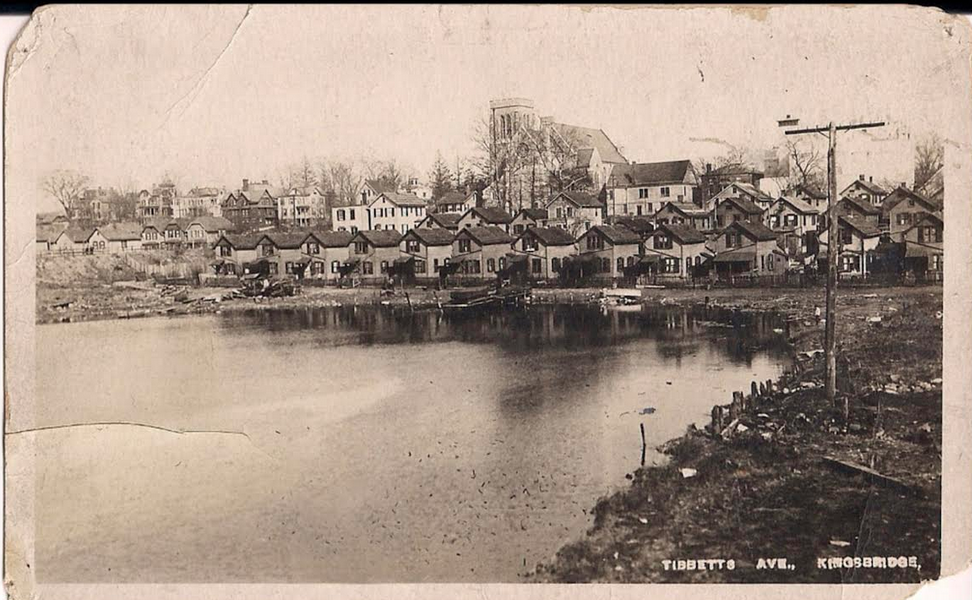
That’s the same approximate view as this turn-of-the-century photo that shows the Kingsbridge over the Spuyten Duyvil Creek with St. Stephen’s in the background behind the trees:
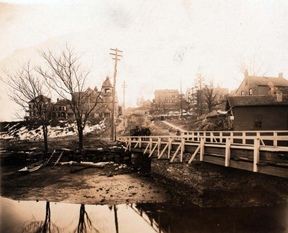
That’s low tide and it does look like you could wade across. Before the bridge was built in 1693, farmers would drive their cattle over the creek in low tide. The plaque states there was a second bridge built in 1713 but I have never been able to find a document explaining that.
Whelan’s garage is refered to (but not by name) in this memoir written about Kingsbridge in the 1920s on page 15.
I also noticed the Whelan name come up on page 14 of this document listing local men that served in WWI. William McBride Whelan and James Whelan are listed.
Eventually, when our headquarters at Edgehill is fully set up, we will house our archives there. They are currently not accessible. We have some issues of the Riverdale News (the predecessor to the Riverdale Press) in our collection and you might have luck finding some information there down the road.
How long did the business last?
Regardless of whether the terms Mosholu or Keskeskick were ever used to describe the Native American settlement in modern Van Cortlandt Park, it was certainly one of the larger settlements in our area.
I just posted an article from 1890 about the excavation of a Native American village site on the Van Cortlandt Parade Ground. The amateur archeologist that explored the site, J.B. James of Riverdale, uncovered human remains and artifacts that are now in the collections of the American Museum of Natural History and the Smithsonian.
The transcribed and annotated article is available here.
Another local name seems to only appear in one colonial document: Keskeskich. I would feel more certain about the provenance of the word if it had been repeated elsewhere.
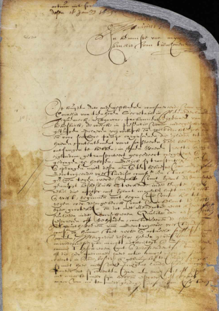
It comes from a 1639 land deed describing the sale of land from “Tequemeck, Rechgawac, Packamieus, owners of Kekeskich” to the Dutch West India Company. The land is described as:
a piece of land, located opposite to the flat on the island of Manhattan, called Keskeskich, stretching lengthwise along the flatlands, which runs behind the Island of Manhattan mostly east and west and beginning at the head of the said kil and running opposite of the high hill by the flatlands, namely by the Great Kil, with all rights titles etc.
This is generally thought to describe at least the western part of The Bronx. It is interesting to think that the purchaser was a company. Photo of the deed:
That makes sense, Tom. Earlier you mentioned the name Gowahasuasing. I think that comes from the deed to Fordham Manor that was executed in 1669 between John Archer and local native people. Fordham Manor was the area south of Kingsbridge Heights along the Harlem River and the deed is a treasure of local place names. Check out how the boundaries of the land are described:
a certaine Tract of Upland & meadow ground upon ye maine, begining Westward from a certaine place by ye Indians comonly called Mascota so it goes to another place called by them Yowahamasing & from thence Round about ye Kill called Papiriniman & so to run into Harlem Ryver at ye Hook called Saperewack . . .
Muscota (or Muscoota, Muskata, Musceeto, etc) seems to have been more of a description than a name. It meant something close to “wetland” so you see it used to describe several different places in our region. In the Fordham deed, it describes the Tibbetts Brook estuary. Side note: I don’t think “Mosholu” was ever used to describe Tibbetts Brook and if you feel like taking a deep dive on that issue, you can read this. I have seen Saperewack associated with Marble Hill and Yowahamasing or Gowahasuasing as the peninsula that historically jutted out from Spuyten Duyvil Hill before it was obliterated for the Harlem River Ship Canal. The tricky thing about some of these terms is that they only appear in one document, which makes it hard to confirm their veracity.
W. 225th Street, where it passes in front of Target, was once called Muscoota Street. You can see it labeled in this interesting map from 1900, which also shows the brief period when Marble Hill was an island.
Thanks for those, Tom. Where is the 2nd clipping from? It seems to allude to doubt surrounding Nipnichsen’s historic connection to our area.
Nipnichsen would seem to be one of the few names that survived into the 20th Century on Spuyten Duyvil Hill. There was William Muschenheim’s “Nipnichsen Terrace” near the Henry Hudson monument. In The Story of The Bronx, Stephen Jenkins wrote that when Muschenheim built his house, “both Indian and Revolutionary relics were unearthed,” which may have had something to do with the name.
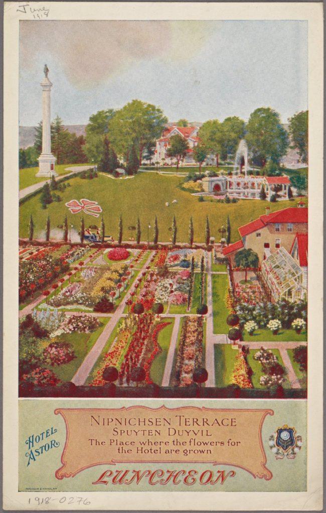
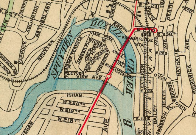
And there was the Nipnichsen Club, a social and tennis club that stood at W. 230th Street and Fairfield Ave
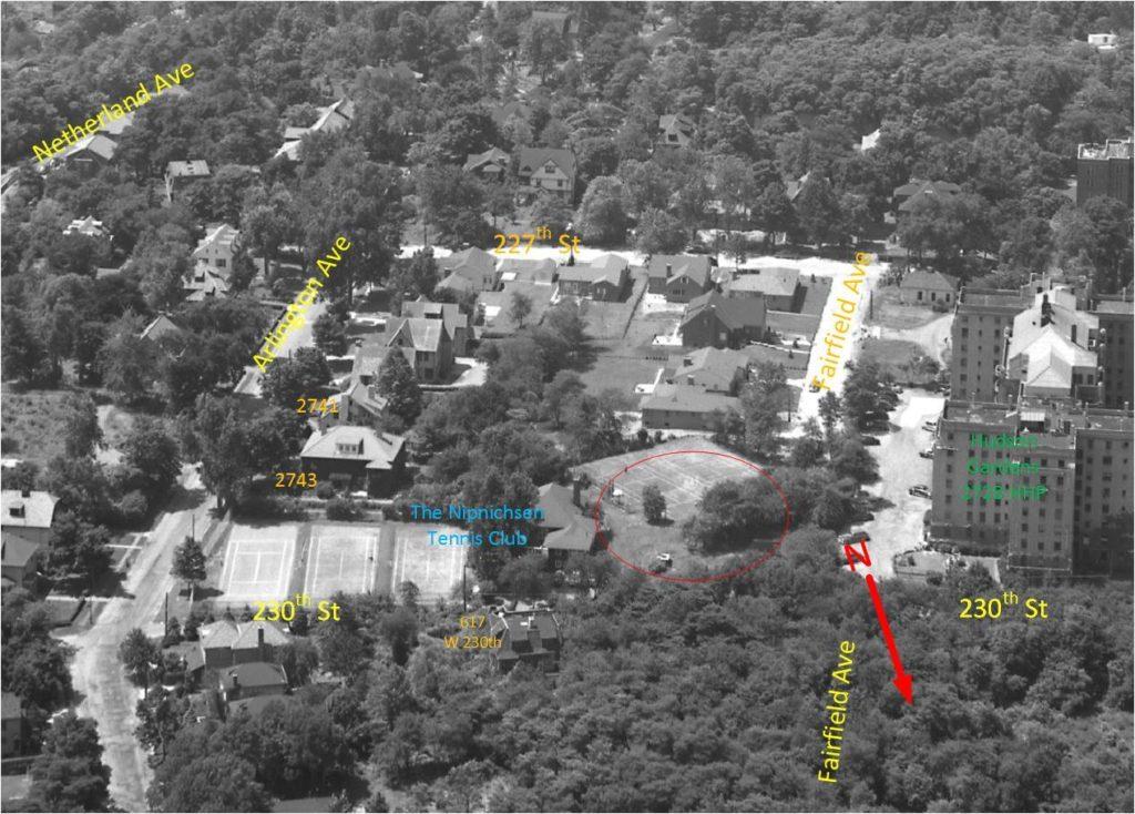 (photo labeled by Alan Lasky)
But more recent scholarship casts doubt on the old story that Henry Hudson’s Half Moon was attacked from a fort on Spuyten Duyvil known as “Nipnichsen.” In 1981, the Museum of the City of New York published Robert Grumet’s “Native American Place Names in New York City” and this is what he wrote about Nipnichsen:
A review of the location of the fort reported by [Henry Hudson’s first mate] in 1609 has, however, indicated that it was located along the west bank of the Hudson River near Hoboken rather than on the eastern shore . . . [A] 1644 document has firmly located Nip Nickson in East Jersey. This location . . . has not been accepted by other regional investigators who have clung to the Bronx County location. The colonial record, however, has made the Bayonne Peninsula location of Nip Nickson the only acceptable locale for this place name.
I would only echo this conclusion by saying that the word Nipnichsen does not appear in any colonial documents I have seen pertaining to this area. But it is still a fun part of local lore.
Another name that shows up multiple times in early colonial documents is Shorakappoch (and other similar spelling variants). This name was primarily used to refer to the Spuyten Duyvil Creek where it met the Hudson River. In the previous post I mentioned, Adriaen van der Donck, the first Dutch colonist who lived in the northwest Bronx with his wife Mary. After Van der Donck’s death, Mary remarried and the English governor confirmed that Adriaen van der Donck’s former lands would go to Mary van der Donck and her new husband in a patent dated October 8, 1666. The patent defined the property boundary as running southward along the Hudson River “to the kill [or stream] Shorakkappoch, and then to Paprinimen, which is the southermost bounds.” This patent set the southern boundary of Yonkers from 1666 to 1872 when Kingsbridge voted to become independent from Yonkers.
Both Manhattan and The Bronx have staked a claim to this ancient name for the Spuyten Duyvil Creek. In today’s neighborhood of Spuyten Duyvil, the name “Kappock Street” honors its Native American past.
[caption id="" align="aligncenter" width="443"]
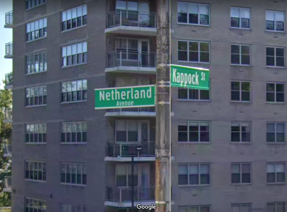 The intersection of Kappock and Netherland hints at our neighborhood’s early history.[/caption]
In Manhattan, Shorakkappoch rock in Inwood Hill Park displays the plaque below:
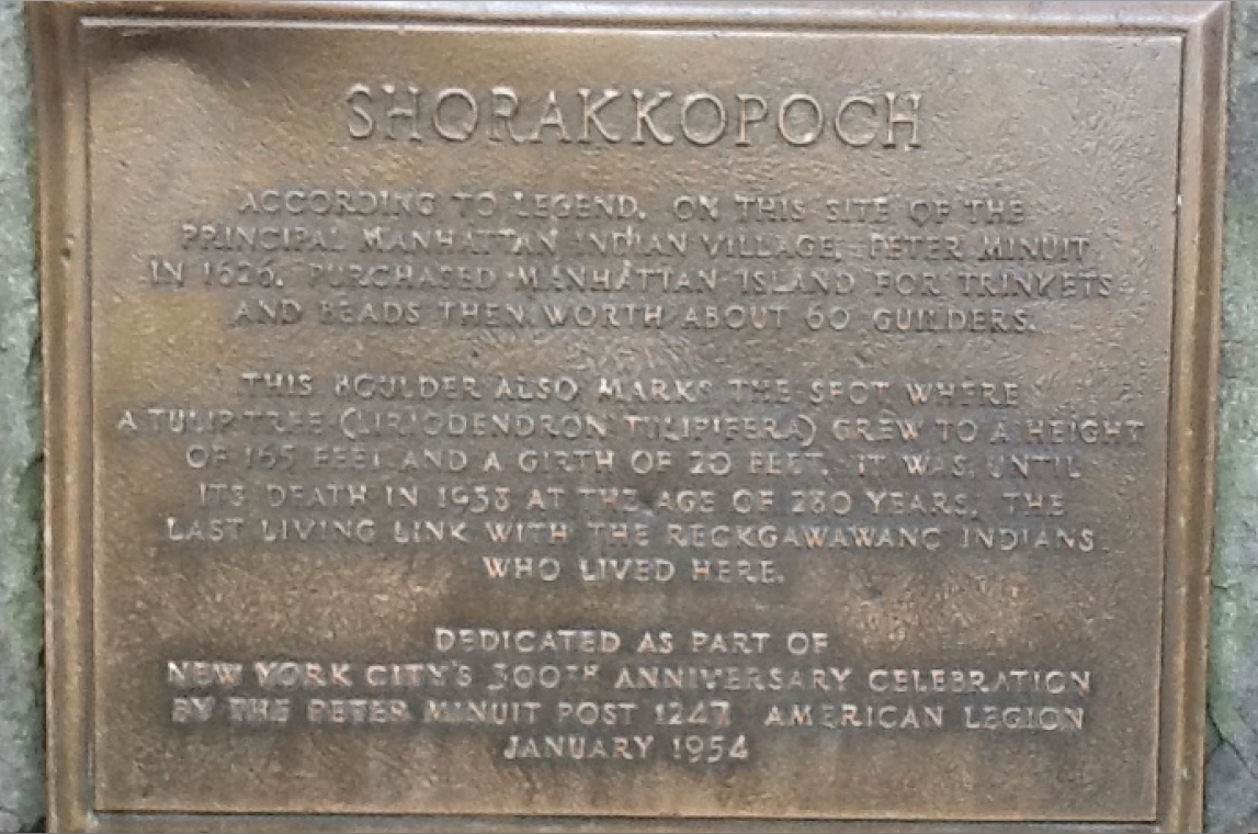
There is no evidence to suggest that Peter Minuit purchased Manhattan on the site but there is plenty of archaeological evidence showing that there was indeed an indigenous settlement in today’s Inwood Hill Park. Local historians have referred to that settlement as the village of Shorakappoch.
You deserve a lot of credit for this moment, Peter. You kept the archives safe and the savings intact even after the first generation of enthusiastic members passed away. Without those assets, there would not have been the reason nor the means to make this happen.
It is no exaggeration to say this has been a long time coming. Check out this blurb from the March 1, 1956 issue of the Riverdale Press!
I wouldn’t say Edgehill is a “modest structure” . . . but it will do!
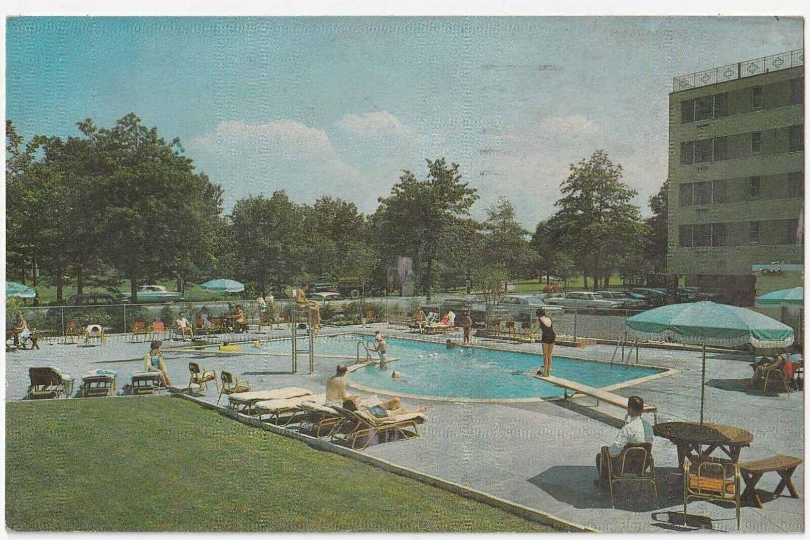
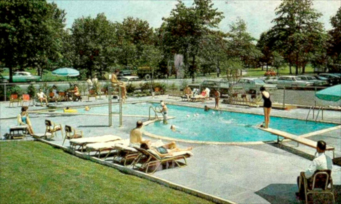
Wow that’s incredible. Martin Luther King working on his book at the Riverdale Motor Inn just might be more interesting than the “R” shaped swimming pool. Well done!
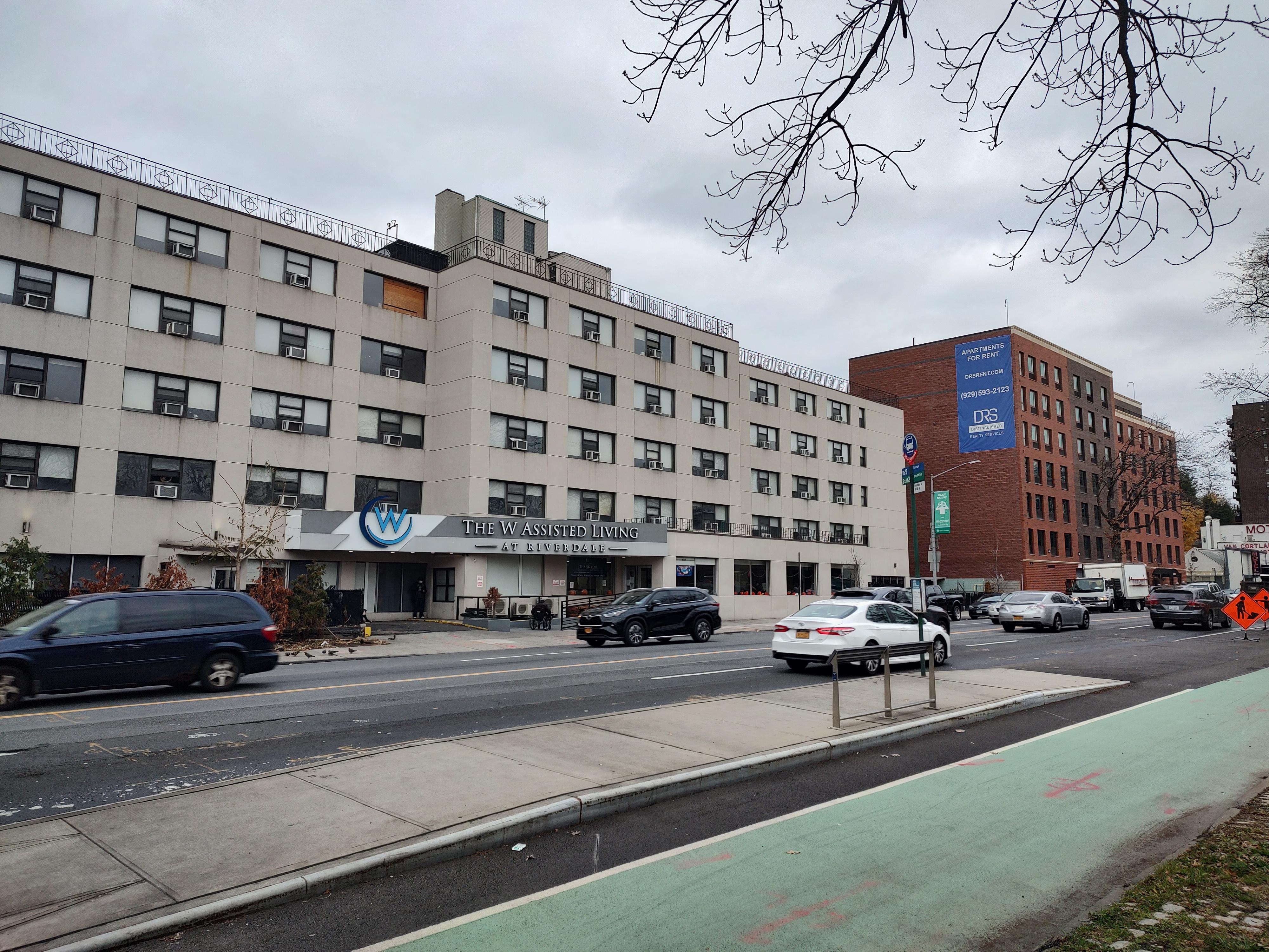
Nice work everyone and good find with the ad. The Riverdale Motor Inn seems to have been perfectly located–across the street from Van Cortlandt Park and the stables and a short drive from Manhattan. I wonder what happened with that venture. I never knew it was a motel until I found the brochure, which boasted of a “Suburban Atmosphere Minutes From Downtown New York City” and “Public Golf Courses, Pony Track, Horseback Riding, Boating, Tennis, Athletic Fields, Picnic Areas nearby.” The site of the swimming pool and parking lot was a vacant lot as long as I was familiar with the area and a new building was constructed there within the past year. That’s the old motel on the left and a building touting “apartments for rent” on the right.
I have two more images for you that should help with identifying the location. The brochure that showed the first image of the pool also showed this image as a feature of the property:
Quite a swanky establishment for our neighborhood! And finally, I am going to pull back on the photo to give you a wider view, which should help:
All of those guesses were in the right neighborhood, so to speak, but just a little off the mark. I am glad I picked a tough one! Here’s another view:
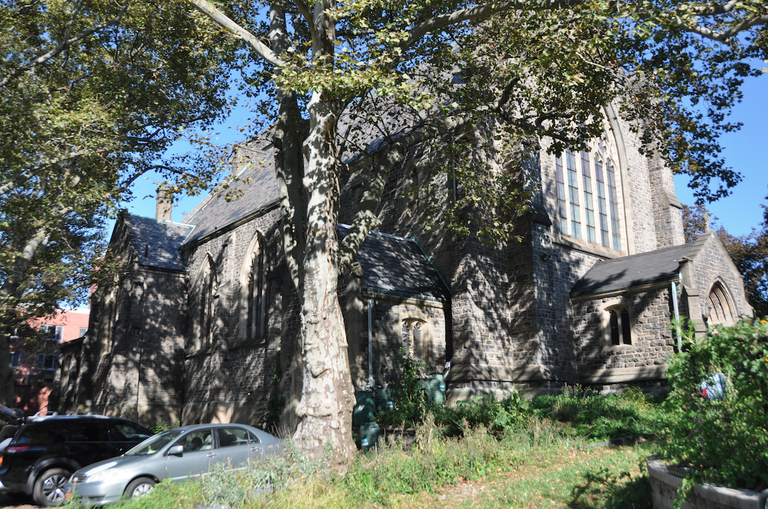
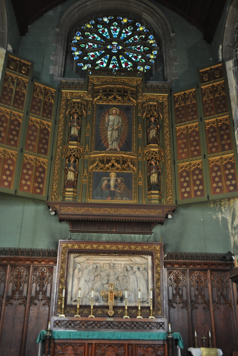
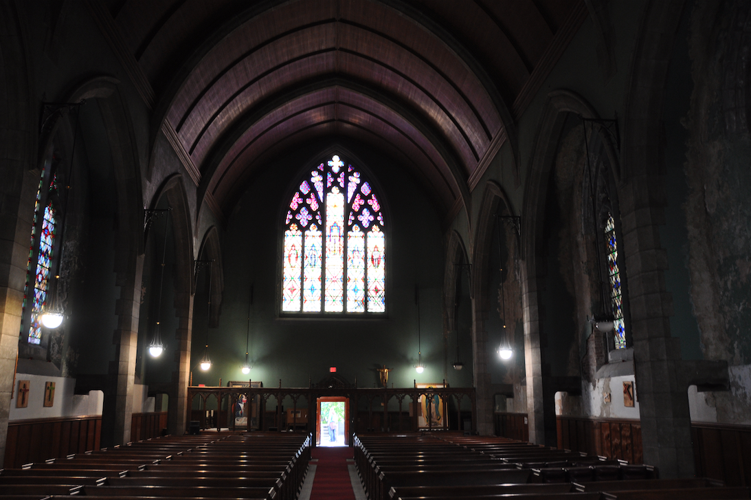
I went to the open house at the Church of the Mediator. It is a truly impressive building on the inside but it clearly needs work. The number I heard at the church was $20 mil. to make all the necessary repairs. As you approach the grounds, you can’t help but notice how much greenery there is on the property–in stark contrast to the urban environment that surrounds it. This is the view from Kingsbridge Ave.
Some additional views:
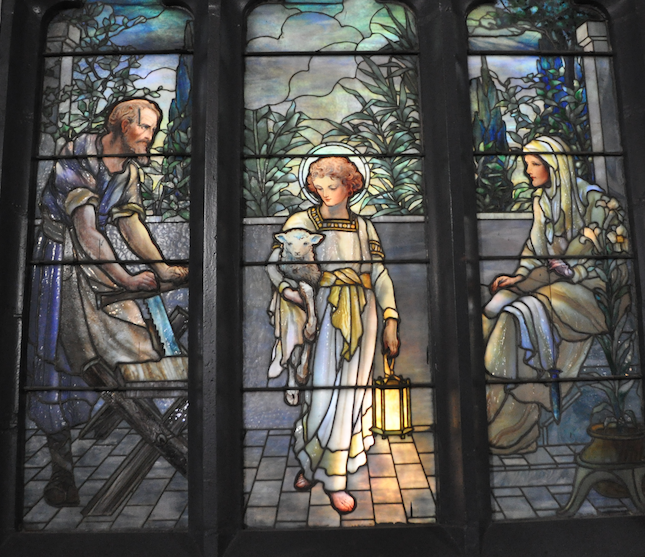
One of the Tiffany windows:
A couple of my favorite historic images of the church with Tibbetts Brook in the foreground:
Thanks, Stephanie. I am going to try to make it to see the place while it is still standing.
A member of the congregation just reached out to ask a question: “Why is Booker T Washington depicted in the stained glass window of the church?” It made me think of something you pointed out earlier, which is that Booker T Washington spoke at Edgehill Church of Spuyten Duyvil in 1915. Construction of the Church of the Mediator began in 1911–so close to that time. I find it interesting that two local churches have a Booker T Washington connection and it makes me wonder if he had any relationship to our community that I don’t know about.
[caption id="" align="aligncenter" width="671"]
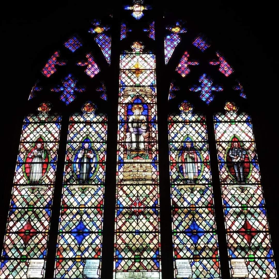 Church of the Mediator Stained Glass Window–Booker T Washington on the right.[/caption]September 23, 2022 at 5:09 pm in reply to: Arson, Blackmail, and $1000 Reward on the Van Cortlandt property #2933
The Harvey Painting hangs in the welcome center of the Van Cortlandt House Museum. It is pretty great, especially since images of the area are scarce from that time. One interesting feature is that it shows the Van Cortlandt house when it was covered in a limewash, which is something like stucco (notice there are no visible stones or bricks). You can still see some remnants of the limewash on the exterior today in a few places. Plus, I like looking at the background to the left and right of the house (the view is to the north):
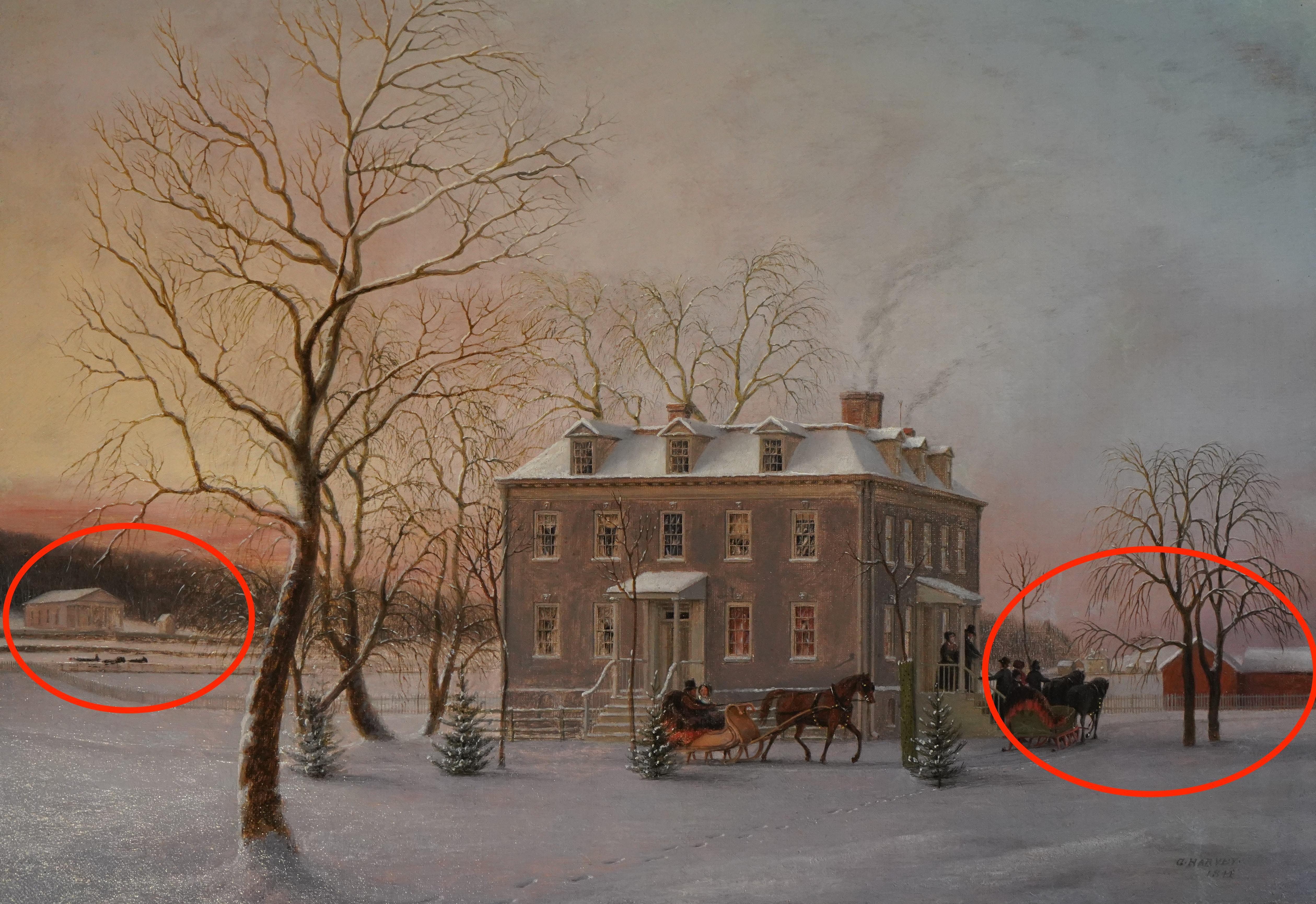
Here is a closeup of the left side:
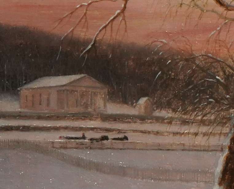
That looks like a horse and cart traveling on the “Highland Turnpike”–known today as Broadway. But what is that neo-classical building?
And the right side:
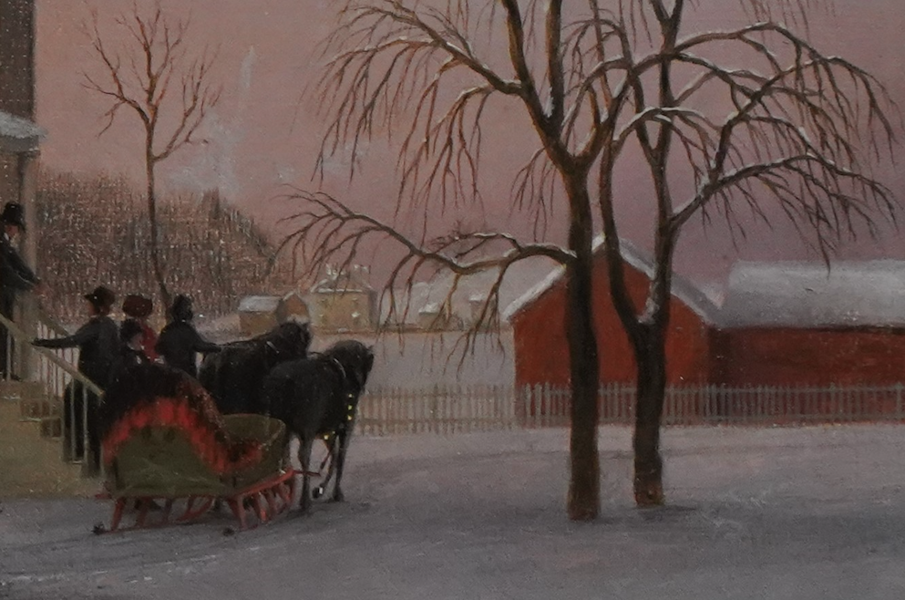
The aforementioned barn(s) are on the right. The visitors on the sleigh are approaching the east entrance of the Van Cortlandt House. But dead center in the distance are some mystery buildings. It seems that they are on the Parade Ground of today’s Van Cortlandt Park. Perhaps that is where the farmer and his family lived. At that time, the Van Cortlandt family no longer ran the farm that occupied the Parade Ground. They leased it to tenant farmers.
Thanks Peter and Julie.
Another interesting thing about Dr. John Cregier is that while he joined the local militia in 1775 and served as the surgeon to the Ulster County regiment in 1776, he spent much of the rest of the war living in today’s Van Cortlandt Park. And that put him in British occupied territory for most of the war in a neighborhood teeming with British and Hessian soldiers. Dr. Cregier’s son, Augustus, mentioned in his memoir that his father provided medical treatment to Captain Benjamin Ogden, who commanded the cavalry troop of a rather notorious British unit–Emmerich’s Chasseurs. So he went from treating the patriots to treating the British and their allies.
I wonder if some local people, like Dr. John Cregier, signed up with the militia early on in the war due to the great social pressure to show loyalty to the patriot cause. Because many of them were not so committed to the cause that they were willing to fight as soldiers for very long.
This clipping from the 1790 census shows that Dr. John Cregier continued to live in the area after the war. His household is listed between the Hadleys and the Van Cortlandts.

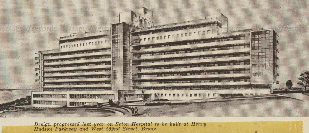
Between all the guesses I think it is fair to say that communally you found the answer. It was indeed part of the Seton hospital complex but it was not Seton Hospital–at least not the “big building,” which faced east. As you can see it was much bigger:
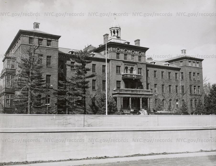
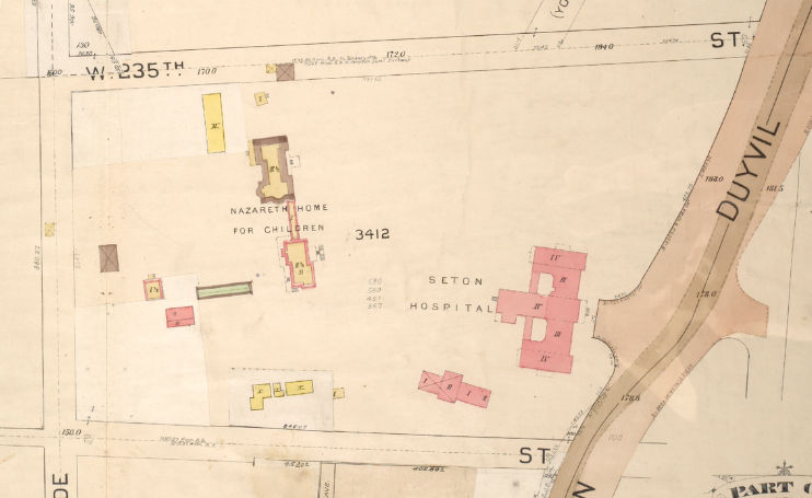
The photo at the beginning of this thread was the separate children’s hospital called the Nazareth Home for Children. Check out this clipping from a 1901 Bromley map showing the locations of the different hospital buildings (the road on the right was the Spuyten Duyvil Parkway, which followed the course of the modern Henry Hudson Parkway):
The Digital Culture site has some photos of inside and outside the hospital such as this one:
The first photo shows some rock outcroppings in front of the children’s hospital and there are very similar ones still visible behind PS 24 on W. 235th Street where there is a playground today at the eastern end of Seton Park.
I was also curious when I came across this image (apparently there were ambitions to modernize and continue operations on the site). That sure would have changed the character of the neighborhood:
I’d love to hear more about Dr. Dan’s earlier post when he sneaked into Seton Hospital before it was demolished. I assume that was neighborhood kids snooping around where they didn’t belong, which must have been a lot of fun!
And to credit the source: http://dcmny.org/islandora/object/childhoodinbronx%3A112 (it is a fascinating archive of photos).
Thanks, Bob. It really is amazing how much transpired in our area during the Revolution. It could easily fill a book and maybe someday I will get around to writing it! At the very least it would make a good series of presentations as we approach the 250th anniversary of 1776. Unlike some places that might be famous for a major battle, there was activity in our neighborhood in every year of the war from 1775 to 1783.
And yes, there sure were a lot of Germans stationed here fighting for the British. German was probably the most common spoken language here at times. One German officer John Charles Philip von Krafft was in the local garrison and left a fascinating diary that was translated for the New York Historical Society by a Spuyten Duyvil resident, Thomas Henry Edsall.
I read that elsewhere–that prison labor was used at the foundry–and was surprised by it. I wonder if any documentation can be found about that. I would not imagine locals were too happy about it.
Thanks. We have a serious advantage over earlier historians with the internet. Being able to search old newspapers is too easy (you can even do it at home and for free if you have a NYPL card). Searching Tetard I found another cool ad that echoes your comment, Peter:
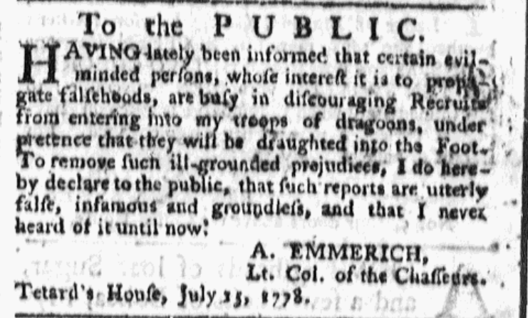
This is ad was placed in the Royal Gazette during the Revolution by Andreas Emmerich, a German mercenary fighting for the British. As you can see, he occupied “Tetard’s House” while Tetard was away in the Continental Army.
-
AuthorPosts