Forum Replies Created
-
AuthorPosts
-
March 15, 2021 at 9:45 pm in reply to: Was the Albany Post Road earlier known as a “Mill Path?” #1905
Last time I was up in the Westchester County Archives, where the deeds are kept, I was told that the deeds were typed up as part of a WPA project.
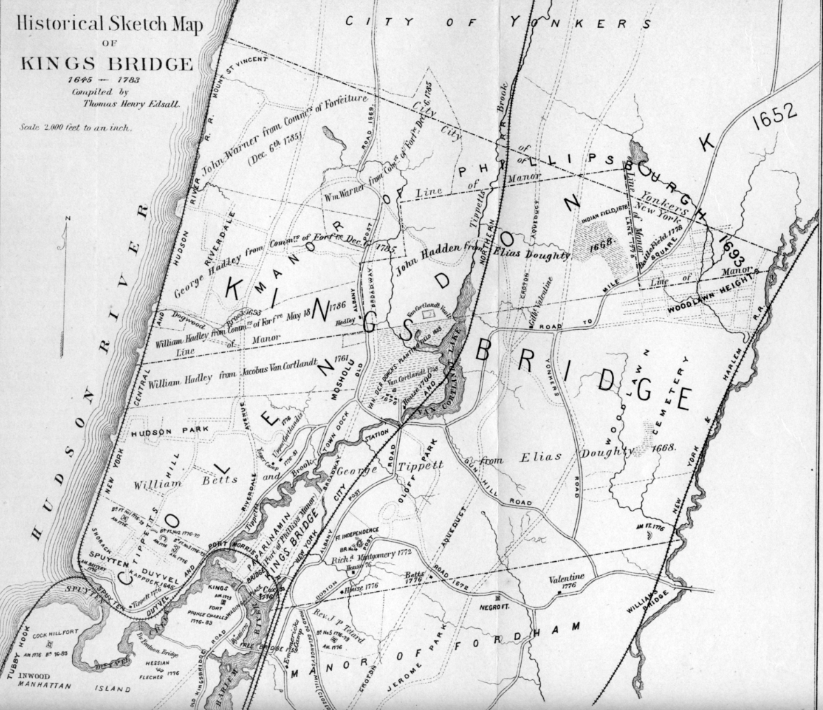
Thanks, Zach and Tom for sharing the maps. Great stuff. I’ve never seen the Bolton map. What book is it from? On that map you can see how Broadway is a straight line but the Albany Post Road had to zig-zag a bit to stay out of the muck. Just above of what is depicted on that map, the Albany Post Road went north under today’s Bailey Avenue and into today’s Van Cortlandt Park. It crossed the park and went north along the ridge just to the west of Broadway.
The “Mill Runn” on the 1684 map is also interesting. This is out of my geographic area of expertise but just under where it says “Mill Runn” it looks like “Coll Morris his land.” I wonder when Morris built his mill. This map shows the source of that stream near the Bronx River somewhere around where the Botanical Garden is. It labels that stream as “Morrisina Creek.” It looks like the Harlem Line of Metro North was built partially on that creek bed.
March 15, 2021 at 12:32 pm in reply to: Was the Albany Post Road earlier known as a “Mill Path?” #1898Thanks. Keep in mind this is just a theory. It is hard to be completely sure because given how sketchy the information is.
Yes, generally the Albany Post Road roughly follows the route of Broadway or Route 9 through Yonkers and Westchester. The original post road was very circuitous to avoid streams and marshes–sort of like the path of least resistance. But by the time Broadway was cut through in the 19th century, they had more manpower and better methods for making roads and they made them wider. But the newer roads didn’t diverge greatly from the same general course as the old roads.
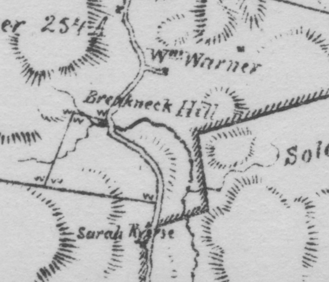
To give you an idea of how rough the old roads were, here is a snippet from a 1785 map showing the Albany Post Road through Riverdale. Note that there is a sharp bend in the road near today’s Mosholu Ave labeled “Breakneck Hill.” No doubt it had that name for a reason! The generals that relied on these roads during the American Revolution were constantly complaining about them and blaming them for why they got lost or were late to the battle.
As a side note, north of 251st Street, you will find a road called “Post Road.” Just to the east is an unpaved lane, which was the original Albany Post Road. Just to the east of that is Broadway. All three are running parallel roughly north to south.
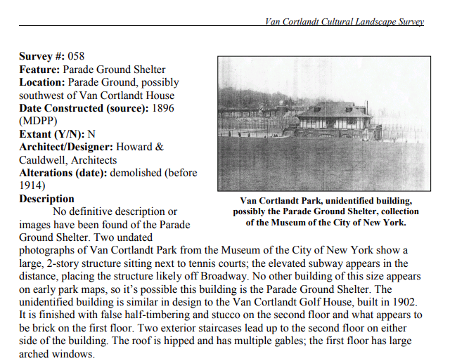
That’s a good question, Zach. I am intrigued by the building in the top right corner and the topography in the background. You wouldn’t happen to have a photo in higher resolution, would you? Or a link to the original?
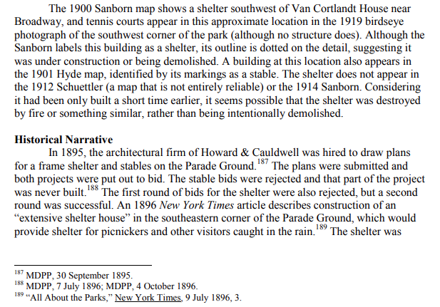
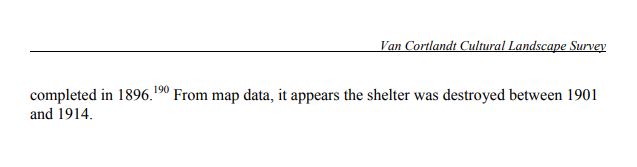
I did find some references to the building in the 2003 Van Cortlandt Cultural Landscape Survey–although, its author is not too sure where this is either. See below:
 Here’s a closeup of the photo:
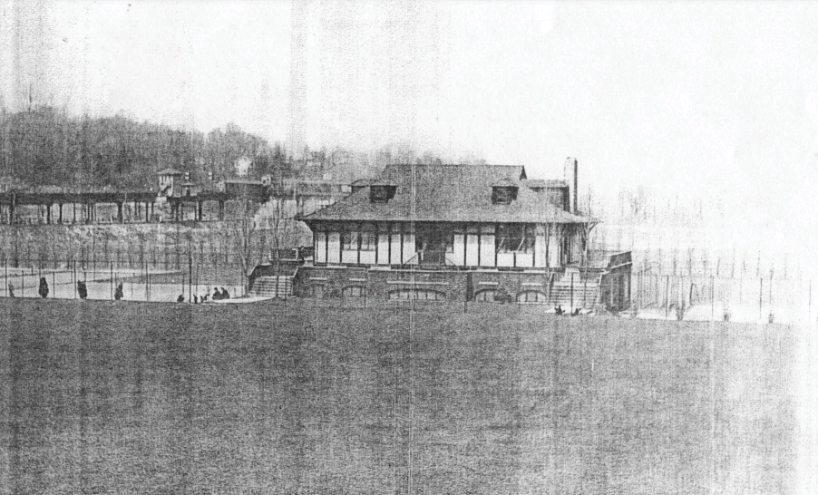
That is very interesting about Charlotte Van Cortlandt taking care of the Vault Hill burial ground. I could not get the link to work though.
Van Cortlandt Park has had big problems protecting historic sites in the park from vandals. Last year the Grand Central Stones were nicely cleaned off and restored by NYC Parks. Just recently they were tagged again with graffiti. A Parks worker painted over it with black paint, which only makes the process of removing the graffiti more difficult. It is the same situation up on Vault Hill. I am not really sure what the solution is. You rarely see Parks Enforcement in Van Cortlandt and I have no idea if there are any patrols at night.
It is funny that you should mention Vault Hill’s connection to the Elizabeth Ann Seton, the first saint born in America. I just recently learned that fact myself from Patrick Raftery’s book. However, I think NYC Parks recently removed the monument to her step-mother from Vault Hill. With the death of Charlotte, I guess there are no Van Cortlandts around to complain about this sort of thing.
Thanks for that, Tom. That was 1912 so they hadn’t been removed before then. Without any evidence to the contrary I would say they are still there.
Cemeteries of The Bronx has a really good writeup on the site including many other things that I did not know. For example, there are two side-by-side vaults within the walled in area. One was used by the Van Cortlandts and the other by the Bayley and Craig families (they were connected to the Van Cortlandts by marriage). One of the monuments for the Bayleys was only just removed by the Parks Dept. a few years ago after it was kicked over. If there are any Van Cortlandts or Bayleys still out there, I wonder how they would feel about the way the city has taken care of their family burial plot.
I agree that the building was most likely a comfort station given the lack of any definite proof. Perhaps it had to be moved when Broadway was widened–sort of like how the train station needed to be changed.
I think you could be right about the comfort station. But I can’t figure out what building it is on the map that you posted. The building in question is east of Broadway (I think) but it looks like the buildings in the map are west of Broadway. Please correct me if I am wrong.
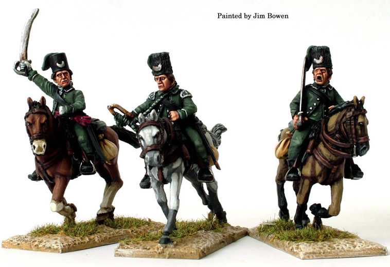
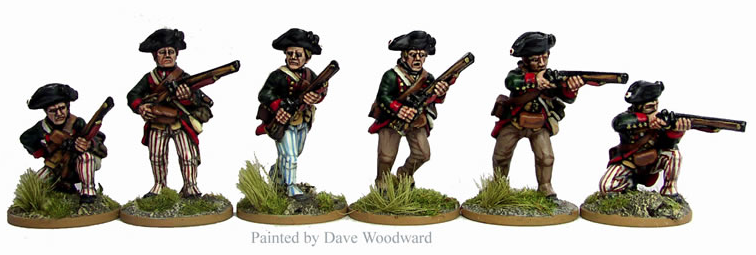
I agree Tom. Here are the miniatures you’re looking for:
You can order them here: https://www.perry-miniatures.com/product/aw33-stockbridge-tribe-skirmishing/
The bad news is they are about an inch tall and you have to paint them yourself. You can get the Queen’s Rangers cavalry, the Hessian Jaegers and make yourself a diorama!
Thanks for the photos, Peter. The second one looks like it could have been taken in a different time. And that’s interesting about Dogwood Close–I never put those things together.
The stream appears as “Dogwood Brook” on Thomas Henry Edsall’s map, which is also on the maps page in better detail:
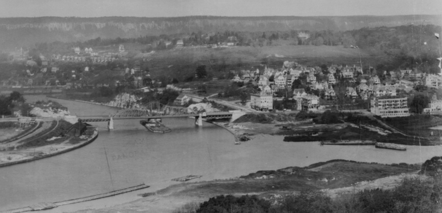
Congratulations Tom on correctly identifying the house, which is 15 Ft. Charles Place on Marble Hill. Here is the original photo that the snippet was taken from. It is one of my favorite photos.
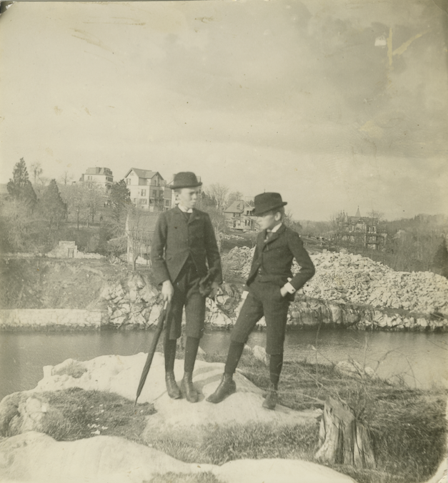
The photographer may have goofed as the boys in the foreground seem out of focus but fortunately the background is very clear. The view of the photo is looking north from Manhattan on the northern bank of the Harlem River Ship Canal. The photo is undated but looks to be shortly after the construction of the canal, which separated Marble Hill from northern Manhattan. A note on the back of the photo reads: “Uncle Fred and Uncle Frank at Spiten Divel about where Baker’s field is now on Manhattan side. Ship Canal built by U.S.”
Zooming in on the rubble pile on the lower right, you can see the chunks of marble that were dug up when the ship canal was blasted through the hillside:
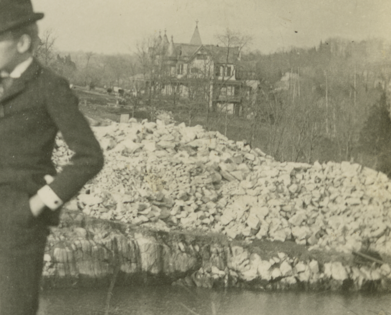
This rubble pile was quite the attraction for geology enthusiasts:
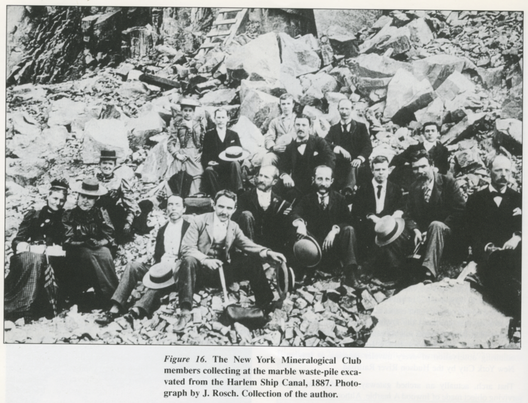 The above photo comes from an article: “An Early Quarrying District on Manhattan Island” by Lawrence H. Conklin, which appeared in the November 1997 issue of The Mineralogical Record. The largest of the quarries at Marble Hill was the one owned and operated by the Boltons in the early 1800s. Technically, it was the Boltons who first separated Marble Hill from Manhattan when they dug a canal across Marble Hill that was used to power a stone-cutting saw mill. This 1867 map of Marble Hill shows that Bolton Canal clearly:
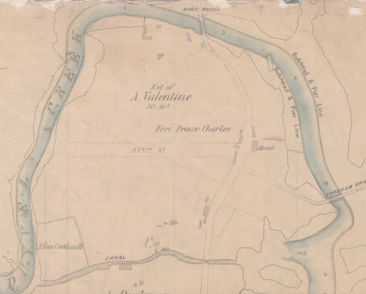
You can see that the canal would have cut off Marble Hill from Manhattan entirely were it not for a little bridge that allowed travellers to continue north toward Kingsbridge. I mention that bridge because you get a nice look at it in this Gustave Milbert drawing of the area:
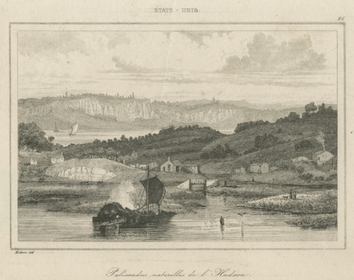
This is looking west from The Bronx from the east bank of the Harlem River ca. 1820. The Harlem River is in the foreground and the Hudson and the Palisades are in the background. Just to the right of the sailboat’s sail you can see that bridge connecting the roadway over the Bolton canal. This canal was obliterated when the Harlem River Ship Canal was dug through.
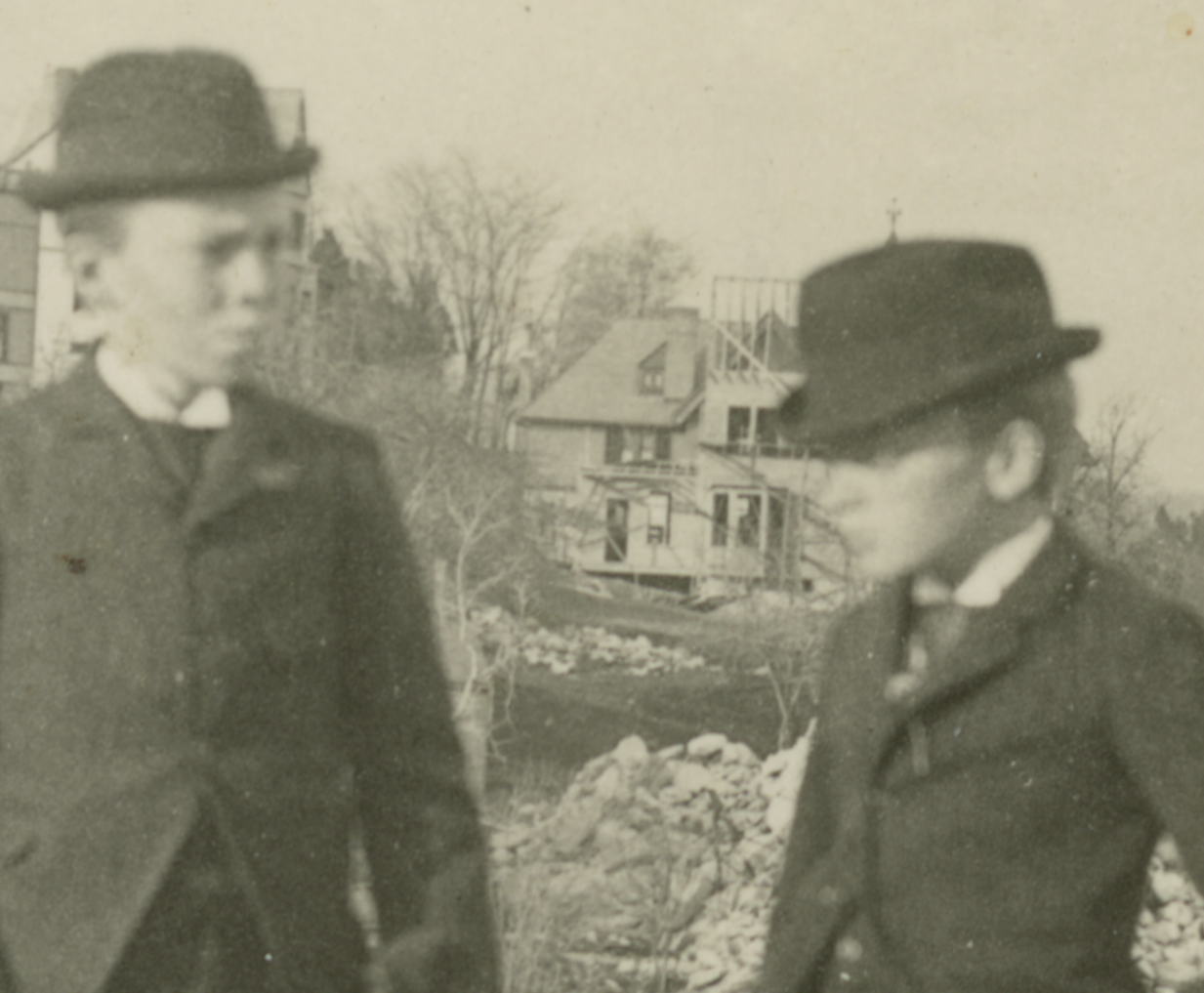
Getting back to this month’s mystery photo, there is some interesting stuff just to the left and behind one of the boys:
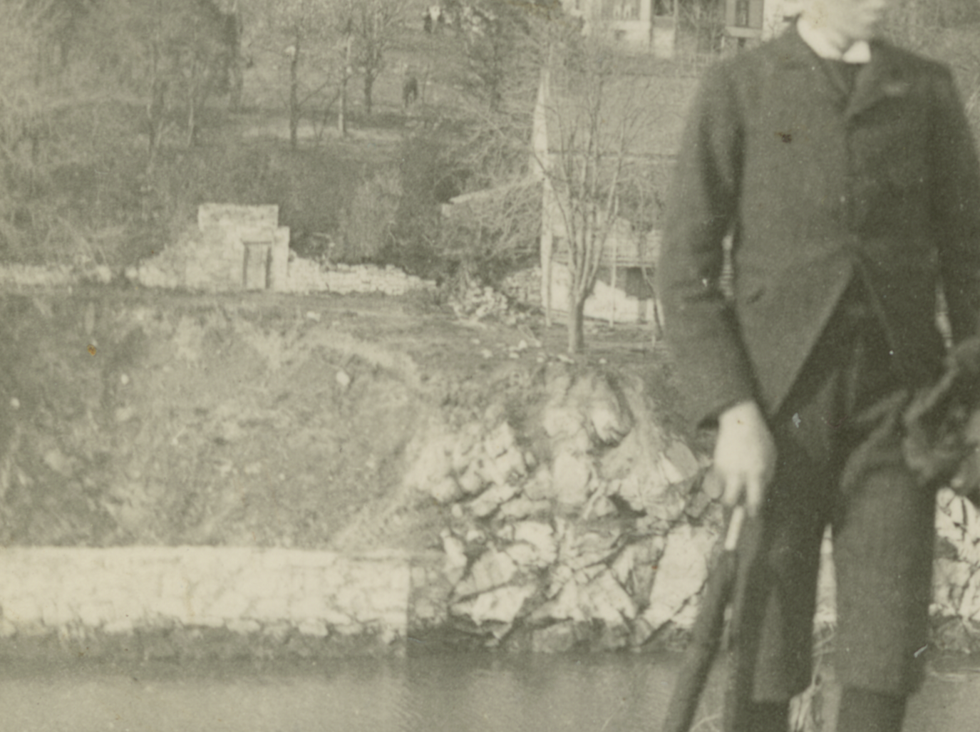
Partially obscured behind the boy is a house standing on the bank of the new canal. To the left is something that looks like a wall and doorway out in a field. That house and doorway are more clearly seen in this 1861 drawing from Valentine’s Manual (view looking north):
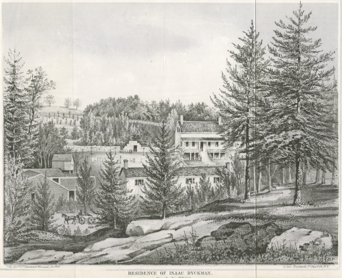
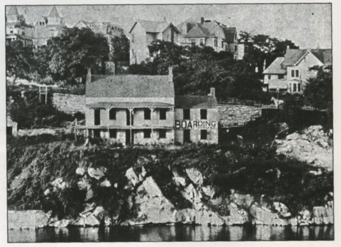
The house and doorway are pretty much center. Can you believe that is Marble Hill in the background? The caption reads: “Residence of Isaac Dyckman, Kingsbridge NY 1861.” Just to be clear, this is not the same Dyckman house that is today the Dyckman Farmhouse Museum. The house depicted above belonged to the Isaac Dyckman, but was earlier owned by the Boltons (according to Conklin). The house shows up in other photos and drawings from the turn of the century. Here it is when it was used as a boarding house (you can see a few more homes on Marble Hill in the background, ca. 1905):
The below panorama shows the view looking west as if you were hovering above the ship canal just south of the Target parking lot. The house is on the right atop the rock face on the canal:
Here is a closeup of another great panorama. The Dyckman house is visible just poking behind the Broadway Bridge, and you can see how developed Marble Hill is on the right. This is circa 1902.
Zooming in on the background of this month’s mystery photo you can see a home under construction:
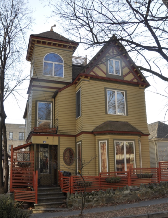
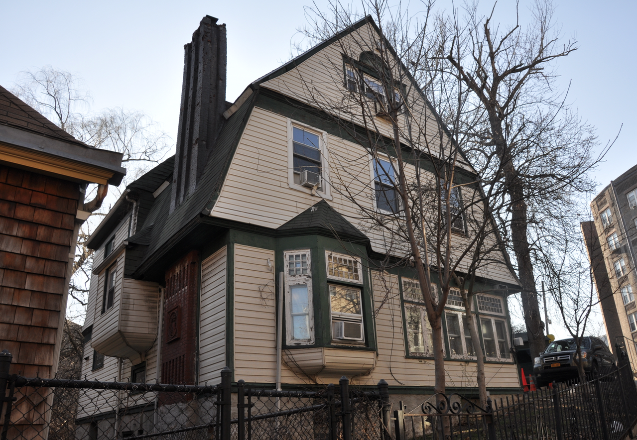
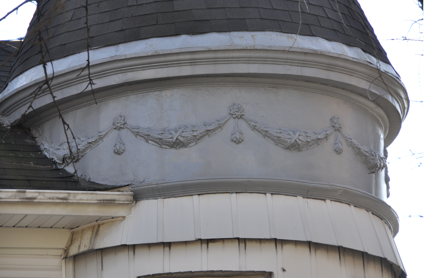
It seems that many of the homes on Marble Hill were built in this late Victorian period. Given how many of these homes still survive, it seems to me that the neighborhood is worthy of a historic district designation. I took a walk around Marble Hill the other day and I was reminded of just how unique it is for our area. I would definitely recommend walking around there if you have not had the chance. Check out some of these Victorian era architectural details:
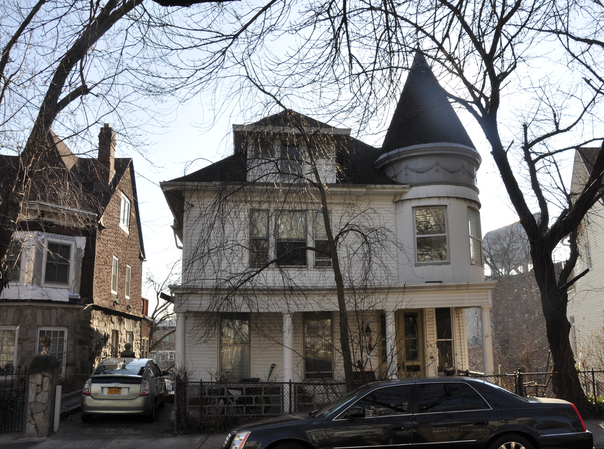

Here’s the first hint–a visual clue. I took this photo a few days ago when walking past the building in question. I was told by the owner that the stonework around the window is not original but was added by the previous owners, who were stonemasons. Speaking of stone: the sidewalk in front is made of large slate slabs.
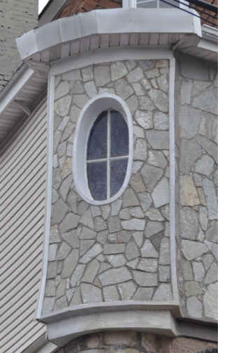
Here it is on an 1885 E. Robinson Map (in the center along Sidney Street):
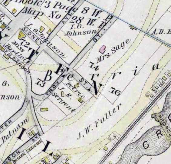
This one better shows the placement of the house, which is positioned at an odd angle relative to the streets.
December 22, 2020 at 2:01 pm in reply to: The Moller Mansion – After 150 Years Are its Days Numbered? #1828An online petition is circulating to landmark the Moller Mansion. You can check it out here:
https://www.change.org/p/save-the-moller-mansion?redirect=false
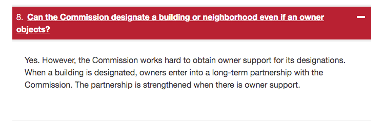
I had been under the impression that the owner’s permission was required to landmark a building but apparently not! Check out the below snippet from the LPC webpage:
Thank you to Stephanie Coggins for alerting us about the petition and thank you Roselin Denis for initiating it!
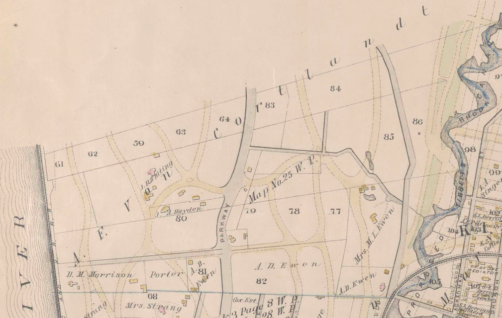
Yes, it would need to be a pretty seriously large tree! I think that the “Hangman’s Tree” (or “Hangman’s Oak”) is probably what the author was referring to. Even though this tree was on Spuyten Duyvil near Seton Hospital, it was still on property belonging to Augustus Van Cortlandt, so perhaps the author was confused. This 1885 map shows that the land around today’s Seton Park once belonged to Augustus Frederick Van Cortlandt:
 My personal opinion is that the “Hangman’s Tree” is an interesting piece of local lore but I am not sold that there were actually any loyalists hanged from it. I have never seen any record of a hanging here. But hey, I guess you never really know for sure.
Great information, Peter. Thanks for sharing.
The painting really shows exactly what Jean Knowles was describing in the article with the neighborhood’s “narrow dirt roads and green fields.” Amazing to think this was only 100 years ago–a drop in the bucket of history.
I have been doing some research on the colonial history of Kingsbridge Heights. Just before the Revolution General Richard Montgomery had his farm on the spot depicted in the Livingston painting. But I was curious who was the previous owner of the land. I have not been able to find any deeds related to Montgomery’s purchase nor have I found any deeds related to its sale after General Montgomery was killed in Quebec in 1775. On his deathbed, Montgomery left the estate to his sister Lady Ranelagh of Ireland. I found it strange that he did not leave the property to his wife–Janet Livingston. (As a sidenote, I never really associated our area with the Livingstons but given that it was home to Janet Livingston, Charlotte Livingston, not to mention Livingston Ave, maybe I should rethink that).
After the Revolution most of the Montgomery farm ended up in the hands of Jacob Cole. It was the Cole family that had the family burial ground on Albany Crescent.
When we are done with Covid-19, I want to visit Princeton University, which holds the Edward Livingston papers. That collection contains a “survey and estimate of Richard Montgomery’s farm, Kingsbridge” that I have never seen. It could have some interesting info about the fort and environs.
Reviving this old thread, I found this postcard on eBay of “The Locust Grove, Van Cortlandt Park”–the same one that Stephen Jenkins referred to in the above quote. I remembered reading about the locust grove in Thomas Henry Edsall’s History of the Town of Kings Bridge as well.
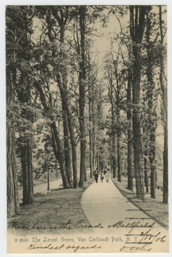
This is what Edsall wrote on page 5 of History of the Town of Kings Bridge:
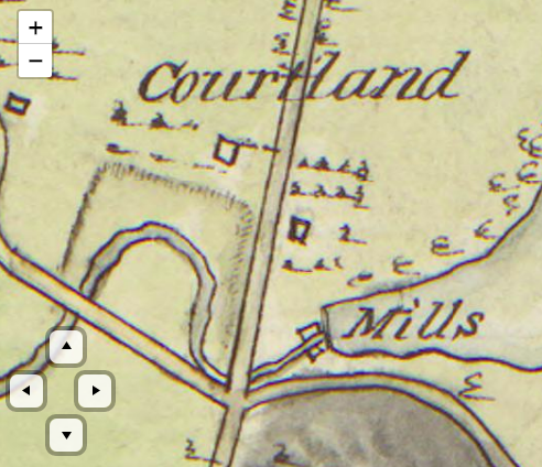
“It is probable that [Van der Donck’s] house was on the flat, and located, perhaps, where the old house of Jacobus Van Cortlandt afterwards stood until the early part of [the 19th] century.” A footnote added “Its site was just behind the present grove of locusts, north of the Van Cortlandt Mills.”
This “flat” is the area south of the tennis courts just east of the path with the stone wall. The house of Jacobus Van Cortlandt that was in that area is depicted on maps like the one below. The house Edsall referred to is indicated by the square dead center–to the east of the path and to the north of the mills. It is a place where parks workers found early colonial artifacts.
In her response above, Catherine Minty wrote that this house could have belonged to George Tippett and I believe she is correct. Tippett was one of the settlers that purchased lands from the widow of Van der Donck.
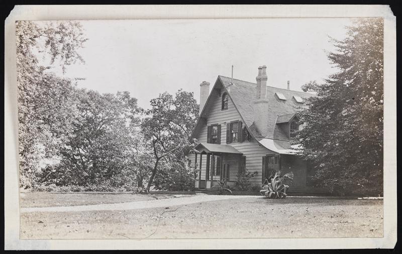
Thanks, Kelli and Tom. The house is still there and it is a land-marked building at 5225 Sycamore Ave in Riverdale. If you want to read all about it, the landmark preservation report is here. So many of these estate houses are hidden behind high bushes and shrubs so it is hard to get a look at them from the street.
I found some additional information about Robert Brown, the multiracial free militiaman from Kingsbridge. Some of this might be “too much information” for everyone but I have learned that a lot of people come to this site for genealogical reasons so I am posting what I found in case anyone out there is searching for it.
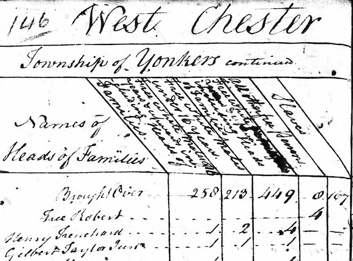
First of all, I am happy to report that Robert seems to have survived the Revolutionary War and continued living in our area through at least 1790. For some reason, I never noticed the last page of the 1790 census but there he is: “Free Robert.” He is listed under the category “all other free persons,” which was the category for free Black people. Robert’s household was the only one in Yonkers composed entirely of free Black people (although there were free Black people living in racially mixed households):
It would be interesting to find out if he ever applied for veteran’s benefits due to his service in the militia.
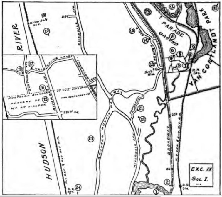
Also, by chance, I think I figured out where he grew up. I revisited an undated and unlabeled map from the Revolution that I never really paid much attention to. It is held in the University of Michigan’s Clements Library and you can check it out here. Once you get your bearings, you will see that the cartographer never completed this map and, unfortunately, he left large parts of the Kingsbridge area empty. And that’s too bad because this map was an attempt to represent the area to a high level of detail that other maps do not show. But despite its semi-completed state, the map maker did at least sketch out the area in light pencil, which you can see if you really zoom in. Below is Van Cortlandt Park in the vicinity of the Van Cortlandt House Museum:
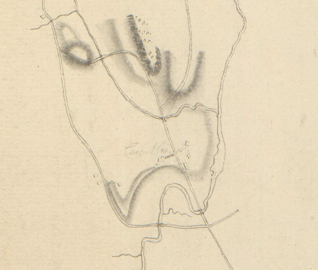
Here I have labeled some of the features:
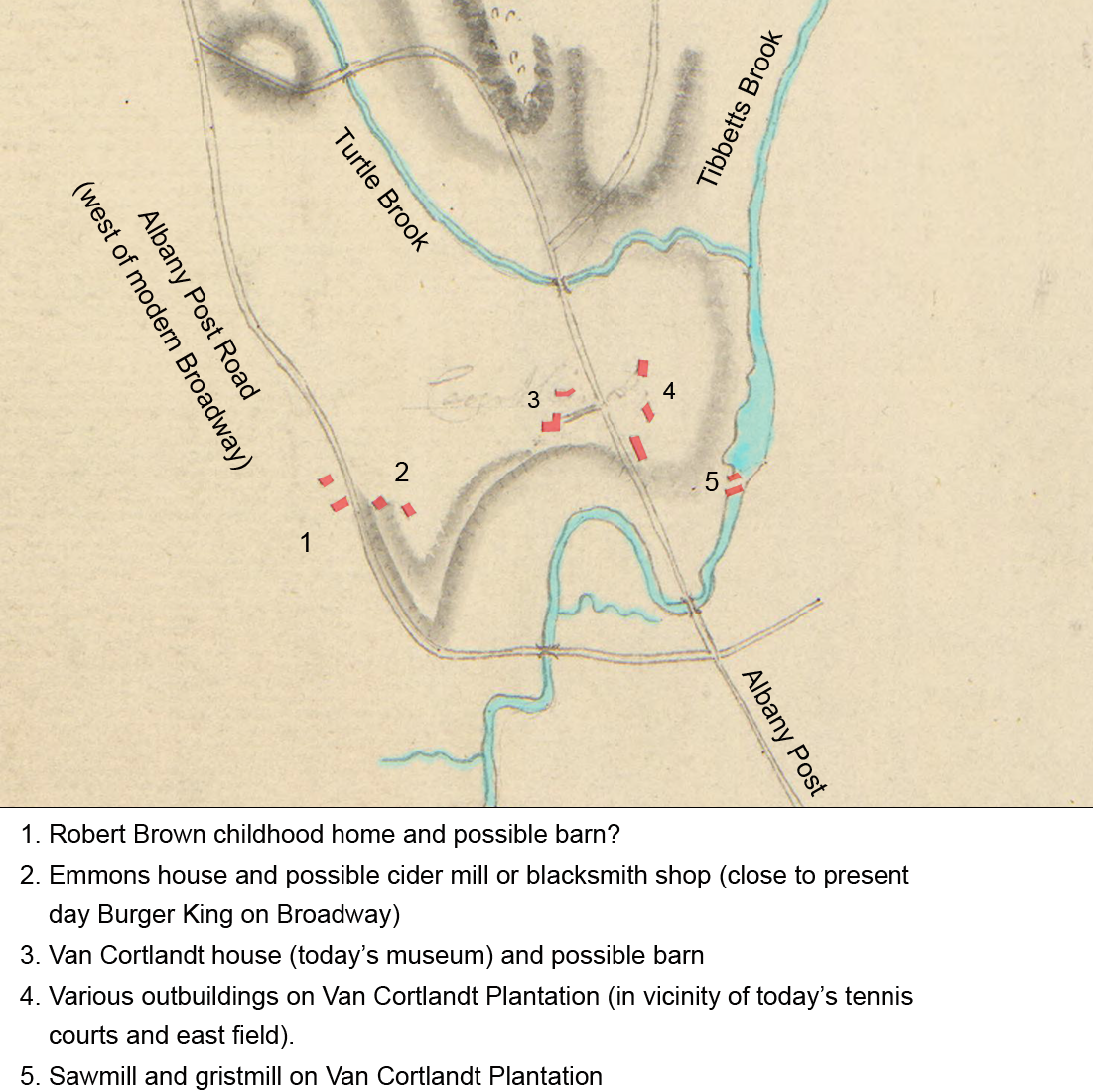
The place where I think Robert Brown grew up (location 1 above) is on the Albany Post Road west of the homesite of Abraham and Abigail Emmons. There is a segment of roadway there (behind the Burger King) that is still called “Post Road:”
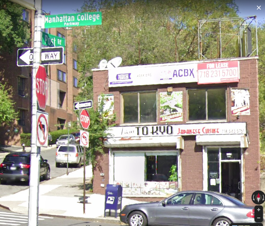
Post Road goes north up the hill (on the left in the above photo) and it ends where it meets the Horace Mann school campus.
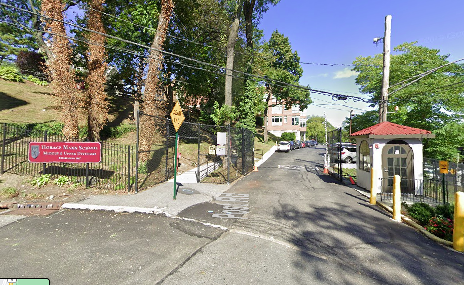 But historically, the Albany Post Road continued past that security booth and headed north toward Yonkers and onto Albany. It is in this area that the Revolutionary War map depicts two buildings where I believe Leonard Brown had his farm.
How do I know? From the will of Abraham Emmons, which refers to “twenty acres of land to the westward of the [Emmons] home lott being part of that Lott of Land on the Neck that Leonard Browne lives on.” The Emmons and Brown families seemed connected in some unknown way because when Leonard Brown died, he left his “Mulatto daughter” Mary in the care of Abigail Emmons.
This land eventually became the property of Garrett Garrison. This is also the location shown in the below photo depicting the old Mosholu schoolhouse (1927 photo):
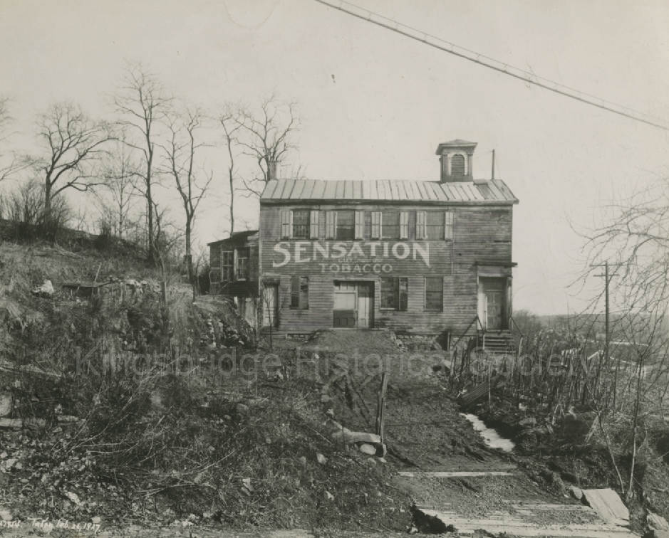
I wonder if this old school school house had a previous life as a farm building.
That was an incredible presentation. You collected a mind-boggling amount of information and incredible photos.
So, even though the Major Leagues were not integrated, you could still pay to watch games where players of different races played each other–I never knew that. It was also fascinating to learn about the Hall of Famers that played there–really a very impressive list of players.
I am looking forward to Friday’s presentation.
That’s interesting, Peter. The house on Waldo that was owned by Bowie Dash (and later Zambetti) certainly had the look of a “gardener’s cottage.” The “Gardener’s Cottage” is also referenced in the Historical Guide to the City of New York here: https://archive.org/details/historicalguide00yorkgoog/page/n225/mode/2up
For anyone who hasn’t checked out that book, I would highly recommend it as a local history resource. It includes maps for self-guided walking tours such as the one below. 22 on the map is the Upper Cortlandt mansion house and number 21 is the “Gardener’s Cottage.”
Although according to the blurb in the book, the cottage was near 238th and Greystone, so yeah, more research needed to really figure it out what exactly was the “gardener’s cottage.”
Tom, would you mind sending a link to the Dash property that you found on the Hudson?
Thank you to new forum user, Nefertiti, for sharing this link:
https://collections.mcny.org/CS.aspx?VP3=SearchResult&VBID=24UP1GMD2J5FO&SMLS=1&RW=1366&RH=625
There is a nice photo of the Bowie Dash house from the side there (dated circa 1915).
Interestingly, it is labeled “caretaker cottage.” Bowie Dash was certainly nobody’s caretaker so the name suggests that the house predates his ownership of it (if the “caretaker cottage” label is accurate).
I would love to know more as well. I assume you already read the next installment in this series:
https://kingsbridgehistoricalsociety.org/forums/topic/the-first-land-deal-pt-3/
Having made the trip to Michigan by car dozens of times, I could only imagine what it was like to walk there as he seems to have done in 1681. He dealt with French Explorers, English visitors, Dutch colonists, and English governors, and all of the local native peoples, he would have had quite the perspective. If I find anything else I will surely post it.
Right now I am researching the last installment of this series. It will be about why Claes a.k.a. Towachkack might have relinquished his claim to the land in the 1701 deal with Jacobus van Cortlandt. And I think there are a lot of reasons. But one thing that I have been thinking about–especially as we are all affected by Covid 19, is the effect of disease on the local Munsee. According to Grumet, “By 1701, the Indian population of the Munsee homeland was nearly 95 percent less than what it was when colonists purchased their first tracts of land from River Indians some seventy years before.” And much of those losses were from disease. He explains that in 1679 “smallpox carried off much of the coming Munsee generation.”
There have been plenty of reports lately about the affect of Covid on mental health and we (mostly) understand the scientific reasons for the disease’s spread. People of that time largely attributed disease to spiritual causes. No doubt many Munsee thought their world was ending with those kinds of catastrophic losses. It must have been a true spiritual crisis for them.
I love the way that map shows that the pitcher and the outfielders would have been in different boroughs. Reggie Jackson and Mickey Mantle would have been Bronx Bombers but Yogi Berra and Whitey Ford… not so much.
I also like the newspaper clipping with the Poe reference–great find, Don. According to that article, the Kingsbridge Tavern had been in existence for 100 years–dating it to approximately 1813? If that is the same “hotel” indicated on the map shared by Tom, then it surely had to have been a successor to Hyatt’s tavern, right? That means it would have been older than stated in the article unless the previous structure was knocked down in favor of a newer building.
I could have sworn that I read that Poe frequented the other tavern in the area–the one at W. 230th and Broadway but I think it makes more sense that he would have gone to the Kingsbridge Hotel instead. I do not think the building at W. 230th was still functioning as a tavern by the time Poe lived in the Bronx. Not to mention that the Kingsbridge Hotel and the Poe cottage were both on Kingsbridge Road.
I was looking for the location of the tavern and found an interesting blog entry on one of the people named in the article, Joe Press:
The Bronx-born Joe Press was in his early 30’s and although he never played professional baseball, he had been managing the New York Metropolitan area’s best semi-pro teams since he was a teenager. Even lacking a professional pedigree, Joe Press was a respected man. After dropping out of school at age 14, the teenage Press skippered the Bronx Orioles, then took over the Highbridge Athletics, a traveling team that featured future Hall of Famer Frankie Frisch, a Fordham University student at the time. By age 19 he was running the Bronx Giants, one of the best semi-pro outfits of the pre World War I period. During the war Press managed a team for the Seabury Shipyards which boasted several big leaguers trying to avoid the draft. After the war he moved up steadily to better clubs, first College Point, then the Springfield Greys. The veteran baseball man gained a reputation of not only assembling top-notch teams but also for his role in finding and nurturing home-grown talent for professional baseball. Among his biggest finds were Tony Cuccinello of the Dodgers and a steady stream of prospects for the Yankees. As one of the most experienced men in the Metropolitan semi-pro circuit, Press’ word was good enough for Yankees super-scout Paul Kritchell to hop on the subway and take a look at whoever the manager recommended. The two men formed an unofficial working relationship that lasted into the 1950’s.
I found that here.
There is some interesting stuff at the bottom regarding Negro League Baseball and the Yankees near the bottom. I still did not find the location of the tavern though!
October 12, 2020 at 3:54 pm in reply to: Villa Rosa Bonheur Street Co-Namings: A (Temporary) Setback #1665The statement from Cohen’s spokesperson, “It’s just that this particular co-naming is not a legislative priority for him,” does not clarify very much at all. A simple follow up question of “why not?” to the spokesperson would have been helpful in understanding the inertia here.
The KHS was happy to endorse this effort.
-
AuthorPosts