Forum Replies Created
-
AuthorPosts
-
August 30, 2024 at 8:16 am in reply to: Beautiful Riverdale “Victorian Home” To Be Torn Down–How old is it? #4366
Thanks and to answer your question, it is difficult, but not impossible, to acquire landmark status when the owner of the property stands in opposition. So, that would take a great deal of effort unless the Hebrew Home decides that they want to keep the “Victorian Home” and maintain it.
The agenda for the next Land Use Committee meeting is not out yet but if they discuss this matter, you can join the meeting and say what you think should happen. The next meeting is scheduled for September 11th at 7 PM and here is the Zoom link: https://us02web.zoom.us/j/2114033690
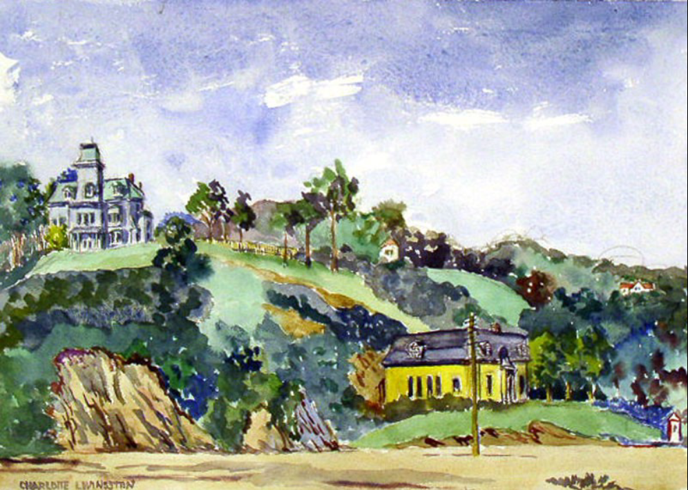
August 27, 2024 at 5:49 pm in reply to: How Was Fieldston Names? When Was Riverdale Born? – Here Are Some Answers #4355It is a fun article! Here’s a Charlotte Livingston Kughler watercolor of Spuyten Duyvil with the old Cox mansion up on the hill on the left:
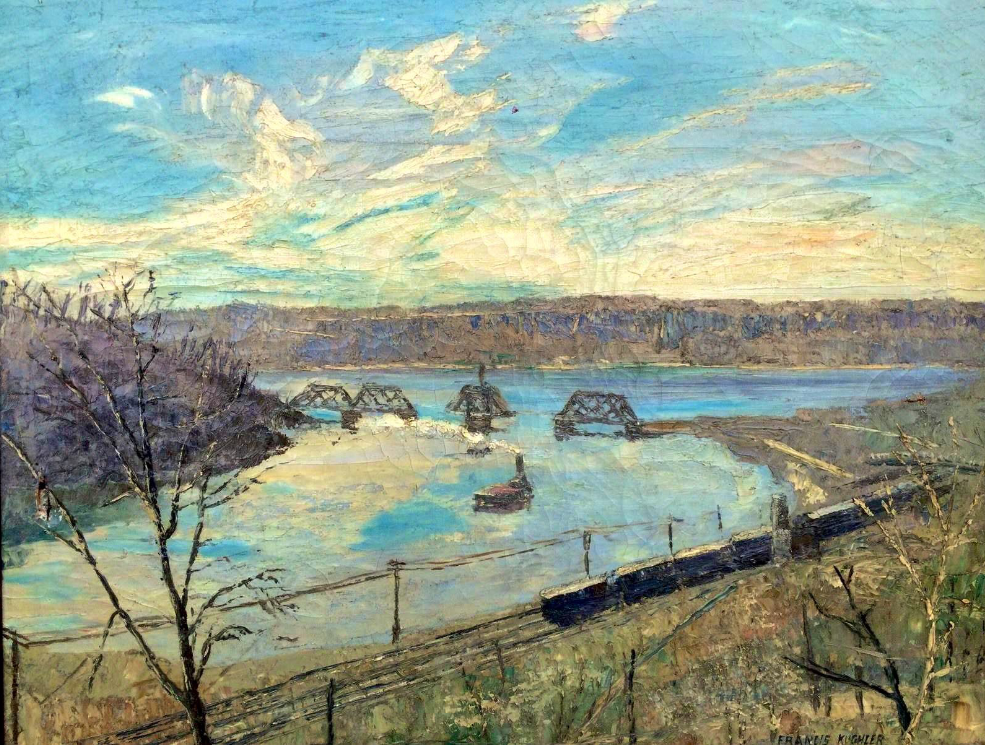
And another Spuyten Duyvil view by her husband, Francis Kughler:
This is interesting stuff that everyone has been finding about the Edgehill Inn. Here’s a little ad placed in the Riverdale News in 1928:

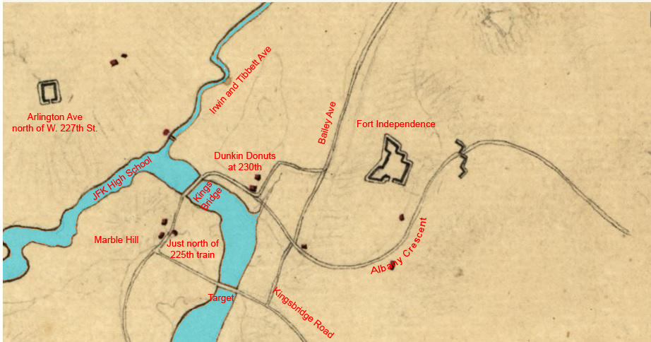
Just to clarify, The Edgehill Inn was formerly the Warren Bishop Sage mansion (or was built where the Sage mansion stood) and that was the site of Fort No. 3–not Fort No. 2. Fort No. 3 was built on the eastern crest of Spuyten Duyvil Hill by the British in 1777 and overlooked the Kingsbridge valley.
I could never figure out how Warren B. Sage came to first own property in that area. His house apparently stood before 1856 because it is visible in this print which was published in Valentine’s Manual:

That is a view taken from modern W. 230th Street a little to the east of Kingsbridge Avenue. That’s the Kingsbridge in the foreground with Manhattan on the left and the mainland on the right. The large building in the center is Macomb’s Mill. Rising in the background you can see Spuyten Duyvil Hill. The large building on the hill appears to be the Sage mansion. Here’s that same view today:

Thanks for sharing that information and those memories, Jonathan. So was the Fanny Farmer factory making candy there?
That’s an interesting map, Tom. The series of parallel lines are the train tracks so are the bleachers the red or yellow rectangle just above the tracks? The image is too small to read the details.
I don’t know where the name “Hedley Hall” comes from. It does sound more like a college building than a train shed but it was, and still is, a train shed.
The original image is held by the Museum of the City of New York but they don’t have a lot of information about it up on their website here. We reproduced it with a license from the MCNY for our exhibit.
The map posted below is interesting as well. Among other things, you can see the “Free Landing Road” outlined in red pencil. That area, which is now the Gaelic Park athletic fields was the Kingsbridge town dock. If you go to that area today, you would have no idea that boats ever docked there because it is completely landlocked.
We may have a speaker lined up on a related topic late this Fall depending on the speaker’s schedule
On the topic of Stephen Simmons, we are cataloging materials in our archives and found a reference to the incident that was described in the New York Times article at the top of this thread. It was in the police blotter from 1880 (we have many late 19th century police blotters in our collection). I would post it but I am away on vacation.
Some may not know about Along the Hudson Park, which was an early 20th century real estate development south of today’s Riverdale Park. Here is a map advertising lots in the development:
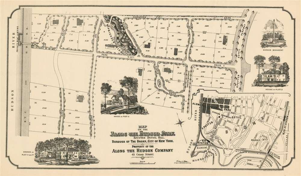
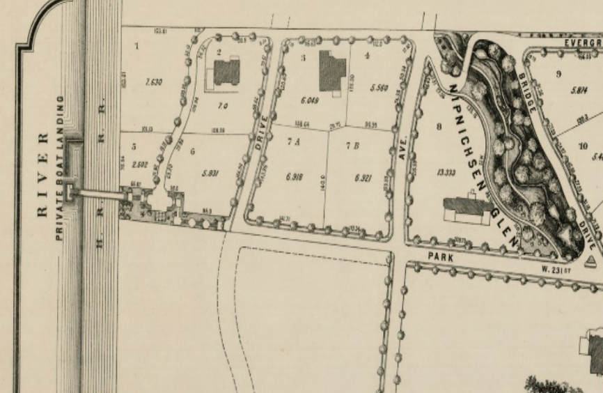
One question I have about it has to do with the “Private Boat Landing” on the Hudson River at the end of 231st Street:
The map shows an overpass over the railroad tracks leading to the river bank. Today there still is an overpass there although it has seen better days (photo courtesy of Kevin Horbatiuk):
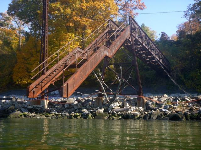
I wonder if this boat landing is collectively owned by the homeowners of the former Along the Hudson Development.
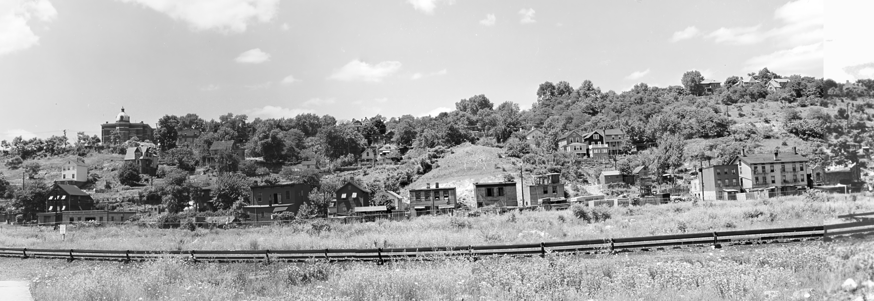
I always wondered where that store was located that is depicted in the Abbott photo. Perhaps part of the “lost village” of Spuyten Duyvil that used to be on the east side of Spuyten Duyvil Hill (as shown in this Percy Sperr photo):
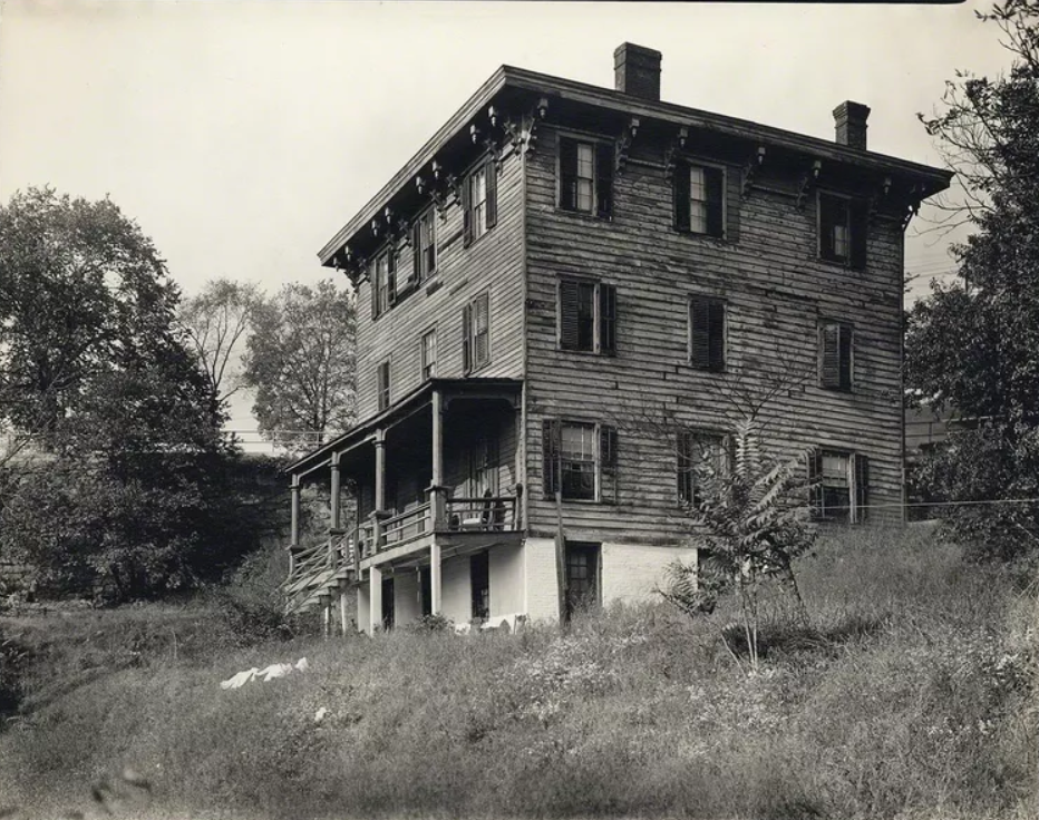
Berenice Abbott also took this photo of a Spuyten Duyvil home:
Thanks, Jennifer.
Were they actually manufacturing uniforms there or just mending them? How many women were working there on sewing machines? Perhaps this blazer was made in Marble Hill? I am curious because I think there was more manufacturing around here than people realize.


The initial questioner sent this in from the April 14, 1965 New York Times.

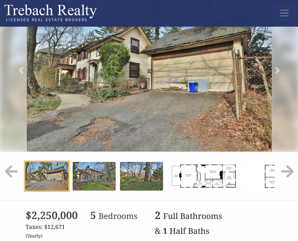
I am reviving this old thread because the Hadley House is for sale! $2.25 million will get you a city landmark that is older than the United States (although the exact date of its construction is a real mystery). Here is the deep dive I wrote about the house: https://kingsbridgehistoricalsociety.org/the-hadley-house-at-5122-post-road/
Well, that’s one heck of a coincidence! Pretty amazing.
Stephanie asked about where the baseball games may have been played at Spuyten Duyvil. That’s a good question since the area is so hilly with very little level ground for a field. I think the answer can be found in this memoir by J.B. James, who grew up in the neighborhood in the late 1800s:
There was a baseball club at Riverdale and one at Spuyten Duyvil, and matches were played between them, usually on a level piece of land at the Spuyten Duyvil belonging to the Cox Estate. Here also were held athletic games, which were quite important events socially.
Cox was a business associate of the Johnsons who operated the iron foundry and stove works on the Spuyten Duyvil Creek. The Cox estate was just to the west of Edgehill Church in today’s lower Henry Hudson Park.
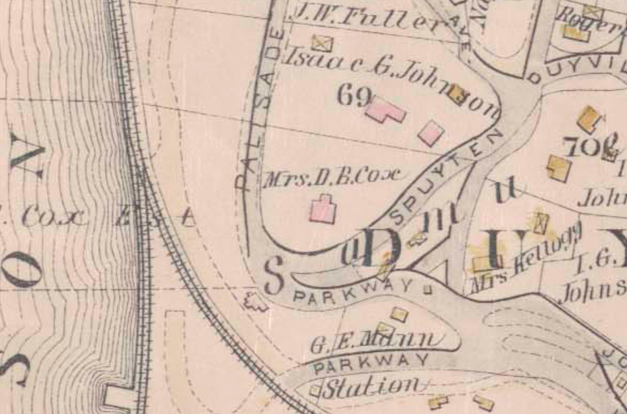
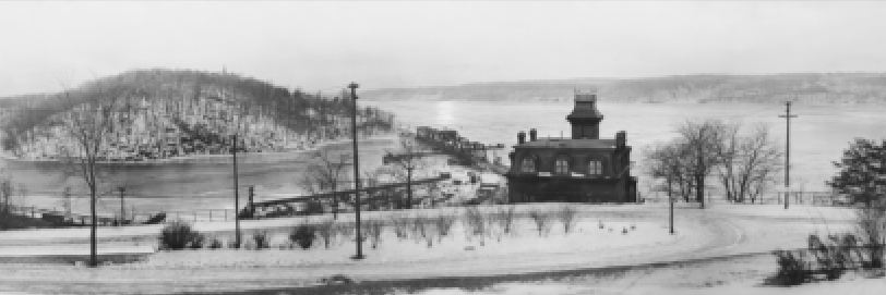
Our neighborhood panorama exhibit, which opens on April 25th at Edgehill, features this image of the Cox estate house and the field behind it that is almost certainly the “level piece of land” described in the memoir. Great backdrop for a ball game.
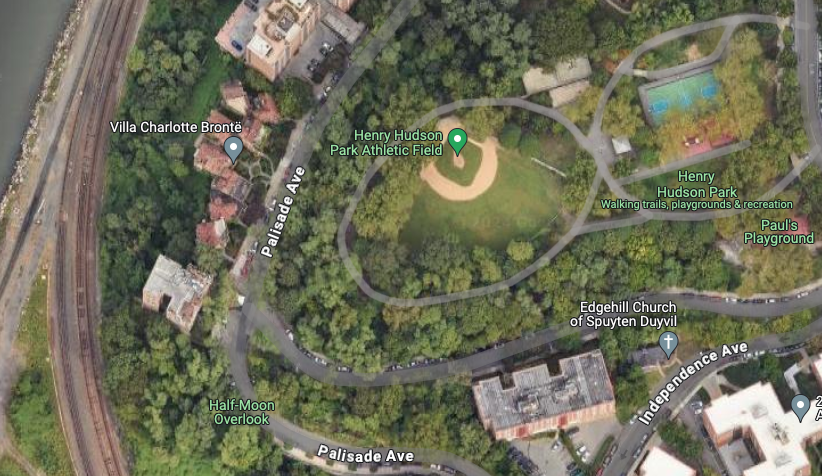
What’s there today? A baseball field! Going by the date of the 1865 New Times article, today’s little leaguers are carrying on a 160 year old tradition of playing baseball at that location.
Fascinating to learn about the women behind the scenes that made those gorgeous windows. Thanks for sharing and great photos.
March 3, 2024 at 8:28 am in reply to: The Russian Mission under construction, from the top down, 50 years ago #3957I had no idea you could construct a building that way.
Interesting that there was a school inside the complex. I wonder if that is still there.
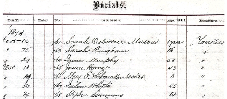
John McMenimon, a teacher in Yonkers, recently reached out to me with regard to the family of Stephen Simmons. John thought to contact the Episcopal Diocese of New York to learn if free Black people living in Yonkers were buried at St. John’s Cemetery. St. John’s Church in Yonkers was the local Anglican church for our area during the colonial period and beyond. He found Stephen Simmons listed as having died on December 24, 1874 at the age of 84. The cause of death was consumption (on the last row below):
From some of the other names on the documents, it is clear that many Kingsbridge/Riverdale residents were interred at St. John’s Cemetery, which is in a historic district in Yonkers (across the street from the Alexander Smith Carpet Mills) in the Saw Mill River valley.
St. John’s Church goes back to 1752. That is where the Van Cortlandts and other local families went to church. The pastor there during the American Revolution, Luke Babcock, was a loyalist who was imprisoned by Patriot revolutionaries. He died shortly after being released and was interred in the Van Cortlandt Family Burial Vault in Van Cortlandt Park.
January 13, 2024 at 1:52 pm in reply to: Isaac Low – Delegate to 1st Continental Congress and local resident #3856Thanks for the compliment. I would probably publicize it more but ever since I upgraded our server, it lost a lot of its functionality.
I think you are right about being your tenure as a member. 1956, wow!
I’m not sure if you are looking for:
1) where railroad stations were located in today’s South Yonkers before the trains entered Van Cortlandt Park or
2) where railroad stations were located in our area before the creation of Van Cortlandt Park (when this part of The Bronx was known as South Yonkers)?
Either way, here are three maps that might be helpful:
Map of the Bronx. [including part of Yonkers, Mount Vernon, and New Rochelle].
Map of the Bronx [including Yonkers, Mount Vernon, and New Rochelle].
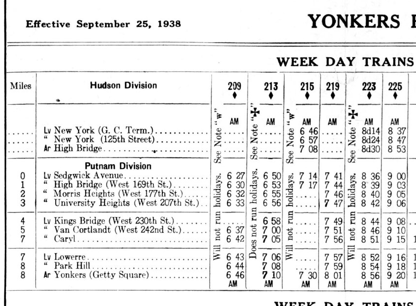
The railroad changed ownership many times even before they finished building it and went by many different names so that’s why it is referred to as the “New York and Northern” above. Below are timetables for the Putnam Division of the New York Central. Here is the main branch (1942):
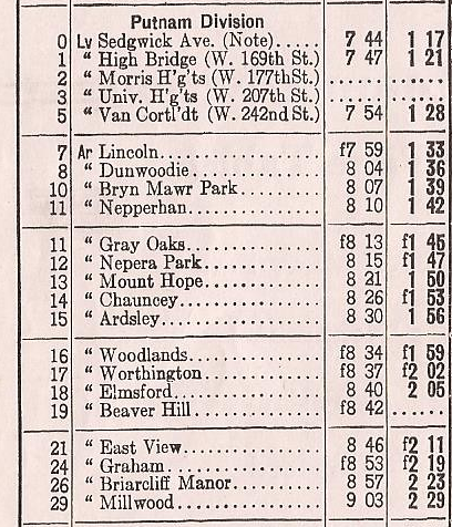
And here are the stops on the spur to Getty Square in Yonkers:
You can still see remnants of railroad infrastructure in several parts of Yonkers.
January 9, 2024 at 12:15 pm in reply to: Isaac Low – Delegate to 1st Continental Congress and local resident #3846Good questions. You sent me down a bit of a rabbit hole this morning. Just a little background for anyone else that might be reading:
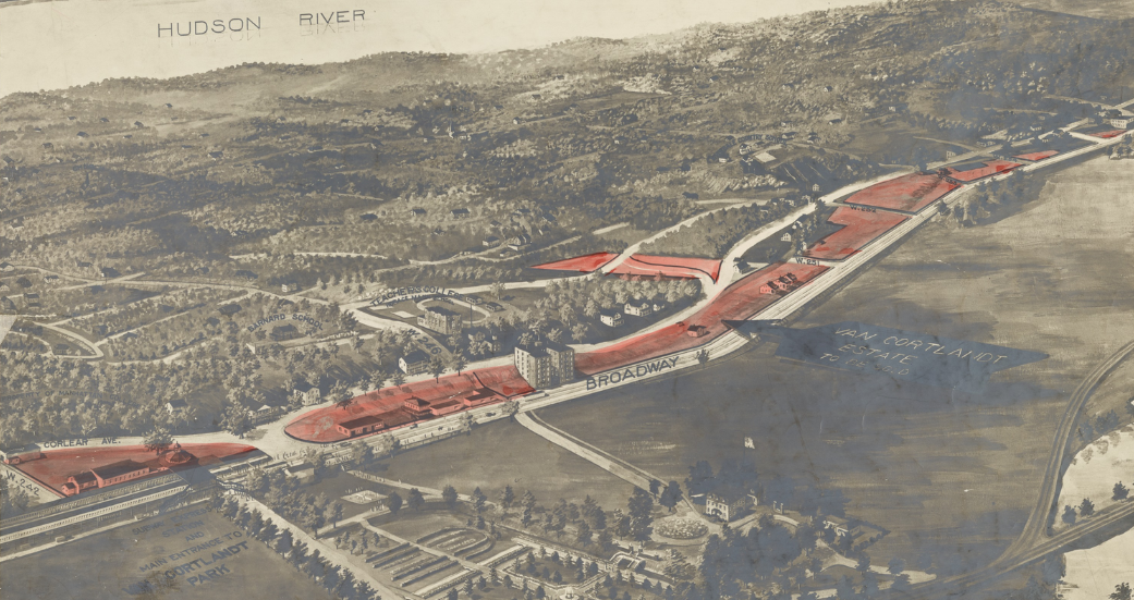
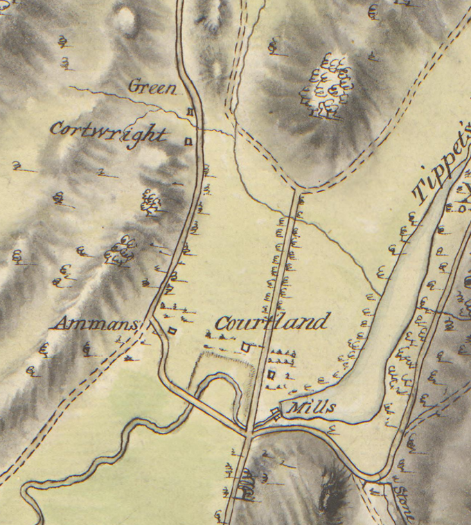
The Hadley House is a house that still stands at 5122 Post Road in Riverdale just north of W. 251st Street. It is a city landmark and I wrote a deep dive article about it here. But the first of your questions relates to another historic house that stood just to the south of the Hadley House on the old Albany Post Road during the Revolution. That building was known as the Van Cortlandt Miller’s House and it is no longer standing. I’ve labeled both houses on the map below (the Hadley House was rented by Isaac Green during the Revolution).
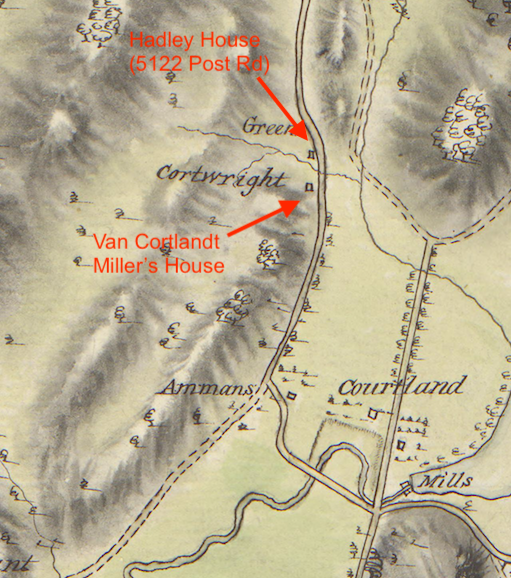
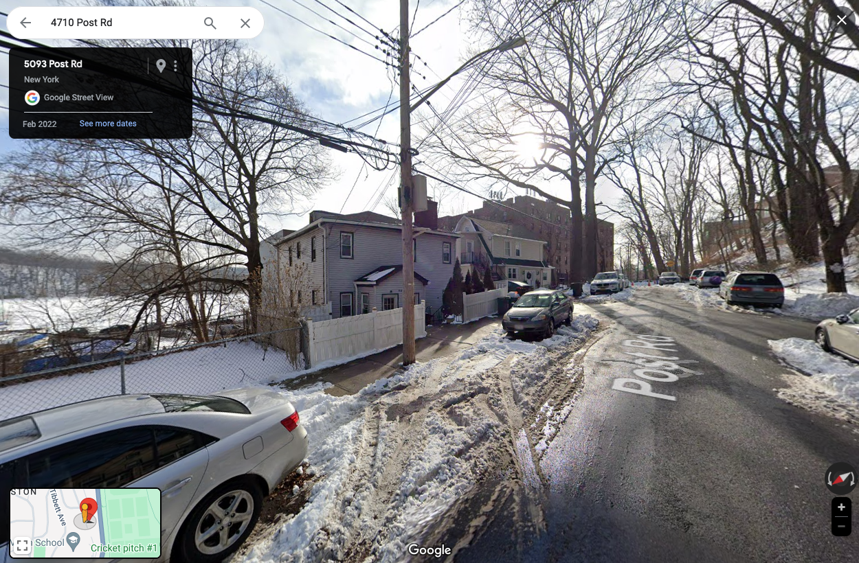
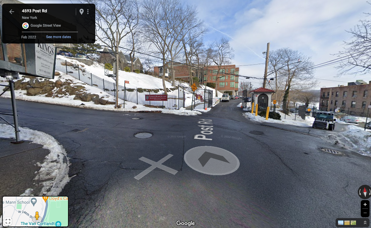
In the above map you can see that the Van Cortlandt Miller’s House was occupied by someone named Cortwright in 1781. But the Van Cortlandts owned the house and property around it. There were a number of people families named Cartwright, Cortwright, or Kortright in our area. Perhaps one of them was the miller at the Van Cortlandt mills during the Revolution and was living in the Miller’s House at the time. The Miller’s House, if it hadn’t been torn down, would have been on the dead-end section of Post Road South of W. 251st. That’s a bit off the beaten path so here’s a photo of that street (view looking south with Van Cortlandt Park’s Parade Ground on the left and the Horace Mann campus in the distance).
The two houses on the left are modern constructions and not historic. I am not sure when the Van Cortlandt Miller’s House was torn down but it was still standing about 100 years ago. The Van Cortlandts owned most of the property between Broadway and the Post Road since the colonial period and sold it at auction in 1919. The NYPL has a great aerial view of the land that was to be sold at that auction:
Zooming in on the area around W. 251st and Post Road….
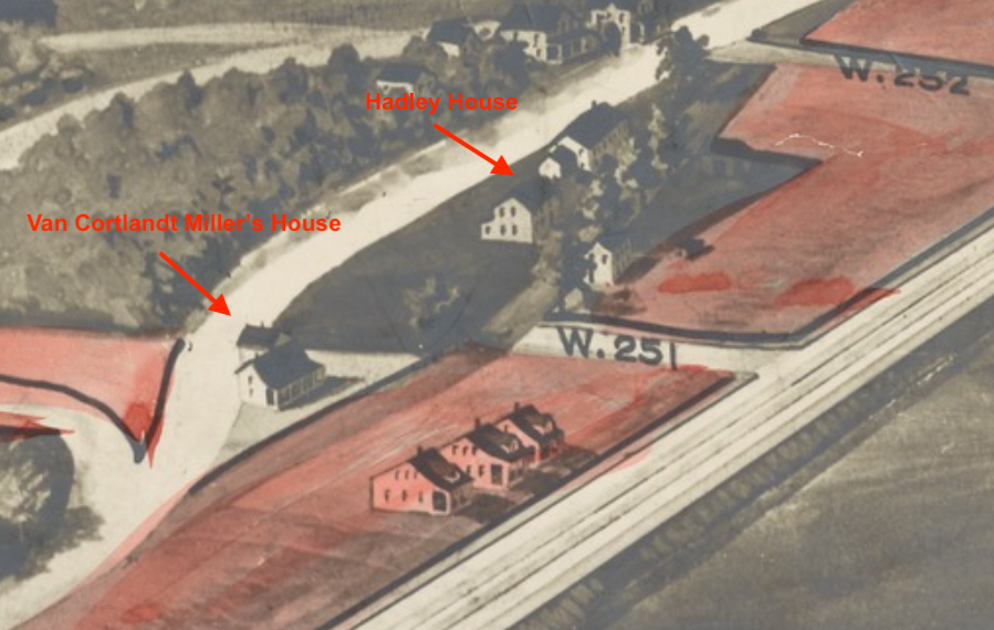
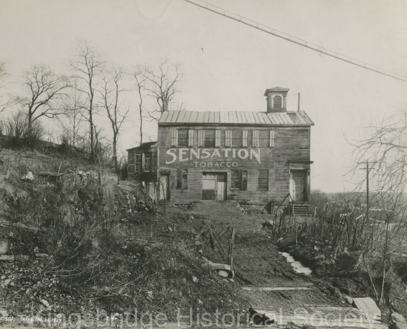
The Miller’s House looks like a Dutch-style farmhouse with a nice porch. Here’s a photo of it in the collections of the Museum of the City of New York:

Perhaps the Miller’s House was knocked down to make way for the apartment building that now stands at the corner of W. 251st and Post Road.
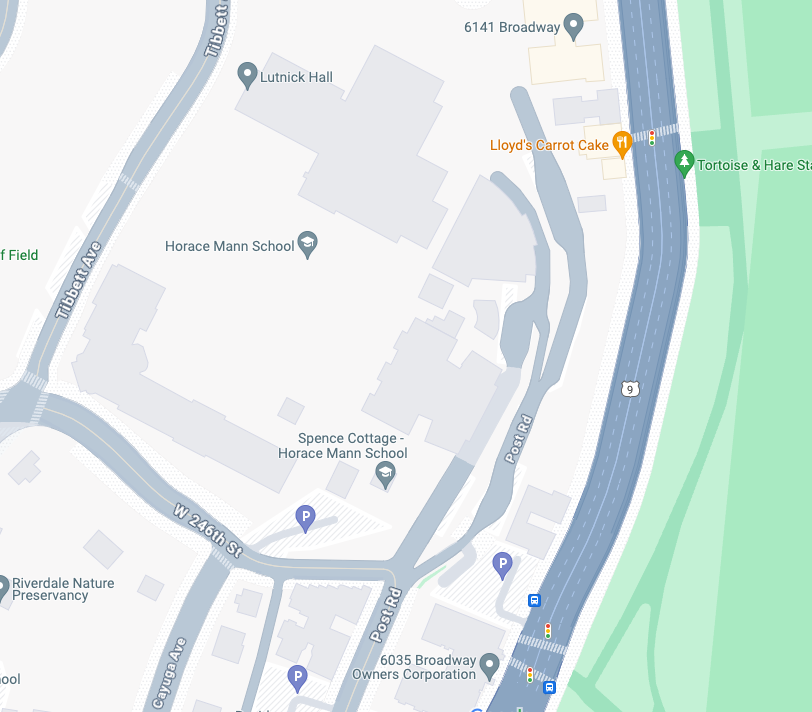
The second part of your question about the section of Post Road that is now part of the Horace Mann campus is interesting. Here’s a photo of Post Road and W. 246th Street. I always assumed that the road leading into the campus to the left of the security booth was the old Post Road.
But there’s a lower road just to the right of the security booth. I’ve never paid attention to it before:
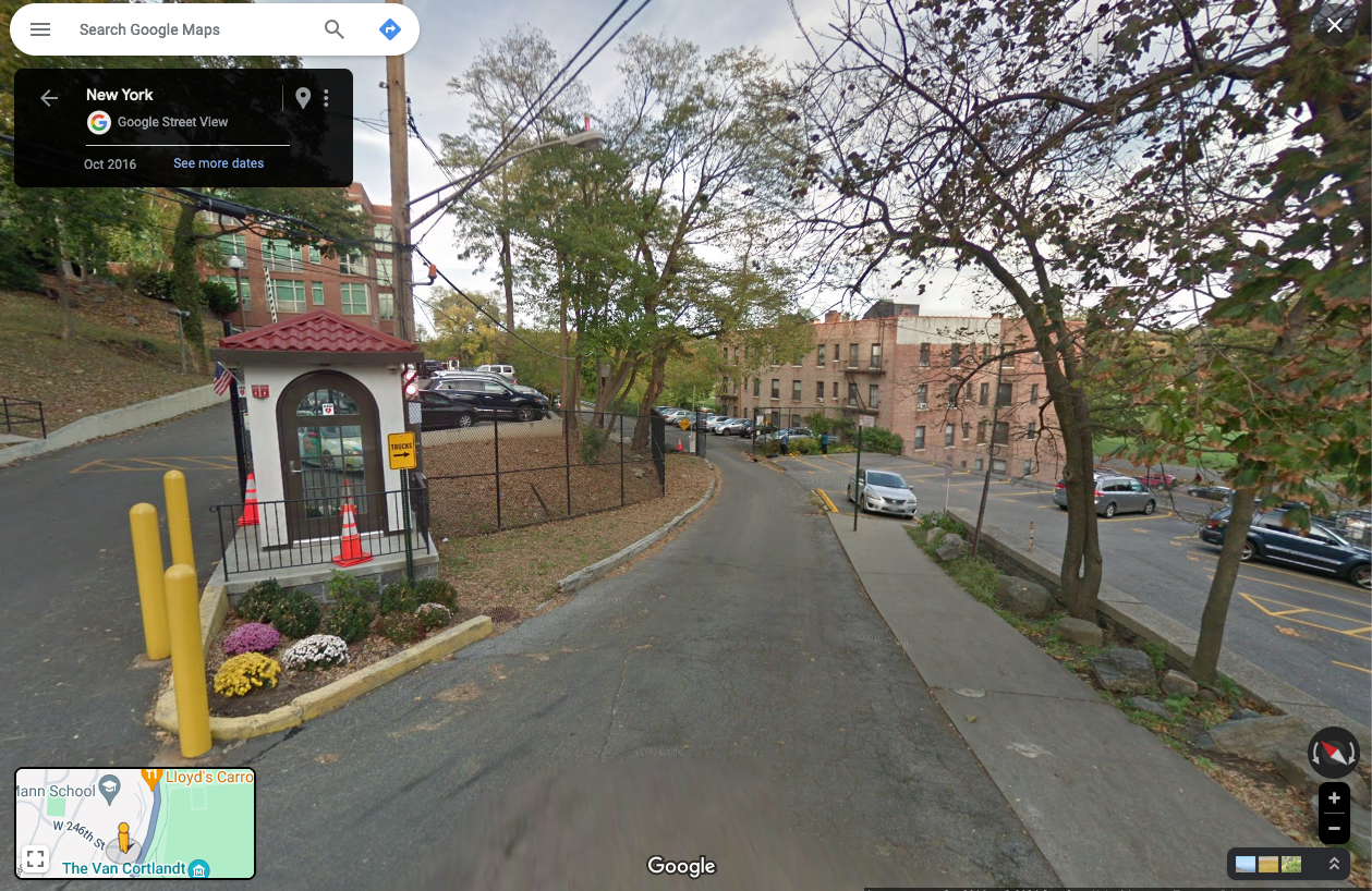
Looking at the Google Map below, it would appear this lower road is actually the Post Road.
The same NYPL Van Cortlandt Estate Sale aerial view depicted that area in 1919:
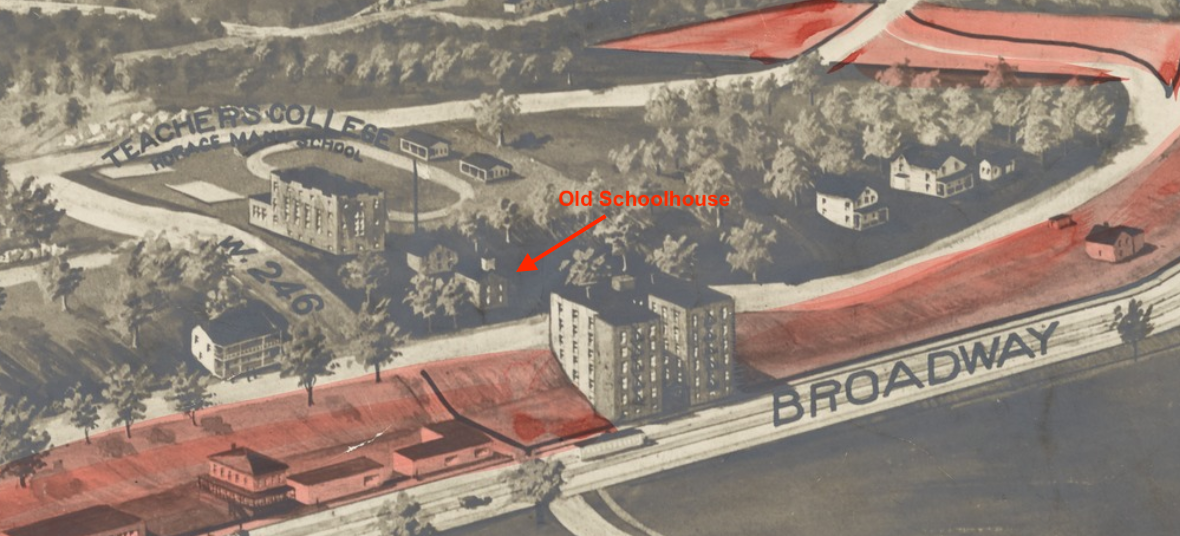
I labeled the old Mosholu schoolhouse because we have an image of it in our collection (ca. 1927):
 January 8, 2024 at 5:42 pm in reply to: Isaac Low – Delegate to 1st Continental Congress and local resident #3843
Thanks Dan. I labeled and colored one of those other maps for you (two versions):
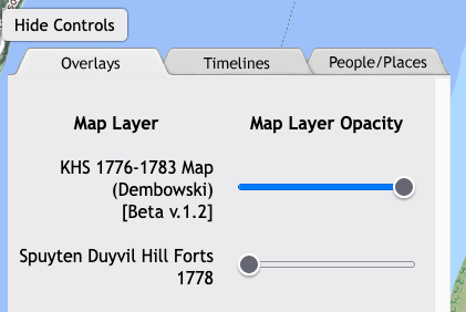
You may want to check out the link here to a map that I made. It is not exactly working as intended because my programming code is outdated but you can adjust the slider buttons that look like this below in order to see different layers:
Back in the early days of the Society a member made this map, which is pretty great.
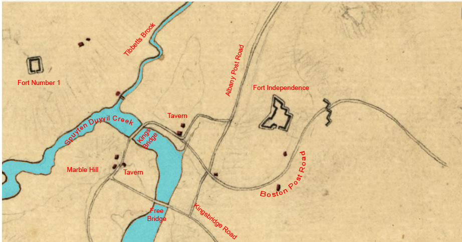
January 5, 2024 at 2:32 pm in reply to: Isaac Low – Delegate to 1st Continental Congress and local resident #3840It has been a weird fixation of mine to figure out what all those unlabled building markers represent on Revolutionary era maps–to find out who they belonged to…
One thing that is helpful (obviously) are maps where the inhabitants are labeled like this one:
But the above map is from 1781 and many homes were destroyed or abandoned by then so many of the residents’ names are missing. The maps from earlier show more home sites than this one. Another document that’s helpful is the 1775 militia roll for the South Yonkers company. It is a long list of names of local people and you search for them in land deeds, recorded wills, and other documents in archives to figure out where they lived. You can also use the 1790 census and later maps to get some clues.
January 5, 2024 at 11:24 am in reply to: Isaac Low – Delegate to 1st Continental Congress and local resident #3838I agree, Tom, that we cannot know for sure that Isaac Low’s house was where I initially suggested (in today’s Van Cortlandt Park). I picked that spot because the testimony stated that Low’s barn was near James van Cortlandt’s house, which is the Van Cortlandt House Museum. But another reason why I think Low’s house could have been there is that the structures I identified on the map don’t appear on Revolutionary era maps from 1781, indicating that they stood at the war’s outset, but could have been destroyed or dismantled later during the war. Although unless something else definitive turns up, your guess is as good as mine.
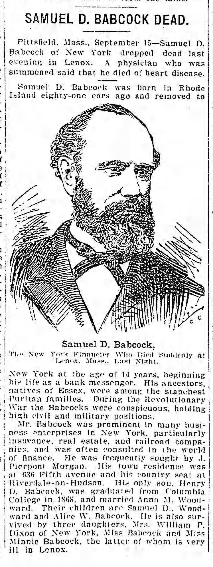
December 17, 2023 at 9:05 am in reply to: Minnie Babcock, a Victorian house, and social life in “Riverdale-on-Hudson” #3825I did manage to find an obit for Samuel D. Babcock, which mentions Minnie at the bottom (9/15/1902 Brooklyn Daily Eagle):
 I have a few more images from the scrap book. In 1878 Minnie went to the American premiere of Bizet’s “Carmen” at the New York Academy of Music.
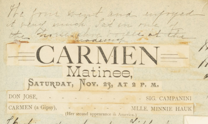
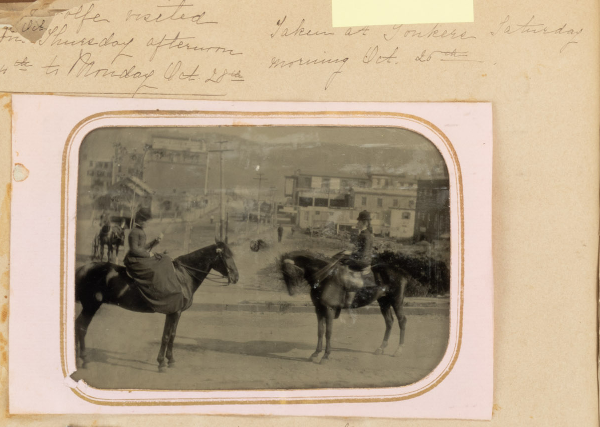
Here is a photo “taken at Yonkers Saturday morning Oct. 25th.” On another day she wrote about “a lovely horseback ride in the morning to Port Chester and back.”
Correction: I was just told that the Columbia Florist was NOT in the same location in the old photo, but rather a couple of stores down.
I think it has to be a property marker. It looks very similar to the one Tom posted for the Delafield property. And I can’t think of anything else it could be.
Good idea. Here is a link to the superimposed map (use the blue bar in the upper right corner to adjust the opacity of the 1872 map and zoom on the top left): https://kingsbridgehistoricalsociety.org/images/stone%20marker%20map/openlayers.html
I think it could very well be a property marker of some kind but it is not lot 54 in Hudson Park as shown in the map Tom found, which was apparently north of 236th Street. This marker on W. 232nd seems to be on the property boundary between Judge Whiting’s property and James Hayden’s property.
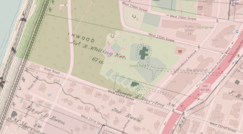
We discussed Whiting a little in this thread: https://kingsbridgehistoricalsociety.org/forums/topic/the-hudson-river-and-railroad-illustrated/
It sure is an interesting question. It is difficult to find a history that does not refer to the Philipses as the lords of Philipsburg Manor. Here, here, here, and here are all examples of histories referring to them as “lords.” But I have never seen a colonial period document addressing him as “Lord Philipse” or referring to him that way. Nor does it seem that the Philpses referred to themselves as “lords.” These clippings are from colonial New York newspaper ads:
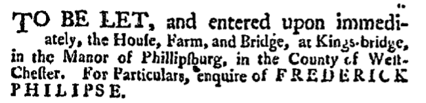
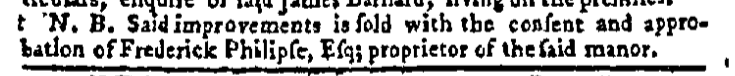

You see him as an “Esq.” or a “proprietor” but not a “lord.” Philipses held many government positions as well and they were never referred to as “lords” in any of the minutes.
But the charter is very clear that, as far as the king and queen were concerned, his property constituted a “Lordship” and they repeat that word over and over (from Westchester deed B 201):
We have thought fitt according to the request of our said loving subject to erect all this aforesaid recited tracts and parcells of land and meadow within the limits and bounds aforesaid into a Lordship or mannor And therefor by these presents We do make erect and constitute all this aforesaid recited tracts and parcels of land and meadow within the limits and bounds aforementioned together with all and every the afore granted premises with all and every their appurtenances into a Lordship or Manor to all intents and purposes.
So, I guess if I could go back in time and ask King William a question it would be “Can you have a lordship and not be a lord?” But since I can’t do that, I will try to get in touch with historian Patricia Bonomi, who is really an expert in this time period in New York. I noticed in her book, A Factious People, that she refers to Philipse as a “proprietor” but not a “lord.” Maybe she has a good reason to believe that the other historians are wrong. I will let you know what she says if I can get ahold of her.
-
AuthorPosts