
Forum Replies Created
-
AuthorPosts
-
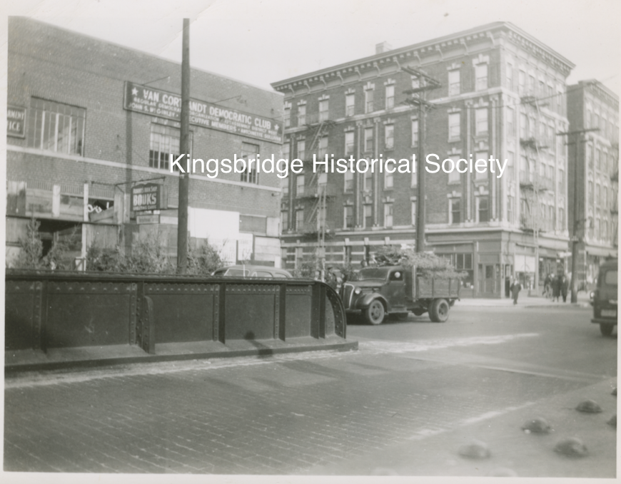
Yes, that’s it, thanks. The large brick building on the right in photo #4 and in the train engine photo must be the old Tynan’s hardware/Robert’s Bookshop building on W. 231st that was torn down to clear way for the thruway. It was on the east side of the tracks where the Deegan is today. It is shown in the photo below on the left, which was taken in 1951.
Thanks for sharing those links, Stephanie. It makes me think of a recent family hike I took through Riverdale Park. We got off the path a little bit and found very old looking oyster shells strewn about high up on the ridge:
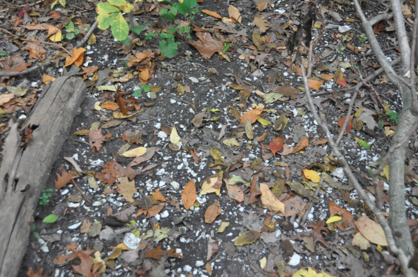
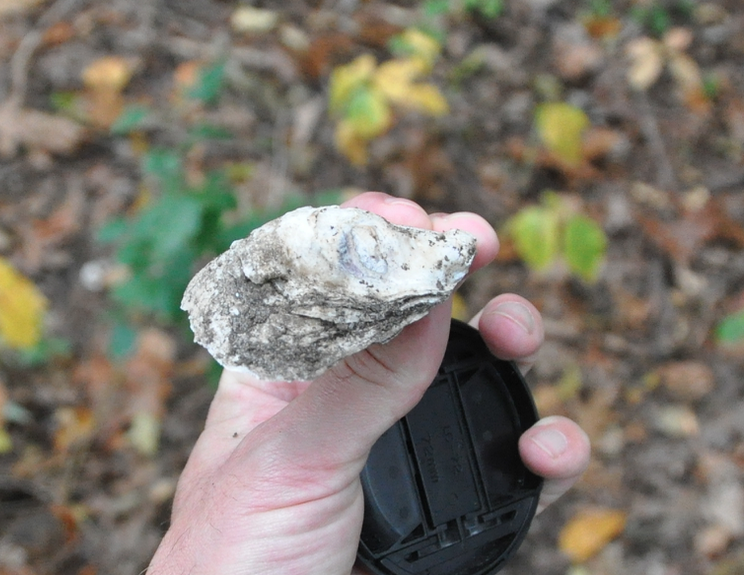
The ancient remains of a picnic of long ago…
It would be interesting to make a map showing places in our neighborhood where Native American artifacts have been discovered. I have come across quite a number of reports in old newspapers articles, books, and memoirs.
On another note, New York State maintains a database of archaeologically sensitive sites in its CRIS system. It is used to trigger environmental and archaeological studies before development can proceed. Oddly, I could not find this study on the CRIS map. I will send an email to the State Historic Preservation Office to ask if they could upload these reports to the database.
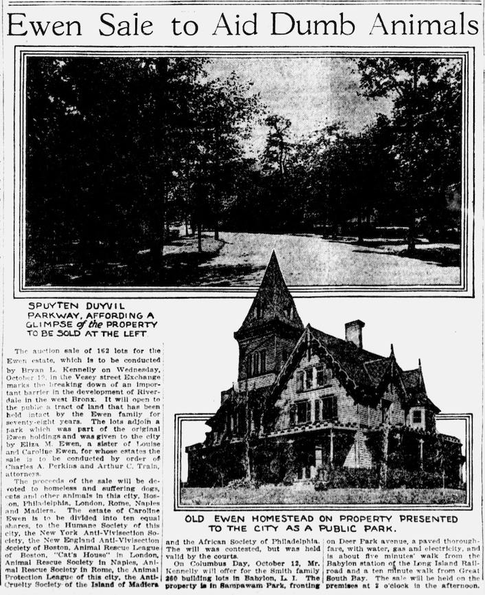
And before anyone says that it is a shame that the city tore down Ms. Ewen’s house for a dog run, it is worth noting that she directed the proceeds from her estate to “be devoted to homeless and suffering dogs, cats, and other animals in this city.”
 December 6, 2021 at 9:06 am in reply to: Burying Tibbetts Brook – Construction and Chaos in Kingsbridge ca. 1900 #2394
Thanks Dott. If you read the article, you get the sense that the relevant city agencies are much more serious about making this daylighting happen than in the past. Here’s the link.
It’s odd that I have not come across any photos of the actual Thruway construction. I would not be surprised if there are photos in the New York State Archives (which has some digitized here) or the State Library but I haven’t found anything from our area yet. The State Archives do have a couple of very optimistic films about the Thruway. This one asks the viewers to imagine how much time they will save with the benefit of the Cross Bronx Expressway!
<p style=”text-align: center;”>[youtube https://www.youtube.com/watch?v=fNvPD6RdrIQ%5D</p>
In the “Members Area” tab of this website you will see our collection of digitized photos. We have one folder there that might be of interest: “Albany Crescent and areas Affected by Major Deegan.”November 28, 2021 at 6:46 pm in reply to: Burying Tibbetts Brook – Construction and Chaos in Kingsbridge ca. 1900 #2387Thanks, Tom. You nailed that one. Peter told me he didn’t think the caption was right and I had my doubts as well.
November 28, 2021 at 3:03 pm in reply to: Burying Tibbetts Brook – Construction and Chaos in Kingsbridge ca. 1900 #2383Yes, those stairs look iffy!
If you want to see the photos individually with a zoom feature click here.
There’s a fun feature in the photo of the Tippett house that you posted, Zach:
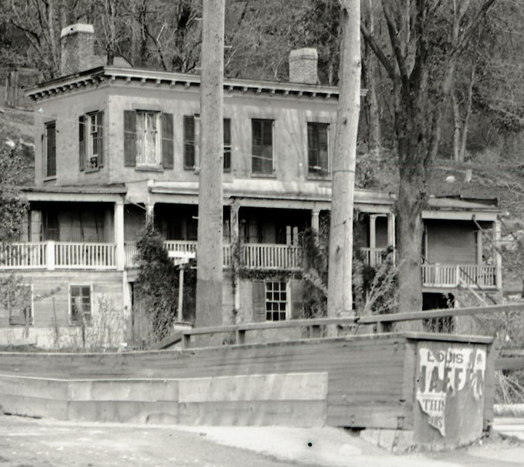
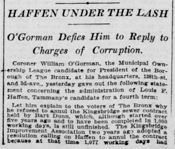
Note the ripped up campaign ad for Louis Haffen on the bridge. That was the borough president that was accused of corruption over the sewer construction:
Here’s one photo from the Lehigh collection that surprised me. I didn’t know this existed at all:
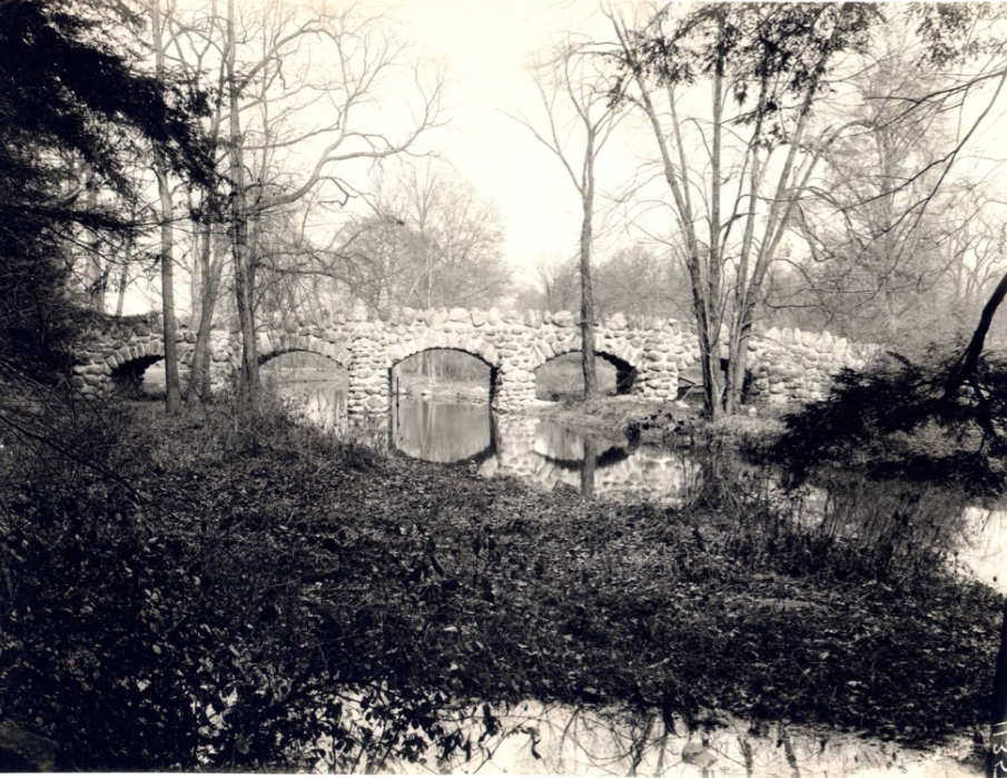
The caption: 654 Ewing Estate Riverdale Ave. & W. 231st St. (Ewen), 1132 in lower right corner, no date, black and white photo 6 x 8 (Bucolic scene with rounded stone five-arch bridge reflected in winding stream among slender, lightly leafed trees)
I wonder, is the caption accurate?
Here’s one that looks like it could be our area but there is no location provided:
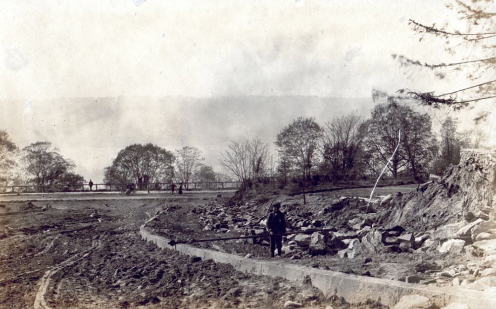
To me it looks like the Palisades are in the distance.
And to echo Peter’s thought–yes, we always welcome donations of neighborhood photos!
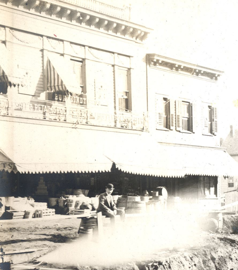
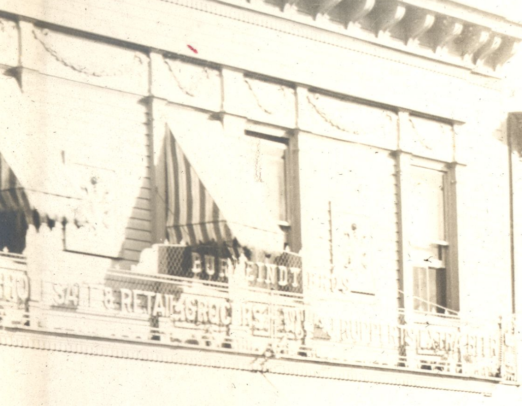
November 27, 2021 at 12:29 pm in reply to: Burying Tibbetts Brook – Construction and Chaos in Kingsbridge ca. 1900 #2377Here is a closeup of the Burfeindt Grocery from the first photo above:
A little more legible:
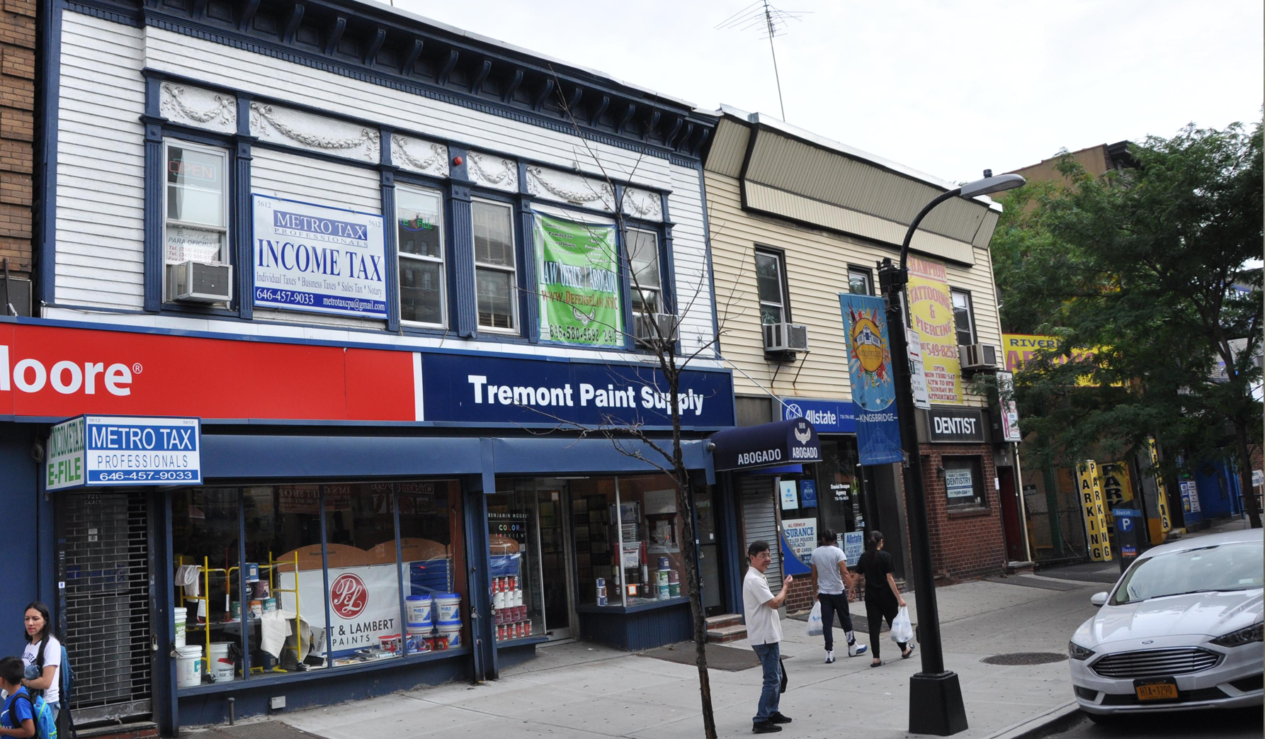
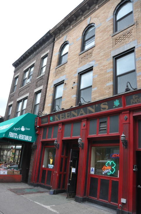
Here’s the detail on the building today:
I was thrilled to find those old sewer construction photos in the Lehigh University collection. They have many more of the neighborhood that I have never seen before. Such as this one from 1904:
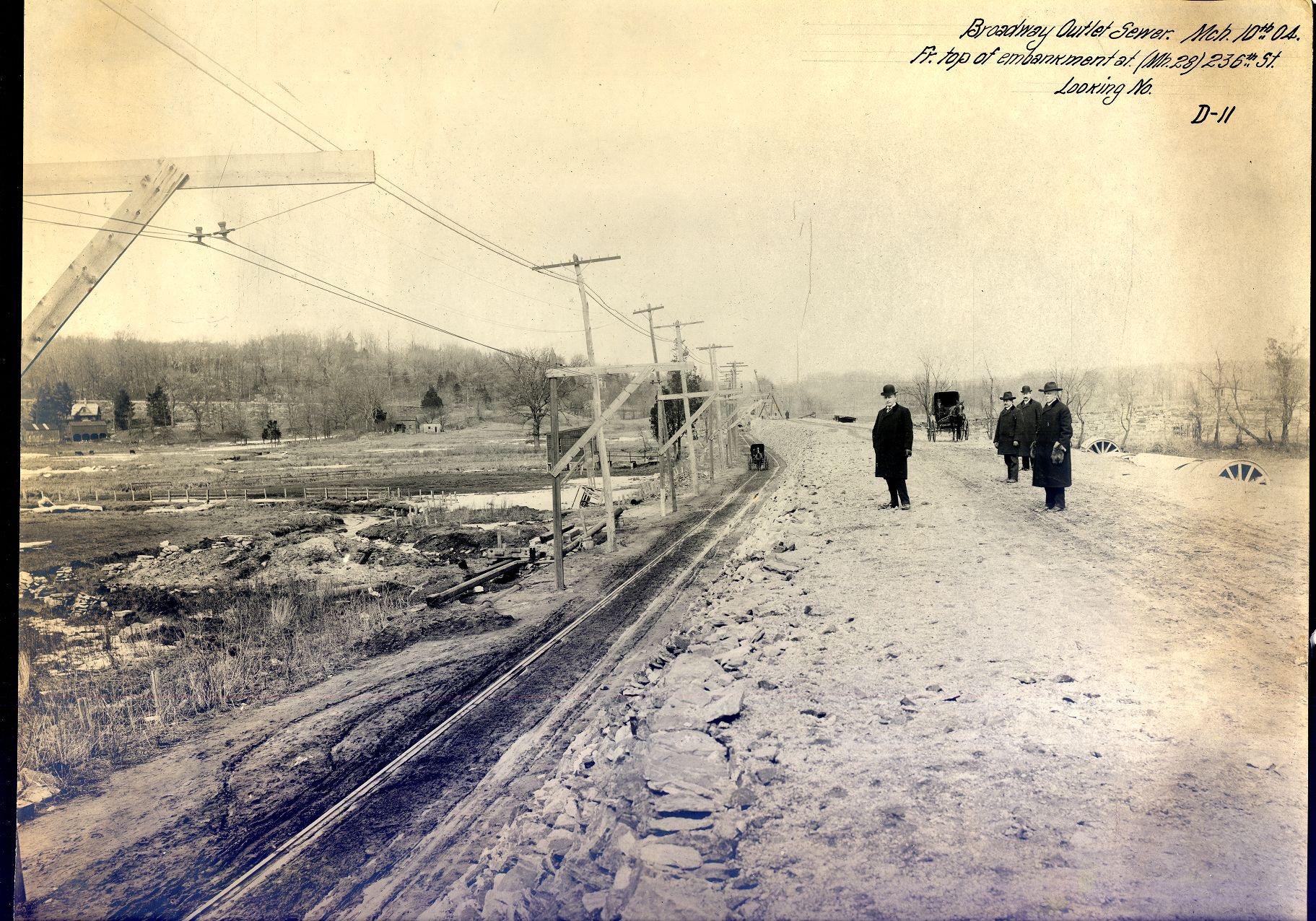
That’s the view looking northwest from about W. 236th Street and Broadway. Here’s a closeup of the area west of Broadway:
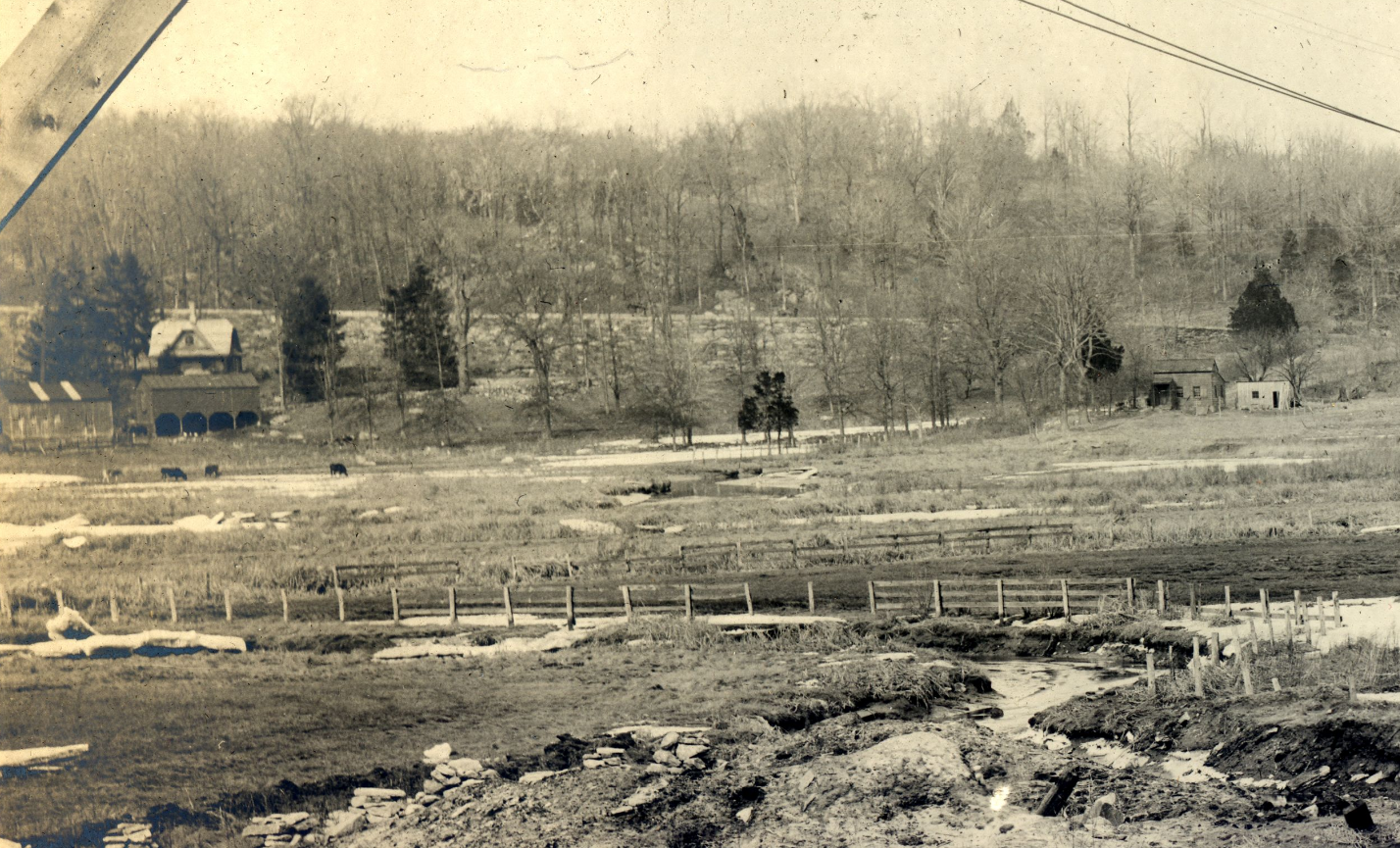
Those cows are grazing about where Gaelic Park is today with Manhattan College Parkway climbing the hill in the background.
Here’s another one that I thought was great:
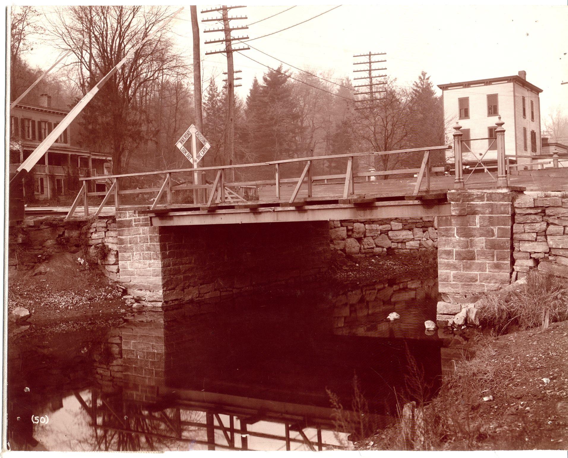
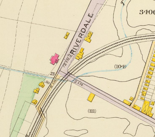
That is a bridge over Tibbetts Brook at W. 230th Street and Riverdale Ave right where the brook flowed into the Spuyten Duyvil Creek. It was also where the New York Central trains crossed so it was another nightmare intersection that locals complained about. The view is looking northwest and that is the old Tippett house that stood in modern day Ewen Park. It is the red building in this 1893 map snippet:
 November 20, 2021 at 2:08 pm in reply to: Patriot Army’s Retreat through The Bronx, October 1776 #2337
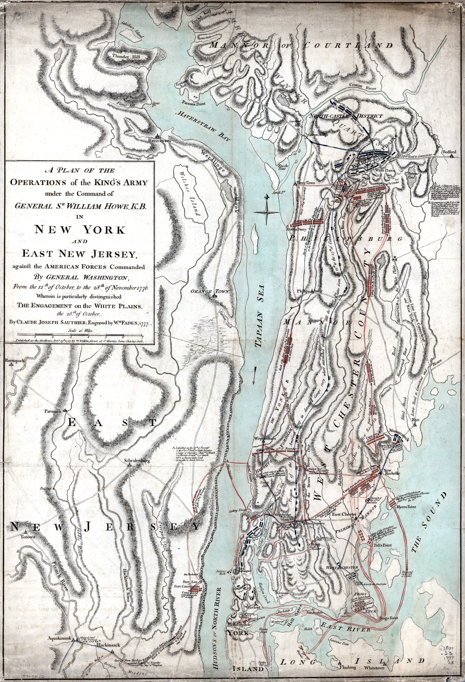
That’s a good point about wanting to stay on the high ground because the Patriots were very concerned about skirmishes breaking out on their retreat to White Plains. Even though it contains many errors, the below map drawn by a British mapmaker, shows Patriots stretched out along western bank of the Bronx River all the way from Fordham to White Plains. It also shows Patriot forces moving north on the Albany Post Road (click on map for larger image):
Thanks for sharing that one–I hadn’t seen it. Coincidentally, I just came across one a couple of days ago as well (click to zoom):
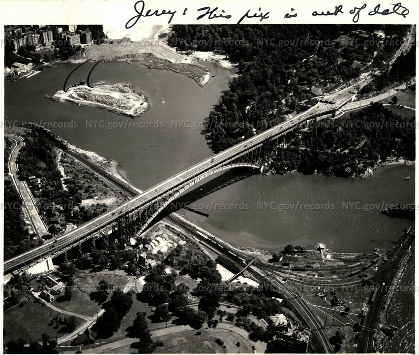
This one has to be about 20 years after the one you posted because the peninsula that the foundry sat on was blasted away before this photo was taken (except for the island in the middle of the canal, which became part of Manhattan).
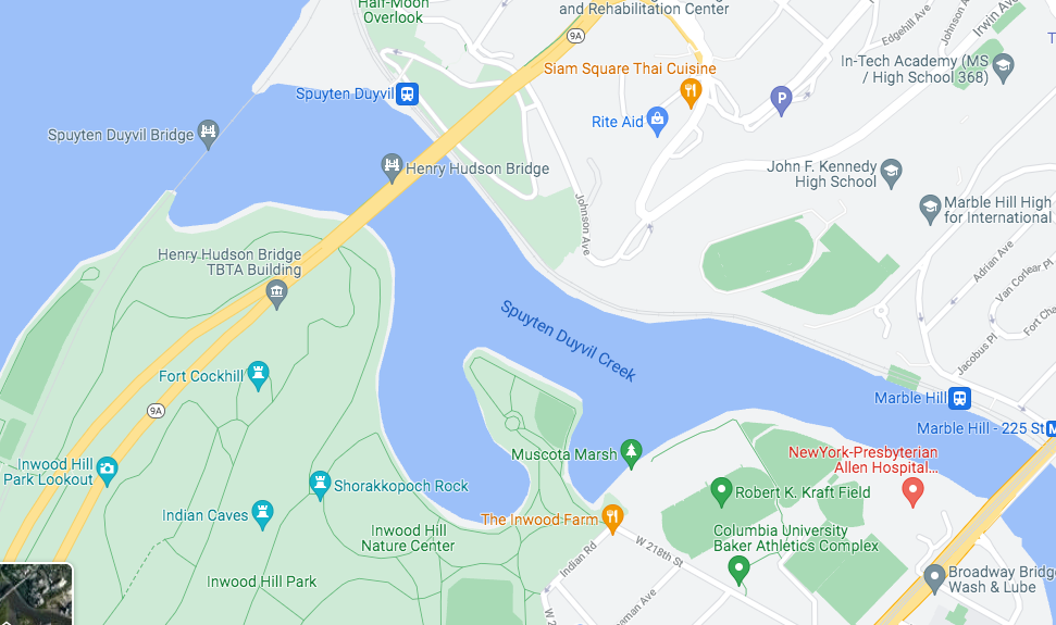
As for your note about Harlem River vs. Spuyten Duyvil Creek…
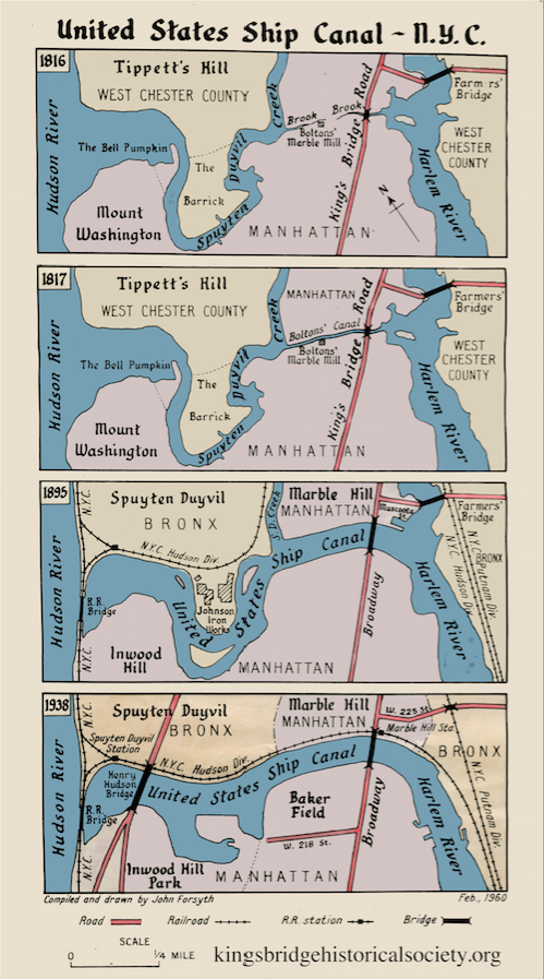
I never saw it defined exactly where one began and the other one ended. I always just assumed it was the Spuyten Duyvil Creek west of the Kingsbridge and the Harlem River east of the Kingsbridge. And then after the Harlem River Ship Canal was built in 1893, the creek really wasn’t a creek anymore.
It is still the Spuyten Duyvil Creek according to Google though:
Here is a handy creek/canal reference drawn by John Forsyth, who I believe was an early KHS member that drew a few maps for us:
I think Diamond Jim Brady was something of a household name for an earlier generation–partly for the rags to riches story but also for his legendary eating habits and relationship with Lillian Russell. I hunted down the film when I learned he was the baggage handler at Spuyten Duyvil station, hoping that they did the filming there.
I think you are probably right, Tom. I tried checking the 1940 NYC tax photo archives for Broadway in The Bronx and couldn’t find those houses. They might have been torn down by then.
October 19, 2021 at 9:22 pm in reply to: The Moller Mansion – After 150 Years Are its Days Numbered? #2205Farewell to a beautiful old house–built overlooking the King’s Bridge when the neighborhood was still part of Yonkers in Westchester County…
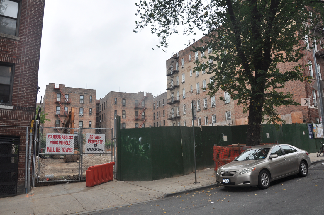
Good sleuthing Zach and Tom.
It is surprising to me that the Davis Cup was hosted here. That was and is still a major tournament. Apparently, in 1911, they drew such large crowds in Kingsbridge that they decided to expand so the club moved to Forest Hills in Queens. Using the clues you provided I was able to find a few more photos from the 1911 Davis Cup:
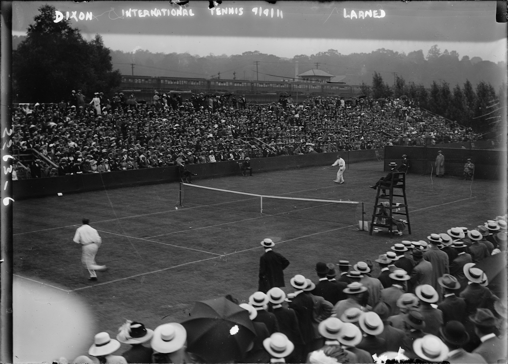 That is from the Library of Congress. You can see the rail-yard shed and the smokestack on Manhattan College Parkway in the background.
Here is another one:
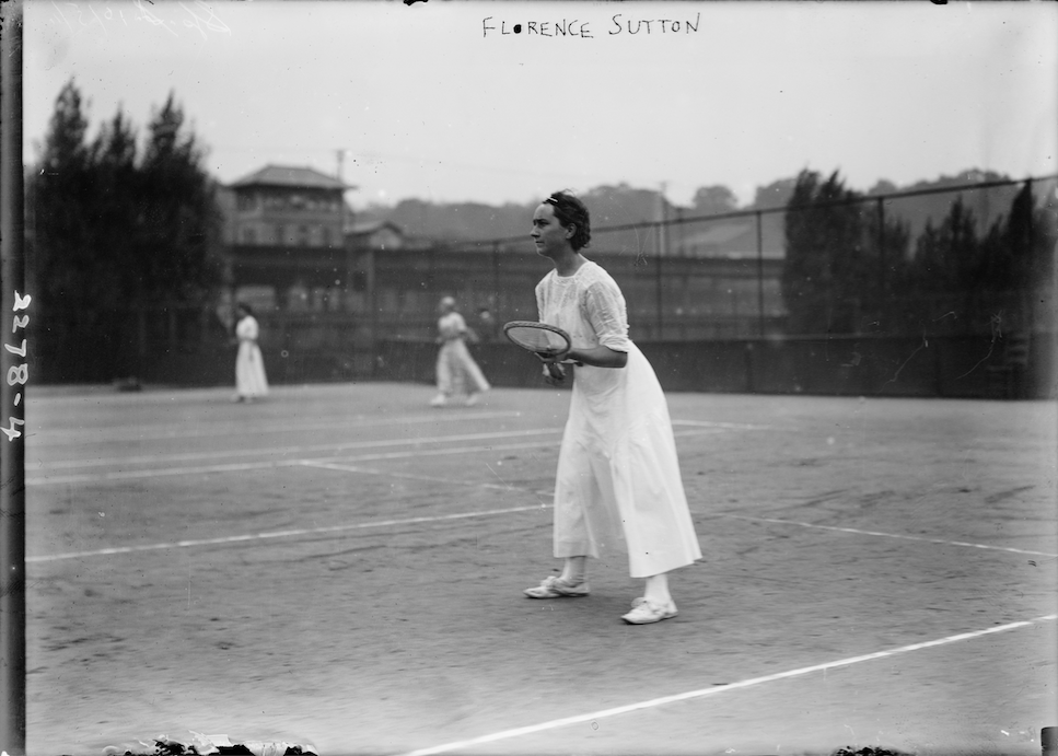
It is astounding how quickly the neighborhood changed in those years. Just a couple of decades before that photo was taken it would have been wetland in the foreground with no tennis courts nor subway.
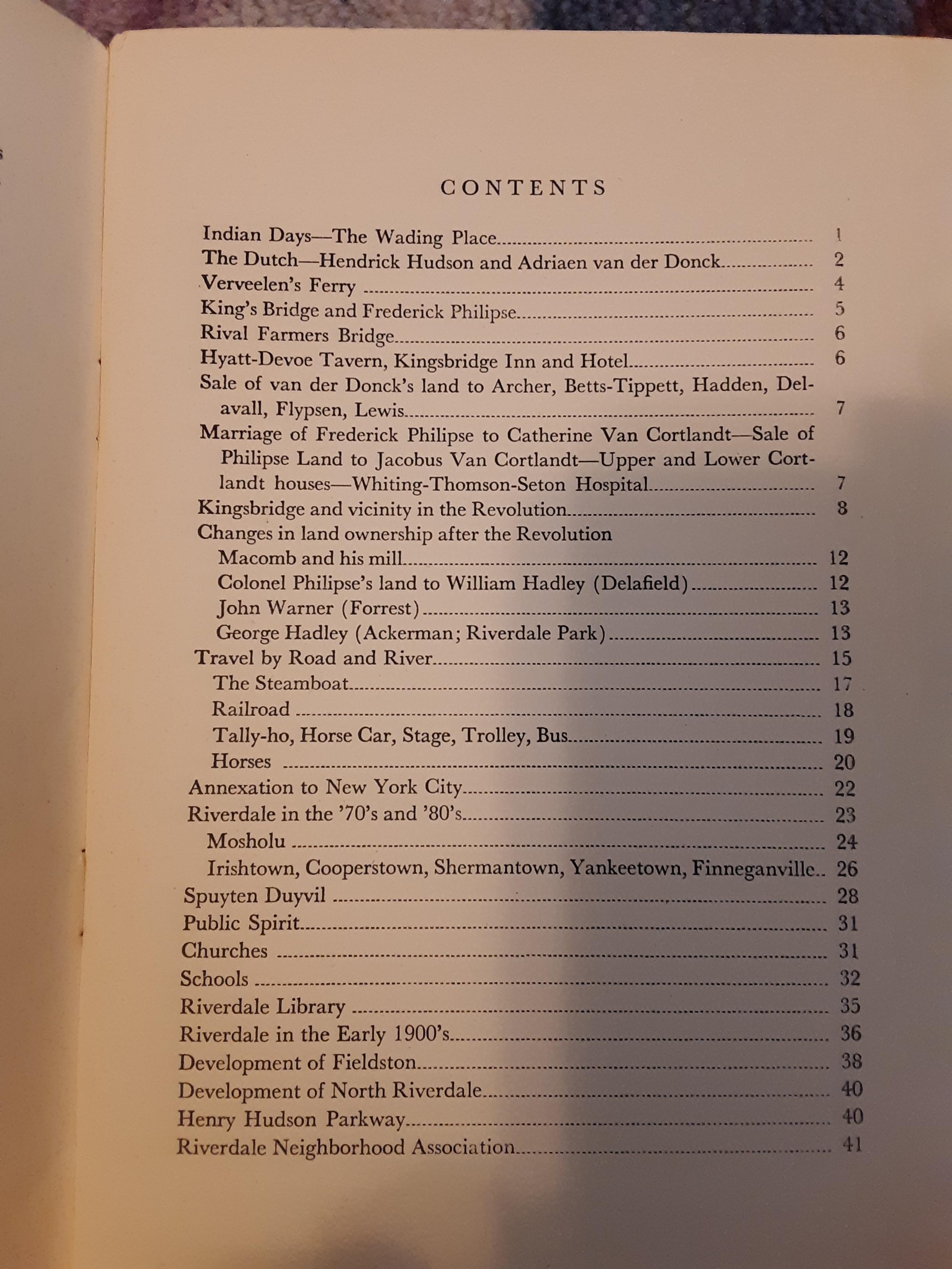
It was copyrighted in 1947 so I think that means it is still protected but I am not sure. However, I could probably scan a few pages and post them.
It is pretty scarce but occasionally pops up on book selling websites.
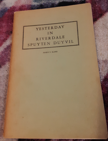
Mary Kane’s book (or booklet) “Yesterday in Riverdale and Spuyten Duyvil” was published in 1947–not that long after the newspaper story about the cabby. So it may not have been such obscure knowledge. The book was “prepared for the celebration of the 75th anniversary of the Riverdale Library” and was copyrighted by the Riverdale Library and Neighborhood Association. I bet the author was the librarian there.
 September 28, 2021 at 12:35 pm in reply to: Battle of Kingsbridge Memoirs (Stockbridge Militia Skirmish) McDonald Paper #2187
I think the British officers involved in the encounter with the Stockbridge militia were trying to impress the British generals and saw this as an opportunity to do so.
Thanks for sharing your article, Zach. The Stockbridge Munsee did get some land bank near Albany, which is an interesting story: https://www.wsaw.com/2021/05/12/new-york-land-being-returned-to-stockbridge-munsee-mohican-people/
To address your questions:
The area of North Riverdale was all owned by Frederick Philipse but the tenant farmers that lived on the land did not revolt against their landlord as the tenant farmers further upstate did. I have seen a number of the estate inventories of local tenant farmers and they appeared to be fairly well off. I have read accounts contending that he was a fair landlord to the tenant farmers on Philipsburg Manor.
Also you wondered if any of the Stockbridge militia knew the area. The account of Samuel Oakley above indicates that Nimham was friendly with some local people (the Ferris family) so it seems possible.
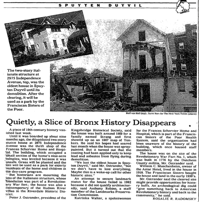
September 25, 2021 at 7:52 pm in reply to: September 27, 1909 – Dedication of the Henry Hudson Memorial #2178A few more old clippings about the area around the monument. The 6/19/1994 New York Times:
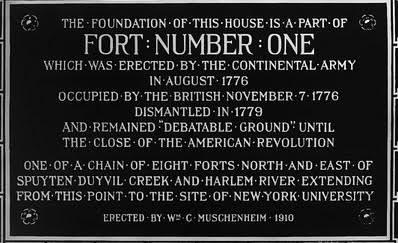
The old plaque:
 September 25, 2021 at 4:35 pm in reply to: September 27, 1909 – Dedication of the Henry Hudson Memorial #2173
There is some interesting information in the clipping you posted, Stephanie. I am particularly curious about the Native American artifacts found on the Muschenheim estate. The Muschenheim mansion was located on the current site of the Shervier Nursing Center property. That was also the location of Revolutionary Fort No. 1 and apparently many artifacts from that period were uncovered on his property. If only we knew where they were now!
It is worth noting that some scholars dispute that the name “Nipnichsen” was ever used by the Lenape to refer to our neighborhood although they clearly had a presence on Spuyten Duyvil.
On a related note, the following Riverdale Press article dated 9/24/1959 is in our archives:
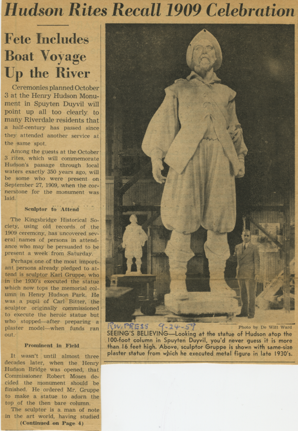
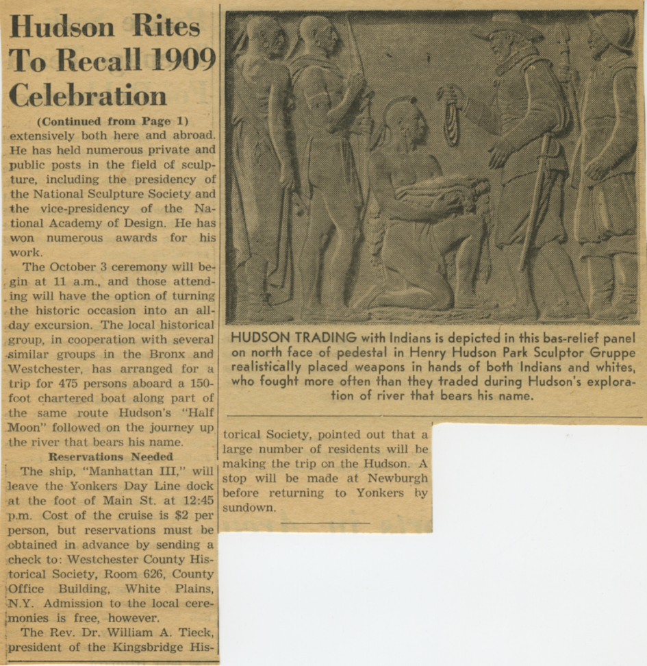
Yes, there was:
 George Younkheere was a real history buff–the Curator of the Kingsbridge Historical Society. He also contributed to the Riverdale Press. The below is from a 1955 issue: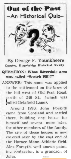
Good find for sure. I had never heard of that company. From the description, the “dwelling and store” on 231st Street owned by Burfeindt seems to have been this one, which matches the dimensions and location provided.
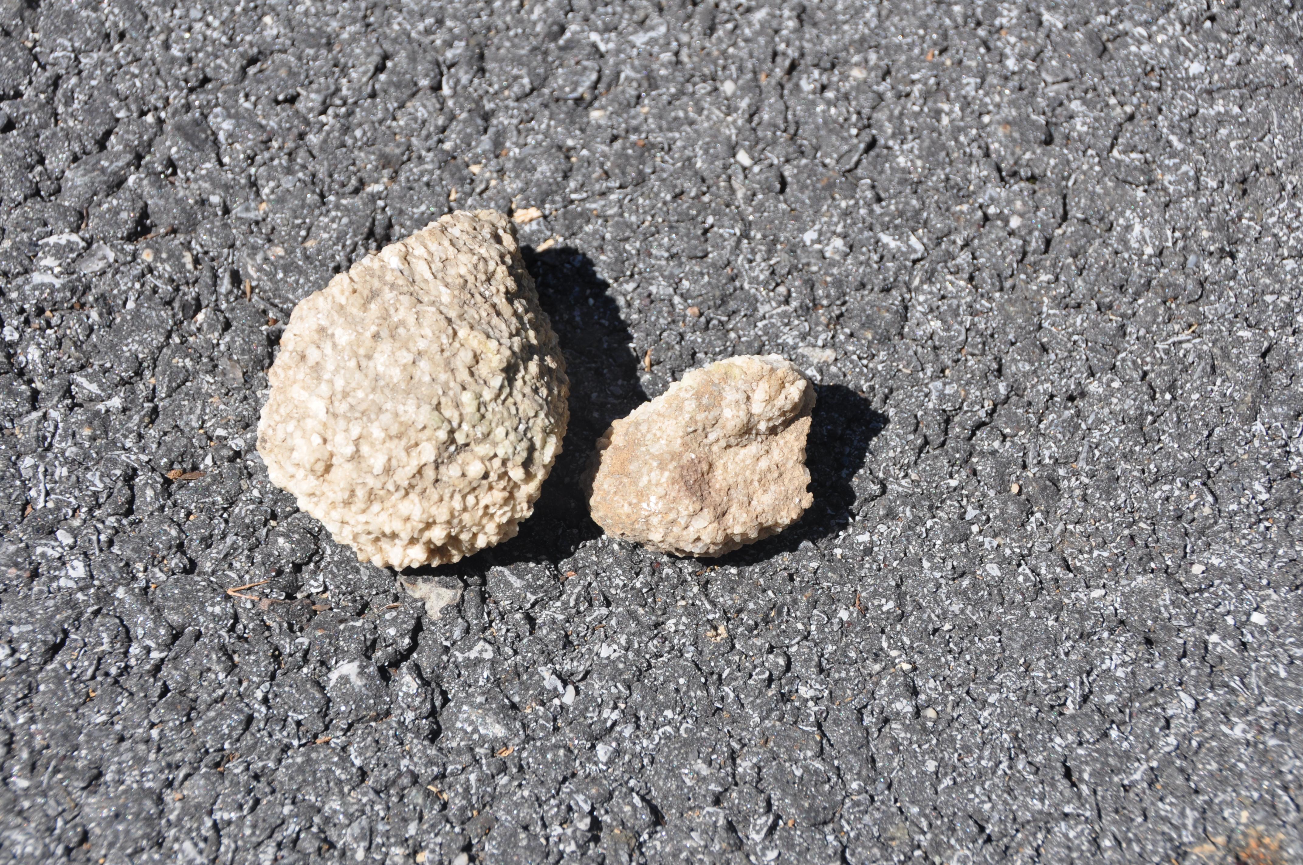
You’re welcome and I found some Inwood Marble in Riverdale Park today, actually a bunch of it right around the entrance at 232nd and Palisades Ave. I was walking along the path into the woods on what appeared to be sand but it was just a bunch of decayed marble. I could tell because there were intact marble chunks all around. Here’s a weathered piece:
 It crumbles when you touch it and if you break it open you can see the white inside: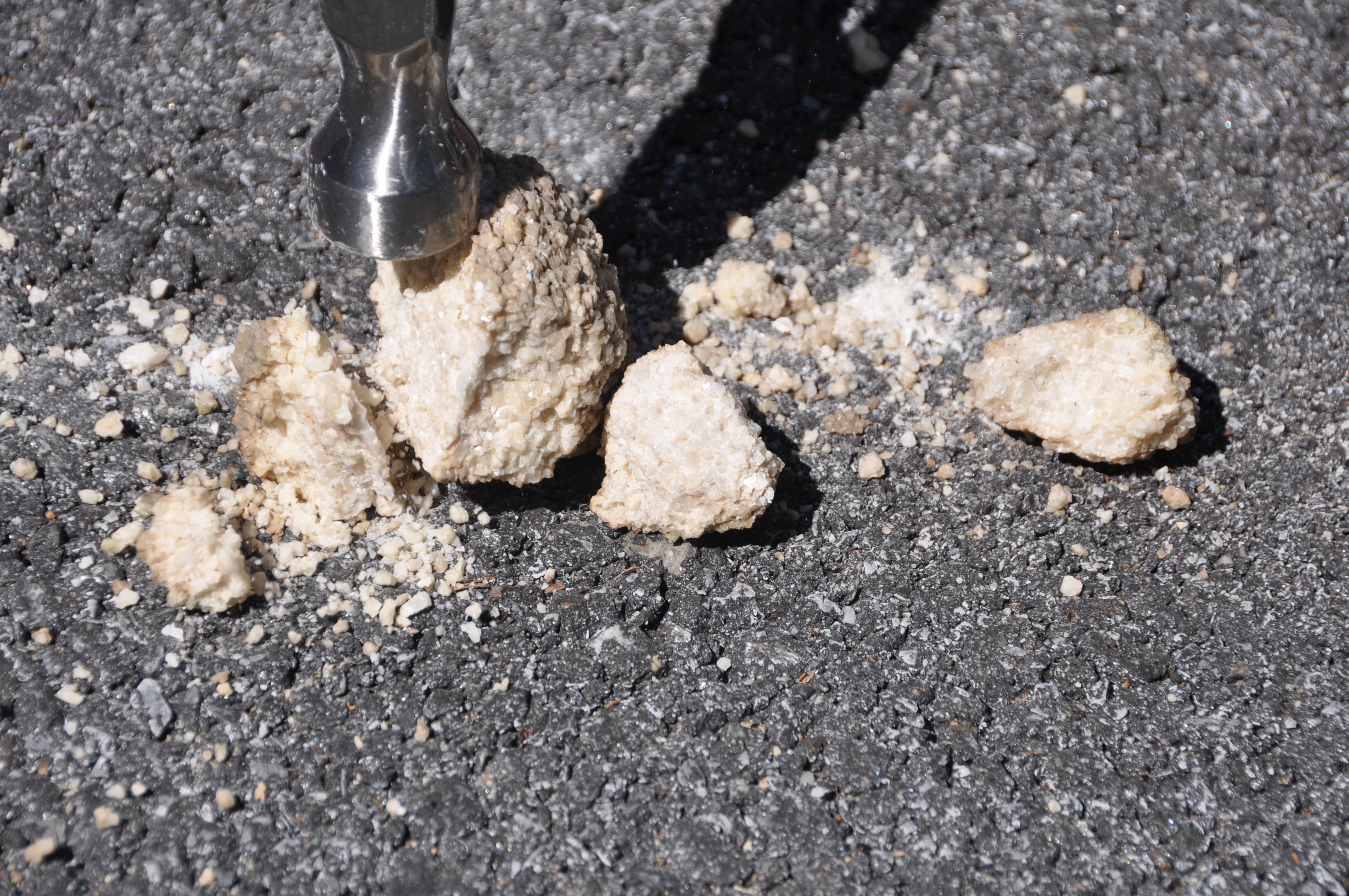
Incidentally, the water rushing down the hillside during hurricane Ida turned up a lot of material in the eroded gullies that lead to the Hudson River. Parts of the park seemed like they must of been dumping grounds in the late 1800s with all sorts of glass, metal and ceramics sticking out of the ground. My daughter found this one (a bottle from the DH Smith factory in Yonkers, circa 1870):
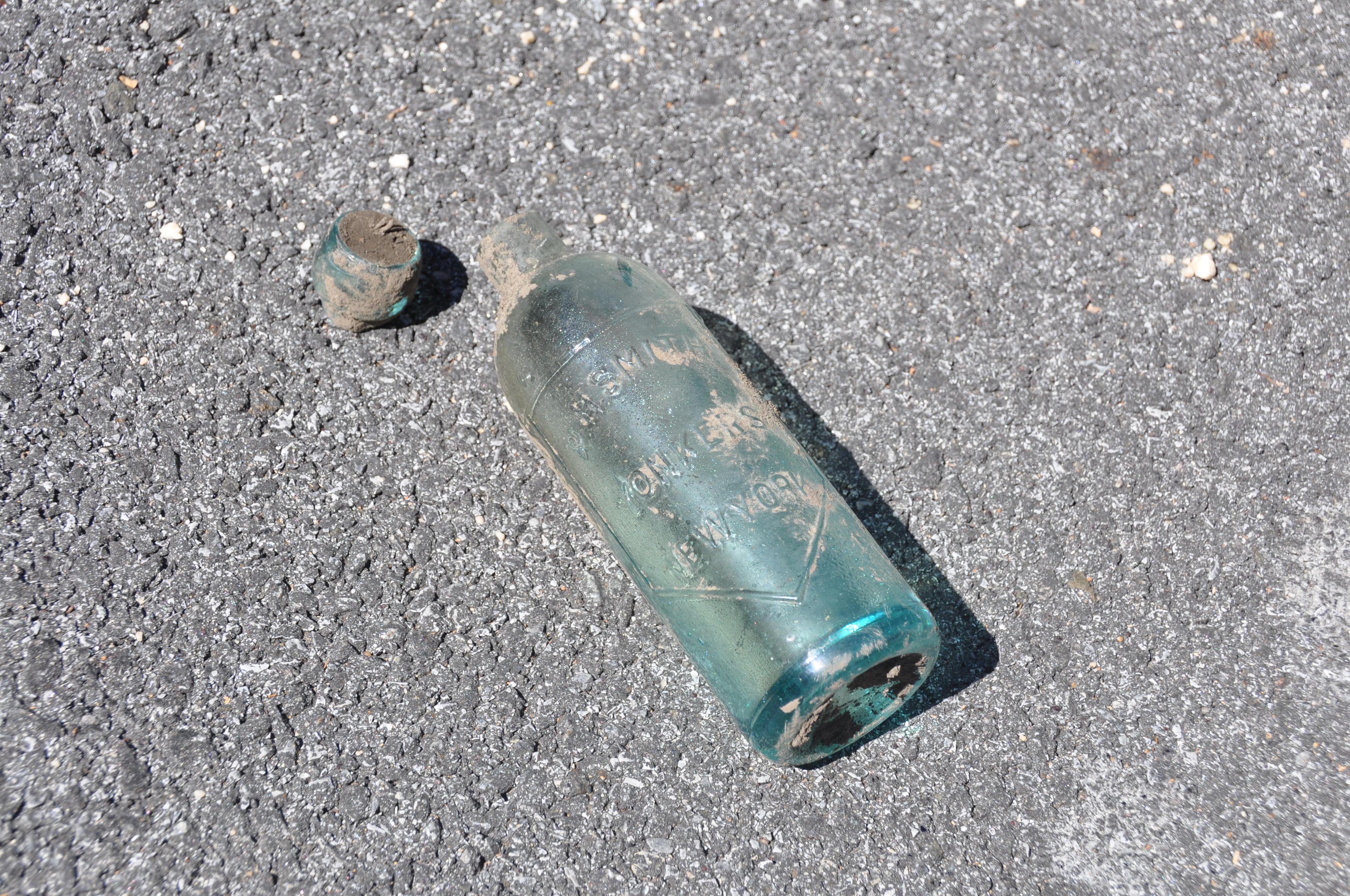
[caption id="" align="aligncenter" width="603"]
 Advertisement in the Yonkers Statesman, 1870s[/caption]
That’s a great line and the article Peter shared is really good. If you want to see some great images, buy the back issue of the “Mineralogical Record” where the article first appeared-Nov. 1997.
Here is the AMNH’s geological map and it shows that Inwood Marble could be found right where you say, Zach.
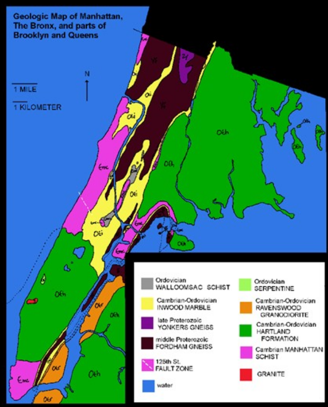
Frederick Van Cortlandt owned a quarry along the Hudson River in the early 1800s and perhaps earlier. I don’t know exactly where it was located, however.
I came across some more interesting information about proposed uses for Inwood Marble and the fate of Nichols’ marble quarry.
First, it seems that the marble was initially called “Kingsbridge Marble” and despite its reputation as a weak and crumbly stone, it was advertised as “suitable for buildings.”
[caption id="" align="aligncenter" width="604"]
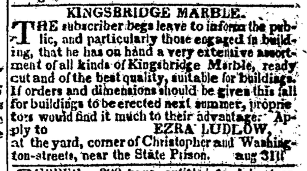 NY Evening Post, 10/2/1818[/caption]
Ezra Ludlow was a local landowner–of the Ludlow family for which the Ludlow neighborhood of Yonkers is named. There were some different proposals for how to use the marble reserves over the years. In 1820, an interesting proposal was considered:
[caption id="" align="aligncenter" width="392"]
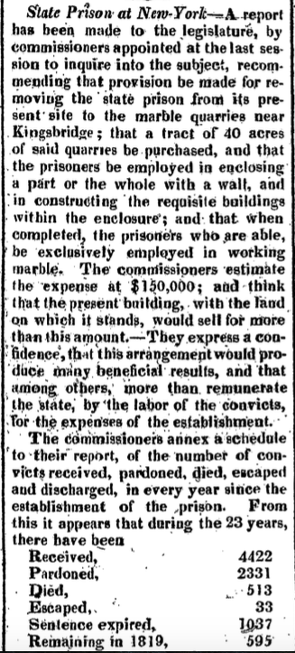 2/23/1820 New York Gazette[/caption]
First time I’ve heard of prisoners building their own prison! Peter Cooper proposed using the quarries to expand the piers and put unemployed New Yorkers to work in an economic downturn:
[caption id="" align="aligncenter" width="460"]
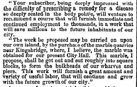 2/10/1855 NY Evening Post[/caption]
Perkins Nichols’ quarry and mill doesn’t seem to have done great business–at least not enough to save Nichols from bankruptcy in 1839.
This 1836 map gives an idea of where the quarry was located. Marble Hill is near the top, where the Kingsbridge crossed the Spuyten Duyvil Creek.
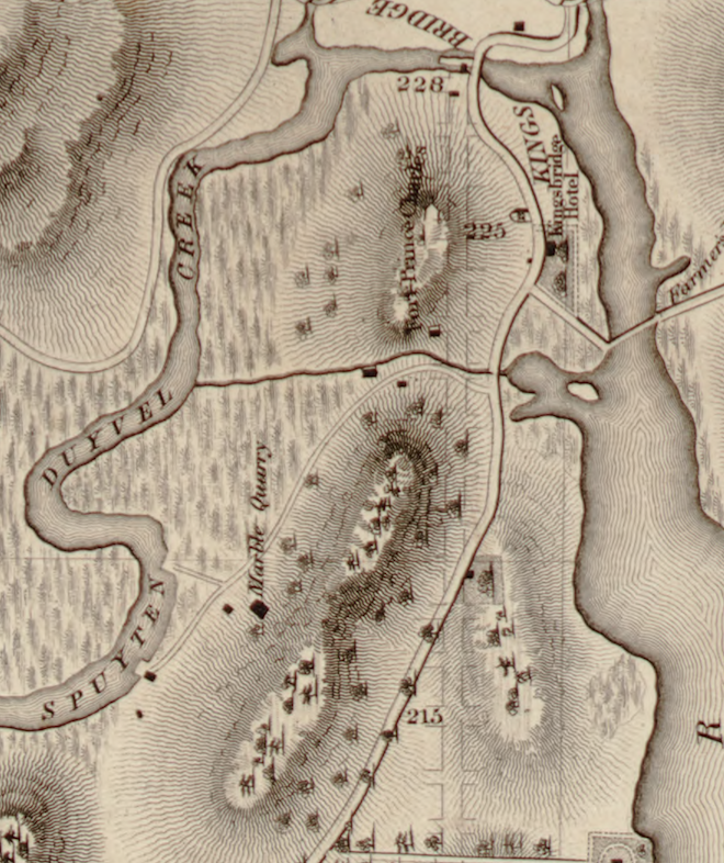
I think the Perkins Nichols marble mill must have either burned or been torn down by 1850. It was on the northern bank of the Spuyten Duyvil Creek, so about where Corlear Ave and W. 230th intersect today. The building on the southern end of the Kingsbridge was originally Alexander Macomb’s gristmill.
That is a very nice panorama. Who painted it?
-
AuthorPosts

