Forum Replies Created
-
AuthorPosts
-
I attended Spuyten Duyvil Infantry in the basement of RNH ca 1963-65. Arline Strong regularly took photographs and her book “Everything Changes”, with text by Ruth Rea Howell, who was a teacher there, has many photos from that era.
Old Riverdale Press articles can often be found at https://fultonhistory.com/Fulton.html, and though it has a very strange search interface, searching for “spuyten duyvil infantry” can show quite a bit of history.I’m not sure when the property at 253rd became know as “Knollwood”, but for a time around 1902-1910, it was known as Nellcôte. Here is a long and involved story that has nothing to do with the original topic…
Samuel L. Goldenberg (1864-1936) was born into a family of lace importers, and spent time back and forth between NYC and France. The business was successful enough to allow him to pursue his interest in dog breeding.
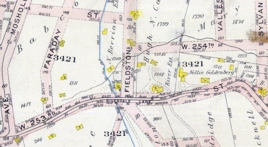
In 1901, he married Nella Carlynne Sondheim, née Wiggins, and they purchased the property in Riverdale as a summer residence and a home for their dog kennels. They named the property Nellcôte, and Nellcote bulldogs were frequent winners at dog shows ca 1905.
Apparently they were spending more and more time in France, and at some point, purchased a villa there and gave up the Riverdale location, which apparently later became known as Knollwood.
The Goldenbergs brought the name Nellcôte to their villa in France, where it had a long storied career, including the Rolling Stones renting it to record Exile on Main St in 1972.
In April 1912, the Goldenbergs were traveling from France to the US so Samuel could be a judge at the French Bull Dog of America show at the Waldorf Astoria. They booked first class tickets on the Titanic. They completed their voyage via lifeboat #5 and the Carpathia and made it to the dog show!
The house in Riverdale is now in and adjacent to the northbound lane of the Henry Hudson Parkway, so presumably was demolished ca 1935.
I learned all this when an author named Geir Hørnes contacted me on Facebook saying he was writing a book on the history of the villa in France, and was trying to locate the property in Riverdale that first had the name “Nellcôte”. I was able to find the Goldenbergs in the 1905 census in an unnumbered house on 253rd St, near Old Post Rd, that led to this map, where their property is labeled.
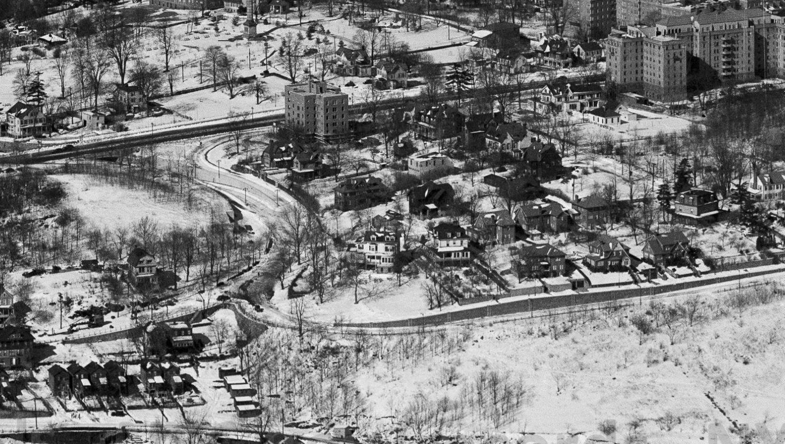
The book is now out, but I have not seen it. The focus is on the villa in France, but I’m sure the Riverdale location gets at least some mention, and I may have some kind of reference credit.I had not seen this thread earlier. Here is a pic showing the building with its surroundings in 1948, and some links to some other great photos of Seton Hospital and environs. Note that some are incorrectly labeled as Seaton Hospital on Staten Island on the source site, but are clearly Seton Hospital in Riverdale.
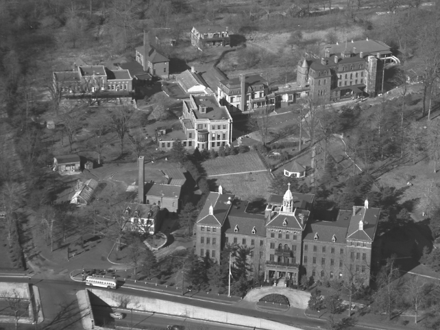
The zoom feature on these links can be problematic, best bet is to download the full size original files, where the tremendous detail can be enjoyed.
https://digitalcollections.archives.nysed.gov/index.php/Detail/objects/27246
https://digitalcollections.archives.nysed.gov/index.php/Detail/objects/27245
https://digitalcollections.archives.nysed.gov/index.php/Detail/objects/27249
https://digitalcollections.archives.nysed.gov/index.php/Detail/objects/27251Plus a few later ones from 1956…
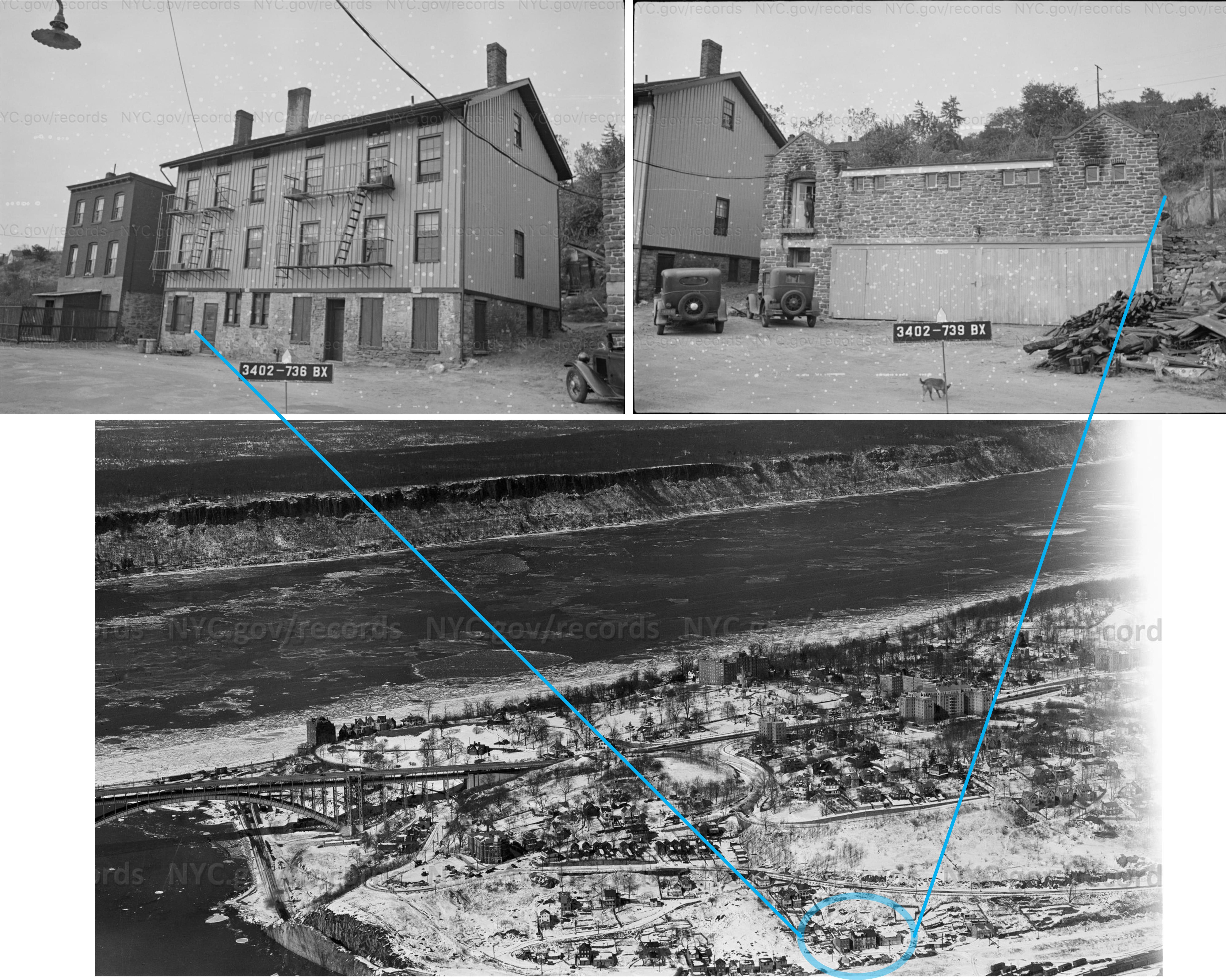
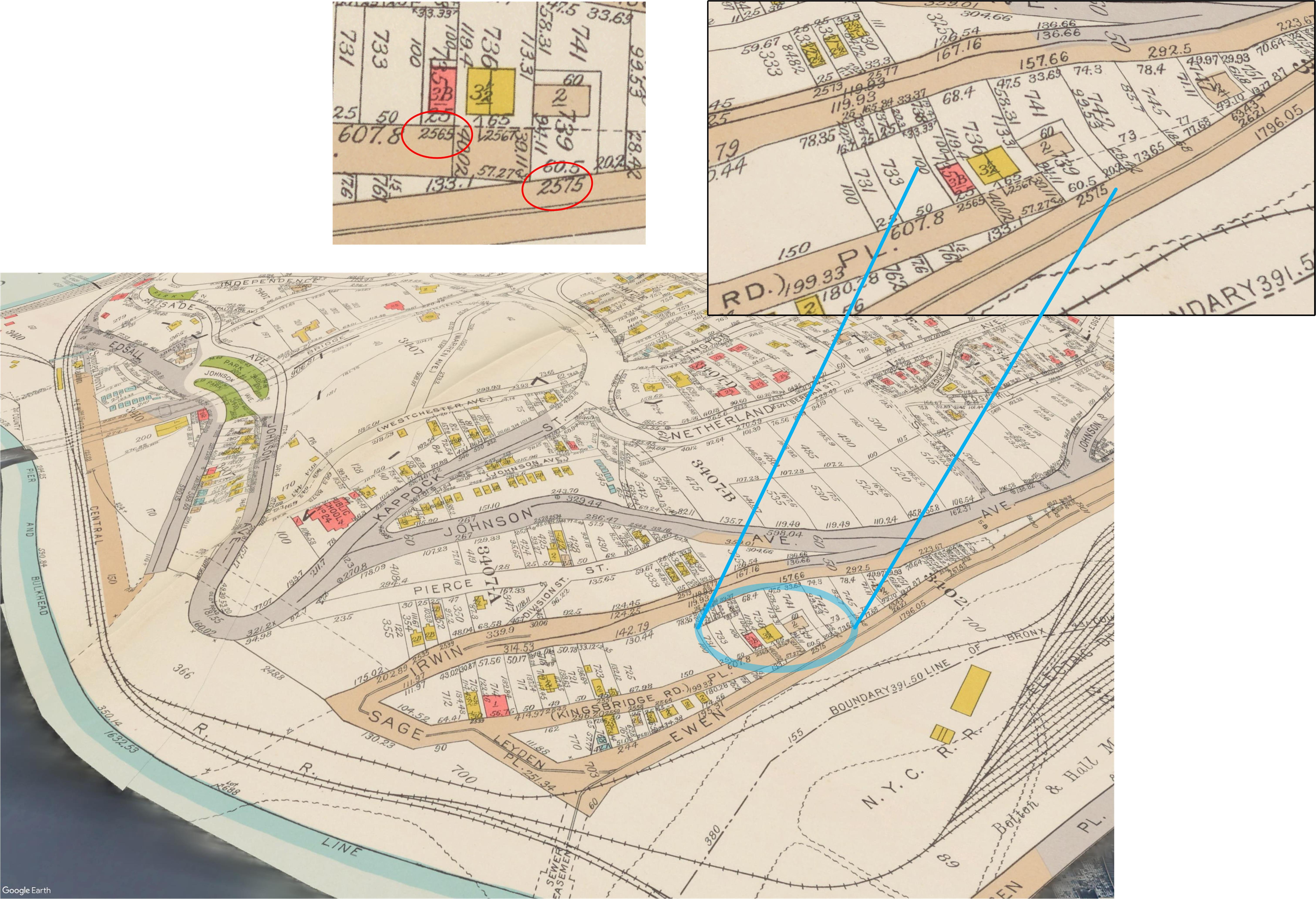
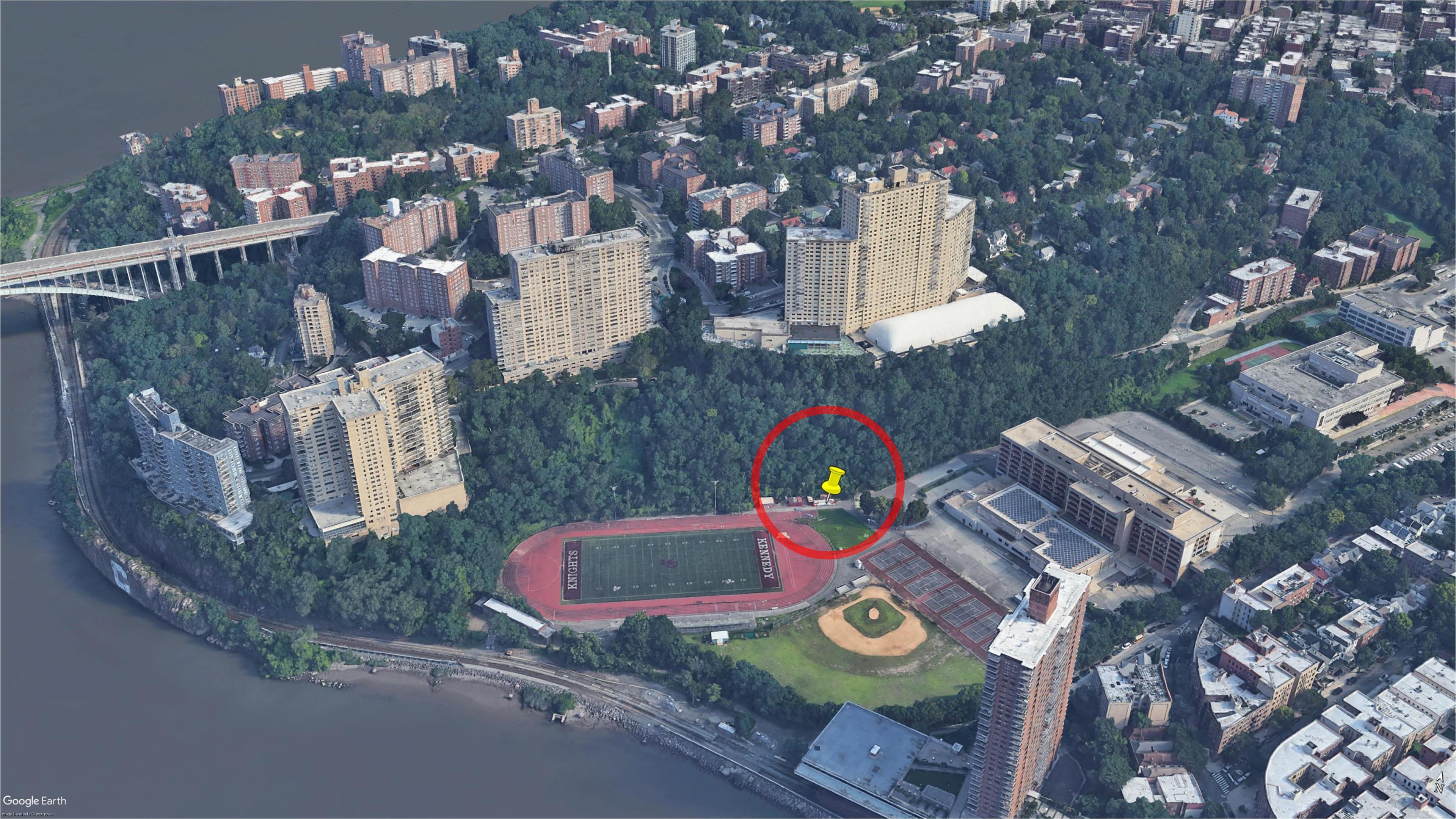
https://nycma.lunaimaging.com/luna/servlet/s/j86s59Here are a couple of pics from the 1940s tax photos, where the buildings are labeled 2565-2575 Kingsbridge Road, and a few others showing where they stood, and a Google Earth simulated view where the location is today.
https://nycma.lunaimaging.com/luna/servlet/s/9g6e2r
https://nycma.lunaimaging.com/luna/servlet/s/r3jen91938 map

https://digitalcollections.nypl.org/items/0701ad80-b6c6-0132-dc4a-58d385a7b928

The market does not look familiar at all, is there any more context before or after? Really, it could have been filmed anywhere. I’ll have to try to get a copy of that movie. The online options look a little sketchy to me.
Here is the house in the background, 629 Kappock St, from 1940 tax photos

And here’s a 1940 aerial view of the whole area. The original has all sorts of fun spots, but here I cropped it, but wanted to include a bit of Puddler’s Row, and also 2640 Arlington Ave.
To see the full original, go here.November 26, 2020 at 8:32 pm in reply to: Old Marble Hill Business – Schumacher Bros. on 225th Street #1763Great pic! I’d guess the building was brand new at that point.
I see some references to a 1914 property transfer from Anna A. Schumacher to Graycie M. Schumacher, and they seemed to service and sell automobiles as Schumacher Garage until at least 1925, when it changed ownership. “Active Holding Company, Inc” purchased it in Dec 1925, but it seems to have still been a garage in 1940.
In this Oct 1914 photo, you can see 168 W225th in the distance with no buildings nearby. Clearly that did not last very long.
Some other things to note in this 1914 photo, Puddler’s Row at the far left, the column of the Hudson Monument with no statue on top, 2640 Arlington Ave straight up from 168, (built in 1899, still there, and due to the shape, mansard roof, and angle, easy to spot in old photos), The Edgehill Inn faintly visible through the trees, and likely the Ewen house, near where Riverdale Ave can be seen climbing the hill to the right.
![View of Kingsbridge / Marble Hill and the Harlem River around 225th Street from Webb College [i.e. Webb's Academy and Home for Shipbuilders], Bronx, October 22, 1914.](https://kingsbridgehistoricalsociety.org/wp-content/uploads/hm_bbpui/1763/yjz5zjzn0975dtit00vt3untbhxmdk1l.jpg)
Close up showing where 168 W 225th is in 1914 photo
Sept. 1916 view from Spuyten Duyvil Hill, with what looks like “W.J. Schumacher” painted on the back of the building. Note the brand new Kingsbridge Armory in the center distance, and the north wing of the Roman Catholic Orphan Asylum at the right. I’d be curious as to the history of the Schumacher family. Who were the brothers? Where were they in 1875? Who are Anna & Graycie, and who is W. J.?
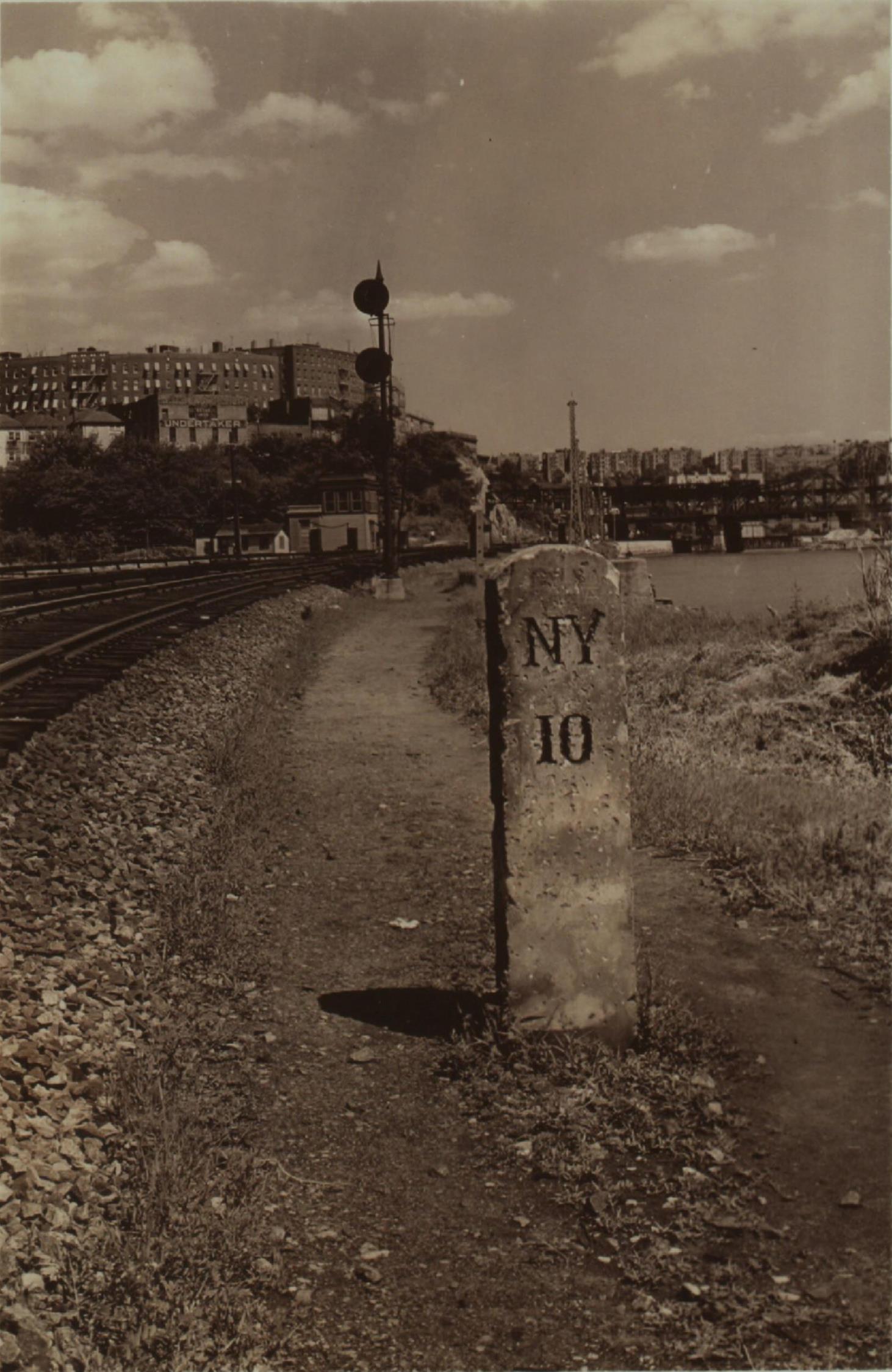
In this Jul. 1939 view, the lettering from the 1916 view appears to still be visible. (I’m not sure what the stone milestone indicates, it does not appear to be one of the Albany Post Rd mile markers.)
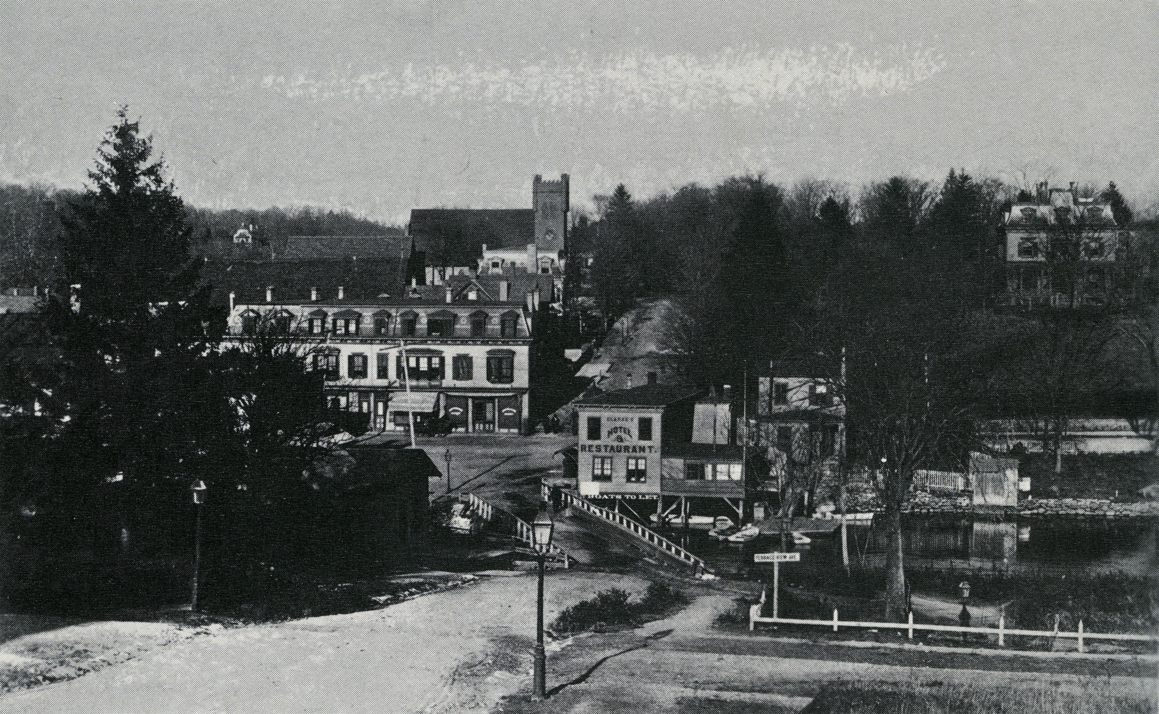
Thanks for posting Nick. Great stories, and each leads to more photos. Starting with crabbing by the Kingsbridge Hotel ..
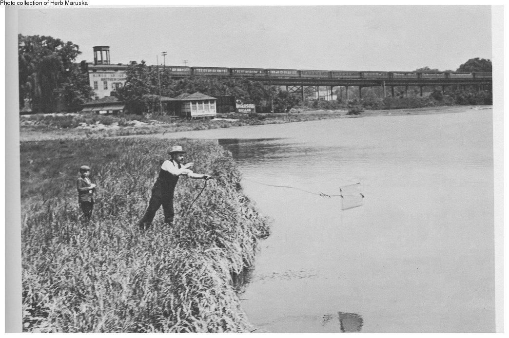
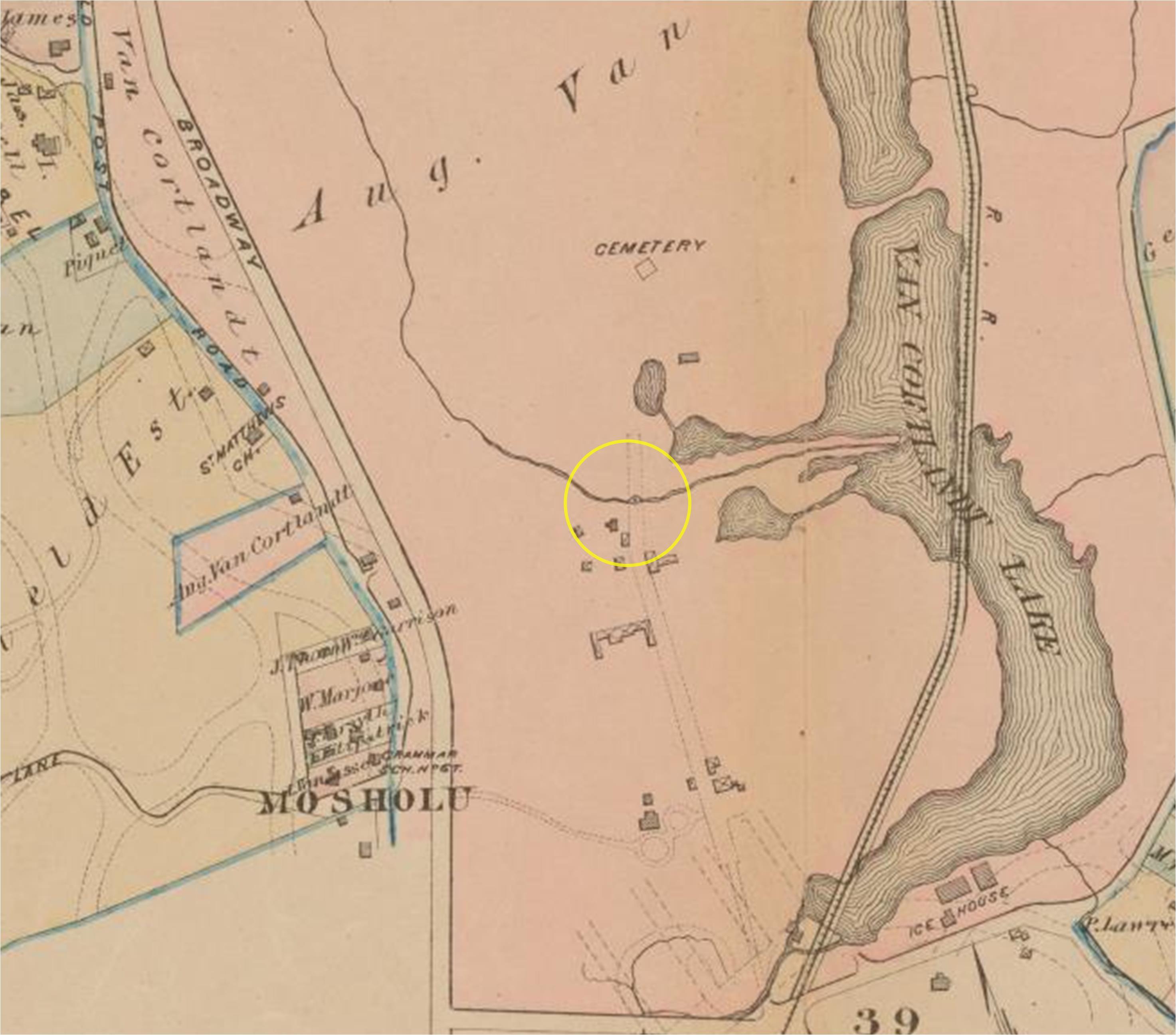
The view is likely from the Farmers Bridge and dated 1909. They are fishing in a spot that is now between two of the buildings of the Marble Hill Houses. The Kingsbridge Hotel is at the left.This is just a guess, but the yellow circle on this 1879 map might be Sheep Barn Bridge where J. B. James caught the fine trout.
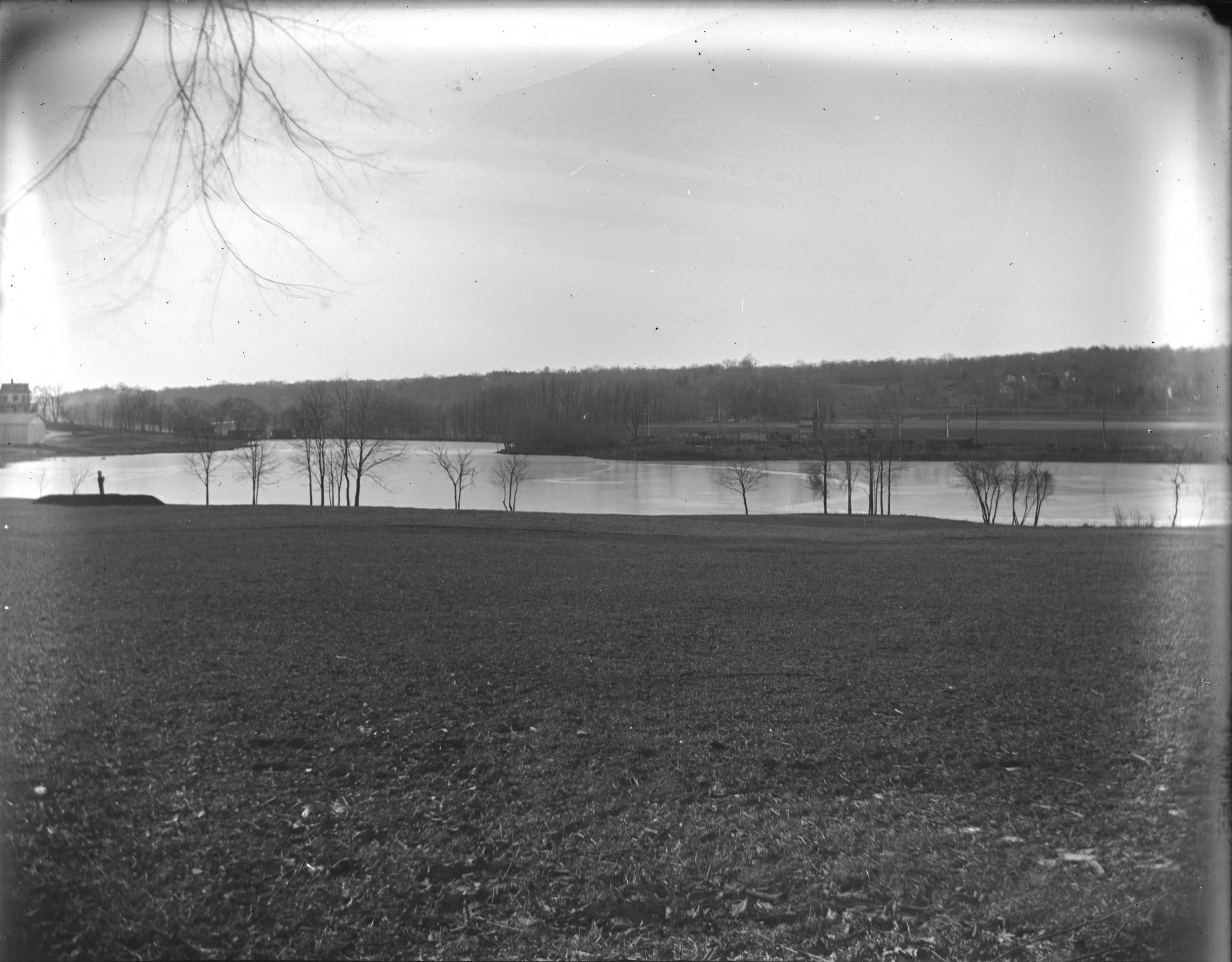
This ca 1902 view is looking south from the north end of the lake. These may be the large oaks in the foreground, or those may have been from an earlier time. I believe the mills are still standing among the elms at the center of this photo, which likely makes it earlier than 1902
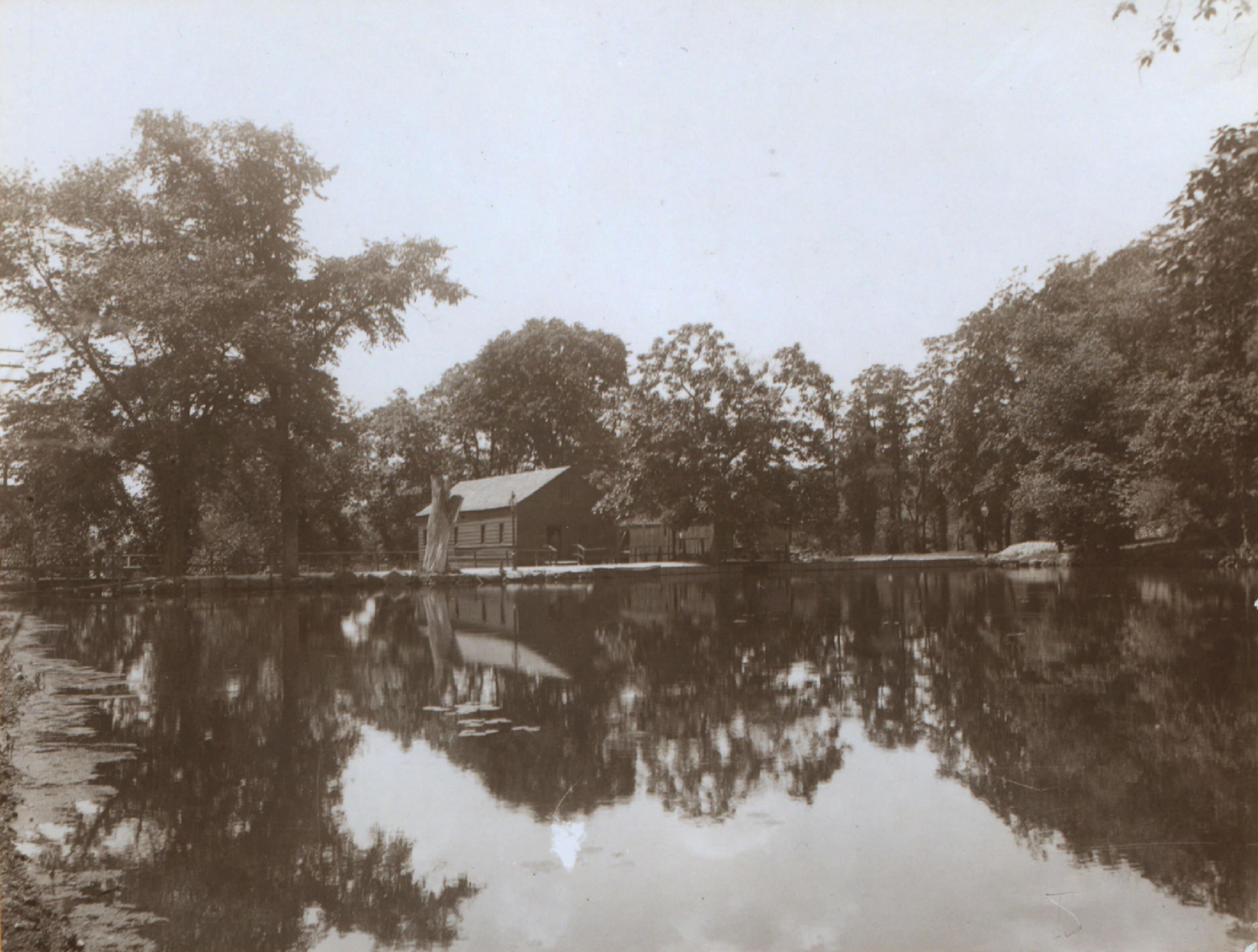
This 1899 view shows the elm trees and the mills on the south bank. Is that the large oak overhanging the water?
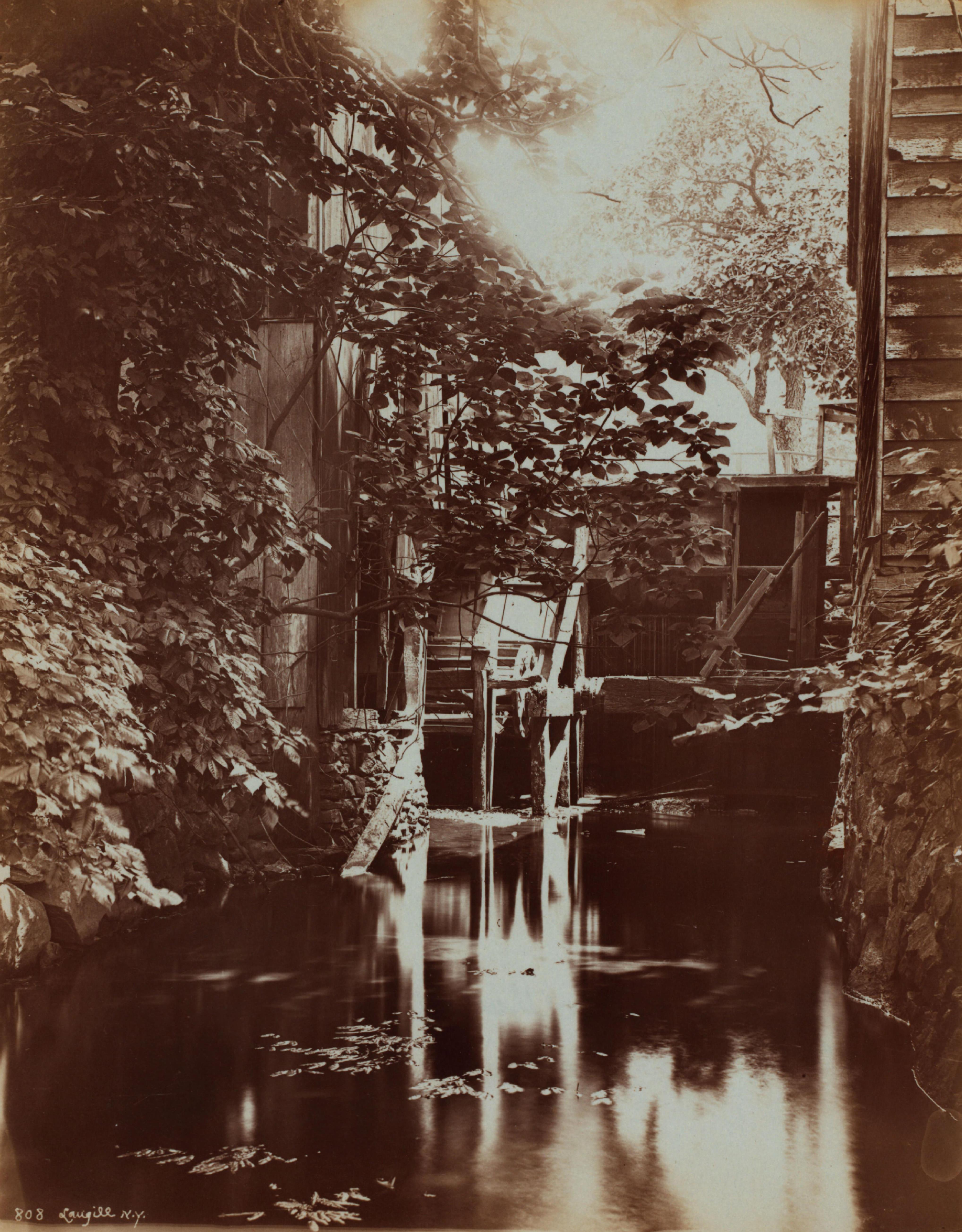
A view of the mills from the south labeled ca 1902 (the original was reversed)
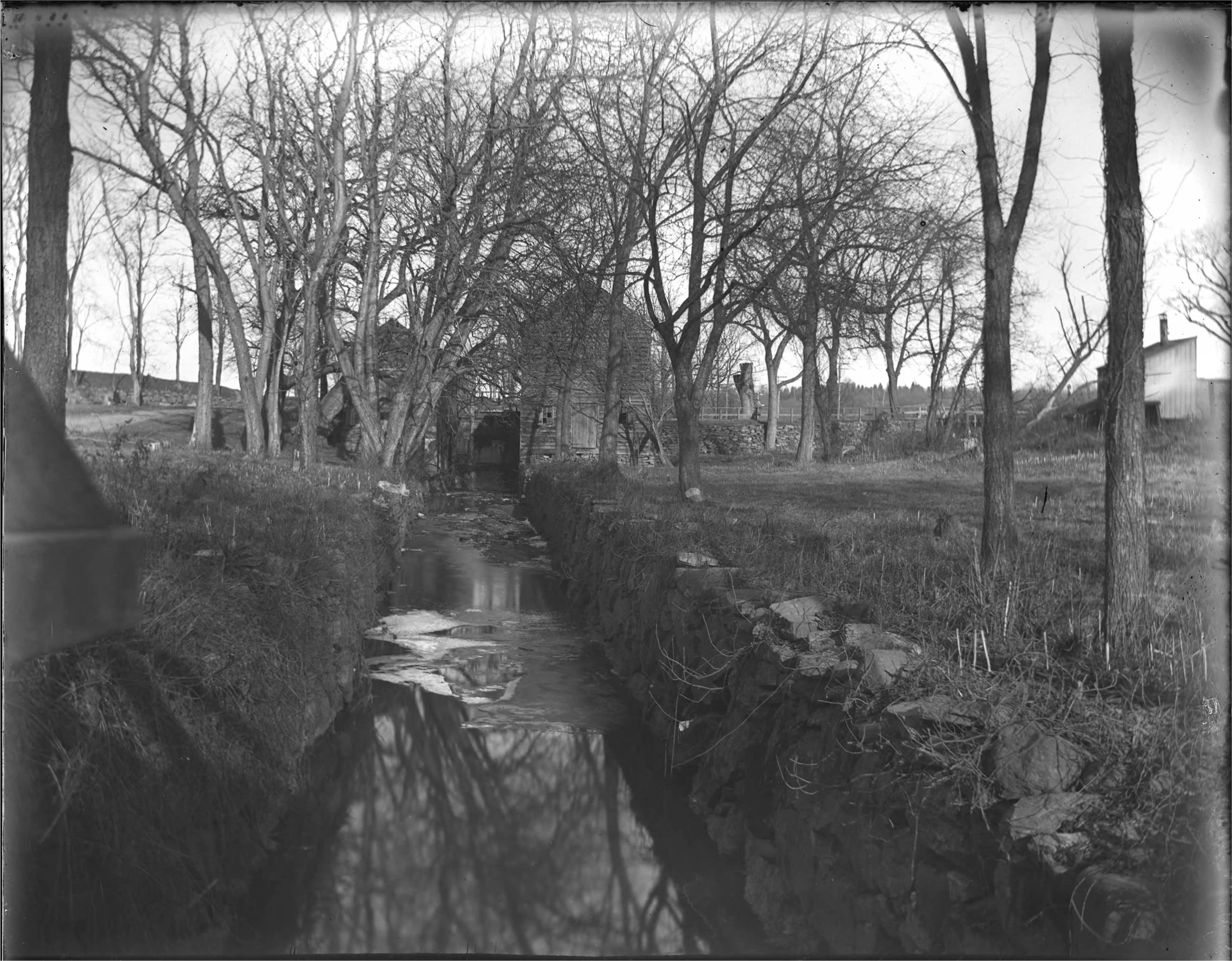
Close up between the mills, ca 1900
Note about the horse car line Nick, I think the pic you posted is of the more modern trolleys that ran down Broadway from Getty Square until the 1950s. The horse-car trolleys were much earlier. You can see the overhead power feed in your pic and this one..
J. B. James mentions Godwin island. This pic is after the tree is gone, and after a footbridge has been constructed across the island. No sign of the swan though.
The house on the right in this pic seems to match the description of Warner’s Store
This photo is labeled “former St. Matthew’s Church” and appears to show the building behind 2601 Broadway in 1925, possibly the Methodist Church Bethel described by J. B. James.
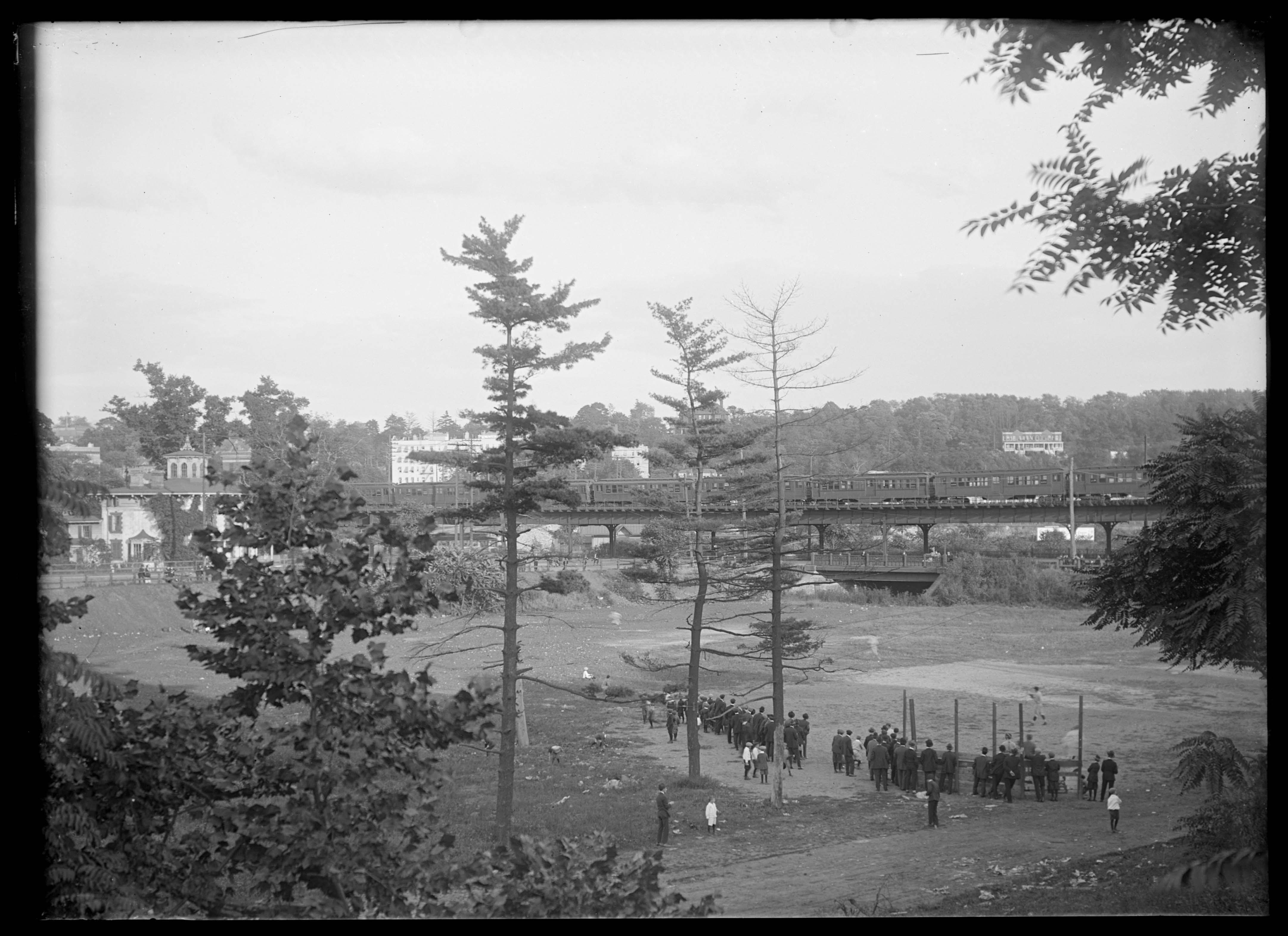
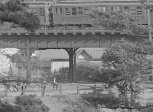
He refers to Winter activities at VCP becoming more popular, this was due to folks taking the 9th Avenue elevated to the 155th St terminus by the Polo Grounds, then boarding the New York City and Northern Railroad (The Putnam Line) to VCP. The IRT didn’t reach VCP until 1907, so crowds before then would have arrived via the Putnam Line at this station, seen here looking west in 1904.
![East Side of Present Railroad Station, Van Cortlandt Park [Parks of the Bronx, 1904.]](https://kingsbridgehistoricalsociety.org/wp-content/uploads/hm_bbpui/1458/3877rk7e6es8ssgwsbejfvz6avv11ljl.jpg)
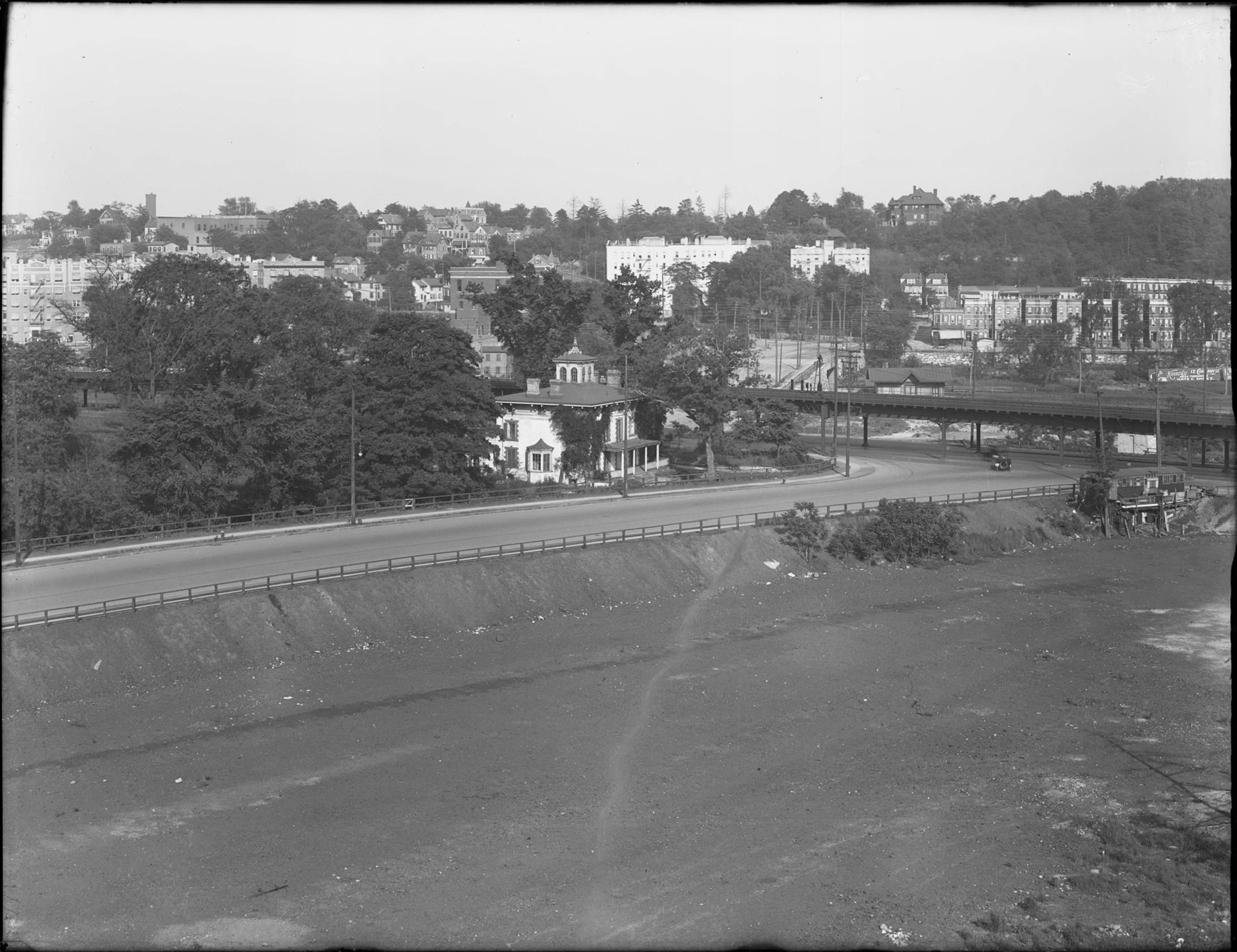
Modern view
View looking northeast at the station in 1904.
![https://collections.mcny.org/Collection/West%20Side%20of%20Present%20Railroad%20Station,%20Van%20Cortlandt%20Park%20[Parks%20of%20the%20Bronx,%201904.]-24UAKV2JTPB.html](https://kingsbridgehistoricalsociety.org/wp-content/uploads/hm_bbpui/1458/5s6qii0rfji7jnrrfnlxvfg5pdoz582r.jpg)
The station is out of frame to the lower left in this photo
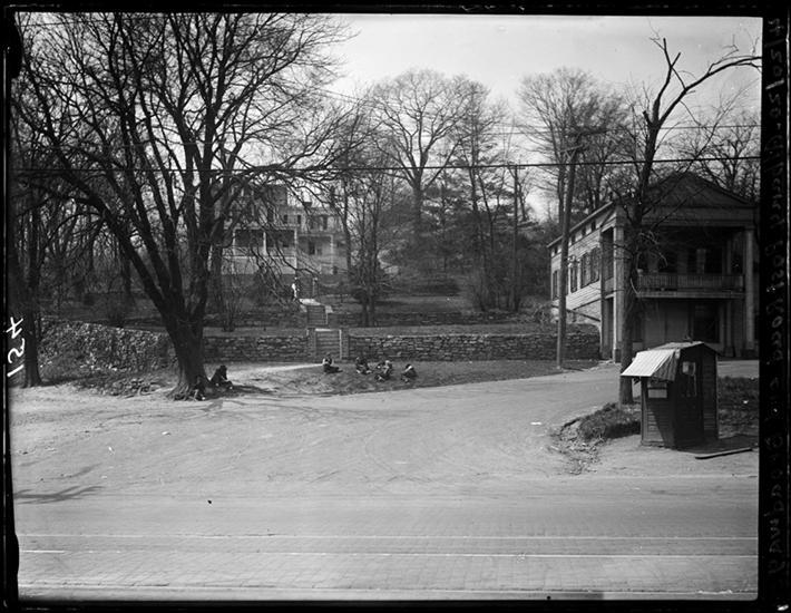
![Ice skaters on Van Cortlandt Lake, Van Cortlandt Park, Bronx, N.Y., undated [February 1902?].](https://kingsbridgehistoricalsociety.org/wp-content/uploads/hm_bbpui/1458/f15ggo3tsoxfseo89u934dp7p51609no.jpg)
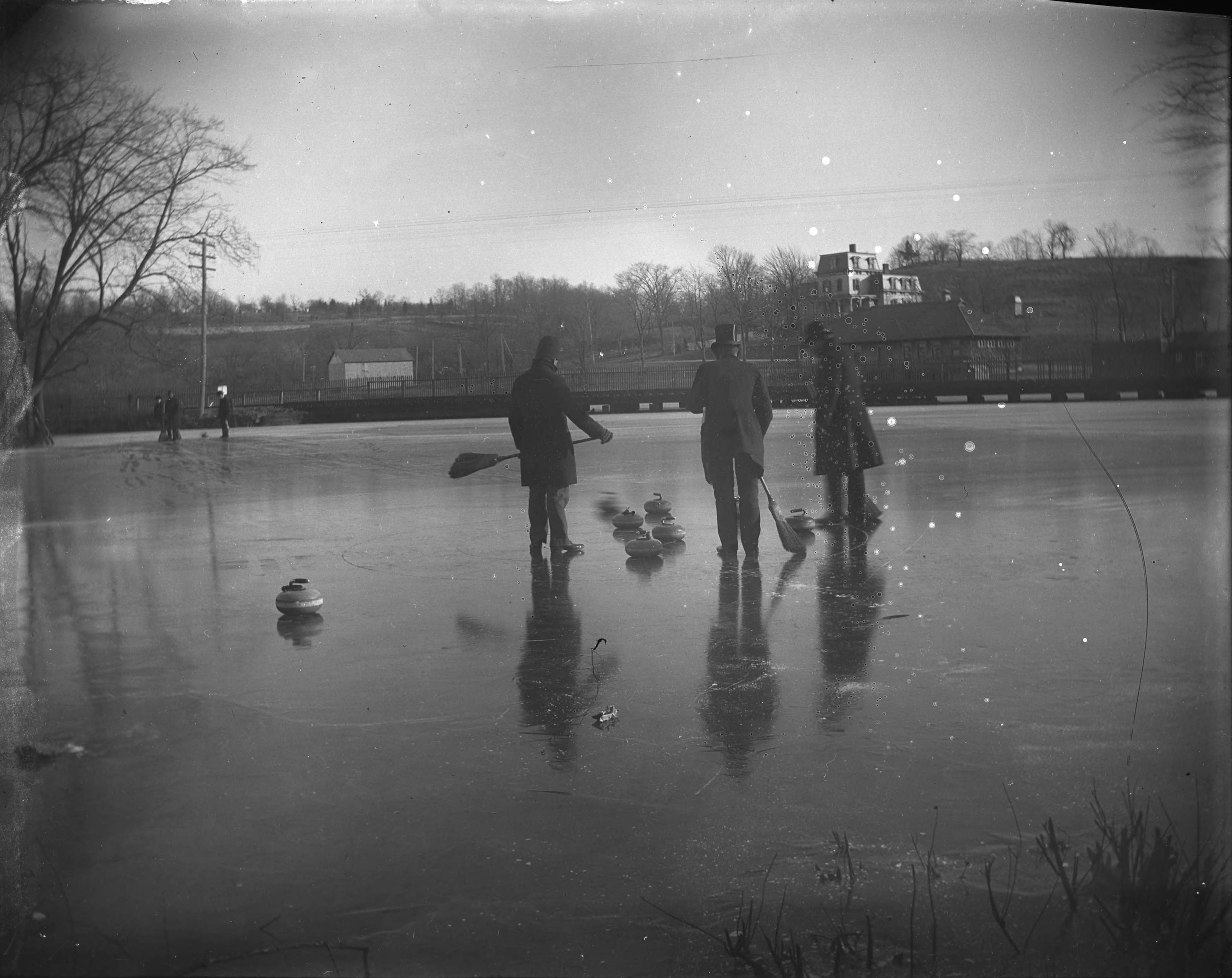
Curling in 1902 in front of the ruins of the old mills.
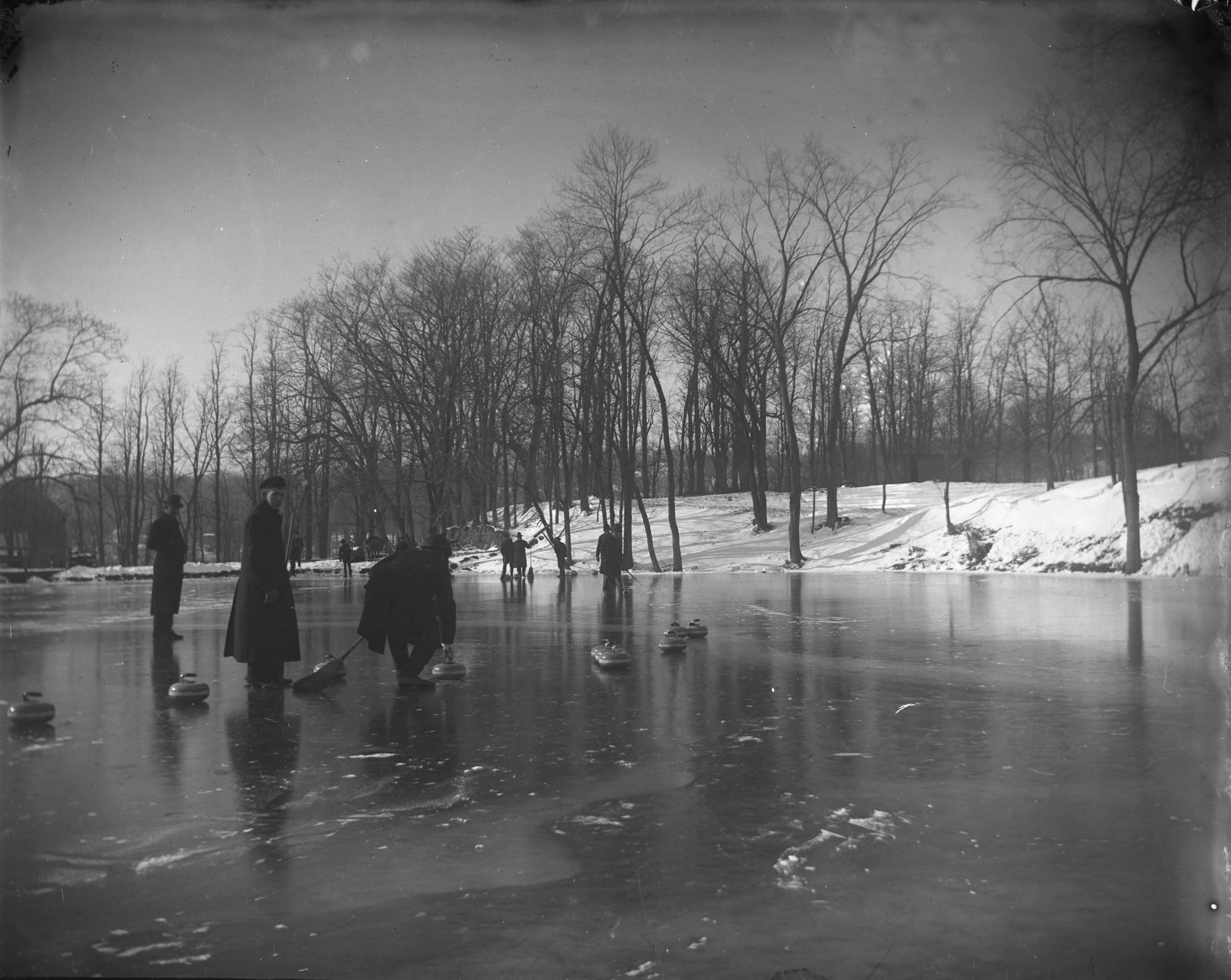
Modern view of above
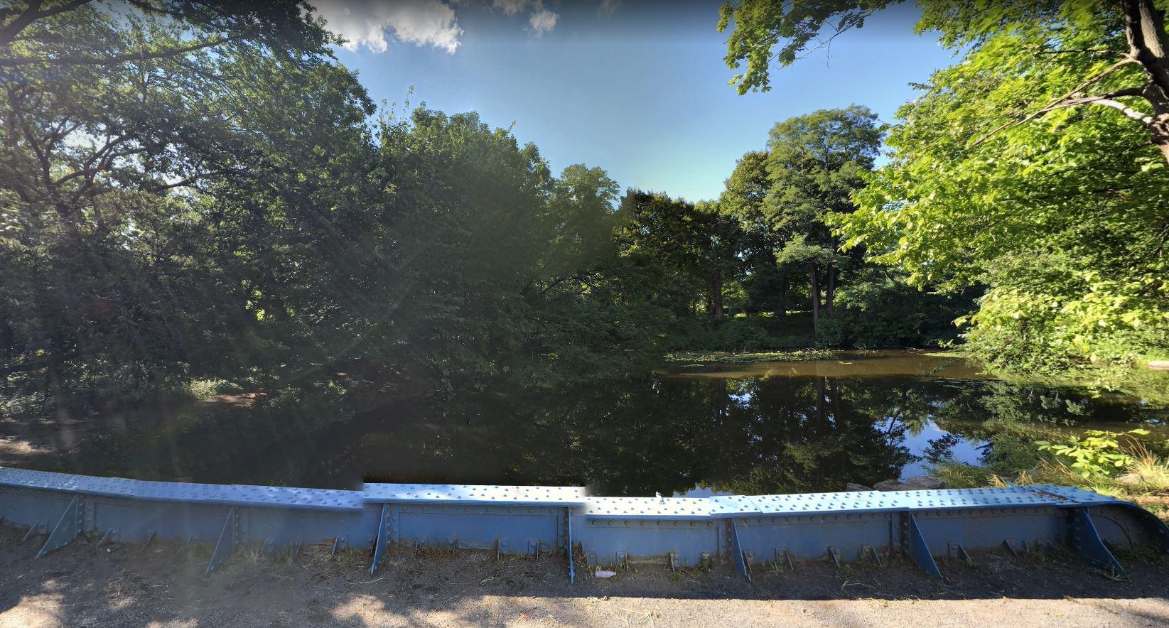
Opposite view from above
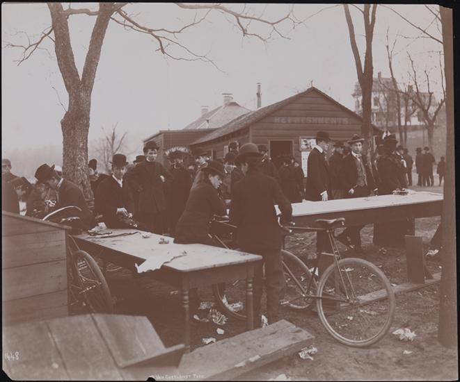
The refreshment stand, seen ca 1895
My great, great, grandmother on my mother’s side was a Fairchild, born near Burlington VT, with roots in CT. I just did some digging, and it looks like Samuel was my 1/2 third cousin, three times removed. His 3x great grandfather Samuel was married twice. He is a descendant of the first marriage. The earlier Samuel is my 6x great grandfather by his second marriage. Not too relevant, but a fun connection.
Peter, I’ve been struggling to identify some of the buildings, and the only one that looks to be in the correct position to be 2860 Webb Ave would be the one at the far right, straight up from the Farmers Bridge RR crossing.
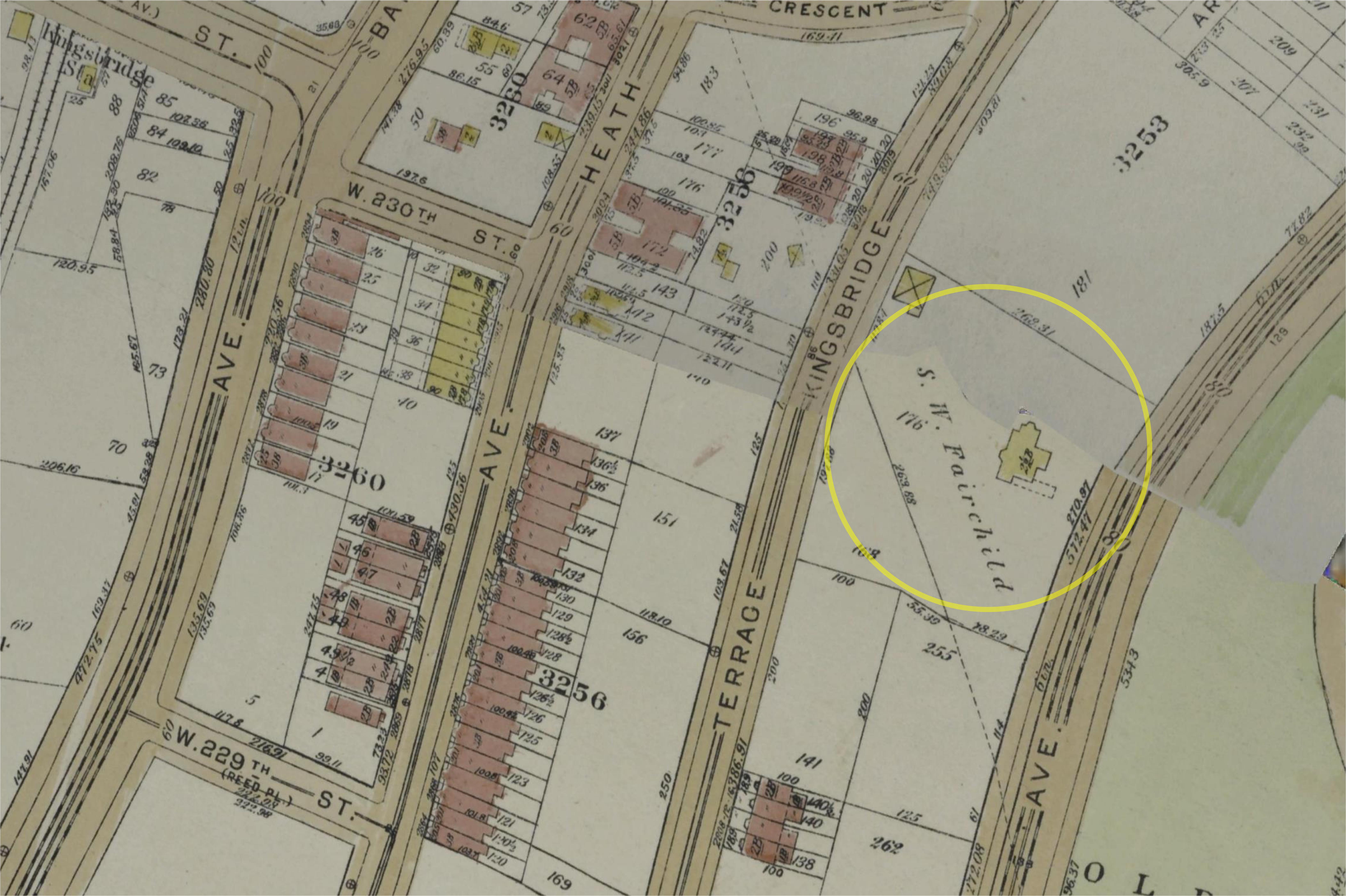
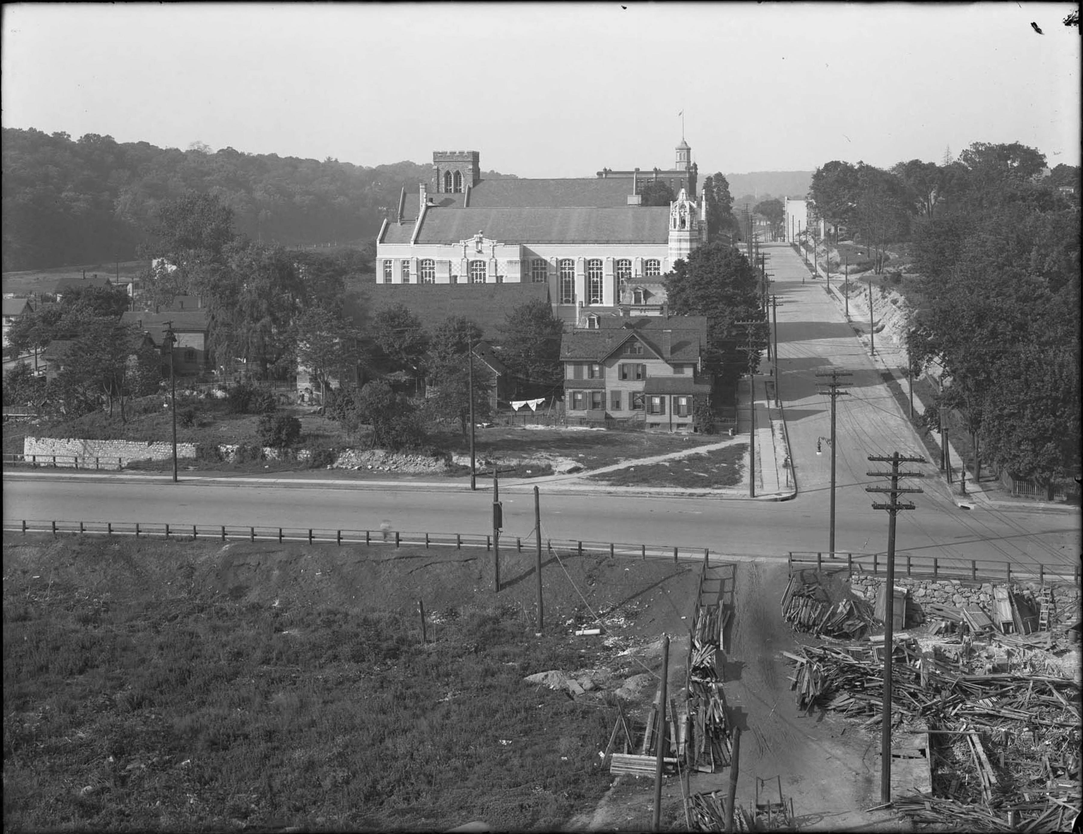
The only one I am pretty sure about is the big one at the center, which looks to me like the Samuel W. Fairchild residence, which was about where the SE corner of the school at 120 W 231 St exists now. I believe it was still there in the 1924 aerial survey, but appears to be gone by 1938 maps, and doesn’t show up in the 1940s tax photos.I found a pic of it in “The Great north side, or, Borough of the Bronx, New York (1897)” and here is a comparison of that pic and the building at top center of the 1893 photo
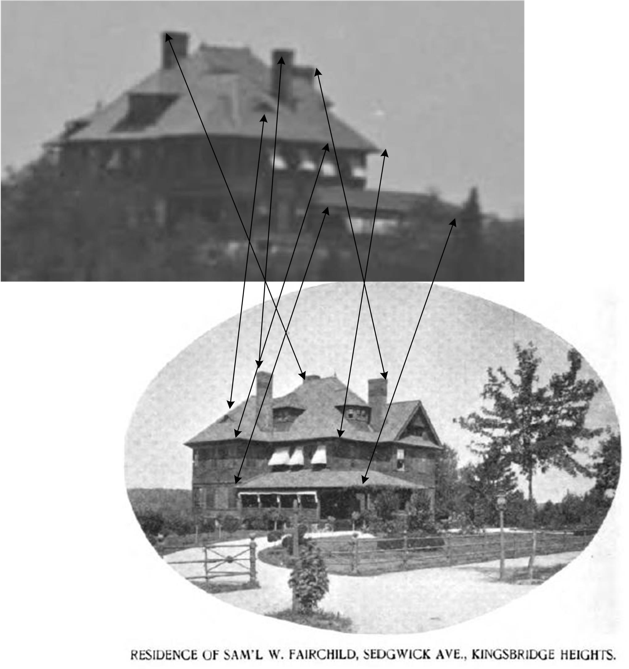
Here it is on a 1921 map …
It also shows up in this picture, which I have cropped somewhat here
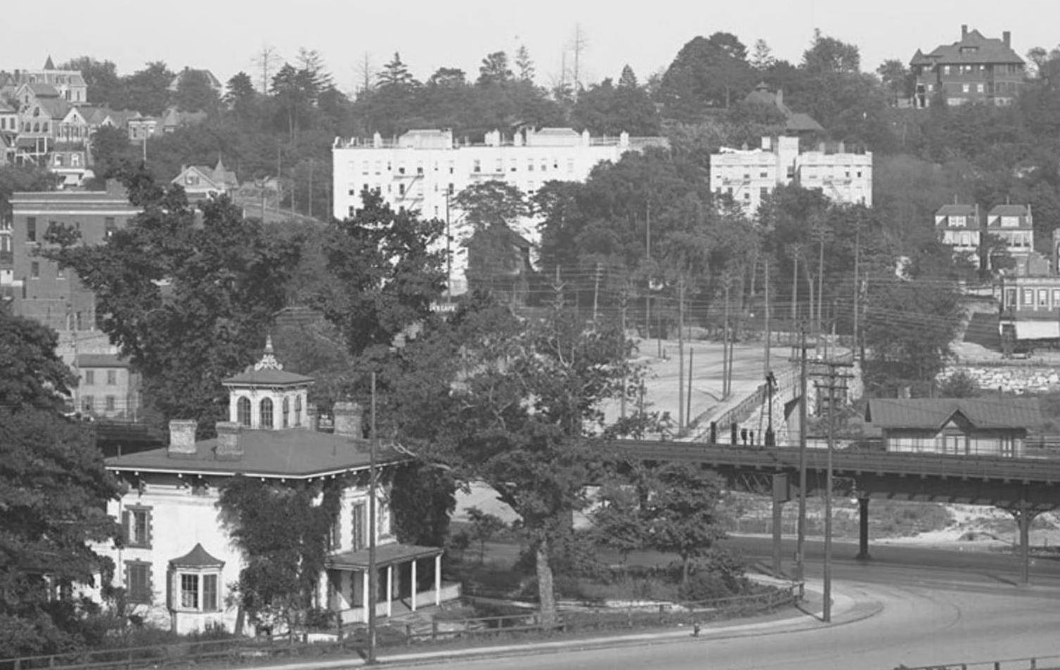
In this crop, the Fairchild mansion is at upper right, and at upper left I would guess is 3065 Sedgwick, also possibly visible in the 1893 photo, which looked like this in the 1940s tax photos.
There are a few others that might be IDed with a lot of work, but so many are gone, often with little or no photo record.
It is always a treat to discover a photo trace that WAS left behind.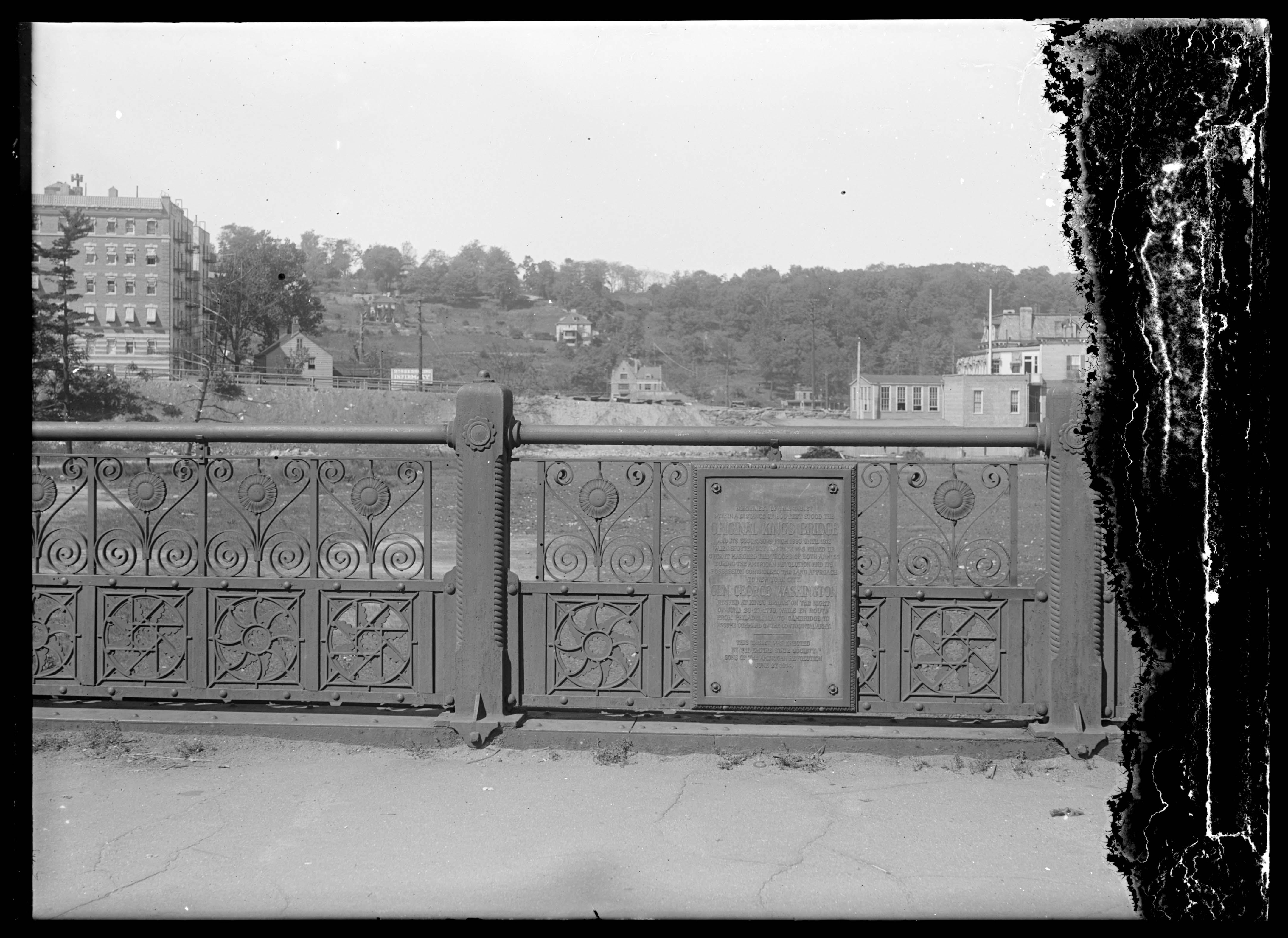
I don’t know anything about the history of 1 Riverdale Ave, but I love its appearance in these two pics.
The view is foreshortened. There is what looks like a newly constructed berm in front of it, but is actually a fair distance in front, and I believe is the best picture of the fate of the King’s Bridge. I believe the King’s Bridge is under that berm, which is Kingsbridge Avenue to the right and Marble Hill Avenue to the left.
The bridge where the photographer is standing is the former Spuyten Duyvil Creek bridge. There is no bridge there today, just a spot on Broadway just south of 230th St.
![https://collections.mcny.org/Collection/[Plaque%20on%20iron%20railing%20marking%20site%20of%20original%20Kingsbridge]-2F3XC5893DG4.html](https://kingsbridgehistoricalsociety.org/wp-content/uploads/hm_bbpui/1407/wmrltojnk0xqgyz5ysiz5kavs5nw6hg6.jpg)
I’m pretty sure this is the construction of the Kappock St overpass/underpass.
Here is a 1937 pic looking the other way. Note the two chimneys on the roof. This would be the house on the left in 1935 mystery pic.
This would be the house on the right, also seen from the opposite direction in 1937.
Here’s a 1940 aerial, showing the Berrian Farmhouse at the far right. This is not a familiar angle on this well photographed house, but almost matches the mystery photo. Edgehill Church is near the center for reference. Villa Charlotte Bronte is at center top.
This 1940 aerial also shows reason to think it lines up with the mystery photo. All three buildings are in this photo, but the angle spreads them out quite a bit compared to the mystery photo.
Berrian Farmhouse at far left. Henry Hudson Monument at right.
Sure looks similar. I’d guess it was the same building.
I have nothing to base this guess on, but I wonder if the blocky looking building that replaced The Old Bridge Tavern might have been temporary offices for The Marble Hill Houses, or the construction company building them.
I don’t know when the playground was opened, but Tieck mentions it in 1964, in what looks like an earlier draft of several chapters of his 1968 book. (Link is to a Fulton Search PDF of The Riverdale Press 4/2/64)
In 1964, Tieck says “…torn down in 1949 to make way for the present playground. At the time of its demolition the comer structure was well-known as the Old Bridge Tavern and was something of a landmark.”He also describes how The distinctive mansard roof shape of the tavern was actually part of a larger building and was moved from across the street after most of the area was destroyed by fire in 1903.
I had not known this wonderful tidbit of info until this thread. It explains some older pics that show the distinctive mansard roof at the site of the phone company building, not adjacent to The Kings Bridge, like this one from Tieck’s book.
I HAD heard (and mentioned in another thread at some point) that the other building that occupied the phone company site (peaking out between the mansard roof and St Johns,) was moved one block south and rotated 180 degrees to where it apparently still stands at 3014 Godwin Terrace. Tieck seems to mention this in passing, but doesn’t add specifics. I learned this from a facebook post from someone who had grown up at 3014 Godwin.
So, Tieck gives us a history of the building that housed the tavern from the 1800s to 1949, and by 1964 mentions the playground.
There is a blocky looking building there in January of 1951, but at most 15 years later it is gone, and is not mentioned.
Here are the 1940s tax photos of the area
The middle building seems to already be reduced to rubble by the time of the OP ca 1949. The one on the left is still there in 1951. The skylights show up in both the OP and the 1951 aerial view.
All of this combines to make me think the blocky looking building was temporary, and leads to my guess about it being the office. Just a guess though.
I love the RCSA photo designation. I try to keep text files of links to photos, so I don’t usually find RCSA photos on my hard drive. My bane is SISBCRW, Seen It Somewhere But Can’t remember Where, when I remember a photo I’ve seen but can’t remember what archive I was perusing or what I was searching for and can’t find it again.
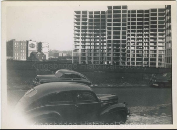
As far as I can tell, the Fordham Hill Apartments were completed in 1949, and as they are under construction here, I’d say this is 1948 or 1949.
I see no signs of construction underway for the Marble Hill Houses, which were completed in 1951. I think The Old Bridge Tavern did not survive that construction. It seems to have been replaced by another structure by the time of this Jan 6 1951 photo.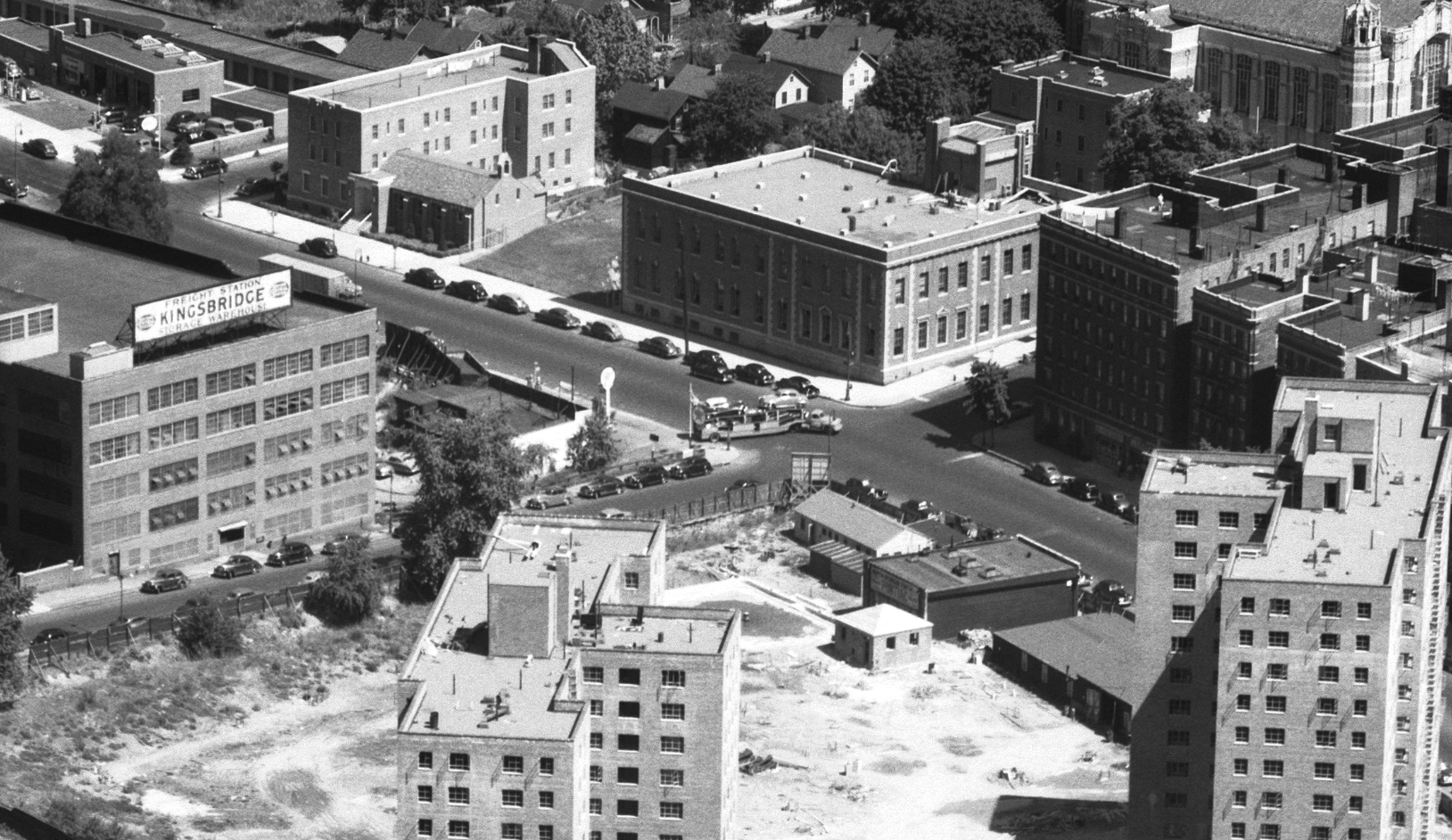
This photo, from Herb Maruska’s collection, credited as 1939, shows the VA Hospital under construction between the original buildings of the RC Orphan Asylum. This source says the asylum was sold to the Treasury Dept in 1921.
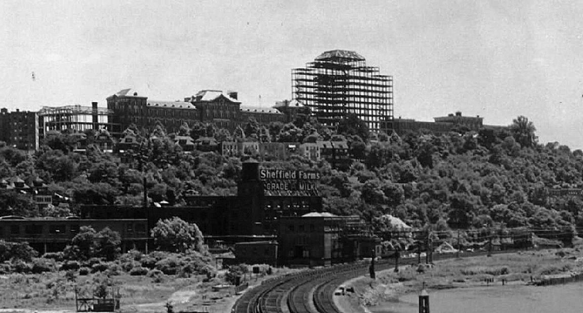
The gasholder shows up in many pre 1950s photos. It was demolished in 1951 to make way for the Deegan Expressway.
The gasholder, the asylum, and Webb’s Academy (demolished shortly before the OP to make way for the Fordham Hill apartments) are great landmarks for old photos of the area.
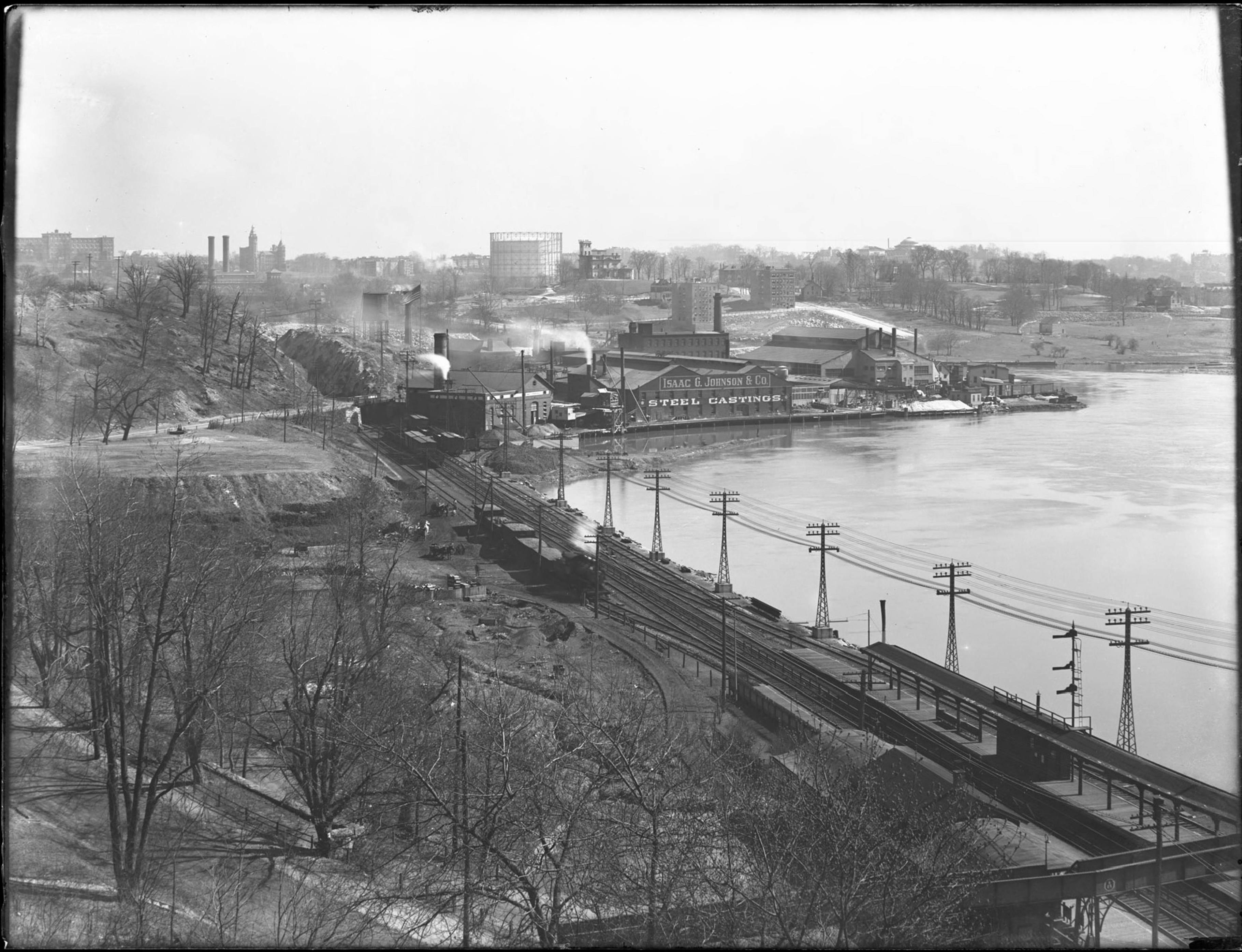
Here all three are visible behind the Johnson Iron Works in 1918. (Only the south wing of the asylum is visible.)
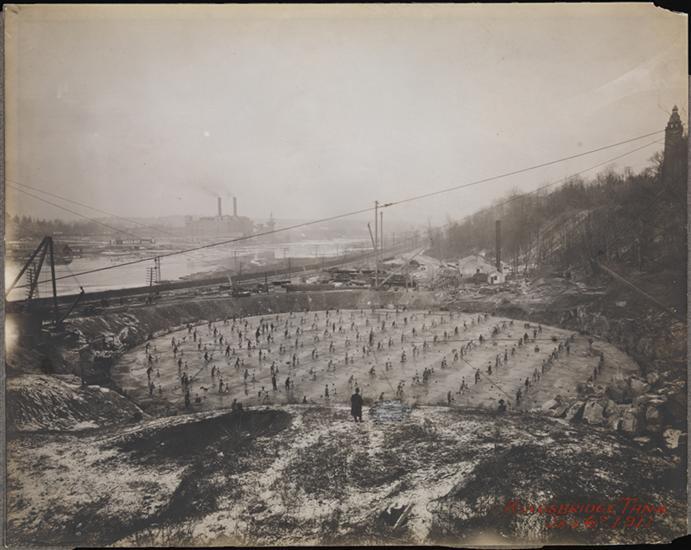
Here is the gasholder under construction in 1911. The view is to the north with Webb’s Academy at the upper right and the Kingsbridge Power House on the Manhattan side. Marble Hill is in the distant center. I don’t know what part of construction needed all these folks, but it looks like a ballet.
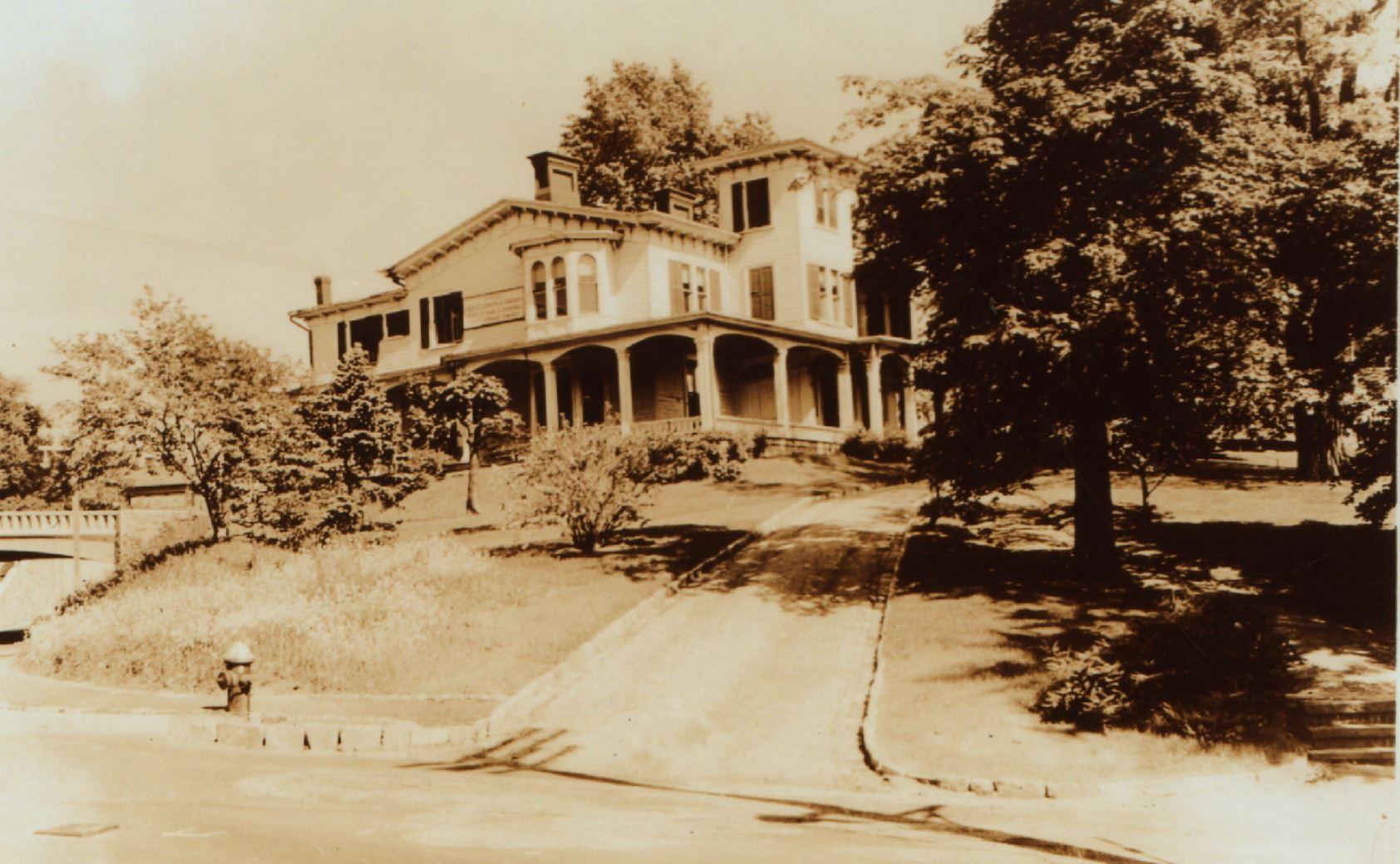
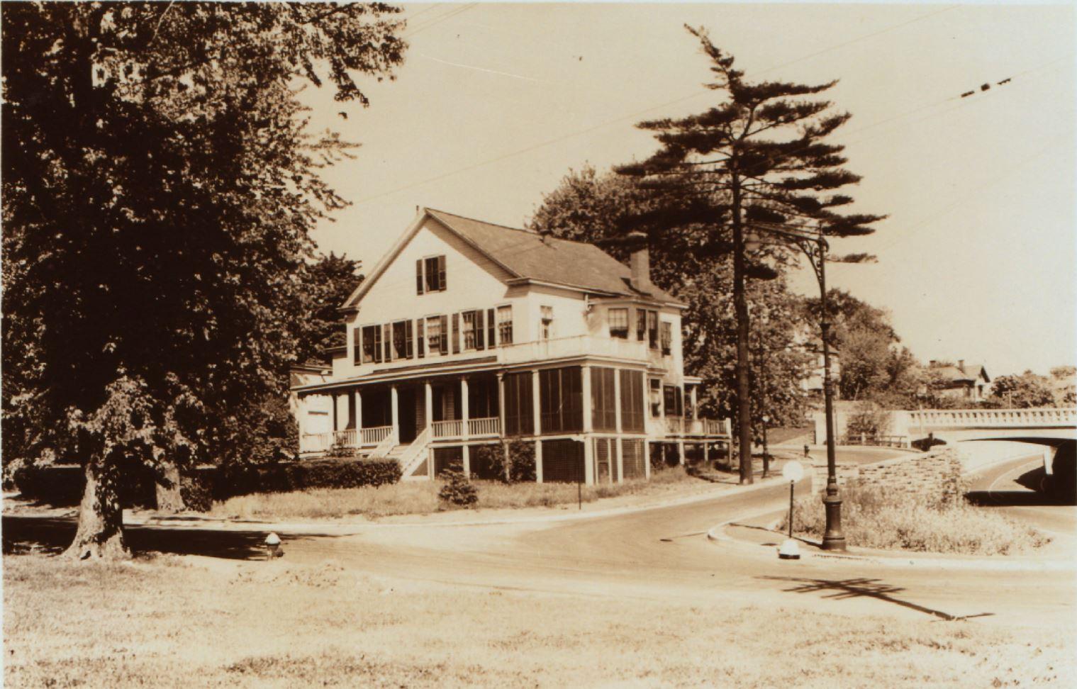
Great info, and it seems likely that “Bonnie Brae” is the spot we are looking at on the map, and perhaps, the spot we are looking at on the map is the house pictured in the postcard, but we aren’t sure.
I’d love to find a wider pic that includes that house.
I’ve looked for 1940s tax photos, but alas, quite a few areas of Riverdale are missing and this seems to be one of them.
I’ve looked at aerial photos, but the best I can find are blurry or tree covered at that particular spot.
I took a quick look at this great old footage, but the Hudson River section seems to start just north of where we are looking.
On the positive side, if that is not the spot, I can’t come up with a better one.
Just like to be sure the we are clear we are guessing, and haven’t backed up the guess yet, even though it may be a good one.1911 map shows John N. J. McKelvey as the owner.
Lots to be found about Mr McKelvey by searching MCKELVEY and SPUYTEN together.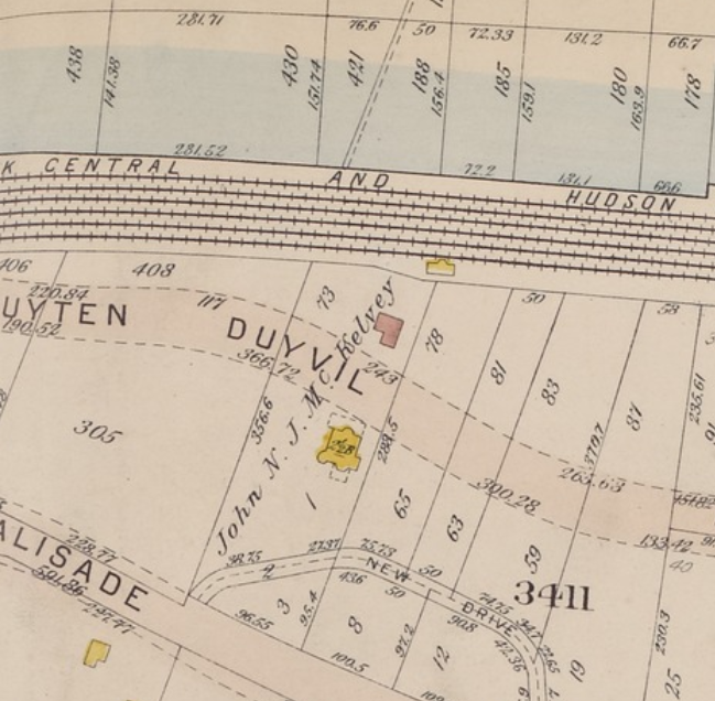
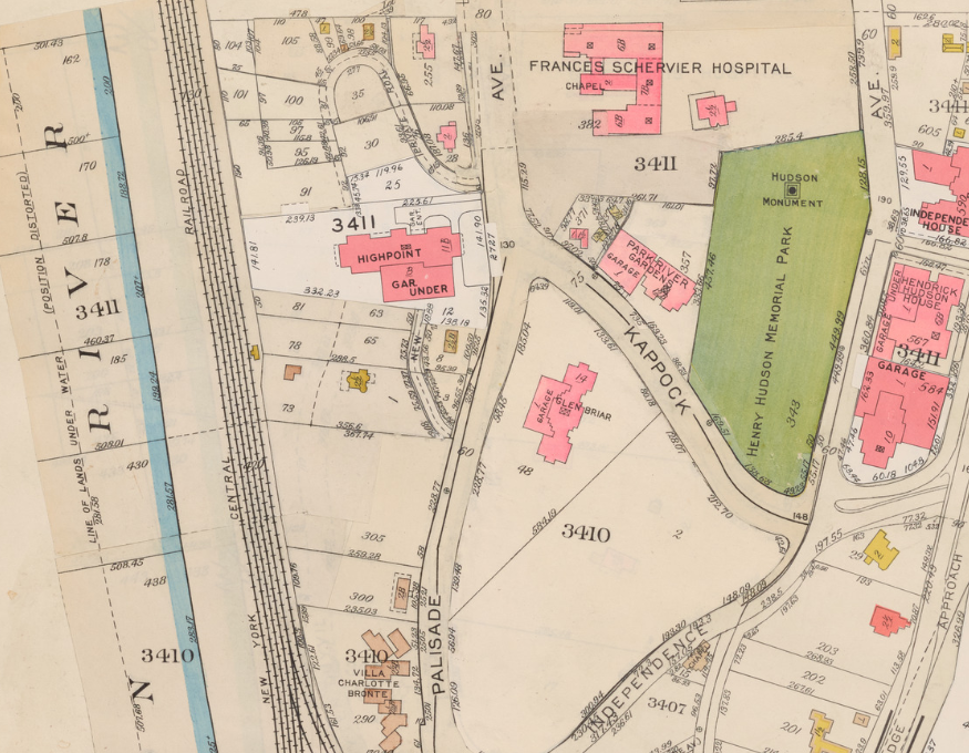
I can’t back it up, but my guess would be the current location of 2621 Palisade Ave, and that it was there as late as 1957, as seen in this 1957 map from NYPL.
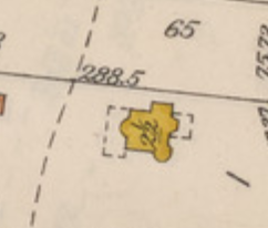
The shape on the map, as shown in the close-up on the right, seems to match the pic, and the geography certainly could be a match.
I’d love to find a pic to back this guess up, but haven’t been able to find one.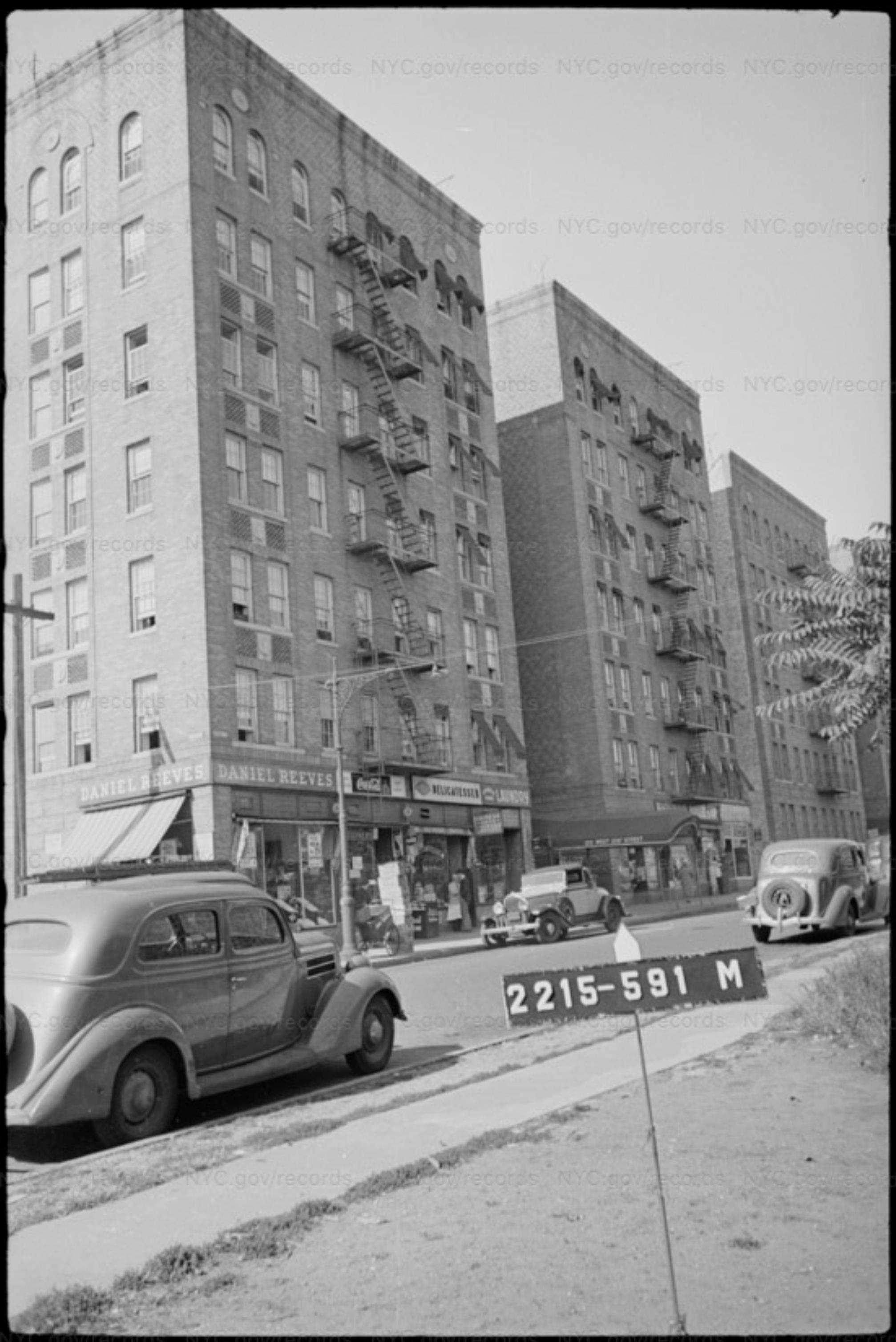
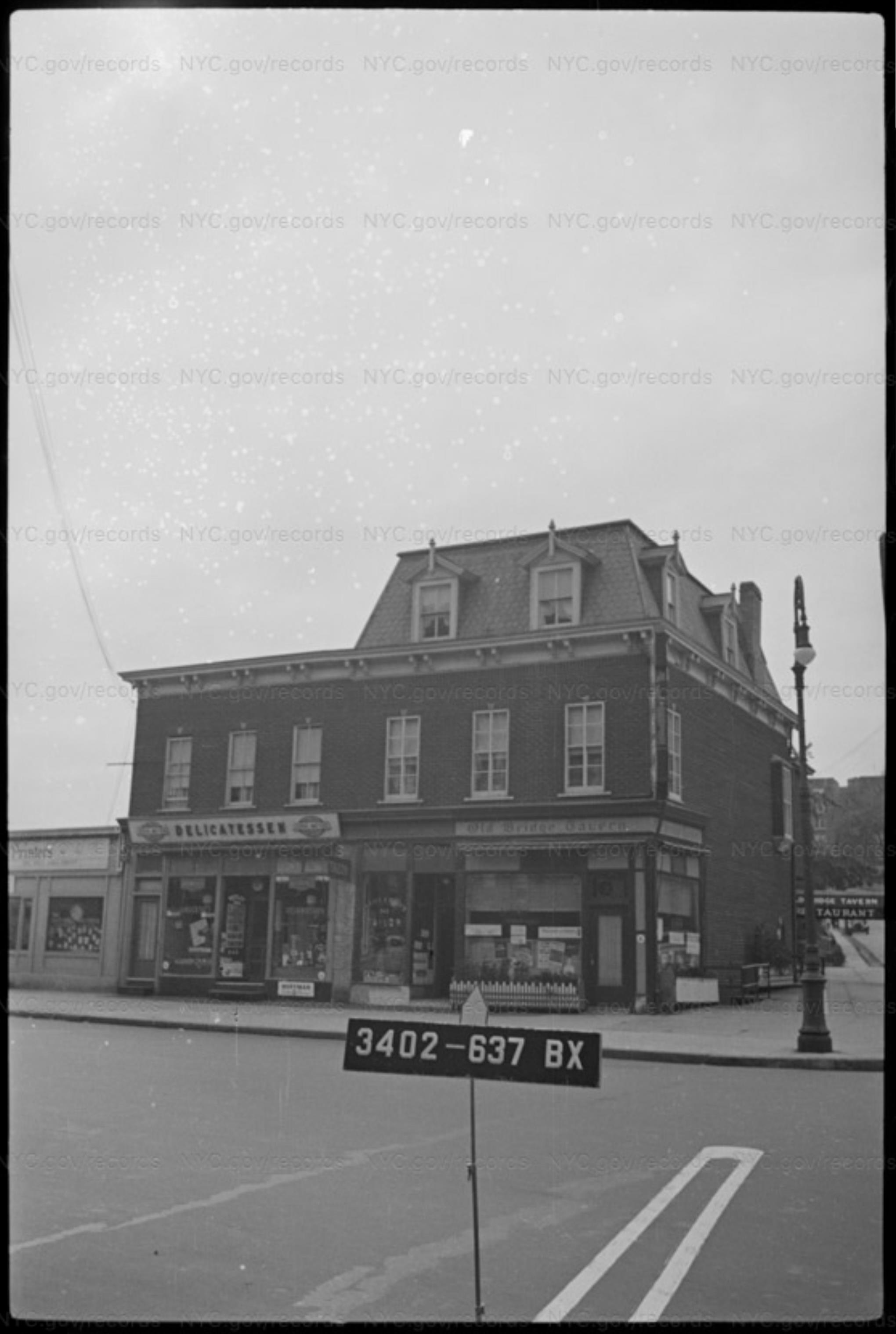
Here is the building on the left in a 1940s tax photo when it was a Daniel Reeves store. I love that the phone pole appears to be the same and the shadow of the pole on the building appears to be almost the same in both pictures.
I love browsing 1940s tax photos. They can be almost as complete as a 1940s version of Google Street View, or at least hint at it.
Here is a map which can assist in searching out 1940s tax photos in the Riverdale/Kingsbridge area.
The 1940s tax photos have only been available online for about a year. They are organized via block and lot number, but unfortunately the numbering of Riverdale & Kingsbridge changed between the 1940s and now. Most areas of the city, including Marble Hill, can look up their current block & lot number at the City-Wide GIS map, and use that to search 1940s photos.Riverdale and Kingsbridge need the block numbers off of old maps, in this case, from the 1938 Bromley Atlas.
The story of how the 1940s photos came to be online is a great read, and explains a lot of why things like addresses are prone to mistakes in the archive. It is a wonder any organizational info managed to stay associated with the original negatives. The block and lot number are usually included in the photo, so can often be more reliable.
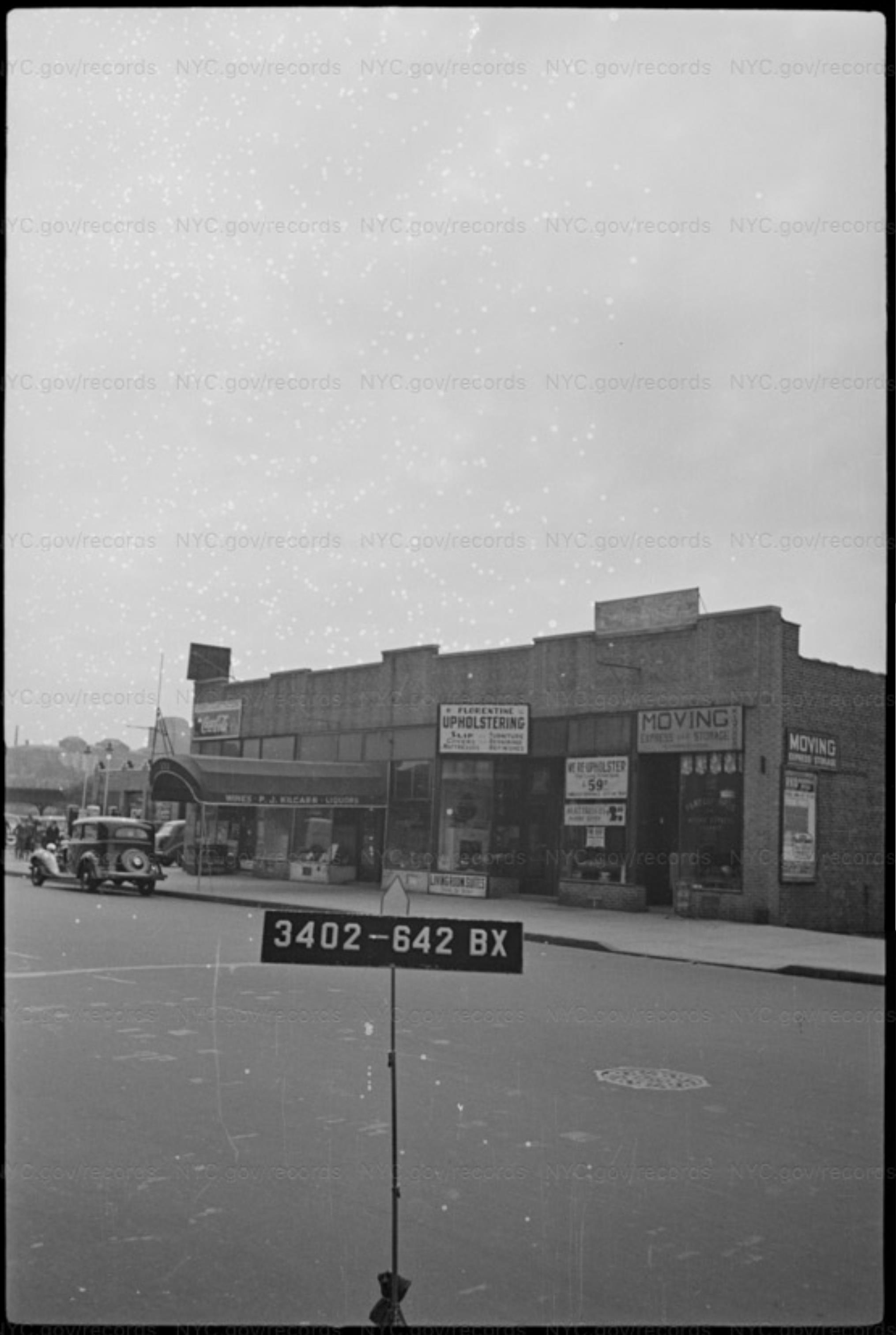
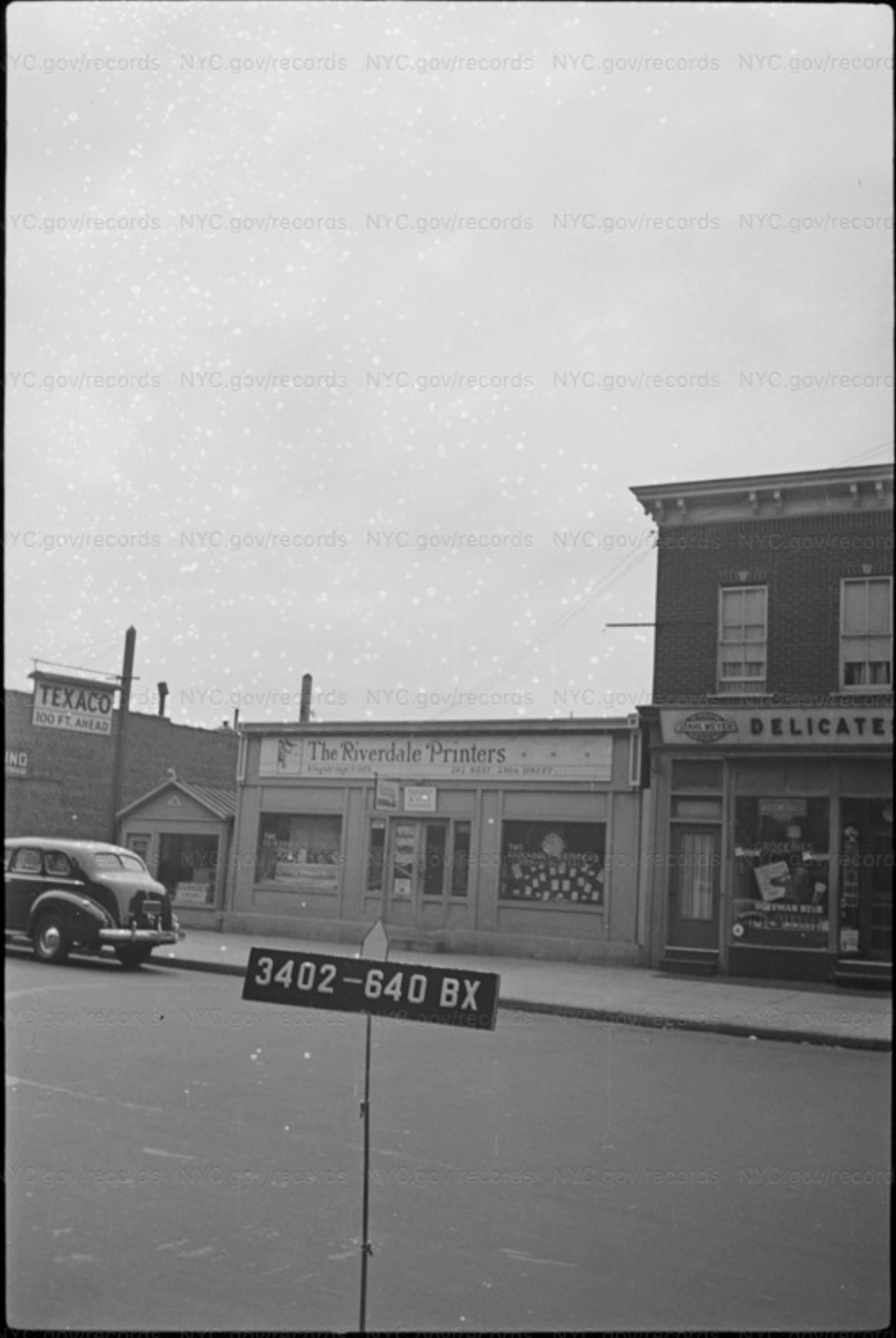
Once you have found the block number, go to the NYC Dept of Records archives, and select the appropriate collection, for instance DOF: BRONX 1940S TAX PHOTOS and try a search like block=3404, or a more complex one like block=”3404 OR 3403 OR 3267″. I’ve found searching by block catches pics you might miss if you searched by address and there was an error or omission in the spelling of the address.
Some Riverdale blocks were huge, and were subdivided by letter, like 3423A–3423W. You can delve into those divisions, and also see lot numbers, by accessing the 1938 maps (and others) at the NYPL Map Warper site. A tremendous resource. The more you learn to navigate the NYPL map collection, the more info you can find.
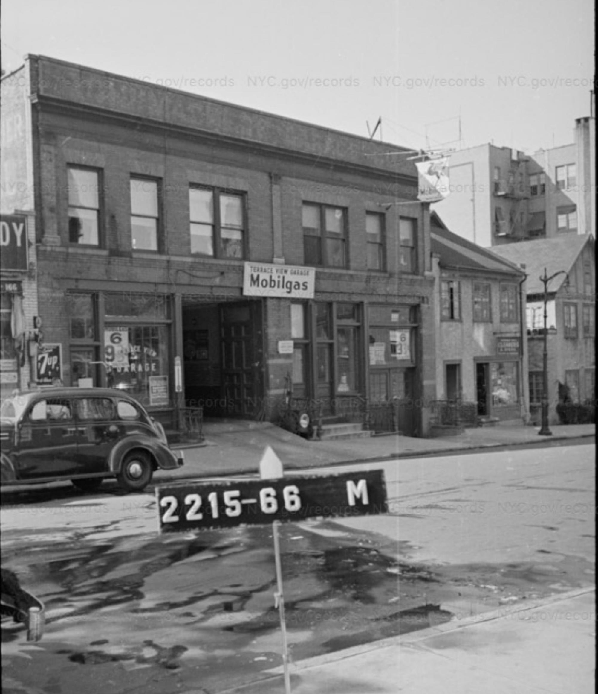
The tax photo above is in Marble Hill, so be sure to select the MANHATTAN 1940s TAX PHOTOS, then search for block=2215 AND lot=591Some other favorite sources for old NYC photos are…
OldNYC, which offers a convenient way to find geolocated pics from the NYPL
NYPL Digital CollectionNew York Heritage digital collections
Museum of the City of New York
New York State Archives Digital Collections
Once I know the location of a photo, I often seek out related photos.
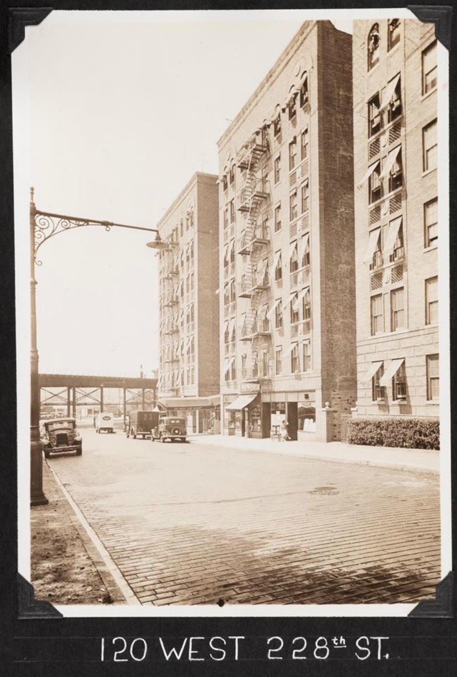
This one from the KHS member area overlaps the OP. (Original Photo that started this thread.) In the back left of this photo are 226 Kimberly Place, and in front of it, 3014 Godwin Terrace. 226 Kimberly Pl is the one with the two billboards painted on it.
226 Kimberly Pl and 3014 Godwin Terrace are in the back right of the OP, and in the OP PS 207 can be seen behind them.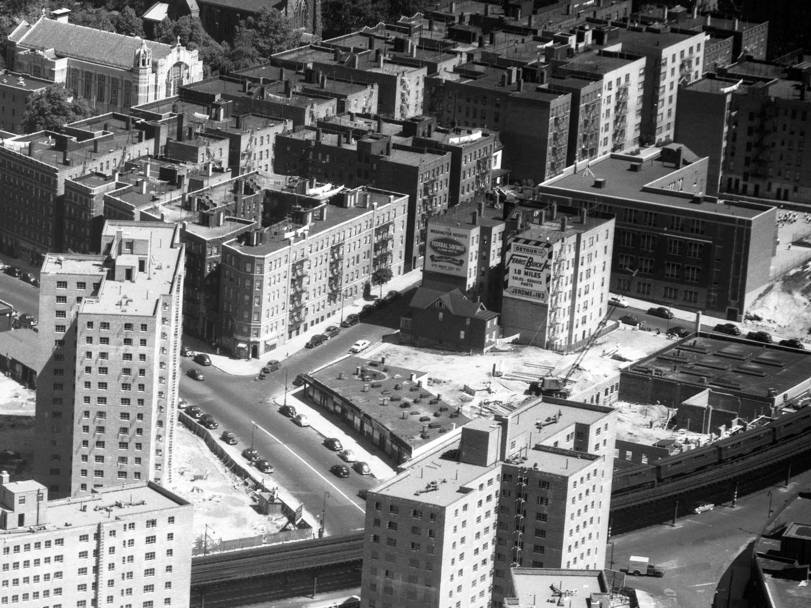
This clip from a January 6th, 1951 aerial photo shows some great detail of the area in the background of the OP.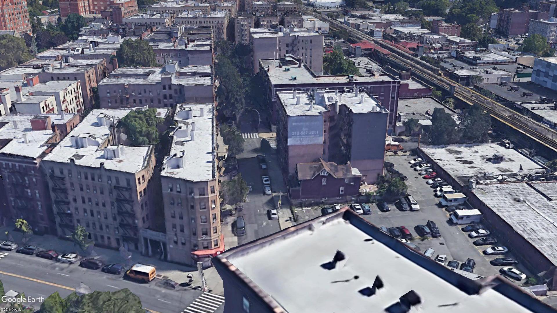
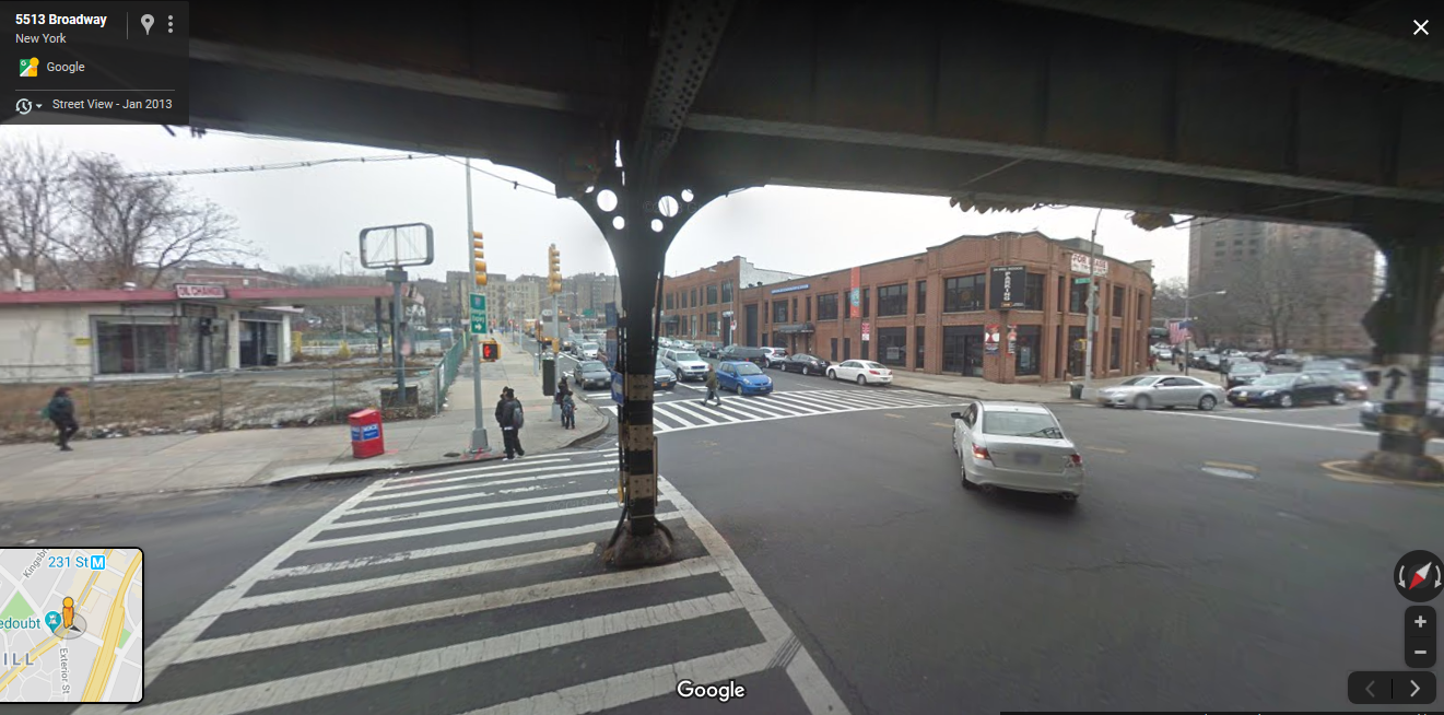
This is a simulated Google Earth view that is the closest I could get to the angle from the OP.I love that the frame house at 3014 Godwin Terrace is still there. I have been told that this is the same house that was across from The Kings Bridge and that it was moved one block east and rotated 180 degrees at some point in the ’20s or ’30s. I have yet to find verification of this, but it seems likely.
This would be 3014 Godwin Terrace at its original location, 3011 Kingsbridge Ave, ca 1916.By 1938, the maps show the phone company building there. On a FaceBook Riverdale group, someone said she grew up at 3014 Godwin Terrace and was always told it had been moved one block and rotated to get to its current location. Perhaps there are pictures of it being moved.
This ca 1940 photo is looking the other way from the OP.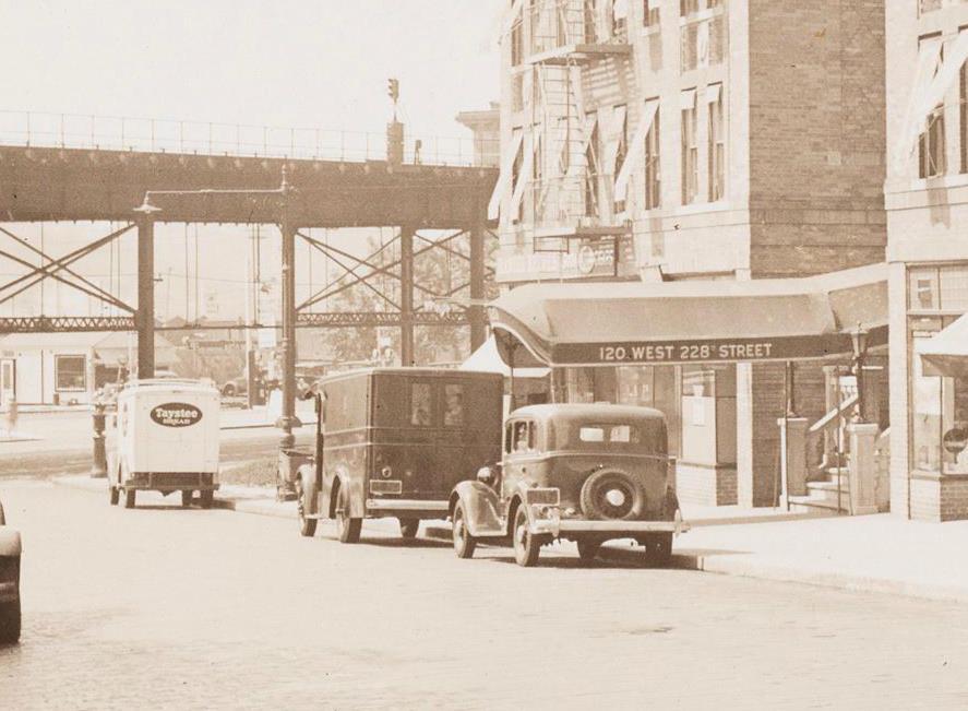
Zoomed all the way in, I believe one can barely make out the Daniel Reeves lettering. At some point soon after it became Lakes of Sligo, which I believe was a bar and possibly restaurant. It appears to have been there well into the 70s.
I noticed that the El supports don’t match up with Nick’s most recent picture. I think the young man in the tartan vest is actually in the Bronx, and I think he is looking at the construction of the Kingsbridge Post Office.
Both photos looking east on 230th St. Notice the Audubon Storage Warehouse building in the 1940 pic, I believe it is also visible behind the Tydol sign in the Kingsbridge PO pic.
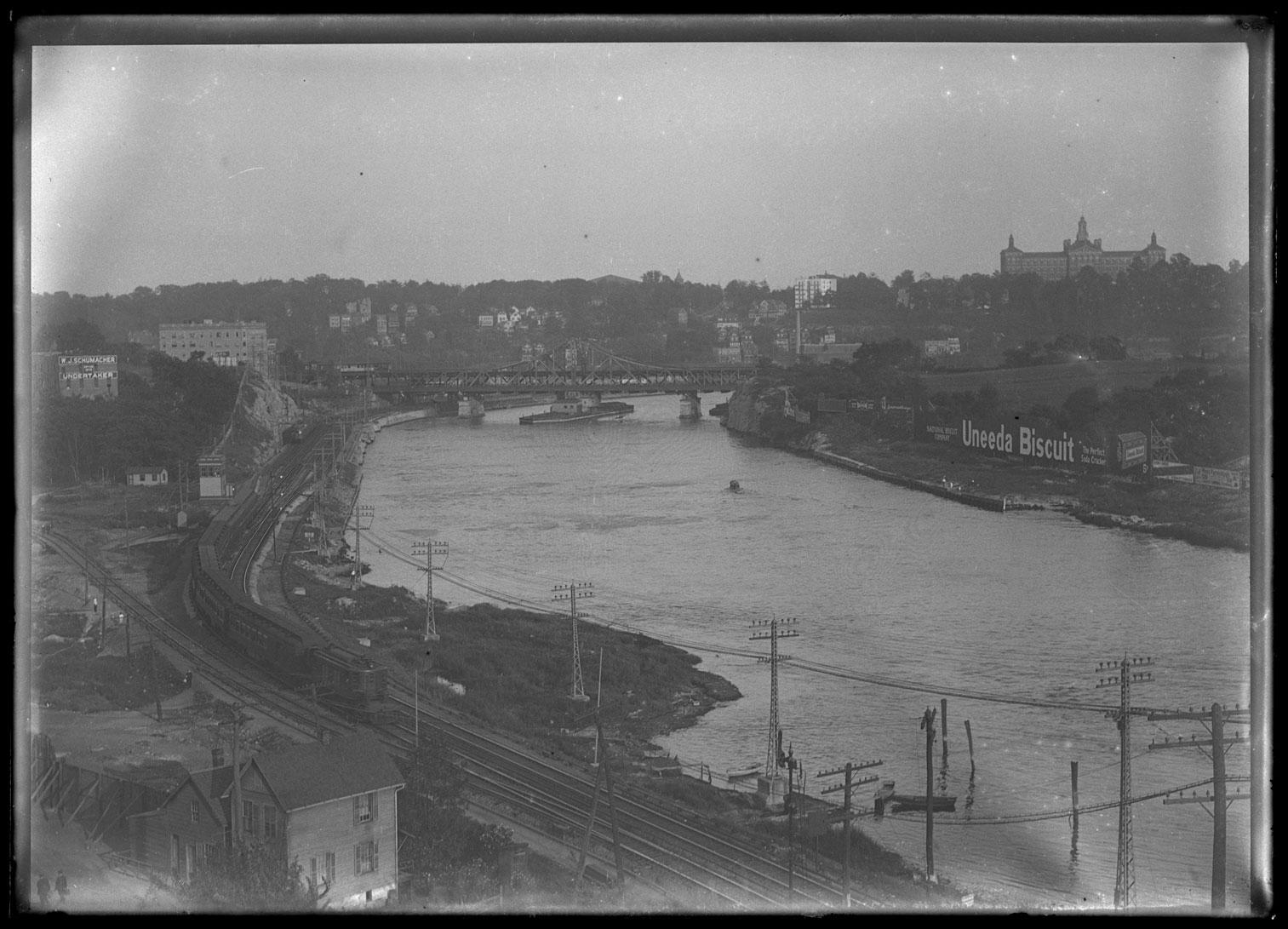
August 19, 2019 at 6:19 pm in reply to: The Spuyten Duyvil and Port Morris Railroad – Part 2: Through the Hill #1101You can see the Kingsbridge station behind and under the tracks in this 1916 view.
Close up of above pic, showing station
http://dcmny.org/islandora/object/nyhs%3A598It shows up even more clearly in this view, which I believe is taken from the steeple of St Stephens
https://cdm16694.contentdm.oclc.org/digital/collection/p16124coll2/id/27554
This pic is one of three that can be combined into this awesome 1916 panorama…
Once I knew several were still standing, that made it a lot easier. I was able to recognize the parapet rooflines of 5582 and 5590 Broadway in 1940s tax photos.
Great photo!
I’m a lucky owner of Tieck’s Riverdale, Kingsbridge & Spuyten Duyvil book and sure enough, on page 108 he describes “the immense Broadway twin sewer” that was laid about 1900.
So, intersection is Macomb St (231st) and Broadway, looking north on BWay ca 1900.
The frame house at the right was replaced shortly after by the 5 story building shown in this 1916 pic with the sign on it
https://cdm16694.contentdm.oclc.org/digital/collection/p16124coll2/id/27564
Going right to left from that frame house in the original photo we have 5580, 82, 86, & 90 Broadway, all still standing and easily recognizable today.
After that it is trickier to see in the blurry background, and according to Tieck those wooden frame buildings were all raised one story to be at street level after broadway was raised. I’d guess we are looking at them BEFORE they were raised up. At least three of them should still exist, including 5610 Broadway, which was the original location of Fuhrman Brothers, though I can’t distinguish them enough to sure which one it is. Here is what it looked like ca 1940
http://nycma.lunaimaging.com/luna/servlet/s/8b33rg
I’m a member of a Facebook group dedicated to solving mystery NYC photos and I had this one on my list of possible ones to submit.
Thanks for posting, I’d come across this one before and wanted to know where it was. Knowing it really was Kingsbridge area, and particularly knowing several buildings still existed made it solvable.
I had no idea there were pipes like that running under Broadway, but it is a great piece of the puzzle of understanding the huge changes to the area that make it often hard to picture what was where. The raising of the terrain can be particularly tricky, and I like how this pic makes it clear that Broadway was raised before some of the surrounding areas, which explains why raising the terrain still left the El as elevated as it still is.Thomas Casey, here is a ca 1905 pic of the location you suggest.
At the right edge, you can see the new location for the train tracks being constructed, which will form a barrier between Spuyten Duyvil Creek on the left and the Ship Canal to the right. I think it was around 1905 that the reroute was completed, before that the train tracks went all the way up to 231st St before looping back down to the Spuyten Duyvil RR cut by the Johnson Iron Works.
The Roman Catholic Orphan Asylum is on top of the hill, which is where the VA Hospital is today, so this pic is very close to the same view as in your post.
https://cdm16694.contentdm.oclc.org/digital/collection/p16124coll2/id/36182The brickwork around the culverts is very similar to that in several photos of the new aqueduct, around the time of the construction of the Jerome Park Reservoir.
The barrels are obviously temporary, making me think that the street over the water may have been extended after the time of the photo. This would be backed up by the brickwork, which looks like it is ready to be extended, as in this photo.
![The brick conduits for the reservoir's water supply [New Croton Aqueduct?] during the construction of Jerome Park, Bronx, N.Y., undated [c. 1905-1906].](https://kingsbridgehistoricalsociety.org/wp-content/uploads/hm_bbpui/958/fejwhmtu9k72i07iptcyb563mraxz525.jpg)
https://cdm16694.contentdm.oclc.org/digital/collection/p16124coll2/id/39611/rec/3I’m also struck by the height of the trees to the left, and the fact it appears they may be downhill from the water. Although I had initially assumed this was somewhere along Tibbetts Brook, those two features make me lean more towards an entirely created watercourse, connected to the reservoir.
I’ve come across this pic before, and seen it labeled as “possibly” Kingsbridge. I’ve looked a little, but not been able to nail down the location, so tended to think it might be elsewhere.
I’m excited to know you know the location! I will have to redouble my efforts to see if I can determine the spot!Thanks for this great post.
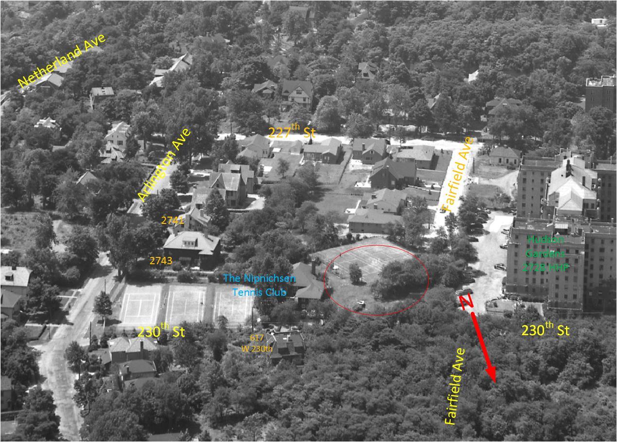
I grew up in the 60s and 70s on Arlington Avenue with the abandoned Nipnichsen tennis club as an extended backyard.
From the looks of it, Fort No 2 was 50 yards from our backyard.
If only we had known back then.
“The Nip” was an anything goes kind of place. The owners showed little interest, and the city couldn’t even track them down when it decided to bulldoze down the fire damaged clubhouse in 1973.Kids in the area dug holes, set fires, built forts, set off fireworks. No one (other than parents) seemed to care. There was a wild west feel to the place.
It would have been easy to just start digging and see what turned up. Now it is likely too late.
I posted a history of The Nip, from 1910-2000 on the FB RIVERDALE NEW YORK MEMORIES page, but did not delve at all into the Fort #2 aspect.
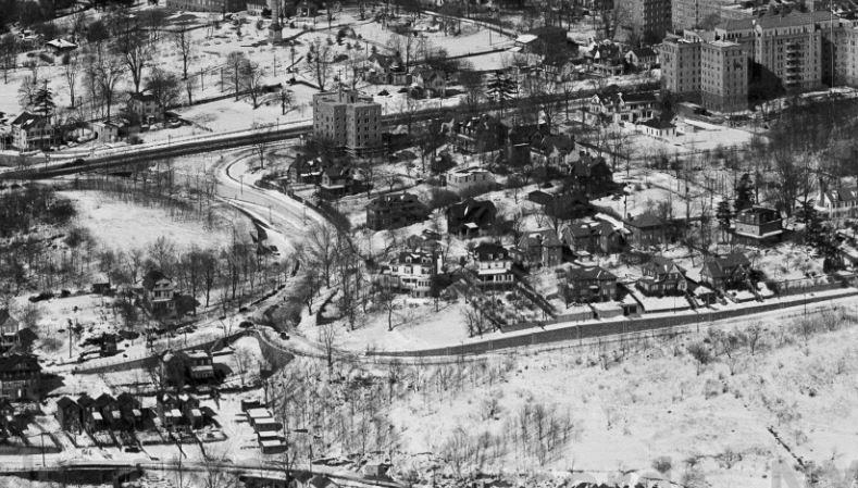
Here’s a version of a diagram I made for the FB post using a 1951 aerial view. I’ve circled the spot you describe as the location of the fort.
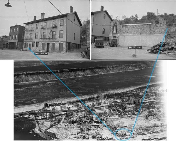
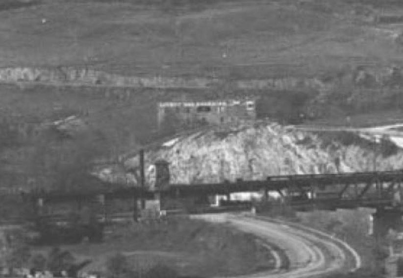
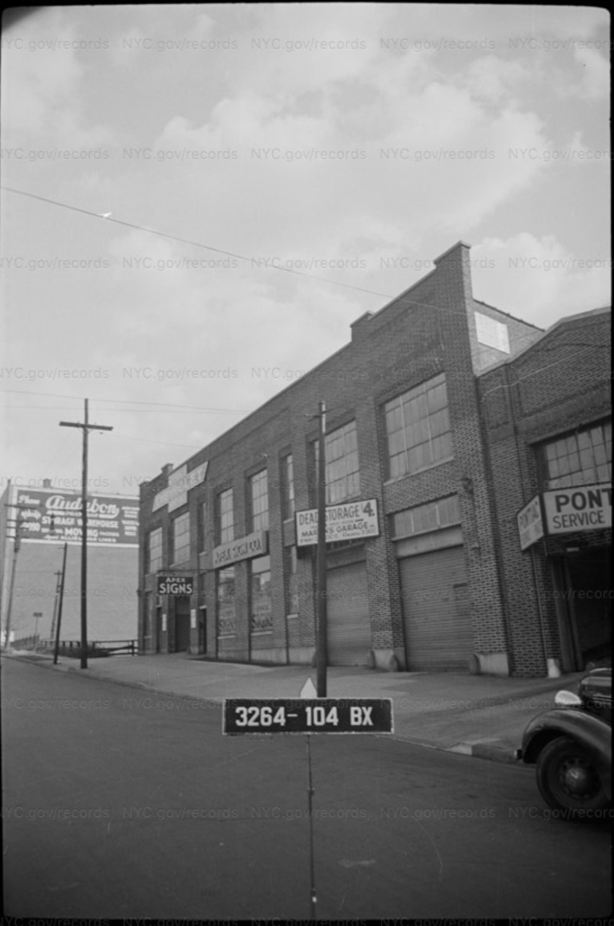
http://digitalcollections.archives.nysed.gov/index.php/Detail/Object/Show/object_id/27545In 1946 it was an automobile warehouse, as shown in this pic.
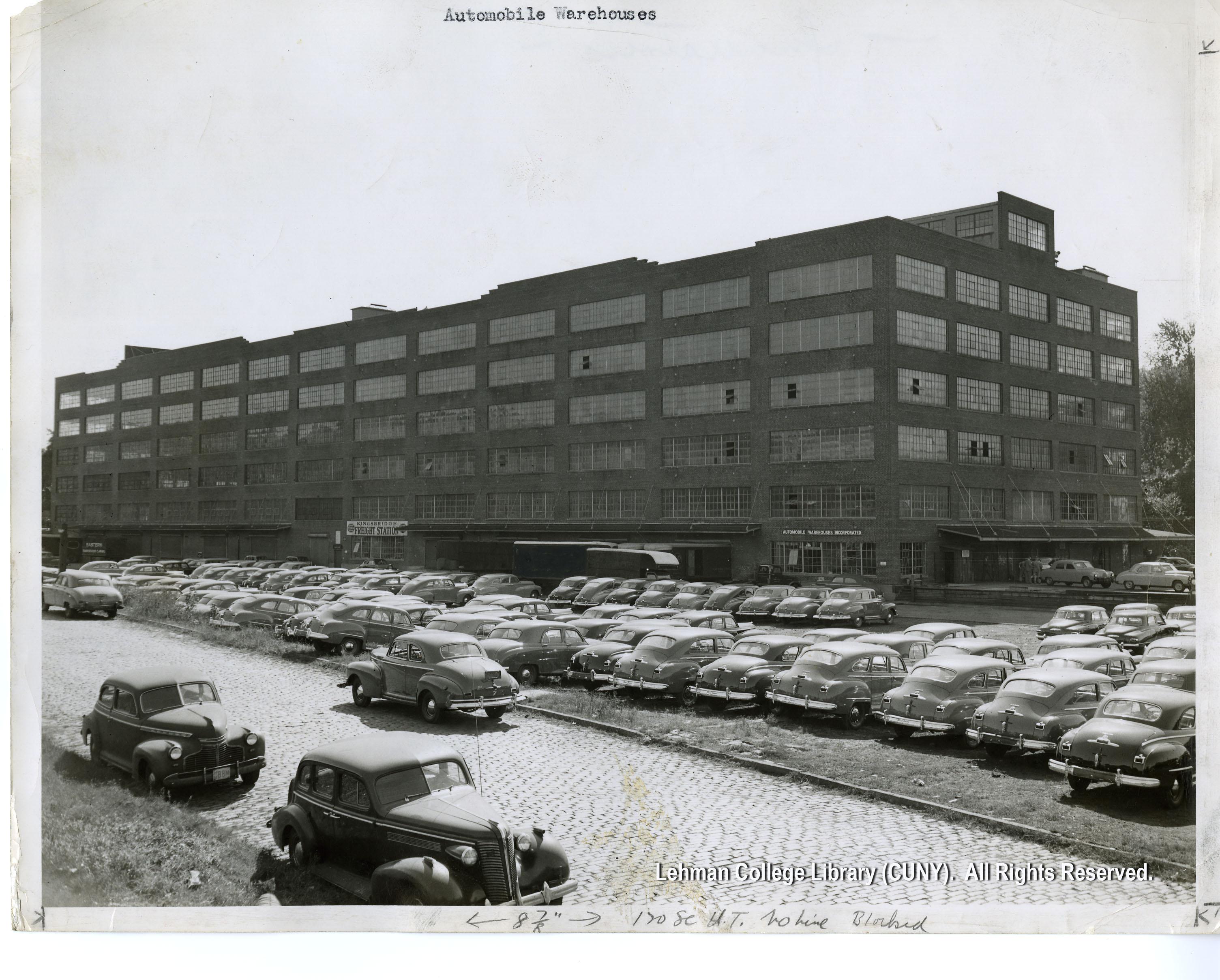
Before that, I’ve seen folks refer to it as being owned by the New York Central Railroad, likely the original owner. It was adjacent to the rail yards, and convenient to them. NYC GIS says the building was built in 1923.
In this 1951 aerial photo, you can see that there were ramps from Terrace View Avenue that led to the upper floors. The rail yards, that later became the site for JFK, are also visible.
http://dcmny.org/islandora/object/bronxbusiness%3A148
http://digitalcollections.archives.nysed.gov/index.php/Detail/Object/Show/object_id/27545
-
AuthorPosts
![Ice skaters in Van Cortlandt Park, Bronx, N.Y., undated [c. 1900-1905?].](https://kingsbridgehistoricalsociety.org/wp-content/uploads/hm_bbpui/1458/zmyu8y1br0c43hzxs8ix8kjsej3b73a0.jpg)