Forum Replies Created
-
AuthorPosts
-
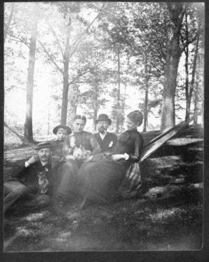
I just found this 250-year-old advertisement so I thought I would post it to this thread about colonial-era schooling in our area. My guess this is the first and last French language boarding school in the neighborhood. They don’t teach “the Doctrine of the Sphere” like they used to! 1772, New York Gazette.
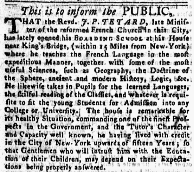
Tetard’s house overlooked the Harlem River from Kingsbridge Heights, hence the sentence about “commanding one of the finest prospects in the Government.”
I tried looking for a property deed as well for Dennis Cronin but I could not turn up anything.
I looked in Westchester County Deeds because The Bronx was part of Westchester at the time and I checked the New York County deeds since “near Kingsbridge” could mean somewhere in Inwood or Marble Hill. The lack of a deed likely means that he did not own the property where his school was located. It could have been leased or housed in another building.
Here’s something interesting: Dennis Cronin apparently also lived in New Rochelle for a while. The Annapolis Heritage Center in Nova Scotia holds a diary of his detailing “time spent in New Rochelle, New York.” That’s a funny coincidence because that means that both John Peter Tetard and Dennis Cronin both operated schools in Kingsbridge and both previously lived in New Rochelle. Maybe they were partners?
I went up to the monument dedication, which was quite interesting. Nimham was a hero both to his own Stockbridge Munsee people and to the patriot cause during the Revolution and the crowd was very proud of their local son. Several Native American Veterans from the Stockbridge Munsee Indian Reservation in Wisconsin came to the ceremony as well and were clearly moved by the expression of pride in one of their own. Every speaker paid homage to Nimham’s bravery during the ‘Battle of Kingsbridge.’
The monument is absolutely stunning. I am going to try to get the sculptor to give a talk for the KHS as his statue is full of symbolism that is interesting to learn about.


 June 7, 2022 at 9:40 pm in reply to: Revolutionary War Veterans of Riverdale, Kingsbridge, and Spuyten Duyvil #2862
Yes, I believe it is. Robert Brown is a pretty common name but he was the only one with that name in our area that I could find. After the Revolution, there is a reference to a “Free Robert” in the 1790 Yonkers census and I think that is probably him as well.
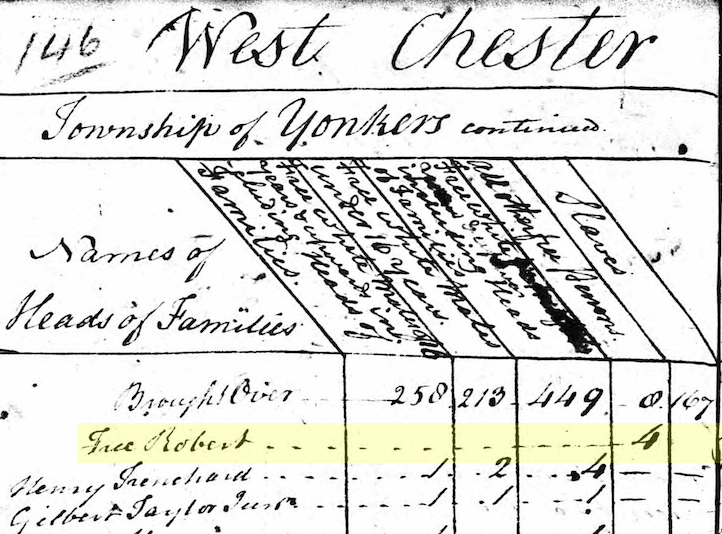
The 1752 will that you mentioned is the document that freed Robert from slavery. And the 1790 census lists 4 people at the house of “Free Robert” in the column entitled “all other free persons” so that’s why I think it is him.
Wow, never heard that one about the Guggenheim before!
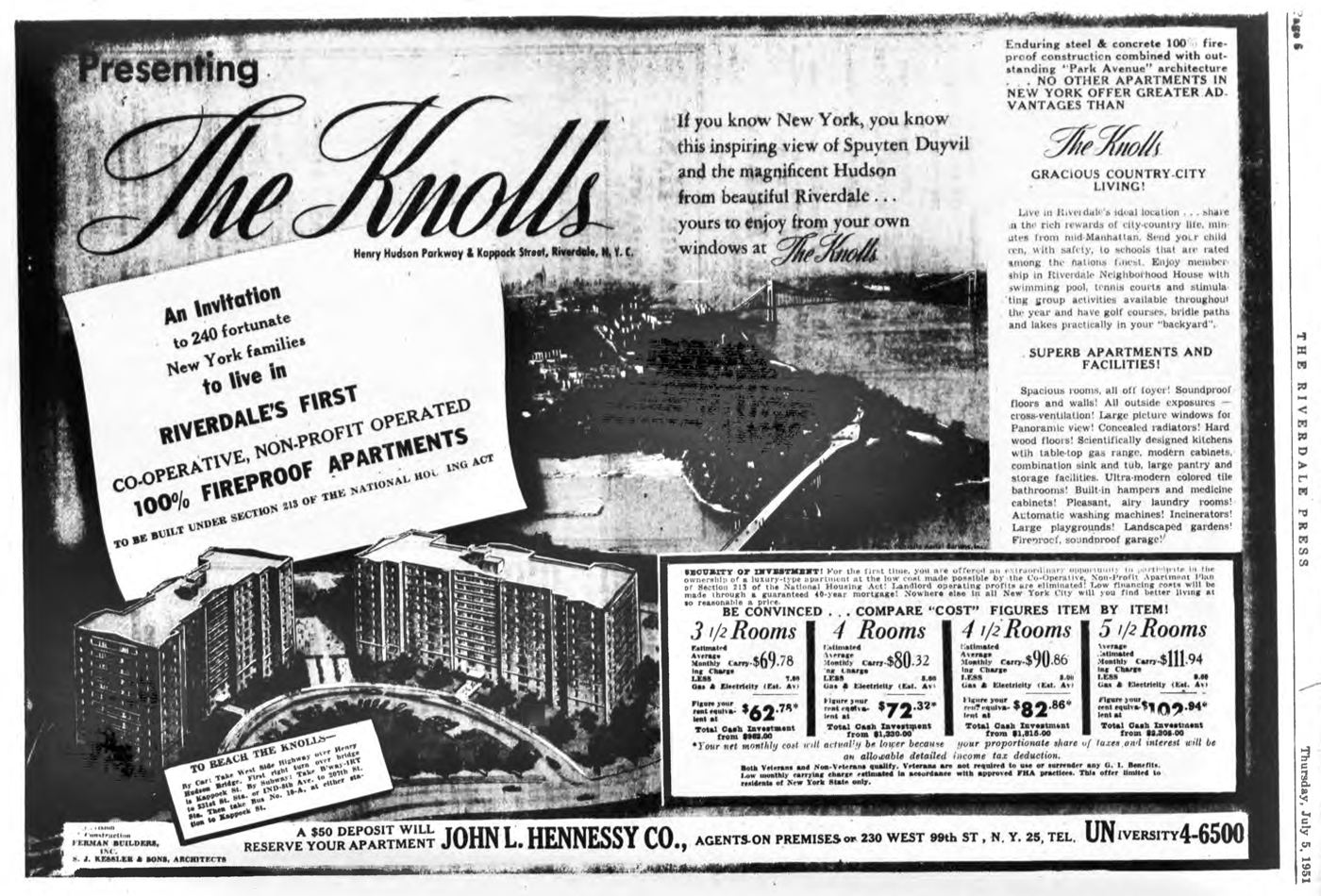
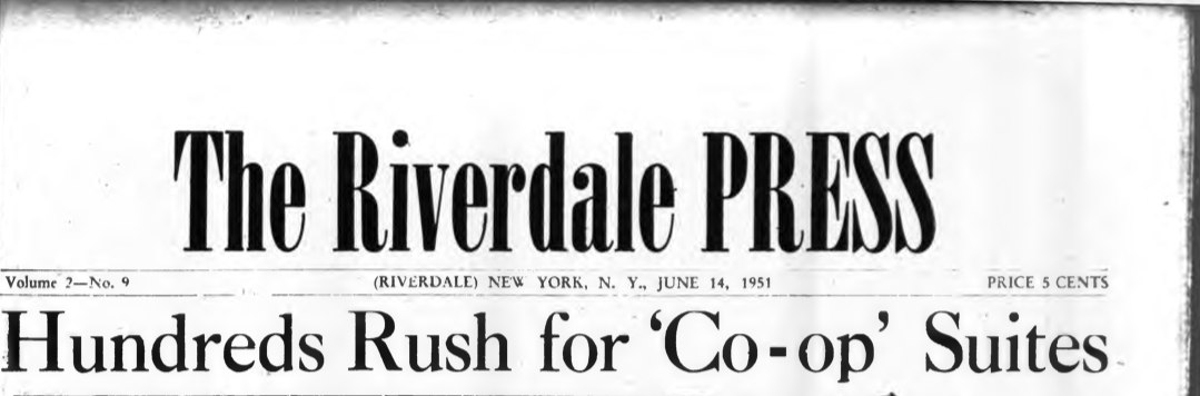
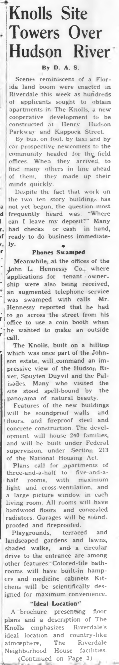
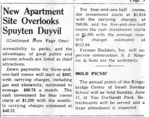
I also wondered about the name. There were a couple of places in the area with the name “Knolls.” Hiram Barney’s Cedar Knolls as Tom pointed out, which stood on the site of the Ethical Culture Fieldston School and Grace Schmitt’s “Knolls just south of W. 261st Street near Broadway. I doubt either had anything to do with the name of this development though.
More Knolls information from the Riverdale Press in 1951:
I have to admit that the whole issue of 6 Ploughman’s Bush was off my radar from 2004 to 2015. So I am glad it was brought up and appreciate the follow up posts that contain information about it.
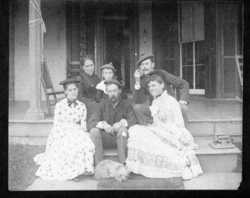
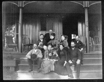
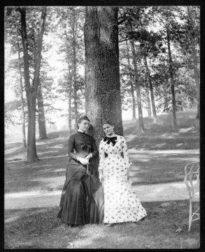
One of the reasons I appreciate the post is that I purchased a collection of photos a few years ago that were advertised as depicting Riverdale. I wasn’t sure if the claim was true as there were no recognizable landmarks. The text, written in pencil on the back, states “Riverdale?” and also lists a few names like “Moses T Pyne,” “Ms. Stockton,” and “Bertha Hurlbut.”
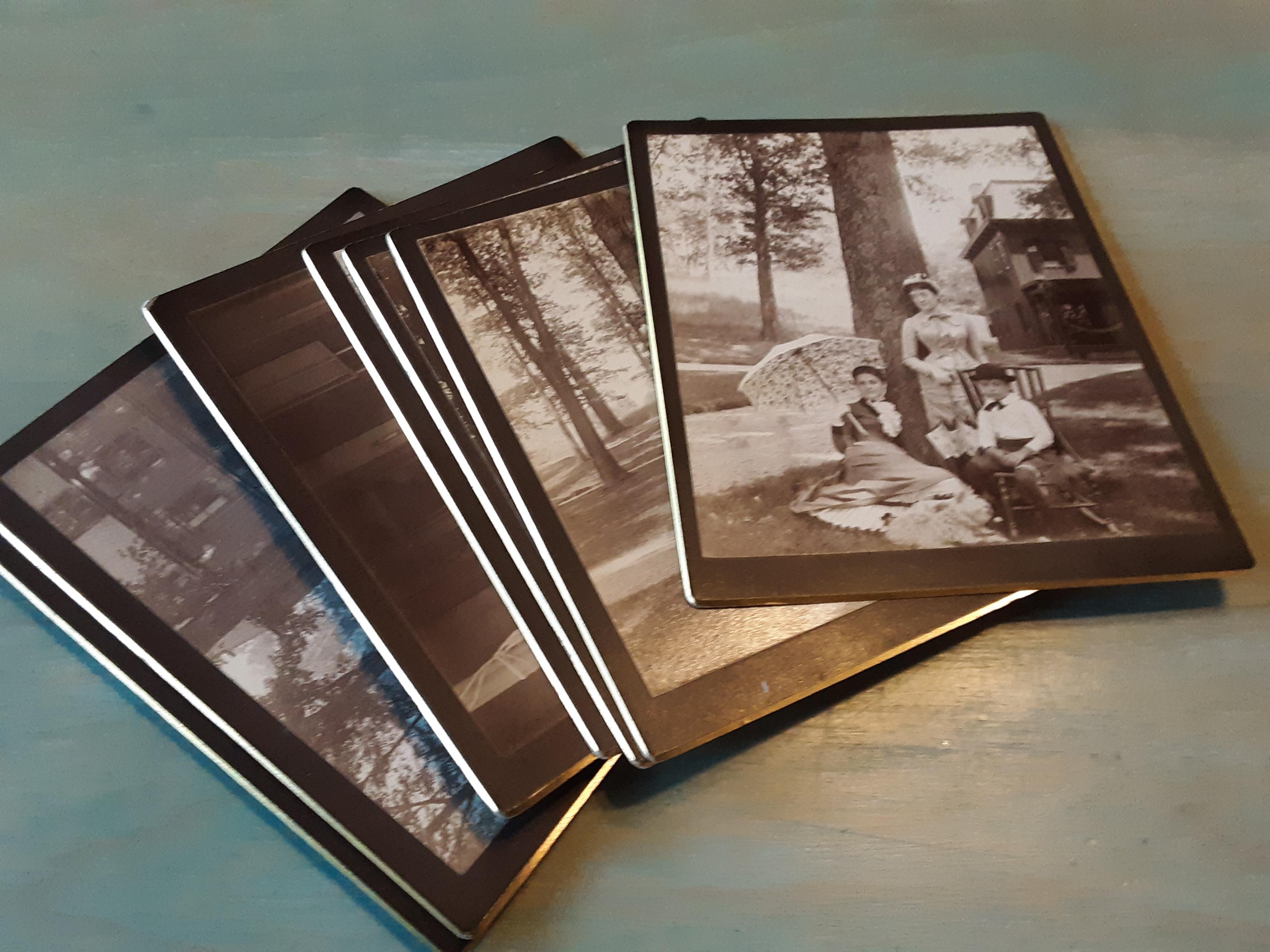
Some of the photos depict a building in the background:
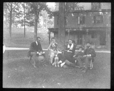
The arches on the porch columns and the “board and batten” exterior bear a strong resemblance to the style of 6 Ploughman’s Bush:
But the building in the old photos has a third story with a mansard roof, whereas 6 Ploughman’s Bush obviously does not. According to the site shared by bstein,
Lewis Delafield expanded Fieldston Lodge in 1877-78 to five bays and two full stories plus a slate-covered mansard roof, with a wide front verandah. Local builder Samuel L. Berrian executed this addition. The building that is today No. 6 Ploughman’s Bush is similar in style and details to the expanded Fieldston Lodge (which remained until at least the 1950s.)
So I figure the building in the old photos is Fieldston Lodge. Here are the rest of the photos for a taste of old Riverdale:
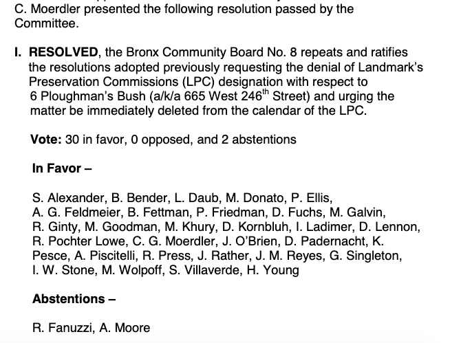
Interesting. 6 Ploughman’s Bush was up for landmarking and then Community Board 8 urged “the matter be immediately deleted from the calendar of the [Landmarks Preservation Commission]” according to the minutes.
Perhaps you can reach out to someone on CB8 who voted on the matter to find out what the story was:
 Nice looking building:
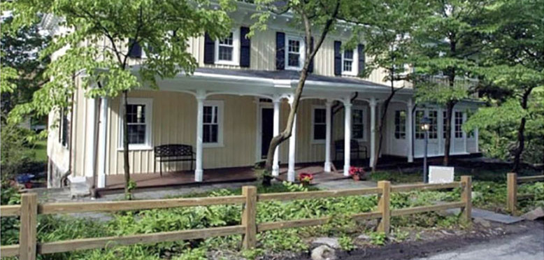
Yeah, “Tappan Zee” is pretty great–combining the name of a local Lenape band (the Tappan) and the Dutch word for “sea”–it would be hard to think of a more appropriate homage to the history of the Hudson River Valley and I’ll probably never top saying it.
But I don’t want to take credit for the “Congress Bridge” discovery. Peter Ostrander told me about it first. Here is a link to the only map I have seen that actually labels the bridge as “Kings or Congress Bridge.”
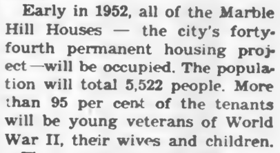
The National Archives were not on my radar so thank you. I imagine that the numbers of local men that served in WWII will be very high when compared with the number of names for WWI veterans. This makes me think of this memorable blurb from the 8/9/1951 issue of the Riverdale Press. It is from an article about the opening of the Marble Hill housing project.
I wonder if there is some searchable database out there that could produce a list of enlistments from our area. While it is always fascinating to hear family stories, I think if the project relied on people coming forward with information about their veteran ancestors, a lot of names would probably be left out. But I don’t know if such a database exists.
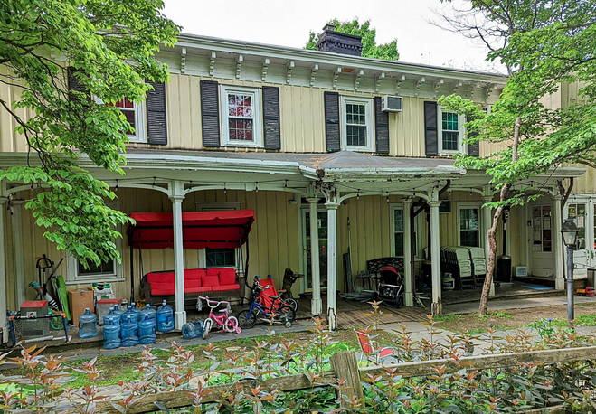
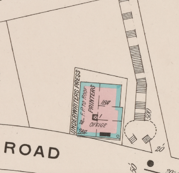
I did manage to find out a few things about it. For everyone’s reference, we are talking about this building at Riverdale Avenue and 230th Street :
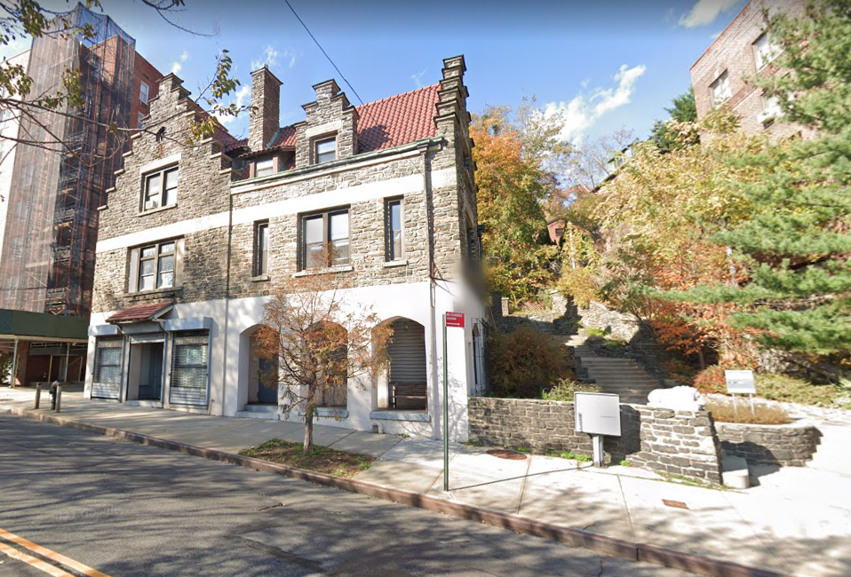
I’ve always gotten a kick out of the architecture because of the stepped roof–an apparent nod to New York’s Dutch colonial history.
It was built to be a printing press. The 1910 construction date in the city records might be accurate but The Underwriters Press set up business in the building in 1912:
[caption id="" align="aligncenter" width="497"]
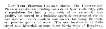 April 30, 1912 Printing Trade News[/caption]
There were not a lot of buildings around it when it was built. Alan Lasky found this photo:
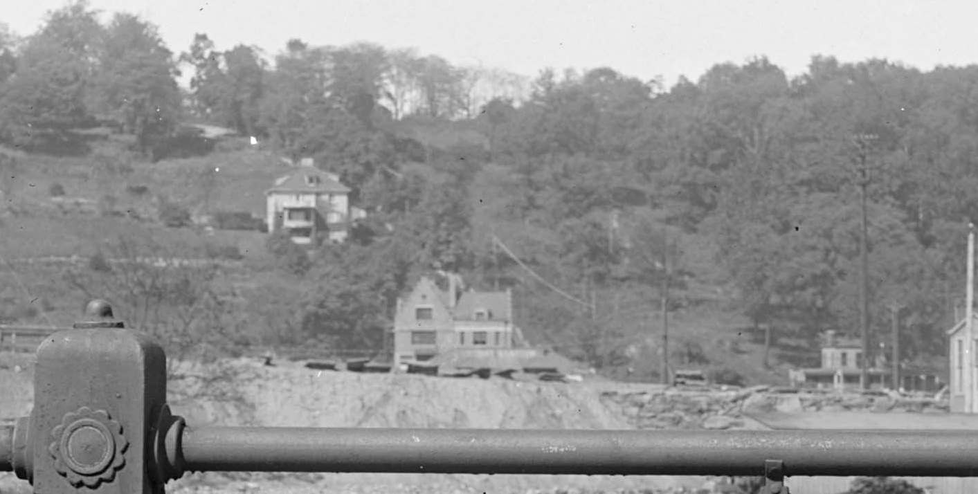
View looking west toward Spuyten Duyvil Hill not long after 1915. 1 Riverdale Ave is bottom center. “Tippett House” is on the far right. Further up the hill is 520 W. 230th St.. A 1914 Sanborn Insurance Map:
There were 10 people working there and they did print some books such as:
 So, it was not built for the Johnson foundry but . . .
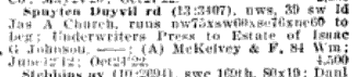
A 1922 issue of the Real Estate and Builders’ Guide shows the Underwriters Press selling property in our area to the “Estate of Isaac G Johnson.” So, the Johnsons may have purchased it and used it as an office after its life as a printing press:
I never quite realized that there were so many structures on top of Inwood Hill. It does not look like much of it could have been forested with all those buildings and gardens. Are there any landscapes depicting Inwood Hill from that time?
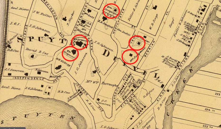
Thanks for that helpful research and the additional artist information. The 1870 census Julie posted shows a 1-year-old William Sergeant Kendall living in a building next to the home of G.H. Petrie, which still stands on the corner of W. 227th St. and Arlington Ave (or Sidney Street and Troy Street as they were known at the time).
This 1872 Beers map shows a building owned by William Sergeant next door to the home of George Petrie at the corner of Troy and Sidney Street so that could have been Kendall’s childhood home:
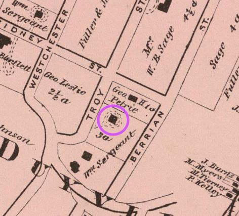
That’s about where 2631 Arlington Ave is today.
The neighborhood certainly seems to have punched above its weight with regard to painters. I imagine the presence of so many wealthy families had something to do with that.
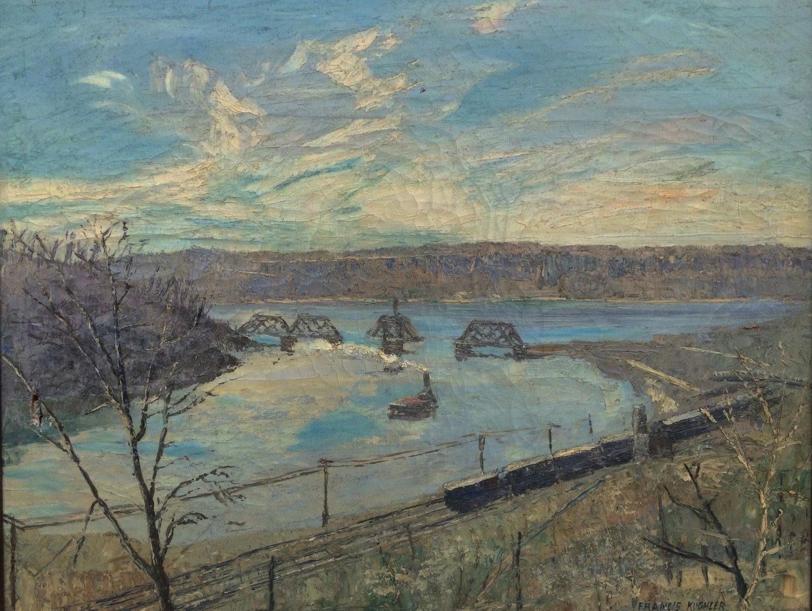
Peter mentioned the painter Francis Kughler, who I hadn’t realized was a member of the KHS. On the topic of Spuyten Duvyil, here is one of Kughler’s paintings of the area:
Bingo, Stephanie!
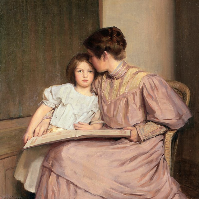
Here’s one of Kendall’s paintings at the Smithsonian:
I was trying to figure out where William Sergeant Kendall (1869–1938) may have lived on Spuyten Duyvil but I could not. Here’s a map from 1868, the year before he was born. Notice how many homes were owned by “William Sergeant”–perhaps a relative.
Here’s another Georgina Klitgaard painting also at the Smithsonian:
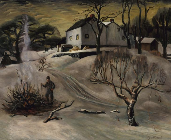
From a local perspective, one interesting thing about Georgina Klitgaard (1893-1976) was that she was born Georgina Berrian. The Berrians had been on Spuyten Duyvil since before the Revolution. Since she painted a lot of landscapes, I was hoping I could find some local scenes in her portfolio but I have not turned up anything yet.
I did recently just come across that book myself and posted some of the photos in this thread:
It really is a treasure and the fact that it is at Lehigh University makes me think just how good digitization has been for local history. So many university archives are being digitized and made public and it is amazing where this stuff turns up.
Thanks for that, Tom. I had never seen a color version of that print. I believe that house was in the vicinity of modern day Henry Hudson Park.
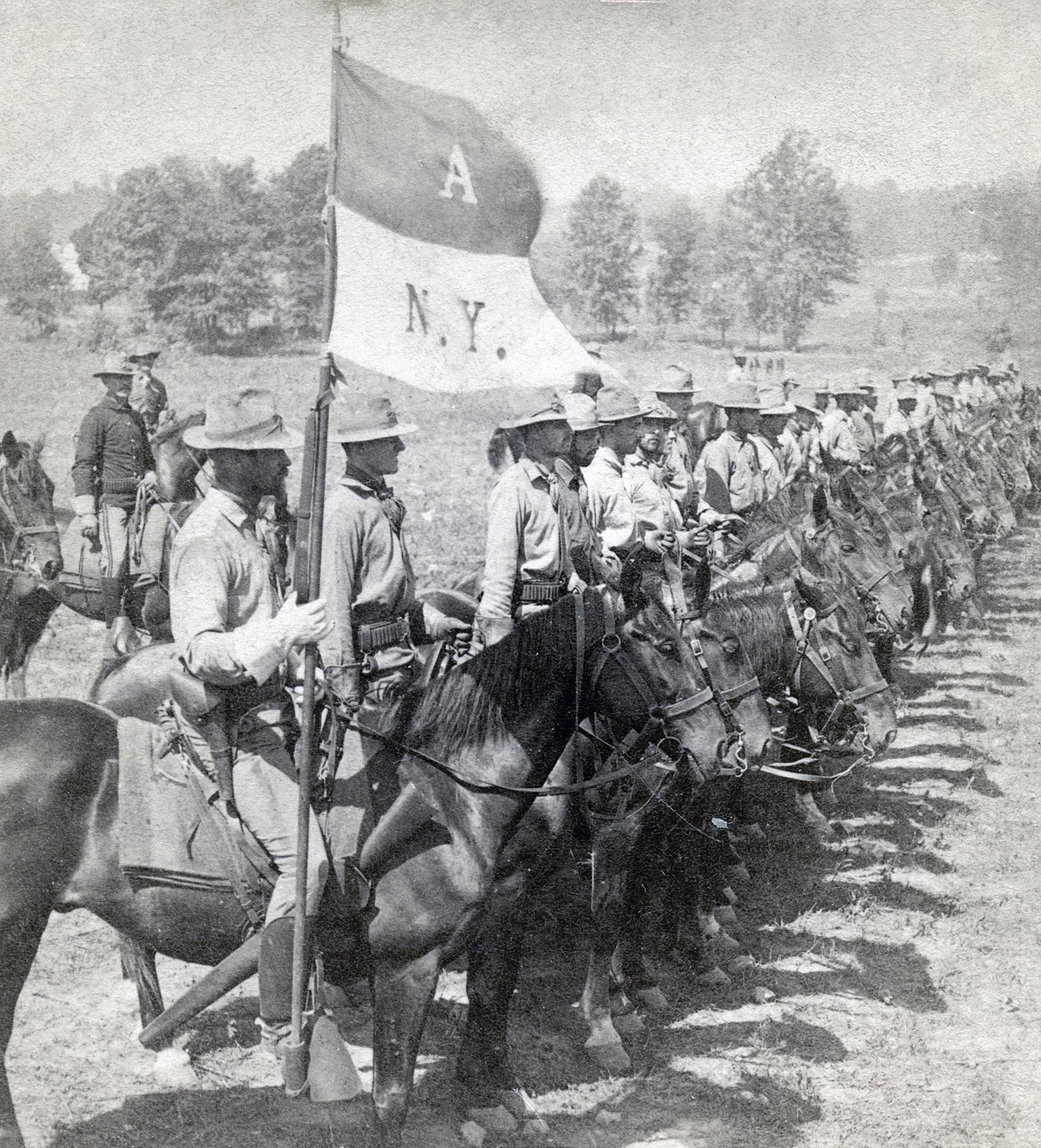
That military record is interesting–Squadron A was a prestigious cavalry unit based out of the Upper East Side and it sounds like Putnam served with them as part of the Pancho Villa expedition. But he was also stationed at Van Cortlandt Park, so he was not always so far from home!
Yes, that is correct that the last photo was not local to Van Cortlandt as the other ones were. I included it in the series because of its label, which explicitly states that “city refuse” was the material being used for fill. And to your point, there are some striking similarities between the history of Rodman-Drake Park and Van Cortlandt–both have colonial cemeteries in addition to adjacent cemeteries for enslaved people.
Another part of Van Cortlandt where trash was used as fill is in the area east of Broadway between Mosholu Ave and 260th Street. As a result, the soil is not stable and trees are often uprooted in storms. When they do, you can often find bottles, lumps of coal, and coal ash under the tree roots. No ancient artifacts by any means, but simply interesting trash. Here are a few items from that area that were shown to me:
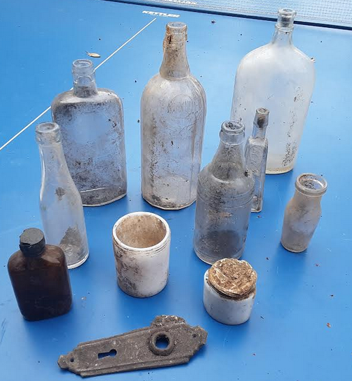
The plastic bottle caps seem to indicate that this stuff is not all that old, I would think. A related fact that I came across in the papers of Harry Emery (a local history enthusiast that grew up in the area in the early 20th century): That this part of the park north of Mosholu Ave is where Israel Russell lived. He was an African American man, who “raised pigs” there and was the “1st garbageman in Riverdale.” I wonder, could he have been collecting trash and dumping it in the park?
March 23, 2022 at 6:01 pm in reply to: Native New York; Course at t he e Museum of the City of New York #2715I have taken courses at the Museum of the City of New York and have never been disappointed so I bet this is good. I took a course there on Dutch New York there and they brought in amazing speakers–Russell Shorto the author and Charles Gehring the translator–all for a class of 20 people.
Anyone who happens to be a NYC teacher gets a professional credit for this course.
Thank you to all who showed up or joined on Zoom yesterday afternoon.
I have just added a gorgeous map to the “Maps” page of the website that was featured in yesterday’s presentation. It was drawn by a French mapmaker based on observations of Spuyten Duyvil, Kingsbridge, and Northern Manhattan. Here is a direct link. Click on the thumbnails on the left and use the slider on the bottom to zoom in.
It was among the papers discovered in the tower of the Chateau de Chastellux and was sold to raise money to maintain the castle. $275,000… not bad!
In my presentation, I was asked just how close the cannon balls came to hitting Washington while he was conducting his reconnaissance from Spuyten Duyvil. Here is a relevant quote that I didn’t have handy at the time, by Friedrich Reinhard, who was with Washington and the French Officers during the Grand Reconnaissance:
The Hessian and Ansbach soldiers . . . fired at our generals who were standing on an elevation. A horse was tethered about 30 paces away. A cannonball hit the ground near its hooves which drove the horse quite wild. Not long after this one, another cannonball hit into soft earth close behind the generals, so that clods shot up very high. A third one flew past them…
Washington, who was not lacking in bravery, would on principle, not have positioned himself in this manner, if he had been alone, in my opinion. But since he was forced into this bravado, it seemed that on purpose he stood with his side towards the enemy, in order to present a narrower front.
Thanks for sharing this interesting piece of history. It would be interesting to know if any locals were involved in this march but I am not sure where you could look to get more information. Lehman College holds the archives of the “Riverdale News,” which published in this period although I do not know if they have issues from 1912.
Tangentially related to this topic, several of our neighborhood’s local historians were women. Mary E. Kane published Yesterday in Riverdale and Spuyten Duyvil, which even predates the Kingsbridge Historical Society by two years. It contains much information that you cannot find in other sources.
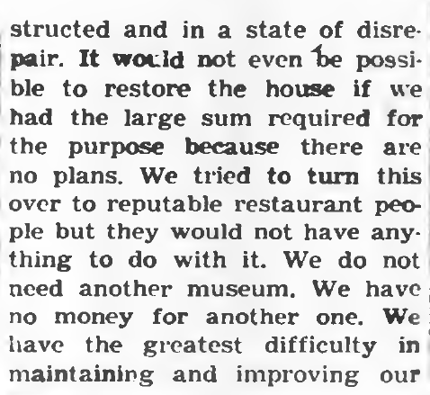
Margaret O’Rourke was an early member of the Kingsbridge Historical Society. She chaired the effort to save the historic Berrian-Johnson House, which stood in lower Henry Hudson Park on Spuyten Duyvil from destruction:
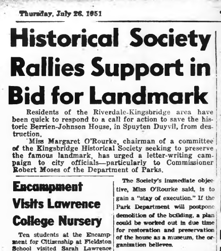
Only to receive face this terse rebuke from Robert Moses in the August 23, 1951 issue of the Riverdale Press: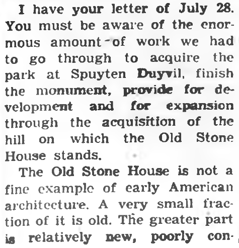
Sadly, Margaret and KHS were not able to save the house from destruction but she continued to be active in local history. As late as 1985, she spoke at KHS meetings about her memories of growing up in the area such as hearing the whistle blow at the Johnson Foundry “that started the day and kept the neighborhood on schedule.”
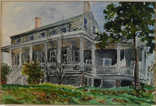
Not to mention that the Kingsbridge Historical Society was led by a woman, Charlotte Livingston, during the 1960s and into the 70s. She was a gifted painter and I always appreciated her loving watercolor of the aforementioned Berrian-Johnson House:
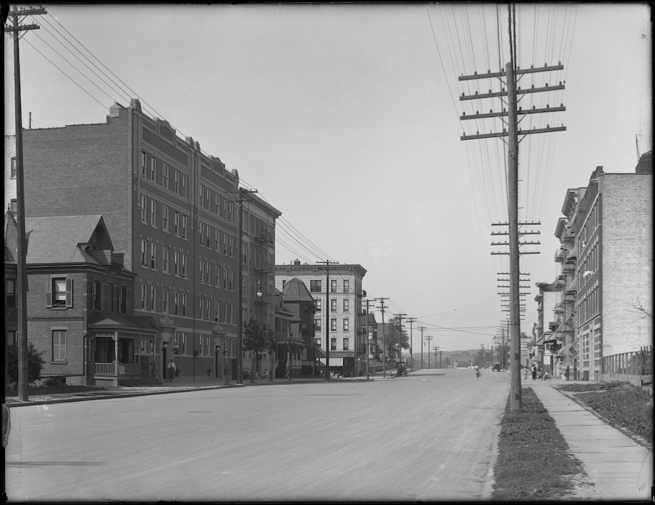
Thanks for that info, Peter and Tom. I found a couple more photos of Bailey Ave from that area around the Lutheran Church (from dcmny.org). This one is looking north on Bailey from Albany Crescent 106 years ago. You can see the intersection with W. 231st in the middle.
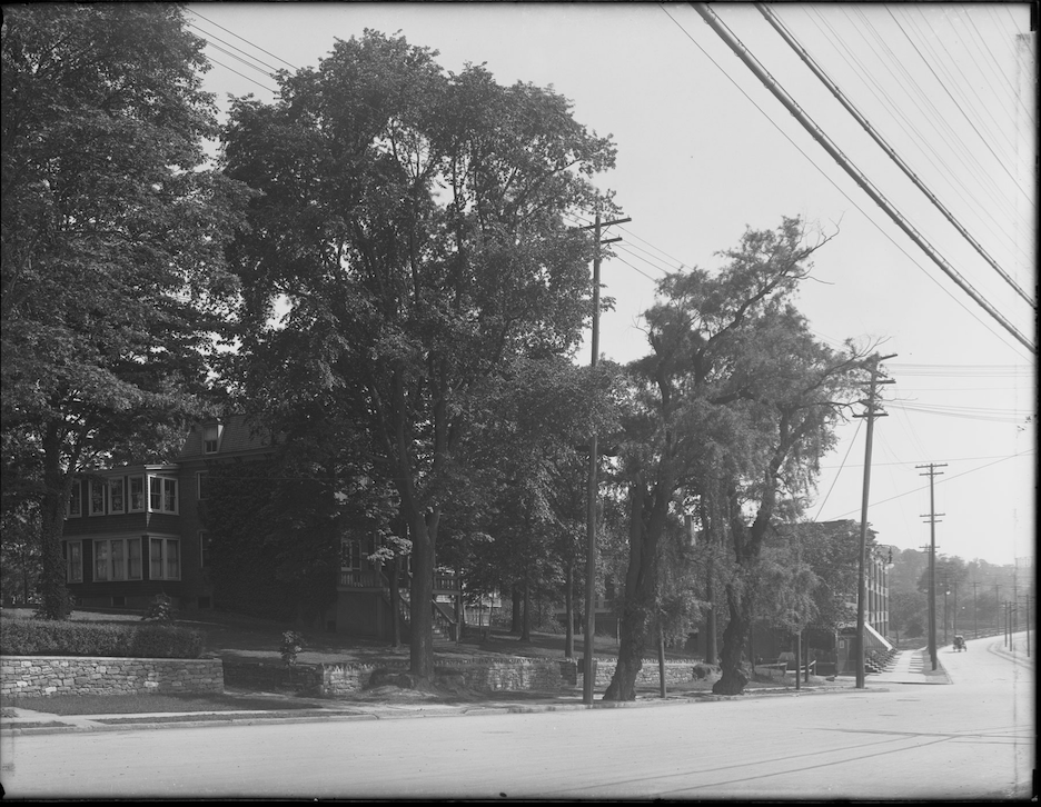
This is looking south from Albany Crescent and Bailey:
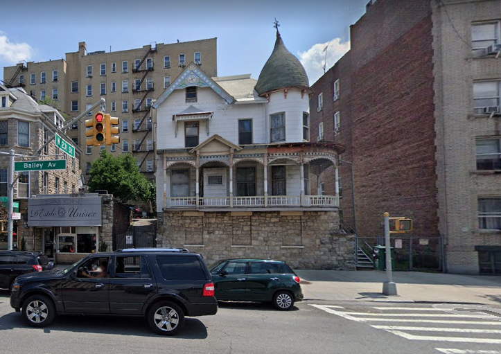
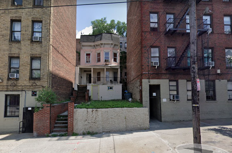
One thing I liked about living on Bailey Ave was the few old Victorian houses still left on Bailey near W. 231st Street. There’s this one at the intersection with W. 231st:
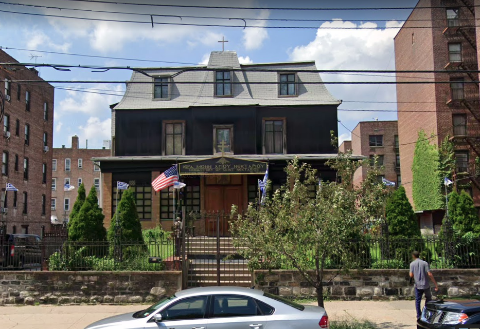
Pretty much across the street from that one is this one, which was converted into a Greek Orthodox Church.
And this row house is pretty well hidden between two large apartment buildings near Bailey and W. 233rd:
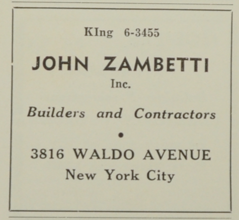
Thanks, Peter. I was confused by the multiple prominent Zambettis of Riverdale! You are of course correct about John Zambetti–Here’s an ad from the old “Riverdale News”:
Related to the Bell Tower Monument and Zambetti, a while back I received this message from KHS member, Michael Tynan, whose father was another local builder who worked with Zambetti on the monument:
That tower was moved once a short distance to its current location to make way for the parkway, I believe the designer was Baum who designed many houses in Fieldston, the mason was Zambetti and my father made and hung the door … massive oak with notable wrought (or cast) metal hinges….and likely the interior staircase… the carpentry.
I say “likely” for the interior staircase because only one of my three family members recently mentioned the staircase while all three of us knew of the door….we estimated the year 1930 give or take. I queried them just a week ago. my brother even recalled a customer coming into our hardware store and mentioning that he saw my fathers name on either the door or staircase….this occurrence was likely during the 1960’s or so during a repair or maintenance period for the tower….that date range is a guess by me…however I do know that my father always put his name on his work..and always in an inconspicuous almost hidden spot …when we worked with him as children he had his helpers sign and date as well….his custom.
Oddly enough when the tower was moved for the parkway my fathers then house..a few blocks south of the tower on the now west side of the parkway lost almost all of it’s front lawn by eminent domain to the parkway and paralleling side- service road project
The Zambetti family that owned the bakery before it was bought by the private equity company lived at 3816 Waldo Avenue, the “Gardener’s Cottage” that was torn down to make way for the “Waterford” apartment building. The “Van Cortlandt Park Cultural Landscape Survey” written in 2003 mistakenly wrote that the house was located in Van Cortlandt Park.
The Zambettis must have had a nice short walk to work at the Stella D’Oro bakery. I wonder if the death of Marc Zambetti in the 1989 earthquake led to the loss of both buildings?
Thanks for sharing that HBO documentary–really quite sad but very interesting nonetheless.
And thanks for the restaurant review, Tom–50 years too late but still good to know.
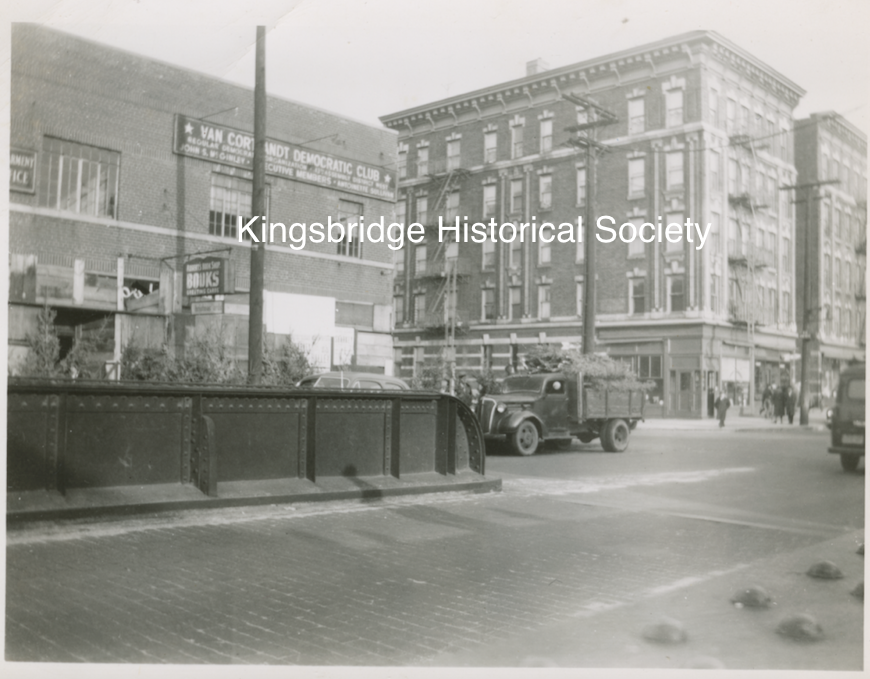
Yes, that’s it, thanks. The large brick building on the right in photo #4 and in the train engine photo must be the old Tynan’s hardware/Robert’s Bookshop building on W. 231st that was torn down to clear way for the thruway. It was on the east side of the tracks where the Deegan is today. It is shown in the photo below on the left, which was taken in 1951.
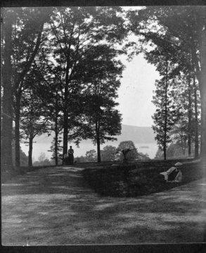
Thanks for sharing those links, Stephanie. It makes me think of a recent family hike I took through Riverdale Park. We got off the path a little bit and found very old looking oyster shells strewn about high up on the ridge:
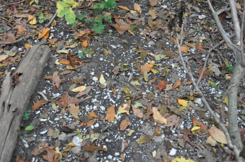
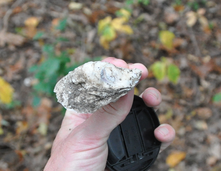
The ancient remains of a picnic of long ago…
It would be interesting to make a map showing places in our neighborhood where Native American artifacts have been discovered. I have come across quite a number of reports in old newspapers articles, books, and memoirs.
On another note, New York State maintains a database of archaeologically sensitive sites in its CRIS system. It is used to trigger environmental and archaeological studies before development can proceed. Oddly, I could not find this study on the CRIS map. I will send an email to the State Historic Preservation Office to ask if they could upload these reports to the database.
-
AuthorPosts